Previous article (Chapter 2)
table of contents
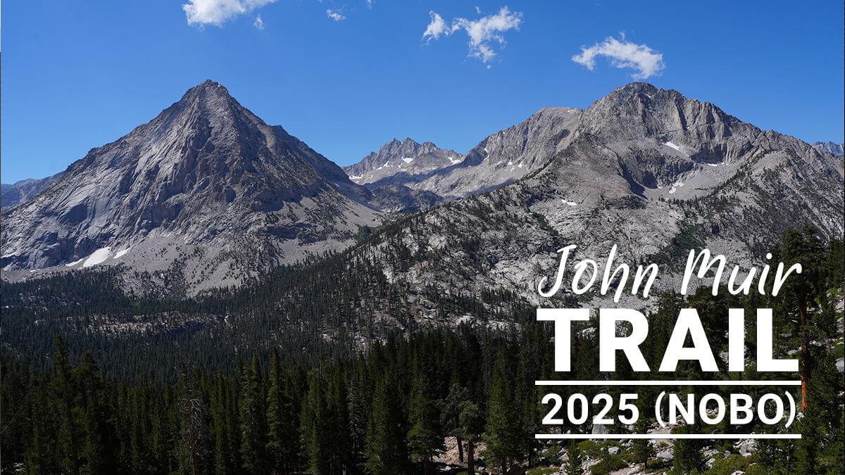
[Chapter 3] Crabtree Meadow to Kearsarge Pass
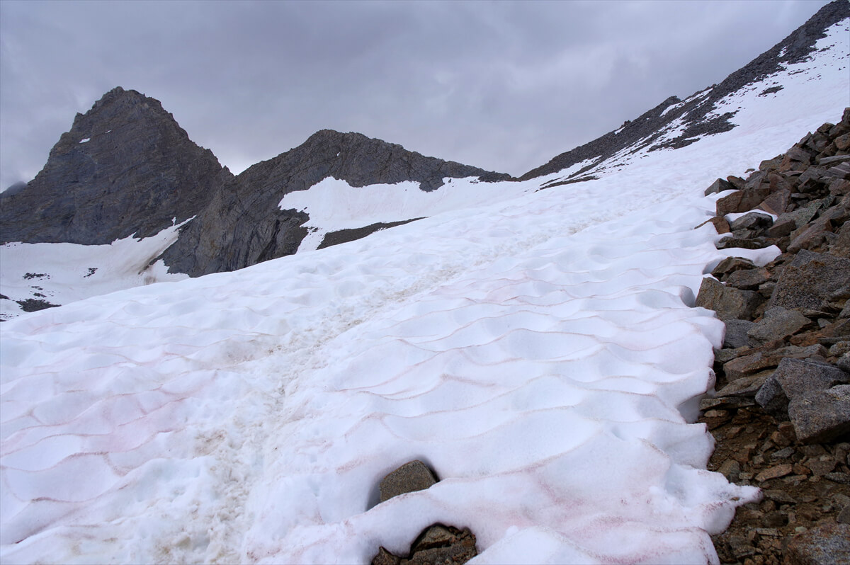
From Crabtree Meadow to Tyndall Creek, there's a gentle descent, followed by a gentle climb after the river crossing. The climb is divided into two or three stages. Diamond Mesa, a rocky mountain, stands to the right, and the trail parallels a long, narrow lake. The wall-like Forester Pass looms. The descent also divides into several stages. After navigating switchbacks and ridges, you arrive just below Junction Peak. From there, head north, make a sharp turn west, and then head north again. This is a fairly long, wide pass, best crossed in the morning when thunderstorms are least likely. We were caught in one pretty severe thunderstorm. As the trail turns north, campsites begin to appear on the left. The trail follows Babbs Creek for 3-4 miles, then turns and climbs. The trail passes Bullfrog Lake and reaches Keasarge Pass. The hike takes about three days
Crabtree Meadow to Tyndall Creek
I woke up before 6am. I slept for about 10 hours. It got light around 5:30am. I only used the lantern a little. It's solar-powered and can be attached to the top of my backpack, so it seems like it can be used indefinitely. For breakfast I had JMT bread, dried fruit, and coffee. I had eaten a fairly good meal, so I thought I could walk as planned. I packed and left at 7:30am, a slightly late start
The trail was easy to walk on, with a gentle, straight descent. I soon passed the fork to Crabtree Meadow Campground. I didn't pass any hikers. It seemed like there were very few people on the trail. After just under an hour, the trail turned north. I checked the map on my watch, and found that the red line on CalTopo was incorrect; the trail was parallel to the contour lines. I marked this point on the map so I could correct it later
Suddenly, I got a message. It was James. "How are you doing?" he asked. He was quite a pain. August 10th was still a long way off, and I was planning to send him my location from somewhere around Onion Valley. I had no choice, so I put down my backpack and sat down on a fallen tree. I took out my smartphone and wrote back
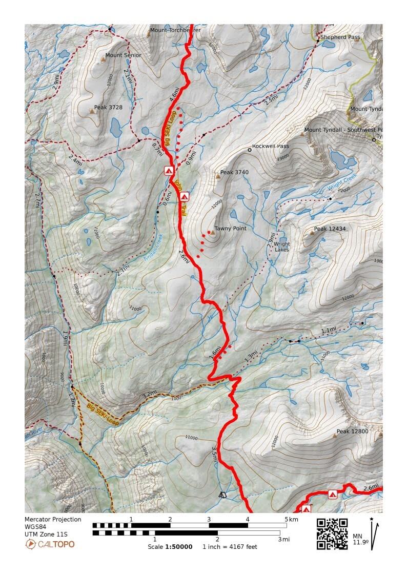
Figure 3.1: Crabtree Meadow to Forester Pass
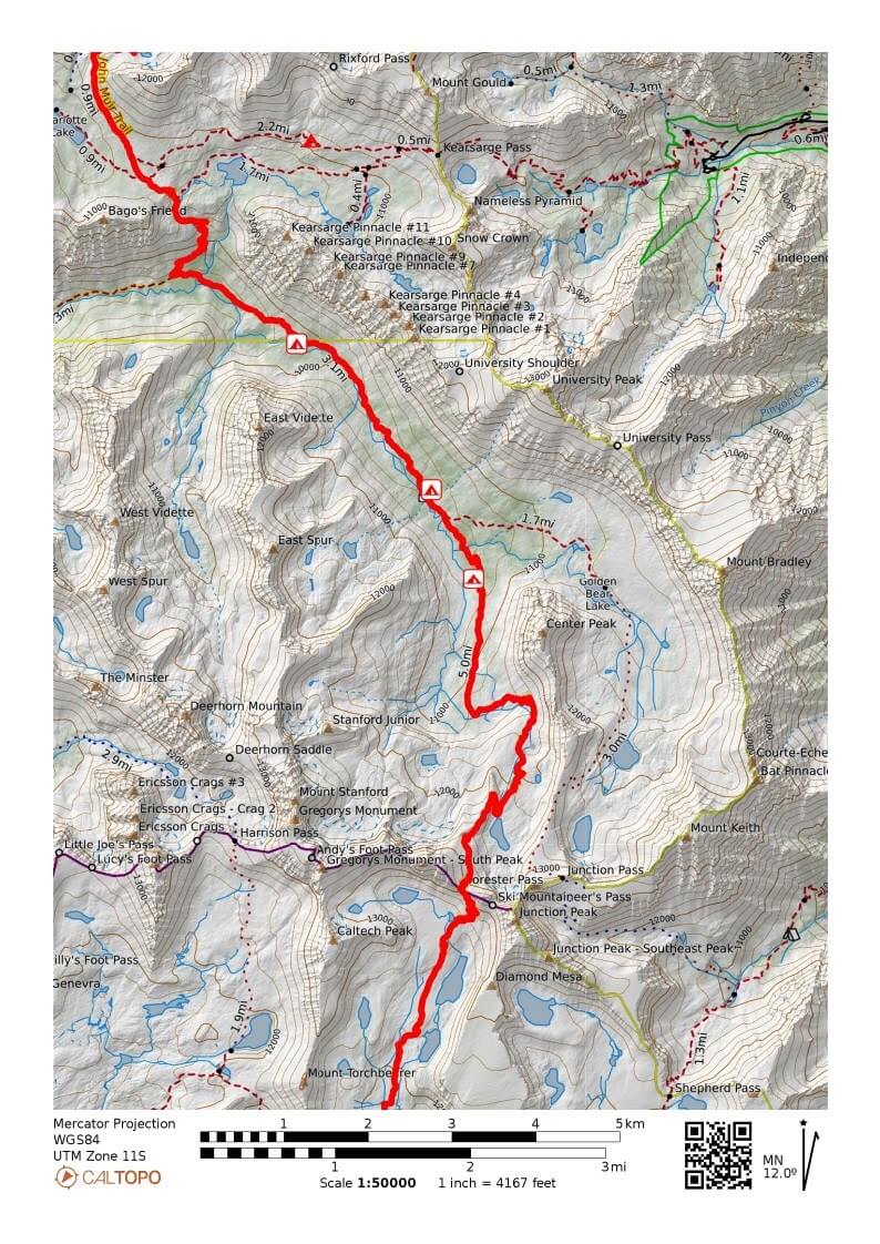
Figure 3.2: Forester Pass via Keasarge Pass to Onion Valley
"I almost died from the round trip to Mount Whitney, but I'm just recovering. I dropped my headlamp. If you can buy a headlamp, could you buy me something cheap? I think I can make it to the MTR."
There are too many types of headlamps, and a lantern is an alternative, so I later declined. Incidentally, while I was writing my reply, several hikers passed by. They were hiking the JMT, heading north, as they were heavily equipped. The trail was flat, making for an easy walk. After a while, I came across a stream. Downstream was Sandy Meadow. A couple was camping near the trail. I stopped and chatted for a bit
"Let's go to Whitney. Oh, I left my headlamp on the rocks. If you see it, please get it for me."
"OK. Undertaken."
Now, apart from the tips of my trekking poles, my headlamp won't remain on the rock as litter for long. A little further on, I reached my usual rest stop. I took a photo just in case (Figure 3.3)
Figure 3.3: Sandy Meadow
The trail turns north and gradually climbs. If you walk slowly, you will soon reach an unnamed pass. I took a short break in a wide, flat area, spreading out my wet tent and letting it dry
A little further down the trail, there was a stream where we could have lunch, but it was only 10:30, so we decided to go a little further. As we started to descend, the trail began to switchback. After descending a little further, the view opened up and Tawny Point came into view. Its name means "yellow-brown mountain," and it is a gently sloping cone-shaped mountain (Figure 3.4)
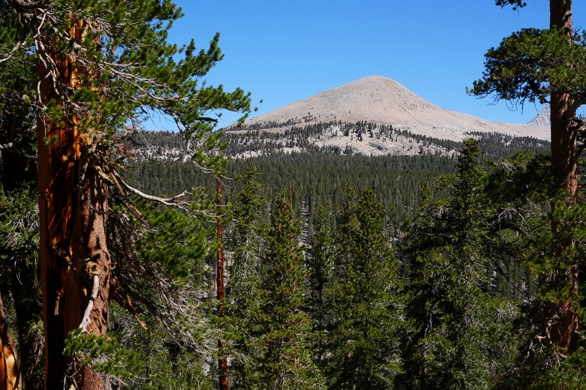
Figure 3.4: Tawny Point, seen from the top of the switchbacks
I got a message from James asking, "Where are you now?"
"Click the mark next to the message, we're south of Wallace Creek."
He's quite a picky guy. He doesn't seem to be very good with technology, which is a bit annoying
"I wonder if they're receiving it on the messenger app via the mini2? If so, I need an InReach address."
I use Messenger Plus and James uses Mini2, so it would be more helpful if he used the Messenger app, but I don't know because I'm not around him. So, from now on, I'll use his InReach address instead of his phone number
Wallace Creek had little water, so we were able to cross easily by stepping over the stepping stones. Normally, this would be a place where our shoes get wet. A little further on, the trail turns west and gains altitude. After a while, we emerged onto a hill with a great view. At 12:15, we put our backpacks down in the shade and had lunch. There were also signs that tents had been set up here. We were envious. Figure 3.5 shows the view from the vantage point
From the lunch spot, the trail is mostly flat, and after a while we come to Wright Creek, a small stream that doesn't leave much of an impression. From here on, the trail becomes flat again. A lone hiker appears
"I've run out of water," he said. When I offered to give him some, he refused, saying, "We're almost to the river." Since it was downhill, it should be no problem if I walk for about 30 minutes
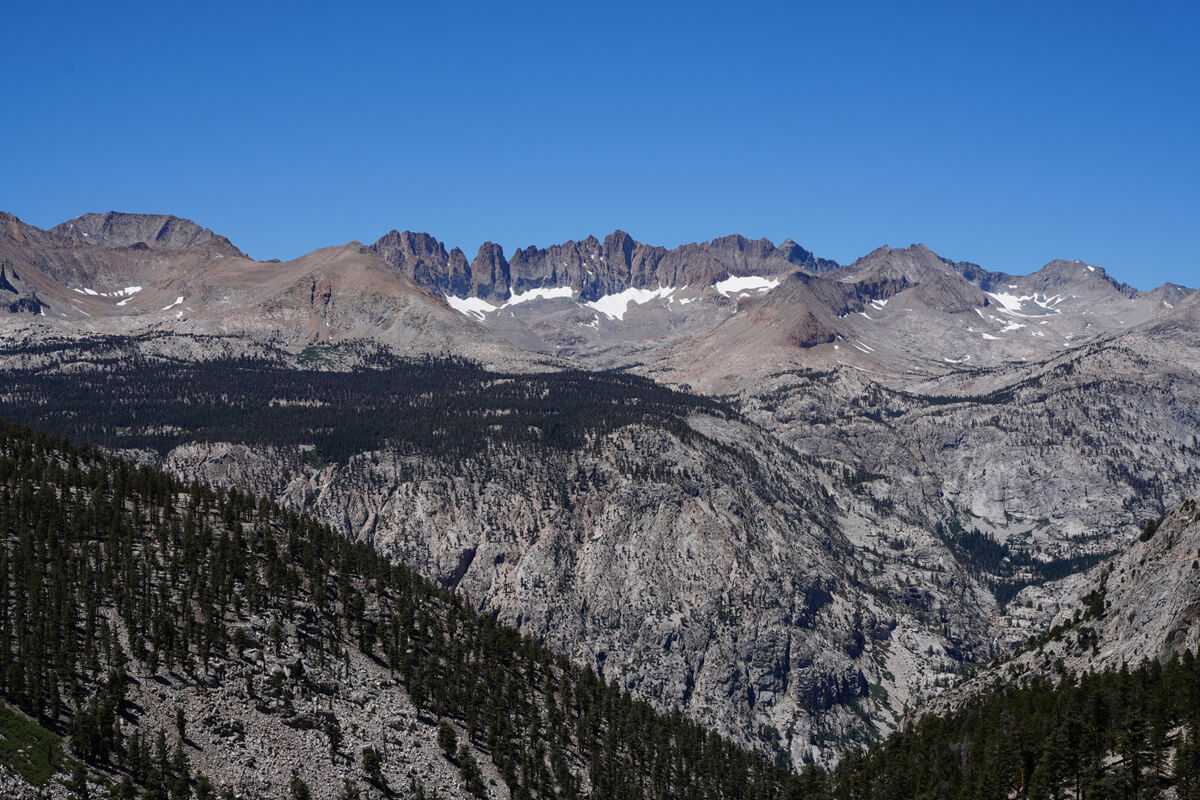
Figure 3.5: Mountains of Black Carware, Red Carware, etc. I think
Come to think of it, back in 2018, I met three hikers here for a chat. They asked me where the water sources were. When I mentioned Schroomer, they told me they lived nearby. The one in the center is Michael Hofmeyer, whose trail name is Pan Tilt, apparently a photo compositing term. The man on the left is a section hiker who said he would complete his full JMT hike
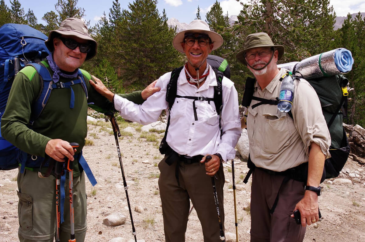
Figure 3.6: Michael Hofmeyer, a friend of Schroomer's. It's a small world. Photo taken in 2018
The question about water sources was asked in almost the same place. Southbound JMT hikers start at Tyndall Creek. Because Tawny Point Pond is far away, it's difficult to replenish water. So, they plan to replenish water at the crossing with a tributary of Wright Creek. The creek is marked on the map. However, in most cases, the water is dry and rocks are scattered everywhere. So, they start to worry about water and ask northbound JMT hikers like me
From here on, the trail was relatively flat and easy to walk on, but around 1:30 p.m., I noticed something strange about the scenery. Mount Whitney was in sight, and I seemed to be getting closer. I checked the map on my watch. Turns out, I was walking the same trail in the opposite direction. I took a short break, then returned the way I came. I took a photo as a souvenir, as shown in Figure 3.7. The hypoxic condition and decreased blood flow after eating must have had an effect. I had forgotten where I'd rested. Although I'd only gone the wrong way for about 200-300 meters, I could understand why elderly people would drive the wrong way on a highway
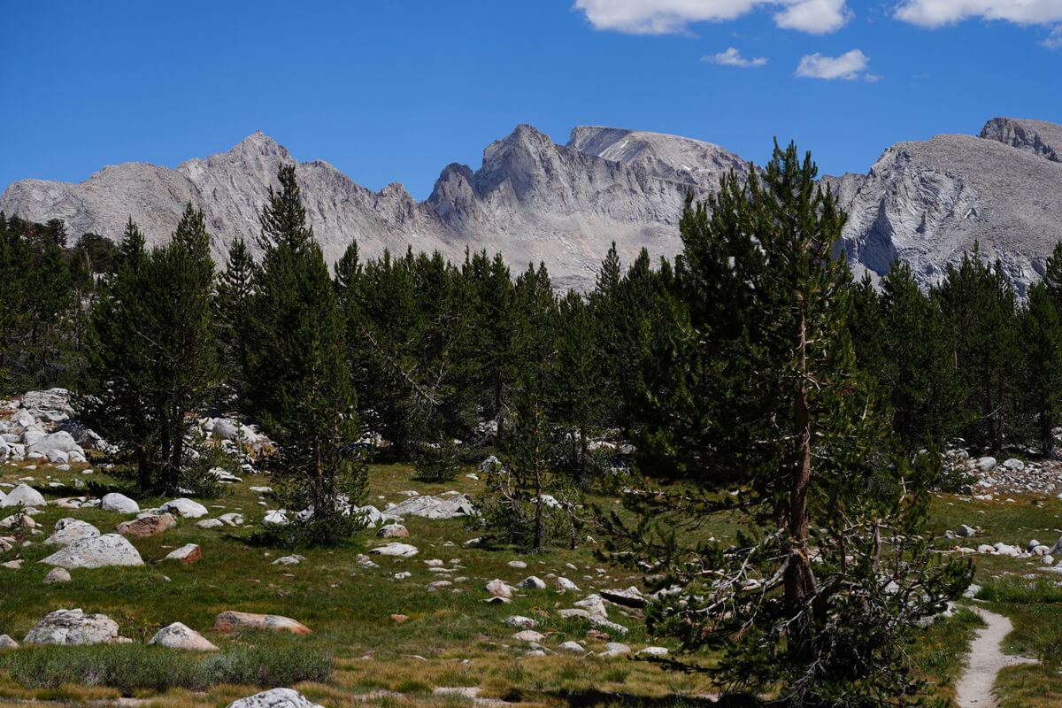
Figure 3.7: There's no way I'm walking towards Mount Whitney. A commemorative photo of the reverse run
As we approached Tawny Point, the trail gradually gained elevation, which was quite tiring. After climbing the final switchback, Tawny Point came into view, and a wide plain appeared. This was the Bighorn Plateau (Figure 3.8). It's a unique spot in the Sierra Mountains, making it popular with American hikers. There's a pond, but pitching a tent on the grass is illegal, and the view is simply too good. Joel's son, whom I met in 2009, told me there were no toilets or places to hide
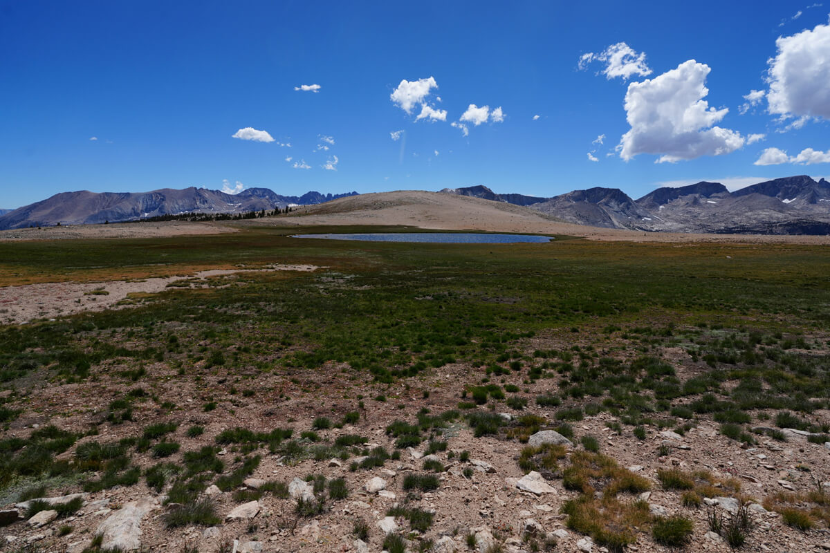
Figure 3.8: Bighorn Plateau, a wide plain with a central pond
A round trip to Tawny Point is the easiest side trip, but not many people do it. It takes about an hour to leave your backpack and go back to the peak. Many JMT hikers are pressed for time. I've climbed it three times, so I decided to pass this time. Also, the best view of the Bighorn Plateau is from about halfway up the mountain. First-timers should at least climb halfway up the mountain. This photo was taken from the trail using a 20mm wide-angle lens
The trail begins to cross the slope next to Tawny Point, and is about 1 km away. As I approached, I saw five or six hikers pitching tents next to the trail. I later found out they were southbound JMT hikers. I didn't want to pitch my tent next to anyone, so I went ahead and pitched my tent in the shade of a tree by the lake. It was 4 o'clock in the evening. The campsite was relatively large, so there were food lockers. Bears never approach tents with people in them. So, as a rule, I don't use food lockers. I just make sure I don't leave my tent unattended
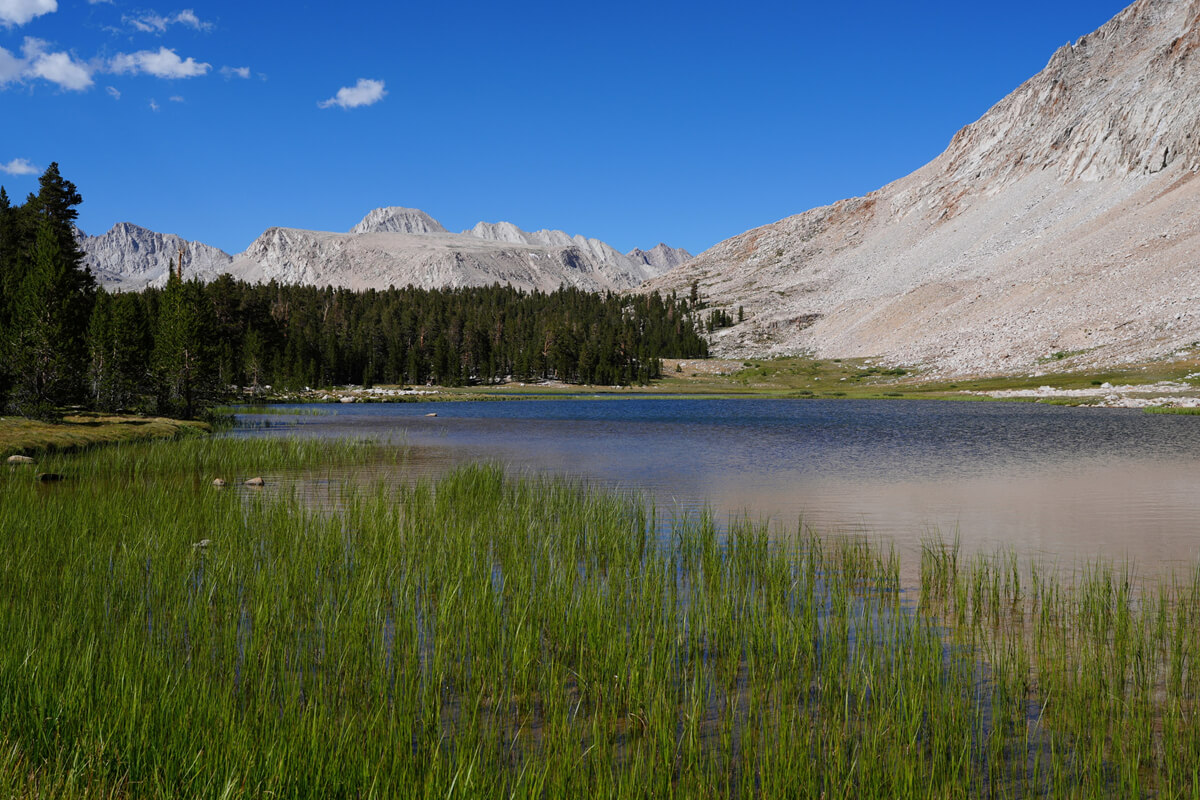
Figure 3.9: An unnamed pond just before the descent to Tyndall Creek. The depression is Forester Pass. My tent is in the shade of the tree on the left
Figure 3.10 shows the lake. Sometimes deer appear. I had mirin-dried fish as a set meal a little after 5 o'clock. I couldn't eat the potato salad, so I buried it in the ground. My stomach was upset because of the altitude. Thunder rumbled in the distance. It was a hot night, with the temperature reaching 13°C at 9 p.m. I had trouble sleeping, probably because I slept too much the night before
Tyndall Creek and the bypass route
I didn't sleep very well, but woke up around 5am. I had a breakfast of JMT bread, cheese, mango, prunes, and coffee, and slowly got ready to leave. I set off at 7am. It was about a 30-minute descent to Tyndall Creek. There were two tents next to the river. It was a short climb to the ford. The ford was just past the turnoff to Shepherd Pass. The water level was low, so I was able to cross easily by following the rocks
Once we crossed the creek, we came across a number of campsites, but there was not a single tent. This surprised me a little. These sites are usually crowded. After walking a little further, we came to a fork in the road to the Kern River. The trail gradually climbed, but the pine trees disappeared, offering excellent views. Looking from a little upstream on the trail, we saw the view shown in Figure 3.10
Figure 3.10: Tyndall Creek as seen from the upstream trail. The fording point is at the back of the forest on the right. When the water level rises, you don't have to cross, but walk along the right bank like a line. There is a small stream near where this photo was taken, and a campsite is located a short distance away. Photo taken in 2018
As you can see, Tyndall Creek flows through a flat area with almost no rocky areas. This means that when the water level rises, you don't have to ford it; instead, you can walk a little along the Shepherd Trail and then follow the river. It's easy to ford upstream, and visibility is good, so you won't get lost
There are many marmots in this area, but because the telephoto end of my zoom lens is 70mm, it's difficult to take a photo. I found one where the trail got a little steeper and rocks started to appear, so I took a photo and cropped it. The result is Figure 3.11
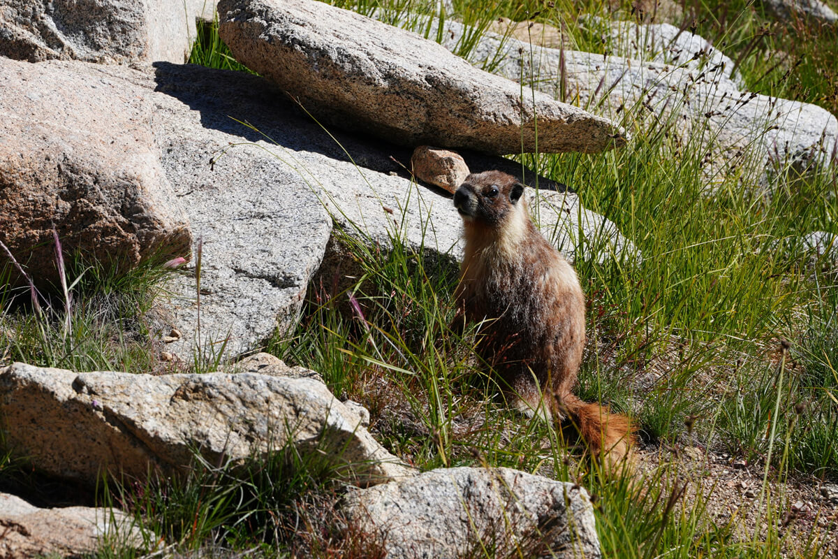
Figure 3.11: This year there were only small marmots
Over Forester Pass
Around 10:30 AM, a hiker approached from the front. Judging from his clothing, he was probably a PCT hiker. I took a photo of him, and he also photographed me (Figures 3.12 and 3.14). His trail name was Trench Foot. He must have had a rough time in the snowy year. Most PCT hikers miss the High Sierra, so I decided to hike the JMT again
Figure 3.12: Trench foot. This refers to the severe condition of waterlogged feet in trenches
Figure 3.13: Approach to Forester Pass. Photographed by Trench Foot
Figure 3.14: Wampatan commemorative photo at Forester Pass
We arrived at the pond just below Forester Pass at 11:30. The switchbacks were well maintained, but our walking speed gradually slowed. In the shade of a huge rock, we found a plaque bearing the name Donald I. Down. This is a memorial to someone who died during the construction of the trail. He was born in 1911 and died in 1930. This means that the Forester Pass trail was also completed around this time
The trail was very well maintained and smooth. Unfortunately, falling rocks made it difficult to walk in some places. After being overtaken by hikers, we finally reached the pass at 1:00. It was already afternoon, but fortunately the weather was sunny and there were no problems. There was no one around, so I was taking photos when a lone hiker came up. His name was Eric Searle (Photo 3.15), and he was a PCT hiker. He said he was hiking the High Sierra again this year because there wasn't much snow
Figure 3.15: Eric Searle, a PCT hiker. He likely had a University of Arizona email address
"Once you walk here, you want to come back again. I think I've been here eight times," he said. I asked him for a commemorative photo, and he took one too. He said he took a photo of me from behind as I was climbing. After a short chat, he headed down at more than twice my speed
The trail descends from the pass in steep switchbacks, but soon the gradient flattens out and the trail descends a short distance along the ridge before winding around to reach the base of Junction Peak, where there is a pond that is a prime spot for water and photography
2017 was a horrible year. Record-breaking snowfall resulted in thick layers of snow remaining on the passes even in summer, causing rivers to overflow and making crossing difficult. Several PCT hikers drowned after failing to cross, including one Japanese. That year, I researched various detour routes before heading to the United States. I also detoured around Tyndall Creek that year. I started from Horseshoe Meadow, but there were hardly any hikers camped there. The photo below shows me crossing Forester Pass. Of course, I brought crampons and an ice axe
Over Forester Pass. July 25, 2017
In 2018, while on the northbound JMT, I met a heavily equipped hiker carrying a camera at a pond just below Junction Peak. His backpack weighed 27-28 kg, the same as mine. He was carrying a Sony full-frame camera and multiple interchangeable lenses. His name was Cam Anderson. The photo he took is shown in Figure 3.16
Figure 3.16: Photographed by Cam Anderson (https://www.instagram.com/awesemblauge/), 2018. In a normal photograph, the person would appear black. This is clearly the work of a professional photographer
It's a good portrait, but what interested me was the contrast adjustment. When you try to make the background look good, the person gets crushed into black. When you make the person look good, the background gets washed out. I could never do that. He's a master of photo development techniques. It might be because of him that I've finally started using Sony's full-frame cameras
The trail heads north, descending into grasslands. Thunderstorms were commonplace in the summer of 2018. It was clear at Forester Pass, but thunderclouds quickly appeared. As the trail descended and headed west, a severe thunderstorm developed, urging evacuation. However, there was nowhere to seek shelter, so we continued walking and finally escaped the thunderstorm as the trail headed north. It was a localized thunderstorm. This time, we walked to a lower level, past a tributary of Babbs Creek
In 2010, I met an important person in the grasslands of Forester Pass. His name was Eric Marchinot. I think he was living in Tokyo at the time and working at a research institute in Tsukuba. We met on the PCT mailing list, coordinated our itinerary, and arranged to meet here. Eric was very impressed, saying I was "fit." Most Americans have a belly, and Eric was no exception
Figure 3.17: Eric Marchinot, then living in Tokyo, an acquaintance of mine from the PCT mailing list. Photographed in 2010
Eric has hiked sections of the PCT several times, including Te Araroa in New Zealand. He wanted to hike the Tokai Nature Trail in Japan and the southern tip of Kyushu, which is why he contacted me. He also said he wanted to practice his ice axe, but unfortunately, I never got to hike with him in Japan. Later, I personally went to the southern tip of Kyushu, but the trails were almost impossible to walk. I also hiked the Tokai Nature Trail in the Kinki region, but the trails were crumbling and I ended up having to walk long stretches of paved road, which I found tiring
In 2012, Eric posted to a mailing list that Delore had developed and begun selling the revolutionary inReach device. The inReach was the world's first communication device using the Iridium satellite network, capable of sending and receiving two-way messages and sending SOS signals. Shortly after Eric's post, I purchased a Delore inReach device, likely the first Japanese user. The device is shown in Figure 3.18. The first generation was quite large and heavy, and sending and receiving messages took a long time. I also had trouble with GPS sometimes failing to converge
Garmin acquired Delore in 2016 and has since made improvements. The GPS and sending/receiving performance have also improved, and most importantly, the satellite email function now returns an error message if the message does not reach the recipient. Garmin's integrated technological capabilities are impressive, and they have now even developed a watch with built-in LTE and Iridium communications. Due to its high reliability, more than half of American hikers own an inReach device
I use the inReach Messenger Plus. The antenna input/output power is two to three times that of previous models, so text messages of up to 550 characters can be sent in 10 to 20 seconds, and images and audio files in 30 to 60 seconds. This time, I was able to communicate with Chieko in Japan without any hassle, and she sent me weather forecasts almost daily. While you can request and receive weather forecasts with Messenger Plus, sending and receiving up to 50 text messages is free, so it's cheaper to have them sent from Japan
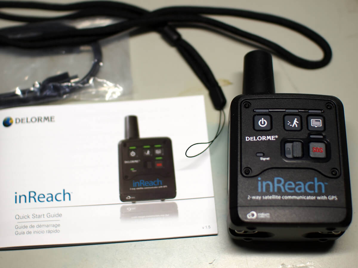
Figure 3.18: Delore's inReach first generation, the world's first communications device using the Iridium satellite network. Accessed June 12, 2012
In 2019, we were accompanied by a Peaks photographer, so we couldn't cover much distance. Therefore, we looked for water and pitched our tent before descending completely. This time, we knew where the water was, so we chose a spot with a good view. However, we noticed five or six hikers resting where we had intended to pitch our tent. This didn't seem very interesting, so we continued on. There was a dried-up stream on the right, and a puddle. We could camp there if we collected and purified water. It was 4 o'clock, and the mountain side was covered with granite, so we set up our tent using rocks and trekking poles (Figures 3.19 and 3.20)
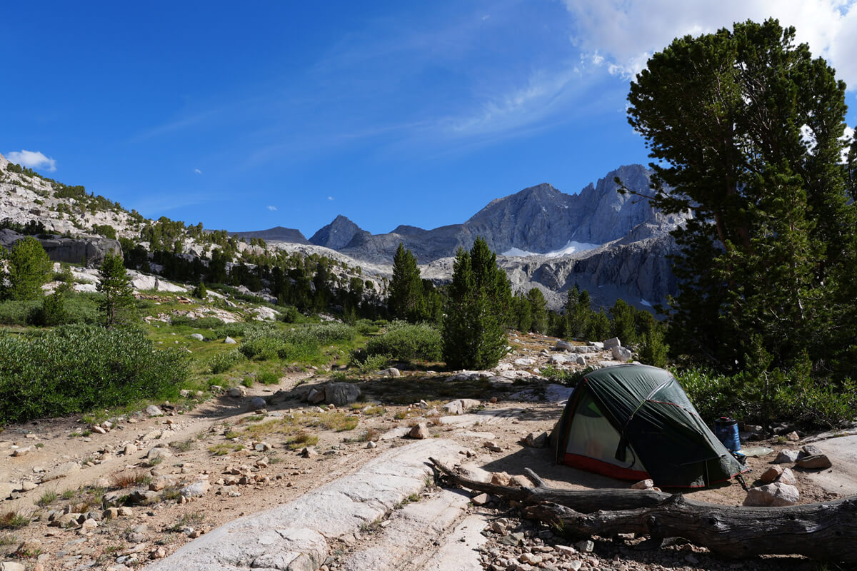
Figure 3.19: Before the Babbs Creek confluence, the trailside is a drawback, but the views are good
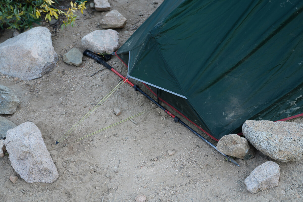
Figure 3.20: One side set up with trekking poles and rocks
CareSurge Pass
As expected, there was no one around after dark. I slept soundly for 10 hours and woke up at 5:30. I had a good breakfast. I used the toilet in the shade of a tree and set off at 6:30. There were a few clouds over the Keasarge Picnal. The cloudless weather was slowly coming to an end. I had gotten over the most difficult pass, so it looked like I could cross Keasarge Pass and head to the lake as planned
The views were good for a while. There was a cloud over Kearsarge Picnal, but it would soon clear. After a little further, a stream appeared to the right of the trail, and there was a campsite to the left. This might have been a better option
As we descended, we entered the forest and the views became less visible. We came across a tributary of Babbs Creek. It usually requires some effort, but this time the water level was low and it wasn't even worth crossing. There was no one camping there. We continued through the forest and neared the main branch of Babbs Creek, where we came across a fairly large campsite with food boxes. There was no one camping there; normally there are four or five tents
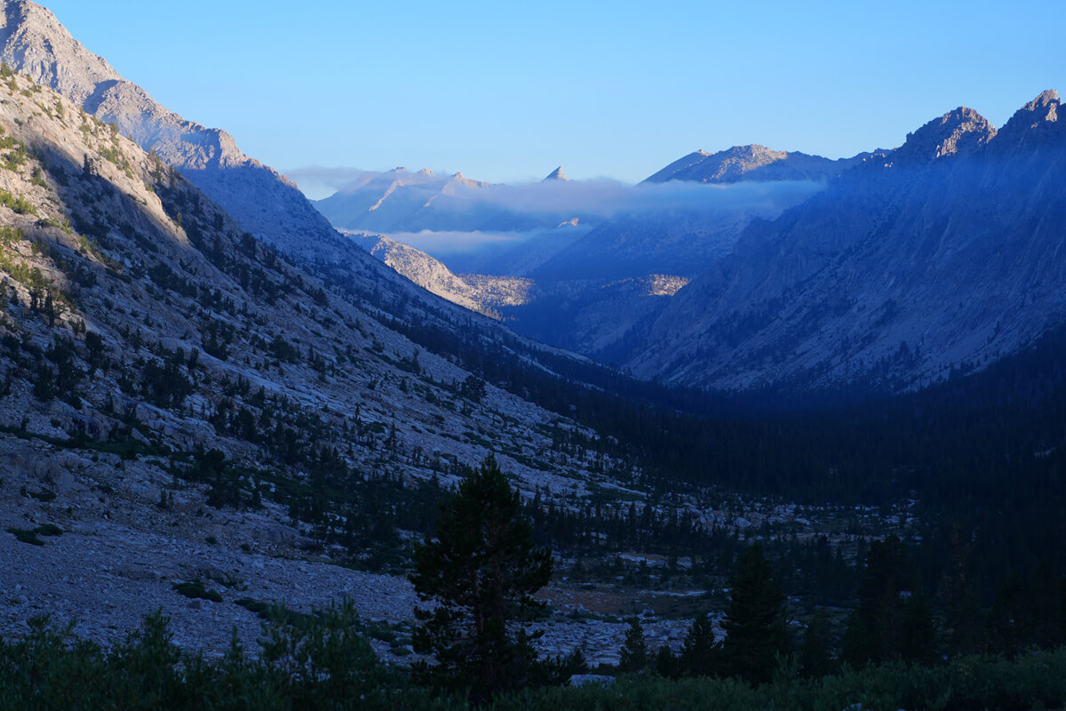
Figure 3.21: The sharp peak in the center is Kearsarge Picnal. The valley is U-shaped and likely carved by a glacier. The slope on the left is that of East Vidette
Figure 3.22: Junction Peak from Babbs Creek
I came close to Babbs Creek. I've pitched my tent here twice, further to the right. Figure 3.22 shows a photo I took close to the creek. The exposure was a little underexposed, so I adjusted it. It's not always possible to take a clear photo, but since it was early in the morning, the shadows were well-defined
The pine trees grow taller as we continue along the trail. After about an hour, a large campsite appears. There's a food locker here, where we salvaged abandoned food in 2022 and, as we'll see later, encountered a bear at the back of Bullfrog Lake. Passing this, we see Keasarge Picnal on our right. Further along, the trail becomes sparsely forested with pine trees, and then nothing else. After passing a couple of campsites, we cross a stream, pass a meadow, and the JMT begins a switchback climb to our right
Figure 3.23 was taken from where the last switchback turns west. This is the best view of East Vidette and West Vidette. Vidette is French for mounted sentry
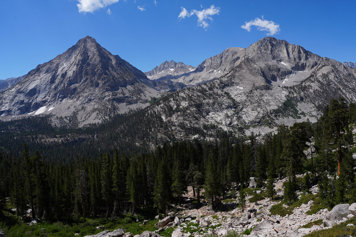
Figure 3.23: East and West Videttes
We reached the turnoff to Onion Valley at 11:00, where we usually have lunch. However, we passed through a little early this time, so we decided to postpone lunch. After walking a little further, we came across an exhausted couple resting there. Their bear canister was empty. I was tempted to call out to them, but decided against it
After a while, we came across a small, unnamed lake. A trail runner came by and took a photo of us. I mentioned the exhausted couple
"It'll be fine. There are a lot of people passing by here, so there's no need to worry," the man said, and ran off. I took a photo of him from behind for my records. He was wearing a bright red Thule backpack
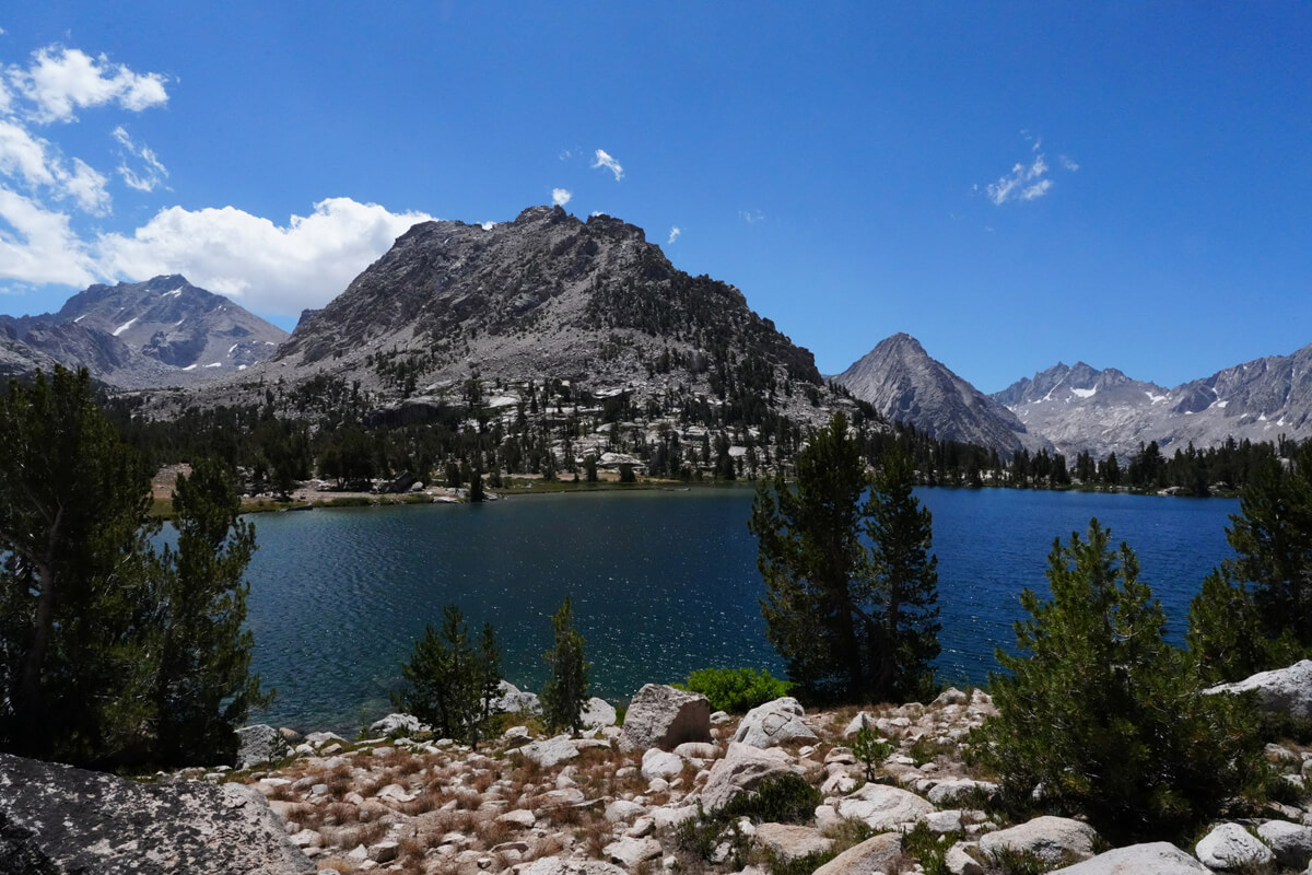
Figure 3.24: Bullfrog Lake is quite large. Unfortunately, camping is prohibited
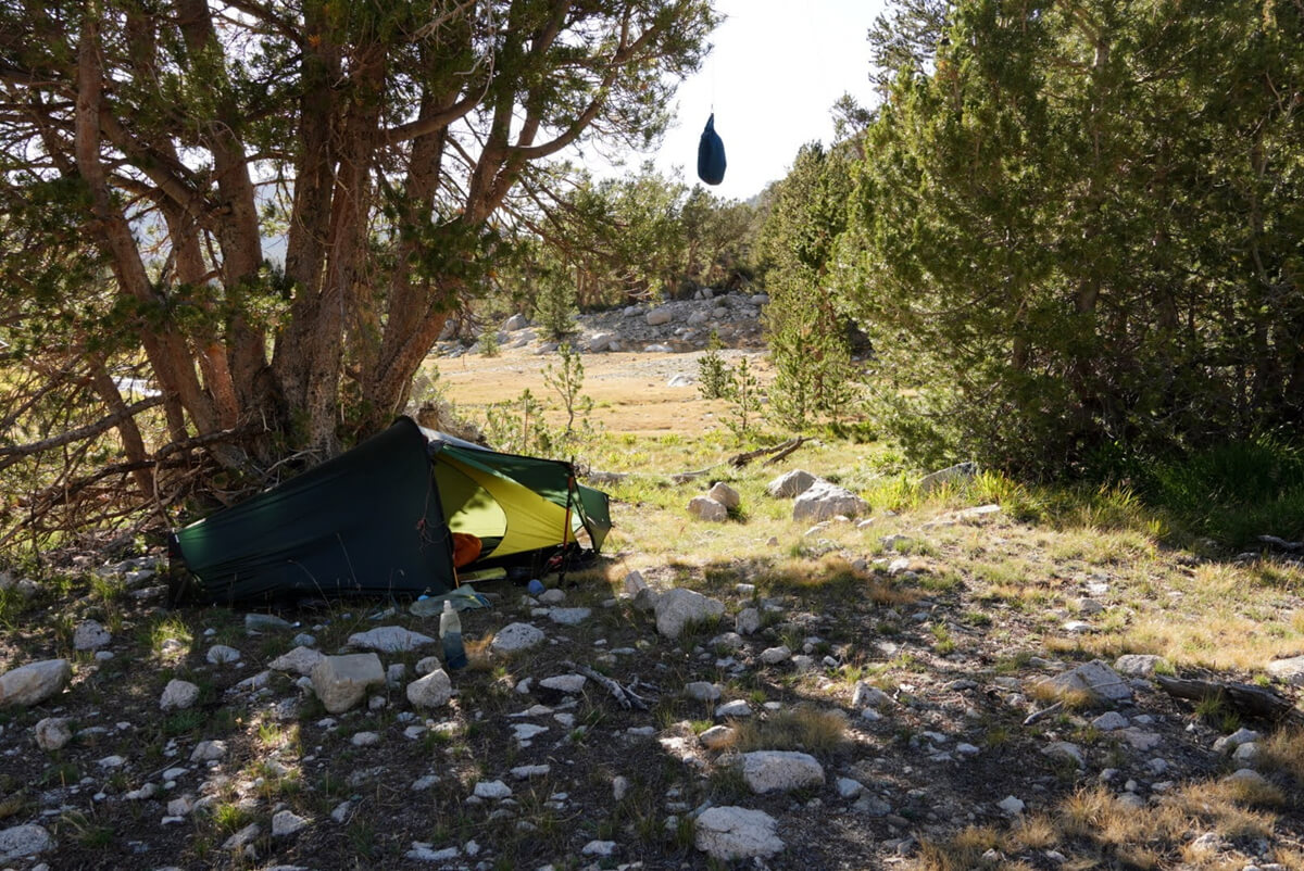
Figure 3.25: Camping upstream of Bullfrog Lake, photographed in 2022
In 2022, I planned to continue northbound on the JMT, descending through Onion Valley to resupply. Since camping is prohibited at Bullfrog Lake, I walked a little upstream and pitched my tent, as shown in Figure 3.25. I cooked and ate the food I'd found in the food box. I looked ahead and saw a bear's face
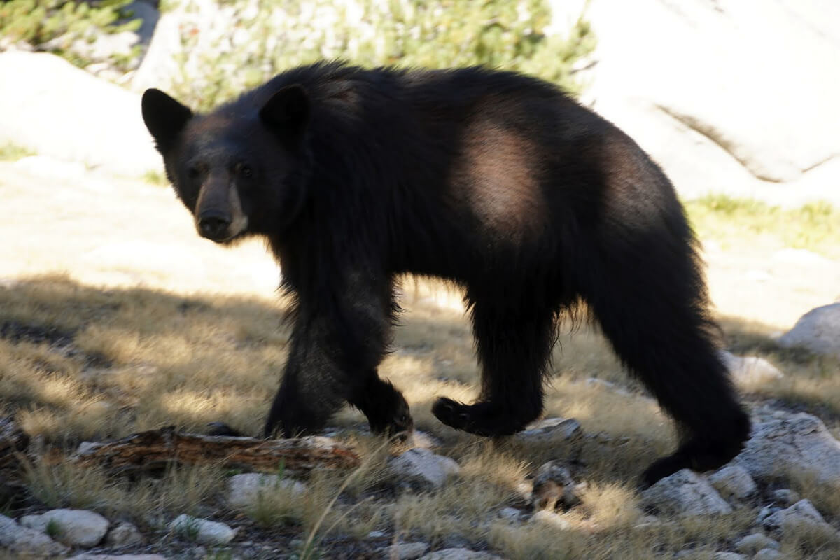
Figure 3.26: A bear looks dejected as it walks away, around the tent
"There's nothing for you to eat," I said, picking up my camera and readying it, but it ran away immediately. This time I was using a Pentax SLR, but I couldn't get it to focus, so I finally managed to take the photo shown in Figure 3.26. You can see from its expression that it was dejected, realizing that there was nothing for it to eat. It was probably a bear that had been lurking around Charlotte Lake. I went to sleep soundly, thinking it would never come again. Of course, it never did. When I posted this photo to an American Facebook group, people asked me all sorts of questions, like whether I had backed away slowly, or whether I had scared it away with a loud noise, but it was just sitting there eating, so there was no way it could back away. I simply whispered, "There's no food for you," and took the SLR photo
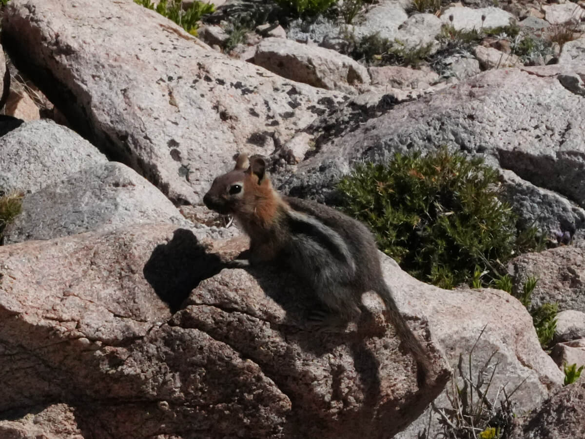
Figure 3.27: There were also some cute ground squirrels
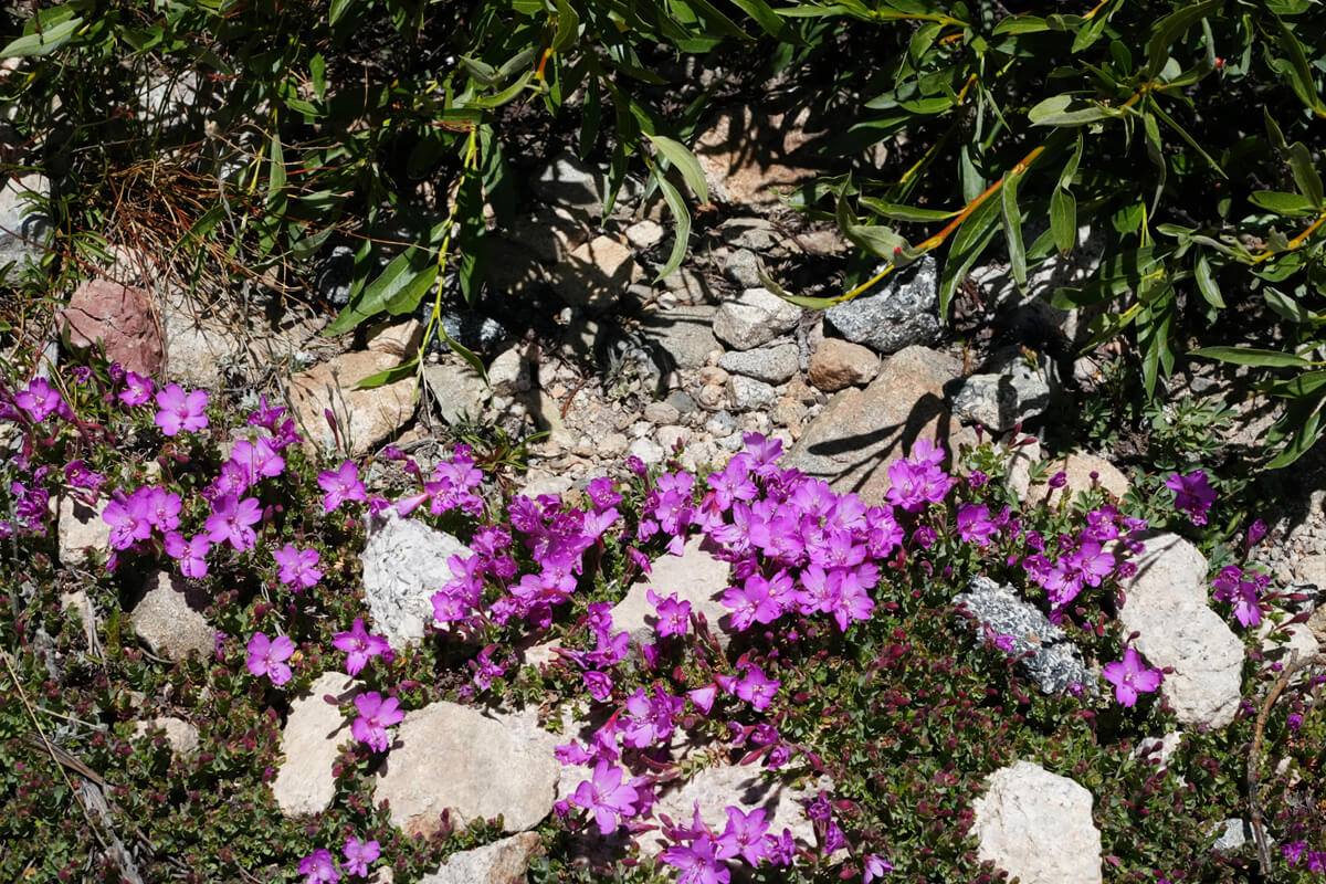
Figure 3.28: Prime Rose
About an hour's walk from Bullfrog Lake, the trail forks. If you take the right, you'll reach Kearsarge Lake. You might want to pitch a tent here and hike to Onion Valley and back. It's a beautiful group of lakes. Of course, bears are a thing, so if you're not around, store any leftover food in a bear canister or hang it from a tree
Keasarge Pass is the rocky hill on the upper left. As we approached, a long switchback began. The slope was gentle. I walked slowly, so I was overtaken one after another. The pass was where the rock tower was. There were usually people making the rounds from Onion Valley, so there was no shortage of photographers to take commemorative photos. The photo I had taken is shown in Figure 3.30. We relaxed and it was already 1:30
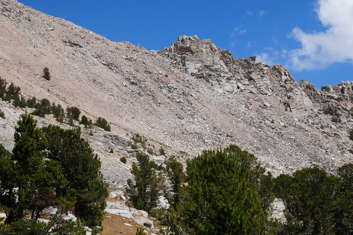
Figure 3.29: Keasarge Pass is to the left of the central depression. The slope is lined with switchbacks
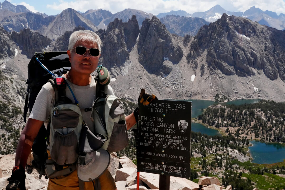
Figure 3.30: At Kearsarge Pass, with Kearsarge Picnal and Kearsarge Lake in the background
From Keasharge Pass, we descended on gentle switchbacks. To the right, we could see a round pond, aptly named Big Pothole Lake. The area around the lake was steep, making it difficult to pitch a tent. The descent then eased off and we circled around the slope. The plains of Onion Valley came into view. This was just before the short switchback, the only place where I could get cell phone reception. I put my backpack down and sat in the shade of a rock. I immediately sent Kurt a text message
"We've just crossed Kearsarge Pass. I'd like to pick up some resupply in Onion Valley."
The reply came immediately
"It's in the food locker by the toilets, at the back left. ... I'm always keeping an eye on you."
Just as planned. Then I checked my email and uploaded some photos to Facebook
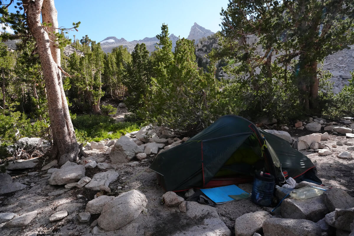
Figure 3.31: At the closest point to Keashurge Pass, there was a stream about 5m away
After a series of short switchbacks, Heart Lake comes into view. The area around the lake is steep and there is no shade, making it difficult to set up a tent. The trail heads north, and after a while, we see a puddle. As we get closer, we see it is a small lake. Water seeps out and a stream begins. Looking closely, we see bare ground. We leave the trail and head in a straight line. There are several sites, and we set up our tent in the shade
It was still 3pm. I had time, and since I was staying for two nights, I did the laundry and hung it out to dry on my trekking poles. Of course, when I say laundry, I don't use detergent, I just wash it with river water. For dinner, I had beef jerky rice. I still had some food left. Tomorrow, I'll finally make the round trip to Onion Valley
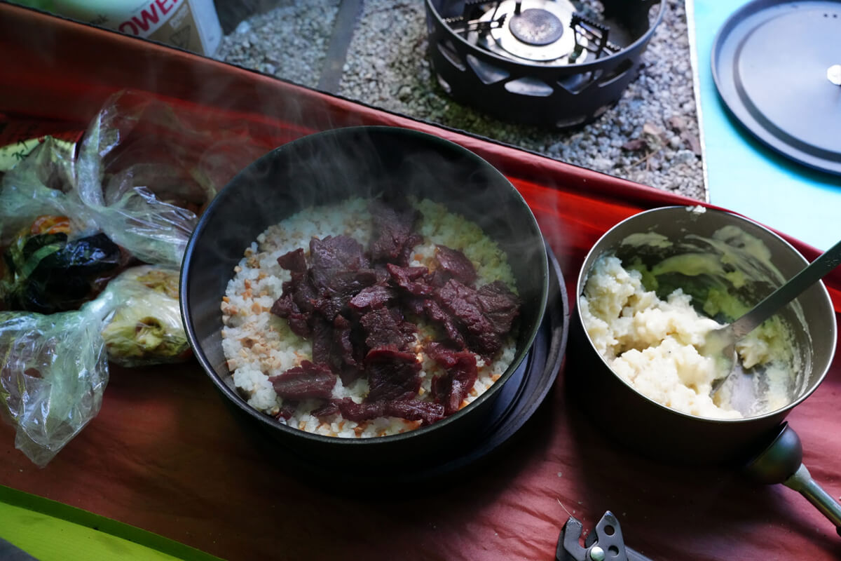
Figure 3.32: Beef jerky and rice for dinner
<Continued in Chapter 4>
Nobuhiro Murakami's new hiking guide, "The Science of Hiking, 5th Edition," is now available on Amazon (Kindle edition is 100 yen)
Nobuhiro Murakami, a former professor at a national university and an experienced through-hiker who continues to share rational solo hiking know-how from a unique and profound scientific perspective in books such as "Hiking Handbook" (Shinyosha) and "The Complete Guide to Hiking in the United States" (Ei Publishing), has released his new book, "The Science of Hiking," which is now available on Amazon. This compelling and logical hiking textbook is based on his accumulated experience dating back to the dawn of long trails in Japan, as well as objective sources such as academic papers on hiking, exercise physiology, and a wide range of other fields
★★Free downloads available for 5 days starting at 5pm on February 3rd★★
Please consider a paid membership to support the site while enjoying exclusive offers and content!
Nobuhiro Murakami


Related reading