Previous article (Chapter 3)
table of contents
Chapter 4: From Onion Valley to Woods Creek
If you walk the southbound JMT from VVR to Whitney Portal, it takes about 10 days. However, it takes about 14 days to walk from Horseshoe Meadow to VVR, so it's best to replenish your supplies along the way. Lately, it's become quite difficult to walk without supplies
The easiest and least expensive option is to camp at Keasarge Lakes or upper Onion Valley and drop off at a supply stop. Then, it's best to cross Glen Pass in the morning. Once you cross the pass, you'll find Ray Lakes. It's a beautiful spot, but due to environmental conservation restrictions, you can only stay overnight.
From Ray Lakes, you can access the Sixty Lakes Basin. A round-trip hike is cross-country, but it's not a problem if you hike out and back. The views from Ray Lakes to Arrowhead Lake are also quite nice.
The descent of Woods Creek is gentle and easy. You will cross two small streams along the way, where you can stop to refill your water supply and camp. There is a large campsite at the confluence with the main stream. Apparently, this area is famous for bears
Resupply Receipt
Yesterday, I set up my inReach to send the preset message "Tent here" to James when I was in range. James wasn't satisfied with that. He always asks me how I'm doing
"So far so good, but age has really worn me out at altitude."
"I've lightened my backpack, which makes a big difference. I'm 67 years old and my base weight without food and water is 9.5kg."
"My base weight is probably double. I'm 75."
"With that weight, it's going to be a blast. I think we'll need a Zero Day with the MTR."
It's free to send preset messages after setting up the tent, but James keeps asking me all sorts of questions. I have to reply every day. It's surprisingly busy
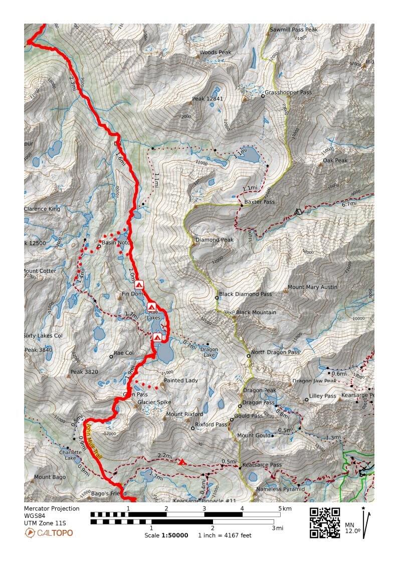
Figure 4.1: Onion Valley to Woods Creek
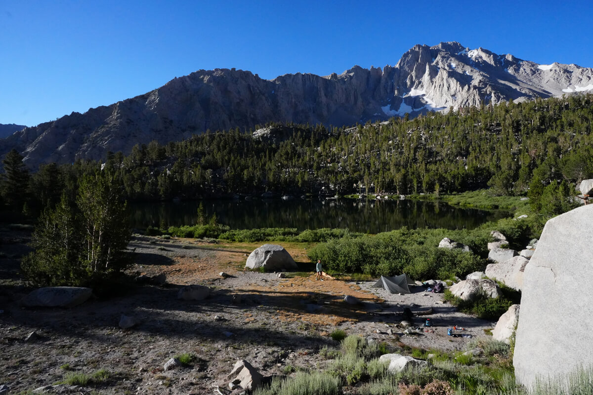
Figure 4.2: Gilbert Lake
It was so hot that night that I couldn't sleep well. It was 14 degrees Celsius inside the tent. But I managed to sleep until 6 o'clock. After breakfast, I checked the gas level on the scale and found that it was 30%. I had no choice but to take it to the trailhead and throw it away. Around 8 o'clock, I slowly set out with only my empty backpack, rain gear, a water filter, a canister with 30% remaining, and 1 liter of water
The trail goes through sparse forest. After passing the switchbacks, you approach Flower Lake. I had planned to sleep further up here, but there were fewer people there and I didn't have to worry about theft if I slept further upstream. So I slept at the very top. There was a thermos cup on a rock. It must have been left there by someone. I left it there and passed by. It was gone on my way back, so I guess the owner retrieved it
Flower Lake is in the forest, so it's not visible from the trail. The elevation difference between it and the next lake, Gilbert Lake, is small. There was a woman camping at the lake. It's a place with good visibility, so when I showed up, she seemed a little confused about where to find the restroom. Several wild deer appeared, some of them with tags. It was the first time I'd seen such a thing
A little further from Gilbert Lake, the trail becomes switchbacks and descends at a steep angle. Since I was still within range on this slope, I checked my email. It was still midnight in Japan, so I couldn't make a phone call. I lost signal as I descended and circled around, but after descending another large switchback, I reached Onion Valley. I walked leisurely, so it took me two and a half hours. The trailhead is narrow, as shown in Figure 4.4. The largest vehicle I could get was about this size, so hitchhiking would take a while
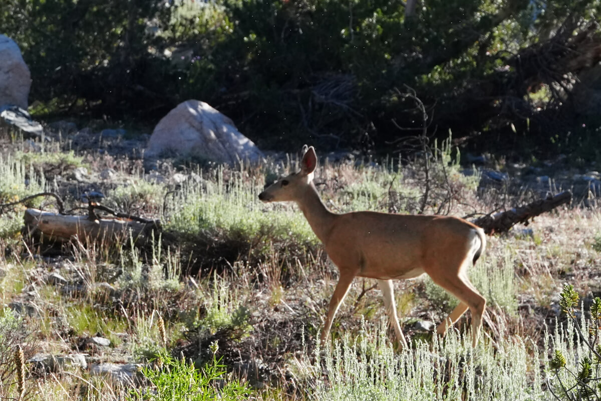
Figure 4.3: Wild deer, some of which had tags around their necks
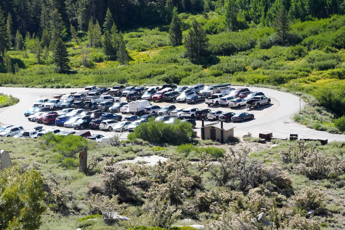
Figure 4.4: Onion Valley Trailhead
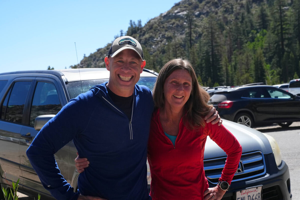
Figure 4.5: Aaron Pearlman. I also met this couple upstream of Woods Creek, likely on a round-trip hike across Pinchot Pass
When I opened the back door of the food box to the left of the toilet, I found the resupply I had asked Kurt to bring. As I was about to take it out, someone was taking pictures of the inside of the food box with their smartphone. It was Aaron, shown in Figure 4.5. He was an experienced trail hiker, and was explaining the resupply to his girlfriend. When I mentioned that I would be camping at the top of the mountain and making a round trip,
"I did too. It's a nice place."
"It's a nice place with a little pond and a stream, but if I go back and forth I won't be able to eat my sandwich. I'd have to be a little smarter to hitchhike back and forth. It's quite difficult."
Figure 4.6 shows the food we took out and arranged on top of the food box. It would be easier to organize it by day, but since one slice of JMT bread lasts for three days, we organized it in three-day increments. On the far left are gas canisters, mayonnaise, etc. Next are ten days' worth of food, divided into three-day increments. On the far right are coffee and snacks, and on the far right are unnecessary food. We couldn't eat much because of the altitude issues, so we threw away the JMT bread and some of the dried potatoes. It's a shame, but there's no other way. We put the gas canister, which had 30% left, on top of the food box in case someone else needed it
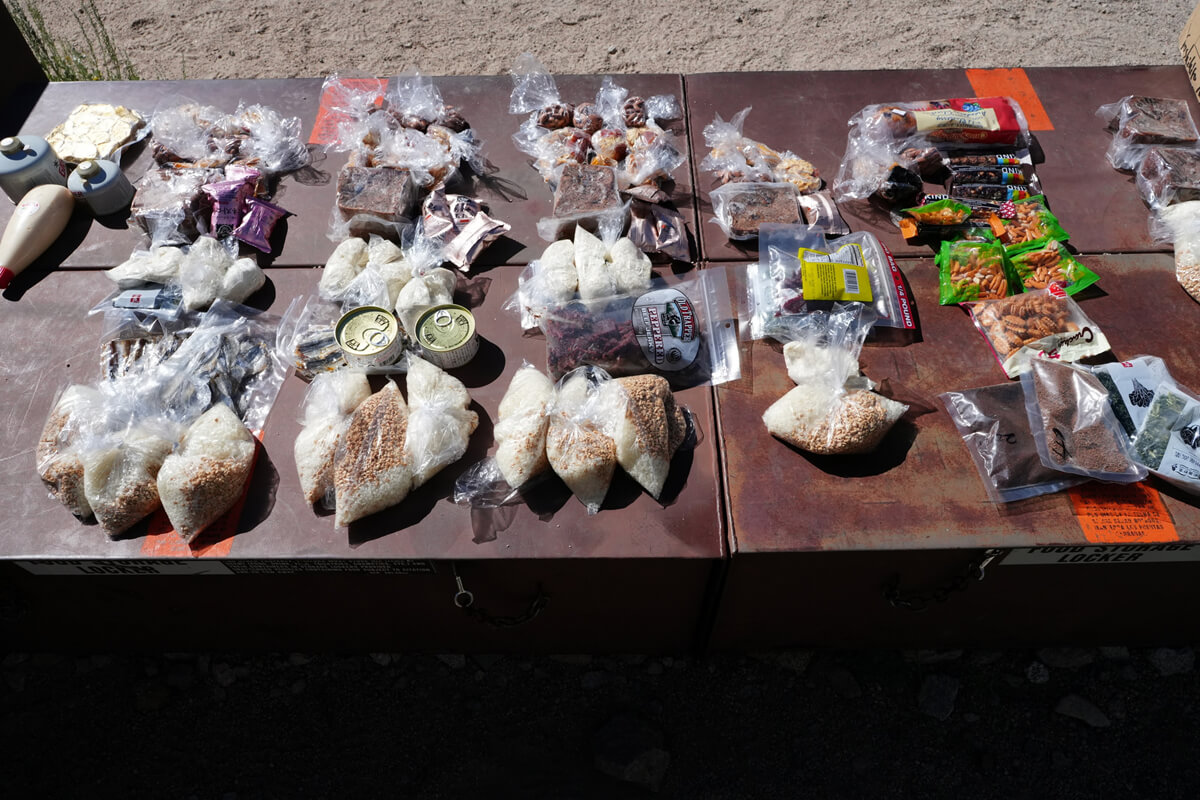
Figure 4.6: Organizing a ten-day supply of supplies
Here's a summary of how to resupply
- Send resupply to the post office in Independence. You can hitchhike back and forth from Onion Valley. You can buy resupply in town, but there is a very small market. Be careful, as there are only a limited number of items available
- Before hiking, store your resupply in Onion Valley food boxes. When doing so, write your name and expiration date on the box. Otherwise, it will be disposed of as trash. Like me, you can go to Onion Valley from the upper reaches or from the camp at Kearsarge Lakes
- The Mount Williamson Motel offers a package deal that includes lodging, resupply, and a shuttle to the trailhead. It's expensive, costing around $400. We stayed there in 2019, but the motel was old and the air conditioning was so loud we couldn't sleep. We canceled the shuttle the day before and they wouldn't refund us. We'll never stay there again
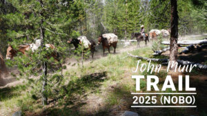
- The easiest option is to have a packer bring you some food at the junction with Charlotte Lake. This would cost nearly $1,000, as it requires two horses and one person. Furthermore, since the packers are essentially cowboys, it's difficult to contact them by email. American hikers often recruit others to share the trail
- I later learned that James had a strong son, and while he was sleeping in a tent near the junction, he went to get some resupply. It was wonderful to have such a strong son. It was the ideal method
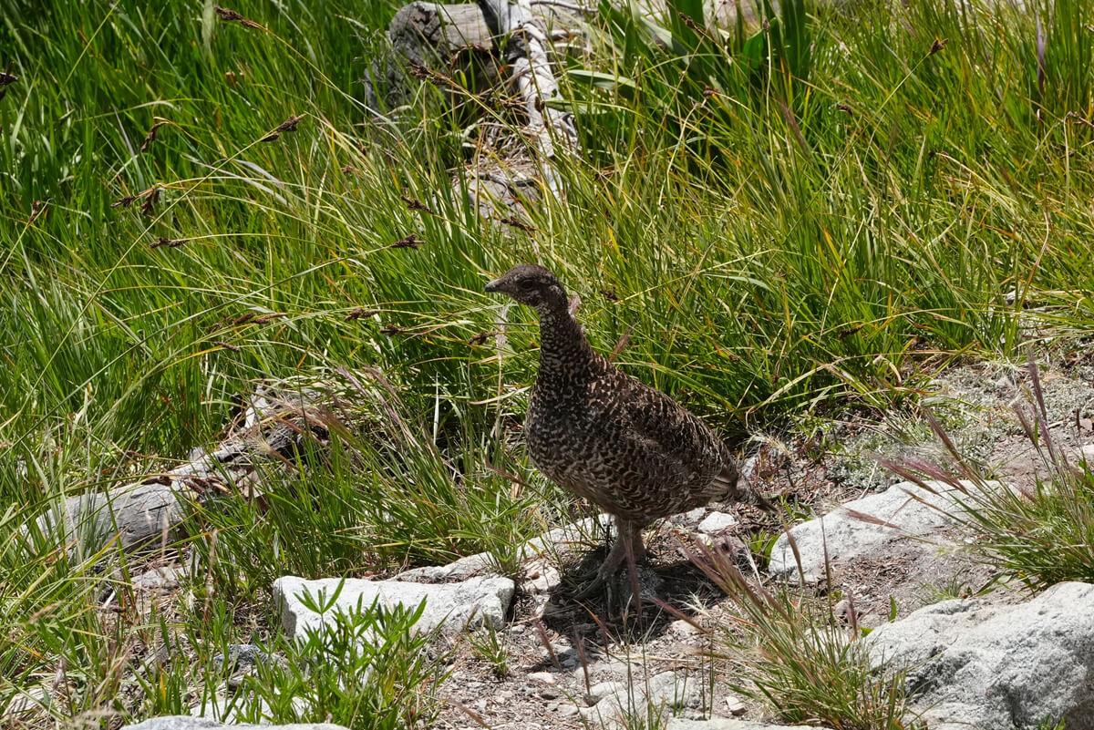
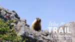
Figure 4.7: For some reason, the Grosbeak (Ptarmigan) refused to budge from the trail
I wasn't confident about hitchhiking back and forth to Independence just to get a sandwich. I had added some long-lasting blueberry cake to my resupply for the day. It was a little early, but I wanted to have lunch. I looked at the nearby campground, but it looked like someone was already there, so I decided to go back a little further up the trail. I found a shady, spacious spot around the base of the mountain, just before the switchback. There I had instant coffee and cake for lunch
I started walking slowly just after 1:00. I wanted to call Chieko, but it wasn't morning in Japan yet. It had to be at least after 2:00. I left a message asking her to call me when she woke up, and then I walked. A little while after the switchbacks began, the call came. It was around 5:00 in Japan. I was told that the resupply was successful without any problems. I was using a 050 internet phone number with a very cheap American SIM card, so I had no problem calling as many times as I wanted
A Grosbeak (a Japanese ptarmigan) was standing blankly beside the trail just before Gilbert Lake, not wanting to move. I took the opportunity to take a portrait and walked around it. I also told a female hiker coming up behind me to move out of the way. Even a Grosbeak has a lot on its mind
It was past 3 o'clock when I returned to the tent. It was exactly as it was when I left. However, the sun was shining on me, so I moved to a shady spot. Since there was nothing else to do, I ate some almonds and took a nap. For dinner, I had a canned mackerel set meal
The resupply was a success and the next challenge was simply to cross Glen Pass
Kearsarge Pass to Glen Pass
I slept well and woke up just after 5:00. Yesterday's lazy round trip to Onion Valley seemed to be a good thing. It was an active rest, and my fatigue was gone, so the bread tasted delicious. The effects of altitude sickness finally faded. We set off just after 7:00, and because we walked slowly, we arrived at the pass just after 9:00. We took commemorative photos and chatted with some American hikers. The hikers are shown in Figure 4.8. They seemed a little heavily equipped, but they were probably JMT hikers or long section hikers
After completing one switchback, I saw a hiker carrying a large backpack by hand instead of on his back, and another hiker sitting at the turning point of the switchback
"what up."
"My legs are cramping and I can't move."
By chance, I had a great subject on hand, so I was thrilled to test the effects of vinegar
"OK. I'm going to prescribe a miracle cure now. Look up and open your mouth. I'm going to drip a little vinegar on you, so hold it in your mouth for a while and enjoy the taste."
The hypothesis that cramps are caused by electrolyte deficiency was rejected more than 10 years ago. A comprehensive review of 69 studies by Julliart et al. (2018) also found that the neuromuscular hypothesis prevailed over the dehydration and electrolyte hypothesis. Recent research suggests that the spinal cord, rather than peripheral motor neurons, is involved. The effects of vinegar were discovered by chance during a literature search. Vinegar likely strongly stimulates and resets the nervous system. Therefore, its effects appear within 10 seconds to 1 minute.*1
His expression changed within about 10 seconds. It seemed to work
"What's your name?"
"It's Hiro."
"You're my hero."
He tried to take a photo of me, but unfortunately the battery was dead. My camera is a Sony, so there was nothing I could do to help. I had killed enough time, so I decided to move on. Just then, my friend came down the mountain. He was probably the same one who had climbed up earlier, carrying his backpack with one hand. He also got up and walked up on his own. He only needed a few drops of vinegar, but he may have become a legendary hero
*1 Nobuhiro Murakami. The Science of Hiking, 4th Edition (p.309). Kindle Edition.
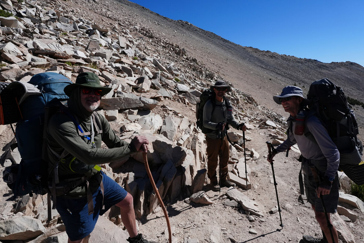
Figure 4.8: Hikers on Keasarge Pass
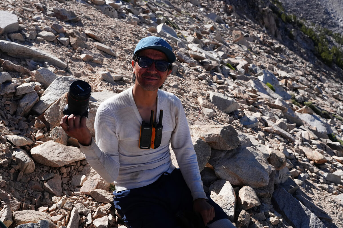
Figure 4.9: Edgar Reyes. According to his Instagram, he is a photographer, holding a Canon mirrorless camera and a Motorola walkie-talkie for communication with his teammates
After the switchbacks, we descend straight for a while, but instead of heading towards Bullfrog Lake, we take the Keasarge Pass Trail. This is a shortcut that connects to the JMT without losing elevation. Figure 4.10 shows the location where we pitched our tent when we did the south-facing JMT with Chieko in 2019. It's between the pine trees, marked with a red ▲ on the map. The water is about 100 meters west of here
Figure 4.10: The location where we pitched our tent in 2019. This is the only water we have
Continuing on, the trail cuts horizontally across the steep slope. From here, we have a panoramic view of Bullfrog Lake (Figure 4.11). We found a fallen tree where the terrain leveled off, so we sat down for lunch. The trail now became gentler and connected with the JMT. Charlotte Lake came into view. The trail inclines more. Turning east, we crossed the tree line and entered a rocky ridge. We searched for water, but it was not in the usual place. The small puddle had dried up. A little further on, we came across a larger puddle, so we refilled it with water from our water filter. Several hikers passed by
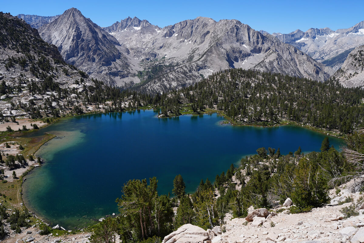
Figure 4.11: Bullfrog Lake
As we climb higher, the first pond appears. It is a round pond surrounded by steep slopes, making it difficult to draw water and there is no place to rest. Therefore, we replenish our water supply before reaching this pond
I passed someone wearing a nice uniform
"Are you a ranger?" I asked. I had seen him before. Upon investigation, I found out that he was someone I had passed at Mather Pass in 2018 and had taken a photo with. He didn't seem to remember me. He readily agreed to be photographed again this time. I asked him about it
"Has your employment status changed under the Trump administration?"
It sounded a bit like a newspaper reporter, and I thought maybe I'd gone too far
"We are not in a position to answer that question," was the standard response. This person had refused to show his permit in 2018, but this time he asked for one and signed it. That was SEKI-116@Glen Pass 8/1. This shows that permit checks have become stricter under the Trump administration
We arrived at Glen Pass at 4:00 p.m. If the weather had been bad, we would have camped near where we had stocked up on water, but this year the weather has been clear every day. Because it was so late, there was no one at Glen Pass. Figure 4.14 shows the view to the north. It is a composite of two photographs. Today's destination is the furthest lake, Ray Lakes, but it is quite far away
Figure 4.12: Pond south of Glen Pass. The pass is in the upper left of the photo
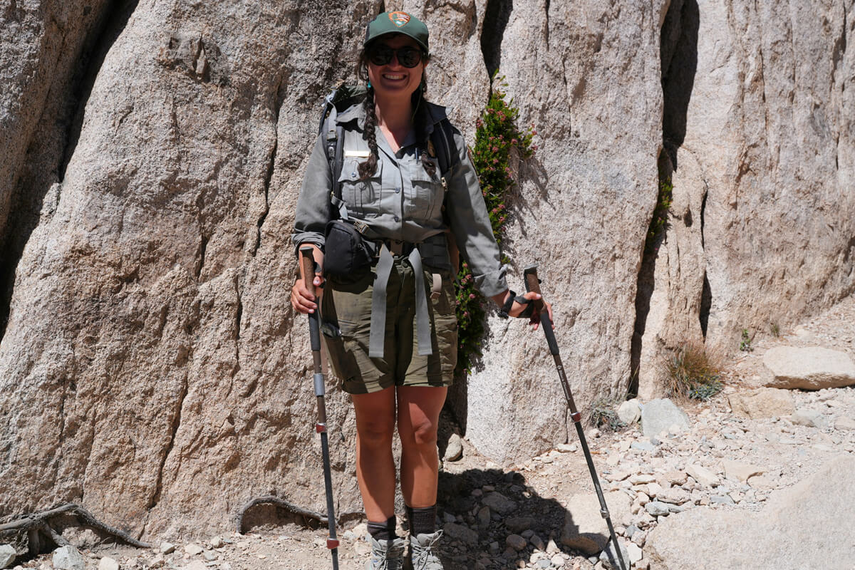
Figure 4.13: Encounter with a ranger. We also met in 2018
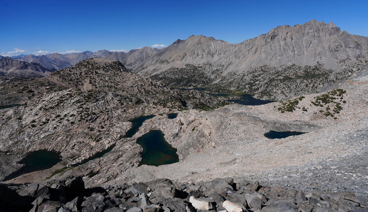
Figure 4.14: North side of Glen Pass. The lake at the back is Ray Lakes, and the high mountain is Black Mountain
A photo from 2017 is shown in Figure 4.15. It is the view on the right side of the panoramic composite photo. At the time, there was still snow on the slope, so ice axes and crampons were needed. As I finished the switchbacks, I encountered a hiker wearing only shoes slipping up the mountain. There were no reports of fatalities, but I imagine they must have been extremely exhausted
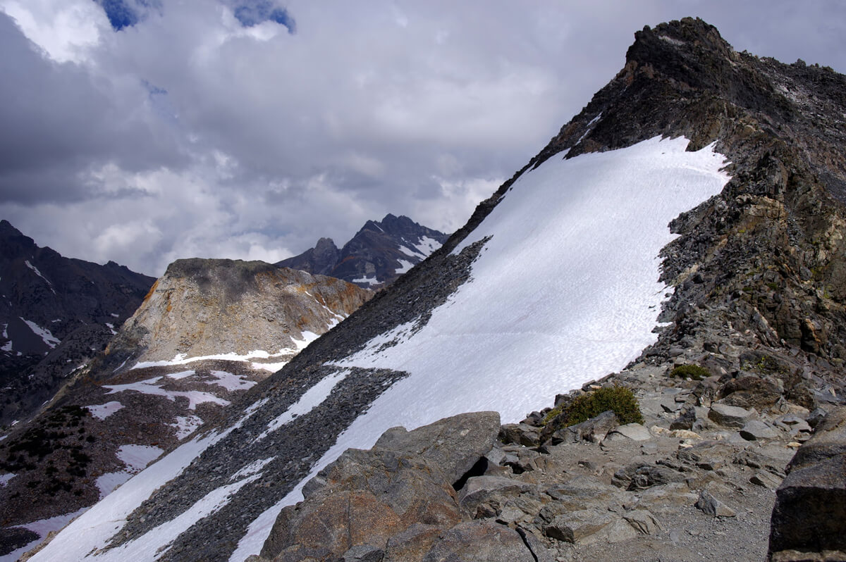
Figure 4.15: Glen Pass on a snowy year. The jagged mountain in the distance is Dragon's Tooth. The table-like mountain is Painted Lady. Photographed July 26, 2017
It takes about an hour to get from Glen Pass to Ray Lakes, but after 4 p.m., my legs start to get weaker. After descending the switchbacks, I reach a horizontal rocky ridge and can see the back of Painted Lady on my right. "Painted" means brown. It's rare to see such exposed geological layers in the granite-rich High Sierra. On my left is the lake where Tosaka-san was camping
Figure 4.16: Akira Tosaka at the summit of Painted Lady. Photographed in 2009
In 2009, Tosaka was waiting for me on the trail and asked me which one was Painted Lady, so we climbed together. Painted Lady looks like a pointed triangular pyramid from the lake, but from the side it is a trapezoidal mass of rock. Without a GPS, it is impossible to find the peak's location. If you're not careful, you could end up taking a long detour. So I used my GPS to select a place with a gentler slope and headed for the peak
His majestic figure is shown in Figure 4.16. I didn't climb it again after that because it would take more than an hour to go there and back, and the view from there was not much different from that from Glen Pass, except for the view of the Woods Creek watershed
The lake where Tosaka-san had camped was a little far away and the approach looked troublesome, so we passed it and went down a short switchback. There was a rock terrace where it looked like we could pitch a tent, but the water was far away. We went a little further. It was hard to find a campsite
Just as I was about to give up, I spotted a small pond on my left and some bare ground between the trees. I walked in and found the only site where I could pitch a tent. It was shaded by the trees and not visible from the trail. There was also a stream. All I could see was the profile of Painted Lady, but it was a perfectly private site (Figure 4.17). I set up my tent at 5 o'clock. For dinner, I had a canned mackerel set meal
I slept until 6 o'clock. I had my usual breakfast of JMT bread, mango, prunes, and coffee. I set off later than usual at 8 o'clock. After walking for a while, I met two hikers who asked me as we passed each other, "Are you Japanese?" When I told them my name, they said, "Low Gear, Low Gear."
Figure 4.17: Camping site upstream of Ray Lakes
Figure 4.18: Tae Okuda on the left and her Mexican friend on the right. They appeared to have walked the Big Seki Loop
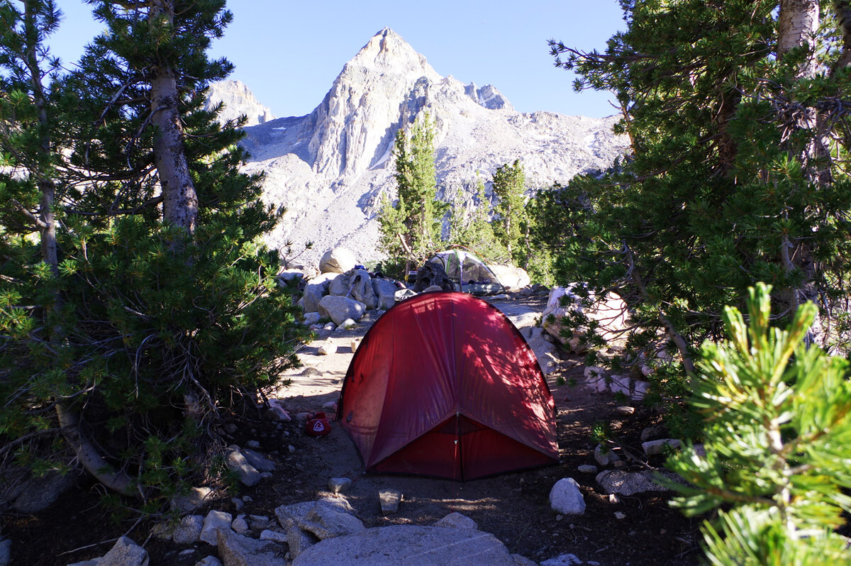
Figure 4.19: The tent is a Robens Buzzard Ultralight, on the peninsula connecting the two lakes, 2016
"I met Shroomer last year when I did the High Sierra Route. Yoshihiro has written a whole book. He told me I should definitely meet him. I can't believe I met him so soon!"
Schroomer is very talkative, so when he sees a Japanese person, he talks about anything and everything. A friend of a friend is a friend, so we stopped and chatted for a while. Tae Okuda and her Mexican friend seemed to be on their way back from the Big Seki Loop. They wanted to do the JMT next, and asked me how I was resupplying. I explained everything to them, but since they live in Los Angeles, we decided to meet in Los Angeles before returning to Japan. A commemorative photo is shown in Figure 4.18
Perhaps we were chatting for a long time, or perhaps we were walking slowly, but we arrived at the junction of 60 Lakes Basin at 9 o'clock. For some reason, there were hikers who had pitched tents instead of crossing the lake. There are many campsites on the peninsula-like area that separates the two lakes, but it seemed like they were unfamiliar with them
Sixty Lakes Basin
The 60 Lakes Trail runs northwest from the point where the two Ray Lakes are separated, passing several lakes before disappearing. From there, it becomes a cross-country trail, crossing a low point called Basin Notch, then a gentle valley, passing Arrowhead Lake, before joining the JMT. Except for Basin Notch, the valley is too steep to walk down
I first heard about it in 2009, during my first JMT hike. A young Czech guy showed up and said, "I've done 60 Lakes. You can do it, too." I think it was near Arrowhead Lake. I'm not sure exactly where we met, but we hiked around Mother Pass and eventually descended to Lone Pine with Crazy Doc. At the time, I wasn't confident I could do 60 Lakes, but it was always in the back of my mind. So I looked at the contour lines on the map, looking for a place with a gentler slope. I was sure I could make it. That place was called Basin's Notch. I found out much later
Figure 4.20: A young Czech man pumping his fist in celebration of completing 60 Lakes. Photo taken in 2009
When I decided to go to 60 Lakes Basin, I happened to be accompanied by a photographer from Peaks, who accompanied me from Horseshoe Meadow to VVR (Figure 4.21)
Figure 4.21: The Peaks photographer and editor on the switchback before Cottonwood Pass. This time, we didn't stop until VVR. Photo taken in 2016
This was the year I hiked the longest distance, from Yosemite to Sonora Pass. I thought we had enough time, so I suggested we go around the area with a daypack and return to the campsite. However, my photographer objected, saying it was a tight schedule. So, I had no choice but to go out fully equipped
At first, the trail climbs uphill. After about 30 minutes, Ray Lakes and Painted Lady come into view. Ray Lakes looks like a hole surrounded by rocky mountains (Figure 4.22). As the trail levels out, Lake One comes into view (Figure 4.23). It is a relatively large lake. Lake Two is small, but there is a larger lake in the background. Walking along the lakeshore, Lake Three can be seen to the north from a small hill (Figure 4.24). The mountains in the distance are along the JMT. Figure 4.25 shows Mount Cotter, visible to the west. As we head north, the trail gradually disappears. We lost sight of the trail and walked along the lakeshore
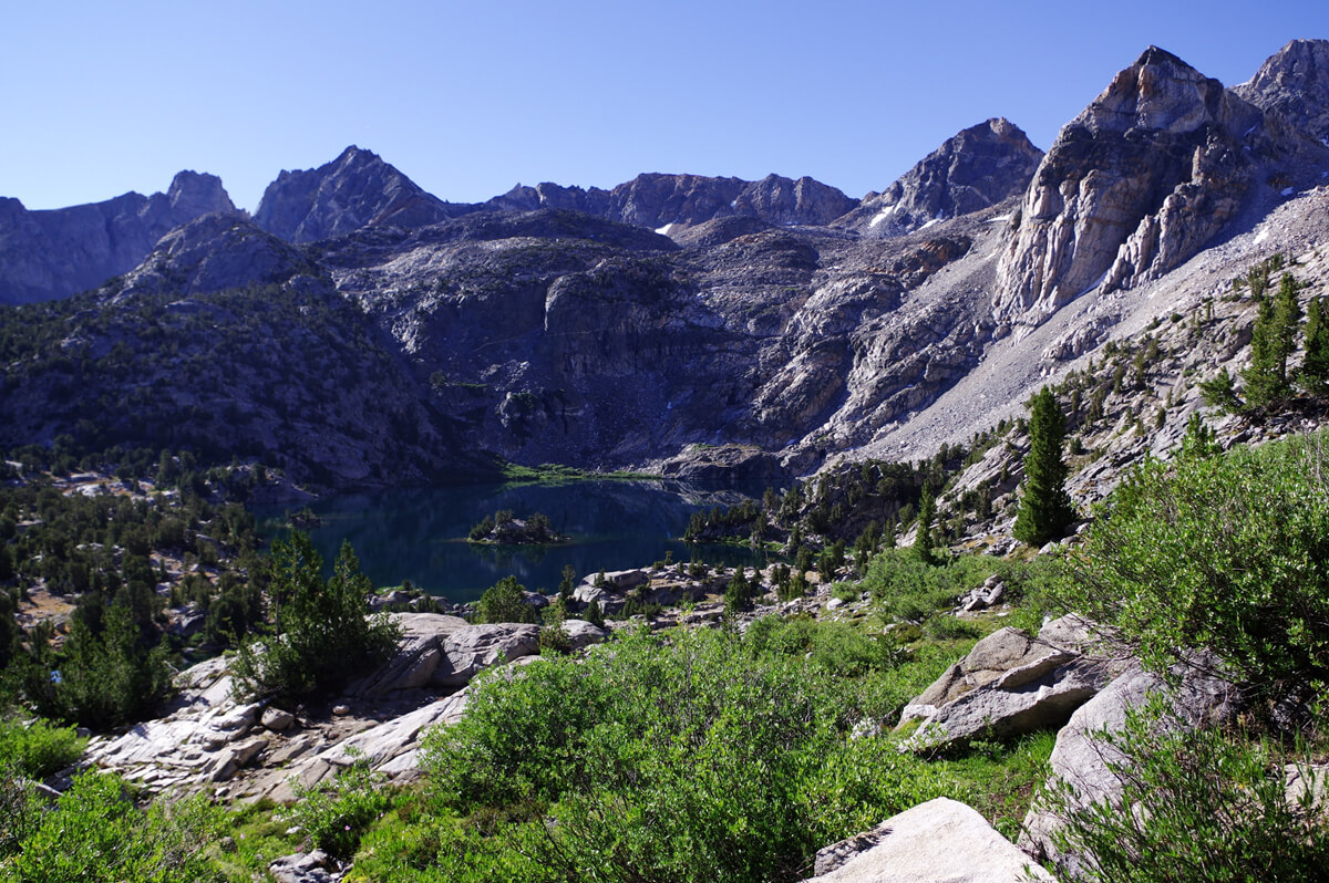
Figure 4.22: Upper Ray Lake is in the center, and the sharp peak on the right is Painted Lady
Figure 4.23: First Lake
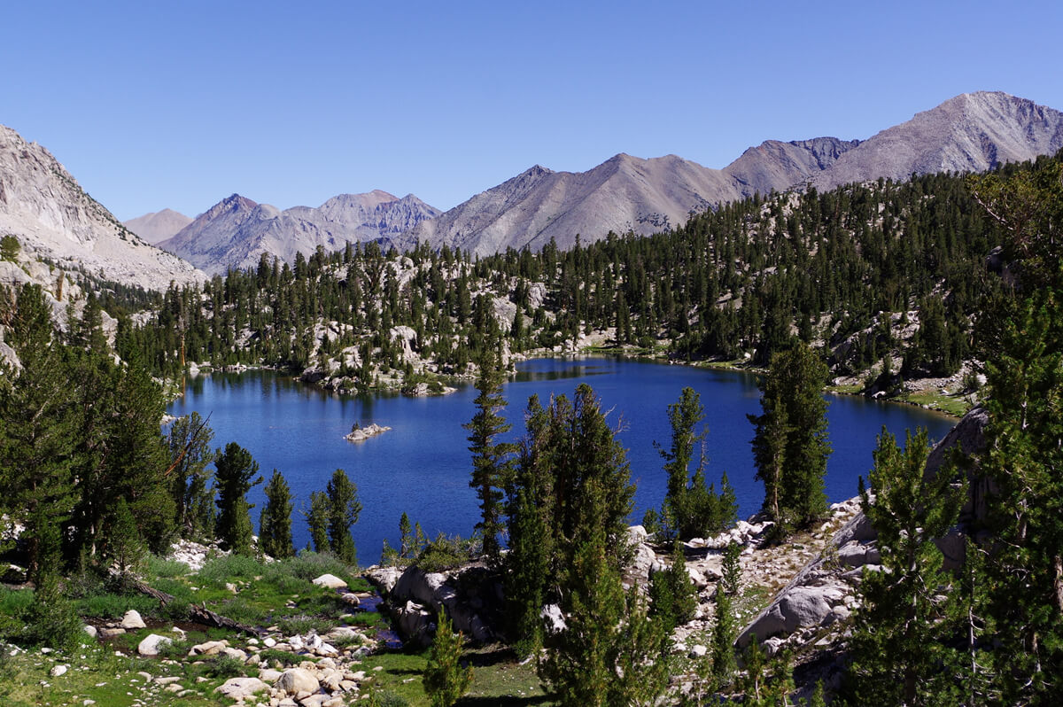
Figure 4.24: The Third Lake
Figure 4.25: Mount Cotter with the lake in the foreground. The trail disappears from here. Use your GPS to find the exact spot
We've now reached the point where we should head east
"I wonder where it is. I'm a little lost," I said. Looking at the GPS, it seemed we had passed by about 100m
Apparently, I hadn't said it very well. The photographer accompanying me was so surprised that he snatched my map and walked away. He didn't have a map
"That's not the way," I said, following him, but soon we came to a dead end on the ridge
"It's too steep to go down."
"I told you so. It's not that way. The only place we can get off is about 100 meters south. I'm tired, so I'll take a break here. Go and have a look."
After about 10 minutes he came back
"Found it. You can go down."
"I guess so. Let's go then."
Cross-country skiing like this requires micro-level judgment. Sometimes a map and compass alone are not enough, and a standalone GPS is necessary. At the time, I was using a Garmin GPSMAP 64, but now any Garmin watch with a map display is sufficient. I transferred a free topographical map of the United States to it, and I still do. Basins Notch is a gentle valley, and I was able to descend it hands-free using only trekking poles. As I descended, I could see the valley. If I descended the valley, I would end up far below Dollar Lake. It seemed possible, but of course, it was dangerous. I crossed the ridge horizontally and had lunch on a flat spot. After a short break, I could see Arrowhead Lake. A smooth walk along the lakeshore would connect me to the JMT. This time, I made an effort to walk a few kilometers upstream from the Woods Creek junction to my campsite
Ray Lakes to Woods Creek
There is a river crossing just after the junction with the 60 Lakes Trail. This year, the water level was low and it was easy. If you walk straight ahead and climb up, you will come to a number of campsites. Figure 4.19 is one of them. Painted Lady is visible directly ahead
As I walked along the lakeshore, the Painted Lady's appearance gradually changed. Figure 4.26 might be my best shot of the year. Going around the lakeshore and heading north, I could see the entrance to the campsite. There were food boxes at the back. I've never used them
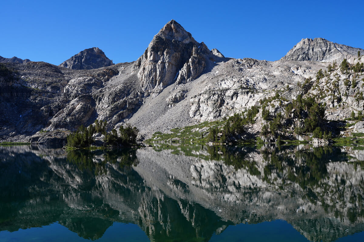
Figure 4.26: The Painted Lady, seen from the lake as a triangular mountain
A little further on, the ranger station building comes into view. This is also a good photo spot as it offers a good view from the trail. A stream flows below the ranger station, making it a good camping site. It was used on the cover of "An Introduction to Hiking in America," but recently camping has been banned here. This may be a valuable piece of footage
A little further on, Fin Dome comes into view. This is also a mass of sharp rocks, making it difficult to photograph as desired. Figure 4.28 shows this year's results. fin is French for fish fin, and Dalton Coit Brown named it Fin Dome in 1899 after seeing the view of the mountains from Ray Lakes and feeling as if he were looking at a sea monster
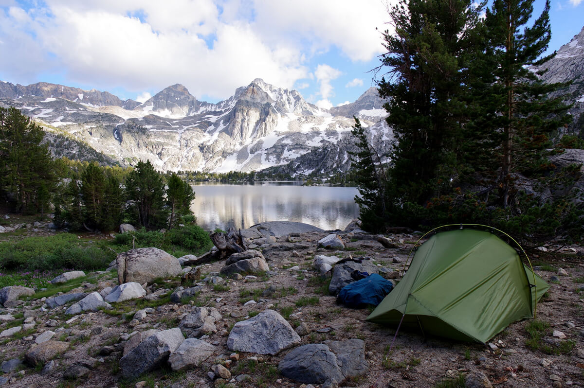
Figure 4.27: Camping site near the ranger station, 2017
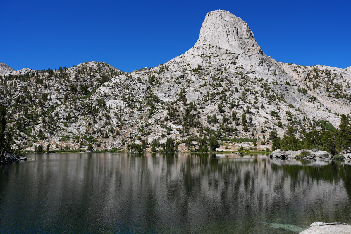
Figure 4.28: Fin Dome
I'm not feeling well today, so I can't walk much. I had lunch at a high point next to a trail with a view of Arrowhead Lake. It was around 10 o'clock. Just as I finished eating, a ranger suddenly appeared and asked me to show him my permit. I showed it to him, and he quickly scanned it with a terminal that looked like a barcode reader at a cash register. I was a little surprised by how high-tech it was. The scanned data could easily be compared with the data entered on Rec.gov. It's very dangerous
"Where did you camp?"
"Upper reaches of Ray Lakes."
"You're not allowed to stay around here for more than one night."
She was a rather unfriendly woman. She refused to take a photo. I secretly took a photo from behind her, but the image was a little out of focus. She quickly left. It seemed like she was checking the entire area thoroughly. It seems like she's quite busy as a ranger
Apparently, having a Nagoya sweet, oshiruko sandwich, for lunch wasn't a good idea. I ate a whole bag, but I still had no energy. I staggered along, and finally reached the river crossing just before Dollar Lake. It was easy, as expected. After crossing this point and climbing a little, I looked back, and Black Mountain, Dragon's Tooth, Painted Lady, Fin Dome, and more all came into view. I was amazed when I first came here on the southbound JMT. Every time I cross a pass on the JMT, I enter a different world
As usual, camping was prohibited at Dollar Lake. Usually, there are many hikers who might violate the rules, but there was no one there. I took a short rest and headed for the area where a tributary of Woods Creek meets the main stream. There was a large campsite, and I had hoped to pitch a tent there
From Dollar Lake, it's a gentle descent of about three hours to the crossing with the main river. There are two stream crossings, each about an hour from river to river. The first stream is wide and rocky. The water level is low, so it's not a problem. I once saw a Chinese couple here severely scolding the woman. It didn't feel good, as they're usually scared when the water level is high. After crossing, there's a campsite on the right, and the trail climbs up the hill
After a while, two tired-looking female hikers approached
Are there any good campsites around here?
"If you walk for another 30 minutes, you'll come to a stream. If you don't cross it and go left, you'll find the campsite. There's no one there yet. It's a nice place."
No one would notice I was Japanese if we were talking at this level. The problem is, I know more than Americans. The second stream was a lovely spot surrounded by trees, but as I got closer, it started to get covered in fallen trees. The area around the stream was also completely exposed, making it impossible to rest comfortably in the shade. I replenished my water supply and headed for my final destination. I was getting tired and my legs were getting weaker. Occasionally, I was overtaken by two hikers who were walking in front of and behind me. They were Kolohe and Paparich (Figure 4.31). There were plenty of places to pitch tents just before the campsite where the streams met, but the water was far away. Dead trees were noticeable everywhere. Perhaps it was because there hadn't been any rain recently. I arrived at my destination at 4 p.m. Kolohe and Paparich were there, and they said, "Good job!" Well, I had to come this far
Figure 4.29: Woods Creek tributary area. Easy walking with a gentle descent
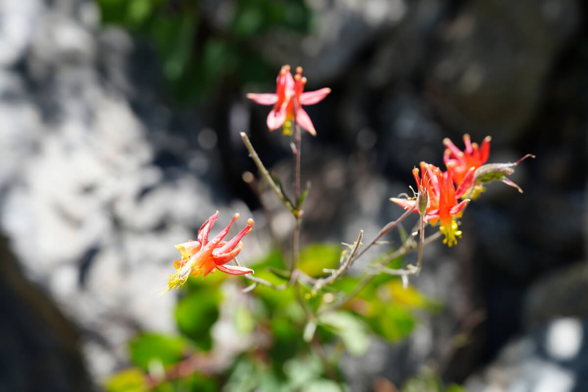
Figure 4.30: Red columpine blooming beside a stream
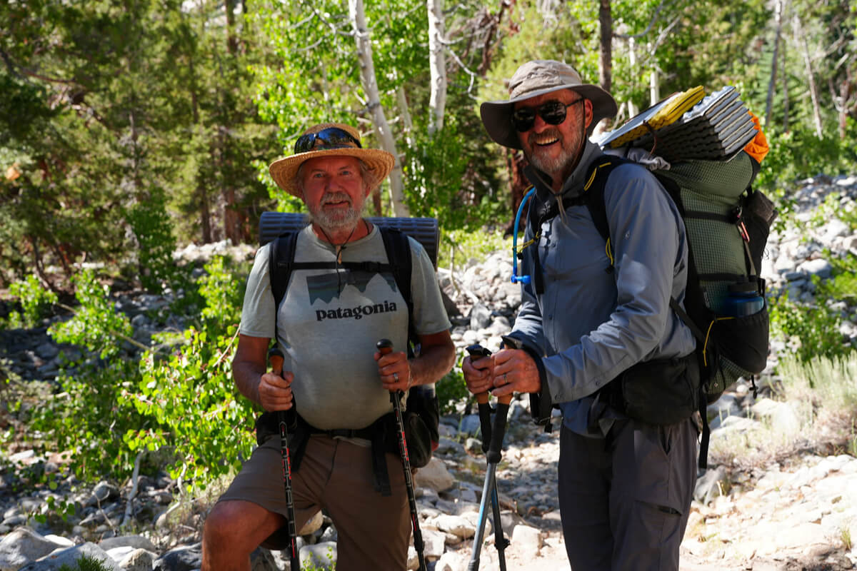
Figure 4.31: Kolohe (left) and PapaRich (right). Kolohe means mischievous in Hawaiian. PapaRich is probably a rich dad. However, PapaRich, with an extra p, is a Malaysian restaurant chain
Kolohe and Papalić were resting and doing nothing. They found a flat area near the food locker, so they pitched their tent. As they were about to hammer in the reinforcement stakes, Kolohe yelled, "Bear!", banging his trekking poles and yelling. It was a noisy campsite
The bear looked displeased with the presence of the person and slowly walked away. It seemed to be quite accustomed to the bear. This must be a common occurrence. Kolohe said, "Camera!" but we were tired and not very interested, so we didn't take any photos. There was no sense of urgency. The bear slowly went down to a tributary of the river
"Put all your food in the food locker. You can't leave food in your tent," he told me. But even if I told him that, it would be a problem if I got hungry in the middle of the night. He seemed like an experienced hiker, but he said some annoying things. And little by little, more and more hikers were coming. Everyone just looked around without pitching a tent. It just didn't seem like a very interesting place. There were too many people. I decided to take the plunge and move
Although I didn't have a campsite in mind, I packed up haphazardly and set off immediately. I crossed Woods Creek on a suspension bridge. After walking a little downstream, I came across a fork in the trail, so I headed upstream. The climb was steep for a while. I kept looking for a campsite, but there wasn't one. Continuing on, I found a spot that looked like it might be possible to pitch a tent. However, it was too close to the trail. Continuing on, I found a spot with a good view. It seemed to be a well-used campsite. I left my backpack and continued on, carrying a bladder to secure water. I came across a stream about 50 meters ahead, and managed to fill it with 5 liters of water. Now I was able to camp comfortably alone. This is shown in Figure 4.32
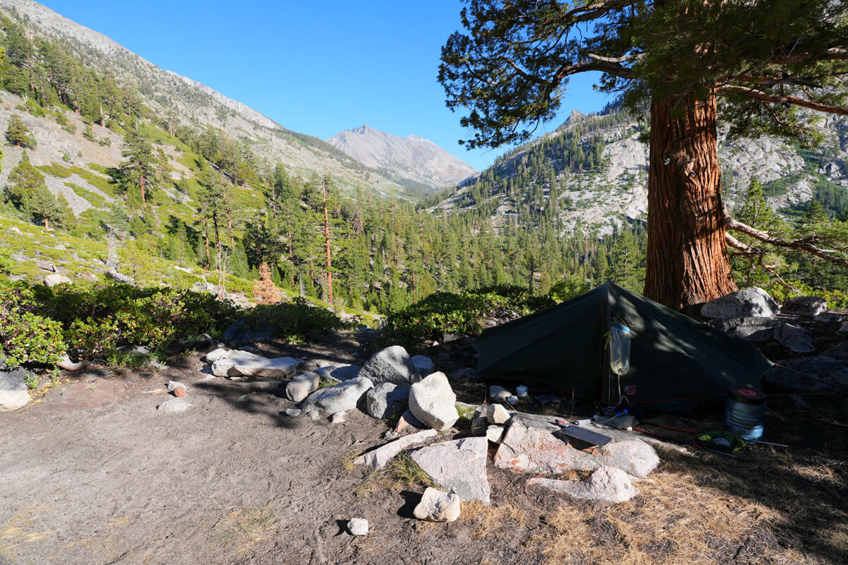
Figure 4.32: Camping at Woods Creek
I moved, so I sent James my location again. I added, "Because a bear was there." I soon fell asleep again. I woke up at 6:30. My usual breakfast is shown in Figure 4.33. JMT bread is crumbly, but delicious when warmed. The igniter, which has a slightly unusual shape, has a funnel attached to it to improve ignition efficiency. I bought a spare lighter, but it was difficult to use, so I used this igniter most of the time
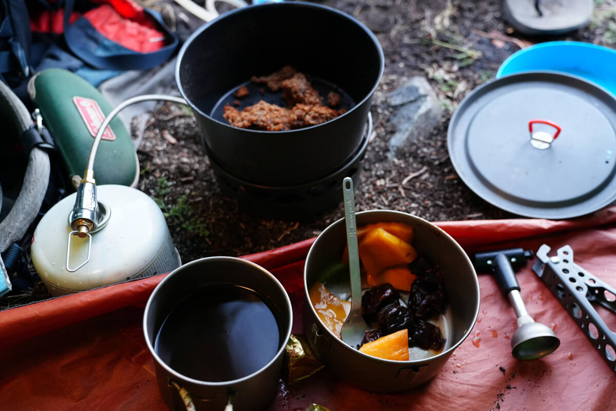
Figure 4.33: JMT Breakfast of bread, mango, prunes, and coffee
I received an email from James
"No more bears. That campsite by the suspension bridge is notorious for bears. I'm at a campfire in Lyell Canyon right now, eating leftovers from Tuarum's grill. Where's your next campsite? I'll send you the GPS coordinates for somewhere near Twin Lakes."
"Near Pinchot Pass. Old and very tired. Opposite the campsite by the suspension bridge. Found a good spot. No bears, no people. Slept well."
As we were getting ready to leave, Kolohe and Paparich showed up
"Did you camp here?"
"It was a nice, quiet place."
"How's the food?"
"Bear canisters and the rest in waterproof bags and tents."
"That's right. Bears won't come if there are people in the tent."
Kolohe finally said something understandable. He must have realized that I was no complete amateur. We took a commemorative photo, as shown in Figure 4.31
Campsites with food lockers are used by many people. When there are a lot of hikers, some are careless about managing their food. These people often leave food in their tents and leave them for long periods of time. When a bear finds such a tent, it simply picks up the food that it doesn't own. The bear we saw yesterday was also on its regular patrol to check for any food left behind at the campsite
So far, I have not heard of any bears attacking people in tents and stealing their food. Some people drop everything and run when they see a bear, as has been the case in Charlotte Lake and elsewhere
<Continued in Chapter 5>
Nobuhiro Murakami's new hiking guide, "The Science of Hiking, 5th Edition," is now available on Amazon (Kindle edition is 100 yen)
Nobuhiro Murakami, a former professor at a national university and an experienced through-hiker who continues to share rational solo hiking know-how from a unique and profound scientific perspective in books such as "Hiking Handbook" (Shinyosha) and "The Complete Guide to Hiking in the United States" (Ei Publishing), has released his new book, "The Science of Hiking," which is now available on Amazon. This compelling and logical hiking textbook is based on his accumulated experience dating back to the dawn of long trails in Japan, as well as objective sources such as academic papers on hiking, exercise physiology, and a wide range of other fields
★★Free downloads available for 5 days starting at 5pm on February 3rd★★
Please consider a paid membership to support the site while enjoying exclusive offers and content!
Nobuhiro Murakami


Related reading