Previous article (Chapter 5)
table of contents
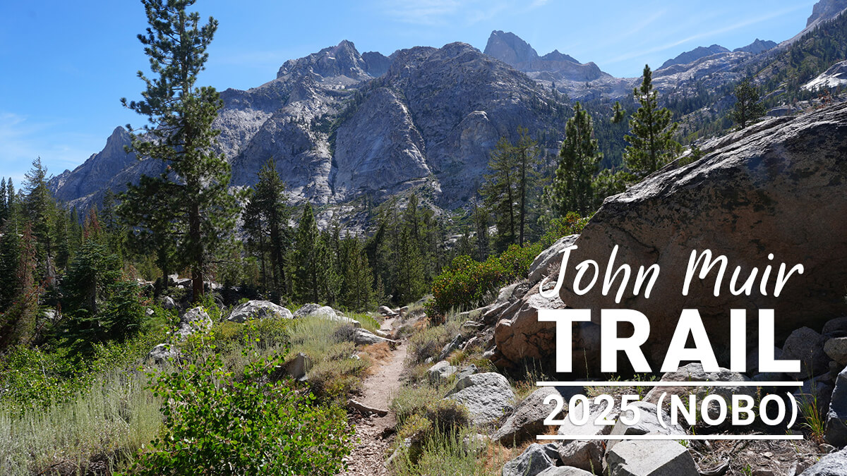
Chapter 6: From the Lower Basin to the Middle Fork
After crossing the Kings River, campsites are scattered around. This year's campsite was the Lower Basin. As we went further, the pine trees became sparser. The views improved and there were many streams, so we could camp if we found bare ground. There were few people and the ideal spots were spread out.
The switchbacks at Mather Pass are easy to walk. However, because it's quite a distance, I walked slowly and ended up being late. The pass should be crossed in the morning, but I arrived in the afternoon. It's a place where hikers take lunch breaks, so there's no problem with photographers taking commemorative photos.
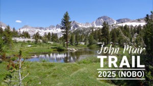
Once we crossed the pass, we could see Disappointment Peak and Upper Palisade Lake. It's a big lake, but it looks like a small puddle. For some reason, we stayed the night at the best site here.
Deer Meadow is dotted with campsites. The most memorable and comfortable site is the one at the very top. My ganglion had gotten so big that it was no longer possible for me to walk, so I pitched my tent at the confluence with the South Fork. This year, I had the place all to myself. If I close the distance to Muir Pass tomorrow, I can walk to the MTR in about two days.
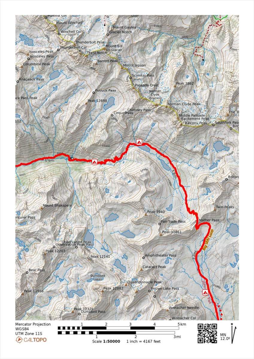
Figure 6.1: From the Upper Basin across Mather Pass and Palisade Lakes
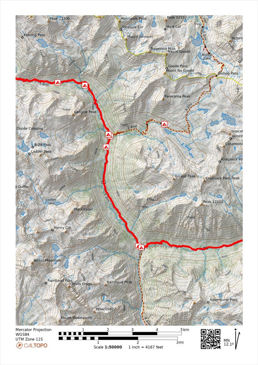
Figure 6.2: Middle Fork towards Muir Pass

Figure 6.3: View of the Upper Basin. The depression is Mather Pass.
Mather Pass to Palisade Lakes
Thanks to the extremely kind American hikers, I slept well. I woke up at 5:15 and set off at 7:00 as usual. According to my records, I arrived at the river crossing upstream at 8:45. Up until this point, I was walking through a pine forest, and there weren't many good campsites to be found. Once the pine trees started to become more mottled, I found a number of good spots. Figure 6.3 shows the view north from around the center basin. There are plenty of streams, so you can pitch your tent anywhere there is bare ground.
In 2017, after the cross-country skiing, I hadn't made much progress, but I did find a good spot, as shown in Figure 6.4. It was where I crossed a small stream. The next day, I jumped over a narrow stream and felt a sharp pain in my left calf, which turned out to be a torn muscle. I contacted Chieko at Bishop via inReach and asked her to extend my stay at the motel. I was able to walk after taking painkillers, so there was no need to send out an SOS.
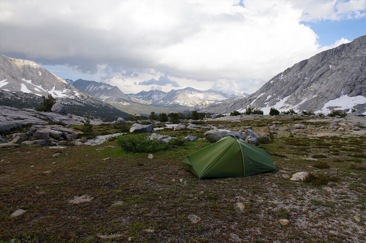
Figure 6.4: Center Basin. Photographed in 2017.
There is a narrow tundra in the middle of the Upper Basin, containing colonies of alpine colonnades and shooting star pine. This year's flowers are shown in Figures 6.6 and 6.5.

Figure 6.5: Alpine Columbine
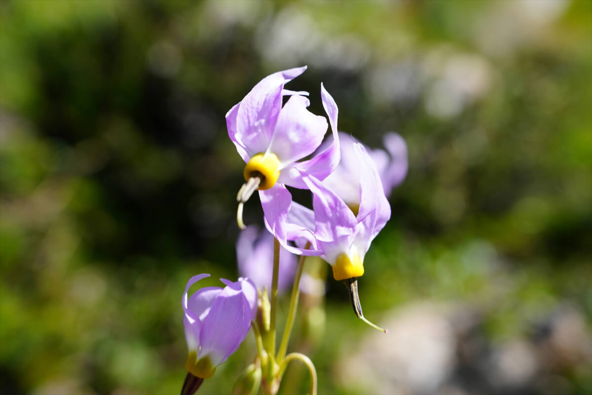
Figure 6.6: Shooting Star
The Upper Basin is spacious and comfortable. Figure 6.7 shows photos of hikers we passed. They seemed to be experienced PCT hikers. Their backpacks appeared to be GO-ON Trail Bum backpacks. The pond just below Mather Pass is also a beautiful spot (Figure 6.8). We camped there at least twice.
Around 11:00, we entered the switchbacks. The trail was well maintained, but because we walked slowly, we were constantly overtaken. However, American hikers often take long breaks, so the distance we traveled in a day didn't change much. We thought we'd reach the pass after 12:00, but as expected, we were delayed and arrived at 12:50. There were many hikers resting at the pass.
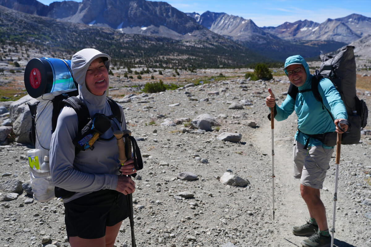
Figure 6.7: Hikers we passed in the Upper Basin.
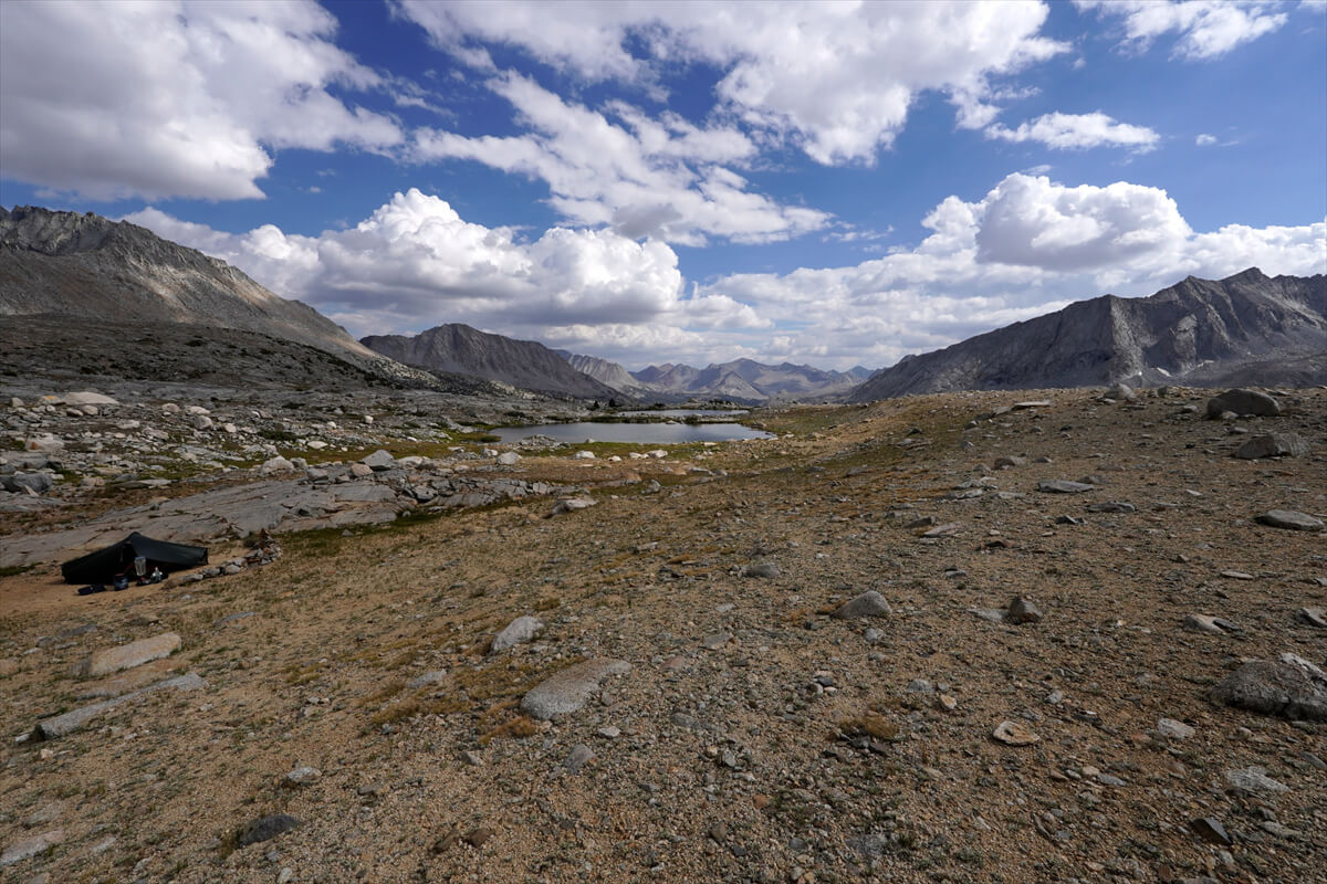
Figure 6.8: Camping just below the pass, photographed in 2022.
First, I decided to photograph the hikers and then have someone take a photo of me. By chance, I handed the camera to Robert Karamitsos, who was very good at posing, changing the composition several times, and taking the photo. One of the photos is shown in Figure 6.9.
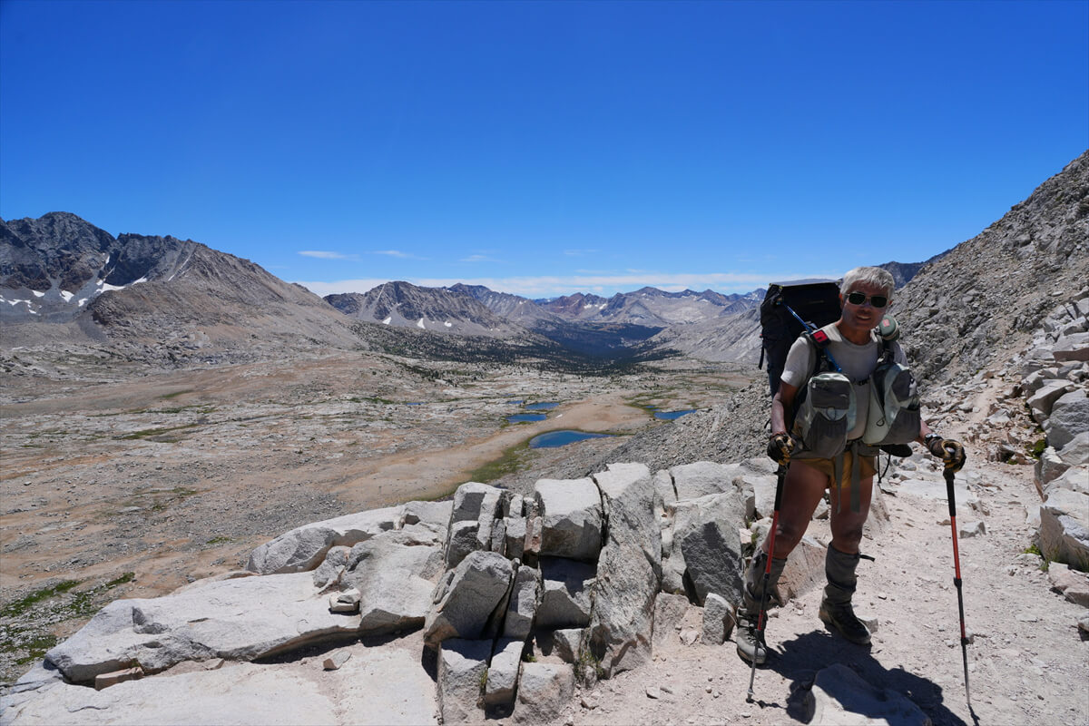
Figure 6.9: At Mother Pass.
It was lunchtime, so I found a spot and sat down. By lunch, I mean a slice of JMT bread and instant coffee. I also took a photo of the hiker beside me. His name was Thomas Maccabe, and he said he was half Japanese. Come to think of it, he had narrow, Asian-looking eyes. He said he was interested in Japan, so I thought I'd hear from him soon. I remember him living in Colorado. Surprisingly, there were a lot of Japanese people involved.
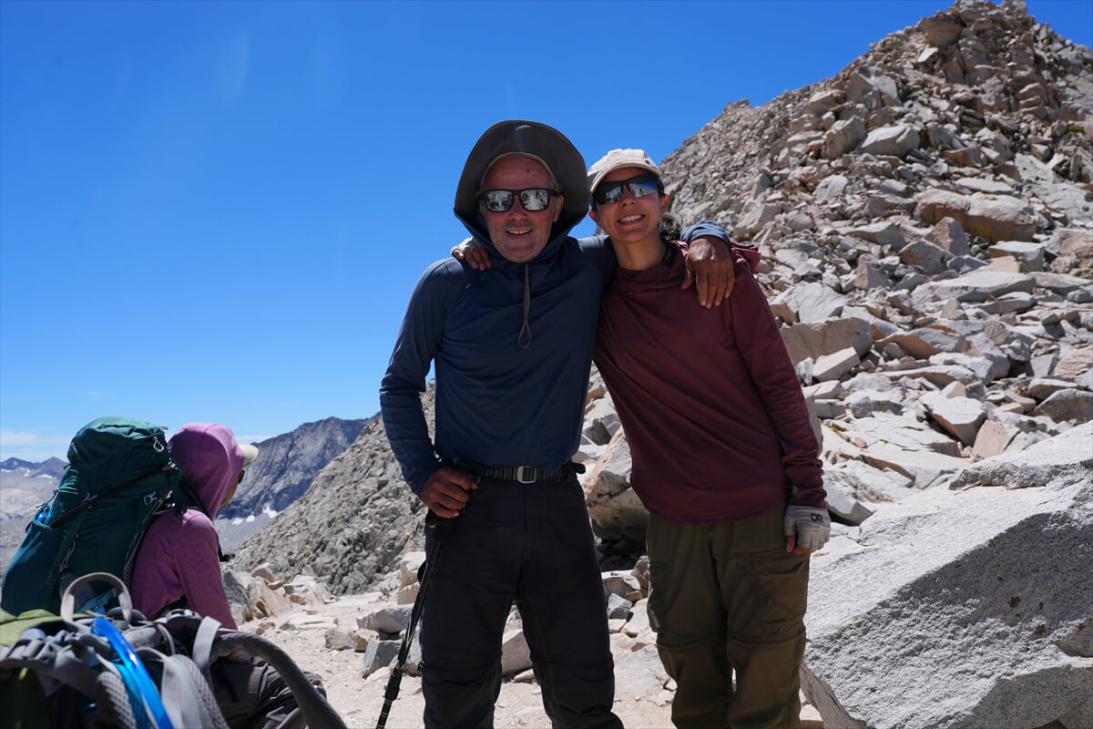
Figure 6.10: He had a great way of holding the camera, and I was able to take lots of photos. Robert Karamitsos is on the left.

Figure 6.11: Thomas Maccabe, who is half Japanese.
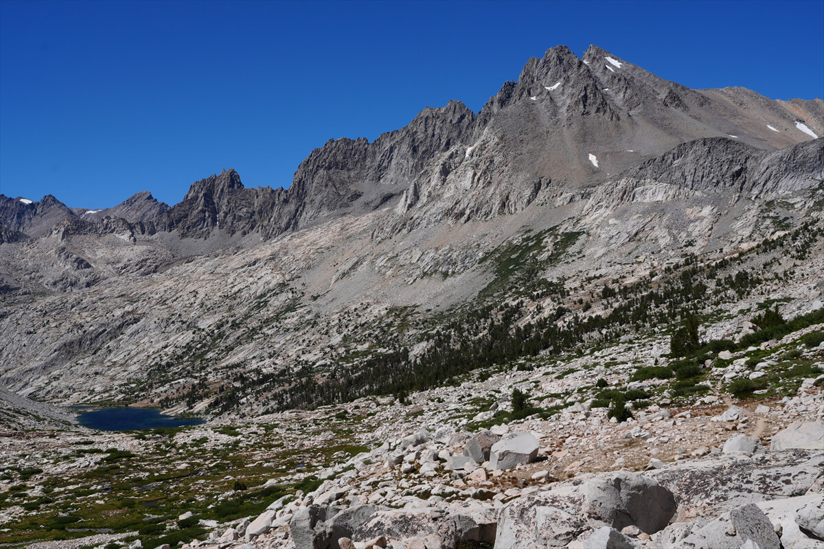
Figure 6.12: Disappointment Peak
Going down a little, you can get a good view of Disappointment Peak. Why did it get such an unfortunate name? It was first summited in 1919 by Davis and his party, who thought it was the highest peak in the Middle Palisades, but were disappointed to find out it was not. It is a magnificent rocky mountain, so it is no wonder that it is mistaken for the highest peak. The small pool of water you can see on the left is Upper Palisade Lake.
The ganglion in my left toe was getting bigger and starting to hurt. *1 I was extremely slow on the descent. I finished the switchbacks a little after 2:00, but by 3:30 I still hadn't reached Upper Palisade Lake. There was a stream just before the large campsite. The campsite on the first JMT was crowded, so I camped in the bushes here. The trail crossed the stream to head to the campsite, but the trail had been mowed downstream.
*1: A ganglion is a small hole that forms in the joint capsule, causing the fluid inside to leak out and form a sac. If you go to the hospital, they will just squeeze out the contents and that will be the end of it, but they say it is prone to recurrence. Apparently it can be cured by removing everything through surgery, but I decided that it wasn't necessary to go that far. If you wrap it with wound tape to apply a little pressure and leave it without irritating it, it will at least not get bigger. It seems to get a little smaller.
We went a little further but came to a dead end. We turned back, forded the stream, and arrived at the campsite at 4 o'clock. Since we weren't in a hurry, we set up our tent in the shade. We'd camped in this area a few times, but this was the first time we'd managed to get a good spot right in the middle. There were few hikers, and sometimes the place was empty. There was a woman who had set up her tent in a more remote area.
For dinner, I had a bowl of beef jerky. Of course, there was also soup with dried vegetables and dried fruit for dessert. The ganglion in my left leg had gotten bigger, and I think it had damaged the muscles in my right shoulder, so I couldn't sleep because of the pain. I only took one Loxonin tablet and emptied the contents of the right front pocket.
James contacted me regularly.
"That's my favorite place," I replied, giving a bit more detail.
"I can't walk like I used to. I've picked the best sites in Upper Palisade Lake. My wife uploads the photos she receives on Messenger Plus to Facebook once a day."
The 2011 debacle
2011 was my third time hiking the JMT, so perhaps I was a little more used to it. Chieko was also on her third section hike, and was supposed to be able to make it from VVR to Mount Whitney. I was careless. A friend offered to buy some beef jerky for me, so I had it sent to VVR. It was cheap beef jerky from Costco, tasteless, and tasted like I was eating a lump of leather. Chieko, who joined us from VVR, had a particularly poor appetite. She ate less and ended up with a lot left over.
After crossing Muir Pass, they had no choice but to dig a deep hole and discard a considerable amount of food. They then camped near the junction to Bishop Pass and then at Lower Palisade. That night, Chieko was overcome with severe nausea and was unable to sleep. She had developed altitude sickness. Due to the heavy snow and exhaustion, they decided to retreat.
First, we turned back from Lower Palisades. The symptoms subsided after just a 50m drop in altitude. However, there were no good campsites. We continued down and found a nice campsite surrounded by the forest in Deer Meadow, so we decided to spend the night there.
After regaining my strength, I took the turnoff to Bishop Pass, spent the night in Ducie Basin, and escaped to Bishop the next day. It was a route I chose by chance, but it was a beautiful one. This route was also used as a detour around Muir Pass when the San Joaquin River bridge collapsed. I'll explain this route later.
When I first went to the JMT, I used couscous because it was easy to cook. In my second year, I was able to buy it locally, so I bought some in San Francisco. However, it had a terrible smell and was very difficult to eat. It didn't seem like the same thing. So I gave up on couscous and made brown rice baked rice, a mixture of semi-cooked dried rice and dried natto, my staple food. Then, due to the coronavirus pandemic, producers of brown rice baked rice disappeared, and now my staple food is a mixture of instant rice for soup kitchens and unsalted dried natto. I don't use cooked instant rice for meals because it is highly salty, expensive, and not very tasty.
The freeze-dried foods eaten by American hikers are generally quite unpleasant. Eating some out of curiosity is fine, but it's unpleasant, expensive, and lacks calories. The quality of beef jerky and other foods is proportional to the price. Cheap stuff tastes awful, so I try to buy the most expensive items possible. Dried fruits and other high-quality items are also shipped from Japan to the US. Your appetite decreases at high altitudes, so you won't be able to eat unpleasant foods. Not being able to eat them directly affects the success or failure of your hike. Nothing good comes from skimping on food.
Palisade Lakes to the Middle Fork
As usual, I woke up a little after 5:00 and had breakfast of JMT bread, mango, prunes, and coffee. My departure time was also around 7:00. However, for some reason, I felt low on energy. I had a lot of trouble on the way down. I arrived at Lower Palisade Lakes (Figure 6.13) at 8:00.
After passing Lower Palisade Lake, the trail continues on a gentle, flat descent. There are campsites here and there. However, as you approach Palisade Creek, the trail begins to steepen and you lose altitude. Figure 6.14 shows the view looking back from that point. Mount Williams and other mountains tower like a folding screen.
Continuing on, the trail crosses a large terrace of rocks. A series of stones mark the trail, so you follow them. Suddenly, the view you're about to embark on comes into view. This is Figure 6.15. The mountains in front of you are Wheel Mountain and others, and at its base is the confluence with the South Fork, where the JMT turns around and heads north.
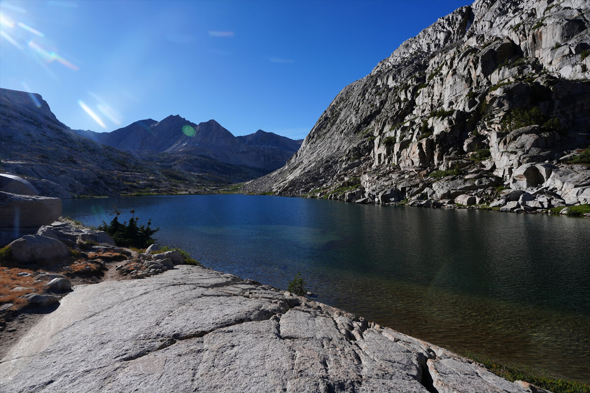
Figure 6.13: Lower Palisade Lake. Camping sites are scattered throughout the lower reaches.
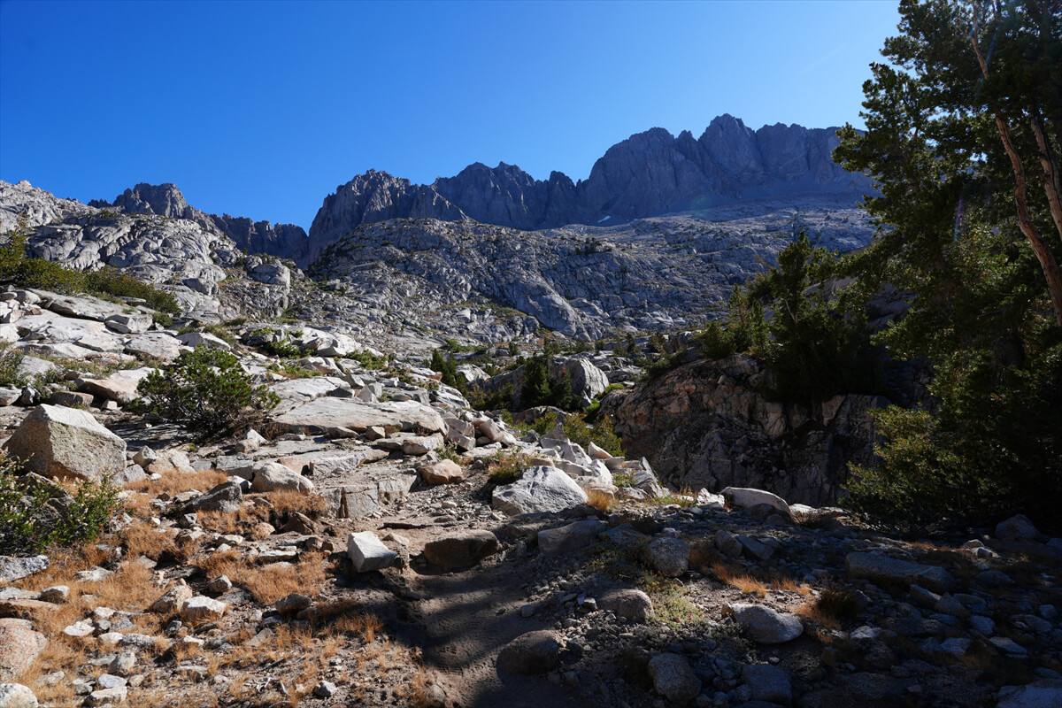
Figure 6.14: The view looking back as you descend from the Lower Palisades.

Figure 6.15: Lower Palisade Creek area. Deer Meadow is the green area.
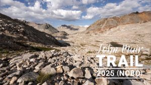
After taking in the panoramic views, the Golden Staircase begins. Translated, it means "golden stairs," so named because of the enormous cost of its construction. It was one of the most difficult steps on the JMT. A 2019 photo of the JMT facing south (Figure 6.16) provides a clearer picture. It takes more than an hour to descend.
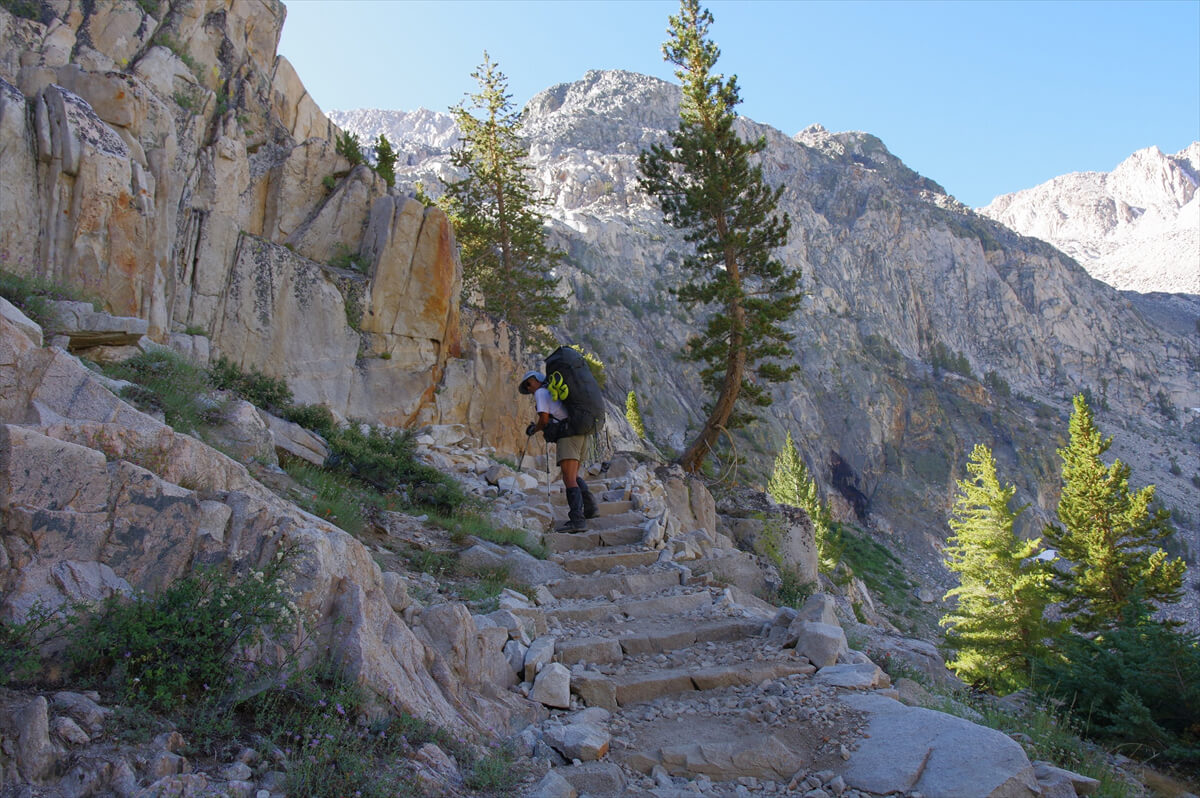
Figure 6.16: The Golden Staircase, photographed in 2019.
Once you reach the end of the switchbacks along Palisade Creek, the gentle descent begins again. Looking back after reaching the bottom, you'll see a pyramidal boulder, as shown in Figure 6.17. This has been in the exact same place since my first JMT in 2009. If you're traveling south on the JMT, it looks like the entrance to Palisade Lakes.
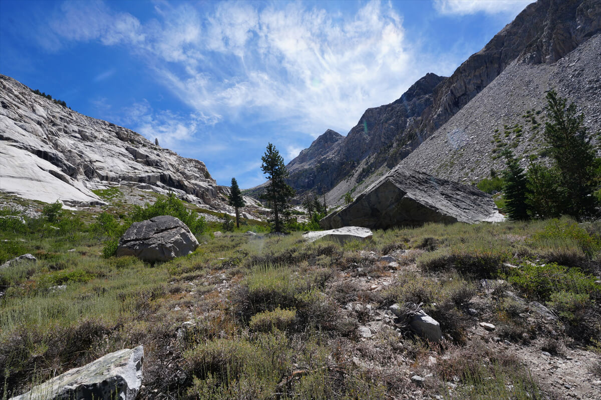
Figure 6.17: Looking back at the pyramidal boulder
After passing the pyramid-shaped boulders, the forest begins. This is also the beginning of Deer Meadow. However, I don't recall seeing any deer here. Deer are more prevalent in the downstream area. The trail descends, weaving its way around the corner of the meadow. The first campsite is spacious and comfortable. It is the highest point on the south-facing JMT.
Figure 6.18 shows a photo from 2011. This is the place where Chieko suffered altitude sickness at Lower Palisade Lake and retreated to, pitched a tent, and rested for a day. Compared to the photo from 2025, the trees in the background are certainly thicker. Also, the dead tree lying on the ground is in a different location. However, that's about the extent of the difference.
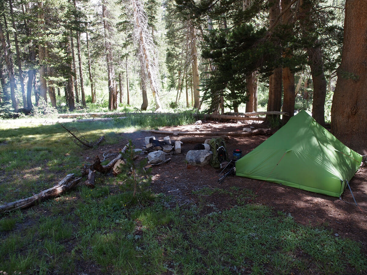
Figure 6.18: At Deer Meadow, 2011.
I arrived at the familiar site at 11:30. This time I made 1 liter of water and took a lunch break. JMT Just took a bite of bread and drank some instant coffee. The ganglion started to hurt, so I tore a little skin and squeezed it out with all my might. Once a white liquid mixed with blood came out, it was over. Once it got smaller, it wouldn't touch my shoes. Covering it with wound tape completed the treatment. After returning to Japan, I went to a dermatologist, but they told me that once it was squeezed out, there was nothing else they could do. It was a bit rough, but this was the correct procedure.
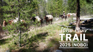
We started walking around 12:30. The trees gradually grew larger as we entered the forest. 2018 was a year of many wildfires, and gas was thick everywhere. Meanwhile, we spotted someone clearing away fallen trees. They were likely Forest Service personnel or rangers. They were working together. We met twice and took commemorative photos. They were very friendly (Figure 6.19).
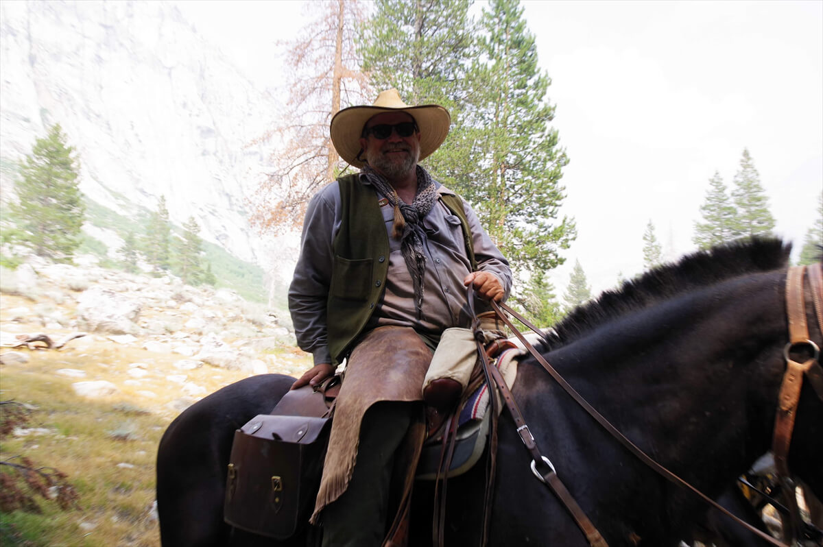
Figure 6.19: Forest Service officer or ranger. Photographed in 2018.
As we went down Palisade Creek, we came across small campsites here and there. They looked comfortable, but I'd never camped there before. I wasn't feeling well, so I couldn't go any further. Just after 2:30, I passed a Japanese woman. I exchanged a few greetings in English, but she told me she was Japanese from her intonation.
After a while, a heavily armed man came up.
"I wonder if there's a good campsite up ahead?"
"Yes, there are some good sites about an hour's walk away. The very edge of Deer Meadow is good, though. Lower Palisade Lake is also good, but a little farther away."
"How many miles?"
"Well, I'm not sure. Maybe two miles."
He took out his Garmin MAPGPS 67i from his pocket and checked the distance on the map. I was intrigued to learn that even American hikers like the latest gear. He suddenly asked me, "Are you Japanese?" When I said yes, he replied in Japanese,
"thank you."
Maybe because I was tired, I didn't take any photos of him.
It's about 2 km to the junction with the Middle Fork Kings River, but it just takes so long. The last kilometer or so is a steep descent. By this time, the opposite mountain comes into view. (Figure 6.20) The trail forks near the confluence with the river. The JMT continues north. A little further along, we come to a large campsite. It's usually a busy site, but this year it was completely deserted. To my surprise, we entered the site and pitched our tent in a shady, well-ventilated spot near the river. It was only just after 3 p.m., but we were tired and didn't feel like walking. A photo of the site is shown in Figure 6.21. We usually pitch our campsite about 100 m from here. (Figure 6.22)
In 2016, the campsite was crowded. I chatted briefly with some ultralight hikers on the trail. They told me that their backpacks had ripped and were no longer able to continue, so they had to give up on the JMT. I remembered that in 2009, Joel and his friends had to sew a new shoulder strap because the seams had come undone. If a backpack is beyond repair, it can actually become impossible to continue. That's why I make my backpacks durable and easy to walk in, regardless of their weight.
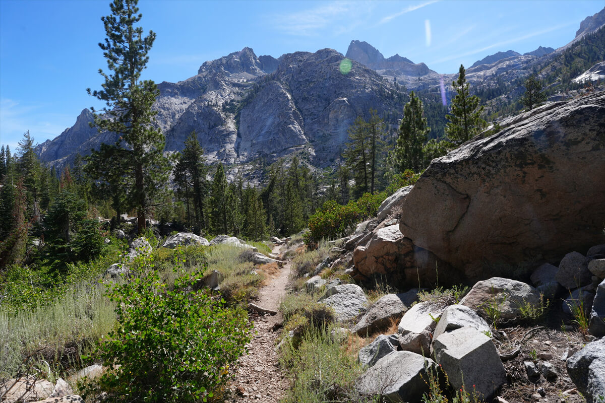
Figure 6.20: Near Middle Fork Junction. The opposite mountain is Wheel Mountain.
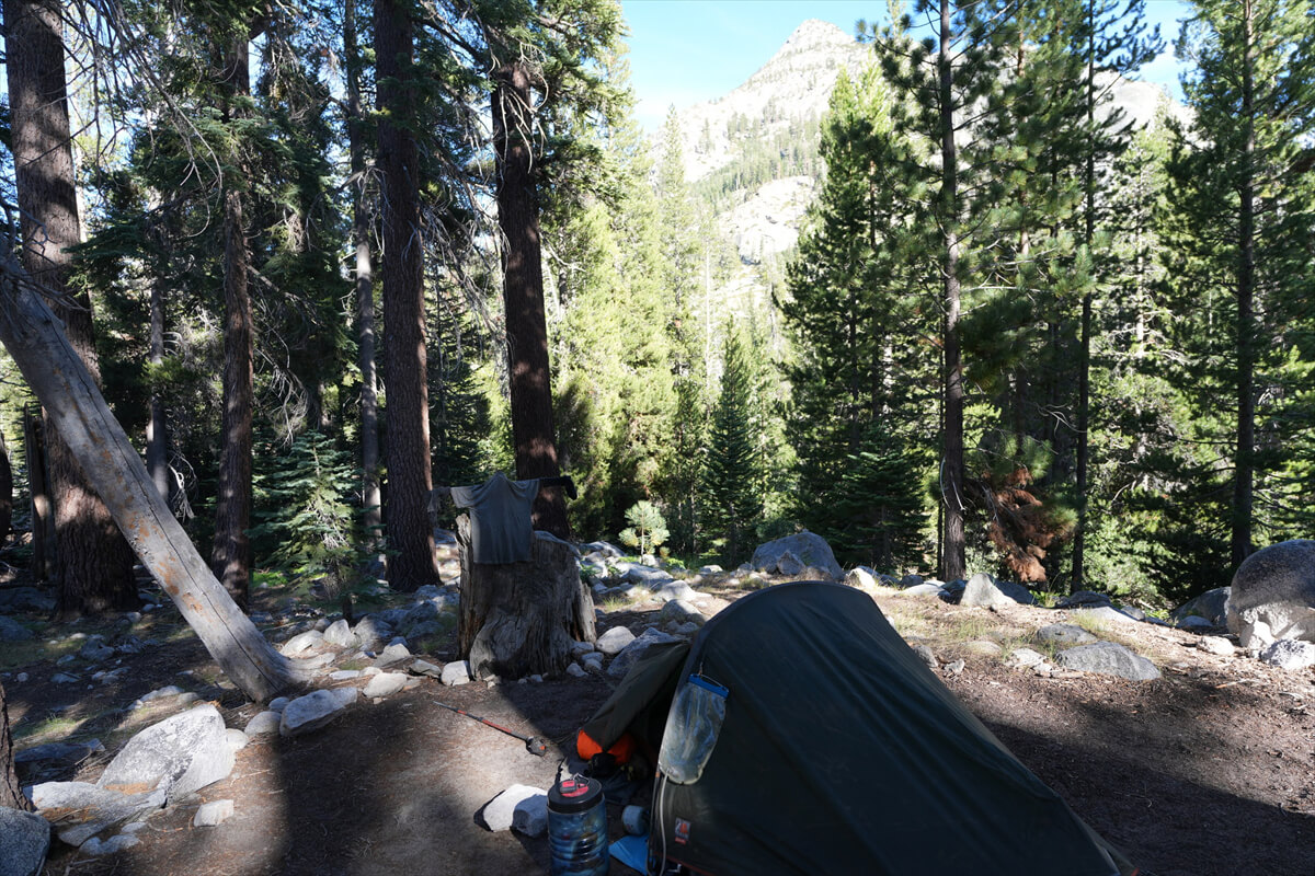
Figure 6.21: A site near the junction. Usually a busy place, but this year there was only one person there.
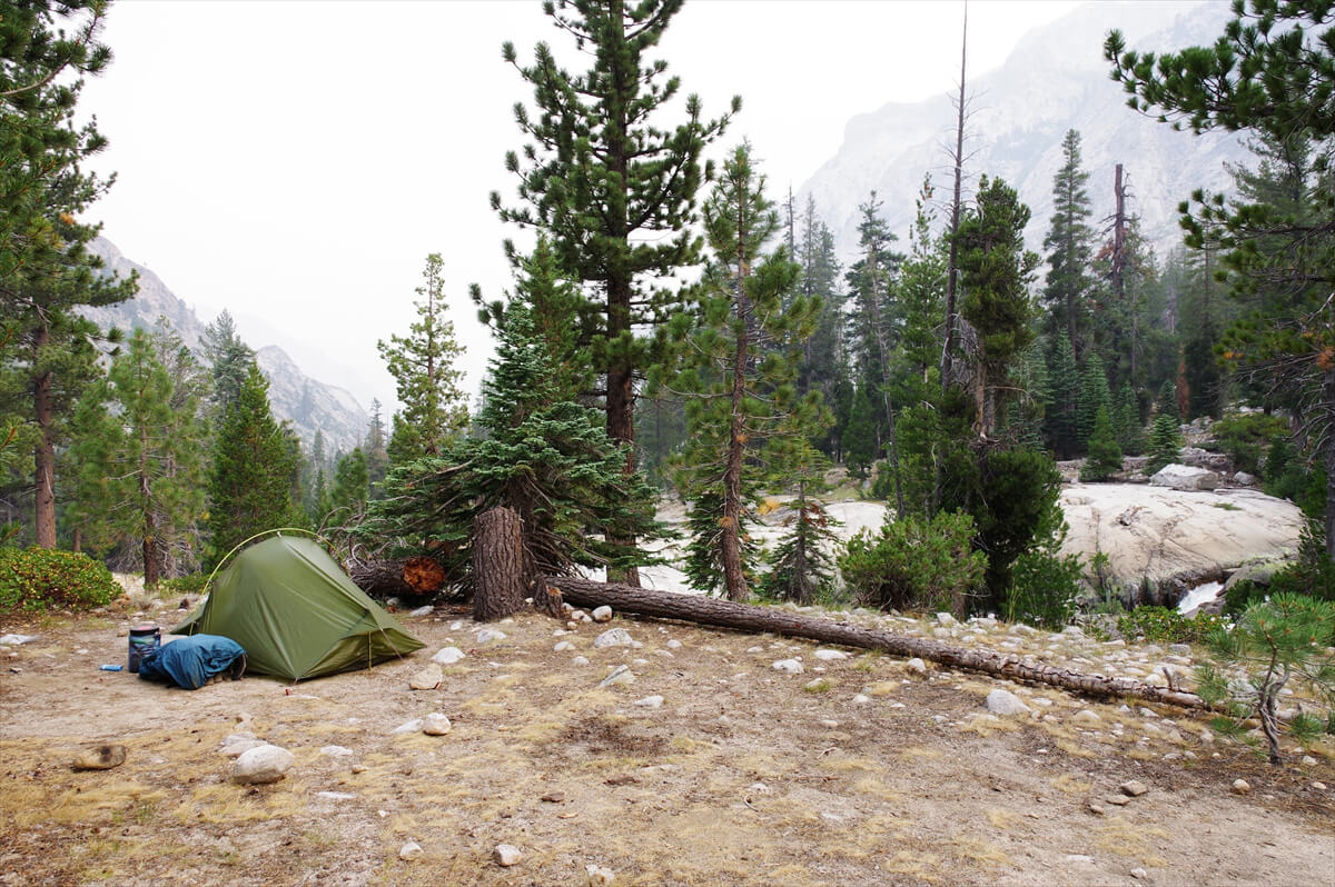
Figure 6.22: A good spot a little further from the larger site. Photo taken in 2018.
A few years ago, I walked from Center Basin to Mather Pass, then north from this junction to the fork with Bishop Pass. This year, I only managed to walk less than half the distance. After a leisurely rest and a hearty meal of beef jerky bowls and other foods, I felt much more energetic. I contacted Chieko.
"My shoulder is getting better. Loxonin is out of stock. I took a lot of D3. I want to get some good sleep today. I haven't received any emails from James. Thank you for everything. I'll try to walk as much as I can."
Chieko told me that there was no need to force myself to fit into the schedule, that I would just have to pay the MTR fare and that I could stop there.
My neck hurt, so I put an ice pack on it with a wet towel and went to bed. I slept for quite a long time. I can't walk like I used to. It's about a day and a half's journey from Muir Pass to the MTR. In other words, if I can shorten the distance to the pass today, I should be able to make it on August 10th. What should I do after that? I'll think about it then.
<Continued in Chapter 7>
Nobuhiro Murakami's new hiking guide, "The Science of Hiking, 5th Edition," is now available on Amazon (Kindle edition is 100 yen)
Nobuhiro Murakami, a former professor at a national university and an experienced through-hiker who continues to share rational solo hiking know-how from a unique and profound scientific perspective in books such as "Hiking Handbook" (Shinyosha) and "The Complete Guide to Hiking in the United States" (Ei Publishing), has released his new book, "The Science of Hiking," which is now available on Amazon. This compelling and logical hiking textbook is based on his accumulated experience dating back to the dawn of long trails in Japan, as well as objective sources such as academic papers on hiking, exercise physiology, and a wide range of other fields
★★Free downloads available for 5 days starting at 5pm on February 3rd★★
Please consider a paid membership to support the site while enjoying exclusive offers and content!
Nobuhiro Murakami