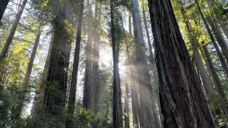
Recently, we've been introducing some of the most beautiful spots in the sacred Mount Shasta area, but this time we'll take a break and introduce some hiking routes in Kings Canyon National Park, another sacred place in California that offers a different kind of beauty

But the giant trees aren't the only thing worth seeing. With magnificent views and beautiful trails, this is also a mecca and paradise for hikers
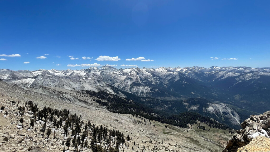
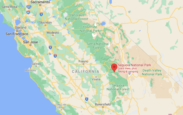
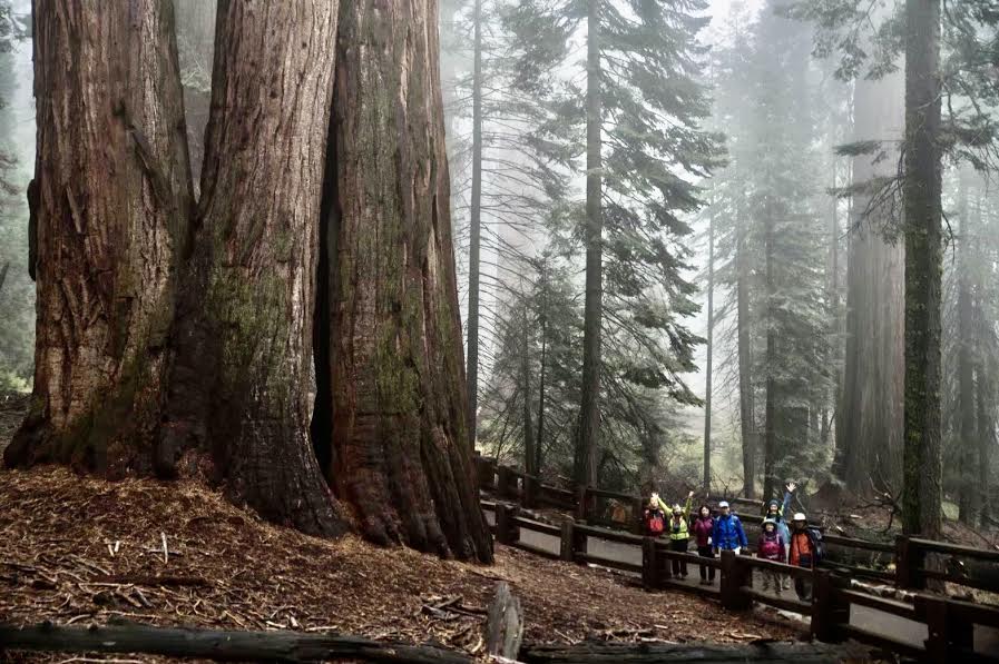
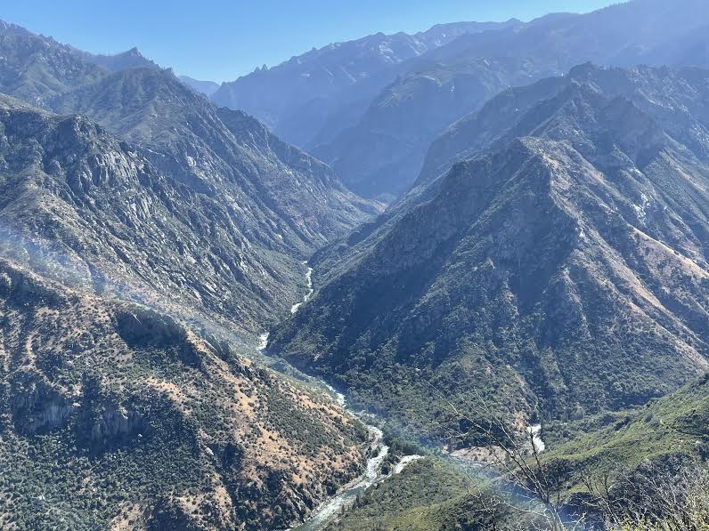
This is a national park I personally recommend (although it's a bit far from SF), as it's less crowded than Yosemite and offers a great opportunity to enjoy serious hiking while viewing the beautiful Sierra Nevada mountain ranges, rivers, waterfalls, and valleys. Kings Canyon is home to the deepest canyon in the United States, approximately 2.5 km deep, recognized by the Guinness Book of World Records. The scenery is spectacular, and the rich variety of California's natural beauty is truly impressive (in a previous Redwood National and State Parks , I introduced hiking trails lined with ancient giant trees, but this is a different national park).

This time, we will introduce Mist Falls Trail, a popular trail in Kings Canyon that is only open to experienced hikers
table of contents
Hiking Information for Sequoia and Kings Canyon National Parks
How to get to the park
Sequoia and Kings Canyon National Parks are about a five-hour drive (approximately 380 km) from San Francisco or Los Angeles. If you're heading from San Francisco, the road to the entrance to both Kings Canyon and Sequoia National Parks is almost the same. After the park entrance gate, the road splits into two. If you go left, you'll head towards Kings Canyon, and if you go right, you'll head towards Sequoia. There is no cell phone signal within the parks, so it's a good idea to download the places you want to go to your GPS in advance to make your trip smoother
Useful items to bring with you on a hike
As for what to bring, as always, prepare the same equipment as you would for a typical hike in the United States
- Drinks (larger in summer, about 2 liters)
- Temperature-adjustable winter clothing
- hat
- sunglasses
- sunscreen
- Snacks to eat during the hike
- If you have any regular medications, bring first aid such as medicines and bandages
- Other than that, your favorite hiking gear
Trail Data
- For intermediate and above
- Season: Best season is from May to October
- Trailhead elevation: Approximately 1,565m
- Round trip: Approximately 14km (8.7 miles)
- Height difference: Approximately 270m (879 ft)
- Course time: 4 to 5 hours round trip (including breaks)
Access (by car to the trailhead)
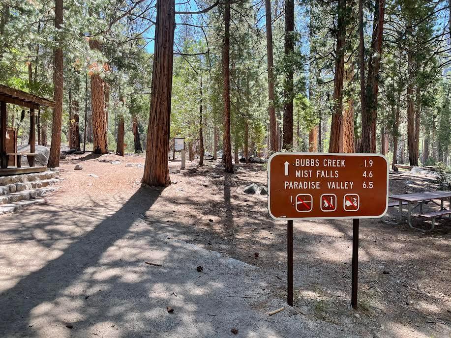
Trailhead Address: Mist Falls Trailhead, CA-180, Cedar Grove, CA 93633 (also known as "Kings Canyon Joint Unified, CA")
Enter this into your GPS and you'll arrive at the trailhead
Start hiking from the trailhead
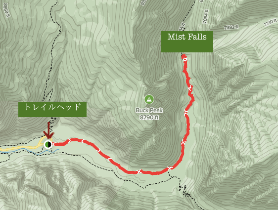
Highway 180 is famous for its beautiful scenery as you drive through the gates of Kings Canyon National Park and up to the trailhead. The final point where the highway ends is the trailhead
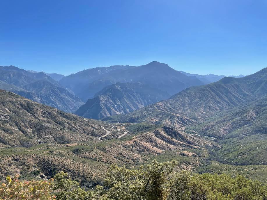

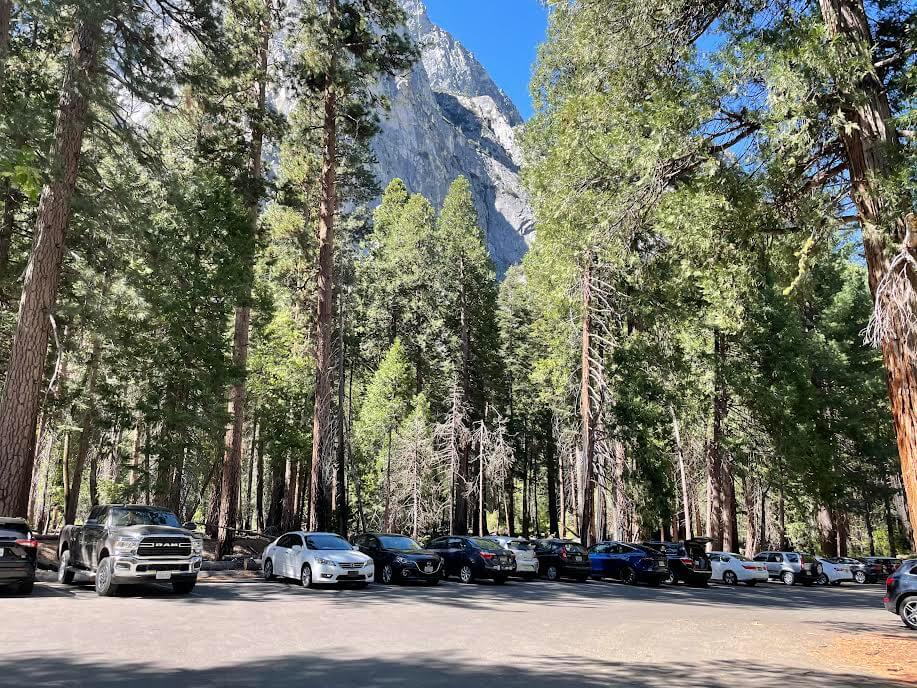
There are viewpoints along the way where you can stop and enjoy the beautiful scenery. There is also a large parking lot and restrooms at the trailhead
We immediately set off for today's highlight, Mist Falls
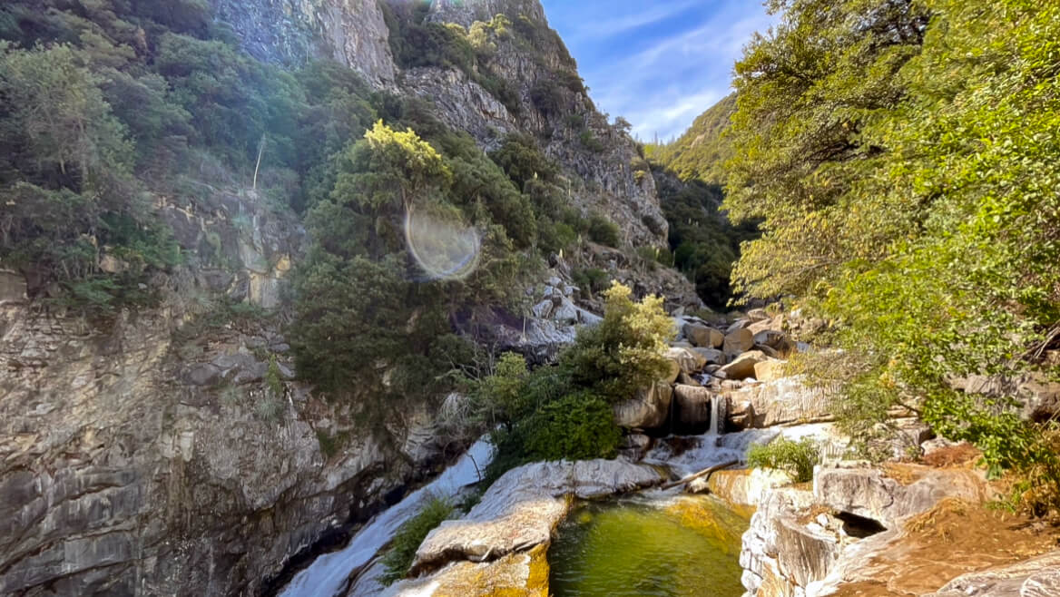
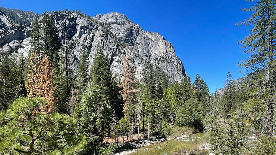
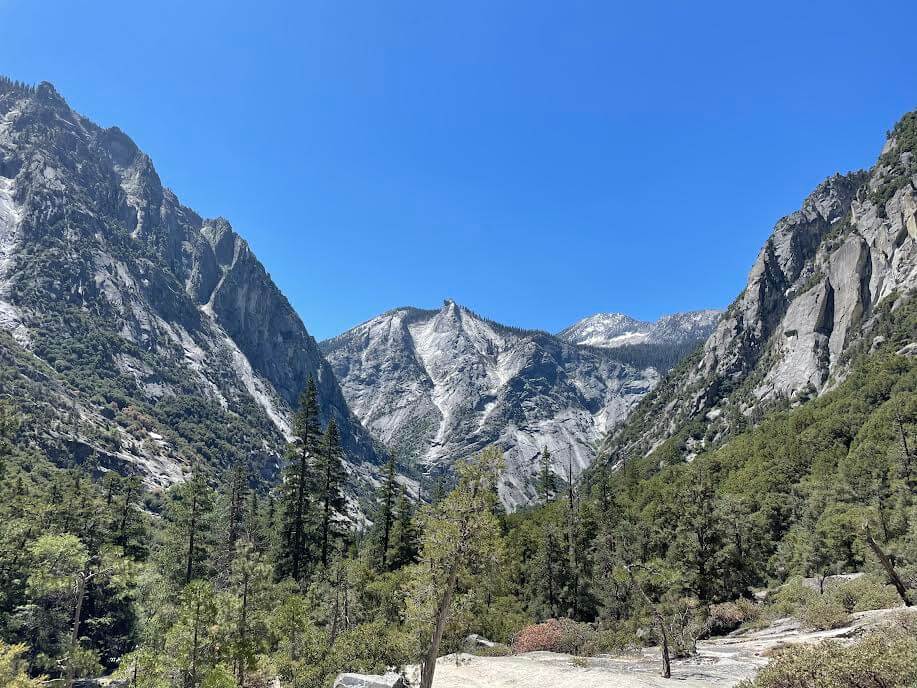
This trail runs along the South Fork Kings River, so there's always water nearby and the fresh greenery is vibrant, making it a really pleasant trail. From the start to just before the waterfall, the trail is fairly flat
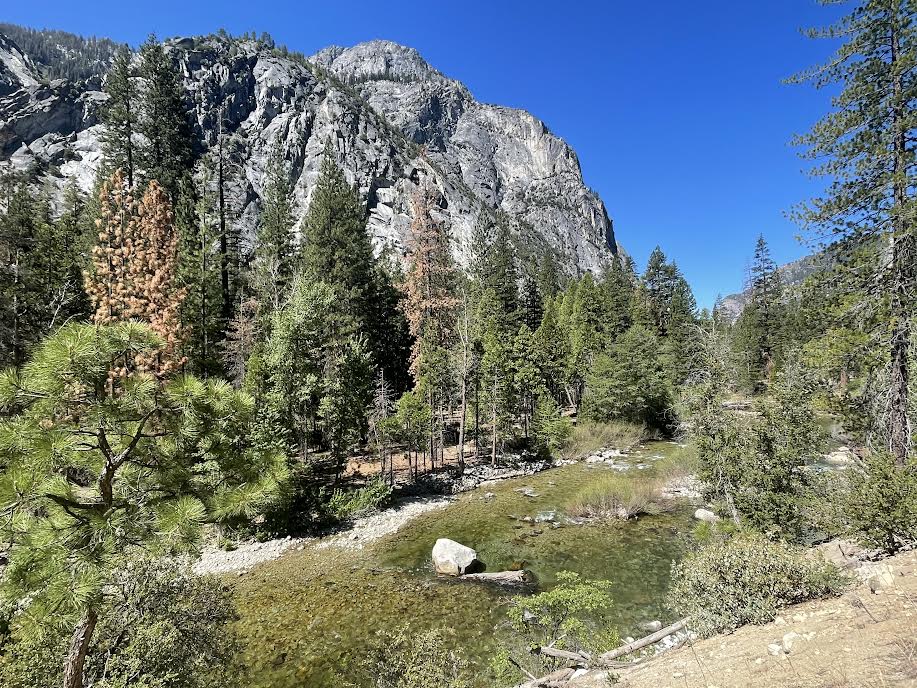
As it was the second half of May, there was a lot of meltwater and the river was full of water. The area is also famous for being a frequent haunt of mother and cub bears. Depending on the time of year, you might be able to see a smiling mother and cub bear
The trail is easy to follow, so you won't get lost. There are forks in the trail, but there are signs, so if you head towards Mist Falls, you won't have any problems. However, be careful as rattlesnakes sometimes appear. I also encountered a large rattlesnake while hiking. It was in the middle of the trail, and when it saw me, it ran off into the bushes, but when you're hiking and taking a break in a rocky area or grassy area, make sure to check for snakes first!
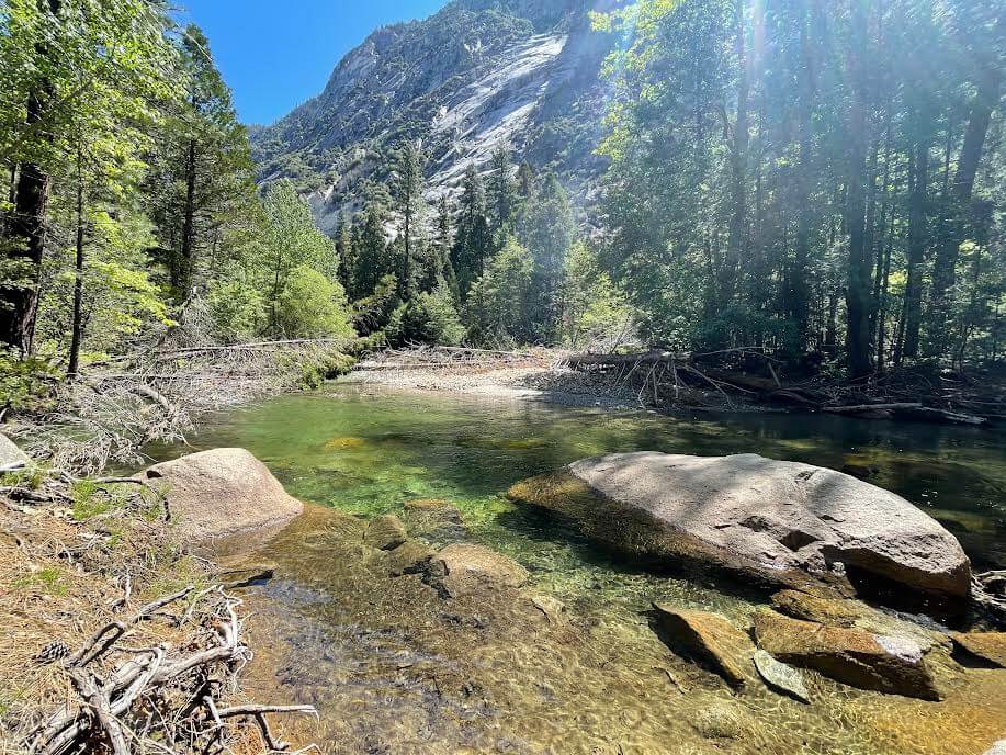
We continue on, soothed by the clear water of the river, the sound of the babbling brook, and the sounds of the birds
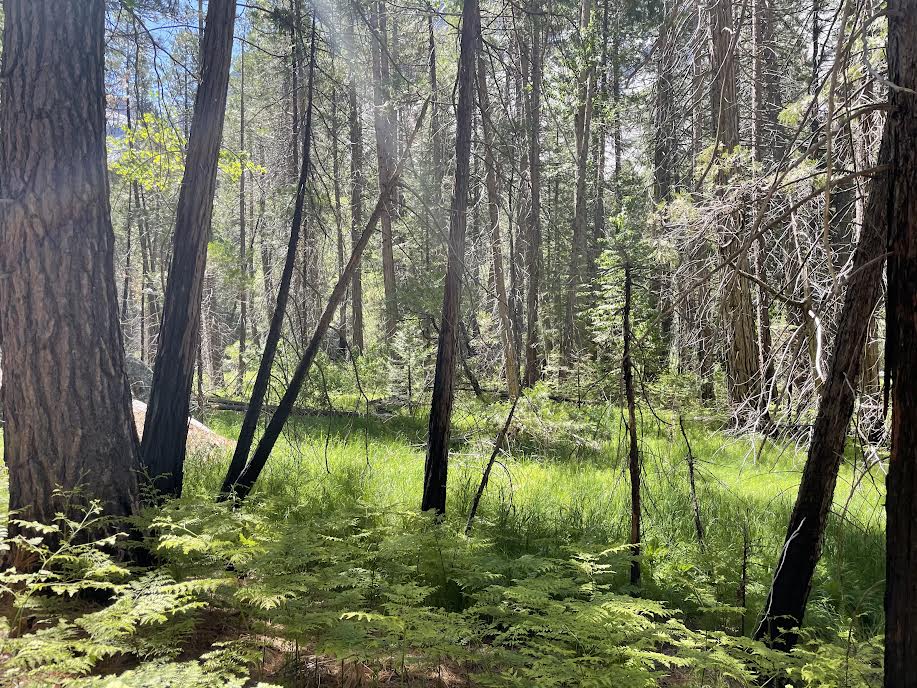
After walking for a little over an hour, the green forest changes to a rocky landscape. From here, the trail starts to get a little hilly
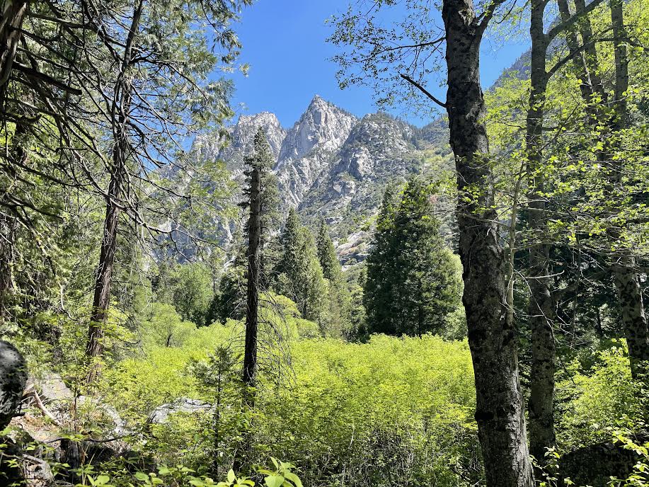
Forests, rivers, valleys, and a wide variety of scenery are one after another to entertain us hikers. For those with good legs, the hiking route is not too strenuous, but it is rare to find a hiking trail that allows you to see such beautiful scenery all at once

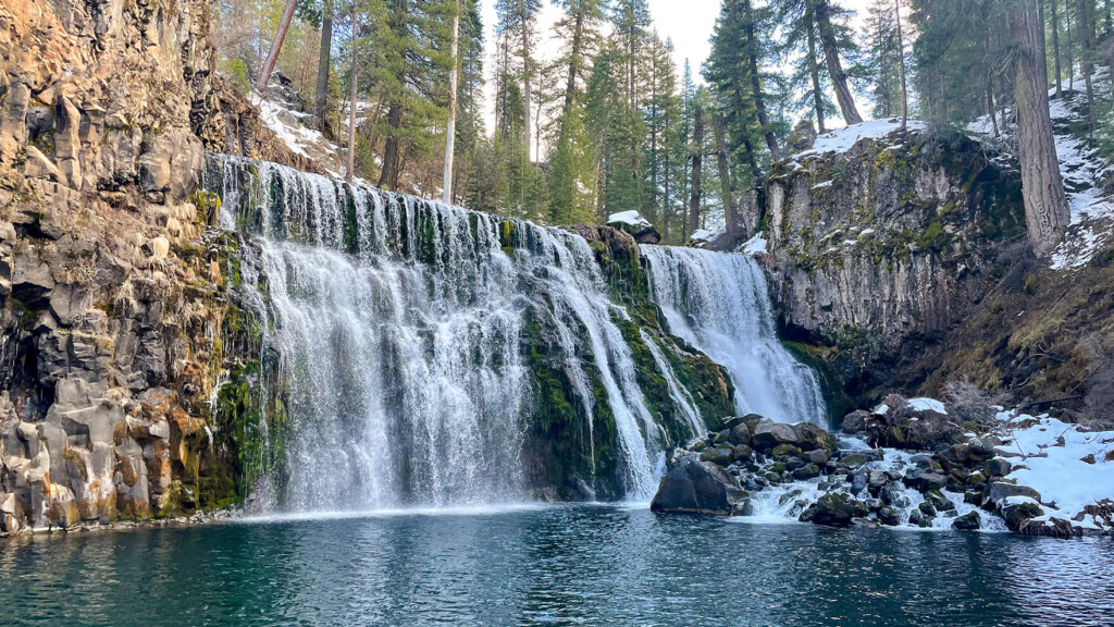
Then, about 1 hour and 50 minutes after we started, it came into view
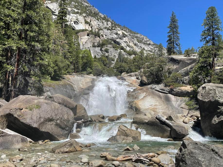
After a very hot, sunny trail, you'll now come to a place where negative ions are flying around in the air. The water is very powerful and refreshing, with a lot of water. Find a place to rest nearby and soak up the negative ions while watching the waterfall. Don't forget to bring a jacket as it may get cold along the way
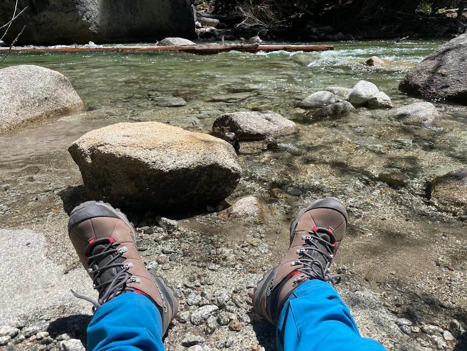
On the way back, you will return the way you came, but if you have time, we recommend taking a stroll down to the river to cool off

Cool down by dipping your feet in the river!

This is the perfect hiking trail for summer
It's less well-known than Yosemite National Park, but that's its charm. There are fewer people and plenty of hiking trails where you can enjoy the stunning scenery. It's a great place for outdoor enthusiasts and hiking fans. It's also a great location for spending two or three days in nature, camping or backpacking
Precautions regarding the spread of COVID-19
As of October 2021, various countries are currently implementing various restrictions, including entry restrictions due to strengthened quarantine measures, restrictions on entry to national parks, and domestic travel restrictions. These conditions are subject to change without notice, so when traveling, be sure to obtain local information from each country's embassy or consulate, the Ministry of Foreign Affairs' Overseas Safety Website (Infectious Disease Risk Information), national park websites, and other sources, and check the information for transit points, the country you plan to travel to, and the areas around the places you plan to visit before making reasonable plans and taking action
Sayaka Kato

Related reading