歩かずに死ねるか!アメリカ国立公園への旅(27)巨木の森とシエラ・ネバダの美しい山脈を見ながらの絶景トレイル セコイア・キングスキャニオン国立公園
written by Sayaka Kato
前回のキングスキャニオン国立公園のハイキングルートに引き続き、今回は同じエリアにあるセコイア国立公園(Sequoia National Park)の美しいハイキングコースをご紹介します。
セコイア国立公園は前回ご紹介したキングスキャニオン国立公園(Kings Canyon National Park)と隣接した場所に位置し、こちらのエリアも負けず劣らず素晴らしいハイキングコースが存在する国立公園です。
前回は美しい川沿い、渓谷内を歩いて滝を見に行くコースでしたが、今回はシエラ・ネバダの美しい山脈を見ながら歩いていくコースです。
トレイルヘッドへいく手前にも有名な巨木、ジャイアントセコイアが多く生息するスポットなどもありますので時間に余裕がありましたらそちらも一緒にチェックして頂くと良いと思います。General Sherman Tree(シャーマン将軍の木・直径31メートル、高さ84メートルなど)
今回のコースはデイハイクですが、距離も長く標高差もありますので、健脚の方向け、中級者以上のレベルになります。
このコースも見所満載です!
はじめは森から始まり、その後シエラ・ネバダの美しい山々を見渡すエリアになり、最終的にはハイシエラ・ネバダのピークに自分も辿り着く、、という流れで運が良いと途中には鹿やマーモットなどの野生動物、様々な高山植物にも出会うことができます。
目次
セコイア国立公園 Alta Peak Trail のハイキング情報
公園への行き方
サンフランシスコ・ロサンゼルスから約5時間(約380km)
サンフランシスコから向かった場合、キングスキャニオン国立公園もセコイア国立公園も入り口まではほぼ同じ道。
国立公園入り口ゲートの後、二手に分かれる道があるので、左へ行くとキングスキャニオン方面、右へ行くとセコイア方面へ向かう形になります。
電波が公園内はないので事前に行きたい場所をGPSにダウンロードしておくとスムーズです。
ハイキングに携行すると便利な持ち物
持ち物に関してはこれまで同様、一般的なアメリカのハイキングと同じような装備を準備していきましょう。
- 飲み物(夏は多めに、4リットル以上を推奨)
- 気温の調整できる防寒着
- 帽子
- サングラス
- 日焼け止め
- ハイキング中に食べるスナックなど
- 常備薬などがある場合は薬やバンドエイドなどのファーストエイド
- その他、通常ハイキング装備で好みのものを
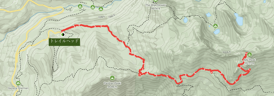
トレイルデータ
- 中級者以上向け
- シーズン:3月から9月
- トレイルヘッド標高:約2,220m
- 往復:約24km(15 mile)
- 高低差:約1,240m(4,064 ft)
- コースタイム:往復8時間から10時間(休憩含む)
アクセス(車でトレイルヘッドまで)
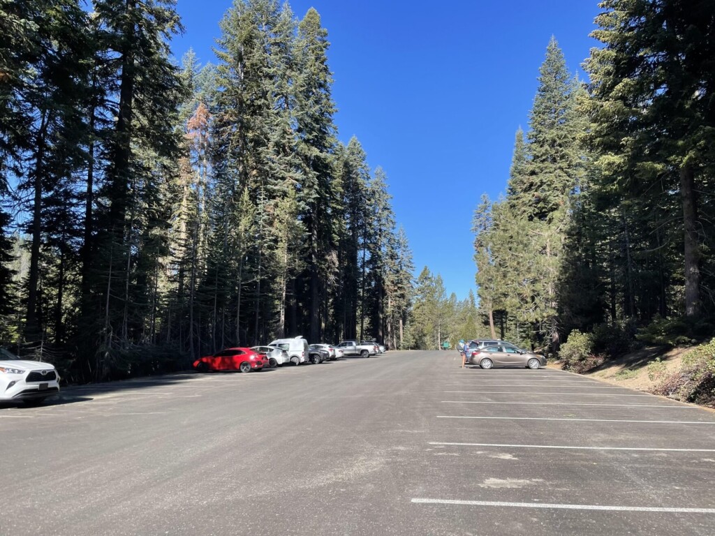
ALTA PEAK TRAILHEAD もしくは、WOLVERTON PICNIC AREA(大きな駐車場あり)
GPSにこちらを入れれば、トレイルヘッドまで到着します。
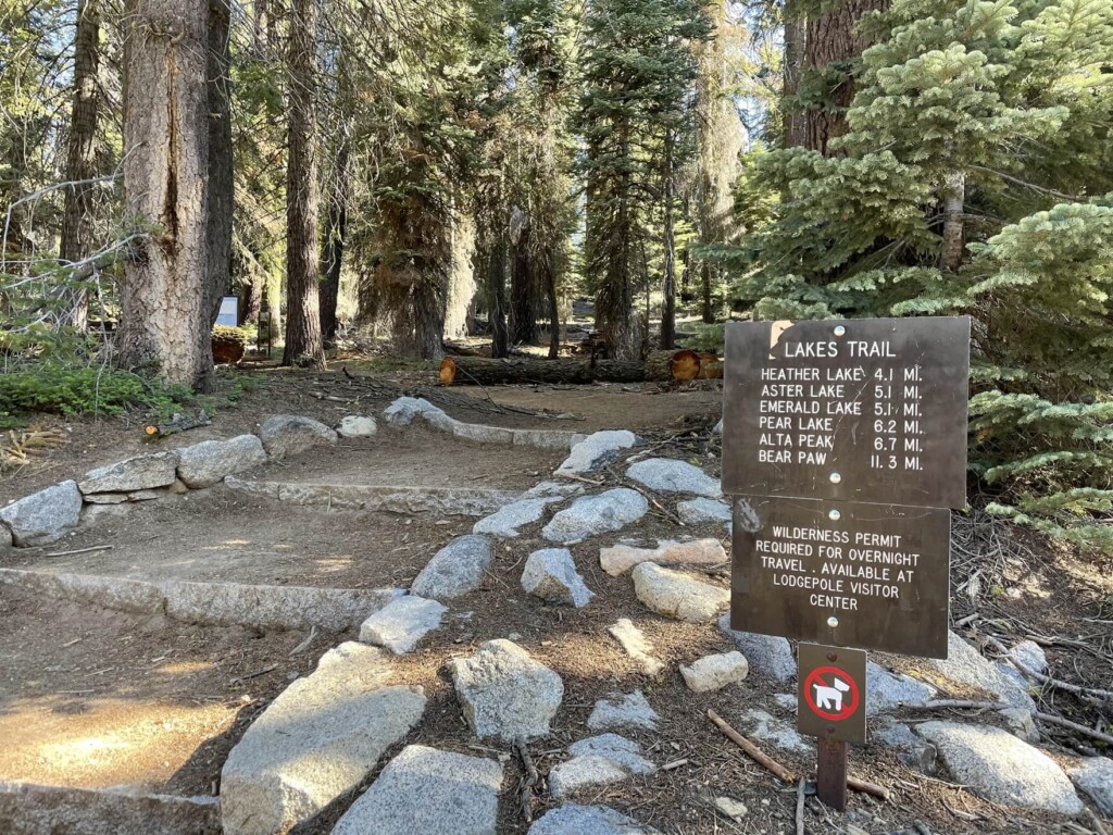
トレイルヘッドには十分に広い駐車場、そしてお手洗いもあります。ここの駐車場を基点にバックパッカーをする人たちもいるので駐車場にあるテーブルで朝ごはんを食べている人や長旅の準備をしているハイカーなんかも見受けられます。
下写真は5月後半の平日、朝の8時半。駐車場には十分にスペースの余裕がありました。
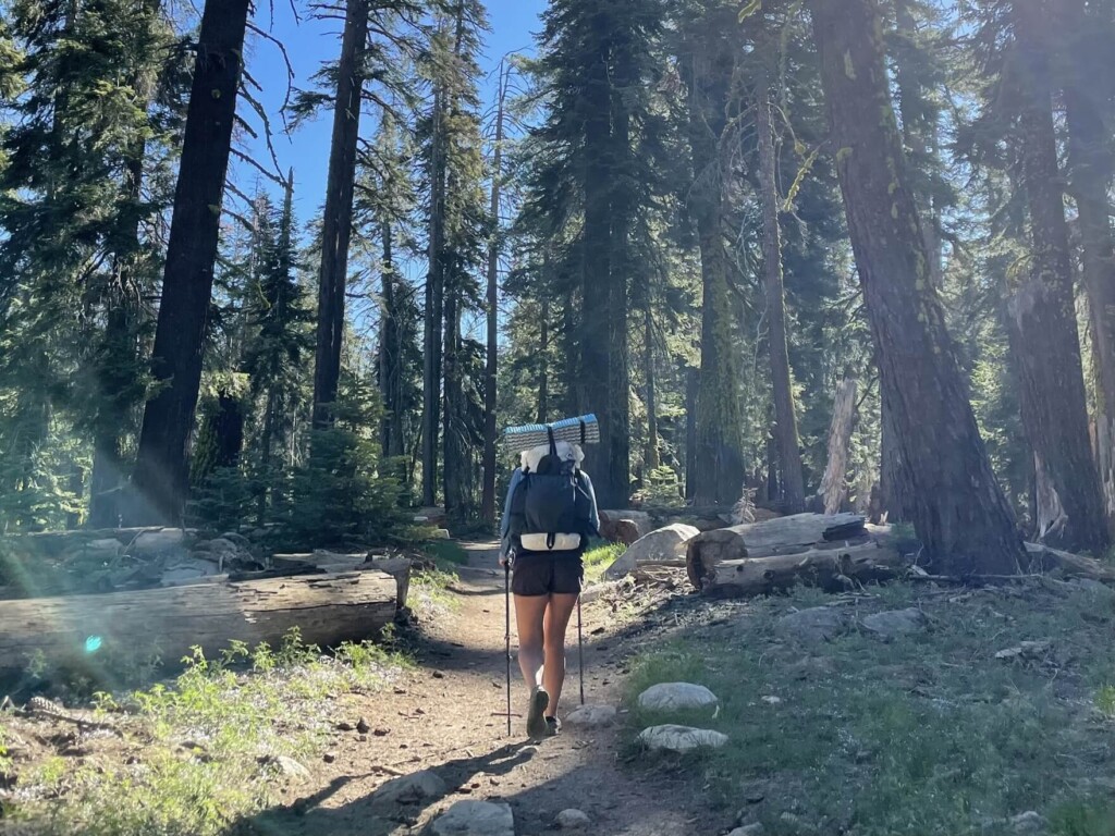
トレイルヘッド(登山口)からハイキング出発
駐車場のすぐ横からトレイルは始まります。準備を終えていざ出発。
新緑も生き生きしていて本当に気持ち良いトレイルです。
後ろからペースの速いパワフルハイカーがわたしを抜かしていきます!笑
ペースが速いのでいつも感心します。が、、本日のトレイルは距離も長く、後半は急勾配もあるので、自分のペースを乱さずマイペースにハイキングを楽しみます。
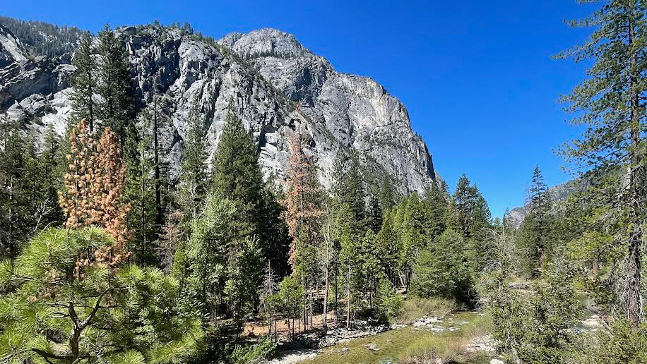
前半は木々の多いフォレストを歩いていきます。
途中には鹿のファミリーにも会いました。とてもピースフルな空間です。
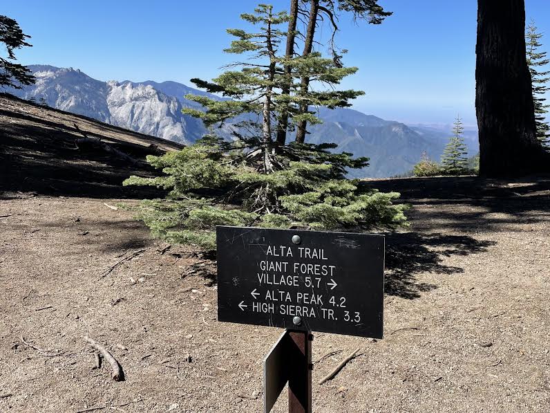
スタートから約40分後、分岐もでてきます。 ALTA PEAK の方へ進んでいきます。
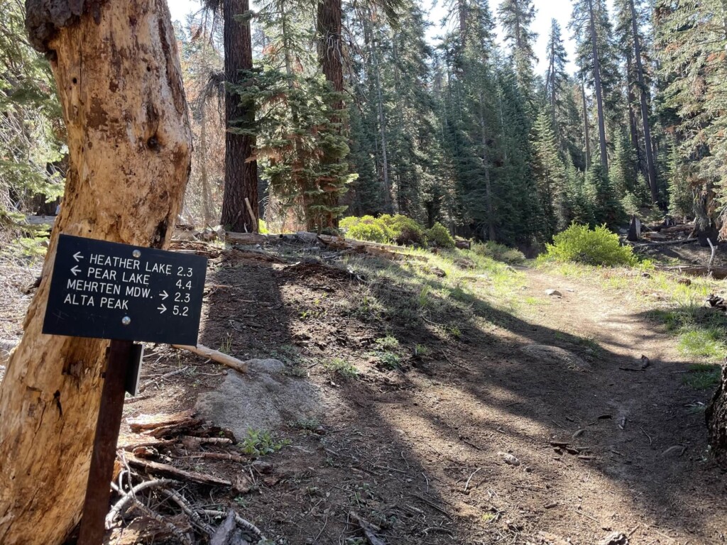
スタートから1時間後にも2回目の分岐が出てきますが同じく ALTA PEAKの方へ。
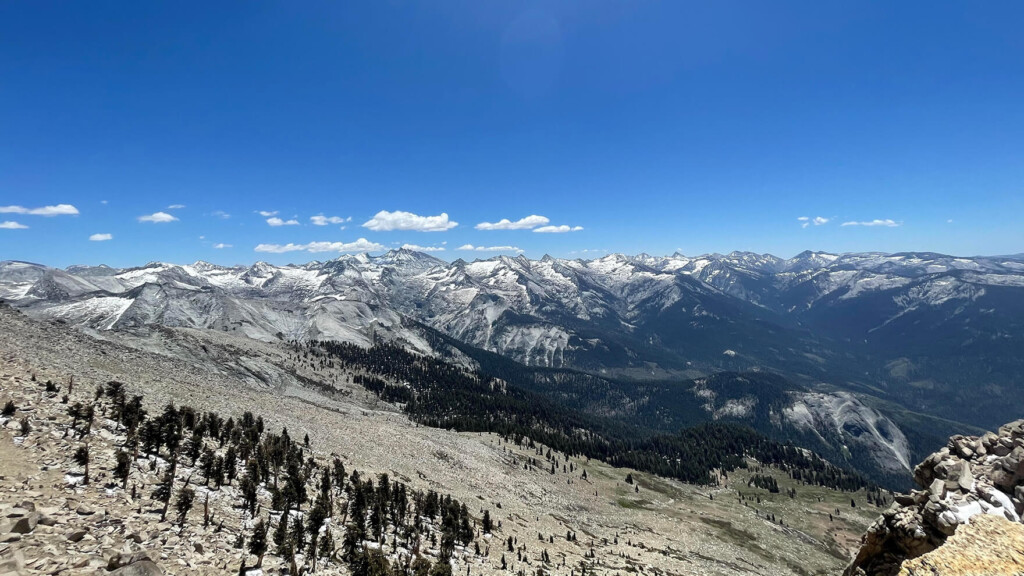
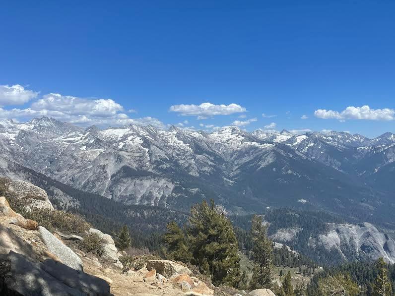
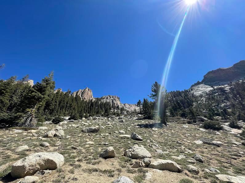
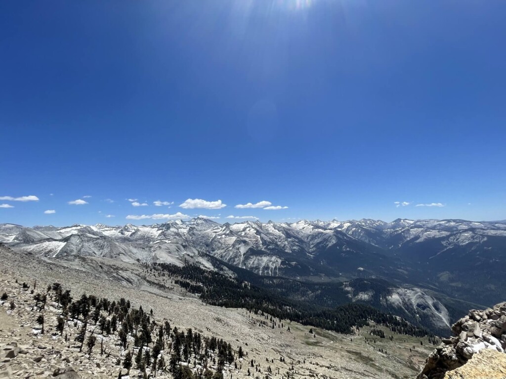
この辺りから視界が開け、森の景色からシエラ・ネバダ山脈が見渡せる景観へと変わっていきます。
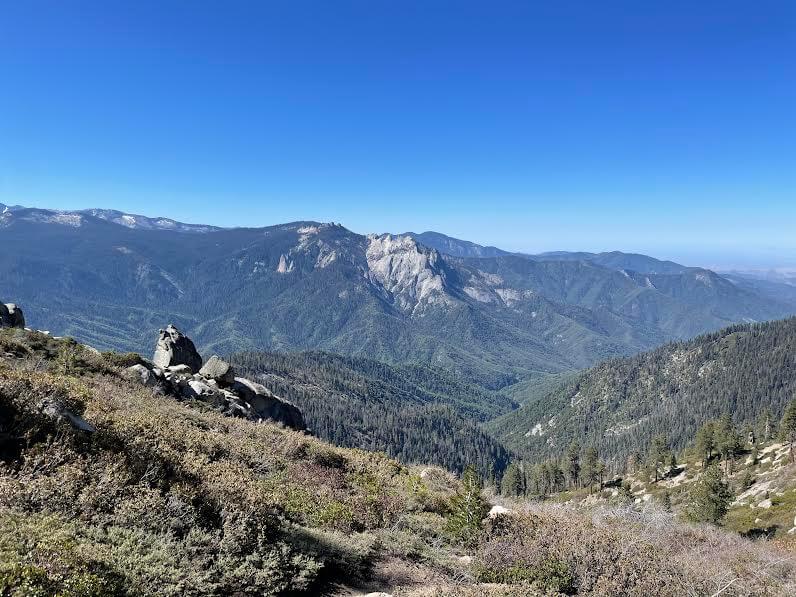
新鮮な空気に気持ちも癒されます。とても美しい景色に心もリフレッシュ。
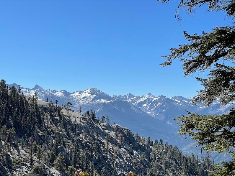
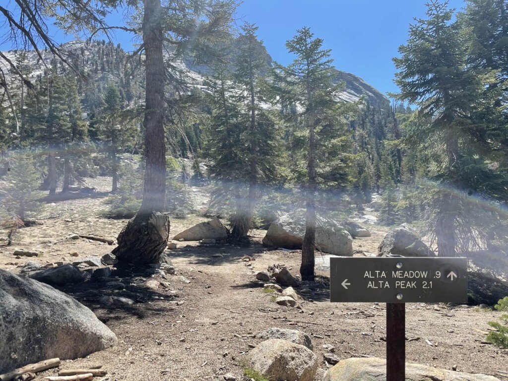
雪が残る美しいシエラ・ネバダ山脈を見ながらさらに進み、スタートから約2時間後にまた分岐が出てきます。 ALTA PEAK の左方向へ進みます。
ここからは残り2.1マイル(3.36km)。
景色も岩々しい景観にだんだんと変わり、山頂が近くに見えてきます。
ここからが正念場。まだまだ坂は続きます。
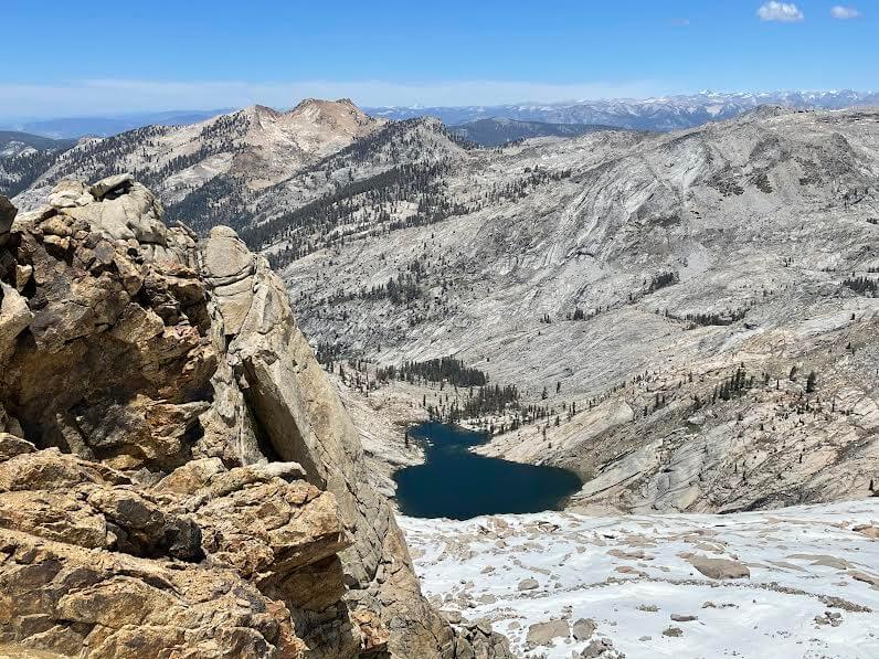
美しい山脈の景色から今度は岩の絶壁が目の前に立ちはだかってきます。
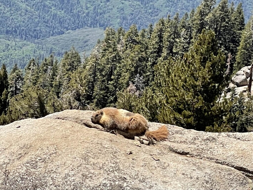
標高の高い場所に生息するマーモットもこの辺りで見ることができました。絶景を前に日向ぼっこしていましたよ。
山から雪解け水がいたるところで流れ落ち、透明度の高いキラキラ光る水はまさに大自然の恵み。
透き通る川の水、水のせせらぎ、鳥達の声に癒されながらさらに進んでいきます。
他のハイカーに出会うことはほとんどなく自然界の中に包まれている感満載です。
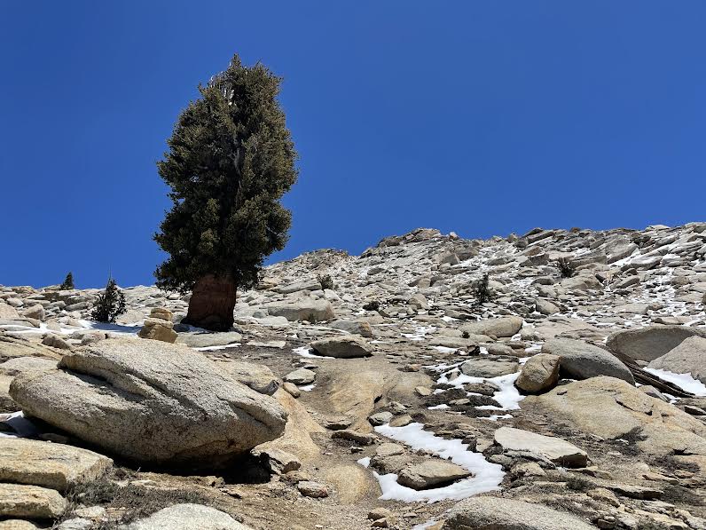
標高をさらに上げていくと森林限界線に近づきほぼ木々も無くなってきます、そして雪が残っているのも見受けられます。
素晴らしい景観に囲まれつつ、空気も薄いので景色を楽しみつつも、息が上がります。

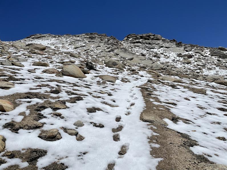
最後の1マイルが本当の頑張りどころ。
今までにない急勾配です。空気も薄い! 休憩しながら登っていきます。
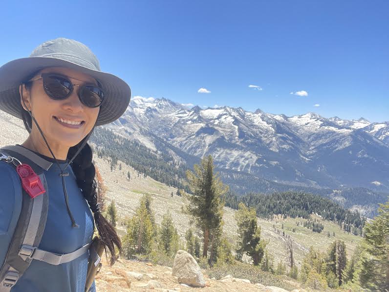
最後のクレイジーな坂を登りきり、スタートから約4時間後アルタ・ピーク到着です。
標高約3,420m
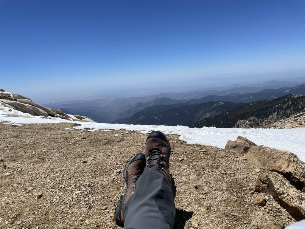
山頂には誰もいません、貸切!! 360度の絶景です。
でもまずは休憩。私は到着してから最後のラストスパートのクレイジー勾配坂で使った体力を取り戻すため即20分ほど仮眠を通り越して爆睡しました。笑
かなりリフレッシュ。最高です。
20分後、2人のベテランハイカー、ケビンとカートが登ってきて、よくあるアメリカンなフレンドリーさで「ハローフレンド!一人で来たの?やるじゃん!」というような感じで話しかけてきてくれます。
このトレイルだけに限らず、アメリカのハイキング中に会うハイカーはとってもフレンドリーな人が多く気軽にに話しかけてきてくれます。お互いアウトドア好きという共通点もあるので親近感を感じますし、時にはお互いの経験や状況をシェアし合いながら会話が弾みます。そんなひと時もハイキングの中の楽しみだと感じてます。
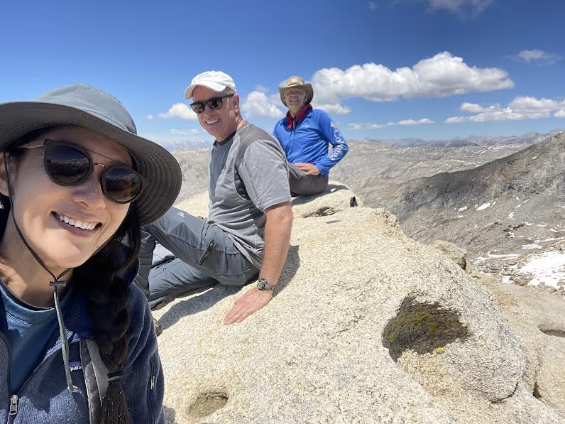
ここのアルタ・ピークは山頂に到着したら大きな岩があり、そこに登ると”登頂完了”。という事になるのだそうで、それをケビンとカートが教えてくれました。なのでさっそくその岩に登ると、小さなグリーンボックスがあり、その中にメモ帳が入ってます。そこに自分のサインや好きなメッセージなどを残します。それをしてピーク登頂完了です。
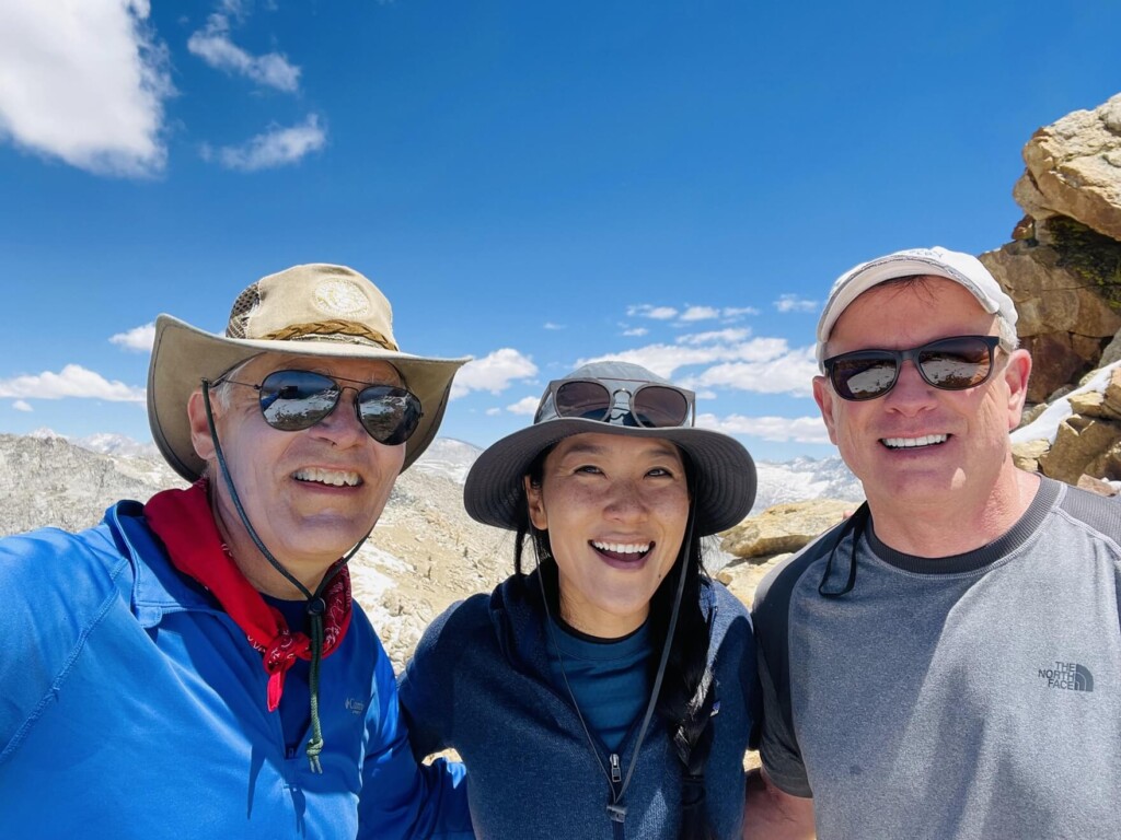
今回は山頂で会った二人と会話もはずみ1時間半山頂で休憩し、その後別れを告げ来た道を下りていきます。休憩含め8時間以上の1日コースですが、夏にぴったりの本格ハイキングコースです。帰りは下りですが、3時間近くかかりました。とても達成感のある素晴らしいトレイルです。
ヨセミテ国立公園よりも知名度はありませんが、そこがまた魅力。人も少なく、素晴らしい景観を楽しむことができるハイキングコースが沢山あります。アウトドア好き、ハイキング好きにはもってこいの場所です。キャンプやバックパックなどをしながら2~3日自然の中で過ごす場合でも最高のロケーションですよ。
新型コロナウィルス感染拡大に関するご注意
2021年11月現在、各国では検疫体制強化に伴う入国制限をはじめ、国立公園への入園規制や国内の移動制限など、さまざまな状況があり得ます。そうした条件は予告なく変更になる場合がございますので、旅行の際には必ず各国の大使館・領事館及び外務省海外安全ホームページ(感染症危険情報)、国立公園ホームページをはじめとした現地情報を入手し、乗継地および渡航予定国、訪問予定地周辺の情報を確認してから無理のない計画・行動をしてください。
加藤 さやか
 カリフォルニアのハイキング・旅行プランはお任せください。父の影響もあり昔からアウトドアアクティビティーが大好きで、日本にいた頃から登山、国立公園巡りをする中で、アメリカやカナダの大自然に魅了され、その結果念願だったアメリカに辿り着きました。現在は日本人ガイドと行く完全プライベートハイキングツアーなど、お客様と一緒に作る現地オプショナルツアーを提供するANAMI TOURSを営んでいます。現地在住だから知り得る、スペシャルなオプションをご紹介させて頂きます。ご興味ある方は下記HPから。
あわせて読みたい
 歩かずに死ねるか!アメリカ国立公園への旅(26)巨木の森の奥には息をのむような渓谷美 セコイア・キングスキャニオン国立公園
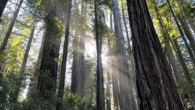 歩かずに死ねるか!アメリカ国立公園への旅(20)樹齢1500年以上の木々が広がる太古の森 レッドウッド国立州立公園
 歩かずに死ねるか!アメリカ国立公園への旅(19)カリフォルニア ベイエリアの名峰へ マウント・ディアブロ州立公園
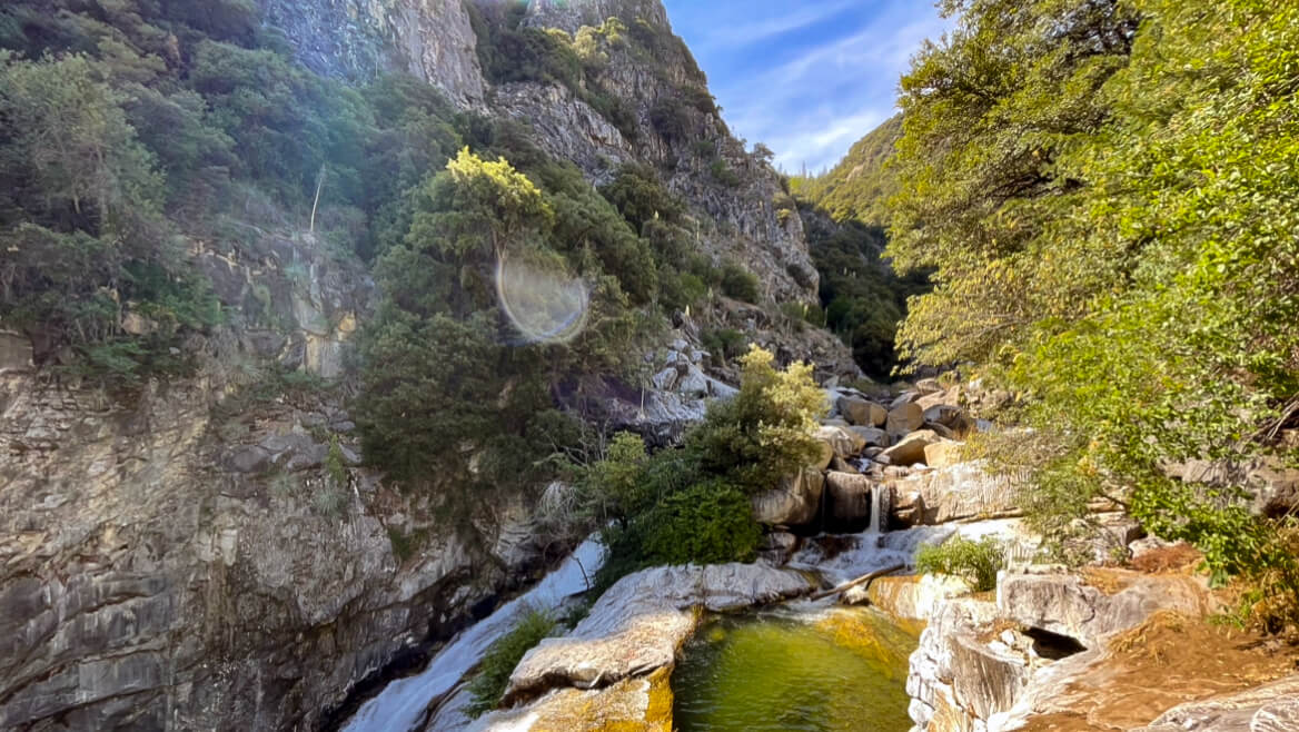 歩かずに死ねるか!アメリカ国立公園への旅(28)光り輝く大理石を流れる滝を見に行こう(セコイア国立公園)