Can you die without walking? A Journey to the US National Parks (19) Mount Diablo State Park, a Famous Peak in the Bay Area of California
Written by Sayaka Kato
Continuing from last time, this time we will introduce hiking trails that are easily accessible from San Francisco and can be enjoyed all year round. These are easy and refreshing hikes that are unique to California!
About an hour north of San Francisco lies the area known as Mount Diablo State Park, where towering over the park is the famous Mount Diablo, a symbol of the Bay Area (San Francisco metropolitan area)
Mount Diablo has long been a sacred site for many Native Americans, and was once considered a creative center by the Miwok Native Americans. The rock pits where they once ground acorns and other nuts can still be seen
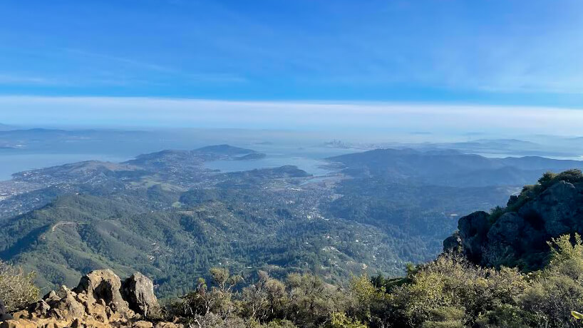
Mount Diablo, a sacred mountain, is located in a 20,000-acre state park in Contra Costa County (near Walnut Creek) in the San Francisco Bay Area. Mount Diablo is not particularly high, standing 3,849 feet (1,173 m) high, but the lack of high mountains around it means the views from the summit on a clear day are spectacular. From the summit, you can enjoy magnificent views of the Bay Area and surrounding areas, as well as Lassen Peak, stretching 181 miles (about 290 km) to the north
It's also a great place for outdoor activities, where you can enjoy hiking, cycling, horseback riding, camping, and more (it's a Bay Area state park that's popular with residents all year round)
This article will introduce the longest route from the trailhead at the base to the summit, but you can adjust the length and intensity by changing your starting point (it is also possible to drive to the summit of Mount Diablo)
The great thing about hiking is that you can enjoy the various natural sights along the way, along with the sounds and atmosphere of each spot, at your own pace to your heart's content. Encounters with plants and animals that can only be seen at certain times can also become fond memories. This area is better suited to hiking in the cooler seasons than in the summer when temperatures rise. The scenery is especially beautiful in the clear air after a rain. It's unique to California that you can casually enjoy hiking even in winter
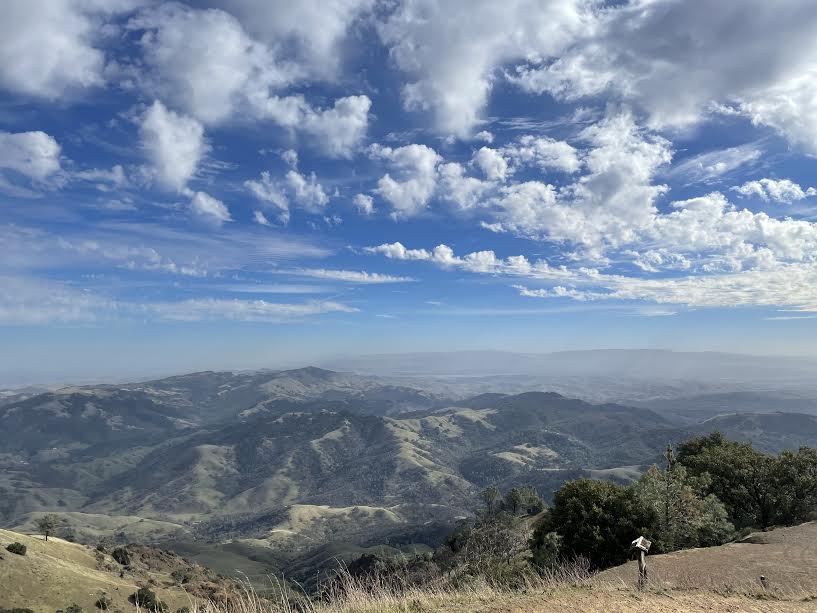
table of contents
Mount Diablo Trail Hiking Information
Here is an overview of the Mt. Diablo: Mitchell Creek to Diablo Summit trail
Useful items to bring with you on a hike
As for what to bring, as always, prepare the same equipment as you would for a typical hike in the United States
- Drinks (larger in summer, about 2 liters)
- Temperature-adjustable winter clothing
- hat
- sunglasses
- sunscreen
- Snacks to eat during the hike
- If you have any regular medications, bring first aid such as medicines and bandages
- Other than that, your favorite hiking gear
Trail Data
- For intermediate and advanced players
- Season: The best season is from September to June (it is possible to climb all year round, but winter is more comfortable than summer when temperatures are higher)
- Mount Diablo Elevation: 3,849 feet (1,173 m)
- Round trip: Approximately 20.8km (13 miles)
- Height difference: approx. 1092m (3,585 ft)
- Course time: 6 to 8 hours round trip (including breaks)
Access (by car to the trailhead)
Trailhead address: Mitchell Canyon Visitor Center (96 Mitchell Canyon Rd, Clayton, CA 94517) (1 on the map above)
Enter this into your GPS and you'll arrive at the trailhead
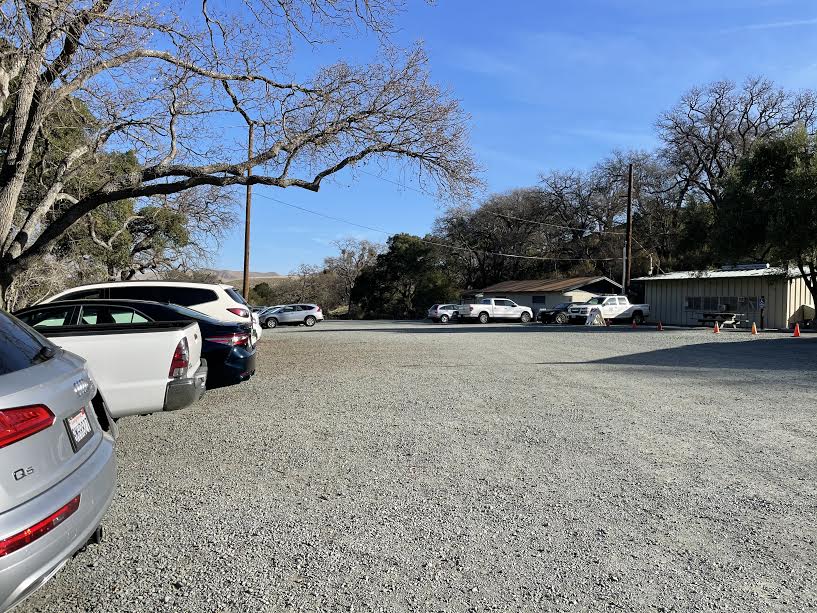
There is a visitor center and parking lot just before the trailhead, and restrooms are also available. There is a parking fee of $6 per vehicle. It is open from 8:00 AM to sunset
Start hiking from the trailhead
Once we were ready, we set off. The trailhead was right next to the parking lot
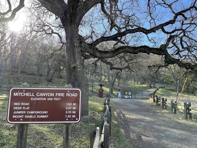
This is the Mitchell Canyon Fire Road, the trailhead
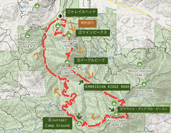
*The route this time follows the looped trails that start from the trailhead: Mitchell Canyon Trail → Meridian Ridge Trail → Summit Trail → Juniper Trail → Deer Flat. You can walk either clockwise or counterclockwise, but clockwise is recommended for better views, so we will go clockwise
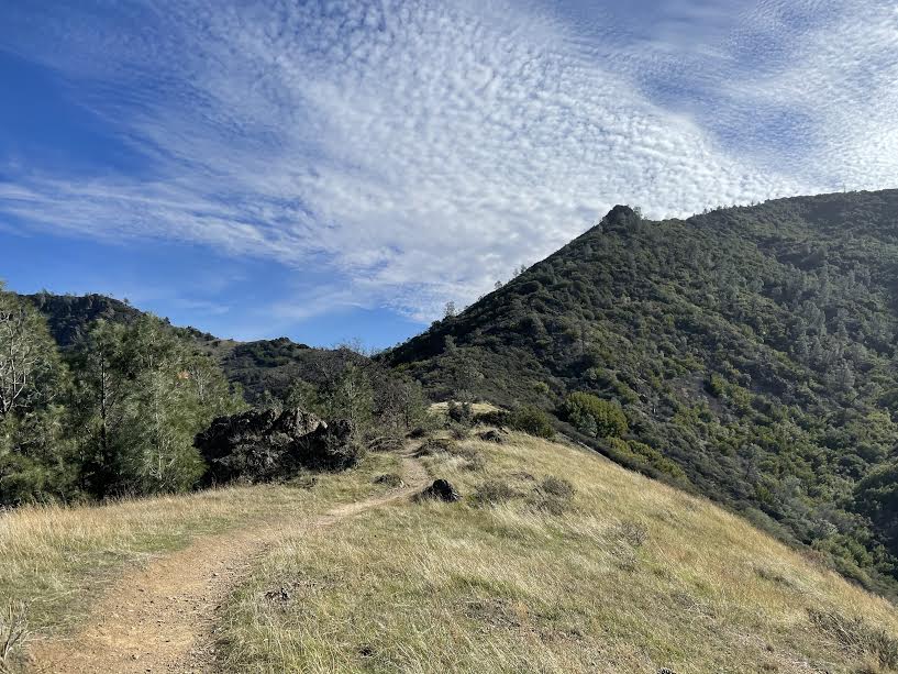
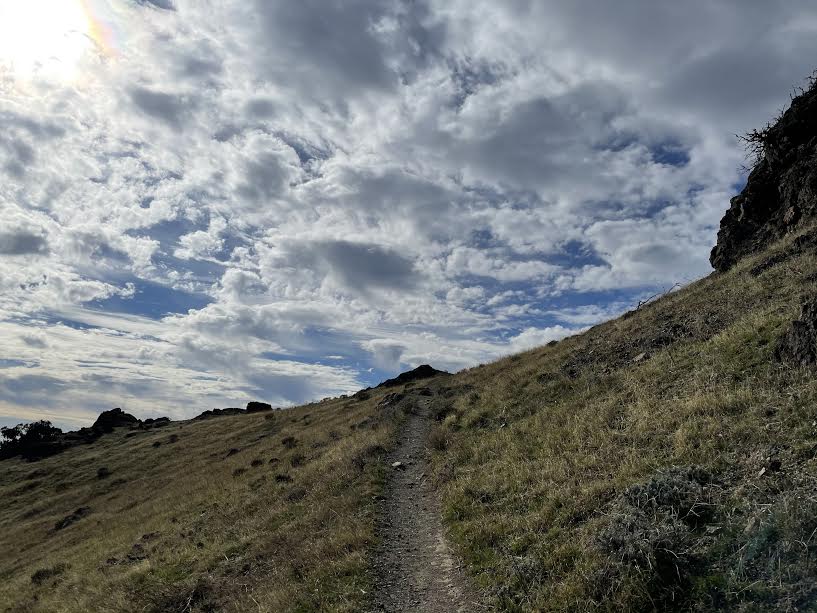
Turn left at the fork just past the trailhead. There's a steep slope from the start, but the morning sun sparkling is very pleasant
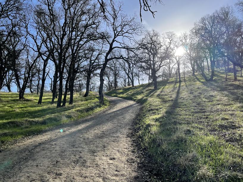
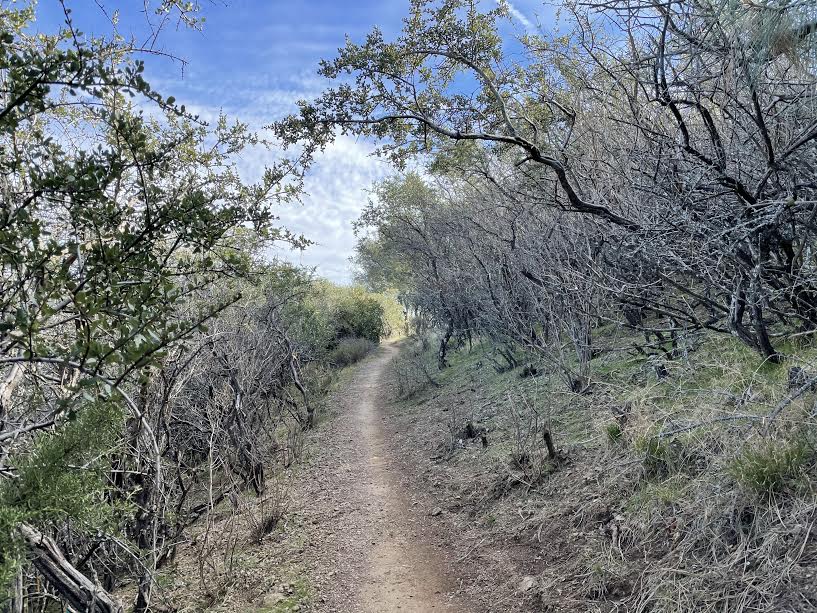
The trail is very clear and paved, but it is basically a gravel hiking trail
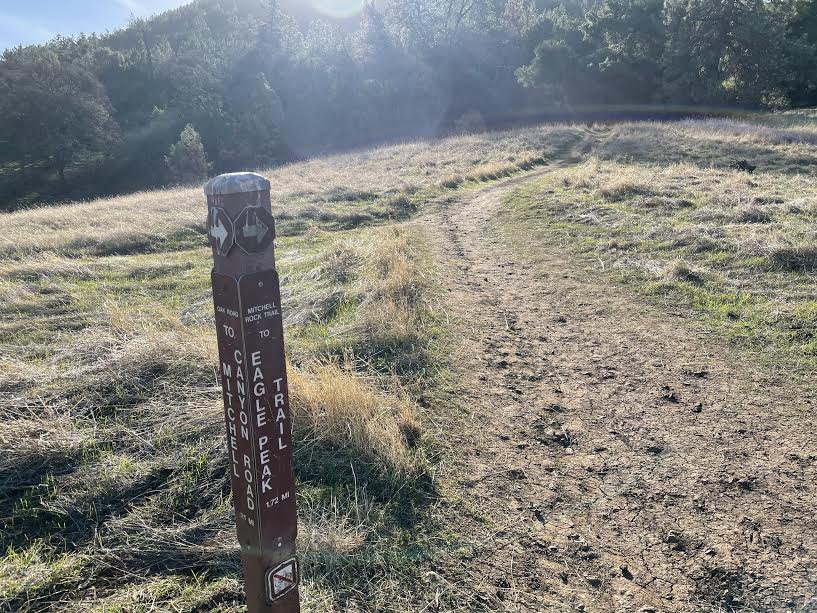
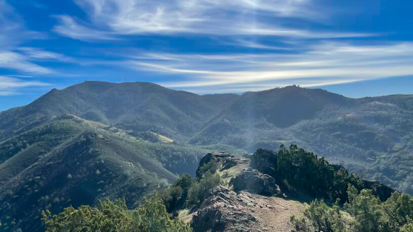
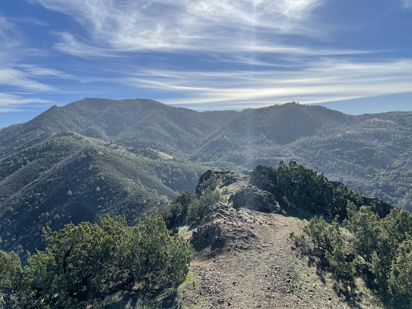
Along the way you will pass Eagle Peak, a summit with a spectacular view, so when you reach the fork in the road, head towards Eagle Peak first
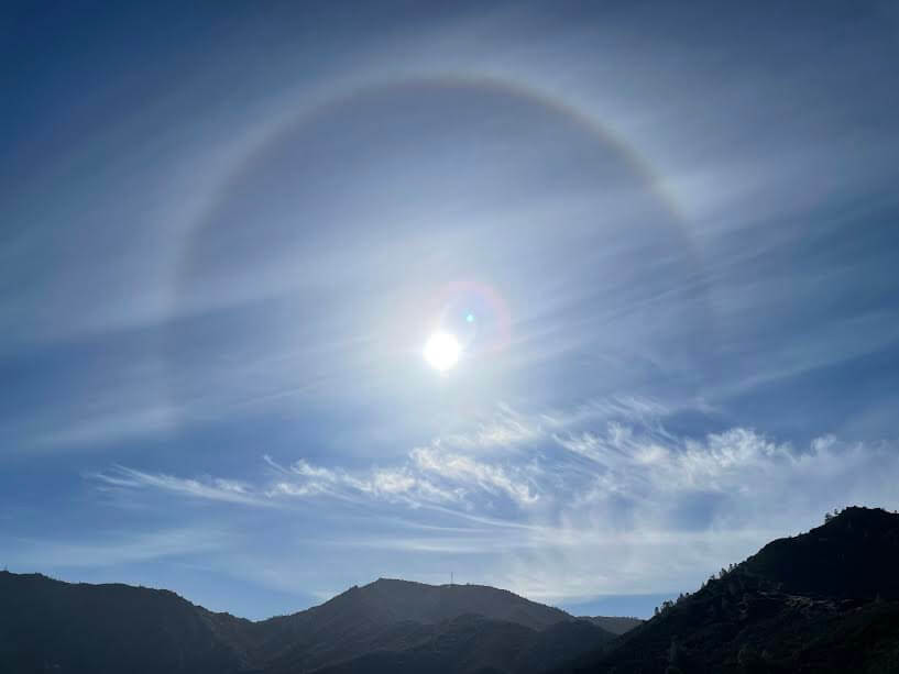
As I walked, I looked up at the sun and saw a beautiful parasol, the HALO. It's said to be a sign that the weather is about to deteriorate, but the weather was perfect for hiking today. About an hour after starting to walk, I arrived at Twin Peaks. (Map 2 above)
The scenery is beautiful and we take a short break here to catch our breath
After Twin Peaks, your next destination is Eagle Peak (722 meters)
The blue sky and clouds were beautiful. The surrounding scenery and the ever-changing cloud formations were also beautiful. We also encountered a coyote here
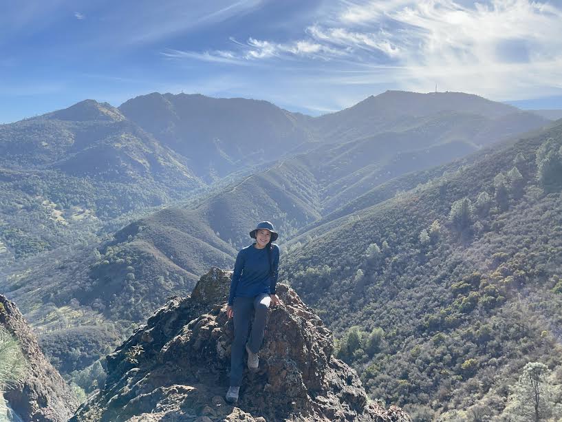
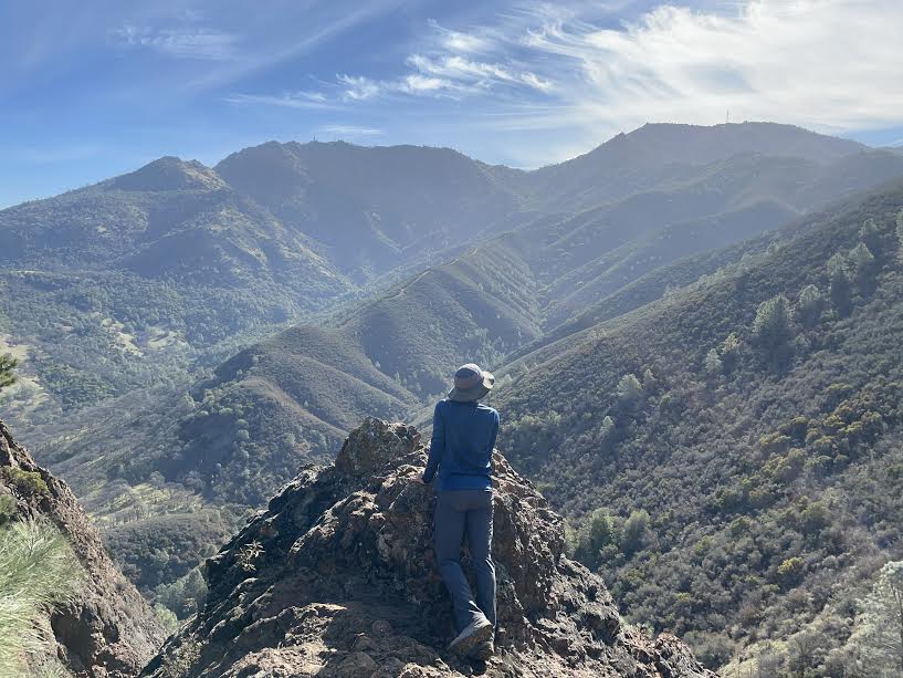
About an hour and a half after departure, we arrived at Eagle Peak (Map 3 above)
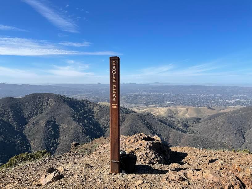
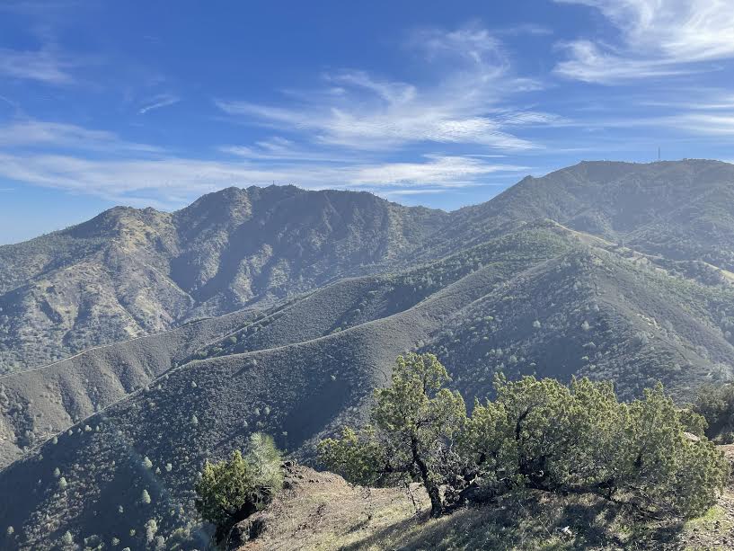
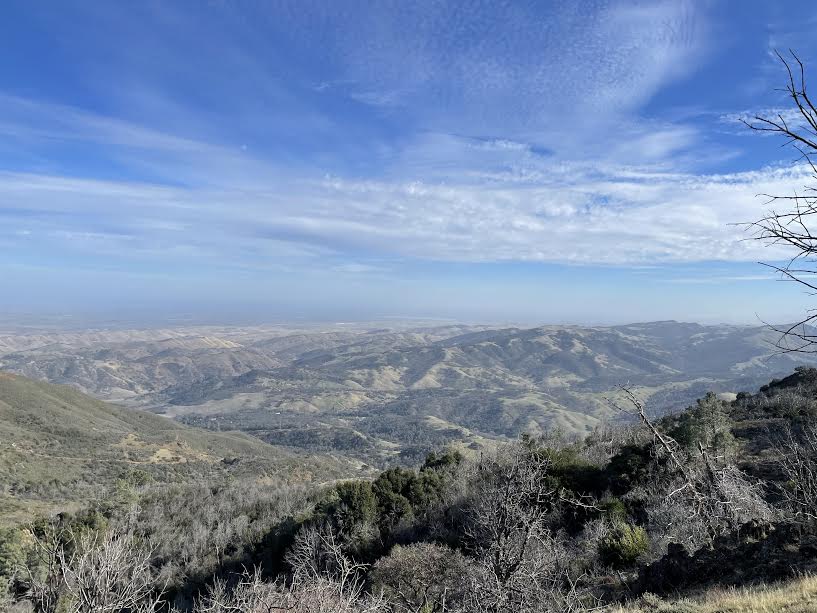
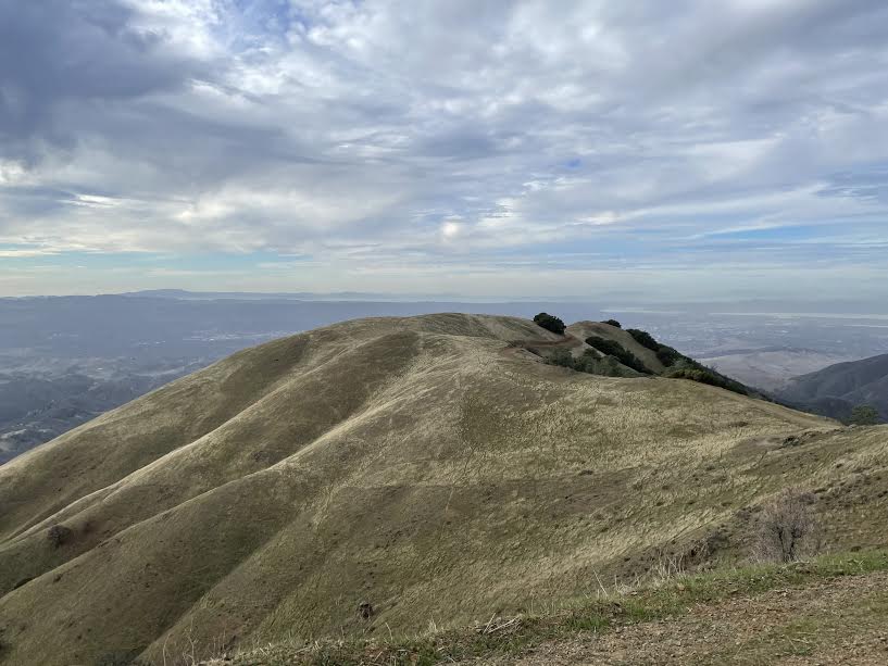
A magnificent 360-degree view unfolds beneath the blue sky. We take a short break here and then set off again
We've been going uphill for a while now, but from here on out we'll start to go downhill a little, so it'll get a little easier
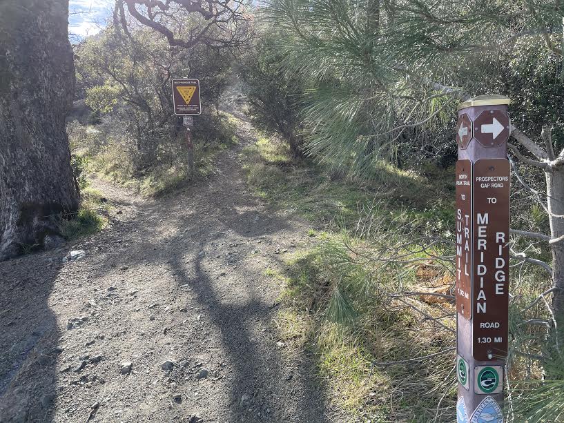
As you continue along you will come to a road. The MRRIDIAN RIDGE RODE trail (4 on map above) continues across the road, so cross the road and continue along the trail
The slope begins again and the altitude gradually increases. Since it was a weekday, we only occasionally met other hikers and the trail was empty (although as it is a popular trail, it is expected to be crowded on weekends)
The sky was clear and it was a very pleasant day for hiking
Continuing on, you'll come to a fork in the road between Meridian Ridge and Summit Trail. Since we're heading to today's destination, the summit of Mount Diablo, we headed for Summit Trail. On this trail, we encountered deer and coyotes. Encounters with wildlife are also one of the joys of hiking
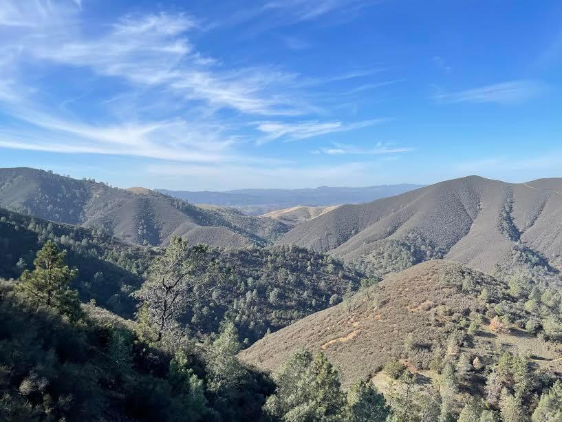
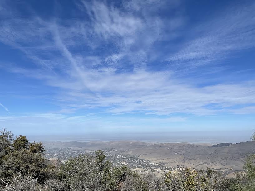
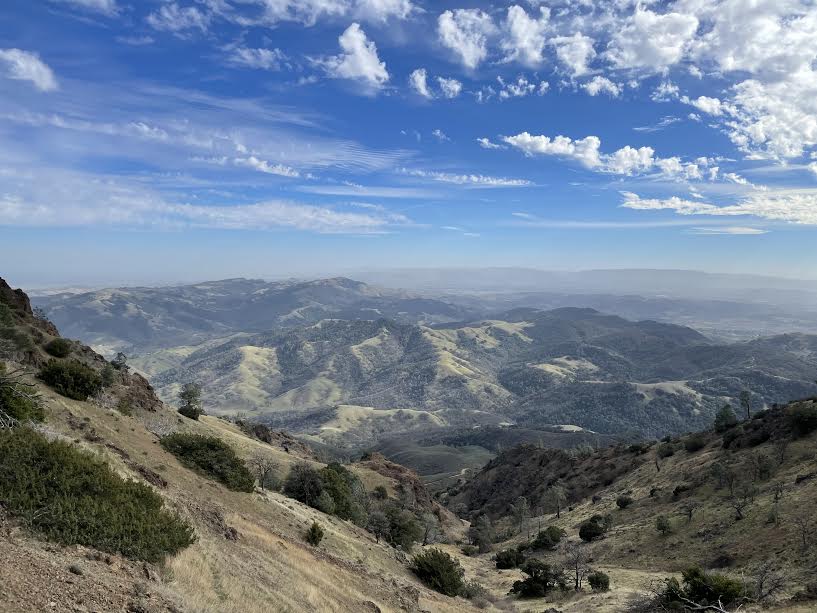
Beyond that, another magnificent view unfolded. It was lunchtime, so we found a spot with a good view and took a break. The weather was fine, so we could see the mountains in the distance, and California condors and other birds were flying happily in the sky
We're almost to the top of Mount Diablo. After a break, we set off for the final stretch
At the top of the mountain is the historic lighthouse called Mount Diablo Beacon, which is our destination for the day.We had seen the lighthouse in the distance several times during our hike, but now it was finally right in front of us
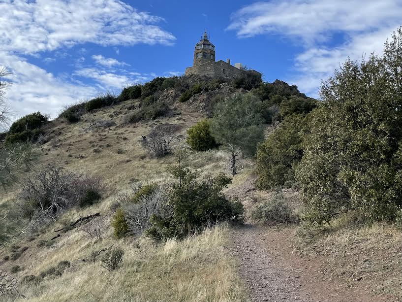
And 3 hours and 45 minutes after we started, we finally arrived at the peak
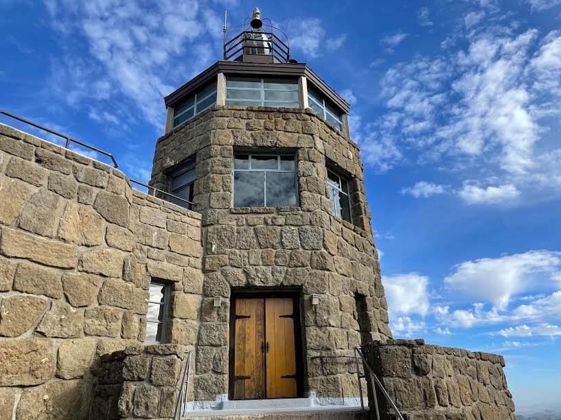
Mount Diablo Beacon (Map 5 above)
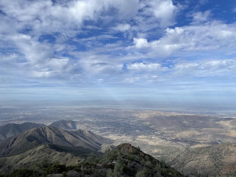
View from the summit
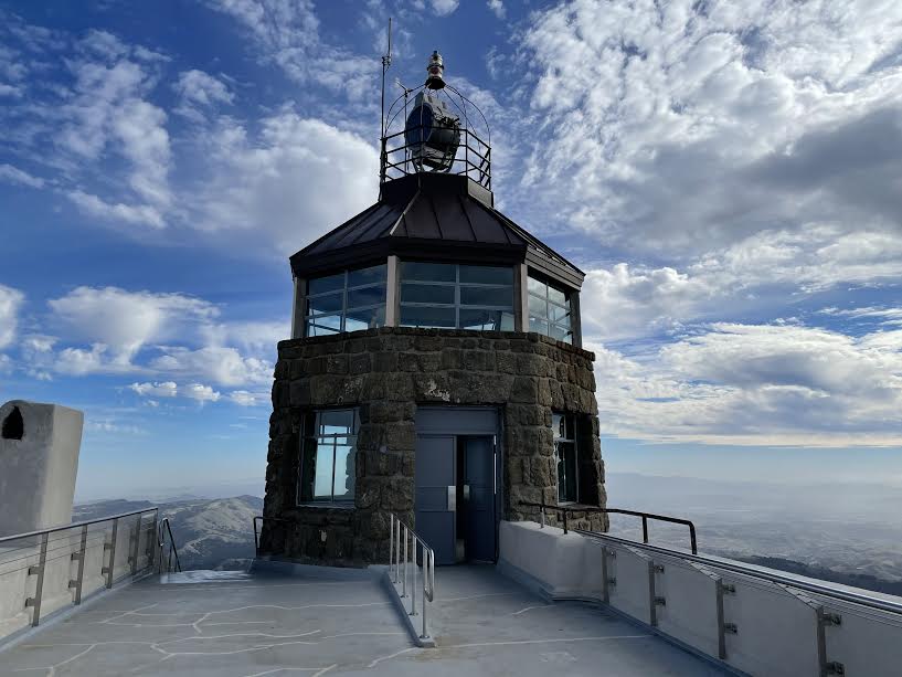
At the top of the mountain is the Mount Diablo Beacon. This beacon (lighthouse) was originally lit from the top of Diablo every night in the early days of commercial aviation (before navigation) to serve as a landmark for planes taking off. It was lit by Charles Lindbergh in 1928
However, after the attack on Pearl Harbor in 1941, the United States, fearing that the Japanese military would attack the mainland, decided to turn off the lights here so that they would not serve as a landmark for the Japanese military
After the war ended, the beacon was once again lit, and a ceremony was held at the visitor center on the summit on December 7, 1964. Admiral Chester W. Nimitz, commander of the U.S. fleet, flipped the switch to turn the beacon on, and after the war, the beacon was once again lit
Since then, even now that the war is over, the lights are still lit every year on December 7th in memory of those who lost their lives at Pearl Harbor. It's a place with such a history, I guess
After taking a break and enjoying the magnificent view from the summit, we set off for the remaining half of the trail
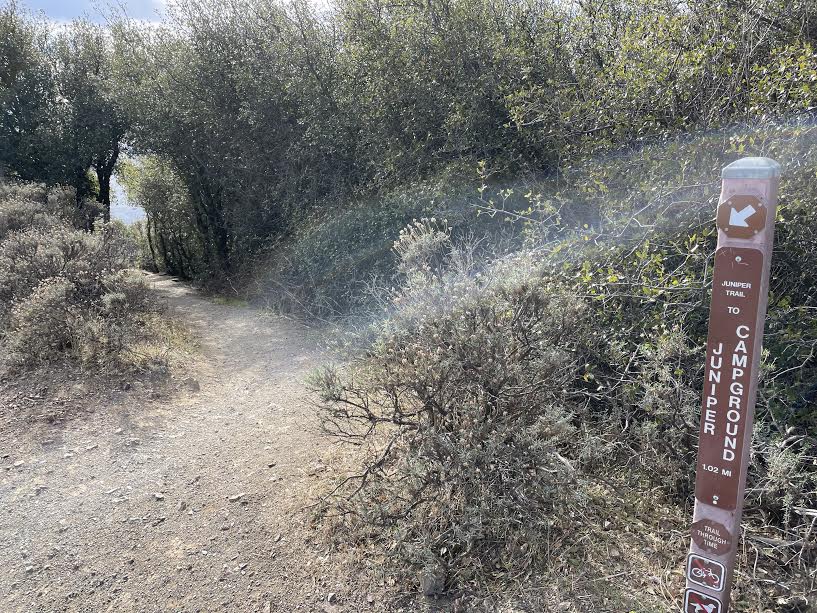
The parking area at Mount Diablo Beacon is equipped with a water tap and restrooms. For the second half of the route, take the Summit Trail, which connects from the parking area, onto Juniper Trail (towards Camp Ground Juniper)
The return journey offers a different view than the outbound journey
As you go down you will come across a campsite (Camp Ground Juniper, 6 on the map above)
Continue on from there towards Deer Flat
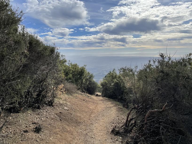
After the campsite, you just keep going through Deer Flat. It's very simple and easy to follow. You'll arrive at the trailhead about six hours after starting. This trail offers beautiful views on a clear day, so be sure to check the weather forecast before you go
Precautions regarding the spread of COVID-19
As of April 2021, various countries are currently implementing various restrictions, including entry restrictions due to strengthened quarantine measures, restrictions on entry to national parks, and domestic travel restrictions. These conditions are subject to change without notice, so when traveling, be sure to obtain local information from each country's embassy or consulate, the Ministry of Foreign Affairs' Overseas Safety Website (Infectious Disease Risk Information), national park websites, and other sources, and check information on transit points, countries you plan to travel to, and the areas around the places you plan to visit before making reasonable plans and taking action
Sayaka Kato
 Leave your California hiking and travel plans to us. Influenced by my father, I've always loved outdoor activities, and while living in Japan, I started hiking and touring national parks, which fascinated me with the natural beauty of America and Canada, ultimately leading me to my dream of visiting the United States. I currently run ANAMI TOURS, which offers local optional tours created together with customers, such as completely private hiking tours with Japanese guides. I'll introduce you to special options that I know only because I live in the area. If you're interested, please visit the website below
Related reading
 Can you die without walking? A trip to the US National Parks (18) A hiking trail that is full of California flavor: Mount Tamalpais State Park
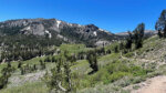 Mount Rose, located near a popular ski area, offers an easy 3,000m hike and 360-degree views. [A trip to the US National Parks (39)]
 A day hike to Mt. Dana, Yosemite's second highest peak, higher than Mt. Fuji. [I can't die without walking! A trip to the American National Parks (38)]
 Can't die without walking? A Journey to the American National Parks (16) Flowers, greenery, lakes, and a panoramic view from the summit. Mount Shasta's magnificent peak, Mount Eddy Trail, has it all