人気のスキーエリア近くで手軽に3,000m級のハイキングと360°の絶景が楽しめる「マウント・ローズ」【歩かずに死ねるか!アメリカ国立公園への旅(39)】
written by Sayaka Kato
レイク・タホのエリアで一番高い山、マウントローズ。
マウントローズはシエラネバダ山脈北部にある山。ネバダ州にあり、レイク・タホの北東数マイルに聳え立つ山です。
カーソンシティ、リノ、レイク・タホに近く、マウント ローズ エリアには多くのスキー スポットがあります。冬場はとても人気なスキーエリアでサンフランシスコなどのベイエリアからも沢山の人々が足を運びます。リノから車で約30分位の場所に位置します。(サンフランシスコからは車で4時間ほど)
マウント ローズ自体にはスキー場はありません。
スキー場があることで冬はスキー、スノーボードをする人たちで賑わい、マウントローズへのトレイルははスノーシューを楽しむ人、その他にも夏はハイカー、乗馬などをする人々に人気な場所です。
レイク・タホからも近く、景色も素晴らしいのでアウトドア好き、ハイカー達に人気のコースです。
Mount Rose Trail のトレイル情報
アクセス(車でトレイルヘッドまで)
トレイルヘッド住所:Mt Rose Trailhead もしくは 24705 Mt Rose Hwy, Reno, NV 89511 (Googleマップでこちらを入れると出てきます。)
※電波状況が悪いので事前に地図をダウンロードしておくことをお勧めします。
持ち物
ハイキングに携行すると便利な持ち物 関してはこれまで同様、一般的なアメリカのハイキングと同じような装備を準備して いきましょう。
- 飲み物(夏は多めに、2リットル位)
- 気温の調整できる防寒着(風避けシェルが役立ちます)
- 帽子
- サングラス
- 日焼け止め
- ハイキング中に食べるスナックなど
- 常備薬などがある場合は薬やバンドエイドなどのファーストエイド
- その他、通常ハイキング装備で好みのものを
トレイルデータ
- 中級者から上級者向け
- シーズン : ベストシーズンは5月から10月
- 標高: 3287m (10,785 ft )
- 往復距離: 約 17.12km (10.7miles )
- 登山口からの高低差: 約 730m ( 2,395 ft )
- コースタイム: 平均5時間半から7時間半
トレイルヘッド(登山口)からハイキング出発
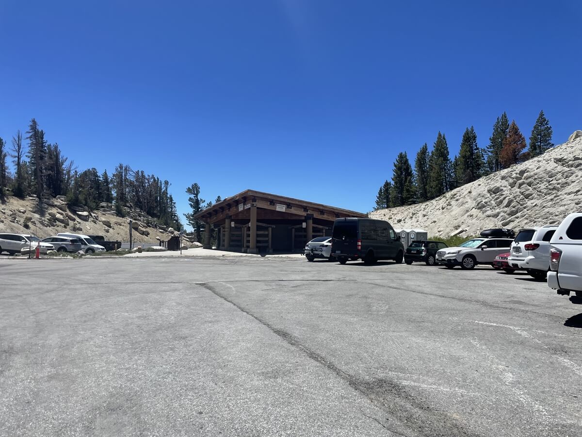
駐車場は割と広さがありますが、私が到着したのが12時(6月)で、すでに沢山の車が駐車されていました。
駐車場にお手洗いもありますがコロナ禍でクローズになっていました。
トレイル内にはお手洗いはありません。必要な場合は青空トイレになります。
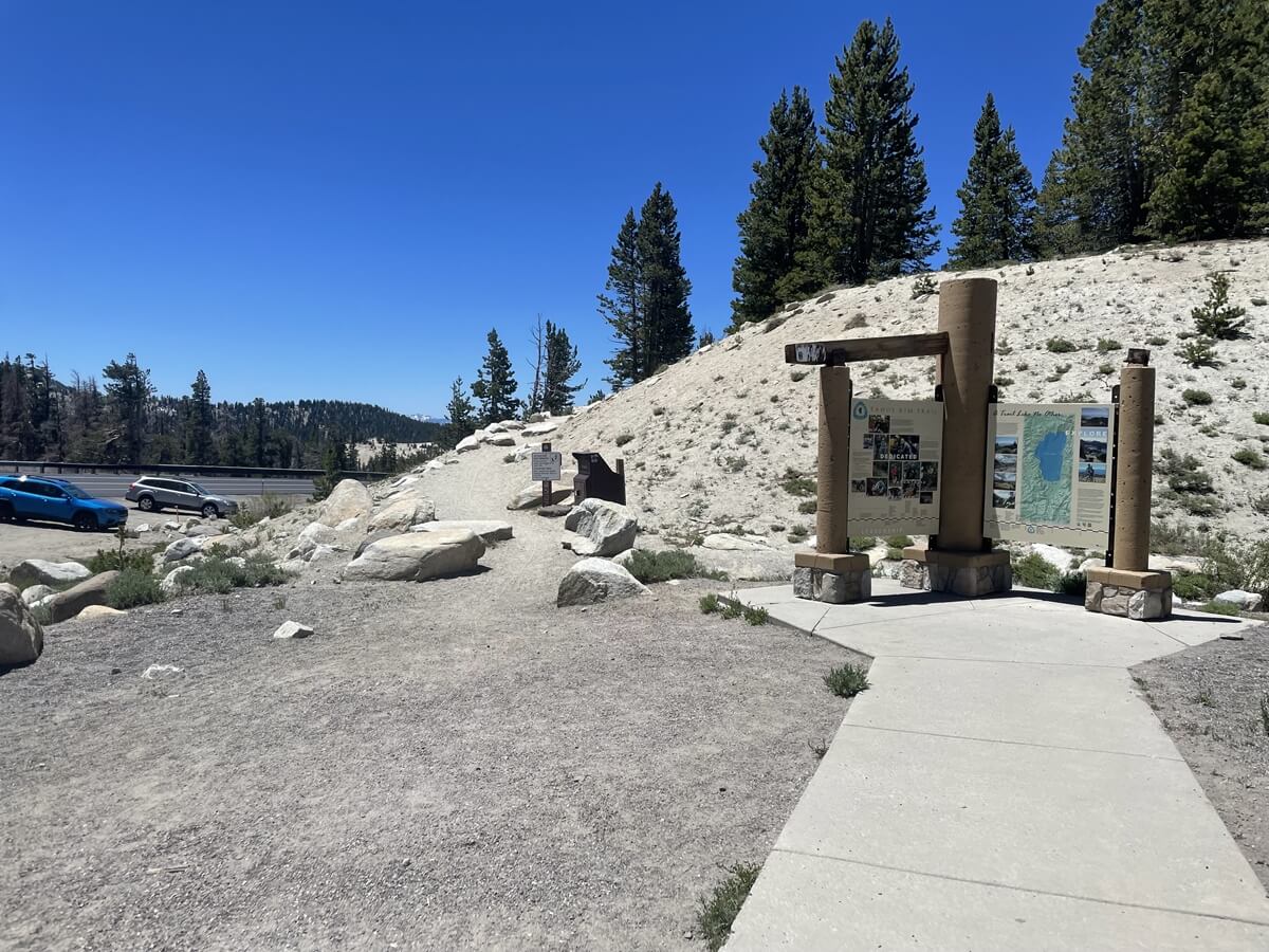
お手洗いの後方からマウントローズのトレイルが始まります。
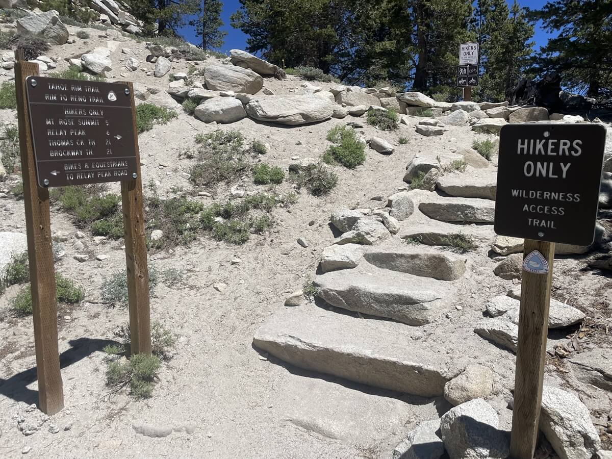
いよいよスタート。
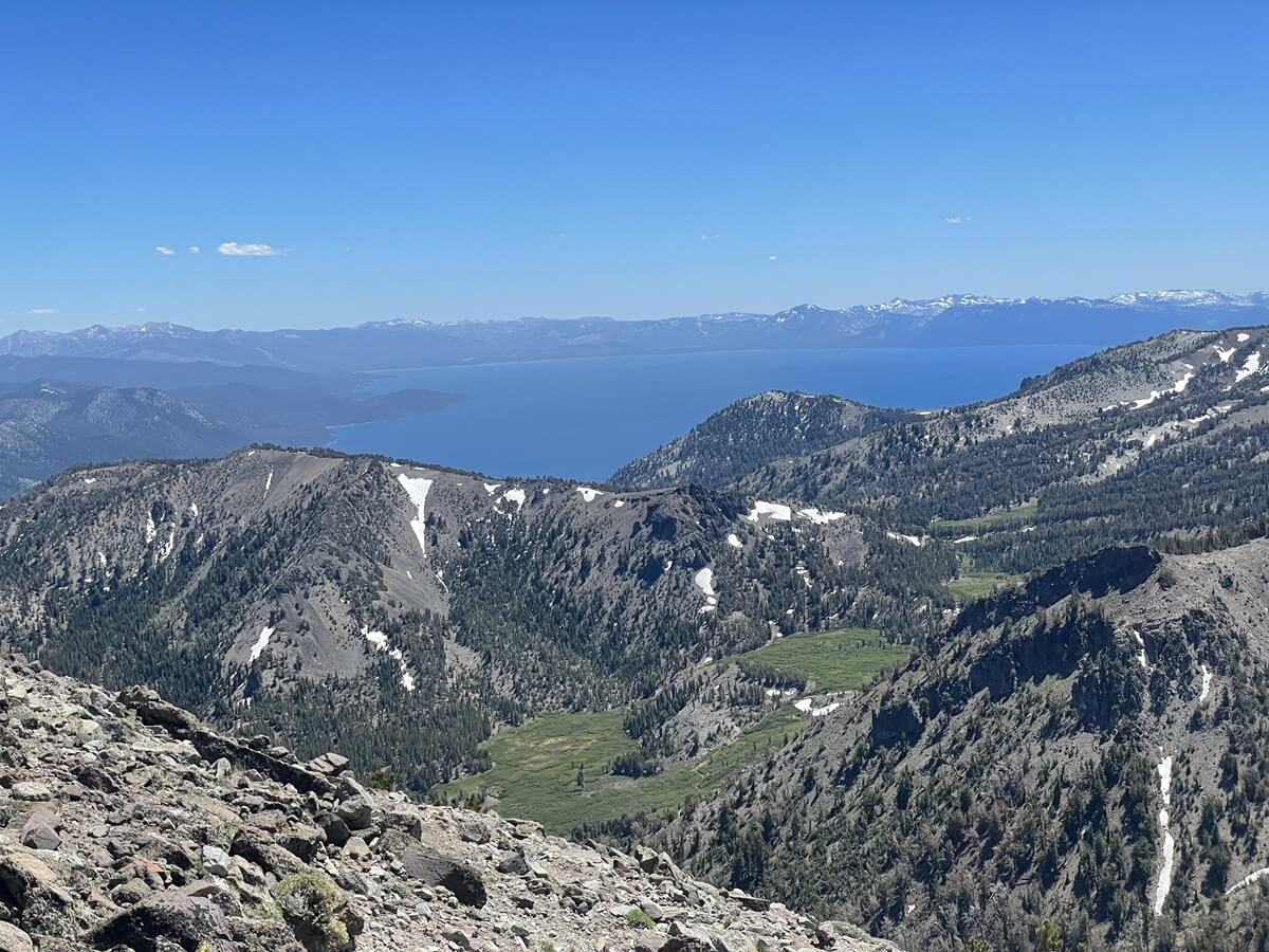
進行方向奥にはブルーが美しいレイク・タホが見えますよ。相変わらず美しい。
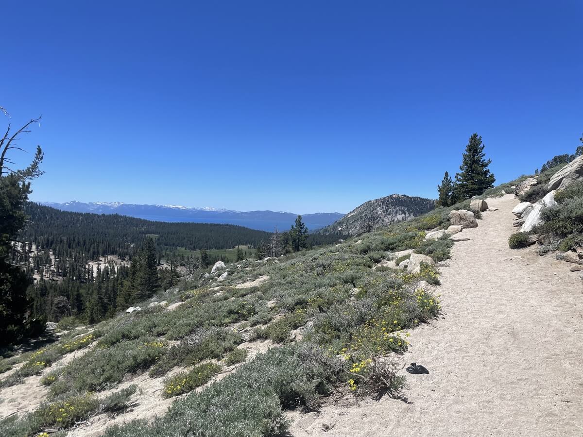
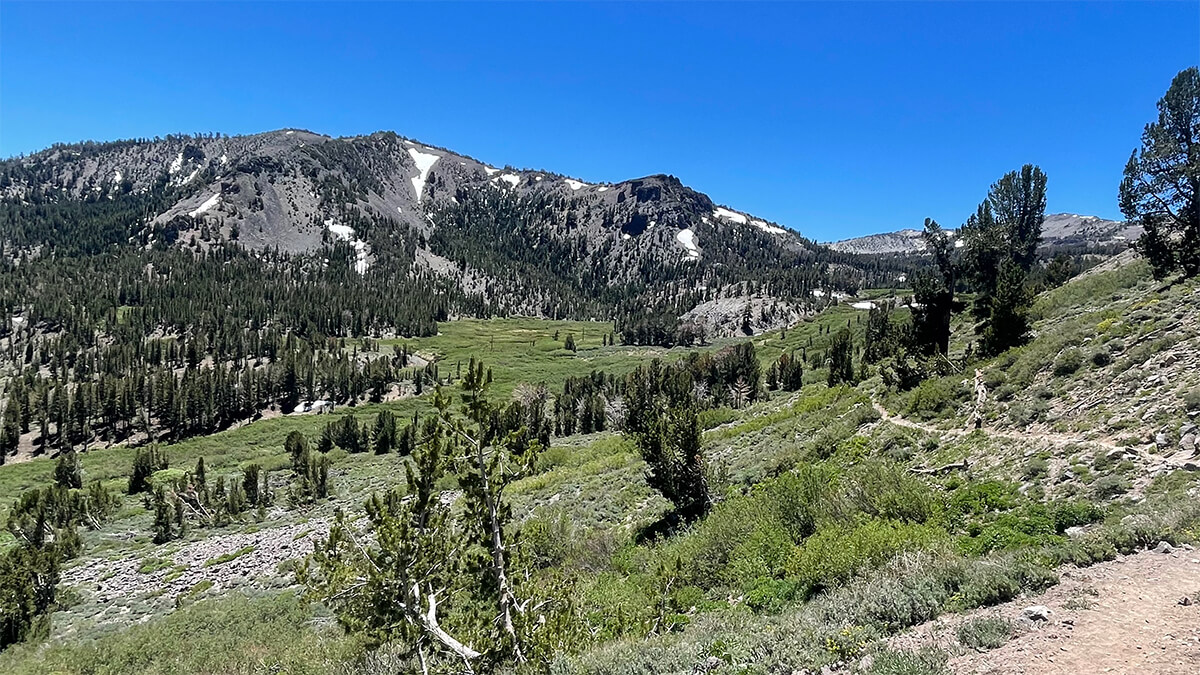
初めの方は割と平坦な道が続きます。天気は良いのですが既に風が強いので、山頂付近の風はどんなに強いんだろう、、と少し心配しながらも美しい眺めが続き心が癒されます。
途中途中、下りてくるハイカーとも通りすがりに話しましたが山頂は凄い風だった!と皆言っていました。
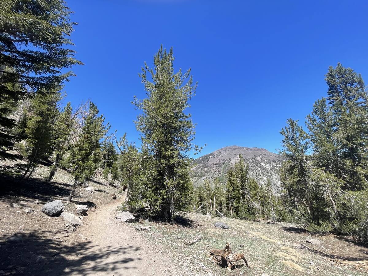
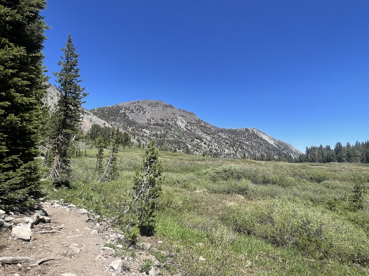
少しづつ坂が始まり、右斜め前方に後ほど行くマウントローズの山頂が見えて来ます。
歩き始めて約4km、時間で約50分のところで滝の音が聞こえてきます。
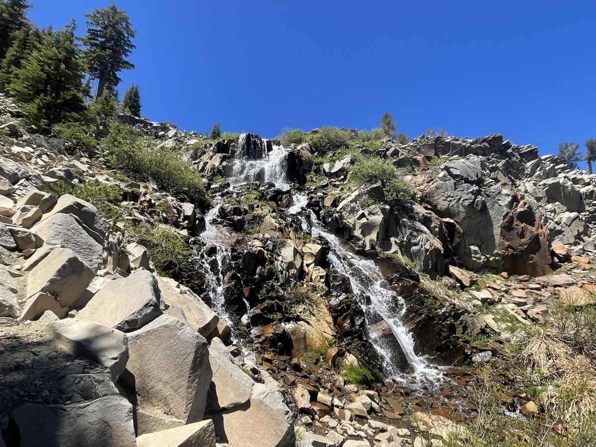
規模はそこまで大きくはないですが、美しい滝が出迎えてくれます。こちらで休憩している人達もいました。清々しく休憩するにはもってこいの場所です。
少し休憩して、また出発です。
滝の手前に看板があり、その奥にトレイルは続いて行きます。
綺麗な小川も流れています。
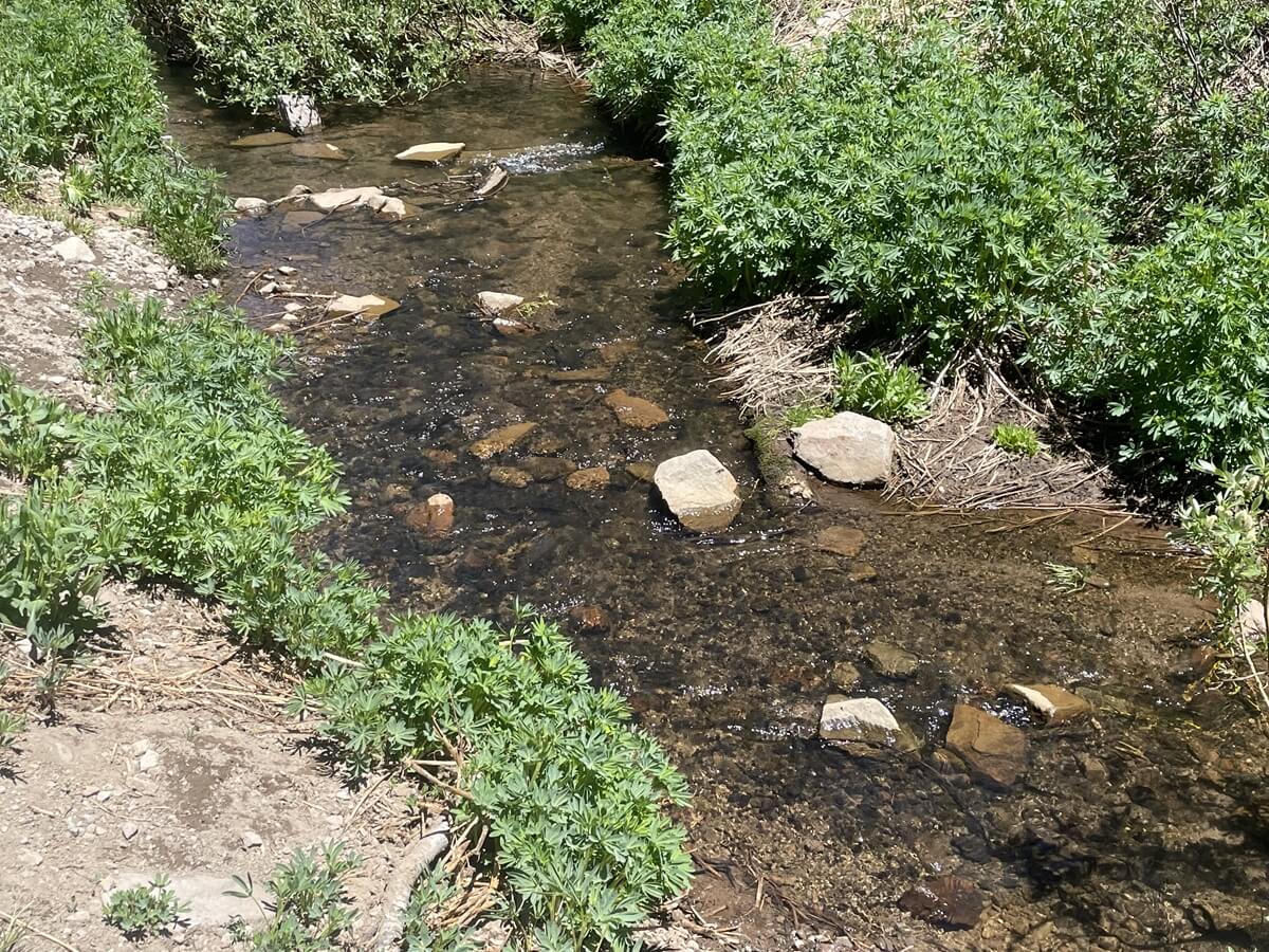
マウントローズが先ほどよりも近くに見えてきています。
鳥の囀りもとても心地よい。。
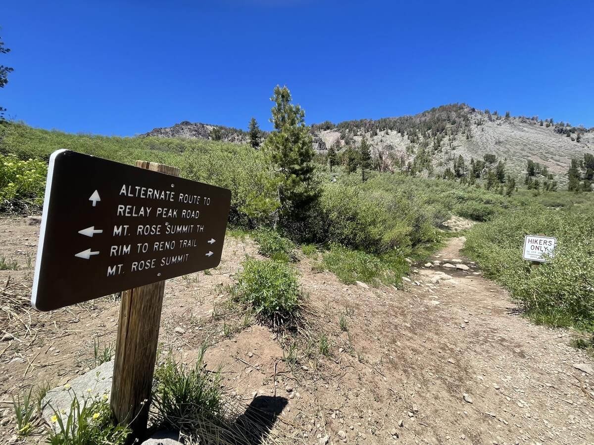
途中何箇所かで看板もでききますが、引き続き MT ROSE SUMMIT TH の方へ進みましょう。
花々もまだ咲いていてとても綺麗なトレイルです。
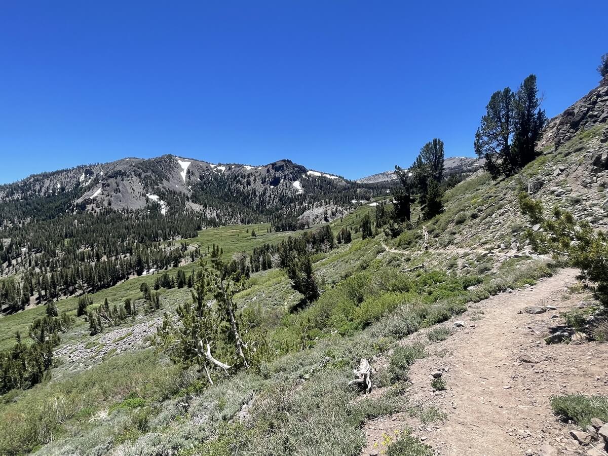
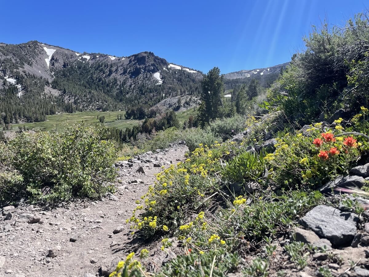
森林限界も超え、頂上に近づくに連れ周りの景色、視界もくなって来ます。
同時に更に風も強くなリ、一歩一歩足を踏ん張りながら登ります。
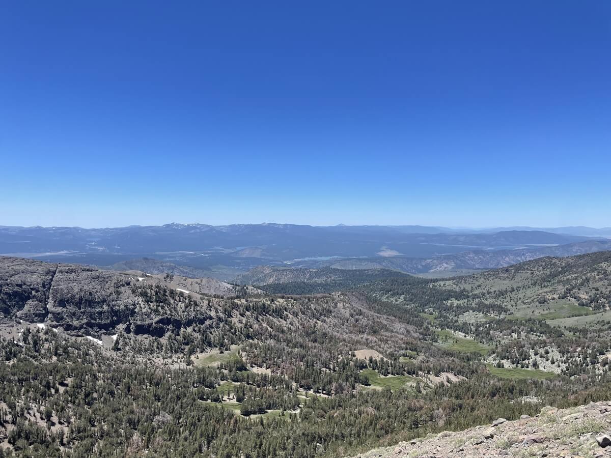
景色は最高です。

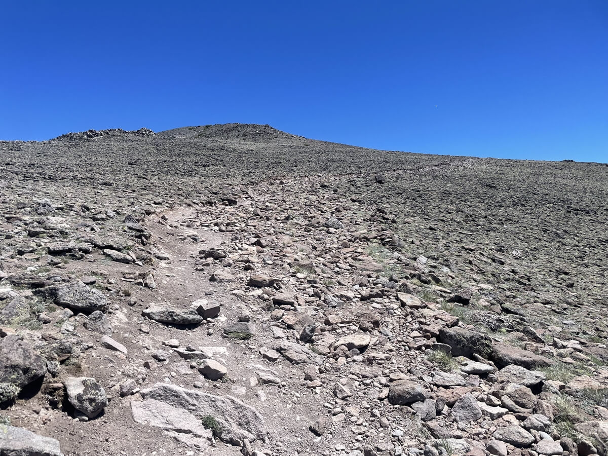
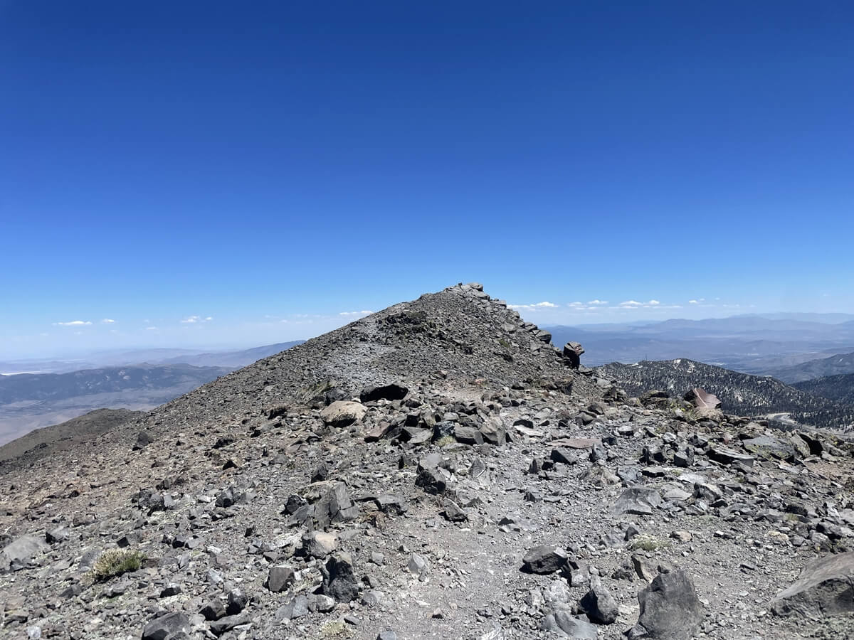
山頂へのラストスパートがこのトレイルのハイライト!という感じできつい登りが続きます。
標高も3000m超え、最後がこのトレイルはきつめです。
山頂も見えて来ています。が、風が強い強い。風避けシェルパーカーがとても役に立ちました。天気は素晴らしいのですがシェルがなかったら間違いなく寒かったです。
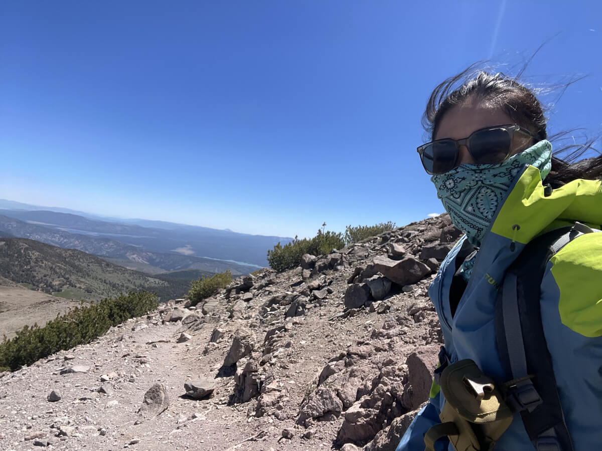
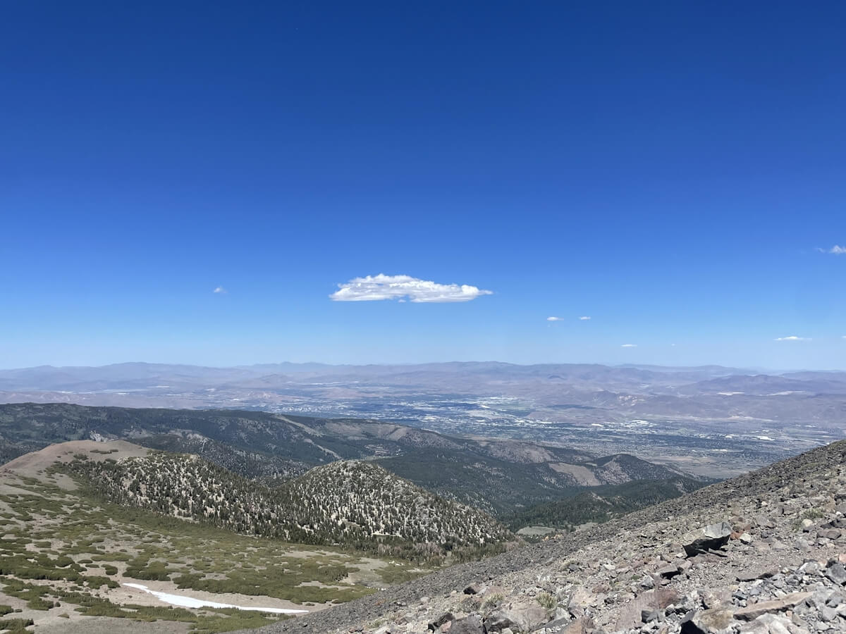
出発から2時間後山頂到着。
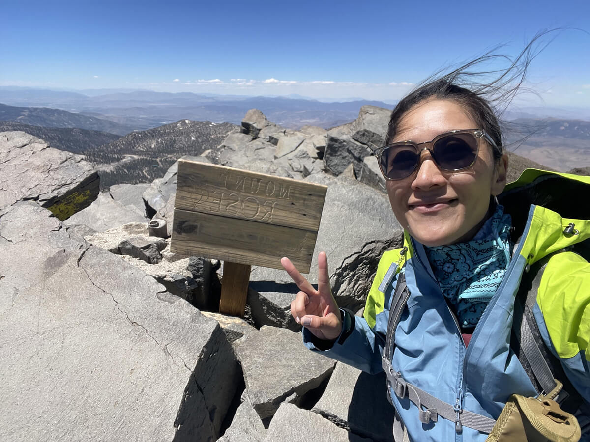
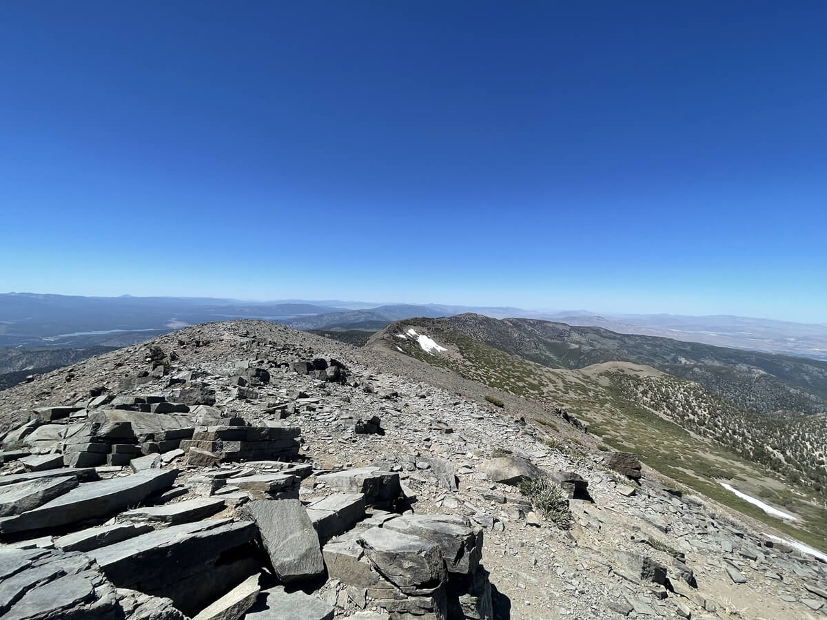
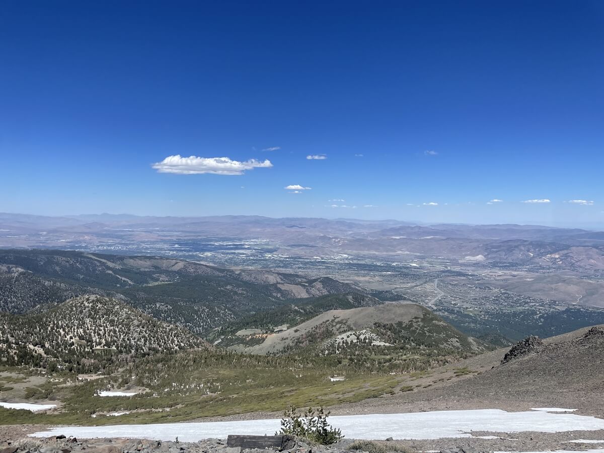
レイク・タホを始め、近くの街、リノ(RENO)やその周りを取り巻く360度の景観が広がります。
サミットの直前の坂はなかなかキツく、最後の最後でかなり体力を使うルートです。
とても良いトレーニングになりました。少し歩いては休憩、という感じでしたが眺めも素晴らしく、登り甲斐のあるトレイルです。
帰りも来た道と同じルートを取り下山します。天気も素晴らしく、レイク・タホ方面、リノ方面へ行かれる時は是非トライして頂きたいマウントローズのハイキングでした。
加藤 さやか
 ヨセミテ国立公園をはじめとした、カリフォルニアのハイキング・旅行プランはお任せください。父の影響もあり昔からアウトドアアクティビティーが大好きで、日本にいた頃から登山、国立公園巡りをする中で、アメリカやカナダの大自然に魅了され、その結果念願だったアメリカに辿り着きました。現在は日本人ガイドと行く完全プライベートハイキングツアーなど、お客様と一緒に作る現地オプショナルツアーを提供するANAMI TOURSを営んでいます。現地在住だから知り得る、スペシャルなオプションをご紹介させて頂きます。ご興味ある方は下記HPから。
あわせて読みたい
 歩かずに死ねるか!アメリカ国立公園への旅(19)カリフォルニア ベイエリアの名峰へ マウント・ディアブロ州立公園
 歩かずに死ねるか!アメリカ国立公園への旅(18)カリフォルニアらしさ満点のハイキングコース マウント タマルパイス州立公園
 富士山よりも高い、ヨセミテ第二の高峰「マウント・デーナ」を登る日帰りハイキングコース【歩かずに死ねるか!アメリカ国立公園への旅(38)】
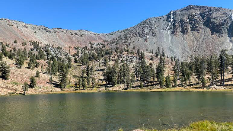 歩かずに死ねるか!アメリカ国立公園への旅(16)花と緑、湖、頂からの大パノラマ。すべてが揃ったシャスタの秀峰、マウント・エディ・トレイル