Can you die without walking? A trip to the US National Parks (18) A hiking trail that is full of California flavor: Mount Tamalpais State Park
Written by Sayaka Kato
The great thing about California is that you can easily go hiking even in the middle of winter and still work up a good sweat!
Mt. Tamalpais, which connects to Highway 1 along the coast with its beautiful scenery, is a hiking trail where you can enjoy the sea and mountains and experience a truly California-esque landscape
About an hour and a half drive from San Francisco, you'll find beautiful beaches and Marin County's highest peak, Mount Tamalpais, also known as "Mt Tam." Locals often call it "Mount Tam!"
It is also an outdoor mecca where you can enjoy the natural beauty of the sea and mountains
In the mountains, you can hike, mountain bike, and watch wildlife. In the ocean, you can windsurf, hang glide, kayak, and more. Just a short trip from San Francisco will make you feel like you've entered another world
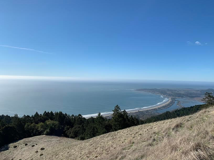
table of contents
Mt Tam, the highest peak in Marin County
This is the very definition of California beauty. The area is home to large redwood trees, oak forests, Douglas fir forests, open hills and grasslands, and on the other side is the Pacific Ocean, creating a diverse landscape. It is also a treasure trove of wild flora and fauna, including endangered species. (In fact, I encountered coyotes, deer, and jackrabbits while hiking this time.) Here, we will introduce hiking routes that allow you to enjoy the California scenery woven together by the sea and mountains
This is a guided tour of the route from the trailhead in the beach area along Highway 1 to the top of Mount Tam and the beautiful scenery around it
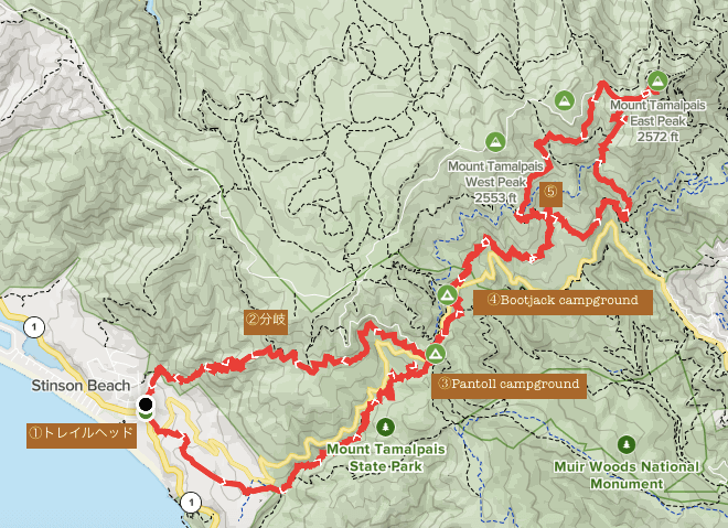
Stinson Beach to Mount Tamalpais Trail Hike Information
First, let's summarize the overview of the trail from Stinson Beach to Mount Tamalpais via Matt Davis Trail
Useful items to bring with you on a hike
As for what to bring, as always, prepare the same equipment as you would for a typical hike in the United States
- Drinks (larger in summer, about 2 liters)
- Temperature-adjustable winter clothing
- hat
- sunglasses
- sunscreen
- Snacks to eat during the hike
- If you have any regular medications, bring first aid such as medicines and bandages
- Other than that, your favorite hiking gear
Trail Data
- For intermediate and advanced players
- Season: It is possible to climb all year round, but winter is more comfortable than summer when temperatures are higher
- Mount Tamalpais Elevation: East Peak approx. 784m
- Round trip: Approximately 27.5km (17 miles)
- Height difference: approx. 720m
- Course time: 6 to 8 hours round trip (including breaks)
Access (by car to the trailhead)
Trailhead address: Matt Davis Trail, Stinson Beach, CA 94970 (1 on the map above)
Enter this into your GPS and you'll arrive at the trailhead
You can either find a spot near the trailhead where you can park, or park in the paid parking lot in the Stinson Beach area. (Stinson Beach, California 94970)
*There is street parking available around the trailhead early in the day, but depending on the day and time of day, it may fill up quickly
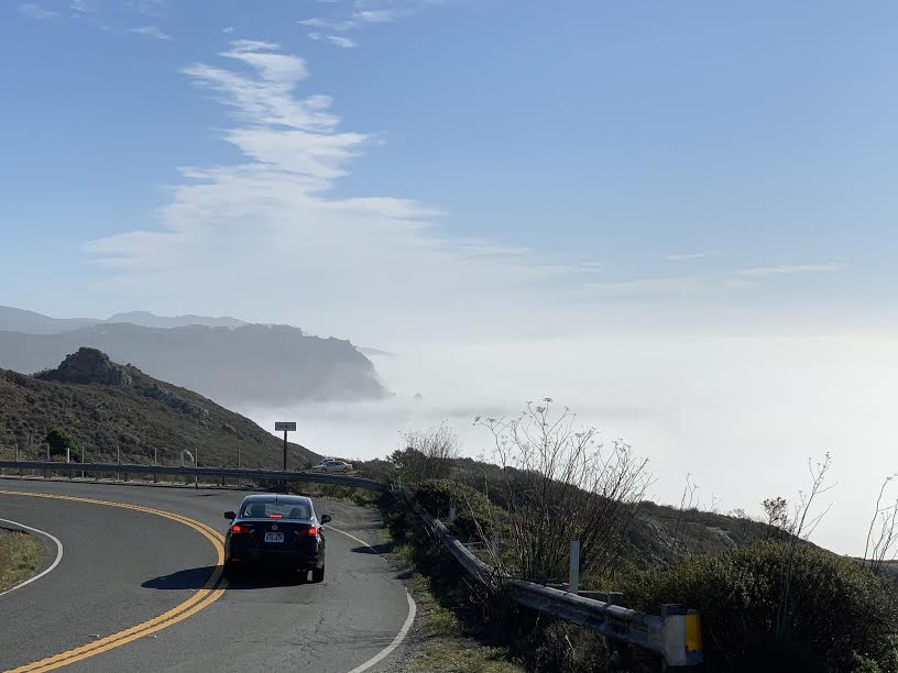
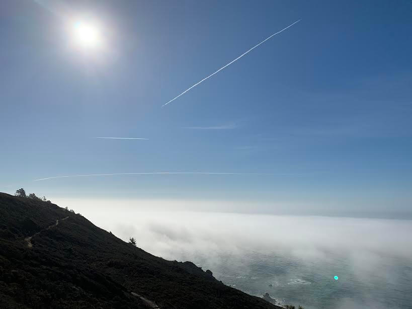
On the way to the trailhead, if you cross San Francisco's famous Golden Gate Bridge heading north, you'll come to a town called Mill Valley. Along the way, you'll pass Highway 1, a road known as the "Dream Drive Route" that runs along the California coastline. As the name suggests, you can enjoy spectacular views of the Pacific Ocean. Depending on the season and time of day, you'll be greeted by fog art like this. The view is so beautiful you'll have to stop your car
Much of Mount Tam is protected by public land administered by governments such as Mount Tamalpais State Park, the Marin Municipal Water District watershed, and Muir Woods National Monument, but because Mount Tam is a state park and not a national park, there are no entrances or fees to pay
Nearby is Muir Woods National Monument, home to many large redwood trees, and several trails extend from there to Mount Tamalpais State Park. *There is a fee to enter Muir Woods National Monument
Start hiking from the trailhead
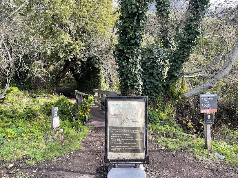
We parked the car and set off immediately. (There are no restrooms at the trailhead.)
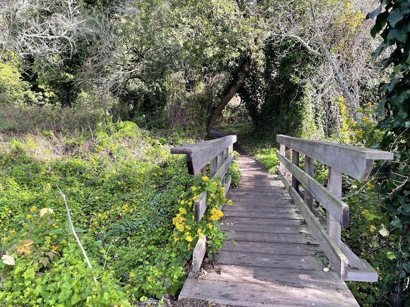
We start by crossing a small bridge
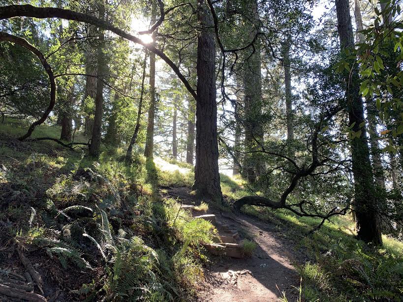
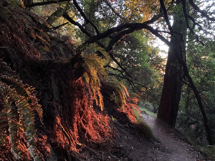
There are several forks along the way, but always stay on the Matt Davis Trail. The trail is easy to follow, and the first half is through the forest, with plenty of shade. There are bridges along the way

The area is home to many types of trees, including redwood groves, oak forests, and Douglas fir. There are also many birds, so you can enjoy bird watching while listening to their chirping. The sunlight filtering through the trees is also mystical. The trail is a gentle slope
About an hour into the forest, the view changed and the grassland (hills) came into view. It was around this time that I came across two coyotes
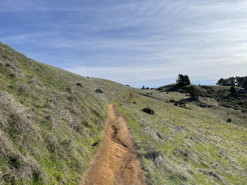
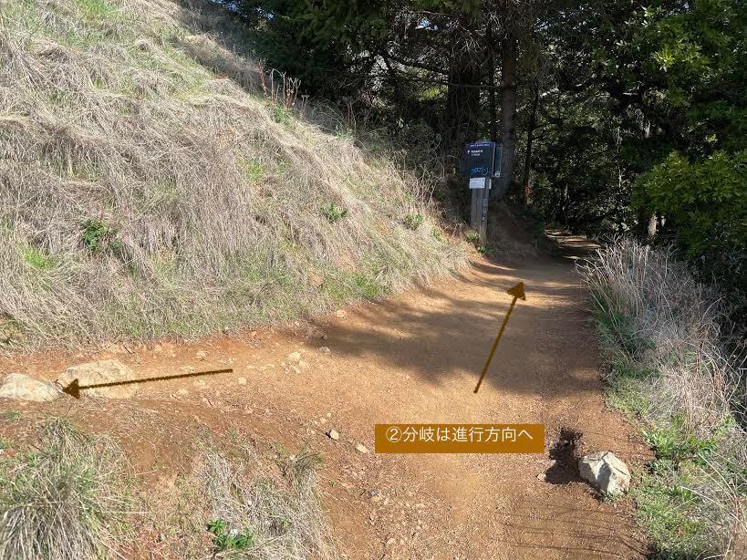
Then, the sparkling sea came into view in the distance to the right. It was a completely different view from before. Continuing on, another fork in the road came into view (see Map 2 above)
Here you will come to a fork in the road where you can either take a sharp left turn or continue straight ahead, but we recommend continuing in the direction of your travels, the Matt Davis Trail (Pantoll 1.7 miles) (photo below)
After walking a little further, the trees start to grow more numerous again. The road is flat around here, so it's very relaxing!
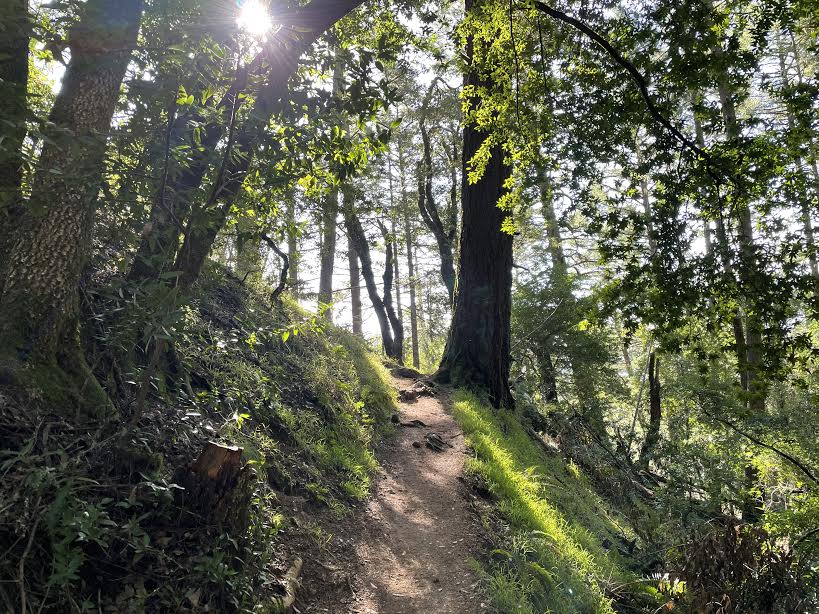
It rains in California during the winter, so the trees that had just absorbed the rain were vibrant and beautiful green. It's truly the season of fresh greenery. (The photo was taken in January.)
As you go further, you will hear the sound of cars nearby, which indicates that the road is nearby (Pantoll Road). There is a campground nearby, so continue on and you will come across a parking lot (Pantoll campground, Map 3 above). The trail continues beyond the road, so continue on the trail
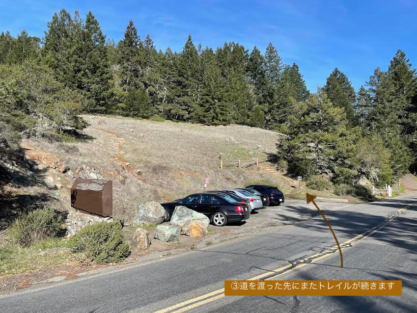
If you follow the trail that runs alongside the road, you will come to the second campground (Bootjack campground, shown on map 4 above)
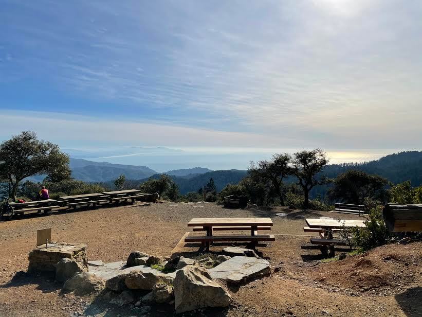
This is a great place to take a break as it has restrooms and tables for eating
Once the break is over, we set off again
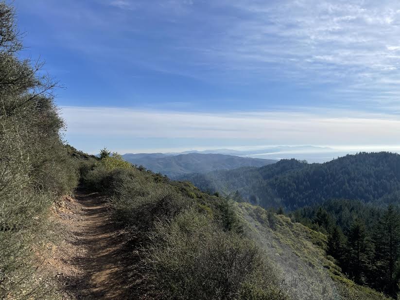
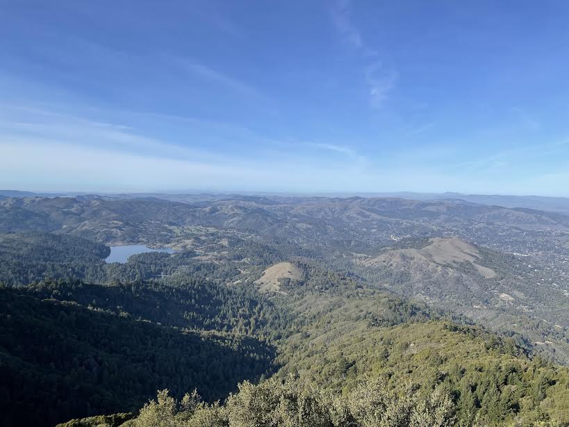
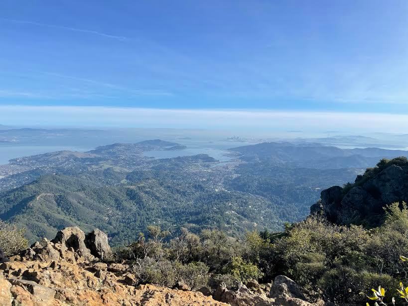
As the altitude increases, you can see the surrounding mountains and the distant scenery, which is very beautiful
Further along, you will come to the second large fork in the road that leads to the finish line. This is a loop that connects West Point, the summit of Mount Tam, with East Point, which is further in the distance and is today's finish line (the 5th fork in the map above)
You can go clockwise or counterclockwise, and you can use the same trail on the way there and back, but I chose to go clockwise as it offers better views
If you go clockwise, you will soon come across West Point Campground and the West Point Inn (see map 6 above)
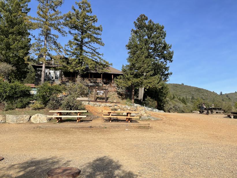
A spectacular view unfolds from here, and there are tables set up in the area so you can take a break
It took about three hours from the start to West Point, including breaks
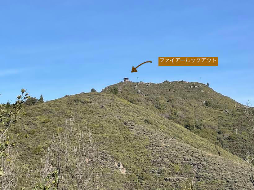
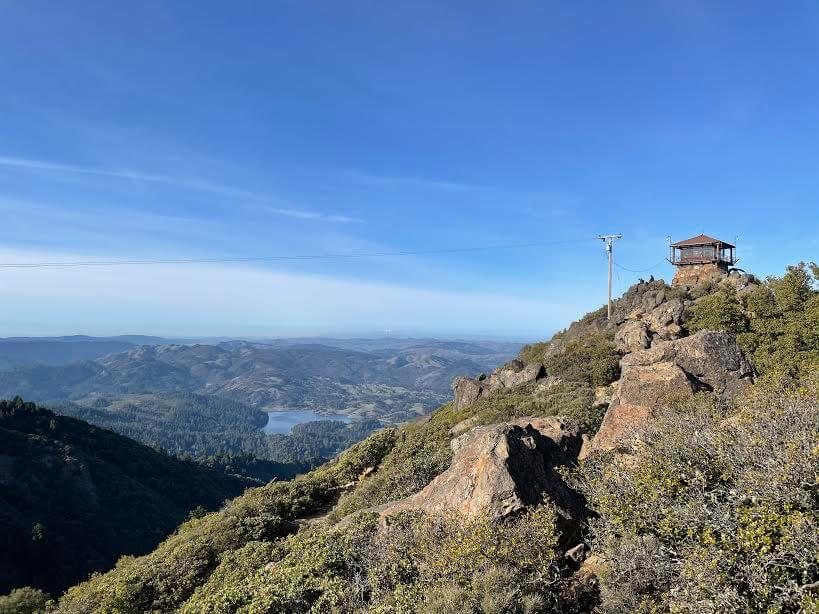
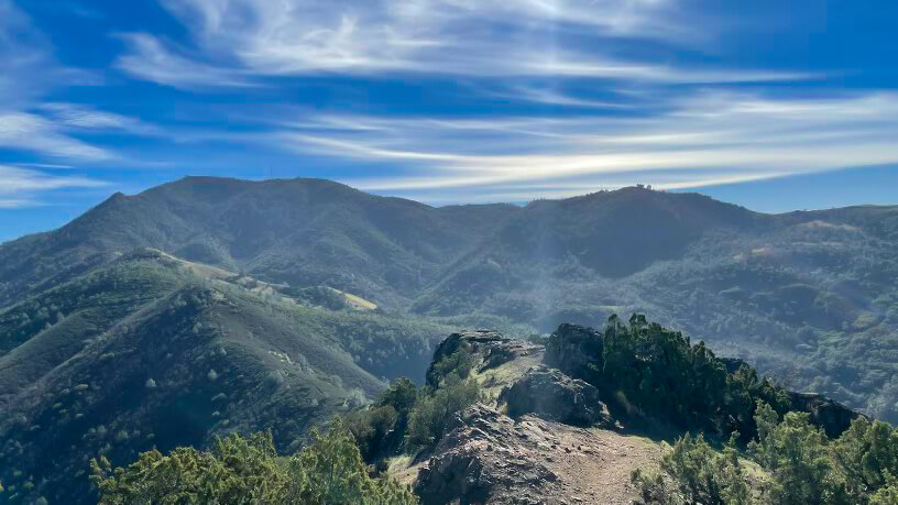
From this point onwards the slope becomes steeper, but the beautiful scenery soothes us as we give it our final push. In the distance, we can see the East Point Fire Lookout, our goal, at the top of the mountain. A final sprint to get there!
After climbing a little further, about 45 minutes from West Point, we arrived at East Point. There is a parking lot and restrooms
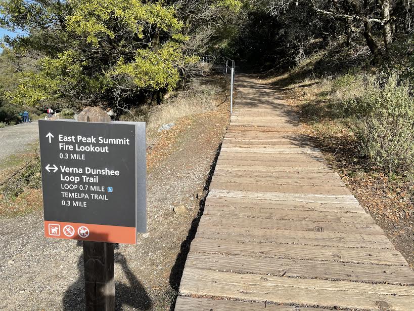
The highlight here is the Fire Lookout! There is a trail to the Fire Lookout just inside the parking lot, and we started climbing up there. We arrived, but there was still a bit more to do. At the top of the climb..
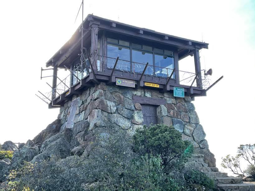
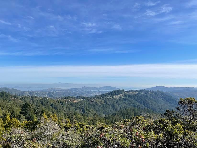
There is a fire lookout (an observation deck to watch for fires and other emergencies) that was previously in use. This is the view from there (photo below)
It's the best
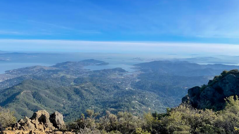
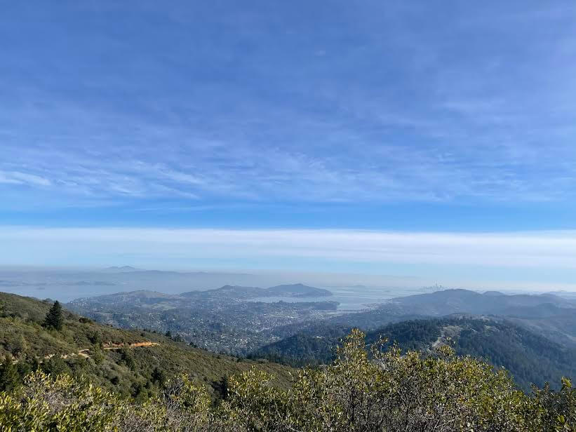
From the summit of Mount Tam (784m east peak), you can see the sparkling ocean, San Francisco Bay, the hills of Marin County, Mount Diablo, the East Bay, the Farallon Islands 40km away, and on a clear day, the Sierra Nevada Mountains 240km away
Of course, you can drive here, but if you want to take your time and enjoy nature on foot, we highly recommend hiking
This time, we have deliberately chosen the longest route (for intermediate to advanced hikers) from the beach at the trailhead to the summit, but the trail can be adjusted to suit any level and mood. You can shorten the distance and time by parking your car at one of the several parking lots along the trail and starting from there
On the way back, you can either take the same trail back to West Point the way you came, or continue clockwise and use the new trail back to the fork
After that, there are various trail options, and you can freely change your route back to the trailhead (it's a good idea to input your destination into your GPS beforehand to avoid getting lost)
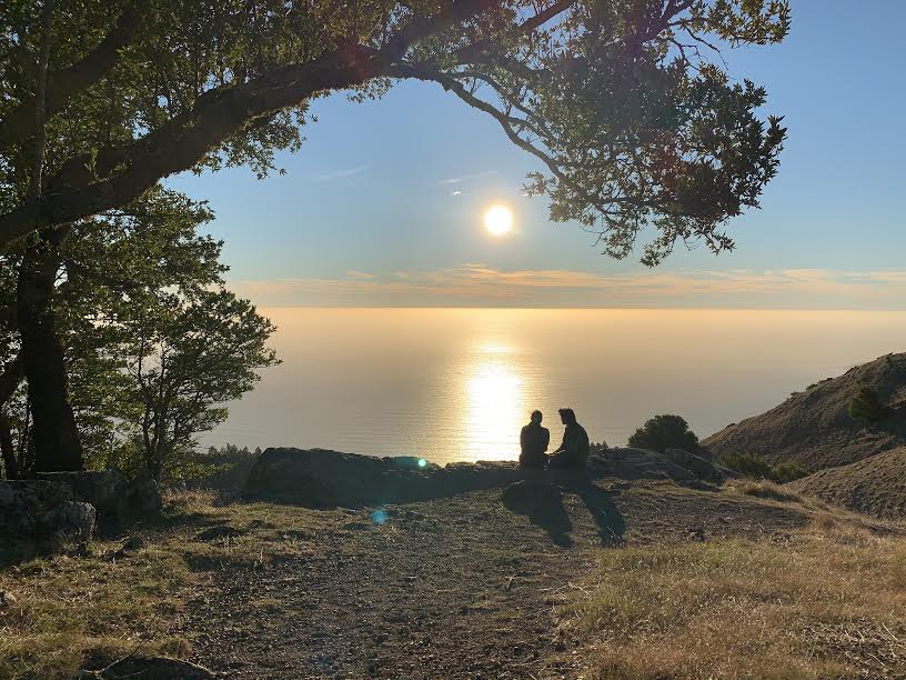
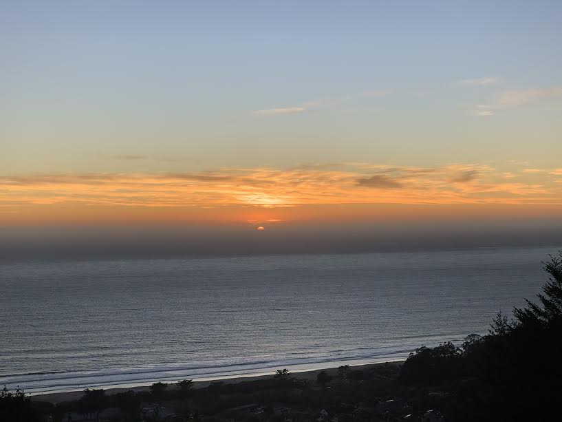
Also, hiking here in the evening offers a completely different view than on the way there. The setting sun illuminates the sea and forest, creating a truly mystical scene. The colors, sounds, and space change dramatically
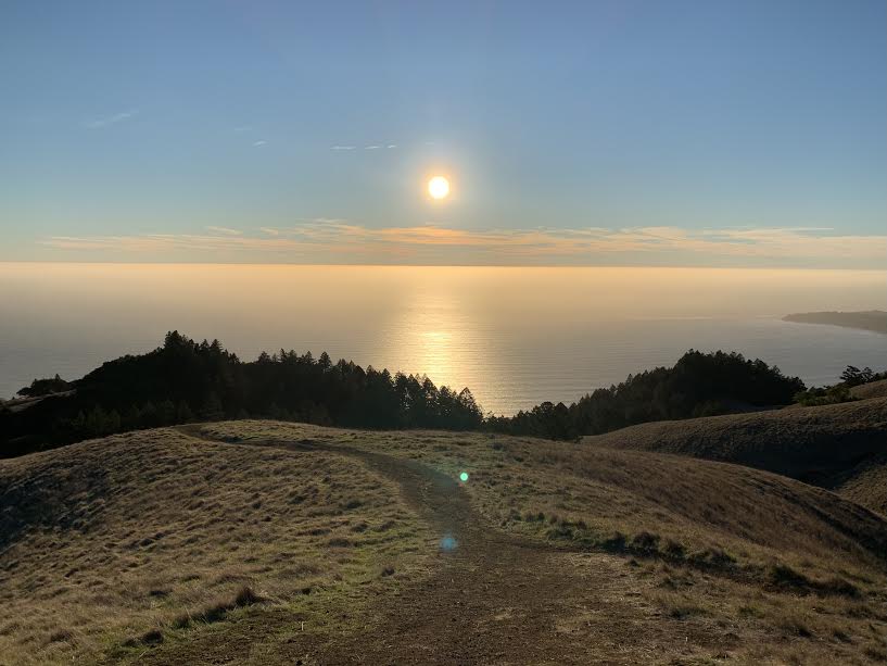
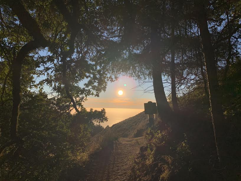
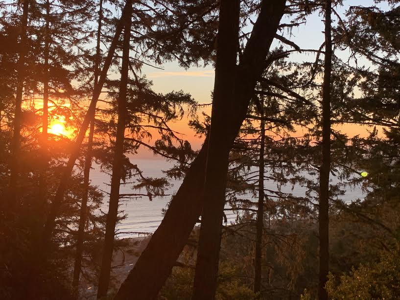
We were lucky enough to make it in time for the sunset
It's a very long hiking route, but you can enjoy it while taking in the various landscapes and working up a good sweat even in the middle of winter. It's a hike that's unique to California, where you can casually enjoy hiking even in the middle of winter
Precautions regarding the spread of COVID-19
As of February 2021, various countries are currently imposing entry restrictions due to strengthened quarantine measures, as well as restrictions on entry to national parks and domestic travel. These conditions are subject to change without notice, so when traveling, be sure to obtain local information from each country's embassy or consulate, the Ministry of Foreign Affairs' Overseas Safety Website (Infectious Disease Risk Information), national park websites, and other sources, and check information on transit points, countries you plan to travel to, and the areas around the places you plan to visit before making reasonable plans and taking action
Sayaka Kato
 Leave your California hiking and travel plans to us. Influenced by my father, I've always loved outdoor activities, and while living in Japan, I started hiking and touring national parks, which fascinated me with the natural beauty of America and Canada, ultimately leading me to my dream of visiting the United States. I currently run ANAMI TOURS, which offers local optional tours created together with customers, such as completely private hiking tours with Japanese guides. I'll introduce you to special options that I know only because I live in the area. If you're interested, please visit the website below
Related reading
 Can you die without walking? A Journey to the US National Parks (19) Mount Diablo State Park, a Famous Peak in the Bay Area of California
 Mount Rose, located near a popular ski area, offers an easy 3,000m hike and 360-degree views. [A trip to the US National Parks (39)]
 A day hike to Mt. Dana, Yosemite's second highest peak, higher than Mt. Fuji. [I can't die without walking! A trip to the American National Parks (38)]
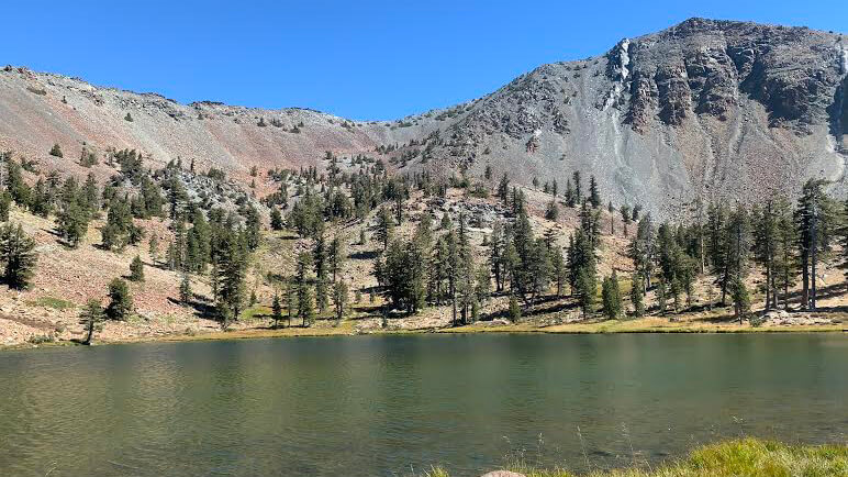 Can't die without walking? A Journey to the American National Parks (16) Flowers, greenery, lakes, and a panoramic view from the summit. Mount Shasta's magnificent peak, Mount Eddy Trail, has it all