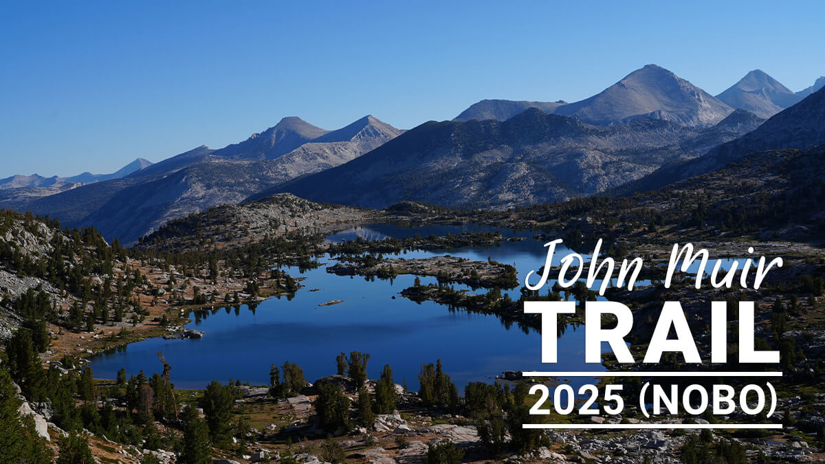
John Muir Trail Northbound Traverse (2025 NOBO) Record [Chapter 11] To Vermilion Valley Resort
Written by Yoshihiro Murakami
Previous article (Chapter 10)
table of contents
Chapter 11: Muir Trail Ranch
It takes about two days to get from the MTR to the VVR. Shortly after leaving the MTR, you'll come across the switchbacks of Sellinger Creek. If you don't complete this climb in the morning, you'll be facing direct sunlight from behind in the afternoon. As you gain altitude, there are plenty of camping spots. Sally Keyes Lakes is a good place to rest and camp. From there, you cross Selden Pass from Heart Lake. From the pass, you'll have a spectacular view of Mary Lake. After descending Mary Lake, the area around Rosemary Meadow becomes gentler. A steep switchback leads down to Bear Creek. Usually, the water here is knee-deep, requiring some wading, but this year, I was able to walk along stepping stones, so my shoes didn't get wet
After crossing Bear Creek, the trail descends gently, with campsites every few kilometers. Beyond that, the trail branches off, the first being the Bear Creek Cutoff Trail. This trail runs along Bear Creek, has great views, and offers water. Its drawback is that it's a little long
The JMT continues straight ahead, crossing two small streams and gaining altitude. The last campsite before the tough switchbacks is the one that runs through the area, and this year the water had dried up. After completing these switchbacks, there are two small streams at a high altitude, making it a good place to camp. At a fairly high altitude, the trail branches off into the Bear Ridge Trail, and this year we descended here. Water is scarce on this trail, and there are only a few places to camp, but it is the shortest route down to Lake Edison
The original JMT route continues straight on Bear Trail, descending through steep switchbacks and crossing Mono Creek. From there, it takes about an hour to get to the VVR ferry terminal. Pickups are at 9:45 AM and 3:45 PM
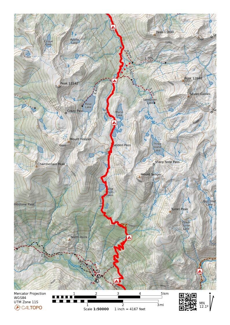
Figure 11.1: MTR to Bear Creek
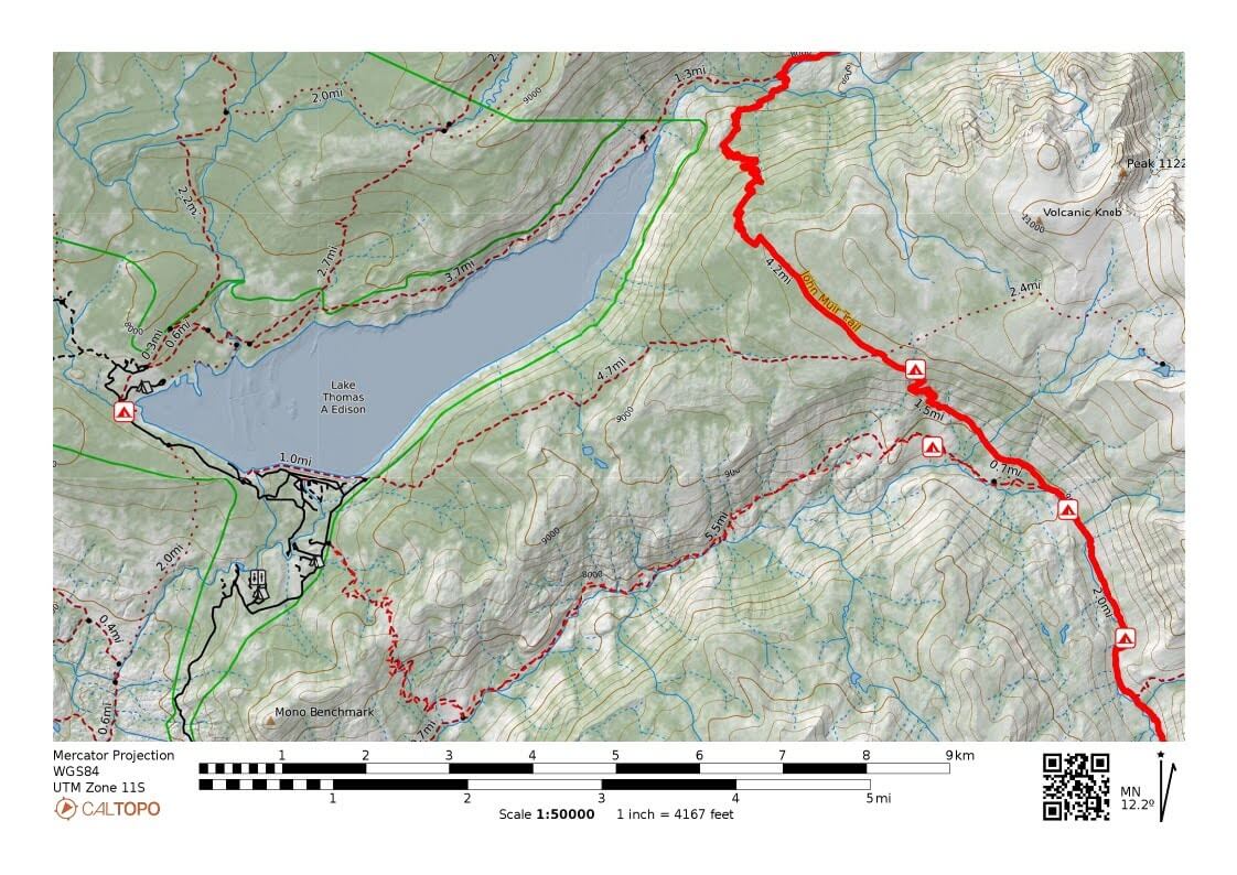
Figure 11.2: Bear Creek to VVR
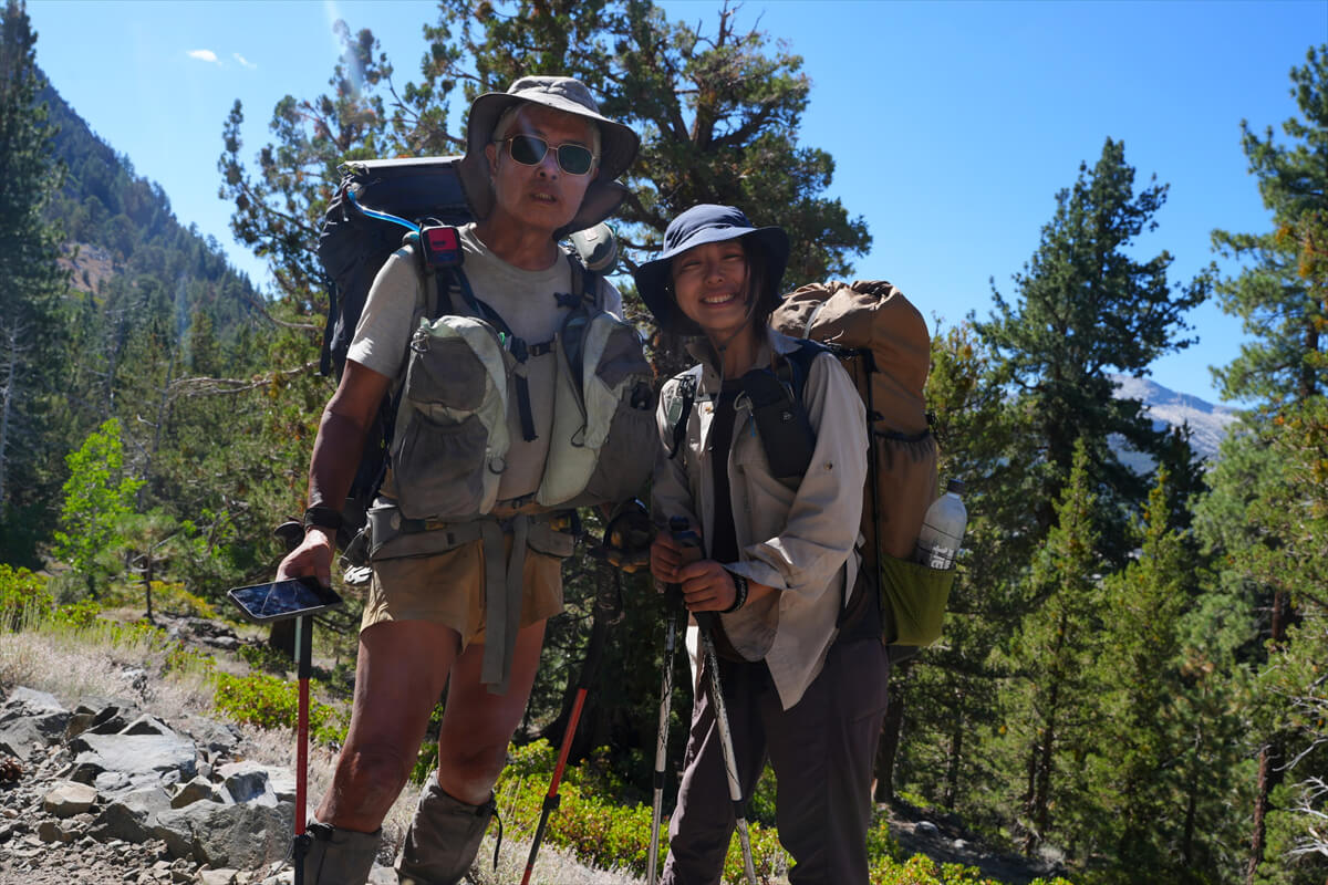
Figure 11.3: Chiho. She seems to be doing a section hike
MTR to Surrey Quay Lakes
James, full of enthusiasm, went ahead. As usual, we had a slow start. We had to stop by the restroom again and check the hiker box at the entrance to the MTR to see if there were any tasty treats lying around. There was nothing of note. We slowly started walking again.
At 9:30, we finally reached the junction with the JMT. It was slow because we were climbing, and we weren't feeling motivated. It was a synergistic effect. As we gained altitude, the visibility improved a little. A woman who appeared to be Japanese came walking up ahead. I asked her, and it turned out she was Japanese. Since we had some free time, we took a commemorative photo. That's Figure 11.3. She said she was going to Muir Trail Lunch ahead to look for food. She seemed quite experienced. Later, I heard that she had received some food from the hikers and succeeded, and that she wanted to do South Lake-North Lake next year.
After completing the switchbacks along Senger Creek, Ward Mountain comes into view. The MTR is in the forest at the base of the mountain, but since I've been there before, I can pinpoint its location. There's a small spot where water seeps out at the bottom of the switchbacks. The trail is wide enough that you can pitch a tent
The switchbacks are long, and at the top there is a steep trail leading down to the river. Beyond that, the slope becomes gentler. After the switchbacks, a meadow appears and the trail flattens out. Just before crossing the river is a good place to camp. I pitched my tent there several times. Figure 11.5 shows the spot where I pitched my tent in 2017. Chieko and I also pitched our tent here in 2023. It's a little way from the river, but it's a quiet, spacious spot. After crossing Senger Creek, there's a small campsite, but we decided against it because it's too close to the river. It was exactly 12:30. We had lunch. We refilled our water supply and set up a water filter with a bladder on a rock so that it would automatically dispense with clean water. We got clean water while we were eating lunch. Lunch consisted of sandwiches made by MTR (Figure 11.6) and instant coffee
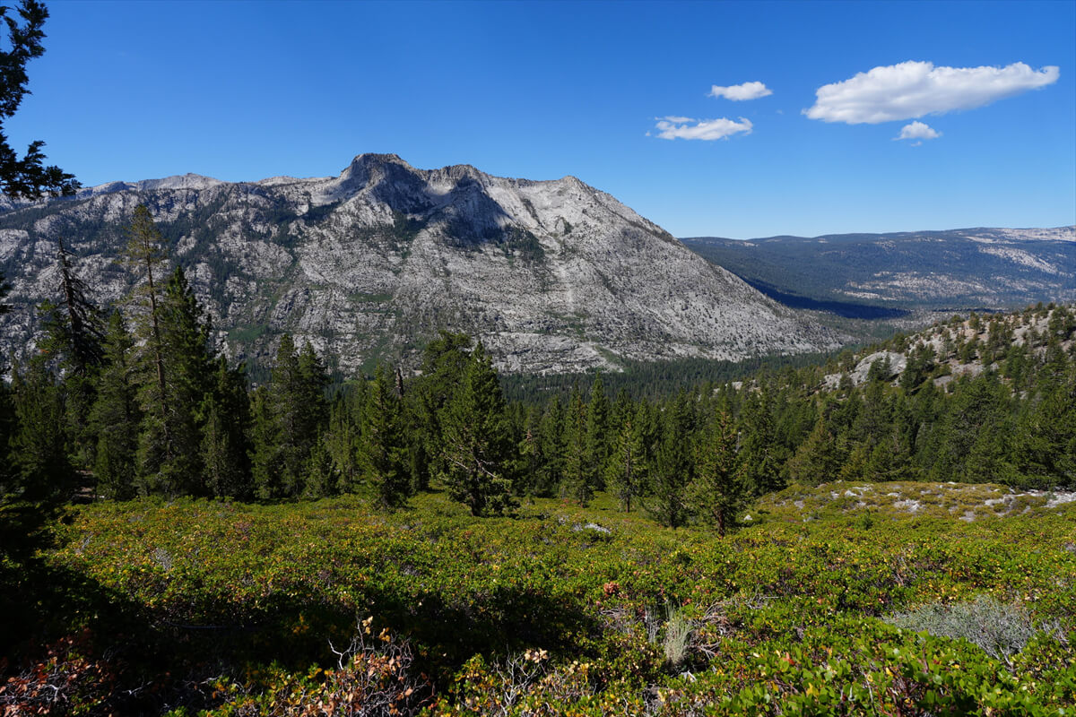
Figure 11.4: Ward Mountain. The MTR is located in the foothills of the forest
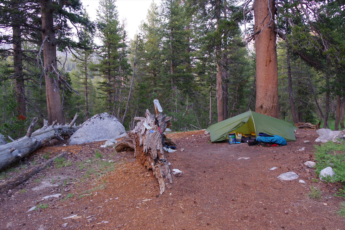
Figure 11.5: Site near Senger Creek, photographed in 2017
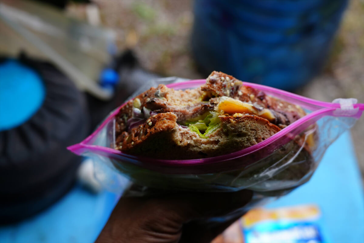
Figure 11.6: Sandwich made with MTR
The trail flattens out and continues through the forest. There is a cabin in the woods on the left, which may be a ranger station. I've seen it many times, but never confirmed it. The switchbacks begin again. There is a campsite at the flat area
As I walked along the flat trail, I came across a meadow like the one in Figure 11.7. This year, there was little water, making it easy to walk, but in normal years the trail is covered in water and difficult to walk on. After crossing the stream, the switchbacks began. There were trail workers at work. I called out to them and took a photo, which is shown in Figure 11.8. As usual, most of the work is done by hand
After completing these switchbacks, the trail begins a gentle climb through the forest again, with campsites scattered throughout. However, Sally Keyes Lakes (Figure 11.10) is close by. Crossing the stream leads to a lake. If you continue along the lakeshore on the right without crossing, you will find a campsite, but even after crossing, it is still on the hill to the left. There are two lakes, separated by a peninsular hill in the middle
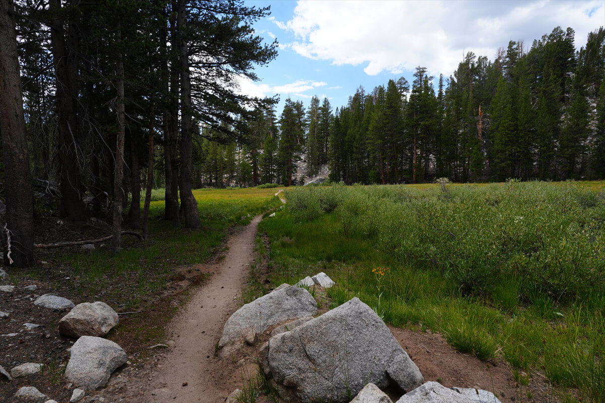
Figure 11.7: A horizontal wetland
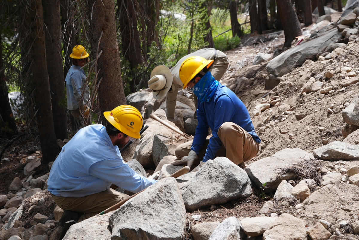
Figure 11.8: Trail workers. This is hard physical labor
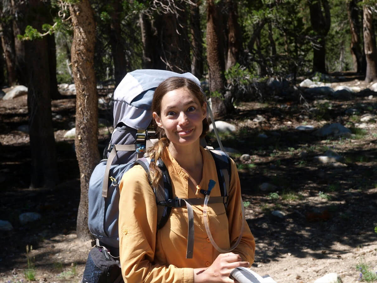
Figure 11.9: Ada, photographed in 2010
This is a popular resting spot for hikers. I think it was my first time on the southbound JMT in 2009, when I was surprised to hear an American hiker say "Ohayo" to me. Apparently, Americans can say "Ohayo" because they have the state of Ohio. However, I was surprised again when I heard that he cooked rice every day in a Zojirushi rice cooker. At the time, I had no idea that Americans would cook rice or anything like that. It was late in the morning, so I took a break on the lakeshore here and ate some JMT bread. I also passed by here late in the afternoon on the southbound JMT in 2010. I met a woman there
"Are there any campsites around here?"
The site is at the top of this hill
She was from Argentina and was hiking at a leisurely pace. She said she was happy because she could camp as much as she wanted for just $10. After enjoying the JMT, she said she wanted to go to Southeast Asia, where prices are cheaper. She was quite a wanderlust-loving person. I have a weakness for talking at length when a woman is a little cute and has a girl-next-door vibe. This time, we chatted for about an hour, and at the end, I asked if I could take a photo. Ada is shown in Figure 11.9. Our planned campsite this time was near the junction with the Paiute Pass Trail, so after we parted ways, I started walking at full speed
We arrived at Sally Keyes Lakes around 3:30 pm. The sky was getting dark and a slight breeze was starting to pick up. There was a chance of an evening shower. Even if we pushed forward, there weren't many campsites, and we wanted to pass through Mary Lake in the morning when the sky was clear and we could take photos. After some hesitation, we decided to pitch our tent early
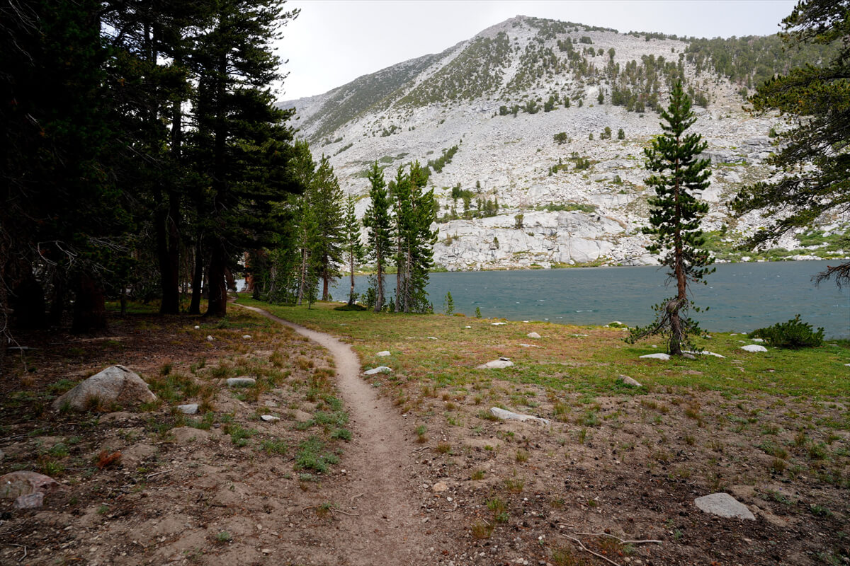
Figure 11.10: Sally Keyes Lakes. The weather has turned a little rough
The location was the upper reaches of the lake. (Figure 11.11) A little rain fell right after we set up the tent, but it didn't collapse easily
I inflated the mattress, unfolded my sleeping bag, took out the food and stove, and stored my backpack in the tent vestibule. I bought 5 liters of water, connected a water purifier, and hung it on the tent. It was a drop-type system, so I had drinking water at hand automatically. There was nothing else to do
About 20-30 meters ahead, there were two hikers spreading a tarp in the shade of a tree. They seemed to be a couple. Japanese people are the only ones who use tarps. They were probably Japanese ultralight hikers. I thought about calling out to them, but I wasn't particularly interested in becoming friends with them, and we often didn't have much to talk about. So I left them there. When the wind died down and the weather improved a little, the hikers disappeared. They seemed to have gone on ahead. They must have been busy with other plans
For dinner, I had the lasagna that James had given me as my main dish. Of course, I ate three meals' worth in one sitting. It also came with soup and nuts as dessert.
I went to bed too early, so I woke up at 4am. I tried the Milo-like drink that James had given me, but it wasn't tasty. I switched to my usual breakfast.
We set off early, around 6:00. It was still dark outside, but we could move around without any problems. We made our way slowly up the switchbacks. It was still dark, but the sun was beginning to shine on Heart Lake. We didn't see anyone. There were many of my favorite alpine columpines in bloom. Because it was dark, I missed many shots because they were out of focus. I only managed to capture a slightly unusual alpine columpine (Figure 11.13)
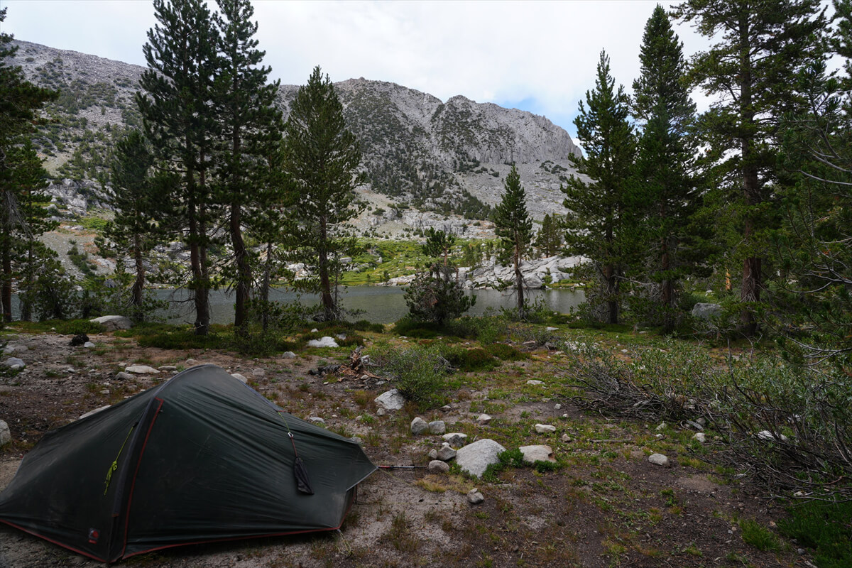
Figure 11.11: Camping at Sally Keyes Lakes
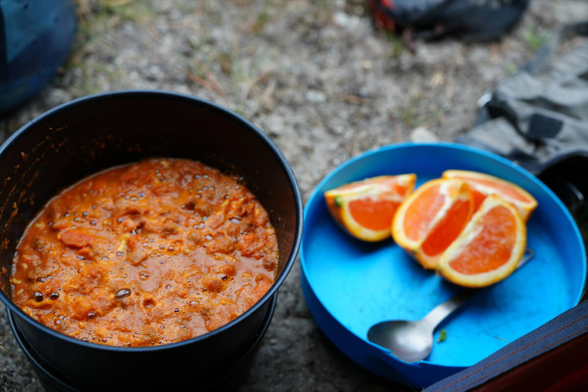
Figure 11.12: Freeze-dried lasagna
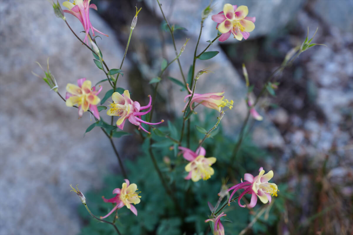
Figure 11.13: A species of Alpine Columbine near Heart Lake
After passing Heart Lake, the trail begins a gradual climb, and Selden Pass comes into view, as shown in Figure 11.14. The pass is at a low point on the right, and eventually becomes steeper with switchbacks. The rock face ahead on the right has an unusually large number of folded patterns. The High Sierra is primarily composed of granite, so there are few places where sedimentary rocks like this can be seen. Painted Lady is a famous landmark on the JMT. I know this place so well because Crazy Doc, whom I met in 2009, was enthusiastically photographing it
I first encountered Hiking Gym (Figure 11.16) in 2017 while doing the southbound JMT
He asked me if I was Japanese, and when I answered yes, we had a long conversation. He seemed to be asking because he was sometimes mistaken for an American. We probably talked for more than 30 minutes. Jim lives in Los Angeles, his wife is Japanese, and his specialty is curry rice. He has one daughter, whom he says is absolutely adorable. He was a friend of Chieko's on Facebook, and they had been discussing the disappearance of Rika Morita, posting a map of a detour route
Jim was actually a stove enthusiast. He was doing a scramble test of gas stoves and gas cartridges. In Japan, it is not recommended to combine gas stoves and gas cartridges from different manufacturers, but stoves that connect with screws and gas cartridges are almost completely compatible. In the United States, there are not many different types available, so it is common to use them in combination. What he discovered was that only the orange label on Coleman gas cartridges was defective. There must have been an error in the length of the thread notch
Figure 11.14: South side of Selden Pass
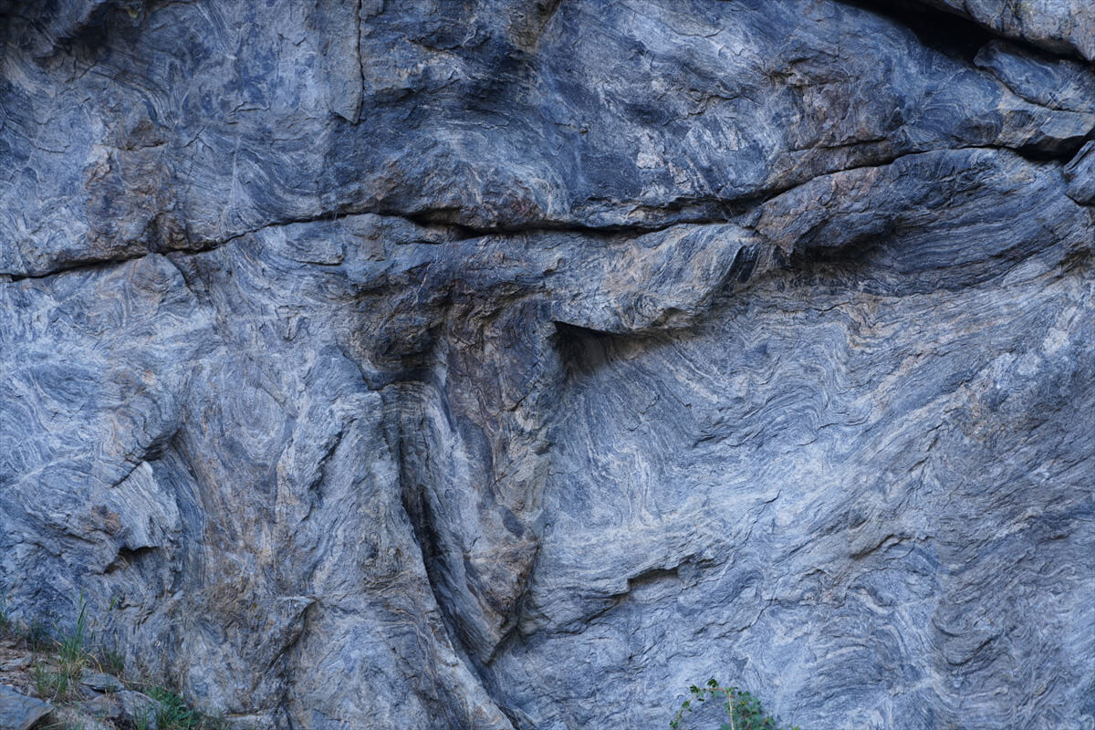
Figure 11.15: Folding of rock face
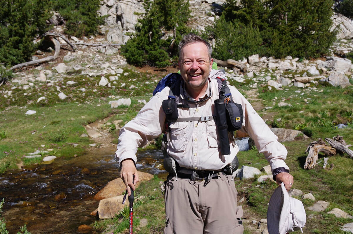
Figure 11.16: Hiking Gym. Photographed in 2017
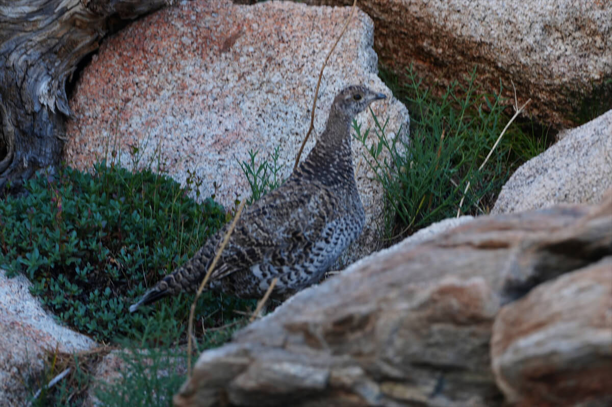
Figure 11.17: Gross (ptarmigan)
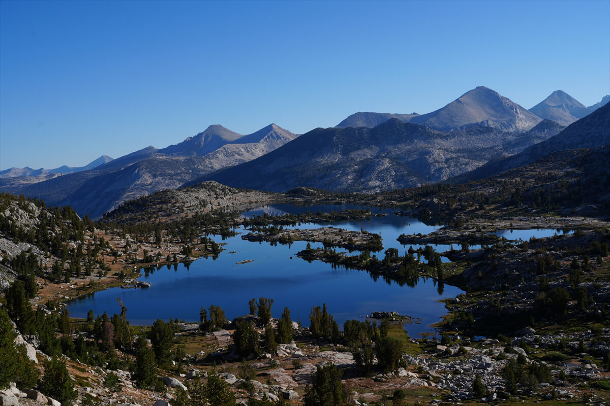
Figure 11.18: Mary Lake, from just below the pass
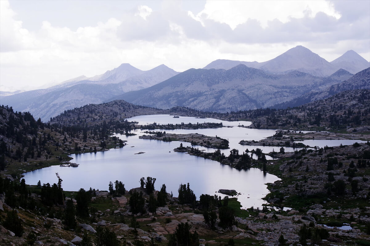
Figure 11.19: Lake Mary surrounded by thunderclouds in 2018
After crossing a small stream, the trail begins to switchback. It's still early in the morning, so no other hikers have caught up with us. Here, we saw a rare glider, shown in Figure 11.17. It was hopping from rock to rock. There are fewer people around this time of year, so we often spot wildlife
We arrived at Selden Pass at 7:50. After about 10 minutes, an American hiker caught up with us, so we asked him to take a commemorative photo. The best spot to photograph Mary Lake is a little lower in altitude than the pass. This is shown in Figure 11.18. Another spot is on the hill just next to Mary Lake
This year we were blessed with sunny weather, but in 2018 we were blessed with thunderstorms. Since we started at Cottonwood Pass, there were thunderstorms every afternoon. On the worst days, there was thunder from the morning onwards. Since we're in America, there isn't much rainfall, so it's not a big deal. However, if you're struck by lightning, you could die. It happens every day, so I've gotten used to it, but it's still not pleasant
When I reached Selden Pass and looked south, the sky was pitch black and lightning flashed horizontally. It was extremely dangerous on the pass, so I quickly hurried down the switchbacks. I saw a middle-aged woman hiker, but she ran down the slope at an incredible speed and disappeared from view in an instant. Her heavy pack prevented her from walking that fast. Figure 11.19 shows Lake Mary at that time
We descended to a lower altitude, and thinking it was somewhat safer, we took a rest in the shade and made water in a water filter. At that moment, an American hiker came by and took a photo for us. The lightning died down smoothly, but about two hours later, just after we had forded Bear Creek, there was a huge lightning strike on a nearby hill. After that, lightning plagued us all the way to VVR. Yosemite was then closed due to a wildfire. The weather on the JMT changes every week to ten days. When the weather is bad, it's always bad. When you're unlucky, it's always unlucky
This year, there was little water in the river flowing out of Mary Lake. I walked across the rocks without any problems. The descent was gentle for a while, but gradually the gradient increased. I could see the river on my left, gradually receding into the distance. After losing altitude on the final switchback, I came into view of a meadow: Rosemary Meadow. Although the meadow is narrow, the terrain becomes level, and there are scattered campsites. The best spot is near the junction with the trail to Rose Lake, a secluded spot on a slight hill. I pitched my tent there at least in 2019 and 2023. Figure 11.20 shows the campsite from 2019. This would have been a nice place to hang out laundry and create a nice atmosphere
From this campsite, meadows stretch along the river, with a few larger sites at the end, and a stepping stone river crossing before a switchback descent to Bear Creek
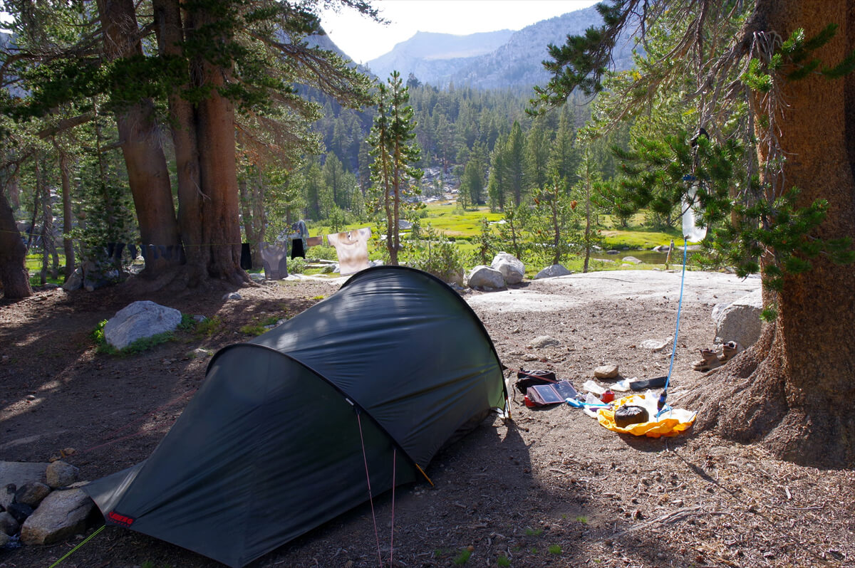
Figure 11.20: Near the Rose Lake Trail junction, photographed in 2019
A few years ago, as I finished this switchback, an American hiker asked me, "How far is it to Lake Mary?"
"It's an uphill climb, so it will take more than an hour. Once you reach the top of this switchback, you'll cross the river. There's a campsite around the place where you cross. Don't push yourself too hard, it's better to sleep around there."
I'm so familiar with the area that it's a bit of a problem. Even though I'm Japanese, I have to teach Americans. It's a long climb to Mary Lake, so if I'm late, I won't be able to find a good site
In 2009, we set off from VVR and headed for Mary Lake, but we couldn't quite make it. Crazy Doc said, "Nobody makes it to Mary Lake." Starting from VVR, we spent the first night around Bear Creek
We arrived at Bear Creek at 10:00. James said he'd found a good spot a little before this. I wasn't sure where it was, but there was some grass about 40 meters off the trail, so it must have been around there. We took a break, made about 1 liter of water, and had lunch
I got a call from James
"Camping here is great. It's the best lake."
I was surprised to see that they had already set up their tent, but I guess that meant they had completed their plan. I was just having fun taking videos as part of my zero-day plan. Looking at the location, I realized I was in the upper reaches of Evolution Lake. It was near where I had quickly set up my tent in 2019, when a sudden downpour was approaching
Figure 11.21: Wayne. Spelling unknown
"Lunch at Bear Creek. Coffee and some energy bars. I ate three servings of the lasagna I was given yesterday. Drinks like Milo have calories. The fording looks ridiculously easy."
Bear Creek is famous for being a place where you can wade, but this year the water level was so low that we were able to wade across it by stepping stones, which was a first for us
The descent was gentle, making for an easy walk. We arrived at Italy Pass Junction at 12 o'clock. I usually hate wading, but this year it was easy everywhere. Come to think of it, it was here that I met Wayne (Figure 11.21). I remember him so well because he had the same name as the movie actor John Wayne, and because he had a Nikon SLR camera on his right shoulder and a plastic bottle on his left. When I asked him about it, he told me he wore the bottle on his left for weight balance reasons. Drinking water would throw off his balance, but I didn't ask him about that
We were going in the same direction, but because we were slow walkers, we only met this person around Sapphire Lake
When I returned to Japan, I was shocked to hear the news that a man named Wayne had fallen from Forester Pass and died. An article about his funeral appeared on Facebook. I looked into it and found out that it was a different man, a university associate. The trail was in good condition, so it would not have been so easy to fall. He probably lost consciousness due to altitude sickness and fell. So it became a memory that was etched in my memory twice
Figure 11.22: A middle-aged couple
I didn't meet anyone here this year. The river wasn't particularly high in water, so I quickly crossed. Trail workers were working further ahead. This is a popular resting spot for hikers who have crossed the river. Many American hikers change into sandals before wading, so it takes time to change shoes. I wear leather hiking boots with gaiters, so if I can cross quickly in water that's 20-30cm deep, I won't get wet
The trail was downhill, so I made steady progress and reached the junction with the Bear Ridge Trail just after 2:00. Since I was there, I headed straight ahead to catch the VVR ferry. It got slower as the trail started to climb, but that was unavoidable
As I started to climb, I slowed down and was overtaken by the couple in Figure 11.22. I remember this because I had passed them once or twice, and also because there was a campsite a little higher up, and the wife was there, stopping and asking me if I had seen her partner in a blue shirt. Luckily, he caught up with me a little later. He seemed tired, but the wife had followed me up by herself. I guess she had come to look for water. The water had dried up, so I don't know what happened to this couple after that
The water sources on this trail are located at low points, but the water becomes scarcer as you climb. The place where the middle-aged couple was trying to pitch their tent was the last water source, and when it dried up, there were two other places with flowing water: one quite a way up the switchbacks, and one just after the switchbacks ended and the trail became nearly level
Around the first switchback, there is the colony shown in Figure 11.23. I remember it because Crazy Doc was so keen to photograph it. He called it a donkey's ear, but it's actually a flower called Wayetia mollis. The flowers have finished blooming this year, so I'll show you an old photo
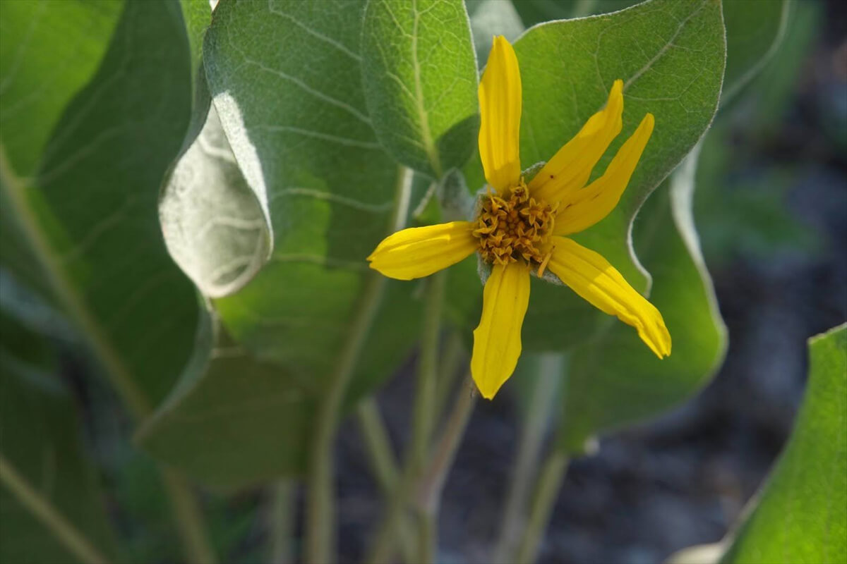
Figure 11.23: Waitia Morris. Photographed in 2009
It was still a little after 3 PM, so I pressed on. At 4 PM, I came to the junction with the Bear Ridge Trail. I changed my mind and decided to descend the Bear Ridge Trail instead of going straight. I remembered that VVR offered a free shuttle to the Bear Ridge Trailhead. If I went down and pitched my tent, I should be able to catch the morning shuttle, which would be faster than taking the ferry
The trail heads downhill, but contrary to the map, it doesn't leave the Bear Trail for a while. After a while, the descent begins in earnest. It's a typical pine forest, nothing particularly interesting. After about 30 minutes of descending, a marsh appears. There's also the beginning of a stream. I didn't feel like going any further, so I continued on. Then, the stream on the right disappeared, and I found myself in a green area in a low valley. There must be water somewhere, but I didn't feel like descending to check. So I continued on
It was 4:40. This was a bad pattern. There was a water source across a stream, but it was quite a ways off. I was a bit stumped. Then a green area spread out on the left. I thought I could find water if I crossed the left side, but I didn't want to take the risk. I continued down the trail. At 5:30, I heard the sound of a flowing stream. It was about 50m from the trail. There was bare ground and it looked flat. I was nearing the limit of my activity time. I decided to pitch my tent
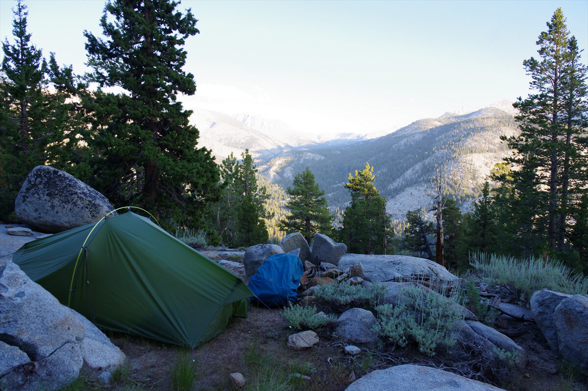
Figure 11.24: A small stream just before the turnoff to the Bear Ridge Trail. Photographed in 2017
Figure 11.25 shows the spot where we pitched our tent. The stream was only about 10 meters away. It was a bit of a slope, but not too bad. We brought 5 liters of water. Looking around, we found other places where we could pitch our tent. It seems that occasionally, people do pitch tents there. For dinner, we had tuna purchased from the MTR on rice as the main dish, as shown in Figure 11.26
The shuttle was at 8:00, so I got up early and left at 6:00. After walking a little, I came to a familiar place. It was 7:00 when I arrived at the stream that was my destination yesterday. I could pitch my tent in the open space just before the stream or where I crossed the stream. I was a little behind, so I picked up the pace. Just before the trailhead, I had to switchback and lose altitude at a steep angle. I arrived at the trailhead exactly at 8:00
I waited for a while, but the shuttle never came. Something seemed strange, so I contacted VVR via messenger plus. I got a reply straight away. They said they didn't offer a shuttle service. That wasn't what I had said. It seems they had stopped it because there weren't many hikers. I asked if there were any cabins available, but they were told they were full. I had no choice but to walk to VVR. I arrived at VVR at 9:30, so I couldn't have breakfast, but I could have a hamburger for lunch
I have never been able to take the VVR shuttle from this area. I was picked up once along the way, but it wasn't free and I was charged $20 later. In 2022, the shuttle was a paid service, but no matter how long I waited, it never came. I had no choice but to walk around the dam site, and..
"Hey, wait there for a second. Wait until the call is over."
I was yelled at from a parked car. I wondered if I had done something wrong, so I had no choice but to wait
"This is the only place where the phone works. It must be Vermillion. Pick up your luggage. I'll give you a lift."
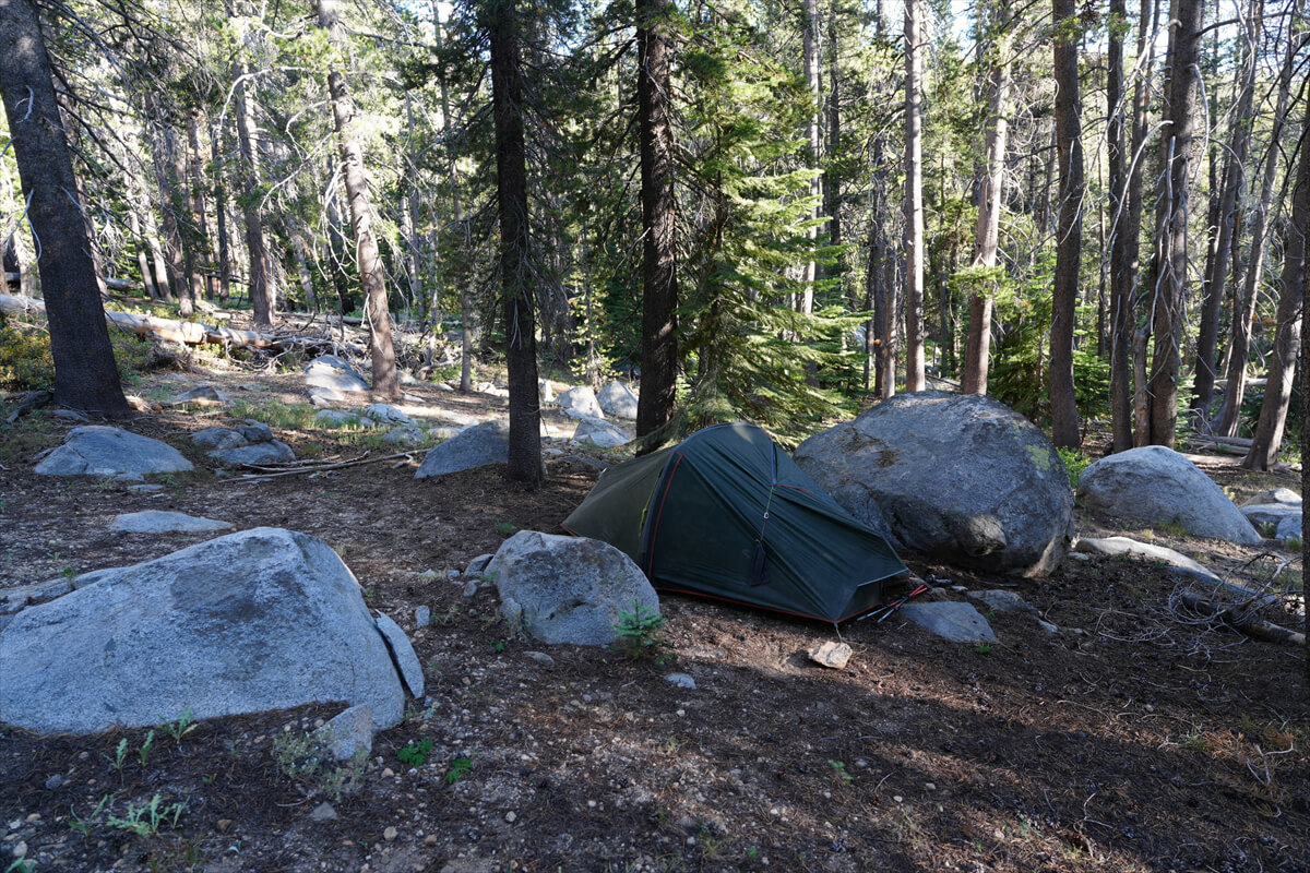
Figure 11.25: On Bear Ridge Trail. I didn't make it to my planned destination
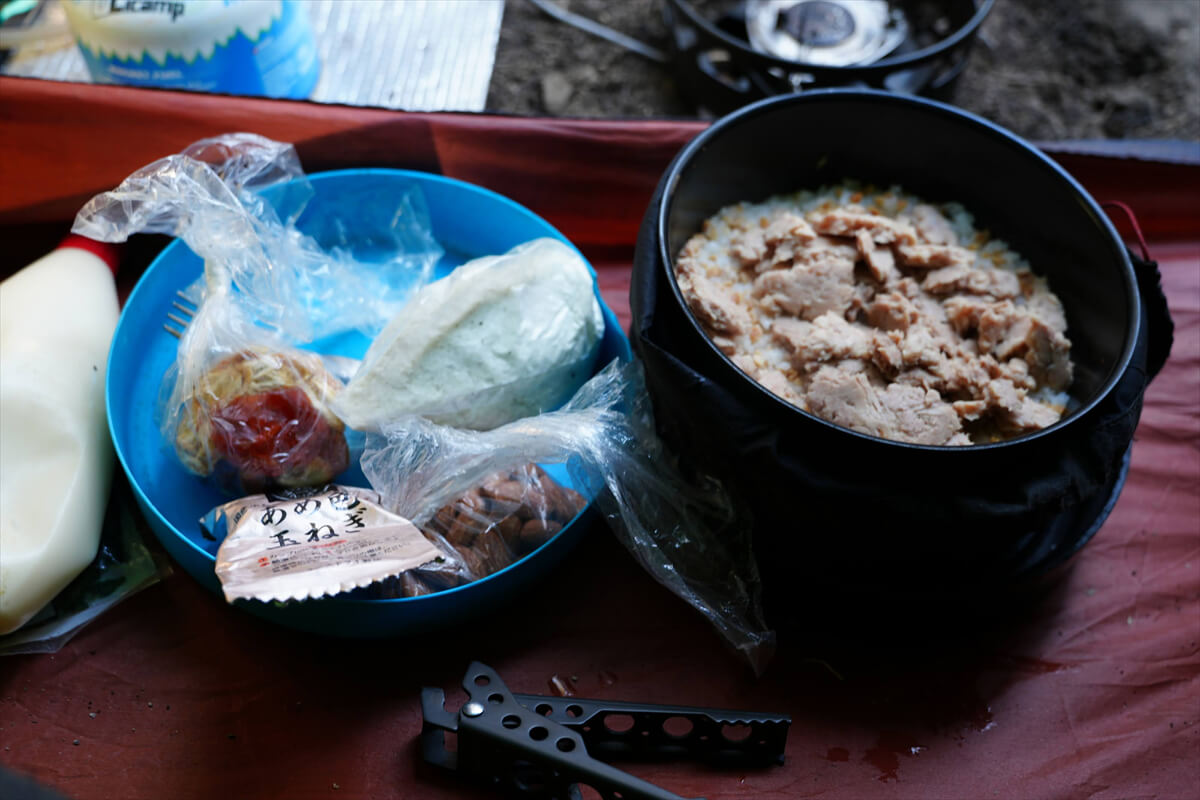
Figure 11.26: Dinner is tuna bowl etc
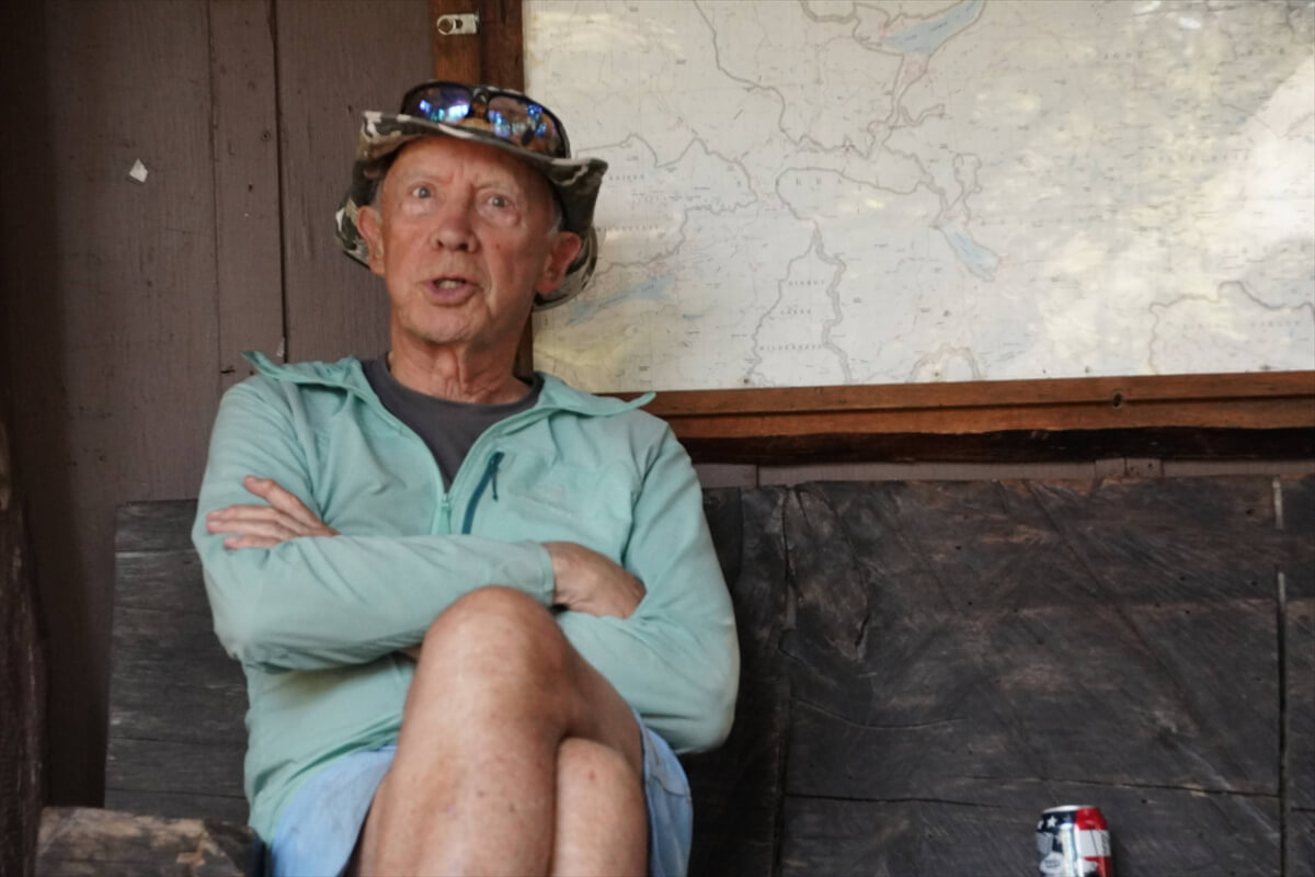
Figure 11.27: Peter William Tellemeyer. Trail name Tin Man. Photographed in 2022
His name was Peter William Telemire, and his trail was called Tin Man (Figure 11.27). He is the author of "On the Bridges Between Heaven and Earth: Sixty Years of Living Dangerously." I found the Kindle edition cheap, so I bought it and read it. He had quite a crazy life. He was from New Zealand, enlisted at age 17, flew various aircraft from age 20, and trained in Antarctica for emergency landings, which he used in his subsequent mountaineering careers. After his military service, he worked delivering aircraft around the world, enjoying dangerous mountaineering in his spare time. He later married an American woman, moved to the United States, and began climbing Mount Whitney. He apparently walked the JMT 14 times. He had both knees replaced with artificial joints, so he was known as the Tin Man. We spent a whole day together at VVR. He's probably the most famous person I've met there. Unfortunately, his website hasn't been updated since 2024
Bear Trail
The main trail to VVR is the Bear Trail. This year, I changed my mind and took the Bear Ridge Trail. If you go straight, you'll reach a plateau and go through the forest. After a few large switchbacks, you'll slowly go up and then a steep switchback
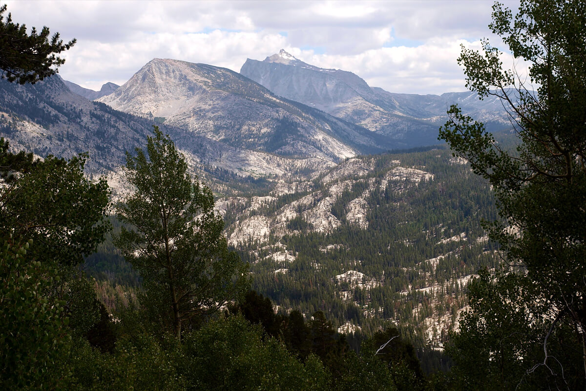
Figure 11.28: View from Bear Trail, 2009
The Bear Trail runs through the forest, so the views are not particularly good. This photo was taken in 2009, but you can see the mountains shown in Figure 11.28
There is one place where you can get water, at a switch pack turning point, quite a distance down. After that, there is no more water until you reach the bottom. After descending and completing the final switchback, you will come to a meadow with campsites scattered here and there. Eventually, you will reach the Mono Creek bridge. The VVR ferry dock is about an hour away. There is no charge when you board. When you check out of VVR, you pay for everything in one lump sum with credit
Bear Creek Cutoff Trail
The Bear Creek Cutoff Trail is a little longer, but you can camp anywhere and there are no steep climbs. I walked it in reverse in 2019, so I have some photos to help explain
As you descend Bear Creek, you'll come across a small stream and a trail going down on your left. This is the entrance to the Cutoff Trail. A little further down you'll come to a marshland with a small stream, and past this is a large campsite along Bear Creek. Unfortunately, I haven't slept there yet
The trail continues along a rocky ridge for a while. After descending a few switchbacks, we came to a green area with a stream. We pitched our tent near the stream (Figure 11.29). Although it was close to the trail, there was water and it was well-ventilated. Few people hike the Bear Cutoff Trail
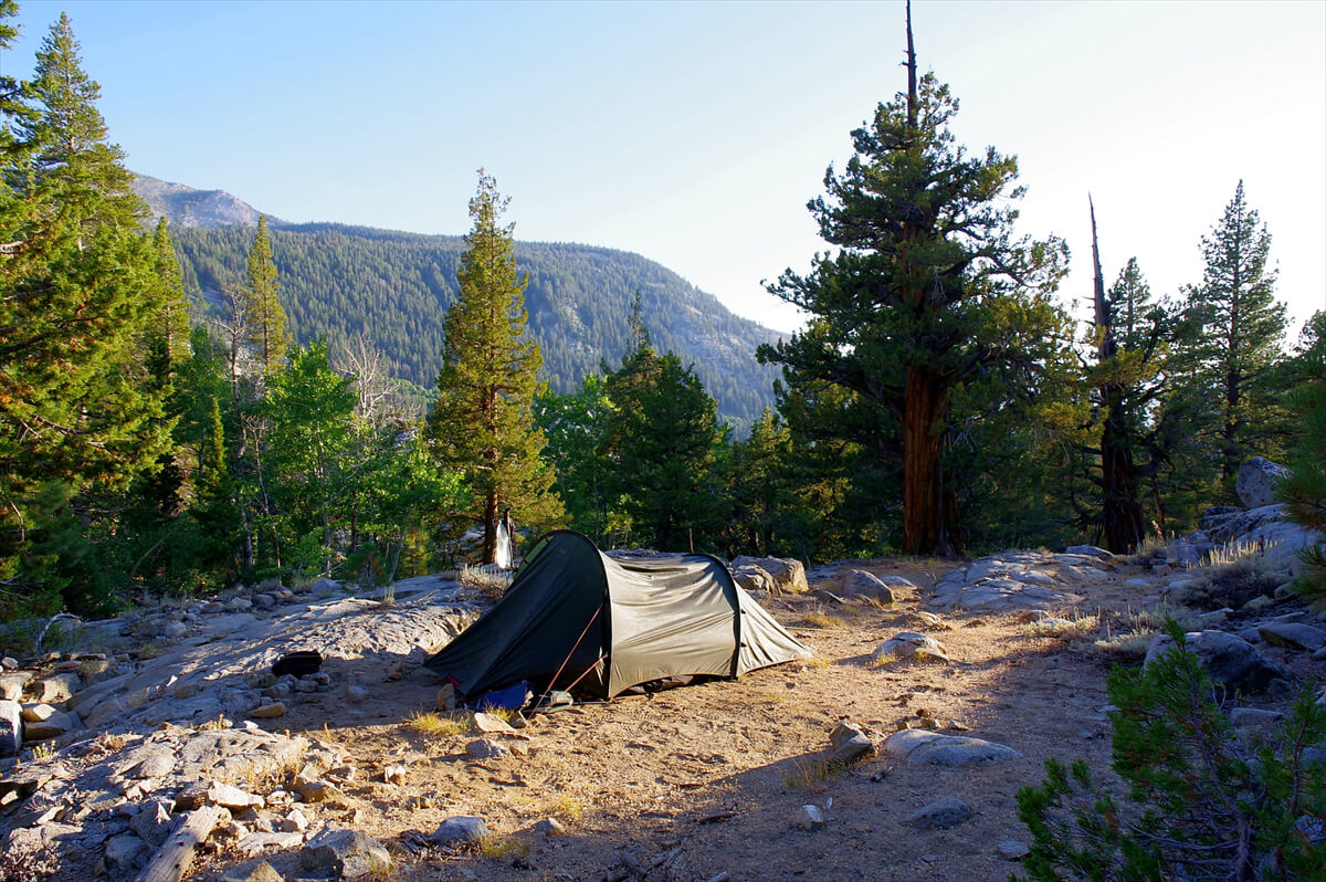
Figure 11.29: About 1 km down from the fork, there are several campsites. Photographed in 2019
After that, you will move away from Bear Creek for a while, but after a while you will be following the creek, as shown in Figure 11.30. Further downstream, there is a wide area where it joins another tributary and forms a pond, as shown in Figure 11.31. As you descend, the flat, wide area continues. Be sure not to miss the trail that continues on your right. As the name Cutoff Trail suggests, it climbs by cutting along low hill switchbacks. Lake Edison can be seen from the pass, as shown in Figure 11.32. After about 30 minutes of switchbacks, you will reach the trailhead. From here, it is about a 3 km walk along the road to VVR
Figure 11.30: The trail beside Bear Creek. Photographed in 2019
Figure 11.31: The confluence of the tributaries is as wide as a large pond. Photographed in 2019
Figure 11.32: Lower path of the Cutoff Trail, with Lake Edison in view
<Continued in Chapter 12>
Nobuhiro Murakami's new hiking guide, "The Science of Hiking, 5th Edition," is now available on Amazon (Kindle edition is 100 yen)
Nobuhiro Murakami, a former professor at a national university and an experienced through-hiker who continues to share rational solo hiking know-how from a unique and profound scientific perspective in books such as "Hiking Handbook" (Shinyosha) and "The Complete Guide to Hiking in the United States" (Ei Publishing), has released his new book, "The Science of Hiking," which is now available on Amazon. This compelling and logical hiking textbook is based on his accumulated experience dating back to the dawn of long trails in Japan, as well as objective sources such as academic papers on hiking, exercise physiology, and a wide range of other fields

Please consider a paid membership to support the site while enjoying exclusive offers and content!
Nobuhiro Murakami
 Born in 1950. Former Professor Emeritus at Toyama University. Specializes in educational psychology and educational measurement. His outdoor-related works include "The Complete Guide to Sleeping Noshiki" (Sanichi Shobo), "Outdoor Gear Considerations: The World of Backpacking" (Shunjusha), and "Hiking Handbook" (Shinyosha). His psychology-related works include "Psychological Tests Are Lies" (Nikkei BP), "What Can Psychology Tell Us?" and "The Deceived Intelligence" (Chikuma Shobo). His recent works include "Introduction to American Hiking" and "The Science of Hiking" (Amazon), which compile the author's know-how from long-term annual hikes on numerous American long trails, including the Glacier Trail, the John Muir Trail, and the Winds Trail
 John Muir Trail Northbound Traverse (2025 NOBO) Record [Chapter 9] Muir Pass Detour Route
 John Muir Trail Northbound Traverse (2025 NOBO) Record [Chapter 7] Middle Fork Junction to Muir Pass
 John Muir Trail Northbound Traverse (2025 NOBO) Record [Chapter 6] From the Lower Basin to the Middle Fork
 John Muir Trail Northbound Traverse (2025 NOBO) Record [Chapter 8] Muir Pass to the San Joaquin River