Following on from our previous hiking route in Sequoia National Park, this time we'll be introducing a hiking trail in the same area that takes you to a waterfall with sparkling marble
Even though it's within the same park, the scenery is completely different from the previous Alta Peak Trail, and even those hiking the route are excited every time by the variety of scenery that unfolds within the park


This is a popular hiking course that is neither too long nor too short and is easy to do. It ends with a river and a waterfall, making it a perfect course for the hot summer
table of contents
Sequoia National Park Marble Falls Trail Hiking Information
How to get to the park
Approximately 5 hours (approximately 380km) from San Francisco and Los Angeles
If you are heading from San Francisco, the route to the entrance to both Kings Canyon National Park and Sequoia National Park is almost the same
After the entrance gate to the national park, the road splits into two. If you go left, you will head towards Kings Canyon, and if you go right, you will head towards Sequoia
There is no signal within the park, so it will be easier if you download the places you want to go to your GPS in advance
Useful items to bring with you on a hike
As for what to bring, as always, prepare the same equipment as you would for a typical hike in the United States
- Drinks (2 liters or more recommended in summer)
- Temperature-adjustable winter clothing
- hat
- sunglasses
- sunscreen
- Snacks to eat during the hike
- If you have any regular medications, bring first aid such as medicines and bandages
- Other than that, your favorite hiking gear
Trail Data
- For intermediate and above
- Season: May to November
- Trailhead elevation: Approximately 2,220m
- Round trip: 11.84km (7.4 miles)
- Height difference: Approximately 495m (1,627 ft)
- Course time: 3.5 to 5 hours round trip (including breaks)
Access (by car to the trailhead)
Marble Falls Trailhead (campground nearby)
Enter this into your GPS and you'll arrive at the trailhead
There is a campground just before the trailhead, so unless you are using the campground, you may not be able to drive all the way to the parking lot just before the trailhead. However, there is a large parking lot across the road (Generals Highway) where you can park
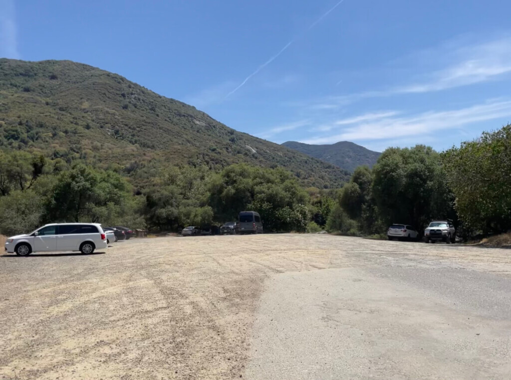

We parked our car in the parking lot across the road (Generals Highway) and headed to the trailhead
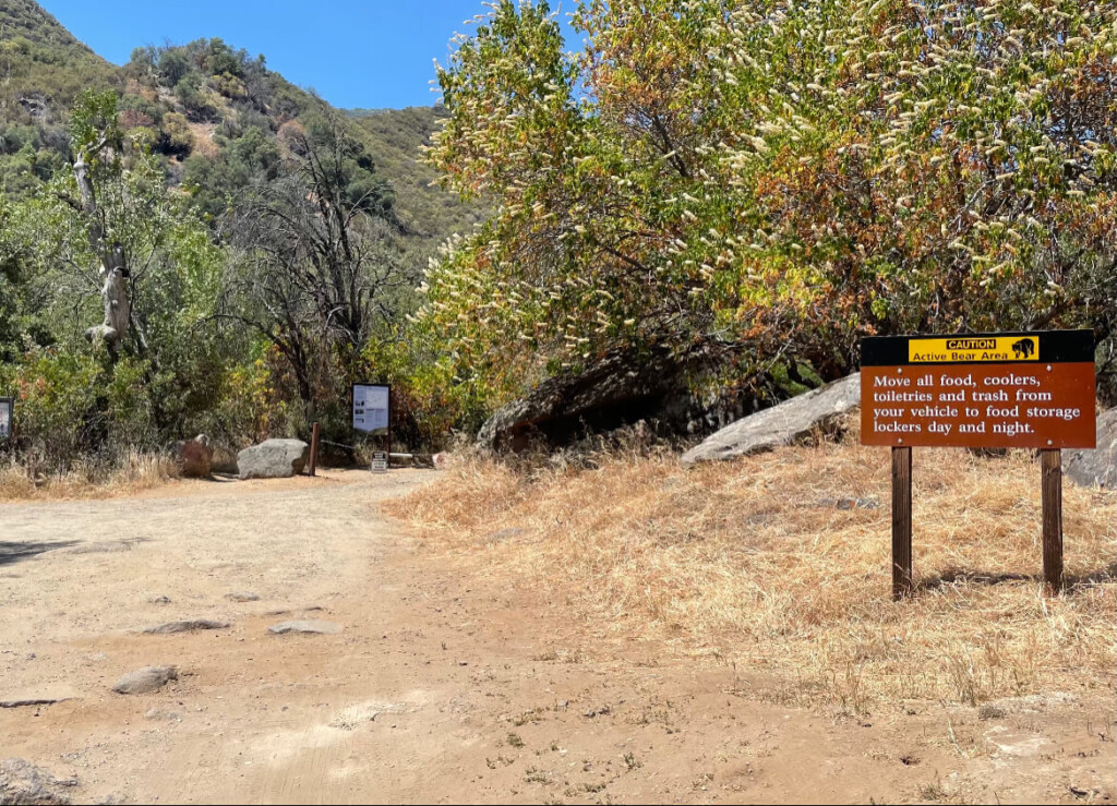

The area around the trailhead is a campground, and there is a sign with a warning that there are a lot of wild animals, so please do not leave food or toiletries in your car at night
Start hiking from the trailhead
The trail finally begins
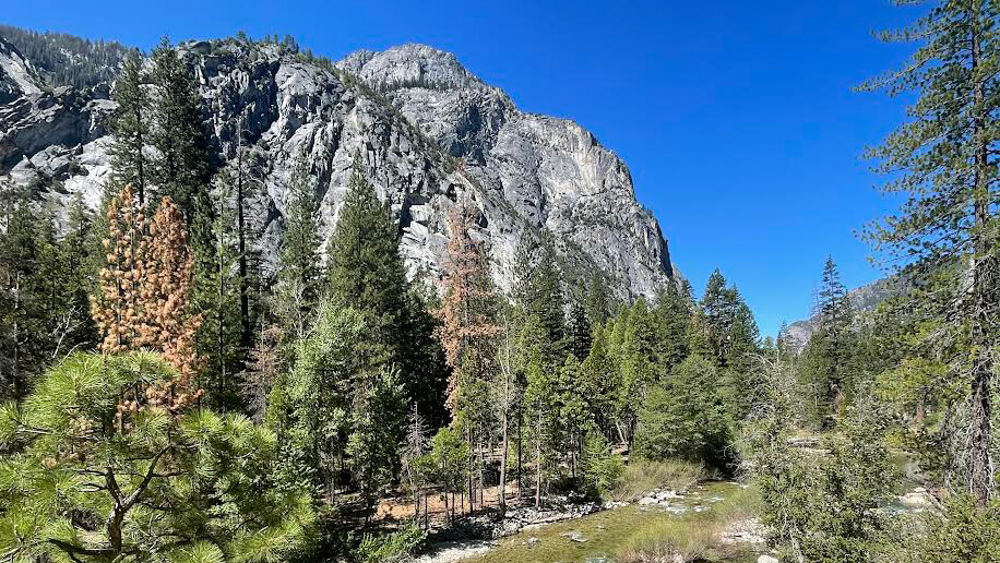
Just a 10-minute walk away, you'll be greeted by a spectacular view
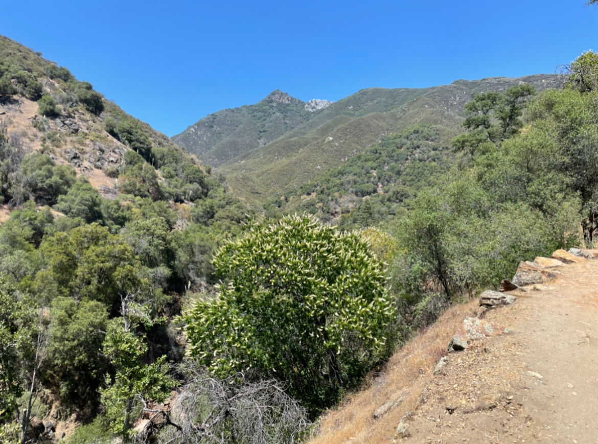

Today we're hiking to a waterfall at the foot of a valley in the mountains deep inside
The weather is nice and the greenery is vibrant, making it very pleasant

The trail is very easy to follow and you just climb along the trail
There are some steep slopes, but if you are a good runner, even beginners should have no problem
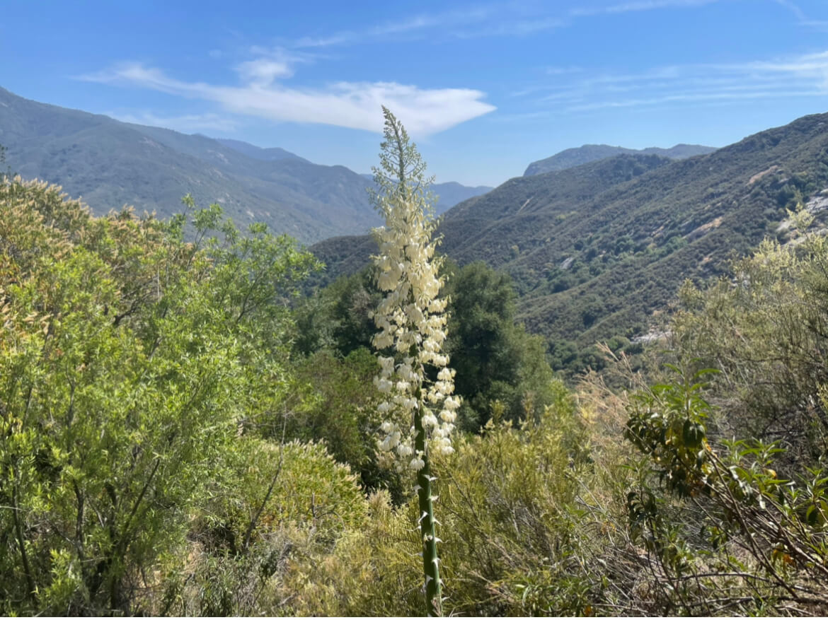

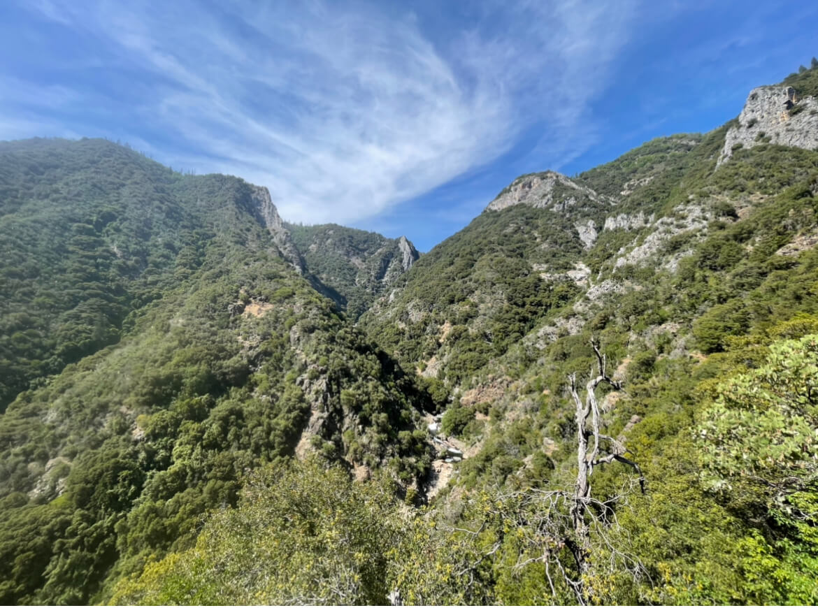
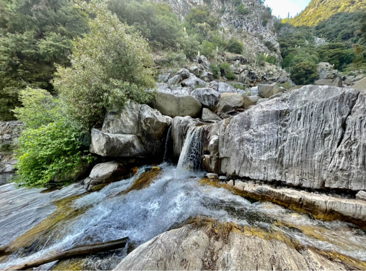
We continue to go deeper and deeper, admiring the beautiful mountains

Gradually, you can hear the sound of the river
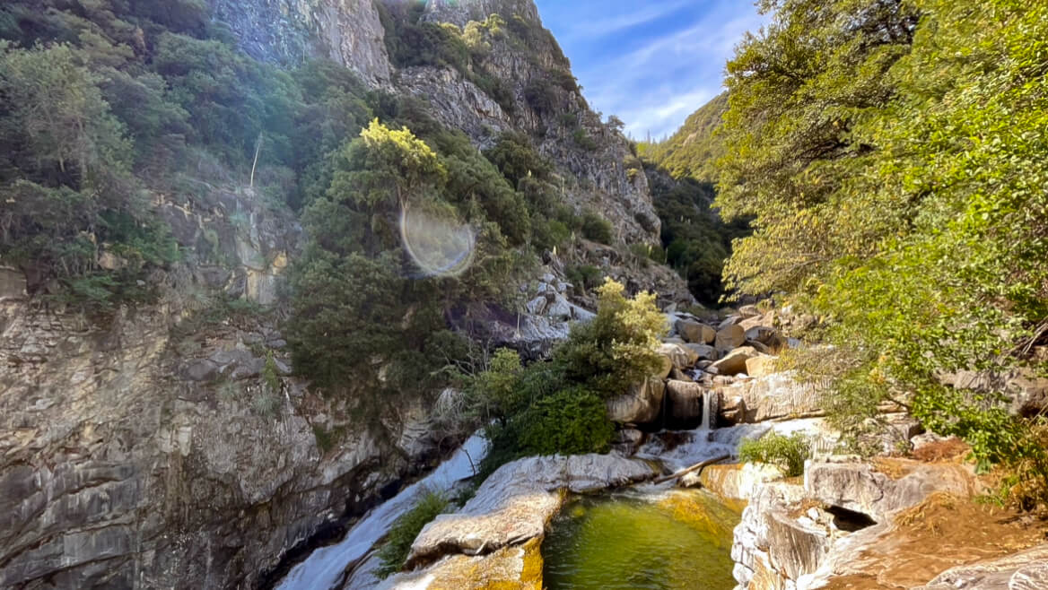
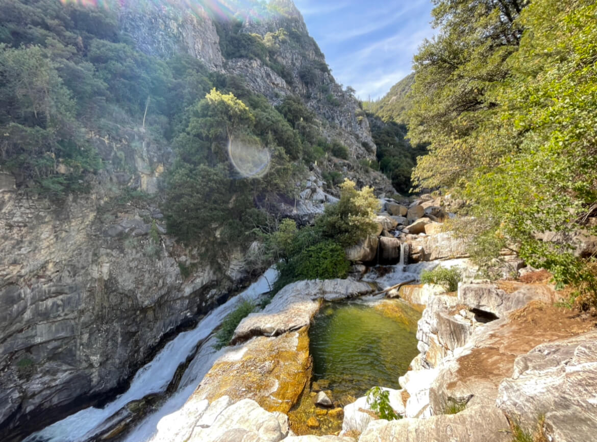
Once you get close to the river, you'll see
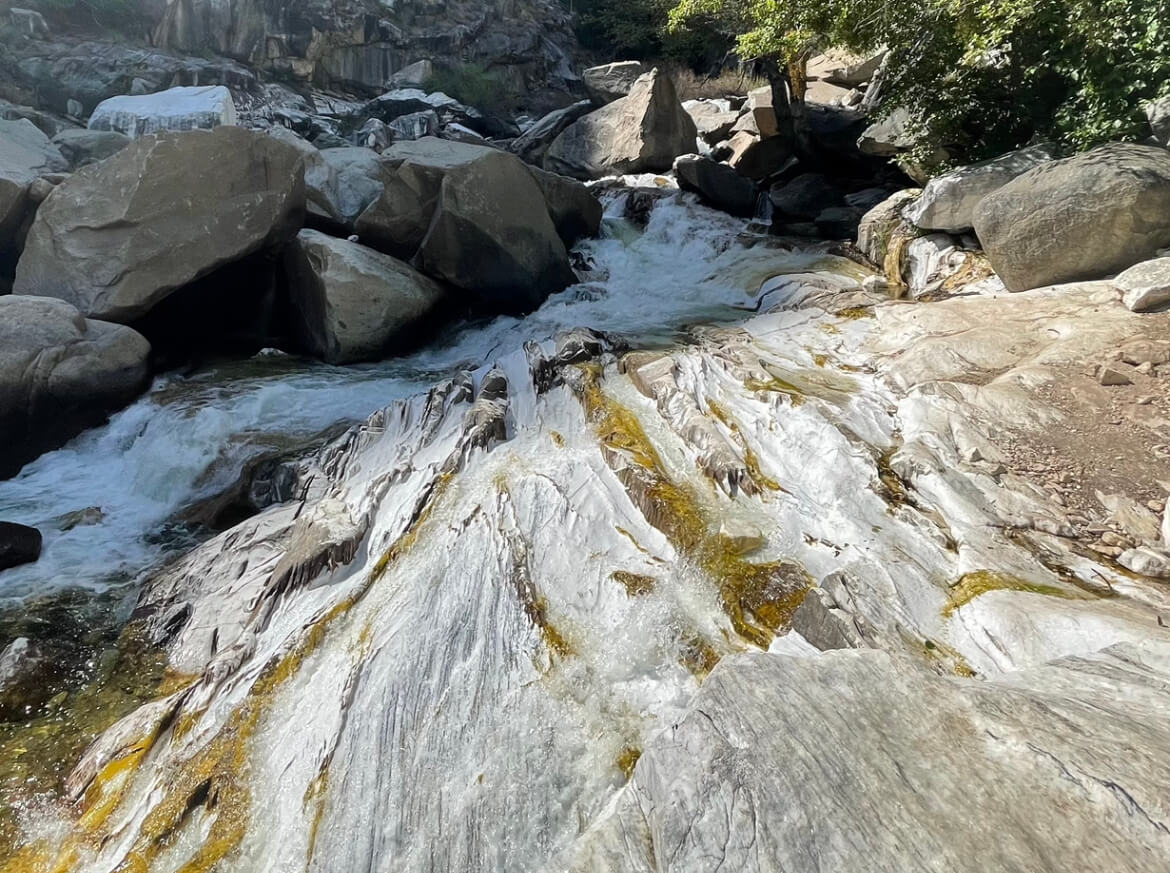

As the name suggests, it's all marble! It's hard to see in the photo, but the pure white marble glitters in the light
I was surprised because I had never seen marble spread over such a large area before
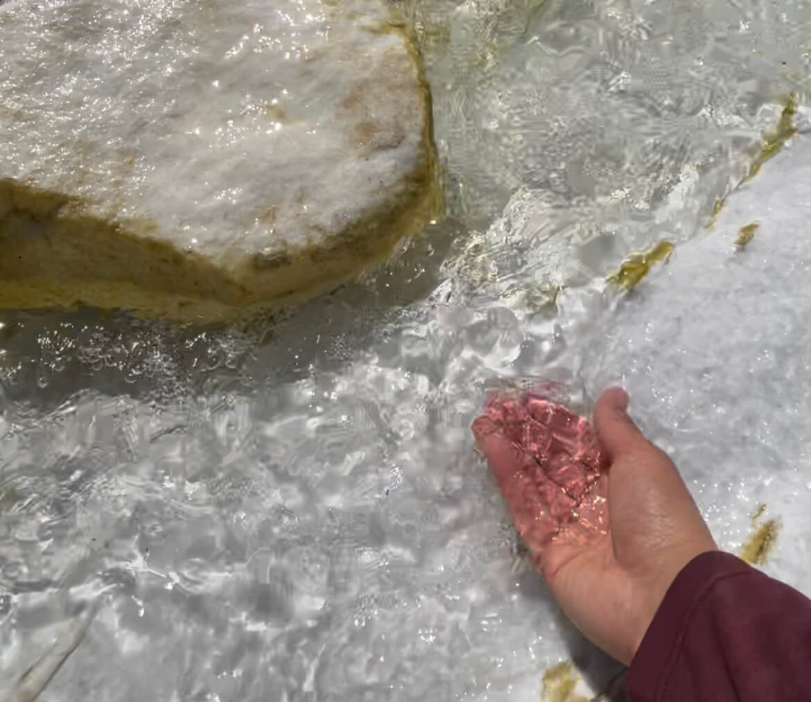

It was a very hot day, so the coolness along the river was truly soothing
Take a short break, swimming or dipping your feet in the water, then return by the same route
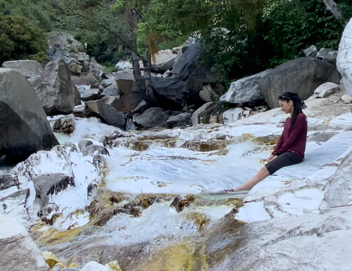


I was able to make the round trip in just four hours. It's an easy spot to visit and offers beautiful scenery
Precautions regarding the spread of COVID-19
As of January 2022, various situations may be in place in various countries, including entry restrictions due to strengthened quarantine measures, restrictions on entry to national parks, and restrictions on domestic travel. These conditions may change without notice, so when traveling, be sure to obtain local information from each country's embassy or consulate, the Ministry of Foreign Affairs' Overseas Safety Website (Infectious Disease Risk Information), national park websites, and other sources, and check information on transit points, countries you plan to travel to, and the areas around the places you plan to visit before making reasonable plans and taking action
Sayaka Kato

Related reading