The Upper Yosemite Falls Trail: A spectacular trail packed with all the charms of Yosemite. [A trip to the American National Parks (41)]
Written by Sayaka Kato
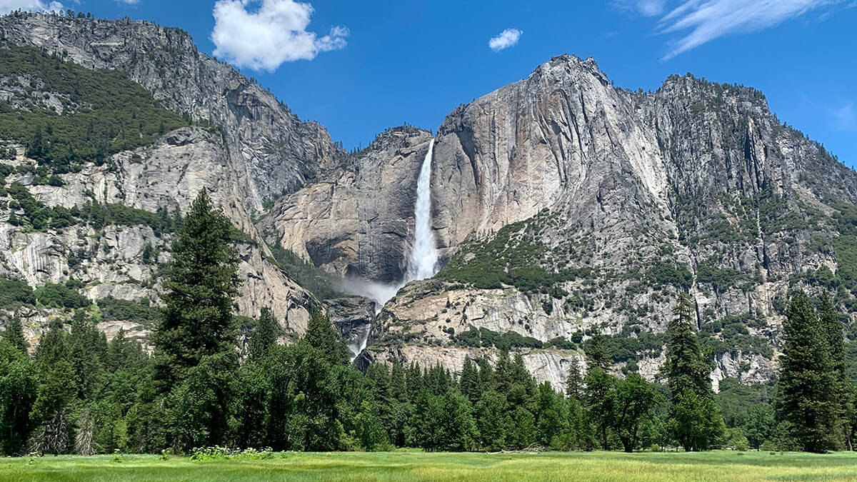
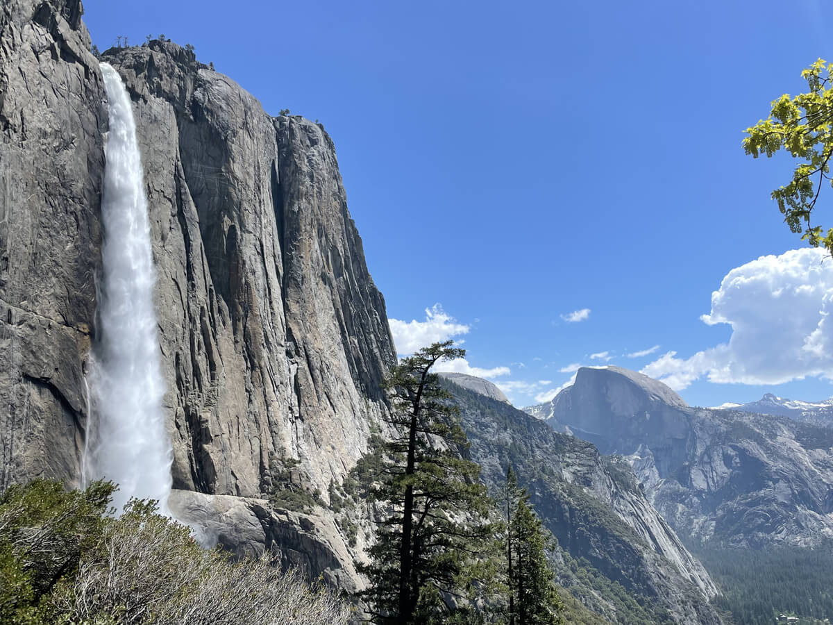
One of Yosemite's most famous spots and iconic views is...Yosemite Falls!!
People come from all over the country and even from abroad just to see this magnificent waterfall. The power of the falls is particularly impressive during the snow melting season, and it's truly
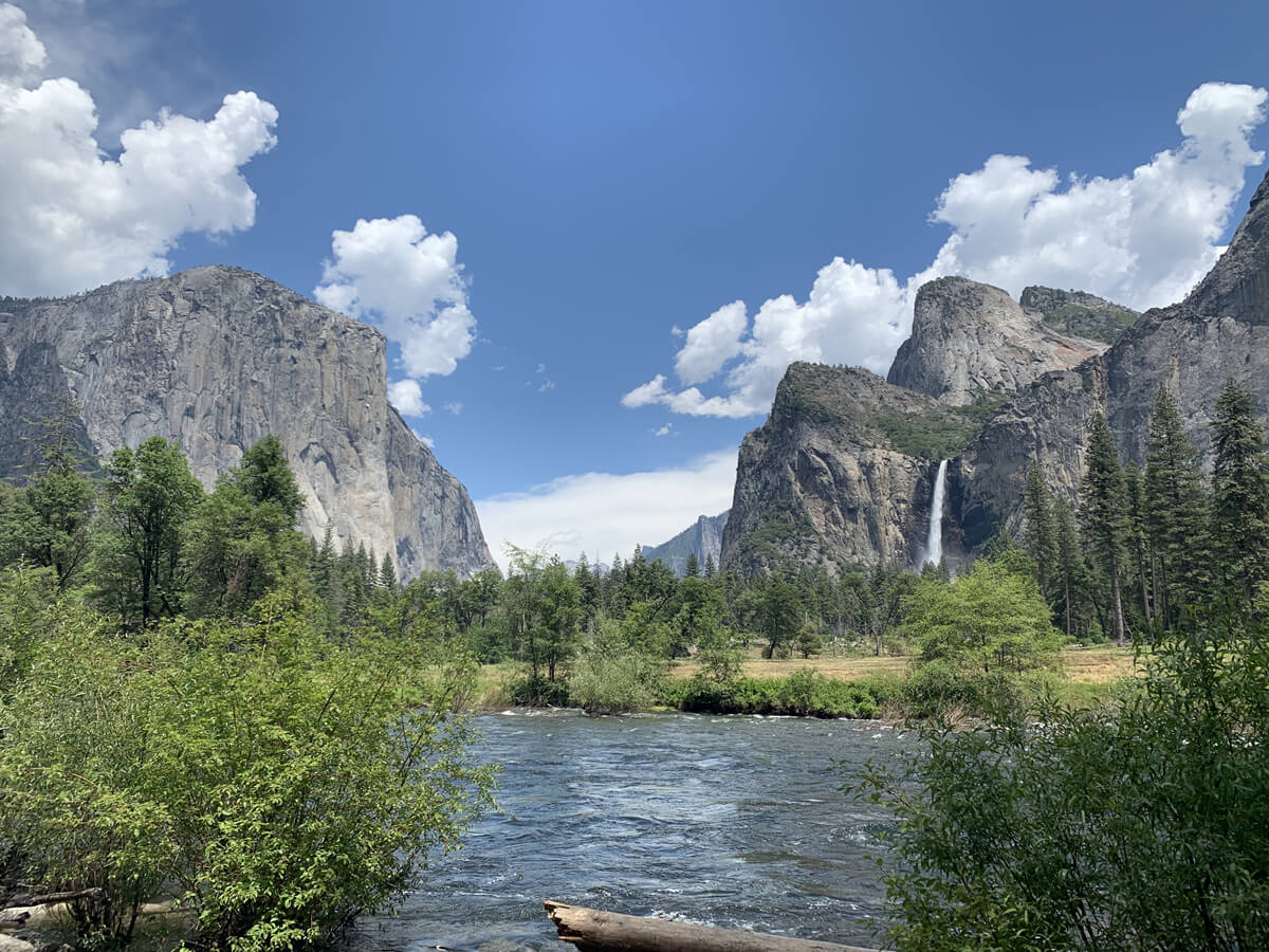
Yosemite National Park in California is a natural paradise that has everything, including waterfalls, rocky mountains, forests, and green meadows
It's also a great place for hikers who enjoy backpacking and camping, and there are so many hiking trails, not only within the park but also in the surrounding Sierra Nevada mountain range, that you probably wouldn't have enough time to explore them all in a lifetime, which is another attraction. It's truly a must-see for outdoor enthusiasts
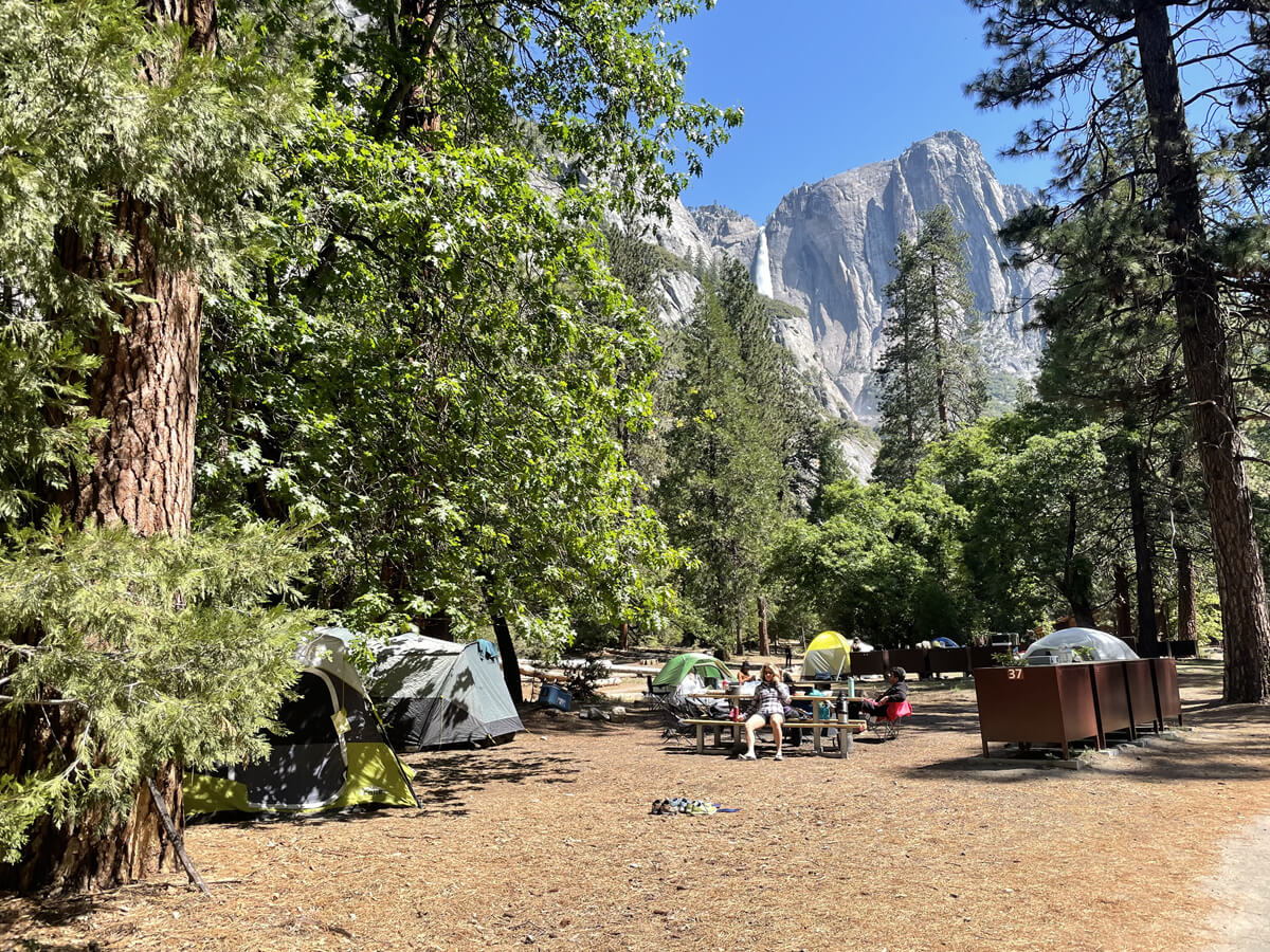
Yosemite Falls, the highest waterfall in North America (739m), consists of three tiers: Upper Falls (436m), Lower Falls (97m), and the cascade between them (206m), which are collectively called Yosemite Falls
It is not widely known, but the waterfall's power can be seen in its full glory in Yosemite's early spring, from April to June. In midsummer, from August to September, the snow that had accumulated on the mountains melts, reducing the flow of water, and sometimes the waterfall runs dry
The most impressive season is from April to early June, when the snow melts rapidly and a large amount of water flows. The amount of snowfall that falls during the winter also has a significant impact on the waterfall's flow. In snowy years, the waterfall continues to flow for a longer period of time. Due to heavy snowfall during the winter of 2022-2023, Yosemite Falls still had water flowing in August in 2023
We haven't introduced a hiking route that takes you to the top of Yosemite Falls (viewed from below), so this time we'll introduce the Upper Yosemite Falls Trail. It's a very popular hiking route
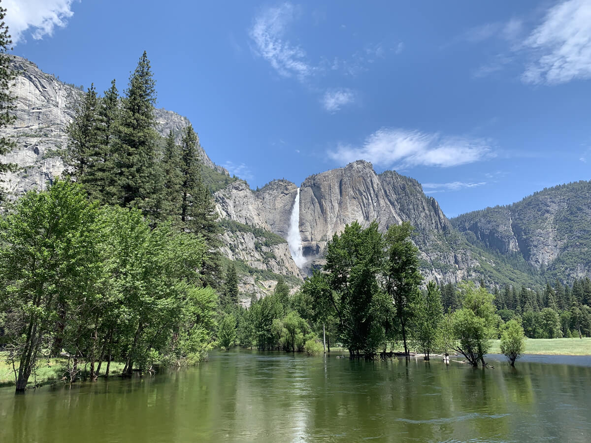
table of contents
Upper Yosemite Falls Trail Information
Access (by car to the trailhead)
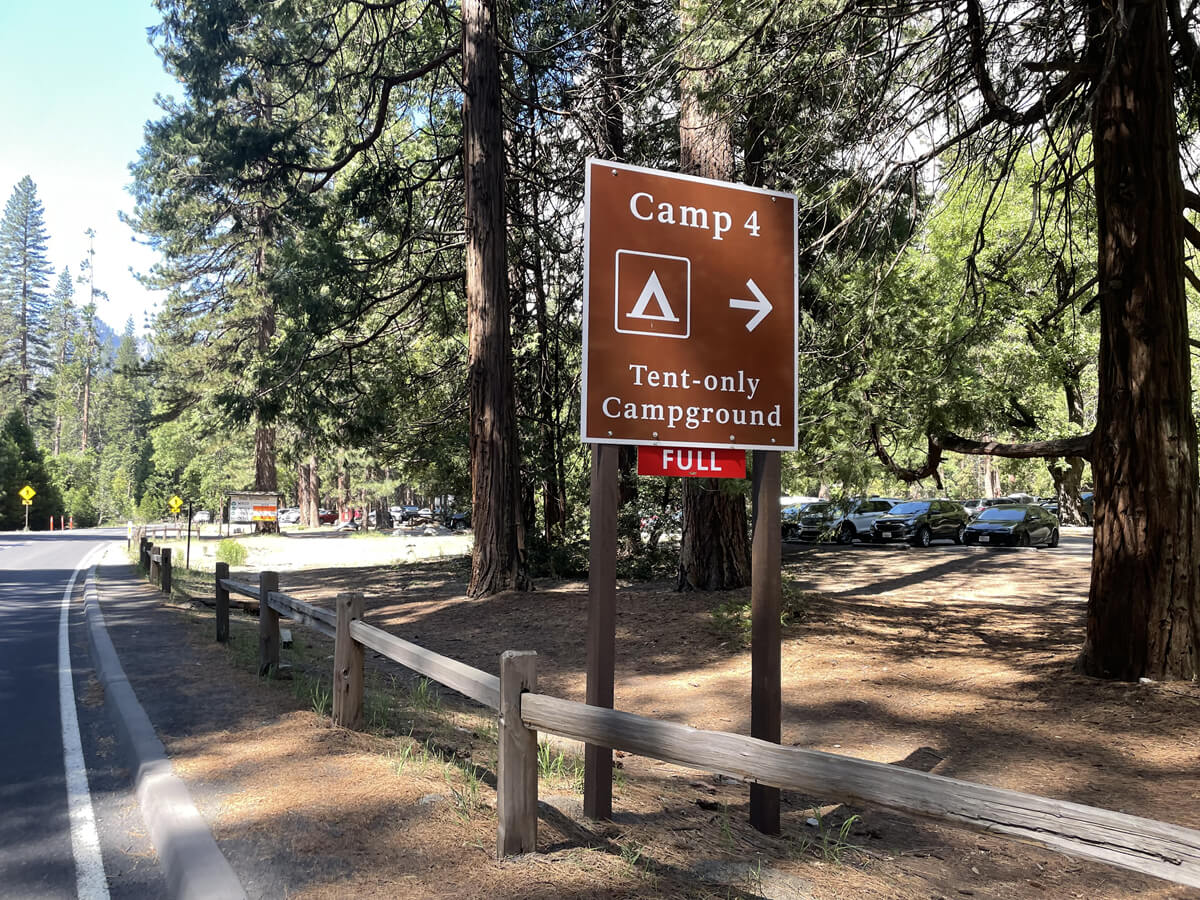
Trailhead address: Yosemite Falls Trailhead or Yosemite Falls Trail, Yosemite Valley, CA 95389, USA. Enter this into Google Maps. (Near Yosemite Valley Lodge. The closest parking lot to the trailhead is Camp 4, across the road.)
*Due to poor signal quality, we recommend downloading the map in advance
What to bring
As for useful items to bring on a hike, as always, prepare the same equipment as you would for a typical hike in the United States
- Drinks (more in summer)
- Warm clothing that can regulate your temperature (a windproof shell is helpful)
- hat
- sunglasses
- sunscreen
- Snacks to eat during the hike
- If you have any regular medications, bring first aid such as medicines and bandages
- Other than that, your favorite hiking gear
Trail Data
- Intermediate
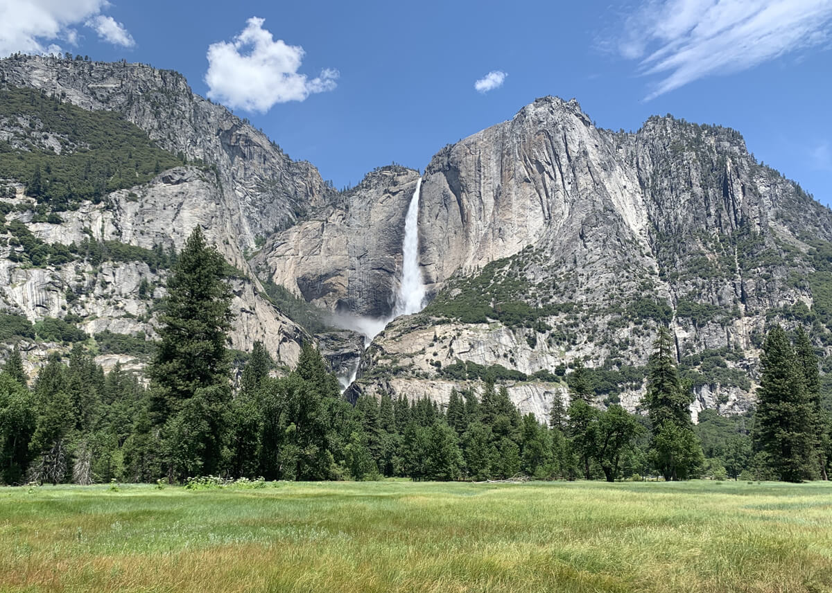
- Season: Best season is from April to October (The photo was taken in May.)
- Round trip distance: Approximately 10.56km (6.6 mi)
- Elevation difference from trailhead: 895m
- Trailhead elevation: 1,219m
- Yosemite Point Elevation: 2,114 m (6,936 ft)
- Course time: Average 5.5 to 7 hours
Note: Reservations may be required for certain dates and times, so be sure to check the latest local information before visiting
For more information, please visit: https://www.nps.gov/yose/planyourvisit/reservations.htm
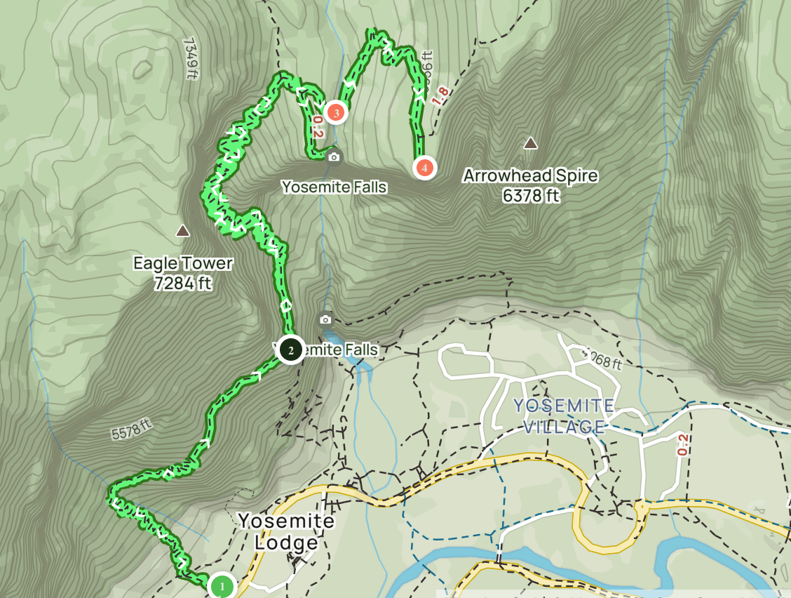
Started hiking (map 1 above) arriving at the parking lot around 10:30am
The Yosemite Falls trailhead begins at Camp 4
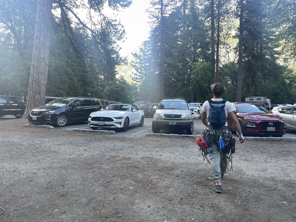
There were spaces available in the parking lot. Many climbers also use this parking lot, which is typical of America, and we saw serious climbers here and there climbing El Capitan, the world's largest monolith
It gets crowded during the summer holidays, so if the parking lot at Camp 4 is full, it's a good idea to look for a space in the parking lots around the nearby Yosemite Valley Lodge. Restrooms are also located in the same building as the Yosemite Valley Lodge lobby or in the surrounding area
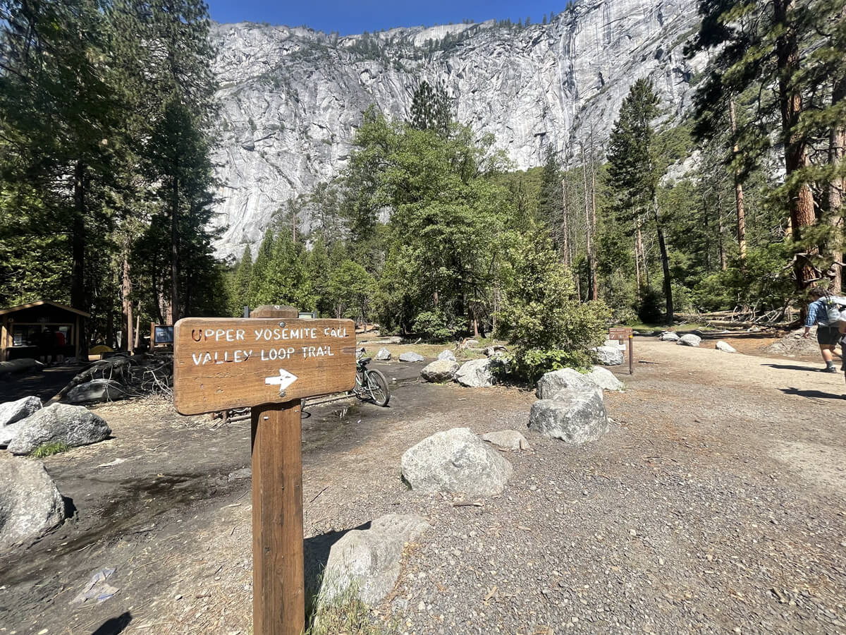
From the parking lot, follow the signs to the trailhead
Start hiking from the trailhead
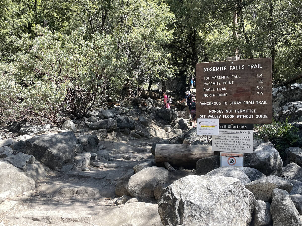
This sign is the trailhead
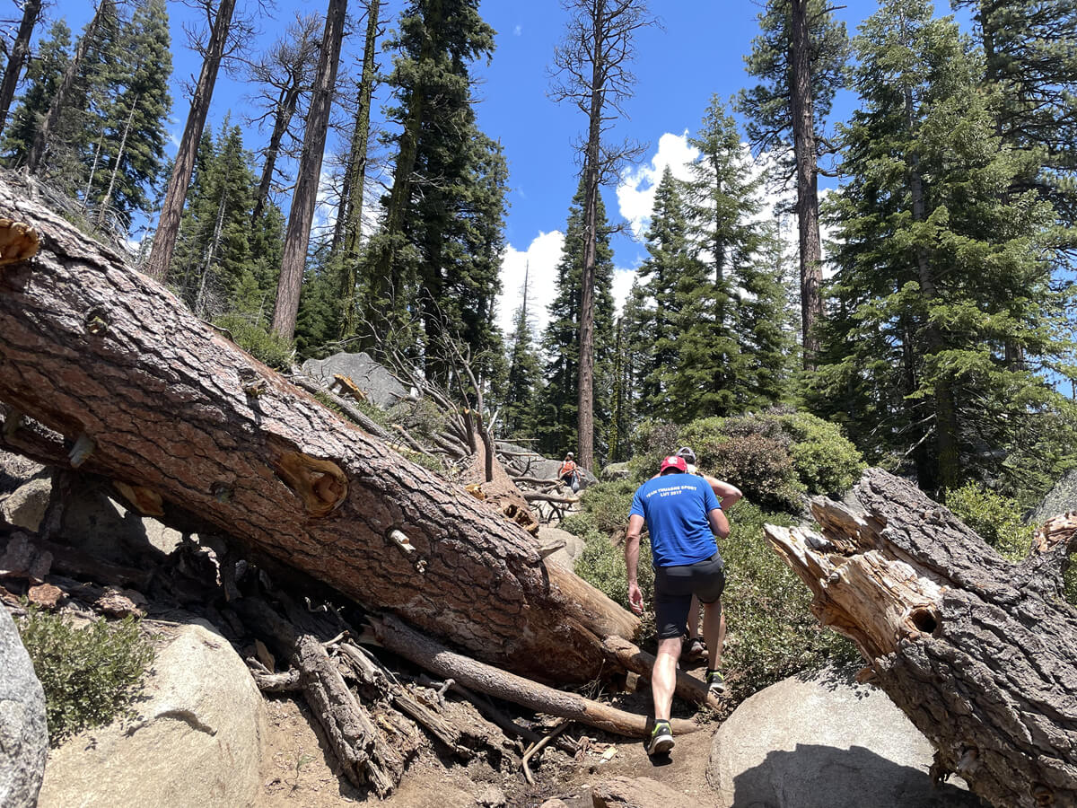
First, we started on a zigzag path. Although it was May, the temperature was already hot and we needed to drink plenty of water. The temperature was around 23 degrees
At first you will walk through an area with lots of trees so there is shade
The trail has many stone steps and wet areas, so we recommend wearing trekking shoes
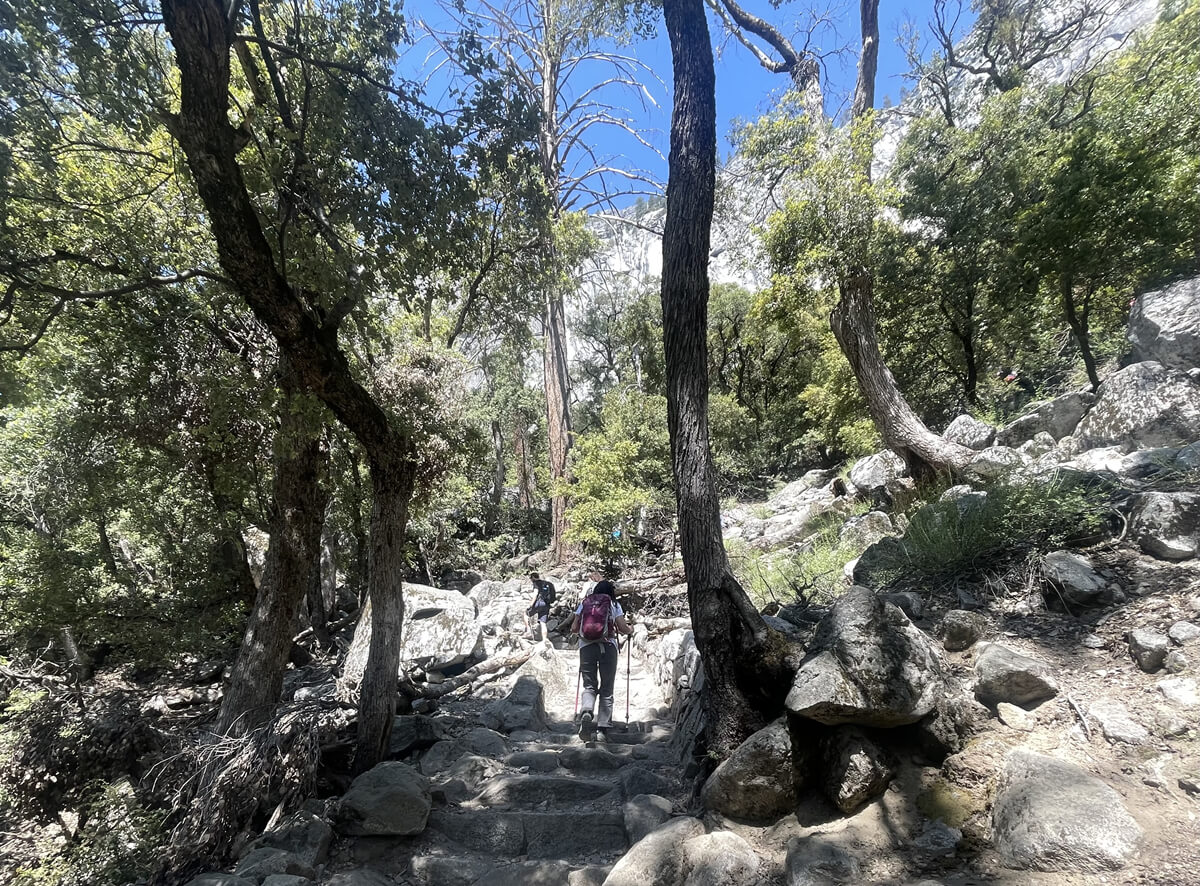
As you gaze upon the scenery peeking through the gaps in the trees, you realize you are gradually climbing higher, and the number of beautiful viewpoints increases here and there
The great thing about this trail is that there are so many spectacular views!
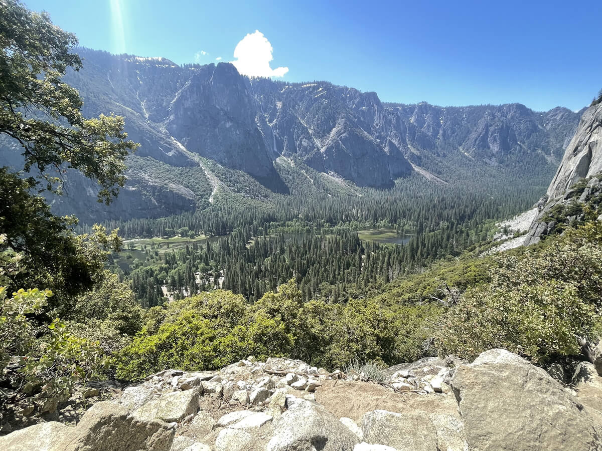
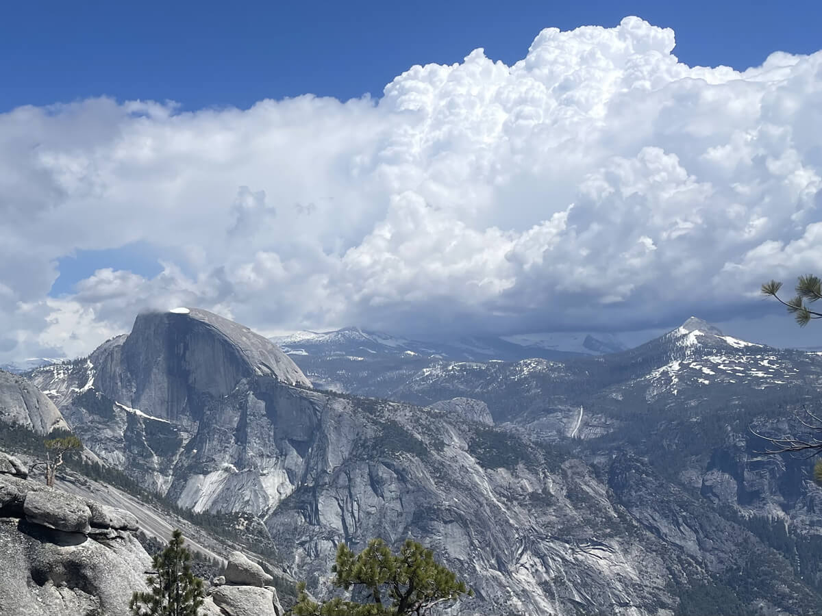
About a 45-minute walk from the starting point is an observation deck called Columbia Rock, where we took a break
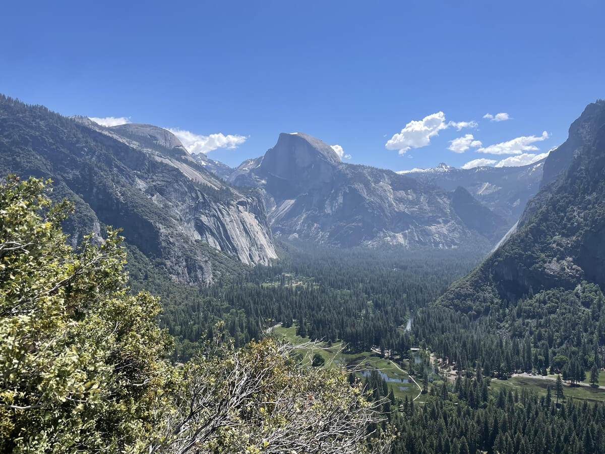
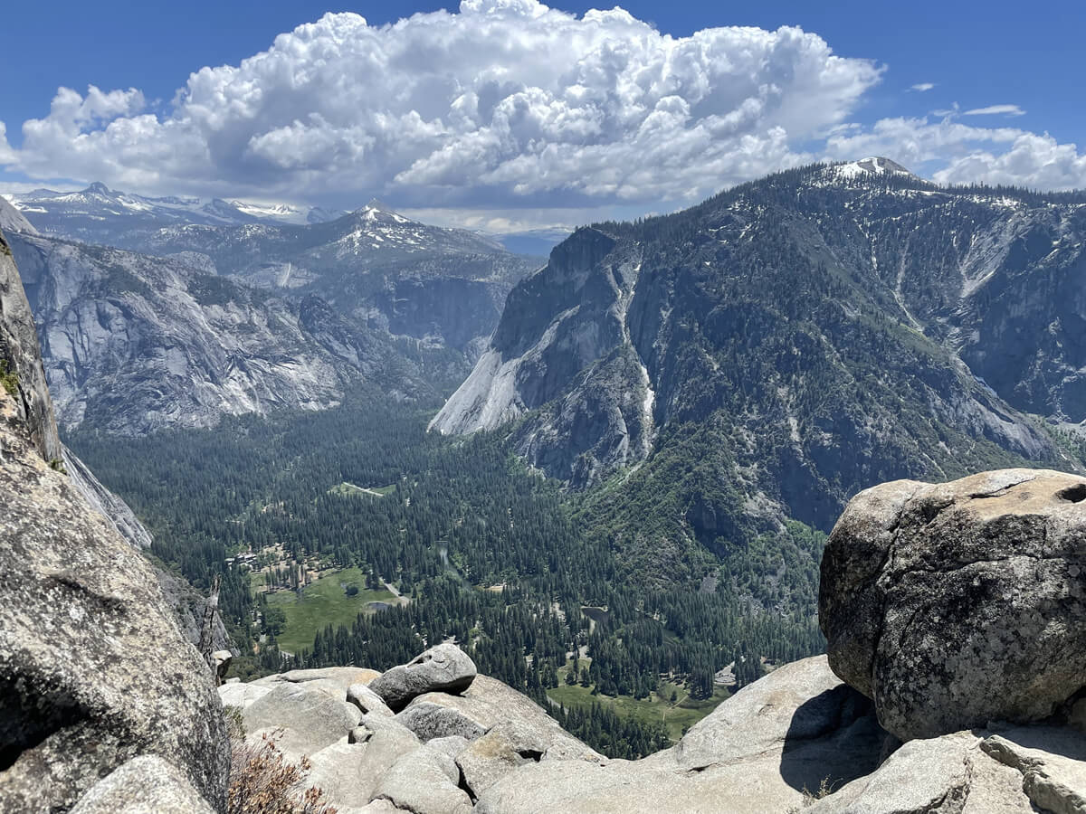
You can get a panoramic view of Yosemite Valley, and you can even see Half Dome from here
Take a short break and move on
Suddenly, the waterfall came into view in front of us. It was a big surprise as it appeared so suddenly
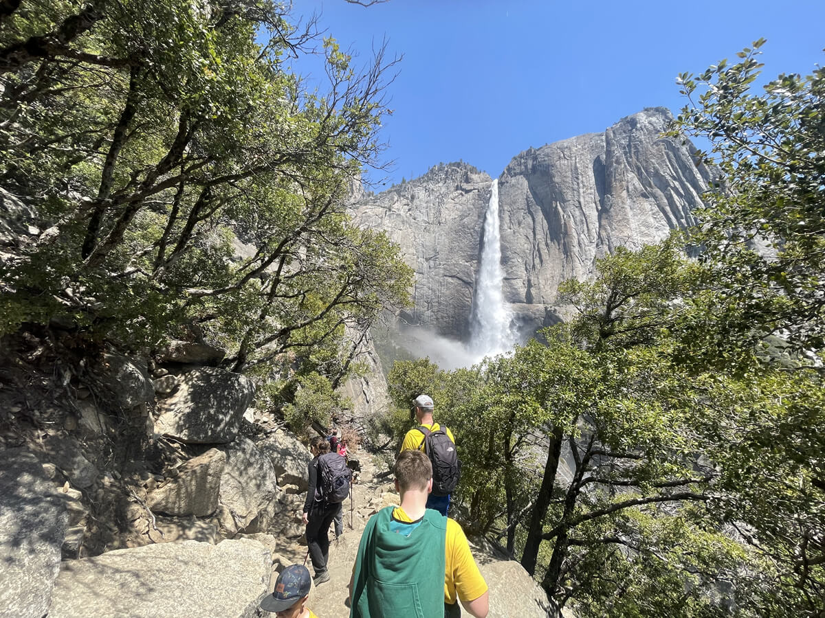

This is also a spectacular view! As you get closer to the waterfall, you can feel the spray of water and the negative ions. The sound is also amazing
There is no shade in this area anymore, and the spray here is very pleasant on hot days
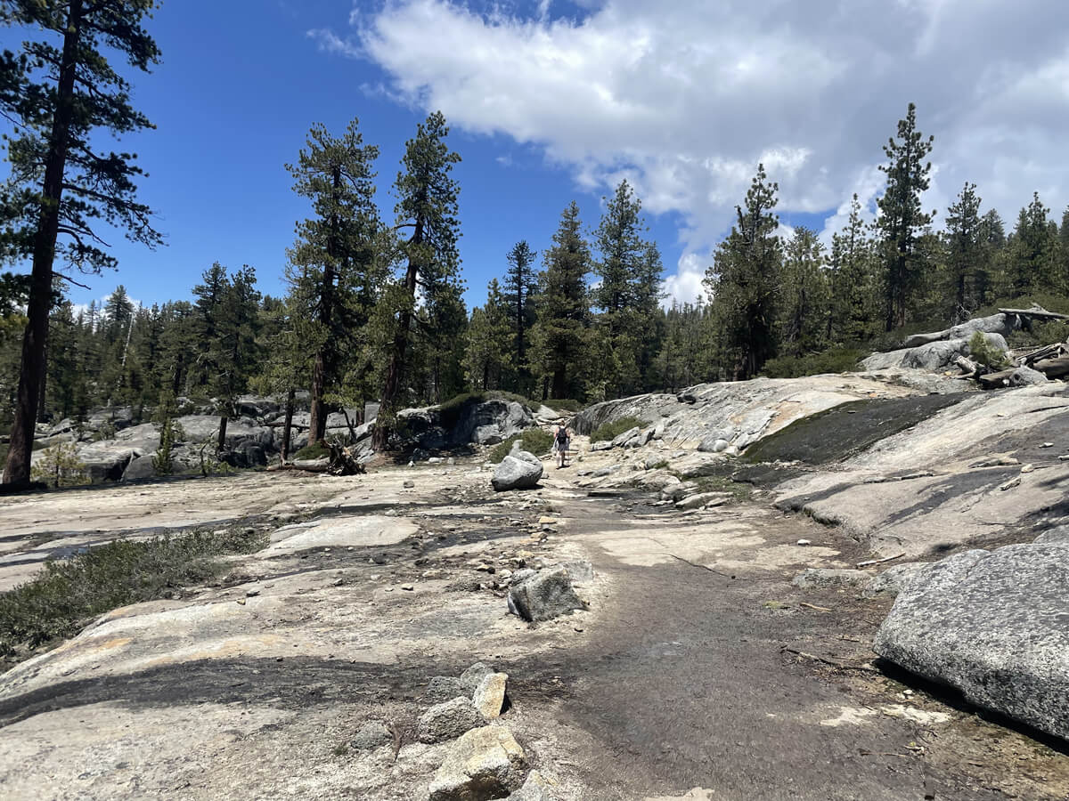
Continuing on, about an hour after starting, you will reach the Lower Falls viewpoint (Map 2). Approximately 2.5 km from the start, you will see the impressive waterfall on your right
This spot where you can see the waterfall from the side is something you can only see by walking this trail, so you'll be glad you came! You can also turn back here depending on your level
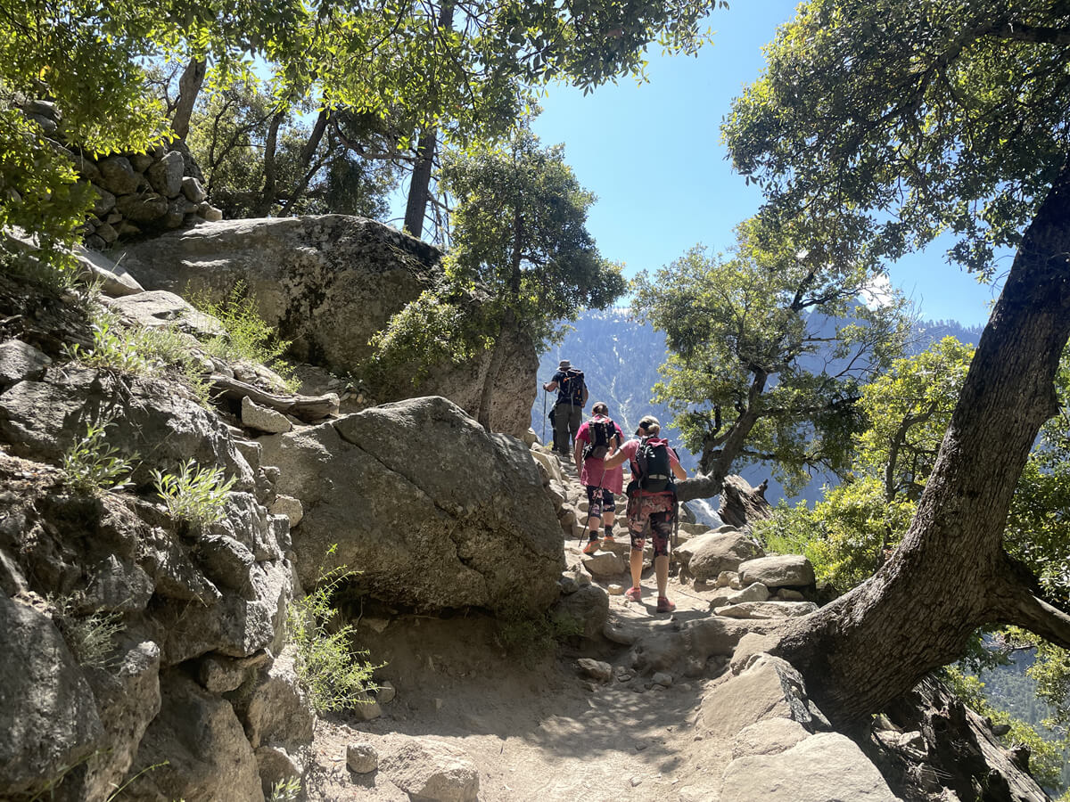
We continue on. The slope continues to be steep, but we take our time and take breaks
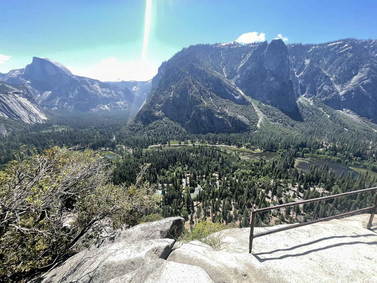
Further ahead, you will come to a fork in the road between Yosemite Falls Overview and Yosemite Point. Yosemite Overview is closer, but if you have the energy, I recommend going to Yosemite Point and enjoying the views of both
The overview offers a spectacular view of the valley
Further ahead is Yosemite Point, where you can look down on Yosemite Falls
Now that you've come this far, be sure to stretch your legs and head to Yosemite Point!
First, head to Yosemite Falls Overview (2029m)
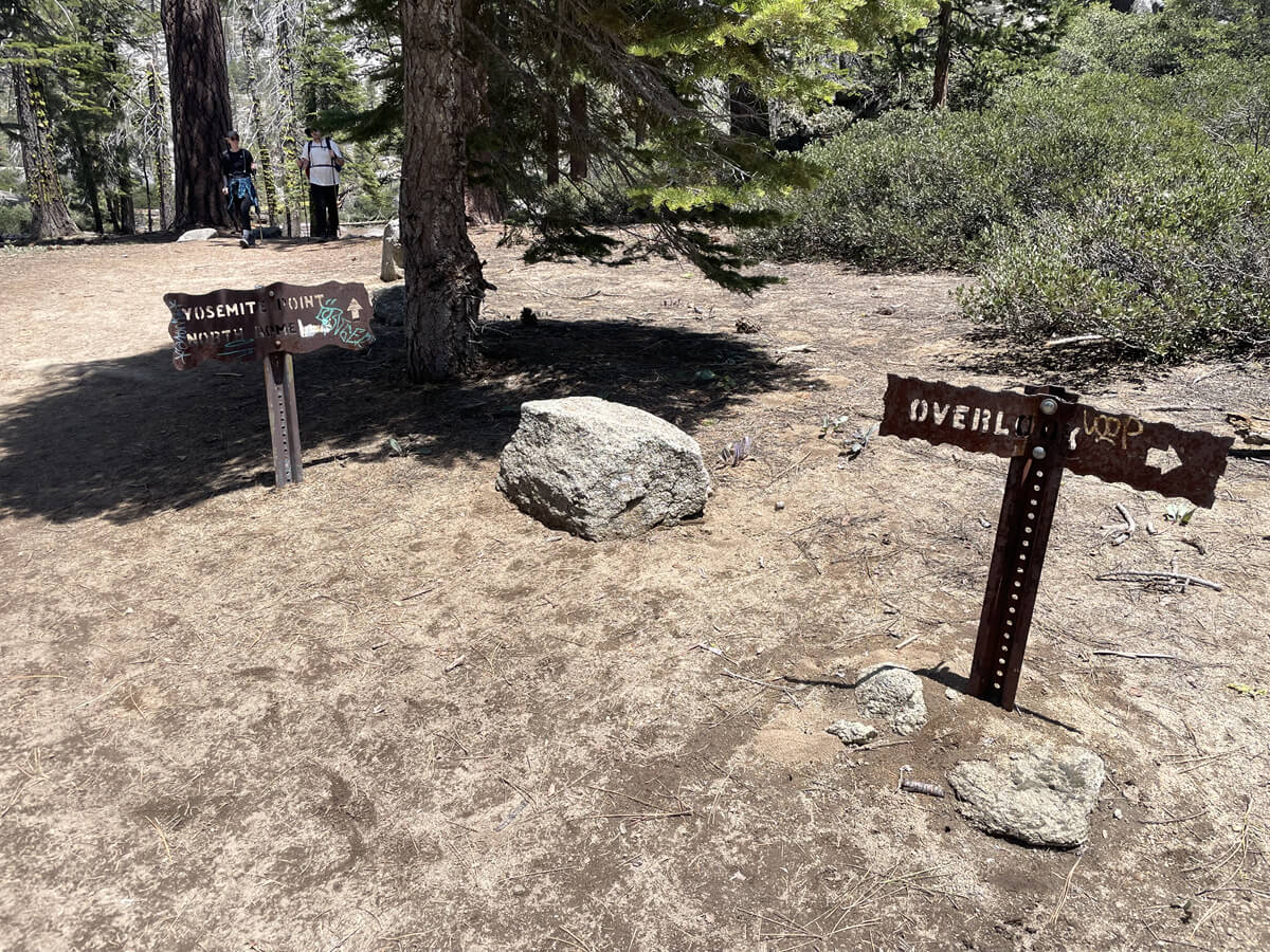
You will see signs for the fork to the right of Overview and the left of Yosemite Point. There is a small stream flowing to the right, so cross the stream and follow the signs towards Yosemite Falls Overview
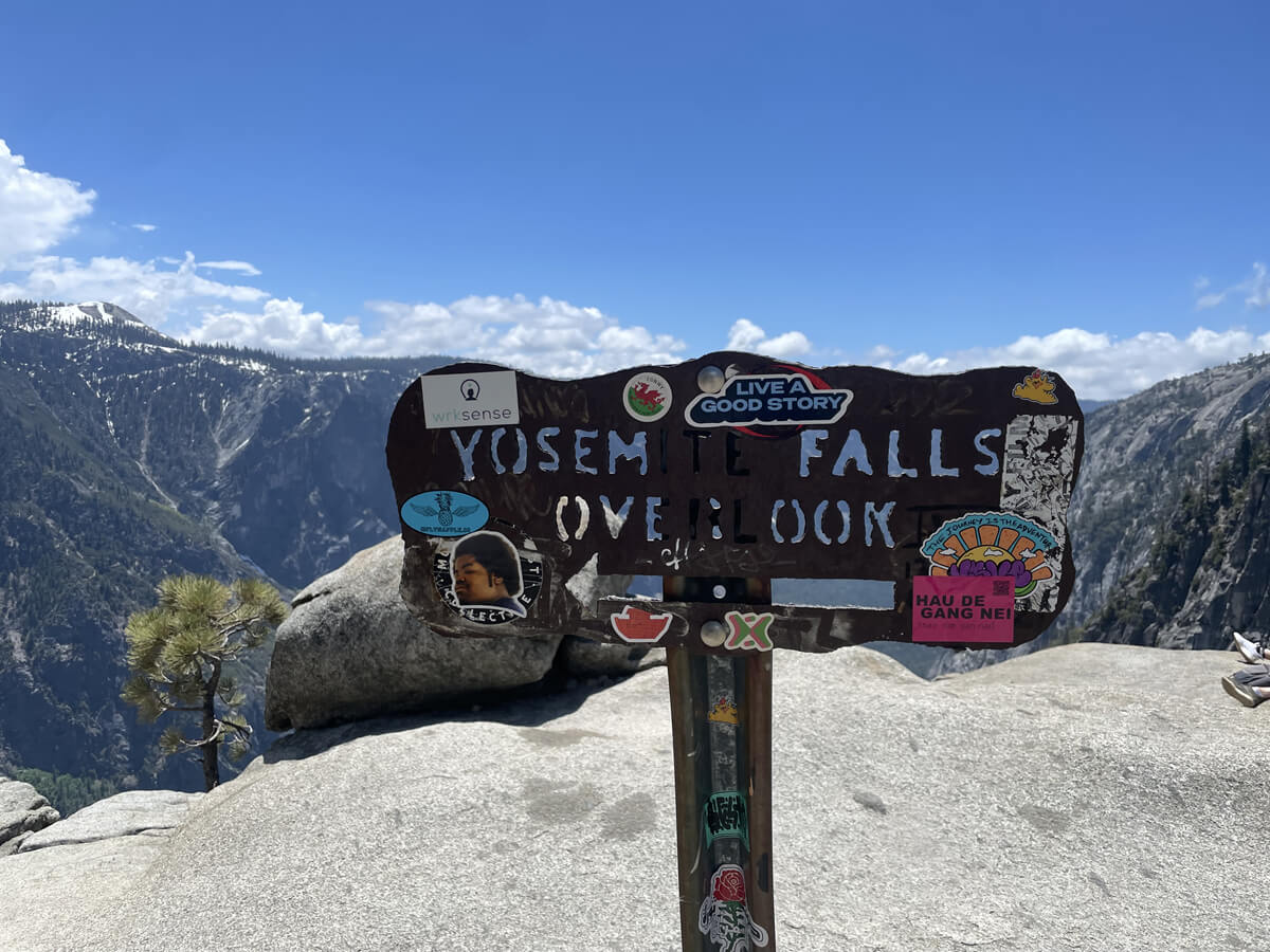
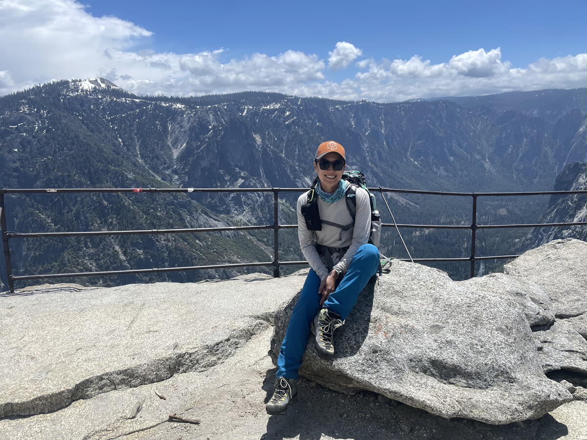
Further ahead, you will see a sign. This is the first viewpoint of the goal. It's a short break with a spectacular view. It's a great place to have lunch
The weather was great and the view was truly spectacular
As is typical in America, there are almost no handrails in most places, even if the cliffs start right in front of you, so please enjoy taking photos at your own risk and be careful
After taking a break at Yosemite Falls Overlook, we headed to the next Yosemite point
This will be our main goal today
Follow the signs back to the fork and head towards Yosemite Point
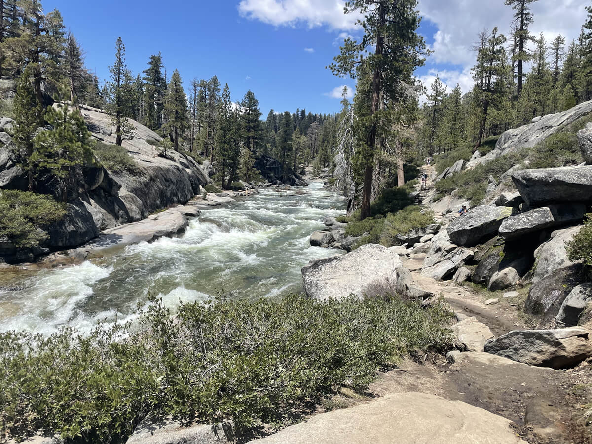
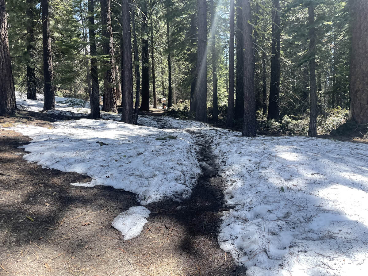
The stone steps continue to climb, and as you go further you will hear the sound of the river flowing and see a bridge (Map 3)
The bridge over Upper Yosemite Falls
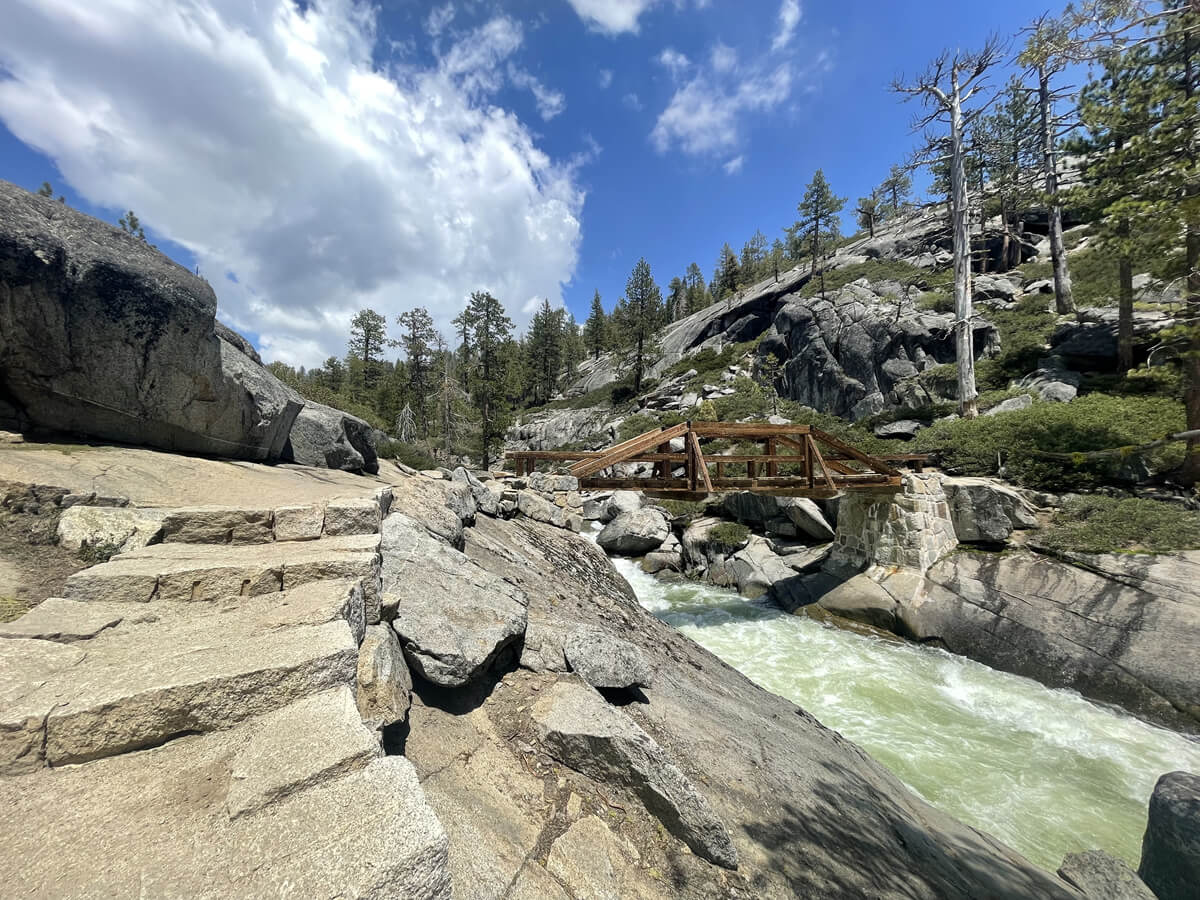
It's hard to imagine this view when you look at the falls from below, but there is actually a river like this above the falls, and melting snow flows through it and falls down as a waterfall. It's a refreshing and very pleasant place
The finish line is about 1.6 km from here
As we crossed the bridge, there was still snow on the ground
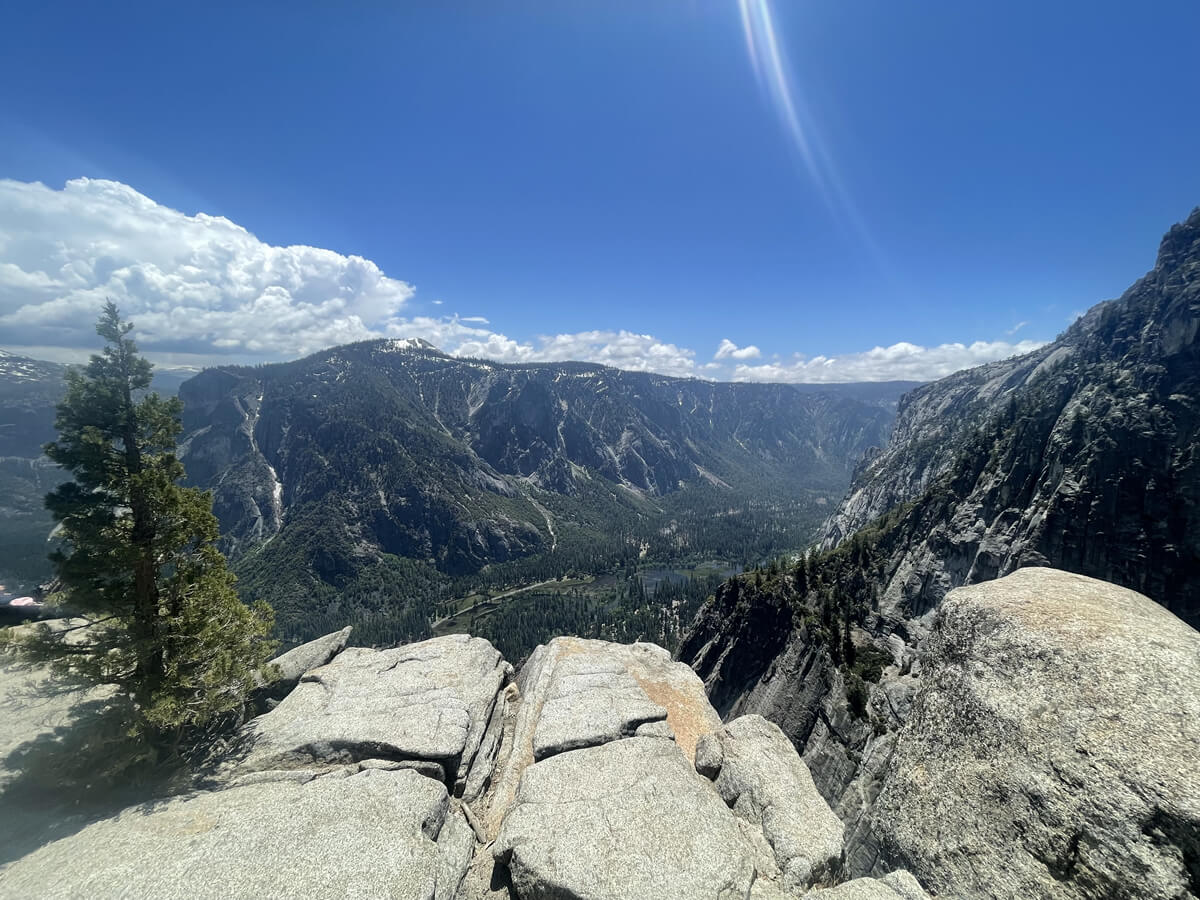
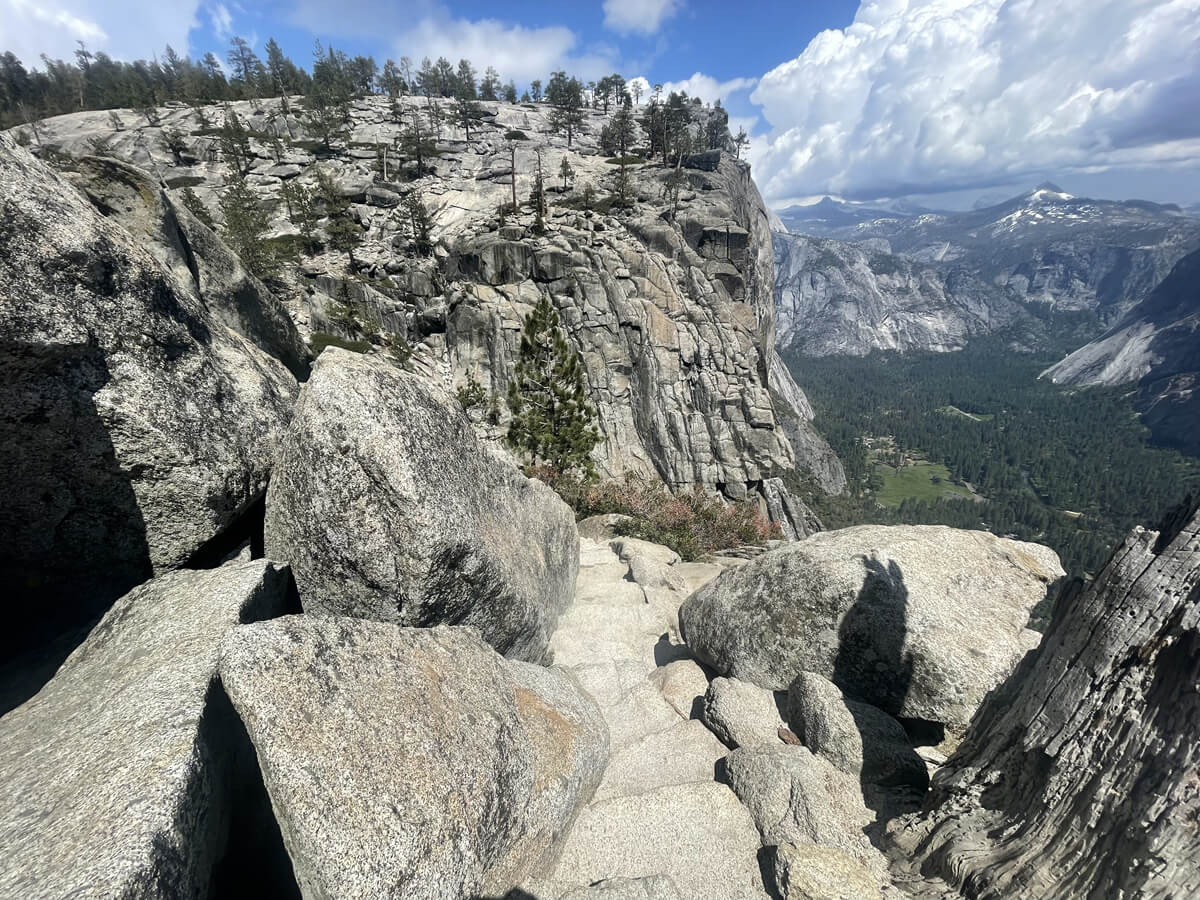
The view opens up and it's time for the final sprint. Up ahead is Yosemite Point (Map 4)

This is undoubtedly a spectacular view as well
But there's something else to see here
The reason for this place's popularity is not just the spectacular views
The highlight of this spot is being able to look down on the waterfall from above
There is a stone staircase trail leading down between the rocks in the back left of the point
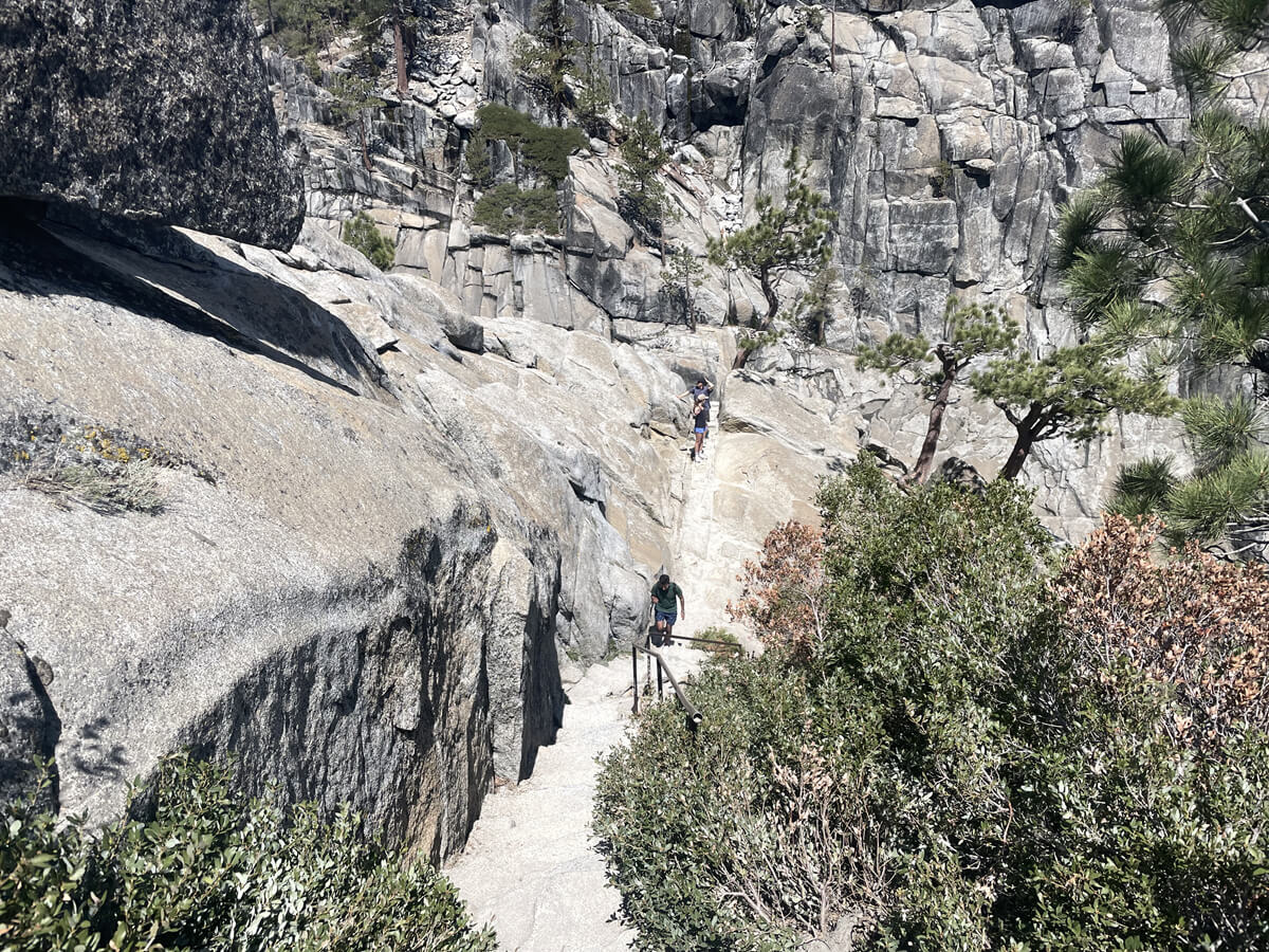
The stairs are quite steep and in some places so narrow that only one person can pass through at a time, so you have to share with people coming down from below as you go down
I continue down, holding onto the handrail which is so thin it seems like it doesn't even exist
It's really scary because there are cliffs and waterfalls right next to it
If you're afraid of heights, this place is out of your reach
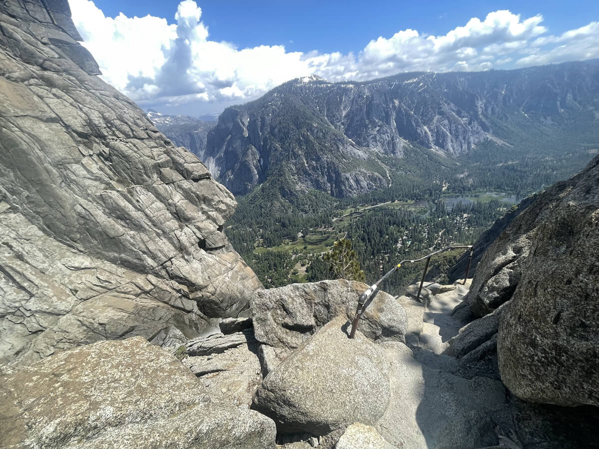
Finally, we arrived at the area directly above the falls. The falls actually flow from much higher up, but this is today's goal, Yosemite Point, where you can look down on the falls from above
More than just the spectacular view, it's also a place that's terrifying due to the sheer force and sound of the waterfall, and the reality that if you were there and there were no handrails, you would be swept away. I don't usually mind heights, but here I found myself gazing at the waterfall below with trepidation. I was completely intimidated

This feeling is unique to America, and I think it's great that there are so many places like this, thrilling places, where you can experience it through hiking
This is the true joy of hiking to Yosemite Falls. On the way back, we took the same route we came. We left around 10:00 and arrived at the parking lot at 17:00. The hike took 6.5 hours
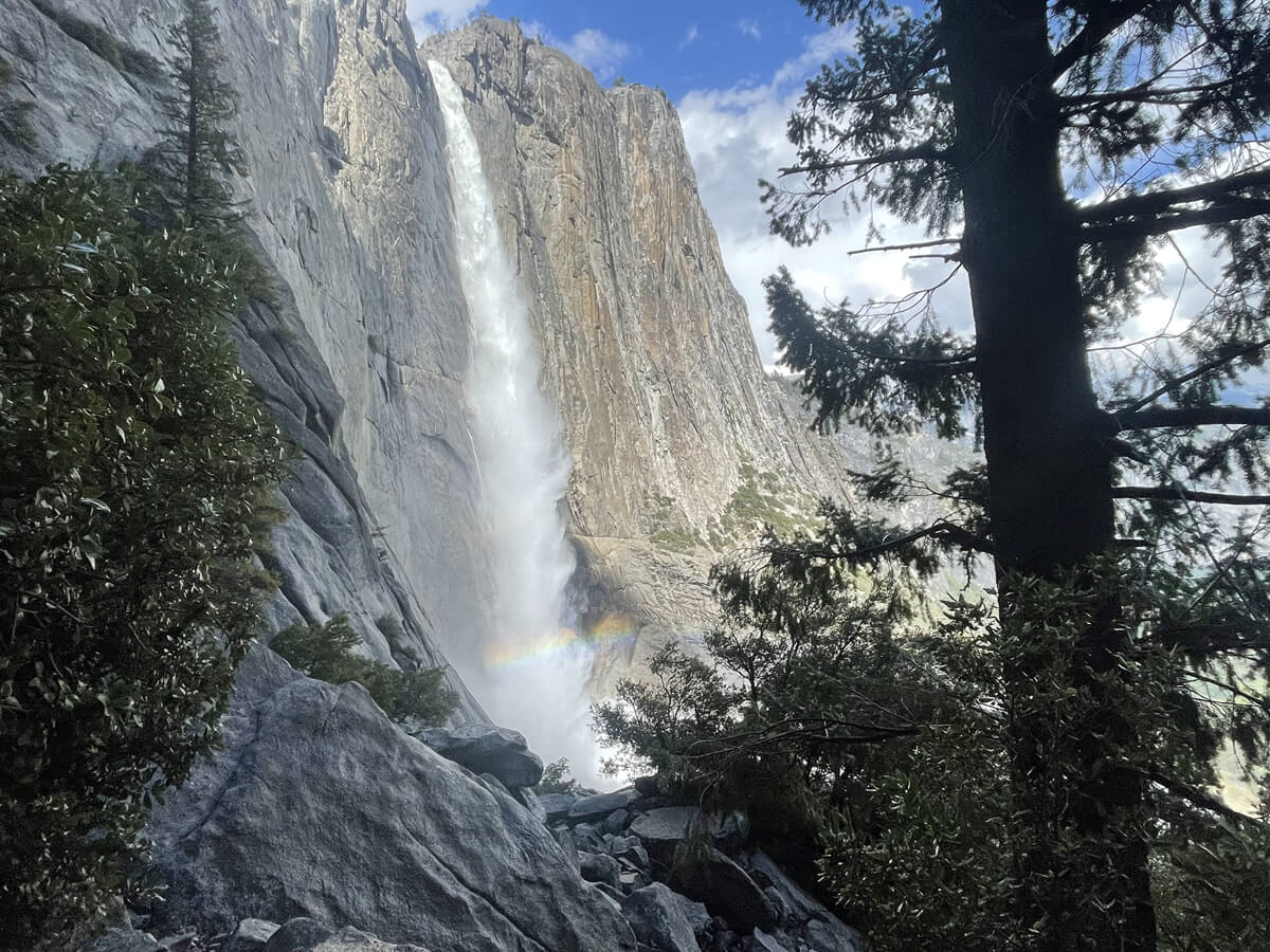
On the way back, there was a rainbow near the waterfall, and although it doesn't really show in the photo, it was very beautiful
It's a one-day hike and easily accessible from the valley, so I highly recommend it to anyone who loves hiking (mountain climbing). The view here is truly spectacular!
Sayaka Kato
 Leave your hiking and travel plans for California, including Yosemite National Park, to us. Influenced by my father, I've always loved outdoor activities, and while living in Japan, I started hiking and touring national parks, becoming fascinated by the natural beauty of America and Canada, which ultimately led me to my dream of visiting the United States. Currently, I run ANAMI TOURS, which offers local optional tours created together with clients, such as completely private hiking tours with Japanese guides. I'll introduce you to special options that I know only because I live in the area. If you're interested, please visit the website below
Related reading
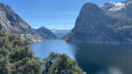 A hidden gem! Another side of Yosemite. The Rancheria Falls Trail, a second Yosemite Valley with breathtaking views. [Can you die without walking? A trip to America's National Parks (42)]
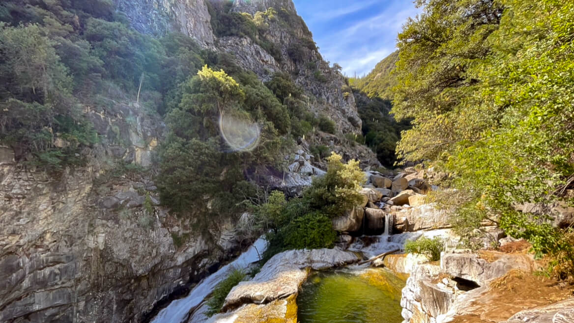 Can you die without walking? A trip to the US National Parks (28) See the waterfalls flowing through the glittering marble (Sequoia National Park)
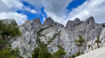 Castle Crags Trail: A tour of the majestic spires towering over the Mt. Shasta area [A trip to America's national parks (43)]
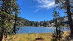 Cathedral Lakes Trail: A special trail to enjoy the quietness of Yosemite [I can't die without walking! A trip to America's National Parks (40)]