Castle Crags Trail: A tour of the majestic spires towering over the Mt. Shasta area [A trip to America's national parks (43)]
Written by Sayaka Kato
I have previously posted several articles about trails around the sacred Mount Shasta, but you should also not miss Castle Crags State Park, located near the small town of Dunsmuir, just before Shasta
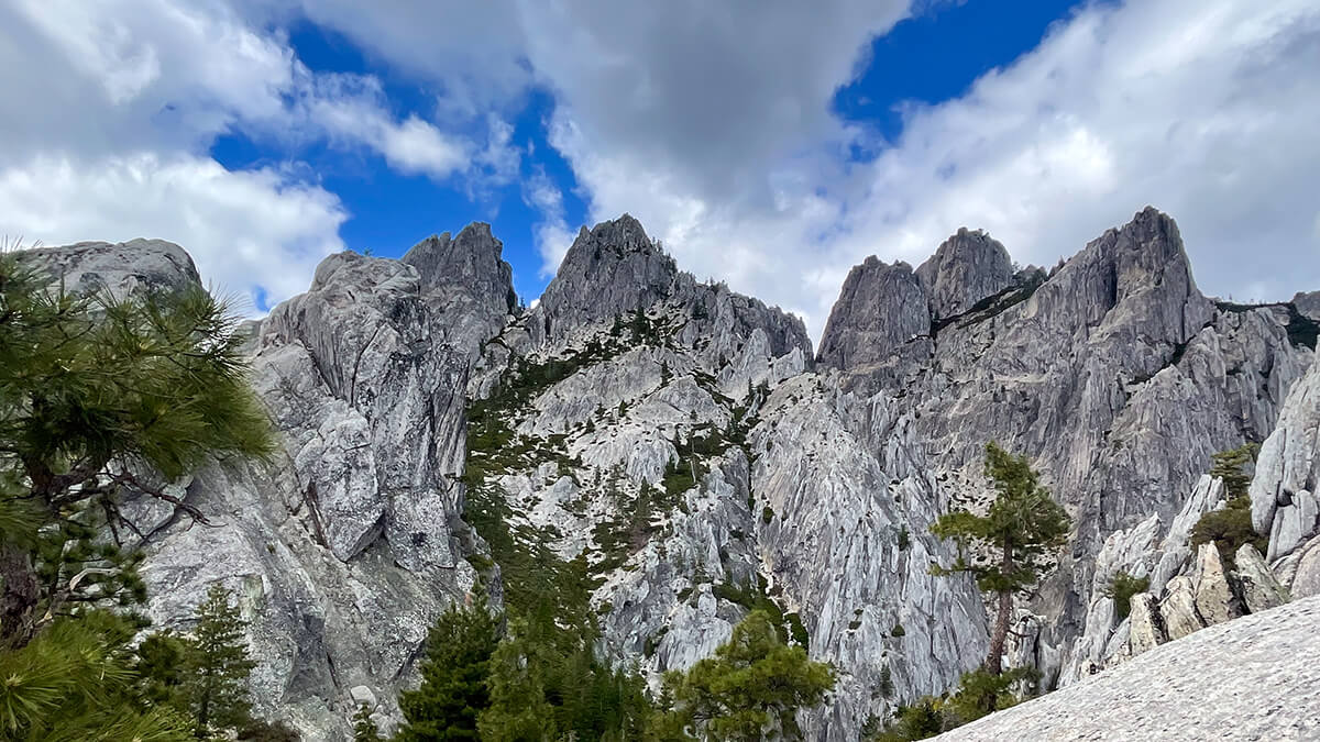
On the way to Shasta on Highway 5 from San Francisco, you can see the granite Castle Crags, also known as "Philosopher's Rock," on your left about 6 miles (9.6 km) before Dunsmuir. The jagged light gray rock formations are very cool
It is a 6,000-foot (1,830m) granite rock formation over 170 million years old and is located in Castle Crags Nature Reserve
Castle Crags State Park is open year-round and offers a variety of outdoor activities, including camping, picnicking, hiking, and fishing
This time, we will introduce a scenic hiking trail that starts within Castle Crags State Park
table of contents
Crags Trail to Castle Dome Trail Information
Access (by car to the trailhead)
Enter 20022 Castle Creek Road Castella, CA 96017 or Castle Dome Trailhead・Castella, CA 96017 (or Castle Crags State Park) into Google Maps and it will come up
The trailhead is at Vista Point Parking just inside the park
What to bring
As for useful items to bring on a hike, as always, prepare the same equipment as you would for a typical hike in the United States
- Drinks (more in summer)
- Warm clothing that can regulate your temperature (a windproof shell is helpful)
- hat
- sunglasses
- sunscreen
- Snacks to eat during the hike
- If you have any regular medications, bring first aid such as medicines and bandages
- Other than that, your favorite hiking gear
Trail Data
- Intermediate
- Best season: April to October (This photo was taken in June.)
- Round trip distance: 8.69km (5.4 mi)
- Elevation difference from trailhead: 670m
- Course time: Average 5.5 to 6.5 hours
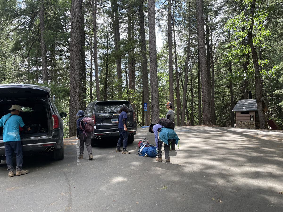
Enter Castle Crags State Park, located just off Highway 5 in Northern California, and pay the $8 entrance fee at the entrance. Pick up a map and other information, then follow the road past the campground and head toward Vista Point Parking, your trailhead for the day
Trailhead: Vista Point Parking
Start hiking from the trailhead
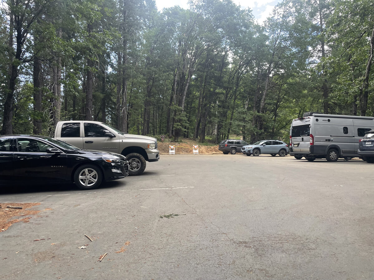
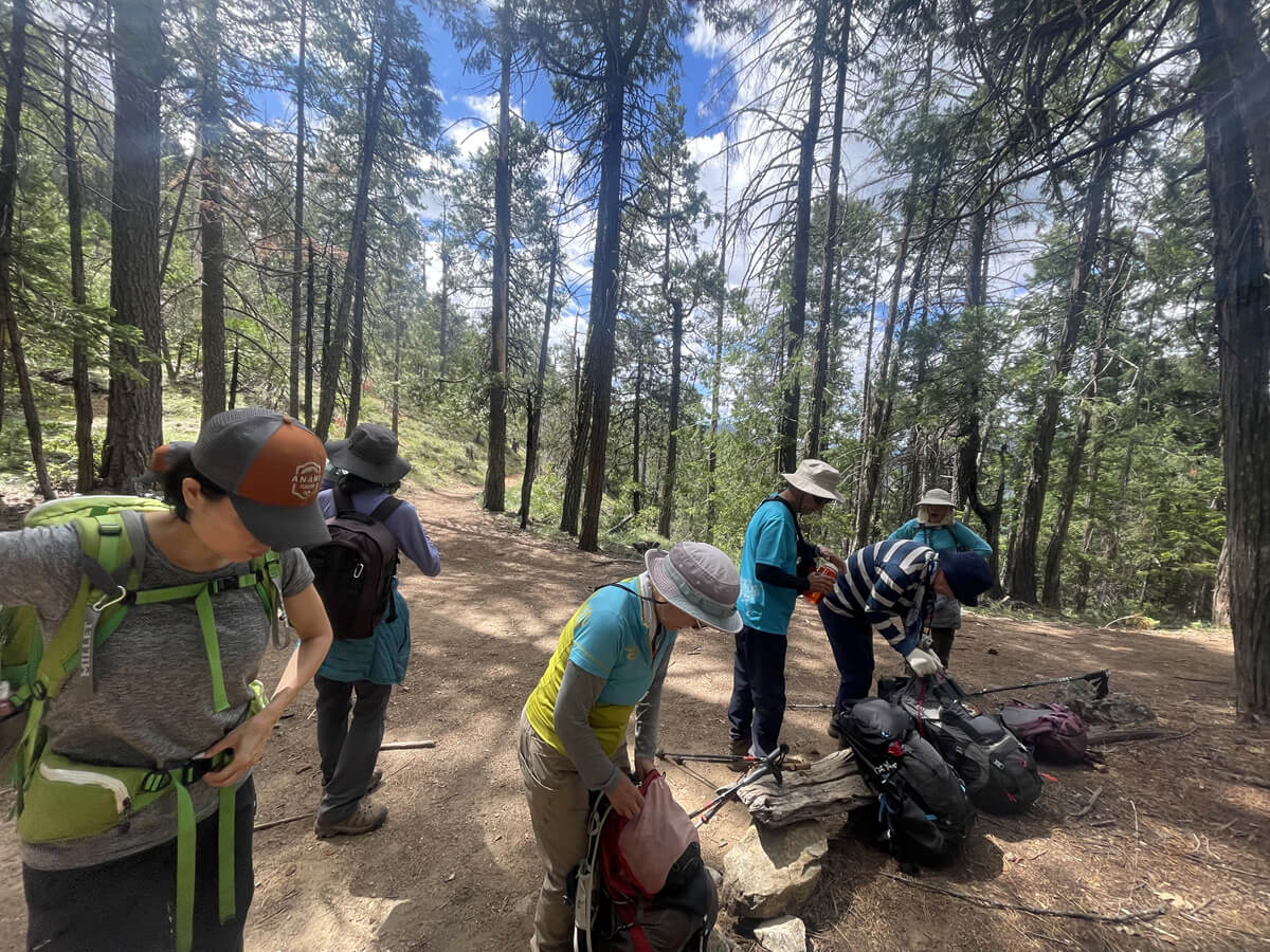
We arrived at the Trailhead parking lot (which has restrooms) just after 9:30 in the morning. There were already many cars parked there, and only a few spaces left. Since it was summer vacation, there were many children at the campsites within the park
The park has 76 campsites, each equipped with a picnic table, food lockers, and fire pits. Flush toilets, showers, and drinking water are available near each campsite
Once we're ready, we're ready to depart
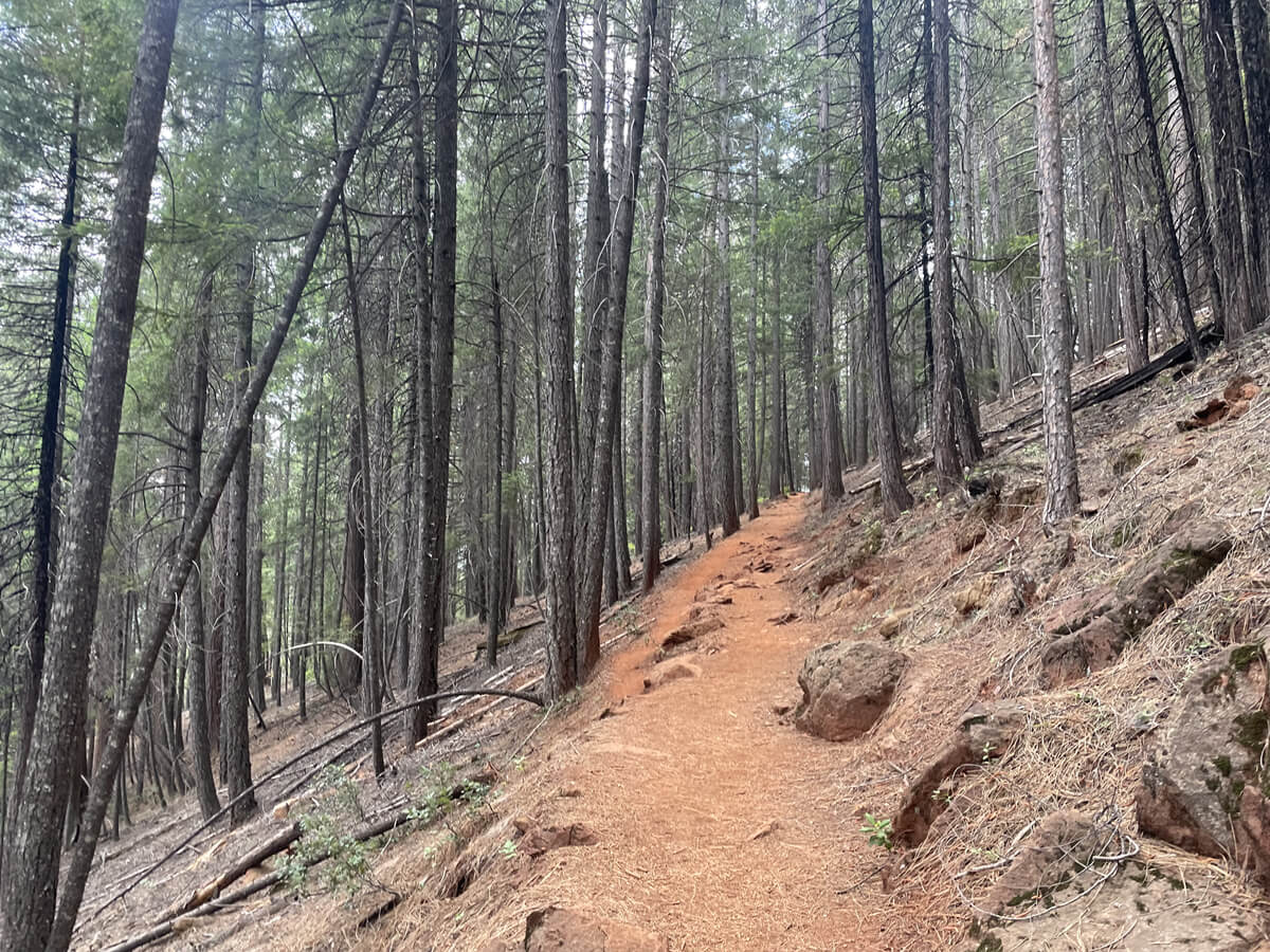
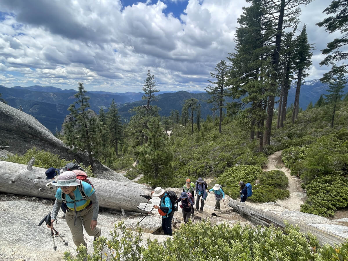
The first 1.5 miles (2.5 km) is a shady walk through forested areas, with the trail starting out flat
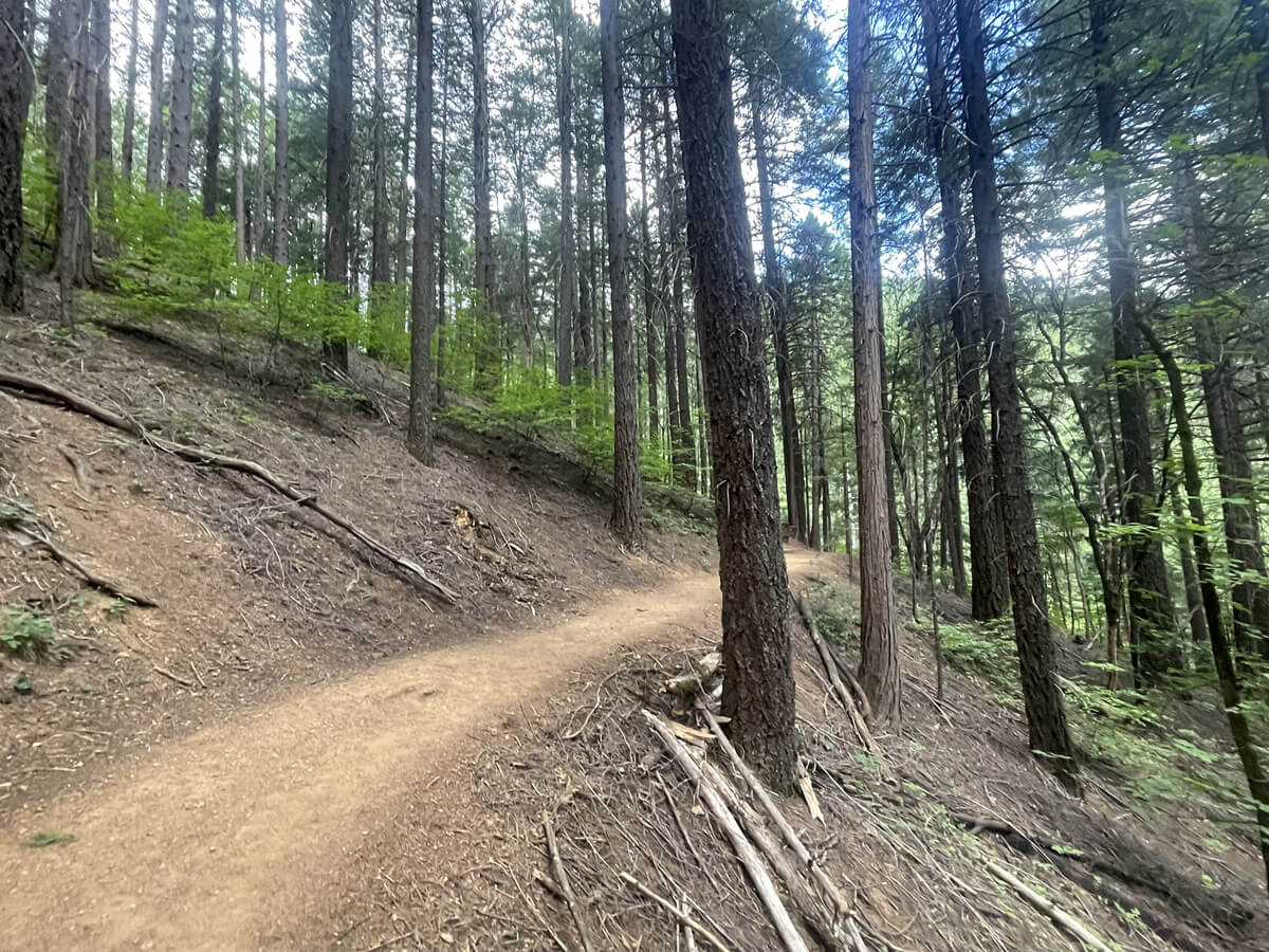
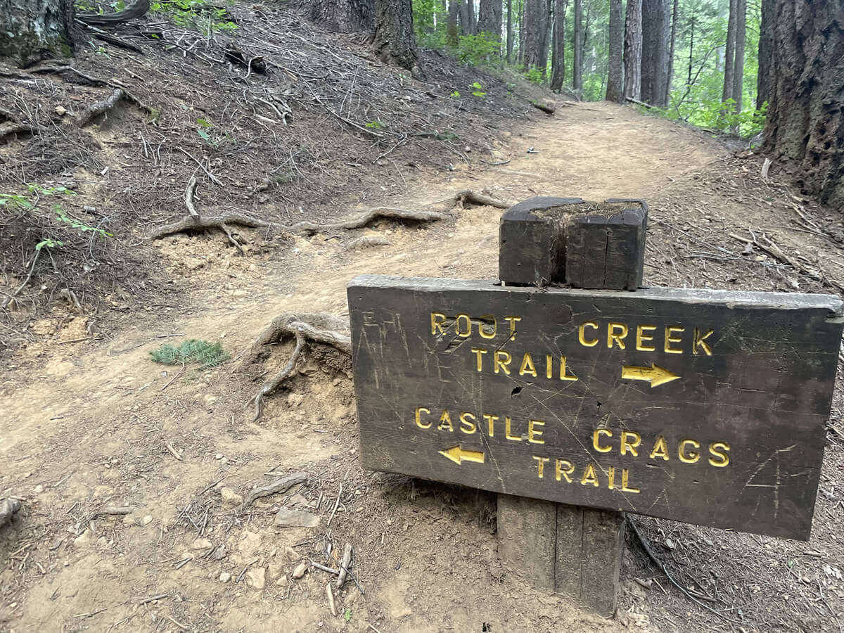
After about half a mile (just under 1 km) you will see a sign for the trail to fork in the road, so take the left towards Castle Crags
From here, the trail starts to get a little steeper. Going further, you'll come to a fork in the road that leads to the Pacific Crest Trail (PCT). The slope continues, but it's easy because the sunlight is not as strong in the forest
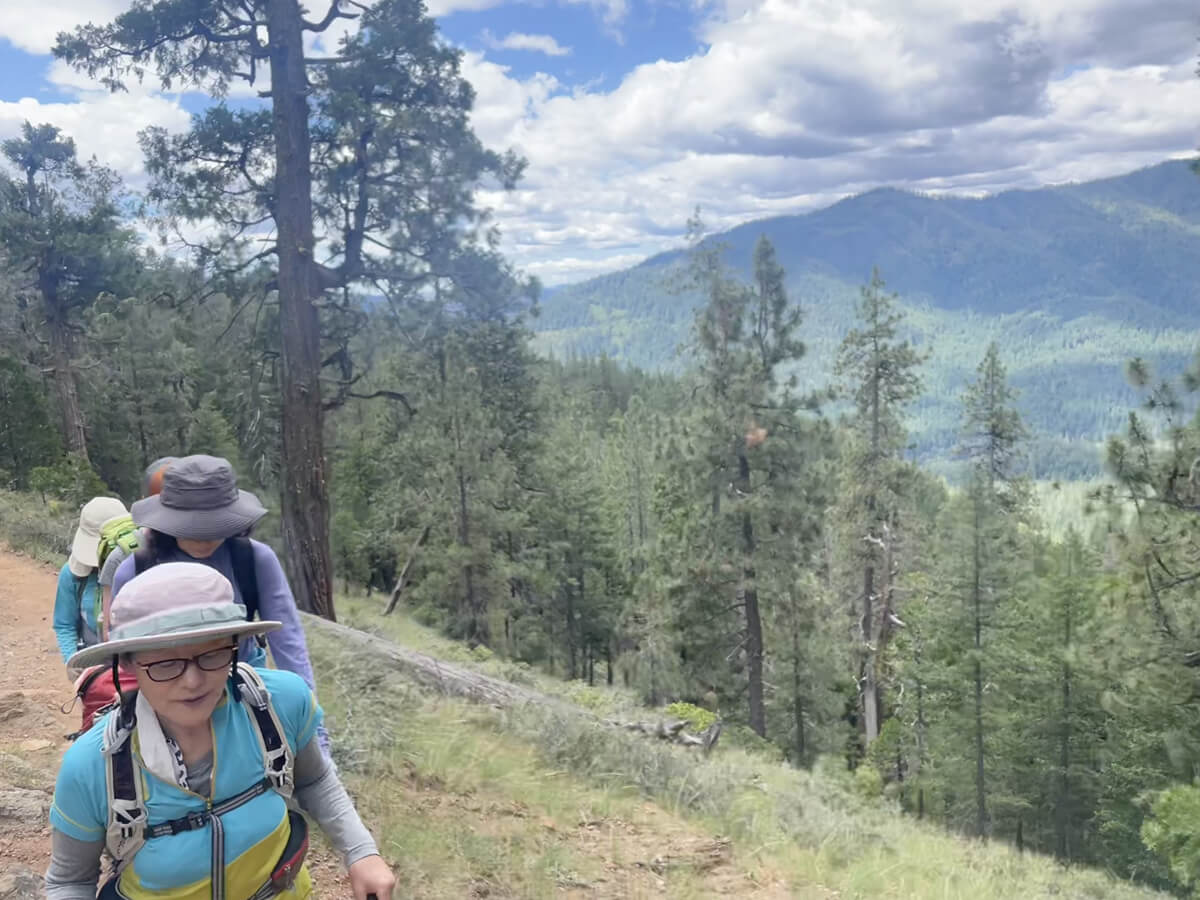
About an hour after starting to walk, the view finally opens up
The top of Mount Crag can be seen peeking out ahead, giving you an idea of how close you'll get to it
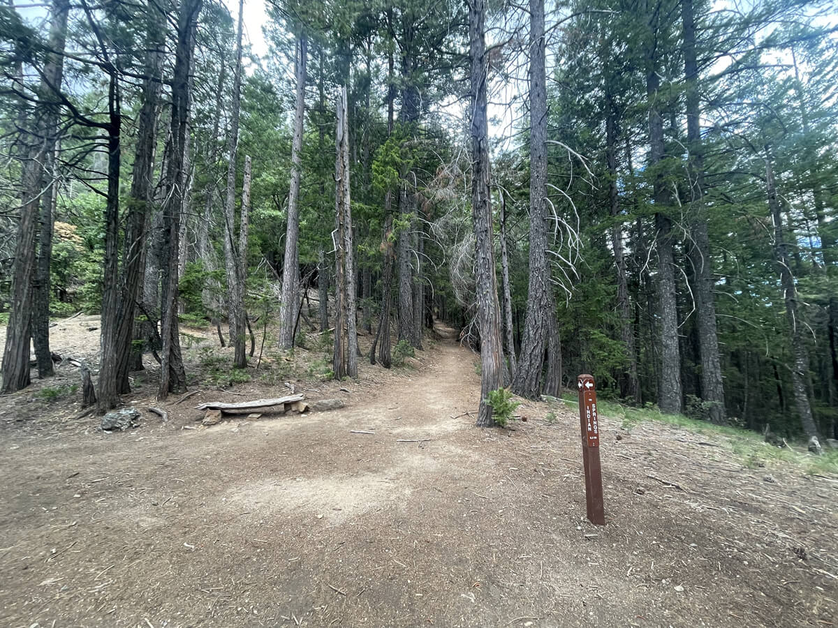
If you continue further you will see a sign for the fork in the road to Indian Springs
It's a nice flat space, so I took a break there
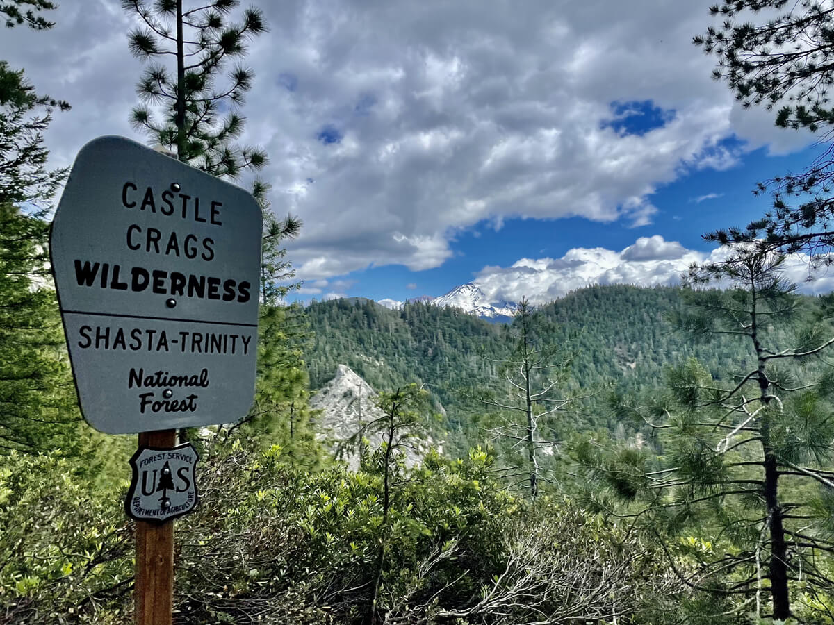
After the break we continued on and came across a sign for Castle Crags, which meant that we were actually entering the Castle Crags Wilderness area
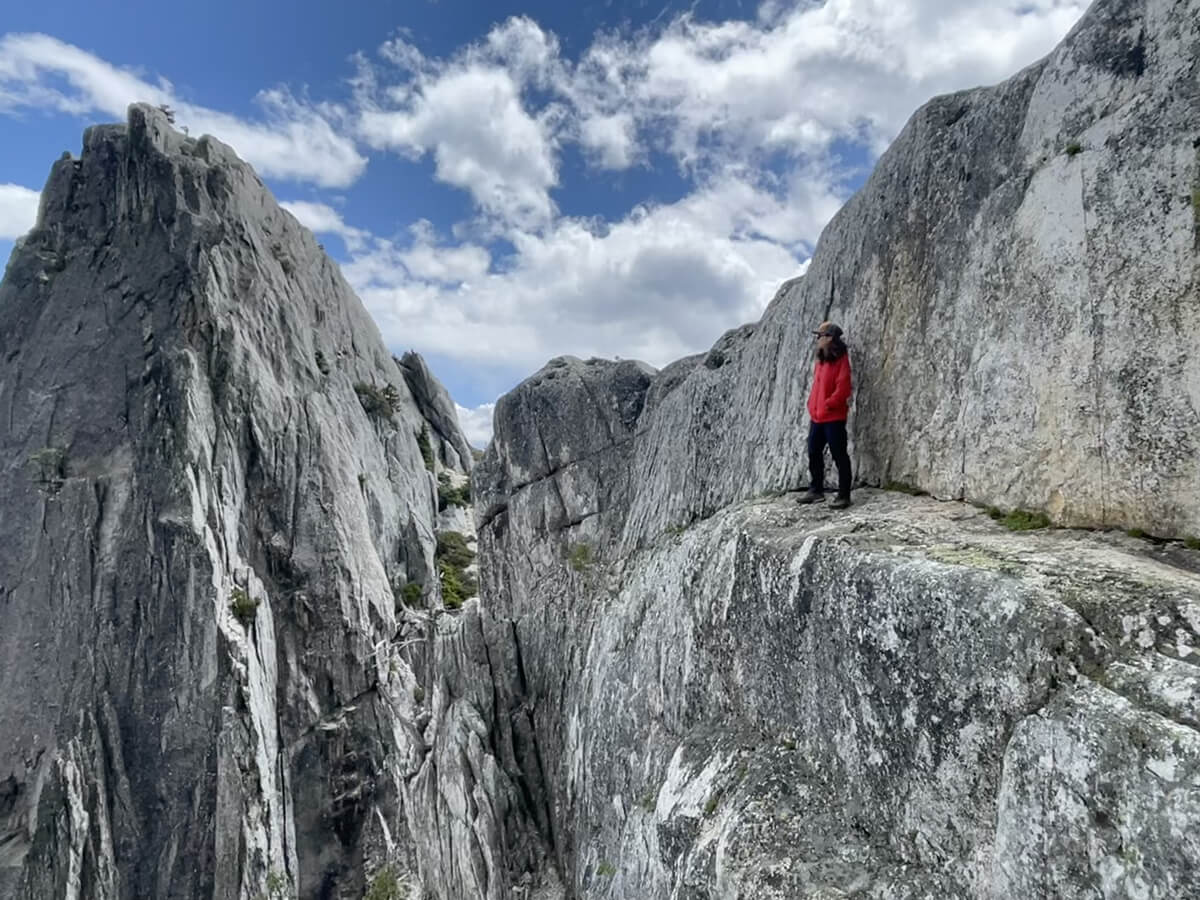
Mount Shasta is clearly visible in the view beyond
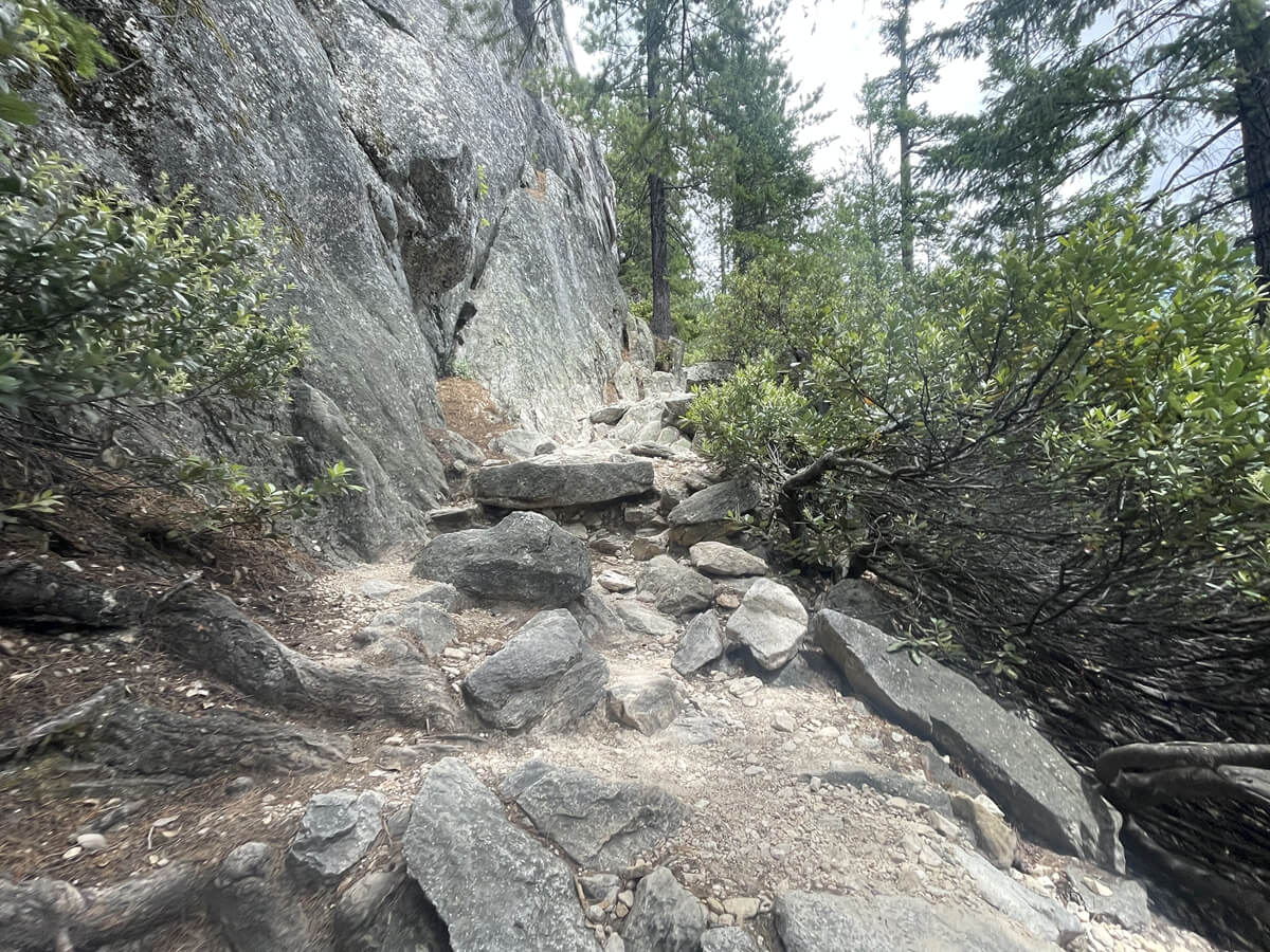
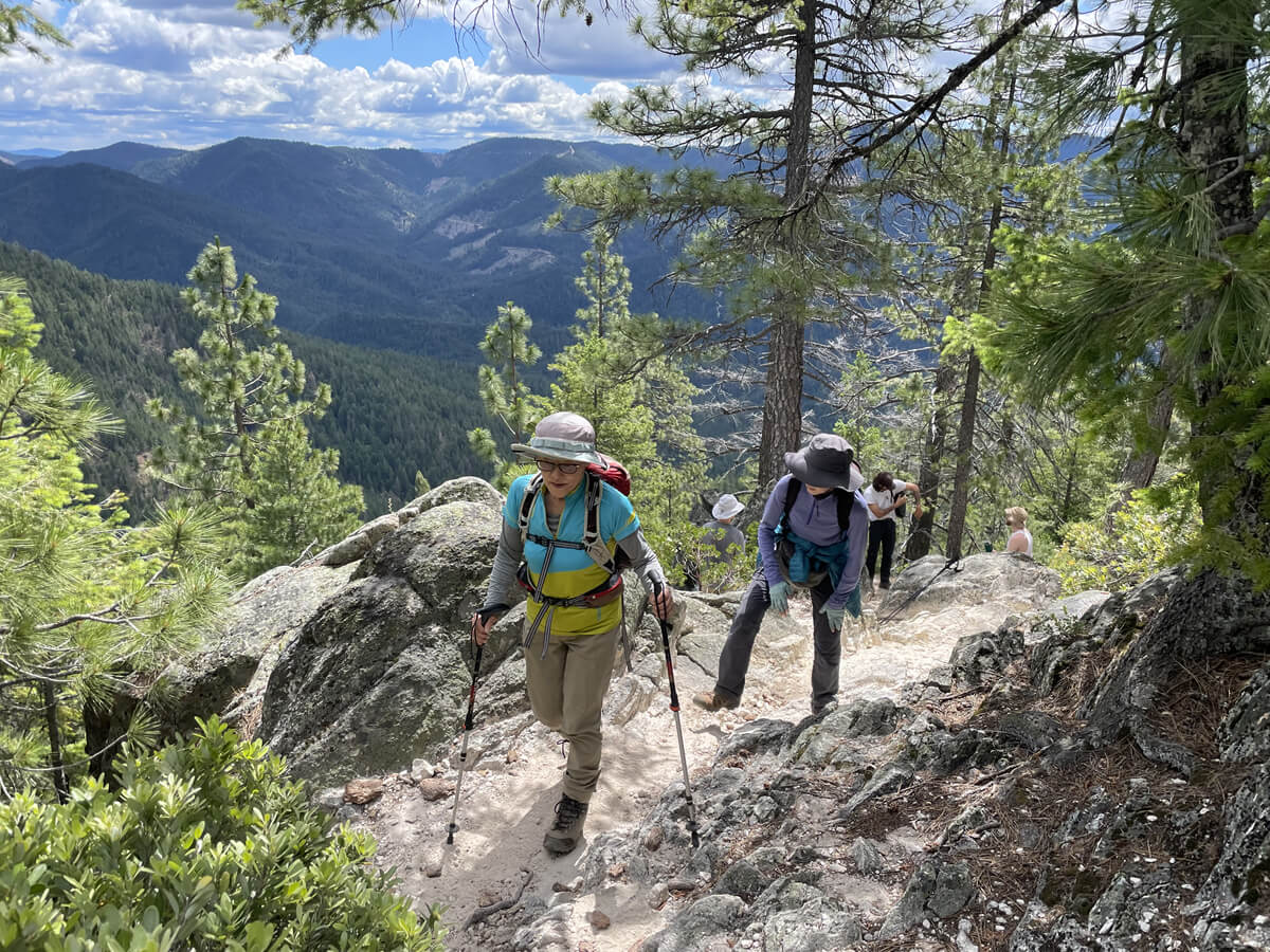
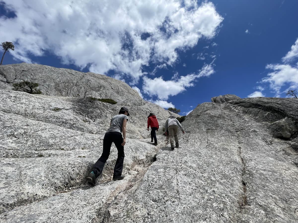
From here, it's 1 mile (1.6 km) to the base of Castle Dome, our destination for today. From here, the slope becomes really steep, and we'll climb about 1000 feet (about 300 m) from here
The basic trail is well maintained and easy to walk on, but there are some unstable areas towards the end, typical of a rocky mountain
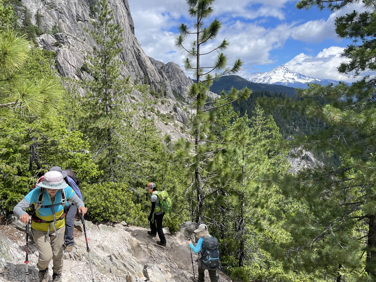
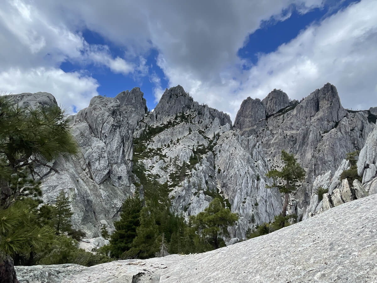
The slope continues, but the views are spectacular when the weather is good
The view from about 6.5km away. The weather was just right, sunny in the first half and cloudy in the second half
At some point, the shade disappeared, but since the altitude has increased, it's not that hot
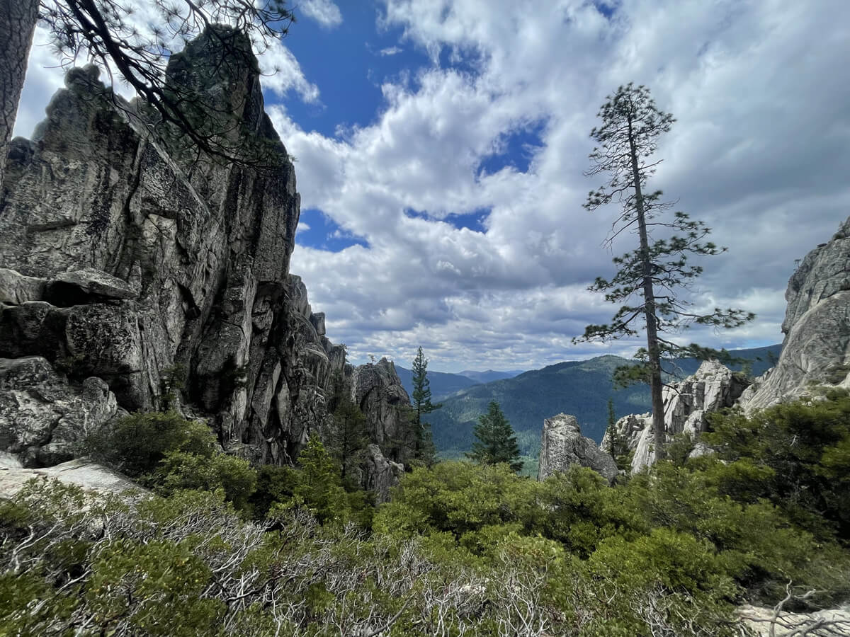
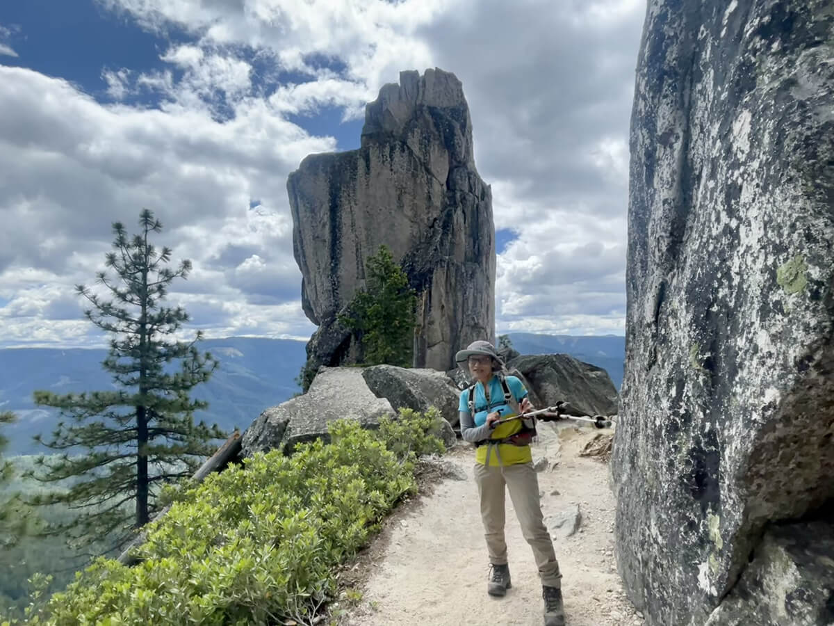
We came across rocks with unique shapes, and it felt like we were finally getting close to Mount Crag
We will move forward in the final sprint
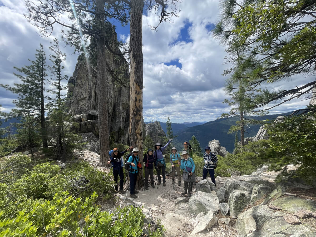
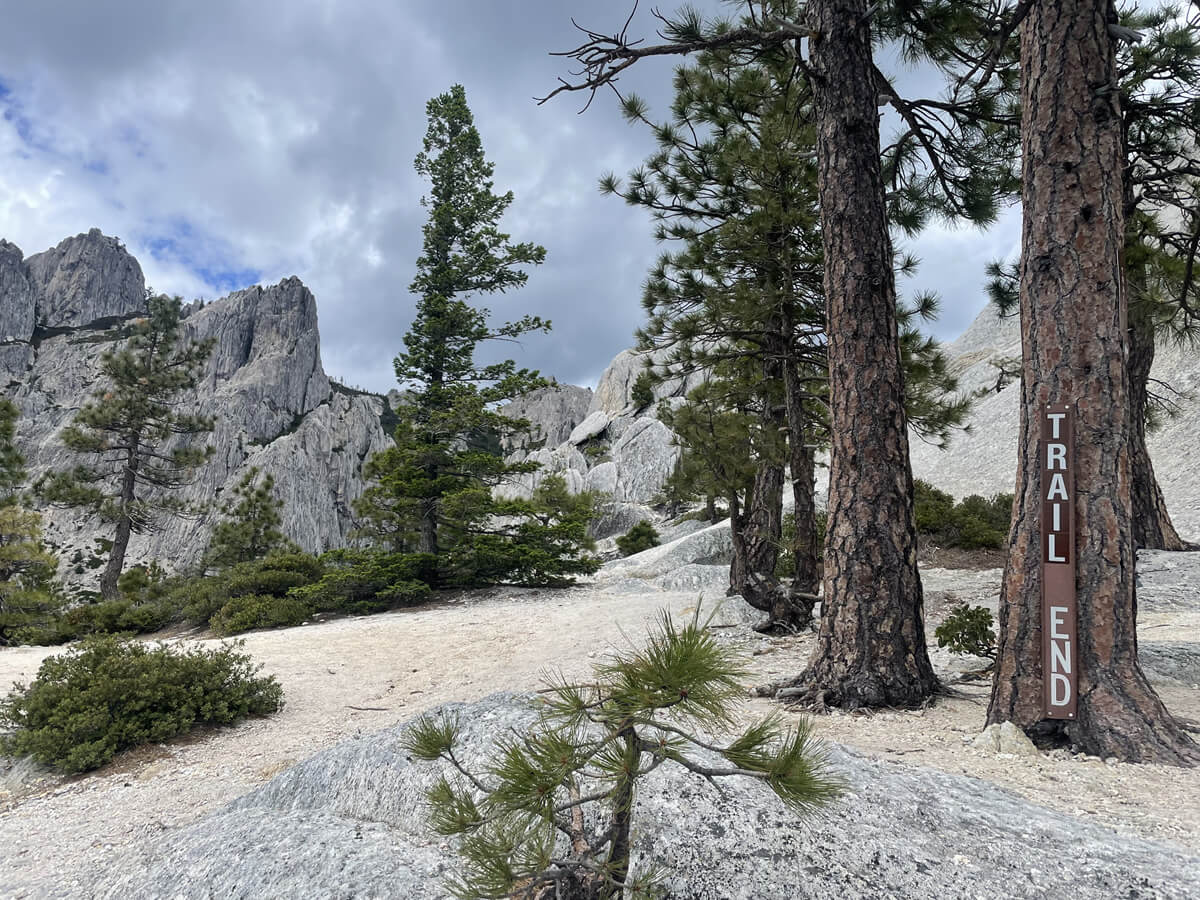
Towards the end, there are several trails that lead to the finish line, so it may be a little confusing, but the original trail is marked with a "Trail End" sign
It feels like the finish line comes suddenly, but of course the trail continues beyond that
We've now reached the base of Castle Dome, but if you go further in, you'll find a spectacular view and some easy spots to rest, so let's go find a place to rest. The surrounding crags look like this. It's cool. Rock climbing is also very popular on this mountain
After finding a place to rest and putting down our luggage, we took a walk around the area
In search of even more spectacular views, the adventure continues without a break
There is a magnificent view from the viewpoint
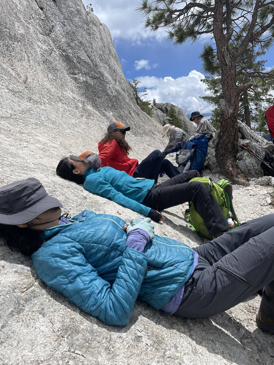
Enjoy the beautiful scenery around you. After a break, return to the trailhead on the same path
This is a recommended day hike with great views
Sayaka Kato
 Leave your hiking and travel plans for California, including Yosemite National Park, to us. Influenced by my father, I've always loved outdoor activities, and while living in Japan, I started hiking and touring national parks, becoming fascinated by the natural beauty of America and Canada, which ultimately led me to my dream of visiting the United States. Currently, I run ANAMI TOURS, which offers local optional tours created together with clients, such as completely private hiking tours with Japanese guides. I'll introduce you to special options that I know only because I live in the area. If you're interested, please visit the website below
Related reading
 Cathedral Lakes Trail: A special trail to enjoy the quietness of Yosemite [I can't die without walking! A trip to America's National Parks (40)]
 A hidden gem! Another side of Yosemite. The Rancheria Falls Trail, a second Yosemite Valley with breathtaking views. [Can you die without walking? A trip to America's National Parks (42)]
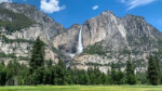 The Upper Yosemite Falls Trail: A spectacular trail packed with all the charms of Yosemite. [A trip to the American National Parks (41)]
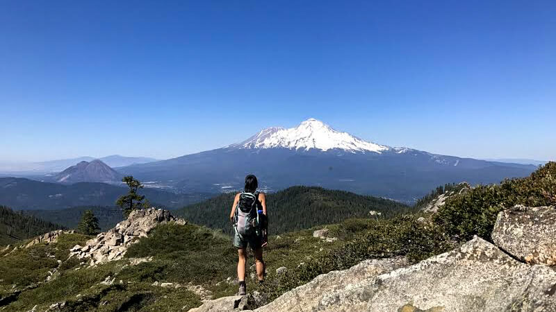 Can you die without walking? A Journey to the American National Parks (23) The Jewel of Mt. Shasta ~Castle Lake~