Previous article (Chapter 7)
table of contents
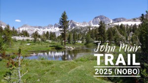
Chapter 8: Muir Pass to the San Joaquin River
On the northbound JMT, the climb is steep but the descent is flat. The trail begins at Helen Lake and Wanda Lake, a rocky plain with no vegetation. There are a few campsites downstream of Wanda Lake. Further along, stunning views continue to Sapphire Lake and Evolution Lake, with relatively good campsites scattered around both lakes. From Evolution Lake, the trail descends via switchbacks to Microa Meadow. Once again, the trail is relatively flat. After passing a famous ford, the trail switches back again to follow the San Joaquin River. The JMT connects with the Paiute Pass Trail, which then connects to the MTR.
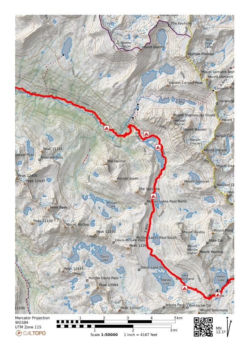
Figure 8.1: Muir Pass to Mikloa Meadows
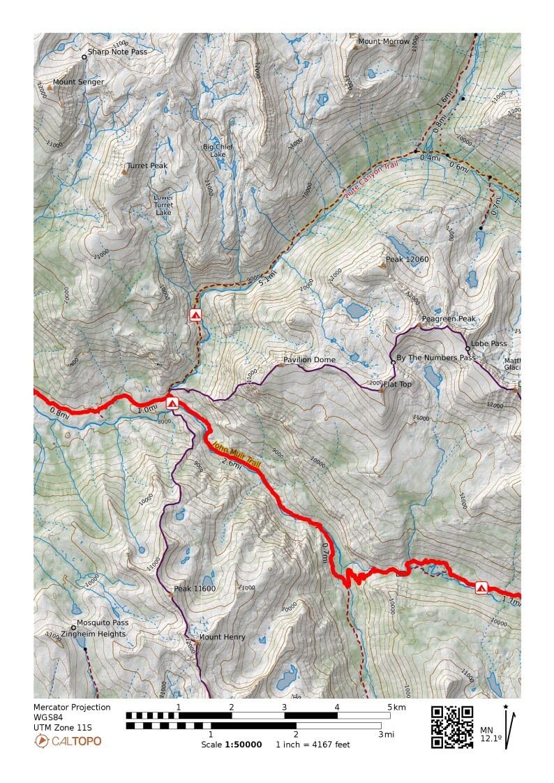
Figure 8.2: Mikloa Meadows to the San Joaquin River
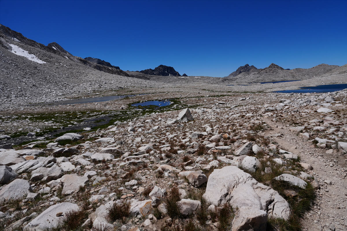
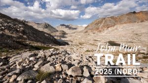
Figure 8.3: Once you get past the switchbacks of Muir Pass, the trail becomes easier to walk.
Muir Pass to Sapphire Lake
From Muir Pass, after a few switchbacks, the trail becomes relatively flat. It's a rocky plateau, but the trail is well maintained. There are a few creek crossings that are a little rough, but that's unavoidable. Water is readily available, and camping is possible, as I did, as the vegetation is scarce, so long as you're acclimatized to the altitude.
After about 30 minutes of walking, the trail passes Lake McDermand. After a short walk through rocks, you reach the shore of Wanda Lake, the largest lake. Wanda was named after John Muir's daughter. Looking back at Muir Pass from Wanda Lake, you see the view shown in Figure 8.6.
Muir Hut is at the lowest point in the photo, but because it is a rock structure, it blends in with the landscape. This means that it is finally clear that it was designed to have the least visual impact on the environment. Environmental protection in the United States is concerned not only with physical pollution, but also with visual pollution. This is why earth colors are important for clothing and tools.
In 2012, I met an exotic couple around here. They started at North Lake, descended the Paiute Pass Trail, then turned around and climbed back up. They were going over the pass and heading to La Conte Ranger Station and South Lake. That's when I first learned about this loop. I had attempted it with Chieko on the northbound JMT in 2017, but tore a muscle and failed.
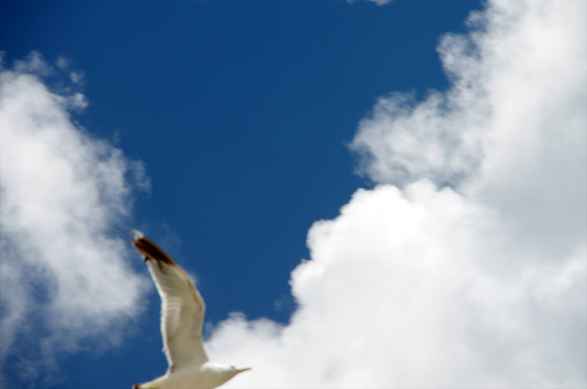
Figure 8.4: Seagulls at Muir Pass, 2012
Suddenly, a bird flew in, so I took a quick photo with my camera, but the focus was off and I missed the target. However, I took a photo near Muir Pass, so I'm including it here. It was a seagull, as shown in Figure 8.4. Perhaps because Mono Lake is a salt lake, it serves as a base for seagulls, and they fly all the way up here. The altitude is 3,600m, but it probably doesn't bother the seagulls.
The trail goes along the shore of Wanda Lake, but I noticed something a little strange. There was another trail stretching between the hills. I didn't walk on it, but it was about 100 meters long and was under construction. According to an American Facebook post, the lakeside trail is being removed for environmental conservation purposes and relocated to the top of the hill. The lakeside is a small green space, so this is an attempt to protect it. Someone apparently donated all the funds. The lakeside trail will likely be removed from next year.
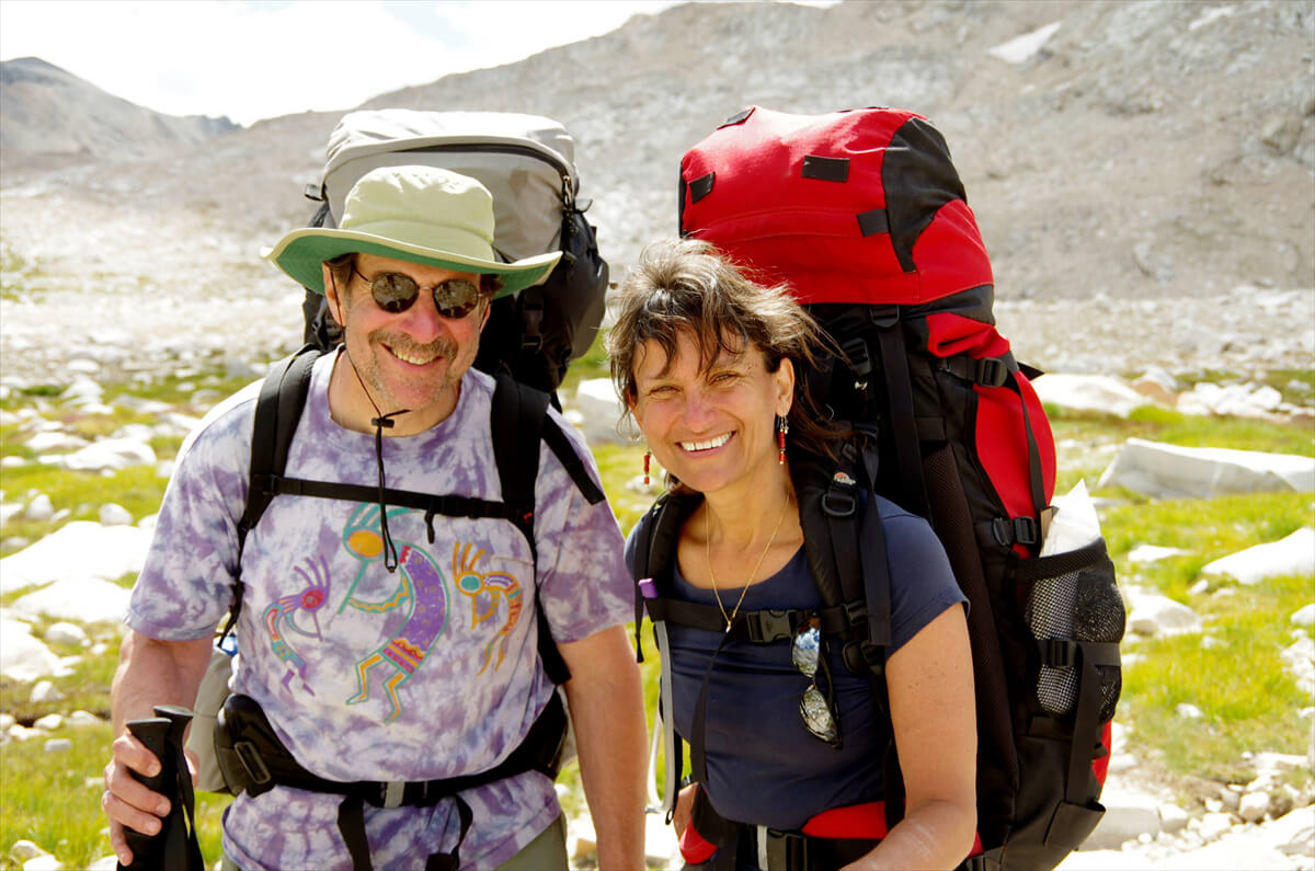
Figure 8.5: Exotic couple, photographed in 2012.
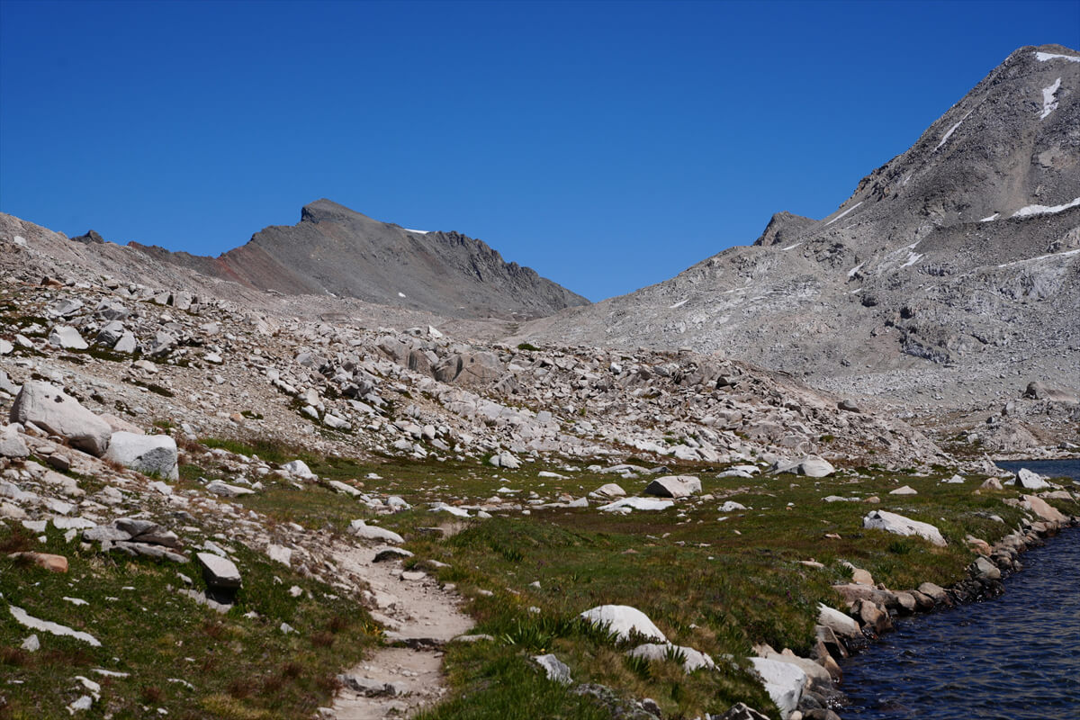
Figure 8.6: Looking back at Muir Pass from Wanda Lake
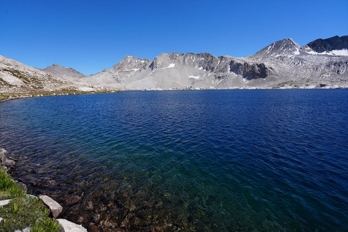
Figure 8.7: Wanda Lake
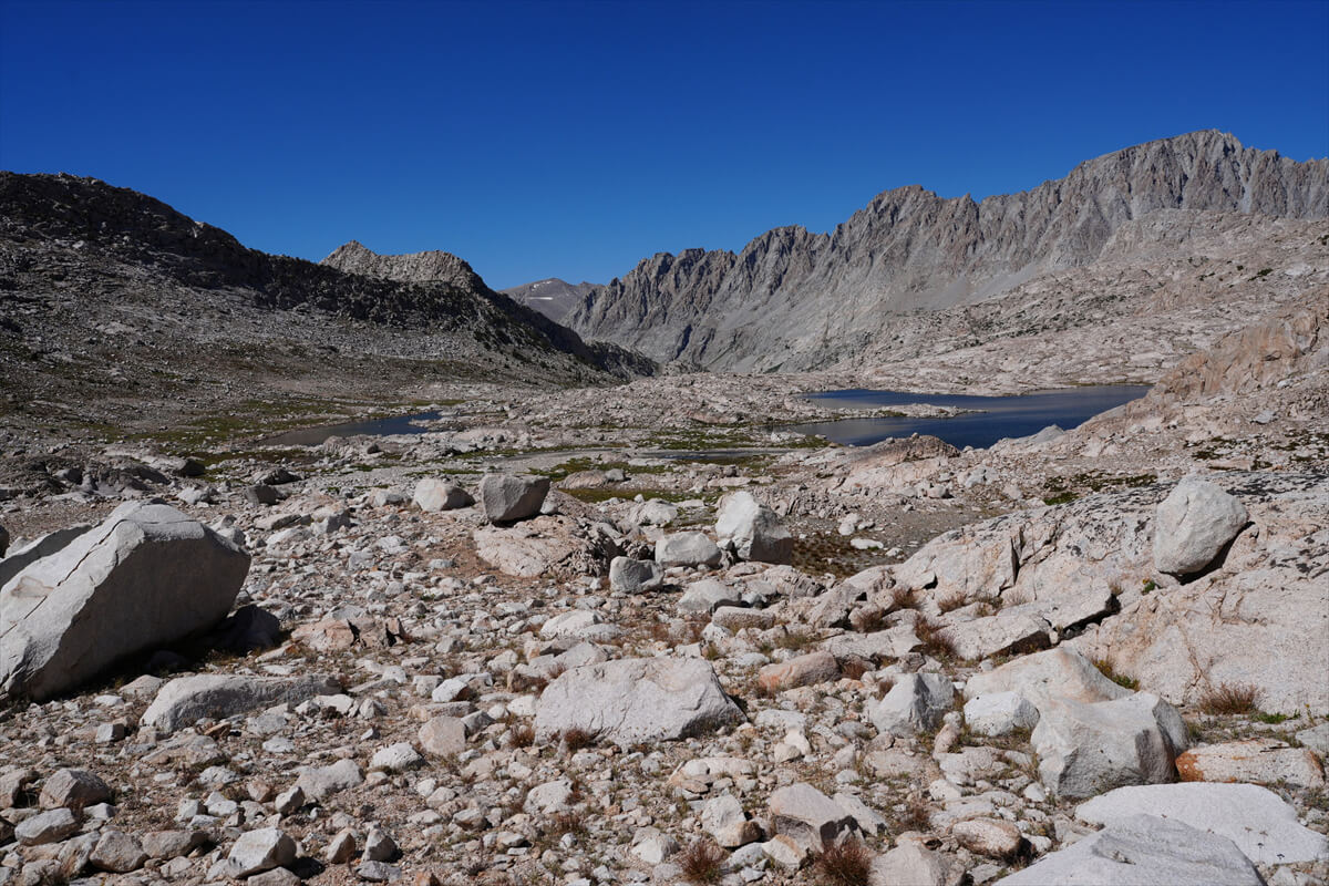
Figure 8.8: Unnamed lake, Sapphire Lake in the valley ahead.
The river from Wanda Lake had little water and many exposed rocks. I almost got lost when crossing. I descended a slightly bumpy trail and arrived near an unnamed lake just before Sapphire Lake at 3:40. The lake was quite dry and had a different shape. As usual, it took longer than expected. I think I might make it to Sapphire Lake.
I got a call from James.
"A shower and a burger."
Looks like we've arrived at VVR.
"It's good to meet you. I've been reading your posts on the PCT mailing list and on Facebook for years. It'll be interesting to meet you in person."
"I'm just a regular old guy. I'm heading to Evolution Lake." After walking a little, three hikers caught up with me. Naturally, they passed me, so I could photograph them from behind. That's Figure 8.9. I didn't look at their faces, but judging from their backpacks, I can tell the father is in the lead with a Mariposa 60, followed by the daughter with an Ariel AG 75, and then the son with a Zenith 88L. Osprey backpacks are common on the JMT. It's definitely a great place for families to hike the JMT. The JMT is popular in the summer because of its stable weather, especially from late July to early August. After that, thunderstorms become more frequent. Because the pass is over 3,000 meters above sea level, thunderstorms often develop after 4 p.m. These thunderstorms often turn into lightning and hail. I've experienced these thunderstorms at Mount Whitney, Guitar Lake, Mather Pass, and Muir Pass. Both are in the afternoon.
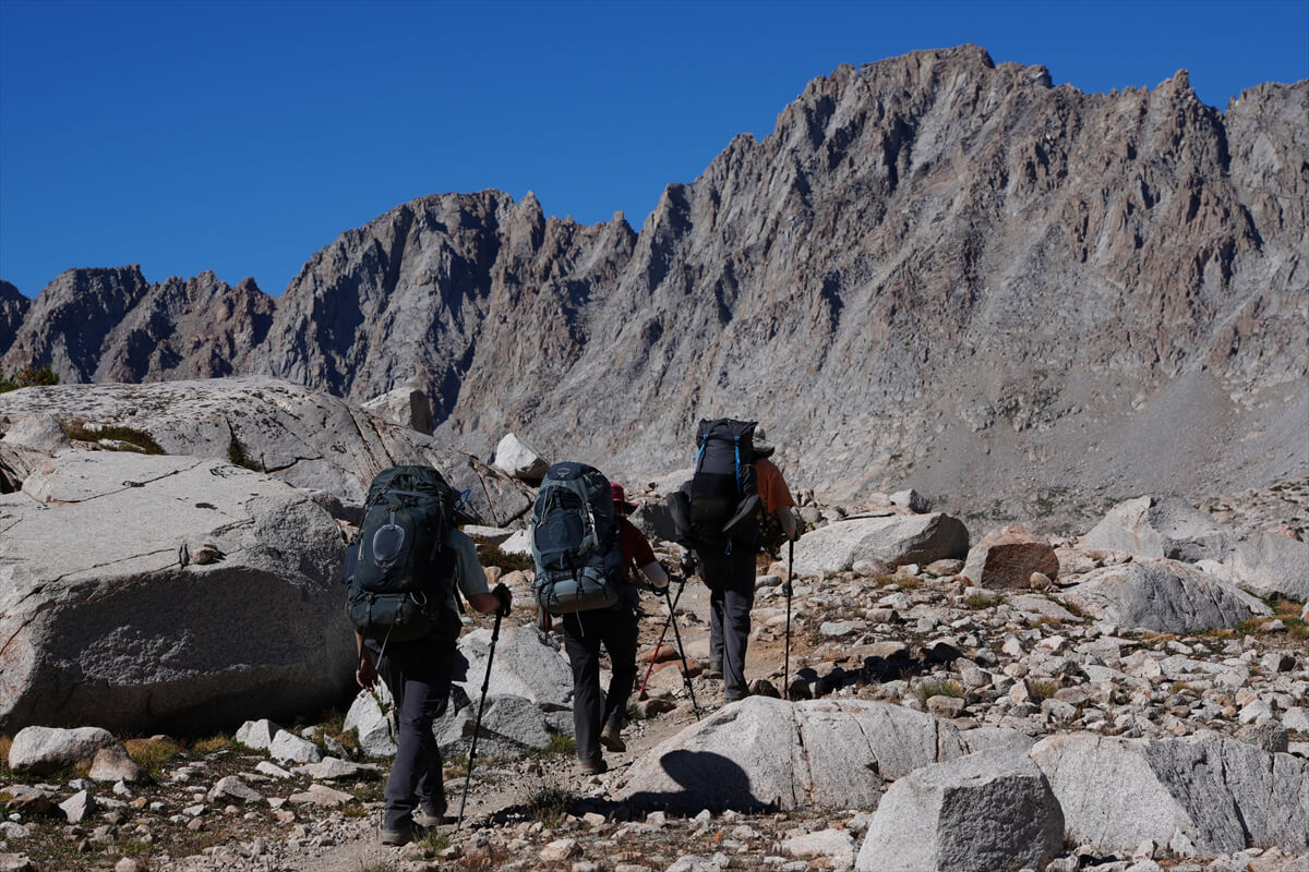
Figure 8.9: JMT hikers passing Sapphire Lake
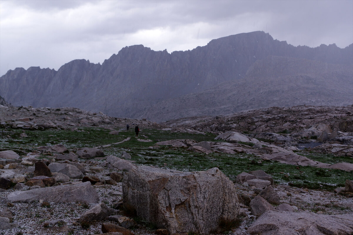
Figure 8.10: Hail starting to subside near Sapphire Lake in 2016.
In 2016, I was accompanied by a photographer. The morning start was about 1 km south of the La Conte Ranger Station, which wasn't a bad spot. However, due to the schedule, the photographer struggled with acclimatization. He also had a small backpack, which made packing difficult and led to a slow start.
It was almost 5 o'clock when we arrived at Muir Pass. The weather was starting to deteriorate. There were several people inside Muir Hut. Normally, we would have been looking for a campsite, but there were no good spots nearby. He was in a hurry due to his schedule. We had no choice but to press on. This was a mistake. A thunderstorm immediately hit. We kept walking, thinking it would stop soon, but it didn't. We put on our rain jacket, but didn't bother putting on our rain pants because it was too much trouble. The rain turned to hail, and the thunder continued. We started to shiver, so we set up a tent at Sapphire Lake as an emergency shelter. Eating something warm helped us stop shivering, but it was the biggest mistake of the JMT. From this point on, we made sure to wear stronger rain gear and pants that could be fully unzipped.
We arrived at Sapphire Lake at 5:00. Since it was an hour away from Evolution Lake, we gave up. Since we knew the area, we planned to pitch our tent upstream, so we walked around looking for a site. When we found a suitable spot, we went straight down off-trail and set up our tent. This is shown in Figure 8.11.
The backpack was acting strangely. I investigated and found that one of the nuts on the swing mechanism of the backpack had come off. I found the nut inside the backpack, screwed it back in, and secured it in place with glue. Once I had calmed down, I contacted Chieko.
"There were lots of famous places to see, so I took lots of photos. I'll send you a few. I think we left Helen Lake after 11 o'clock. We ate some almonds and refilled our water, which made us late. We reached the pass around 1 o'clock, and an older woman who seemed to be the leader took some photos for us. We had lunch inside Muir Hut, and by the time we set off, the older woman group was gone. Those going round the pass were lightly dressed, and didn't have bear canisters. Those doing the JMT were, as expected, heavily armed. By the way, one of the screws on my backpack had come off. I found a nut and fixed it with glue. That's why I'm late in contacting you. I'm going to have a mirin-dried fish set meal now. Tomorrow's goal is to cross Evolution Creek. The road is pretty good, and it's mostly downhill. We'll manage."
I sent my location information when I set up my tent, and then I received an email from James saying, "It's a great campsite where you can be alone. I love Sapphire Lake. It's a gem."
Although it was a little late, we had a mirin-dried fish set meal for dinner. We had enough food for three days, but the Pro Bar snacks were so delicious that we ran out. We had no choice but to substitute it with JMT bread
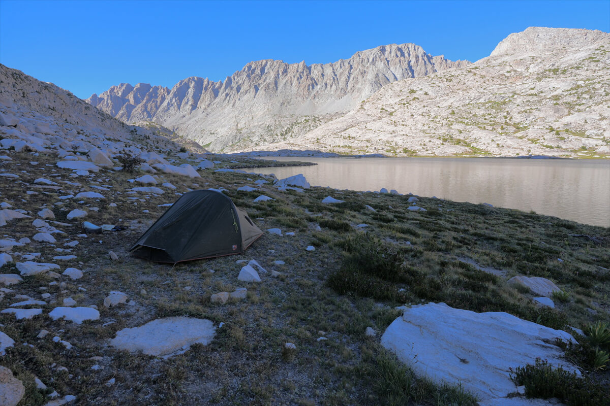
Figure 8.11: Camping at Sapphire Lake
Sapphire Lake to Evolution Valley
I slept with the fly open at the entrance. There was no wind. It was somehow warm. However, the temperature inside the tent in the morning was 10°C, which must have been because my body had gotten used to it. I woke up around 5:00, had my usual breakfast, and left at 6:30. Figure 8.12 shows a morning at Sapphire Lake.
At the bottom of Sapphire Lake, we crossed over stepping stones. This year, the water level was low, so it was easy. Next, the trail continued between the rocks of a narrow valley.
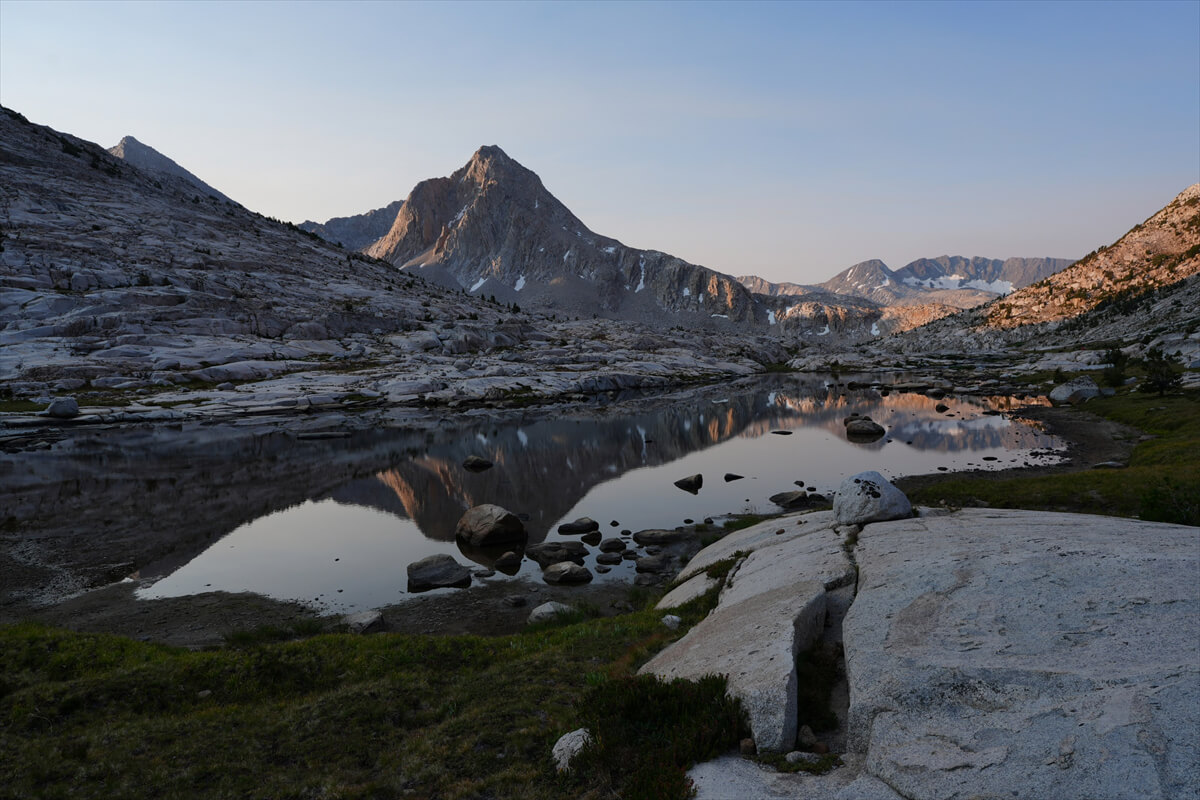
Figure 8.12: Morning at Sapphire Lake
A hiker caught up with me from behind. Of course, I let him go first, but he had a rather unusual backpack, so I took a photo from behind. That's Figure 8.13. The backpack was a Swedish Fjallraven Kaika 75. He was probably a hiker from Europe. I've never seen an American carry a Swedish 75L backpack. Incidentally, I also carry a Swedish Thule. They have a wide range of sturdy outdoor products.
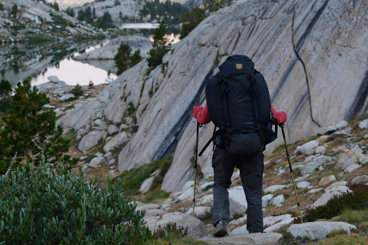
Figure 8.13: A hiker with a huge backpack. This is likely a European hiker.
As I walked along the trail between the rocks, I came across a pika. For some reason, this was the second time I'd seen one this year, and they didn't run away much. (Figure 8.14) Then, a deer with its young appeared. I've never seen a deer here before. (Figure 8.15) There was also a Grosbeak (Ptarmigan), but I failed to photograph it. Perhaps this is due to the lack of hikers. I've never seen so many animals here.
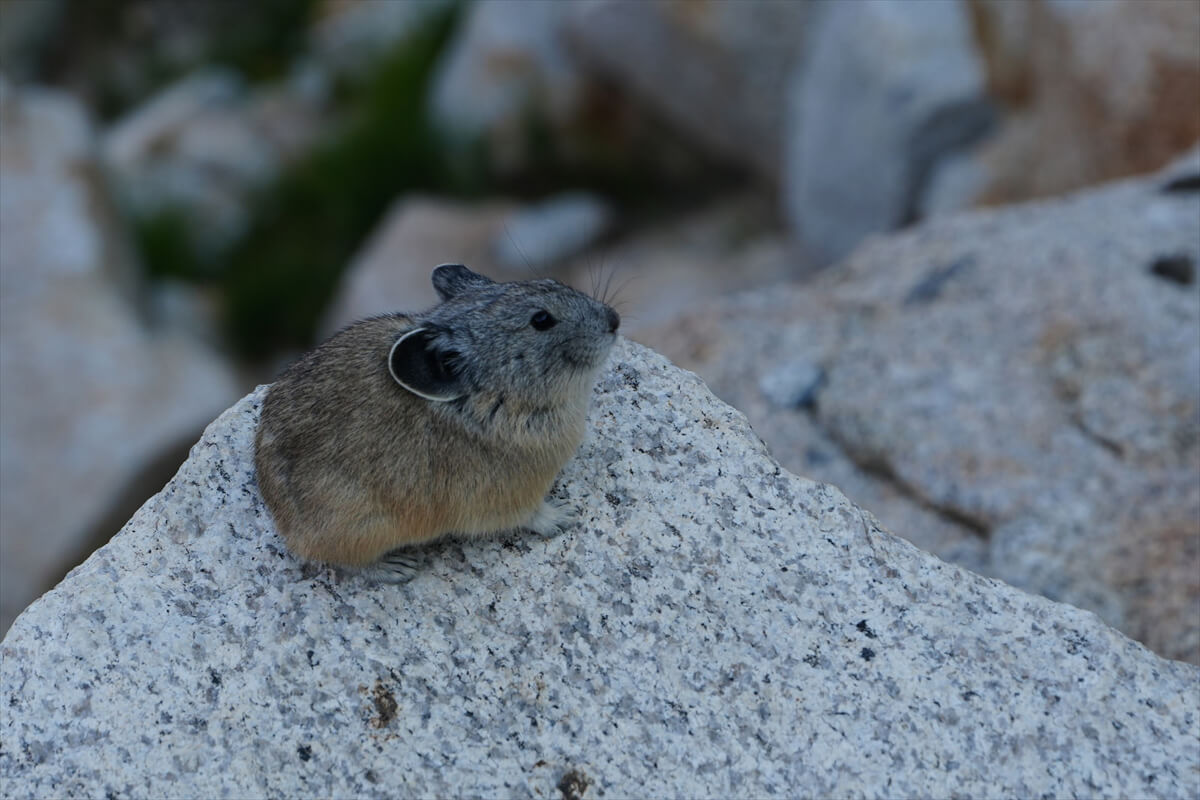
Figure 8.14: Pika
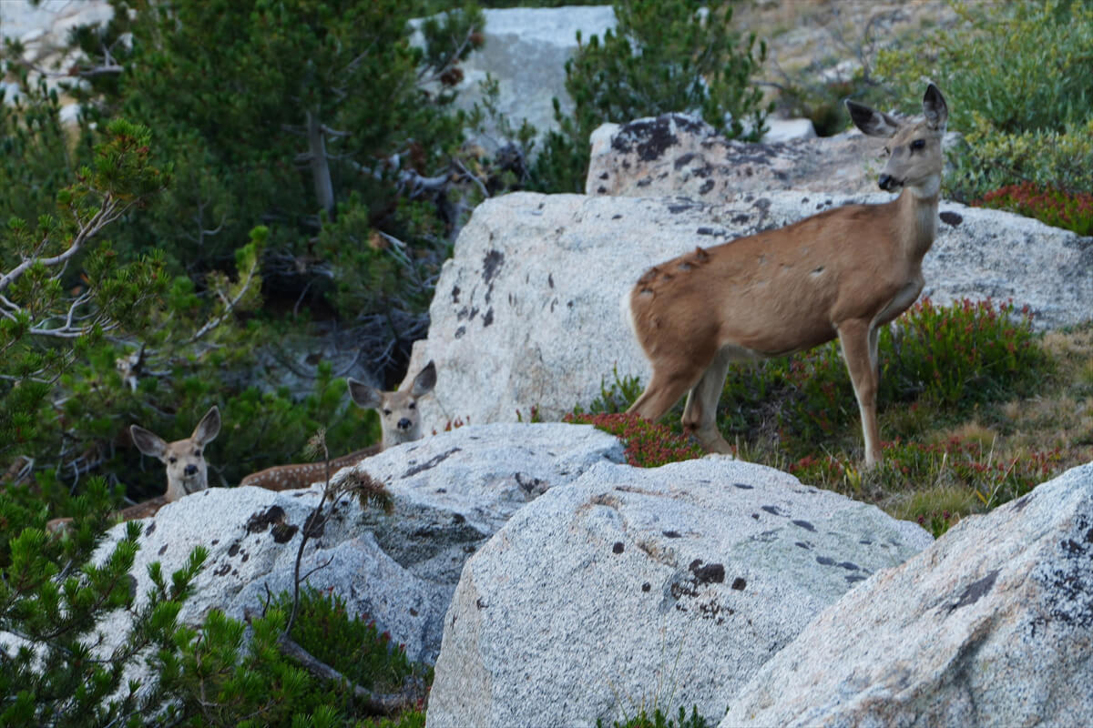
Figure 8.15: Deer with their young
We arrived at Evolution Lake around 8:30 in the morning. I sent the photo in Figure 8.16 to Chieko, who gave it a good response. We took a break and replenished with 1 liter of water. When we first arrived, we were confused because we couldn't pitch camp around the lake, but we found that there were various campsites among the pine trees northeast of the lower reaches of the lake.
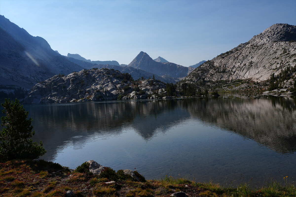
Figure 8.16: Morning at Evolution Lake
In 2019, we had to camp in a place with little vegetation as an emergency evacuation due to an approaching evening shower. (Figure 8.17) There was a tarp a little upstream. Japanese people are the only ones who camp under a tarp on the JMT. I went to check and say hello, and it turned out to be two Japanese women. I was a little worried about whether they had permits, but it seemed fine. I often have trouble talking to Japanese people in ultralights, so I just said hello.
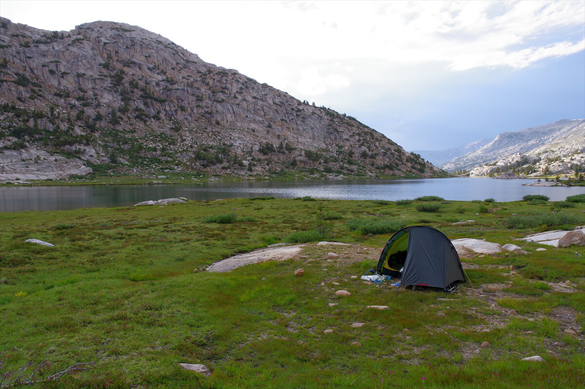
Figure 8.17: Emergency evacuation at Evolution Lake, photographed in 2019.
We left Evolution Lake a little after 9:00. The small pond downstream of the lake had dried up. At that time, we passed a couple who appeared to be married. From their accent, they sounded Japanese, but they only greeted us in English. Since I don't look particularly Japanese, and I'm not particularly interested in Japanese people, we just passed each other.
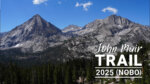
When you reach the rocky area, you can see Mount Hermit (Figure 8.18). From the vantage point, you zigzag down and enter the forest. Once again, you come to a gentler area with better views, but this is a small campsite.
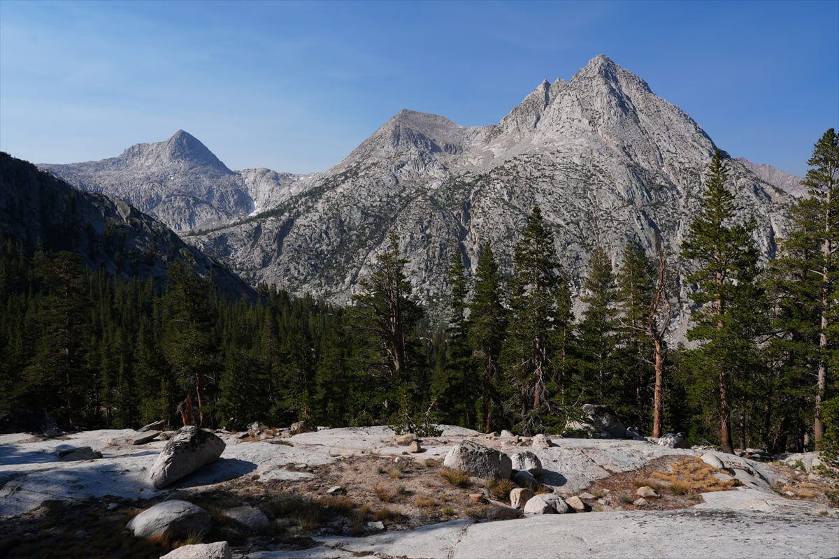
Figure 8.18: Mount Hermit
As I was walking along, checking things out, I noticed a pair of underwear tights stuck to a huge rock. It seemed like someone had washed them and forgotten about them. If it had been something valuable, I would have picked it up, but since it was underwear, I didn't feel like touching it. So I left it there and went down.
As the altitude decreases, bushes begin to appear. You may also cross streams. For reference, Figure 8.19 shows an example of an American trail. The actual trail heads to the left, but rocks have been placed to prevent rainwater from flowing in, causing the flow to change to the left. Japanese people often confuse the direction of the rainwater flowing with the trail and get confused.
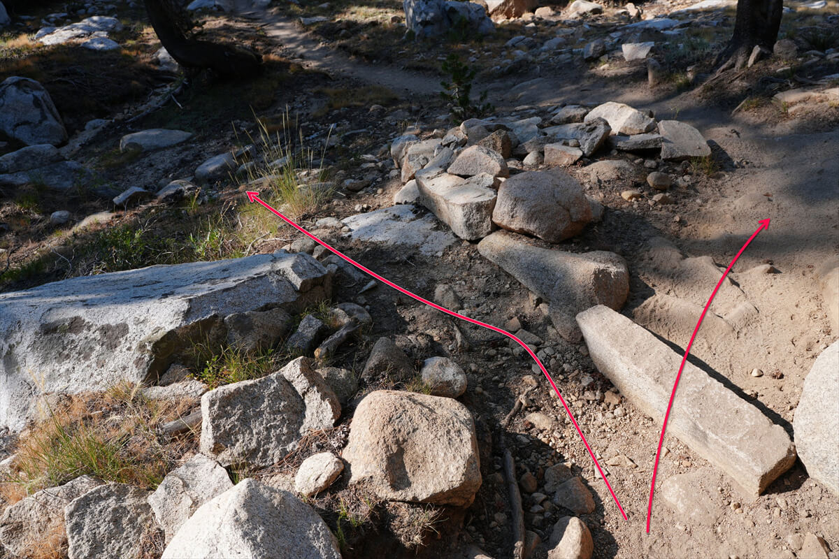
Figure 8.19: American trails are designed to prevent rainwater from running off the trail.
In 2016, I was accompanied by a photographer. When we left Sapphire Lake, he brought a small backpack, so he struggled to pack, and I had to wait about 30 minutes. So we took a break together at Evolution Lake. He seemed impatient, so he got ahead of me, and I ended up following him. However, we lost sight of him as we were going through a switchback. No matter how fast I sped up, I couldn't catch up.
Something was wrong. The cameraman had gone missing. There was no way he would be found even if he backed up and looked for him. I quickly moved on, and every time I passed an American hiker,
"I got separated from my son. He's the guy with the big camera on his chest. Did you see him? Or did you not? Then you can come after me. Tell him I'll go to the ranger station first and wait there."
To Americans, all Asians look the same. Since it was too much trouble to explain, I left it to my son. The cameraman seemed to have strayed from the trail somewhere. However, this wasn't his first time on the mountain, so I figured he'd be back soon. From then on, I kept walking, lying to other hikers I passed: "I got separated from my son. He's the one with the big camera. Let me know if you see him. I'll be waiting at the ranger station."
The photographer caught up with us about 20 minutes before the ranger station. He had been walking down to the river at a drainage area like the one shown in Figure 8.19, but when he noticed something strange, he crawled back up. There are still obstacles at height, and if you rush, this is what happens. When walking in pairs, make sure that your partner never leaves your field of vision.
At lower altitudes, flowers are also blooming. Figure 8.20 shows the Mariposa lily. It is popular among Americans. There are some local variations. This summer has been dry, so there has been a poor flower harvest.
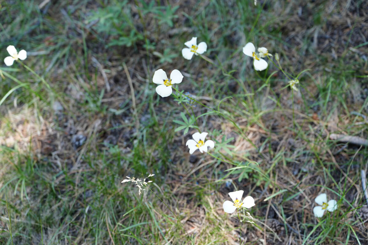
Figure 8.20: Mariposa Lily.
The campsite is located near the end of the switchbacks. A little further on, there are several streams. Crossing them is surprisingly difficult. Many American hikers change into sandals, so I catch up with them here. I'm wearing boots with gaiters, so I can easily wade through water about 30cm deep. One hiker saluted me and said, "Great Accomplishment!" I think he was a hiker who had been overtaken somewhere. Americans are so dramatic. They thought I was a young foreigner. They were actually quite old, and didn't realize I was a casual walker who'd been here seven or eight times.
The trail in Evolution Meadow looks like Figure 8.21. Occasionally, you walk beside boulders that were rounded off and left behind during the Ice Age. The trail runs along the edge of the meadow, but does not enter the meadow, likely for environmental conservation reasons. This means there are some ups and downs.
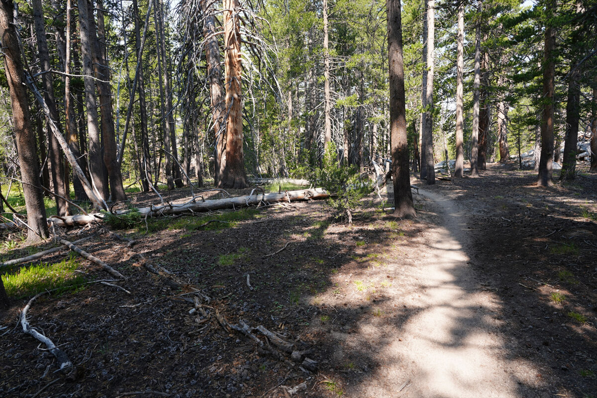
Figure 8.21: Evolution Meadow Trail
I thought I'd have lunch at the ranger station, but I was getting hungry. After crossing the second stream, I found a fallen tree on the right that looked like it would be nice to sit on. It was exactly 12 o'clock, so I had lunch. First, I scooped up about 1 liter of water from the river and set up the water purifier. It's a drop-type, so if there's a slight difference in elevation, it will automatically produce clean water. My lunch was small, consisting of JMT bread and instant coffee.
There were a couple of campsites on the way to the ranger station, but no one was there. There were two hikers at the ranger station, but they didn't speak. Usually there's a ranger there, but this year there was none. There was an emergency sign, but it was old and probably several years old.
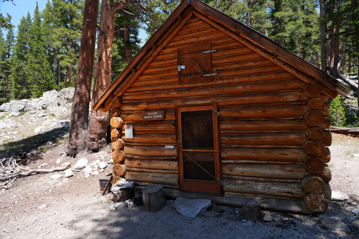
Figure 8.22: Evolution Meadows ranger station
There was a campsite near the ranger station. It was a large area, but there was only one tent. After walking another hour, the trees disappeared and we came to a grassy area. This is where Chieko and I had camped along the river. Because it was dry this year, there was no water near the trail.
Around 3 o'clock, we finally found a sign indicating the crossing point upstream of Evolution Creek. The sign had been temporarily removed, but has since been re-installed. This alternative crossing is to be used only when the river is high in water. The water is shallow and safe, but it passes through a meadow, so it seems that it is not recommended for use too often. However, American trails are suitable for horses, and while they are good for powerful hikers like horses, crossing the river can be difficult for women. It may be worth taking the initiative to use the alternative crossing (Figure 8.24). It is wide but shallow, making it easy to cross. There are clear tracks, so there is no need to worry. The only downside is that there are a few mosquitoes.
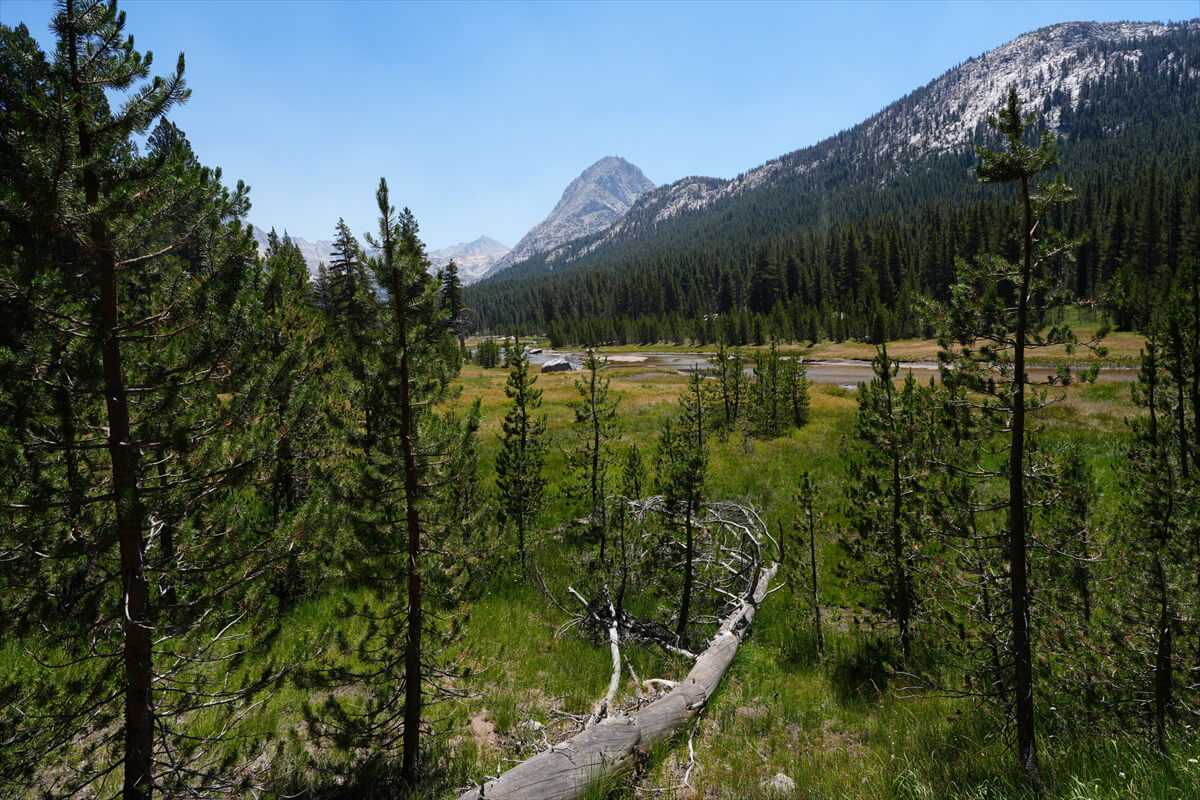
Figure 8.23: Evolution Meadow
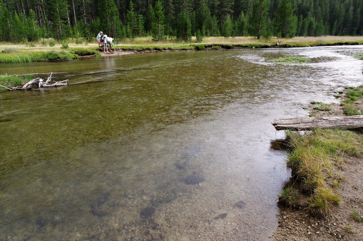
Figure 8.24: Alternative Crossing. Photographed in 2018.
I approached the crossing point of Evolution Creek, but for some reason I don't remember much about it. I was surprised to see tents at a nearby campsite, so I took a photo. That's Figure 8.25. I remember there were five or six of them. Thinking about it, I'd done the alternative crossing three times, and crossed the river once along the way. I hadn't walked much on the main route.
Figure 8.25: Campsite upstream of Evolution Creek ford
After a few ups and downs on the trail, I suddenly came to a familiar spot. The water level here is usually knee-deep, but it was at a record low. The shallow part stretched quite far out to the other side. It was about 1-2 meters deep, but only about 40cm deep at most.
American hikers are generally skeptical of waterproof hiking boots, but I wear heavy waterproof hiking boots with gaiters. Unlike shoes, if you walk quickly in water about 40cm deep, the water won't get in. So I walked slowly in shallow areas and quickly in deep areas. The top of my left sock got a little damp, but that was it.
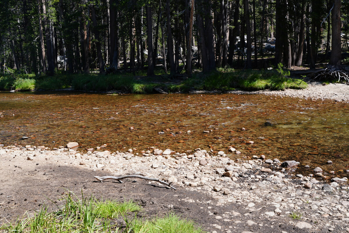
Figure 8.26: Evolution Creek fording point, with record low water levels.
There used to be boletus flowers just across Evolution Creek, but this year they're completely dry and there are none. A little further down the river there's a marshland with beautiful flowers, but this year it's deserted. A little further along is a small waterfall (Figure 8.27), a popular photo spot.
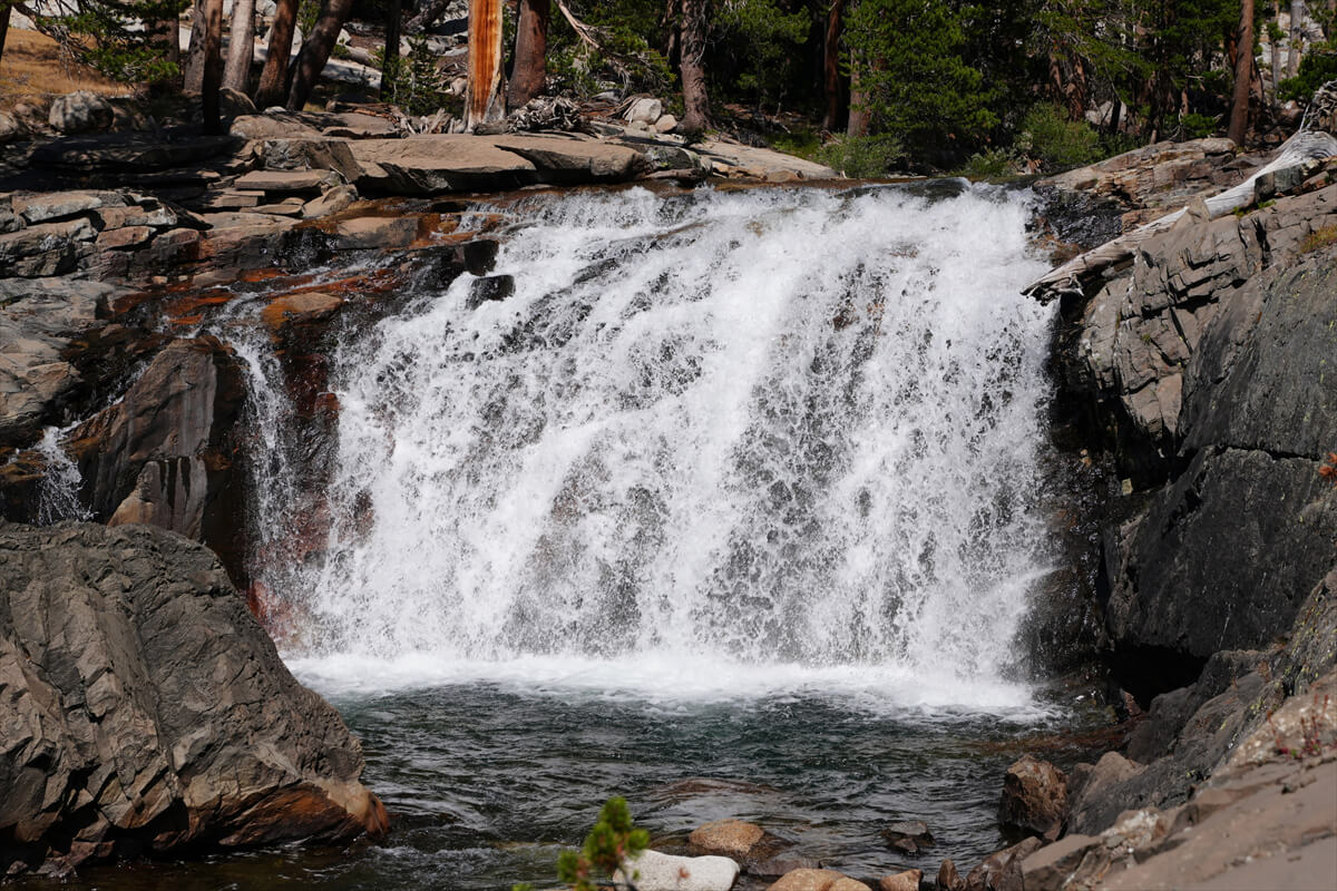
Figure 8.27: Small waterfall on Evolution Creek
The view improved as the switchbacks began. I could see the junction with the Paiute Pass Trail. However, it was 3:20 PM. I needed about an hour to decide on a campsite.
There was a site at the end of the switchbacks, but there was someone there already. Since it was still a little distance to the river, we passed them and continued on. Suddenly, we received an email from James.
"I found a good spot. It's a private site."
The location information tells me it's a little south of Bear Creek. I don't know where it is. I guess they found a good spot somewhere.
"That's pretty good. I'll walk a little further. I have a few campsites in mind."
"I think you'll arrive at the MTR first. Tell them you'll be with James Vesseli. I think I emailed you the booking confirmation."
As we approached the confluence with the San Joaquin River, the trail flattened out and we came across a number of campsites. The problem was, there were three hikers resting by the river. One of them had gone down to the river to get some water. I asked the male hiker about it.
"Are you going to camp here?"
"No, we're just taking a break. We're going further, to the crossing of Evolution Creek. It's awful."
"Right now? That's a long way off. That's what we call a Hell Hiker."
This is a word I learned from Schroomer. When I tried to cut my break short after five minutes, he called me a hell hiker.
When I said I wanted to camp here, they kindly showed me a spot further back. It was completely flat and there was even a rock circle where I could make a bonfire. I forgot to take a photo of the tent, but since I was sure I would arrive at the MTR the next day, I had a leisurely dinner (Figure 8.29). No one showed up. I was camping alone. There was one problem: I only had about 5g of gas left. I would replenish my food with the VVR, but if there was no store at the MTR, I would have no choice but to cold soak (soak food in water and eat it).
Figure 8.30 shows how to check the exact amount of gas remaining. Although there will be some error, first hang the gas canister and set the scale to zero. Then remove it and a negative number will appear. Simply convert this to a percentage. MSR has a dedicated scale, but the error is the same, so you can use a travel scale. It can also be used to weigh food. In my case, 1 kg per day is no problem.
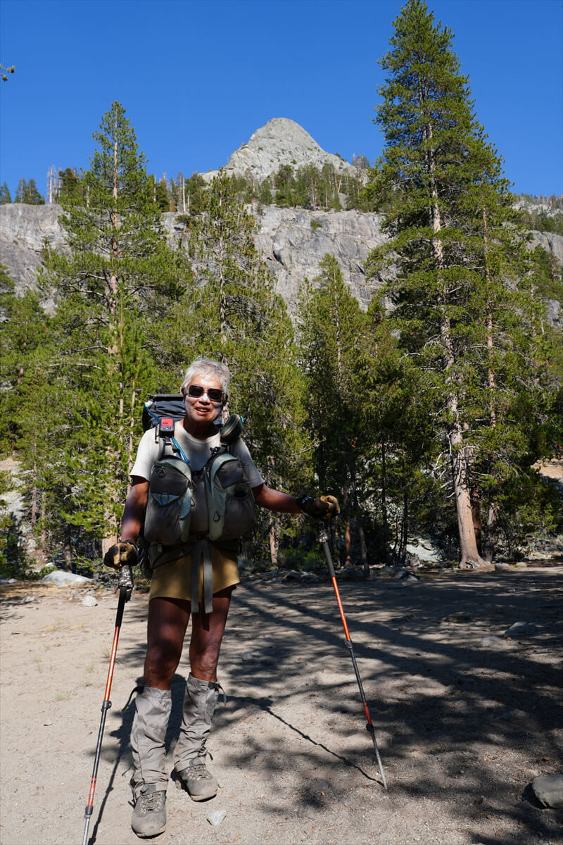
Figure 8.28: Along the San Joaquin River.
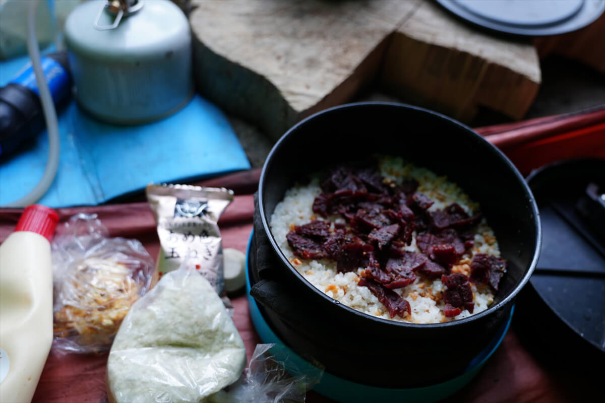
Figure 8.29: The usual beef jerky bowl, potato salad, soup, dried fruit, etc.
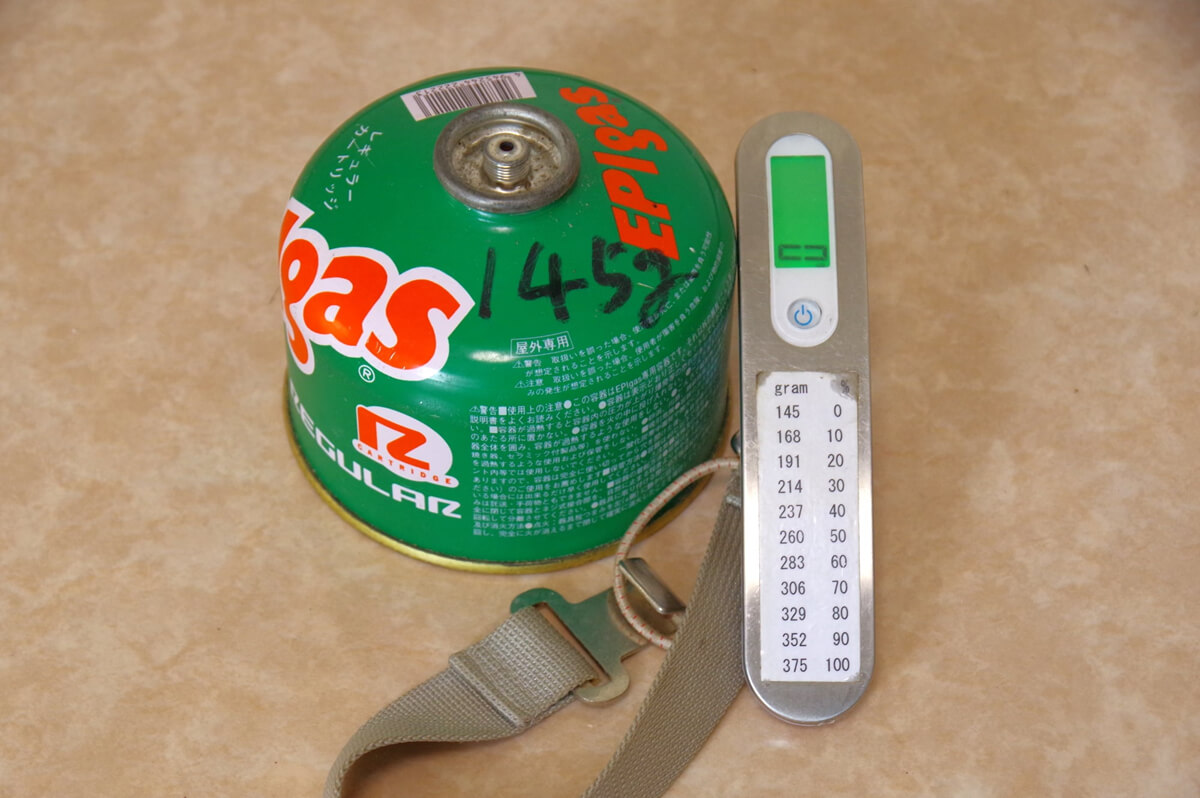
Figure 8.30: How to check the remaining gas level
<Continued in Chapter 9>
Nobuhiro Murakami's new hiking guide, "The Science of Hiking, 5th Edition," is now available on Amazon (Kindle edition is 100 yen)
Nobuhiro Murakami, a former professor at a national university and an experienced through-hiker who continues to share rational solo hiking know-how from a unique and profound scientific perspective in books such as "Hiking Handbook" (Shinyosha) and "The Complete Guide to Hiking in the United States" (Ei Publishing), has released his new book, "The Science of Hiking," which is now available on Amazon. This compelling and logical hiking textbook is based on his accumulated experience dating back to the dawn of long trails in Japan, as well as objective sources such as academic papers on hiking, exercise physiology, and a wide range of other fields
★★Free downloads available for 5 days starting at 5pm on February 3rd★★
Please consider a paid membership to support the site while enjoying exclusive offers and content!
Nobuhiro Murakami