Previous article (Chapter 11)
table of contents
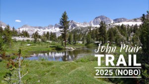
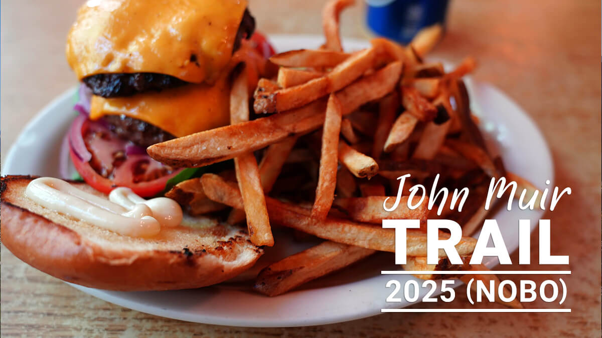
[Chapter 12] VVR to Silver Pass
We arrived at VVR at 9:30 a.m. after walking along the forestry road. As expected, there were no cabins available, so we pitched our tent at our usual site. Since we arrived early, we grabbed some food from the hiker's box and had a hamburger for lunch. Then, just as James had predicted, there was a big fuss over the electric toothbrush. A longtime staff member, Paint Your Wagon, seemed strange. I couldn't remember the author's name. He died suddenly 10 days later, so something must have happened
Since James and I spent two days on the MTR, unfortunately we only had one day in VVR. The VVR ferry was out of order, so we had to travel by small boat. As I'm getting older, I thought it might be impossible to get to Silver Pass Lake from the other side of Lake Edison, but I managed to walk as planned without getting too tired. Unfortunately, our usual spot was occupied, so we set up our tent somewhere else. There had been no rain near Silver Pass, so it was pretty dry
I also explained the route from VVR to Goodale Pass. In snowy years, Silver Pass Creek is full of water, so PCT hikers passing through in June and July must avoid it. From VVR, it's a monotonous climb with scattered campsites and only two fords. Once over the pass, it connects with the JMT north of Silver Pass. I walked it in 2012, when Lake Edison was dry, and in 2023, a summer of heavy snow
VVR (Vermilion Valley Resort)
The forest road at the dam site has some ups and downs, and the views aren't great. No one wants to walk there. However, it's only about 3km long, so it can be done in about an hour. I arrived at VVR at 9:30. The main building of VVR is shown in Figure 12.2. The ferry had already departed, so the hikers arrived much later. I missed breakfast, but I checked in and set up my tent at the furthest site

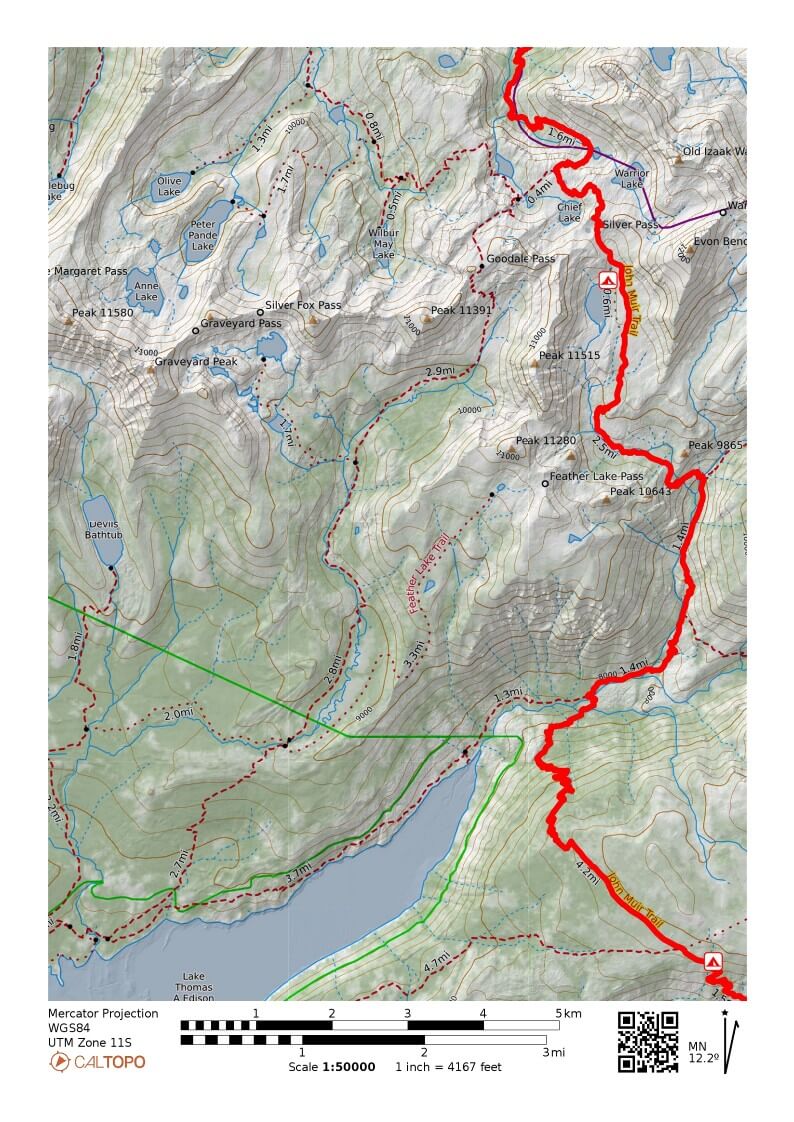
Figure 12.1: VVR to Silver Pass

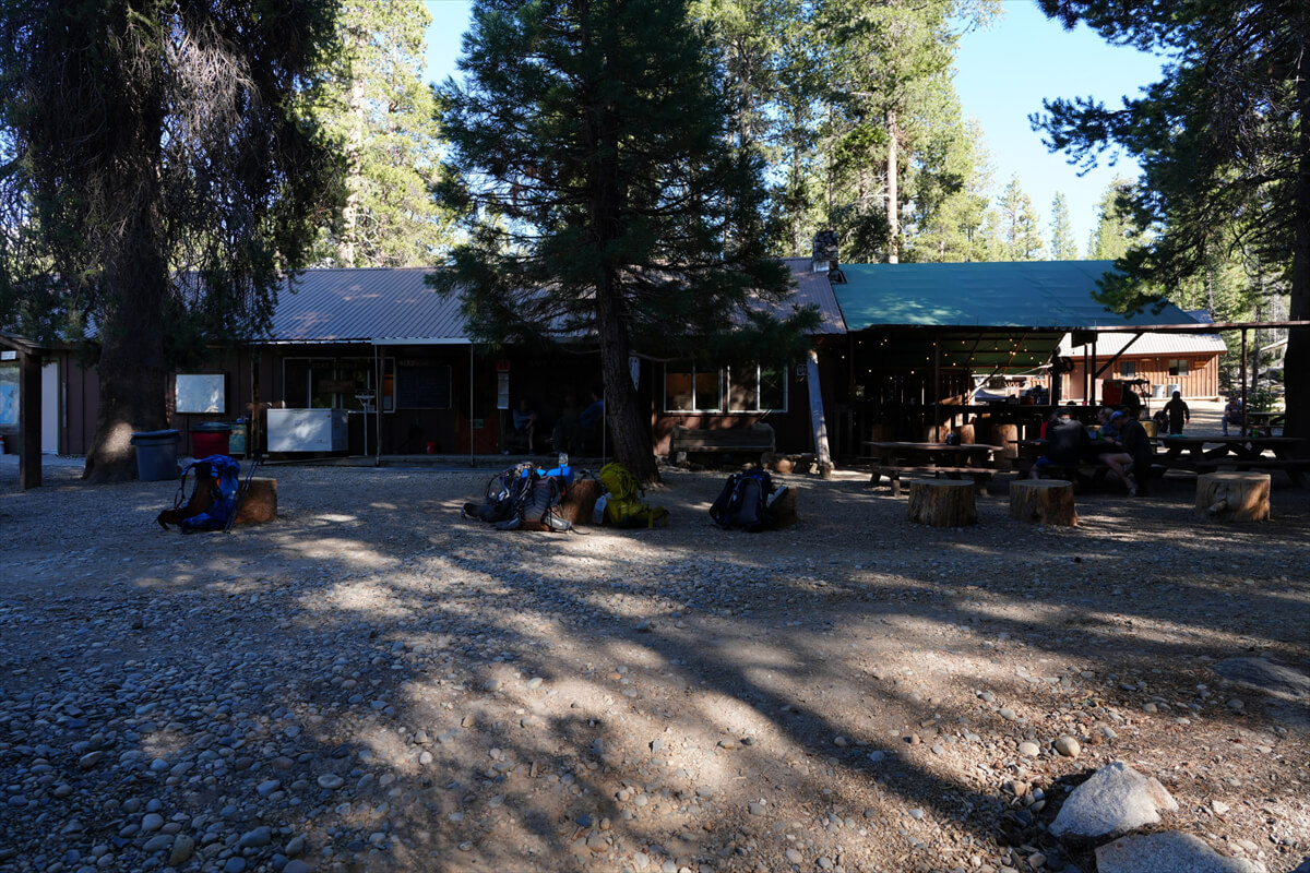
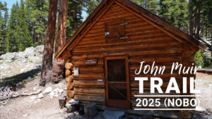
Figure 12.2: VVR's main building, housing the reception, shop and cafeteria
There is usually a beautiful receptionist here (Figure 12.3). After registering your name and listening to an explanation, check-in is complete. Wi-Fi, showers, and laundry are available at this location, and these are charged separately. If you wish to use the dining room, order here. The receptionist in 2023 had an amazing memory and remembered the faces and names of everyone who checked in. This surprised me. She had been working there for several years

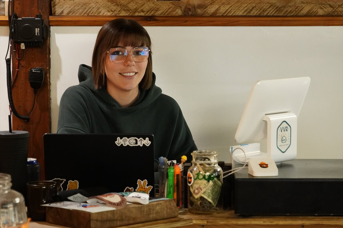
Figure 12.3: VVR reception desk. As with the MTR, it is staffed by a beautiful woman. Photo taken in 2023
I had a bad upbringing, so whenever I have free time, I rummage through trash cans. When Schroomer saw me rummage through trash cans in Glacier National Park, he was happy that he'd ruined Yoshihiro, but unfortunately, it's just a habit I've had ever since I was a bad person. Many American hikers are wealthy, so they have a psychological resistance to rummage through trash cans. Trash can rummage is a rite of passage for hikers, and being able to do it without hesitation is a sign that you have become a full-fledged hiker. Figure 12.4 shows a trail hacker happily picking up an empty bottle from a trash can. If you don't feel genuine joy when you pick up trash, you can't be called a real hiker. I was born with a talent for hiker trash (trash hiker)
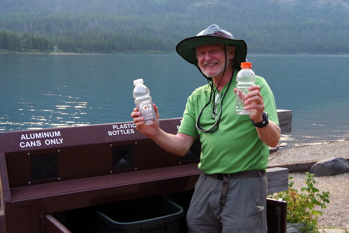
Figure 12.4: A trail hacker delights in retrieving a bottle from a trash can, Glacier National Park, 2013
VVR has a hiker box. It's not a trash can, but a barter box for hikers. Hikers can throw away excess food and unwanted items, and hikers who need them can pick them up and keep them. Some food and other items may be spoiled. It's at your own risk
Hiker boxes tend to be overflowing with items after hikers depart on the ferry. This means that if you want to get the best items, it's a good idea to check them as hikers move around. One PCT hiker took everything out of the box, secured what he needed, and then put it back in again, one by one. I was impressed by how thorough and efficient this method was. When the box is full, you can't see anything below
This year, I found four freeze-dried packs for $10-15, a bunch of energy bars, tuna heat packs, AA batteries, etc. I have a mountain of energy bars that I've thrown away, so my strategy is to get the amount I need for now and then replace them later if I find something more delicious
Unfortunately, I couldn't find any gas cartridges. Usually, I throw away a lot of unused ones. I had no choice but to buy one at VVR. I also bought a headlamp. They only had two: a $40 battery-operated one and a $50 rechargeable one, and they were pretty dusty. I hesitated, but I decided to buy the $50 one
Black Diamond Astro R. It's probably an older model. I tried it out and found it had a large battery, adjustable brightness, and a remaining charge indicator. It lasted about five days. The only drawback was that it didn't have a red light. Price aside, it was a good product. I looked at the headlamps again the next day and about half of them were dead. It's surprising how many people drop their headlamps
Because there were fewer hikers this year, we didn't find anything valuable. Figure 12.5 shows the items we found in 2022. As usual, some pretty high-quality items are thrown away. The folding tripod in the photo is an improved version of one I left behind in the Wind River Range (Wyoming). It was well-made for outdoor use. After researching, I found out that it was a Kestrel portable tripod, costing about 7,500 yen. The black square object is a mobile battery

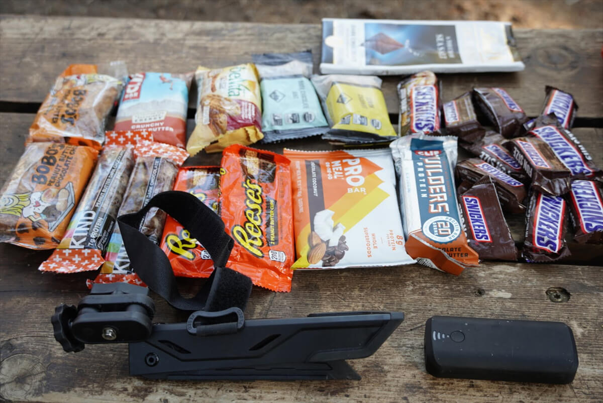
Figure 12.5: Good pick-up with VVR. Photographed in 2022
Here are some of the valuable items I found at VVR
- A Patagonia running shirt. The medium size fits me perfectly. It probably costs about 10,000 yen. I've had it for years. I haven't been using it much lately because my shoulders get sunburned
- A Platypus 2L bladder with a big zip for water supply. I still use it for my water filter. If I were to buy it, it would cost 7,000 yen. I also found a 1L Platypus without a cap. Together, they would easily be worth 8,000 yen
I found out through Facebook that someone had thrown away their portable tripod. When I contacted them, they said they didn't need it and didn't need it. So I decided to use it gratefully. American hikers throw things away in an effort to make their hikes even lighter. Even if they save a few hundred grams, it doesn't affect their energy consumption, but they still throw it away. They must be very tired
For lunch, I had a VVR hamburger (Fig. 12.6). Since it's made for hikers, it's large and high in calories. It was surprisingly delicious
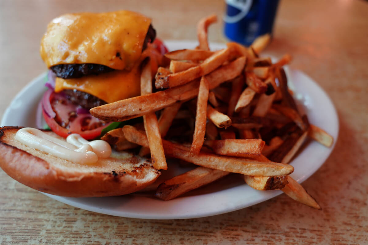
Figure 12.6: VVR hamburger
The longtime owner of VVR was Jim Clement (Figure 12.7). He was a kind and caring man who cared about hikers. He sold VVR a few years ago and ran a hiker shuttle for about three years. Now 71 years old, he plans to sell the shuttle and retire completely in 2026

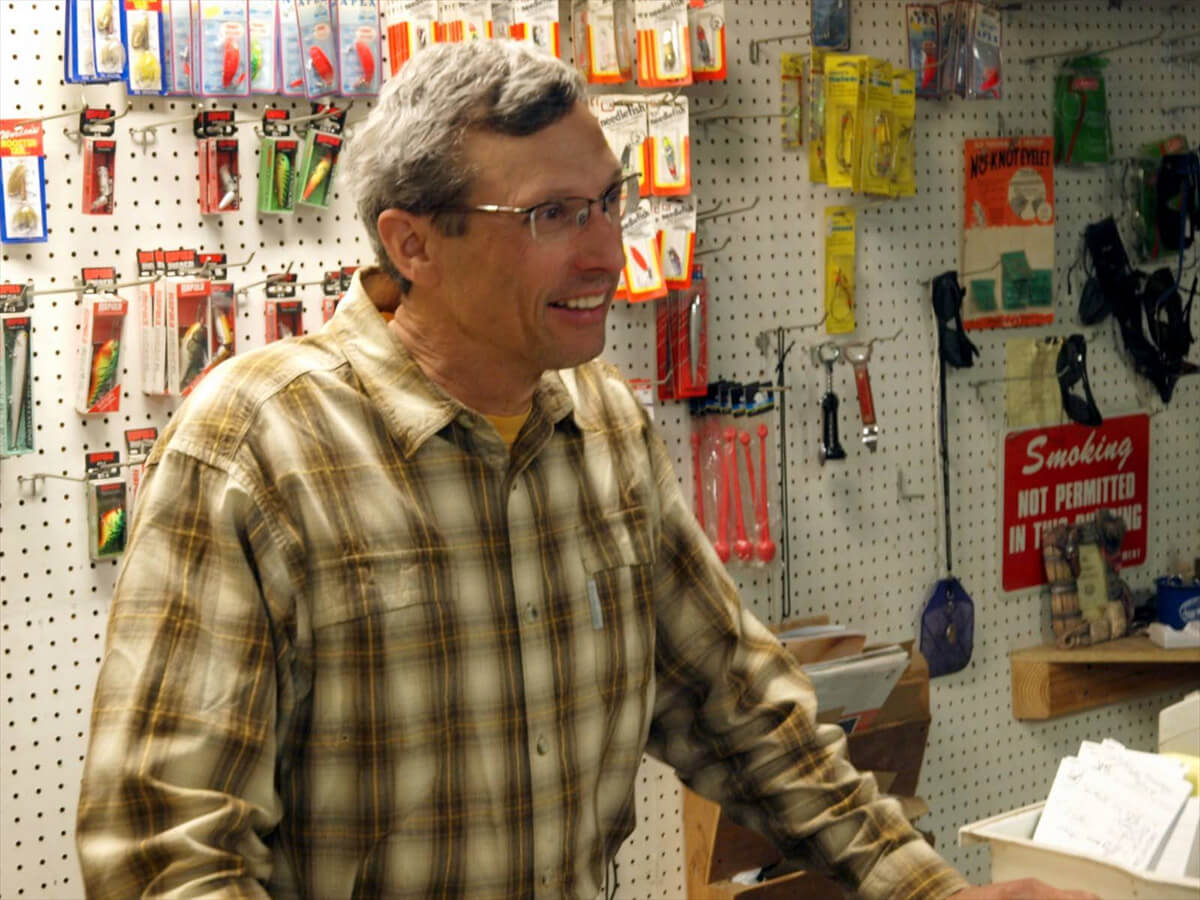
Figure 12.7: Jim Clement, longtime owner of VVR, photographed in 2009
Let me introduce another hiker-friendly staff member (Figure 12.8). The trail is called Painted Your Wagon. "Painted your wagon?" I remember hearing it on a PCT mailing list about 15 years ago and thinking it sounded strange. I met the person in charge at VVR and asked him what it meant. That was about four years ago
"Paint doesn't mean paint. It means oiling the axles. It means oiling your carriage so it can run."
"So that means helping people. A hiker facilitator."
He smiled and nodded. Painted Your Wagon was a kind man who always helped hikers. His gentle smile reflected that. He even remembered that my trail name was Low Gear
However, this year I couldn't immediately remember his name. Something felt strange, but about 10 days later, I realized that my feeling was correct. I received word that he had suddenly passed away. The cause of death has not been revealed. Since he is American, it was probably a cerebrovascular accident or myocardial infarction. I will never see his smiling face again, even if I go to VVR
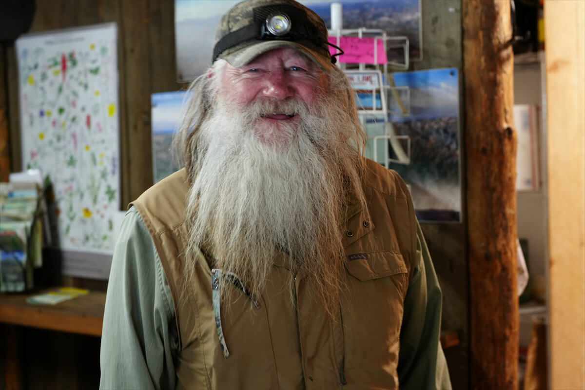
Figure 12.8: Painted Your Wagon. Photographed on August 14th, died on the 23rd
This year I saw some rather unusual people. They were called the Fish Police. They were police officers who specialized in fishing. I was surprised to see that they even had guns. It was the first time I'd seen them at a VVR. I took a commemorative photo with them. That's Figure 12.9. They were all very charming

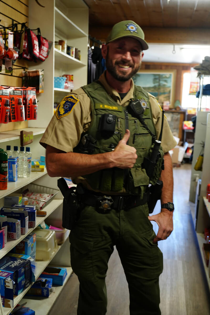
Figure 12.9: Fish Police
I've already introduced the daring adventurer Peter William Tellemeyer. I also got to know another incredible person during my time at VVR. While eating at a restaurant, I met a hiker who said he'd hiked the JMT 10 times. Ten times is ridiculous. He must be a bit crazy. I quickly distanced myself, knowing there was no way we could have anything in common. This was probably around 2010. However, having hiked the JMT many times myself, I can no longer criticize others. People who enjoy hiking the JMT once will do it twice. And if they enjoy it enough, they'll hike it a third time. And so it goes on and on
A few years ago, I came across a guy on Facebook who posted some interesting answers, so I decided to become his friend. He was a long, rambling, and sticky English writer, and his posts were always quite entertaining. He seemed to be an experienced hiker. His name was Bob Shattuck. Unfortunately, he had suffered a cerebral hemorrhage about two years ago, and it seems he has difficulty moving part of his left hand. He has been undergoing intense rehabilitation training with weights, and is now feeling much better, and is expected to return to hiking soon

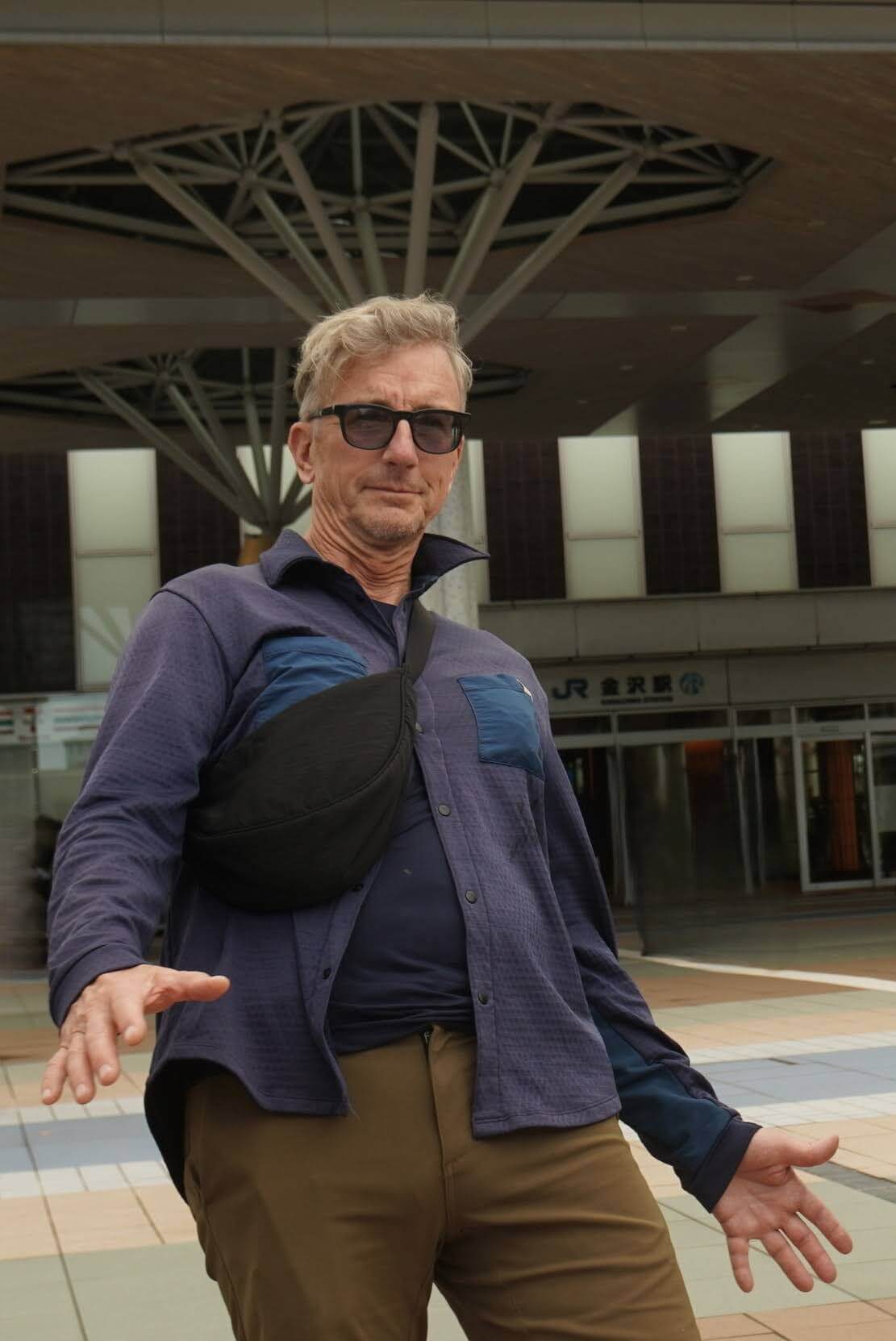
Figure 12.10: Bob Shattuck, a veteran hiker who has hiked the JMT 13 times and also the CDT, Shasta, Alaska, and Nepal. At Kanazawa Station. Photographed in 2024
He was strangely interested in Japan. He seems to visit Japan occasionally. I spoke to him when he came to Kanazawa. I'm sure we met at VVR quite some time ago. His adoptive father is Japanese, and he knows many Japanese Americans living in the United States. That's why he has a special interest in Japan. He wasn't crazy, but a kind and intelligent man
I usually stay at VVR for about three days, so I often meet Japanese people. Figure 12.11 shows a commemorative photo from 2023. On the far left is Manabu Ishikawa, who thoroughly read the author's book "Introduction to Hiking in America" and memorized the entire contents. He even remembered Bishop's proper name, "Eastside Sports." However, it's not perfect
"Everyone has inReach. I never thought people actually had them," he said
All American hikers have one as an emergency contact method, but I didn't trust what the author wrote, so I deducted 20 points and gave it the bare minimum of an "excellent" rating. He is a serious mountain climber who occasionally works at the Sanjo-no-Yu mountain hut in Okutama in addition to his day job
In 2023, I met another Japanese person. The trail was called Castle Oshiro. He was an expeditioner from Okinawa. He had secretly joined the "Hiking in America" website I manage. Of course, he was a reserved person who never posted anything on the website. It was pure coincidence that we met at VVR
2023 was the year Muir Pass could not be crossed, but it appears that both Manabu Ishikawa and Castle Oshiro managed to thru-hike to Mount Whitney
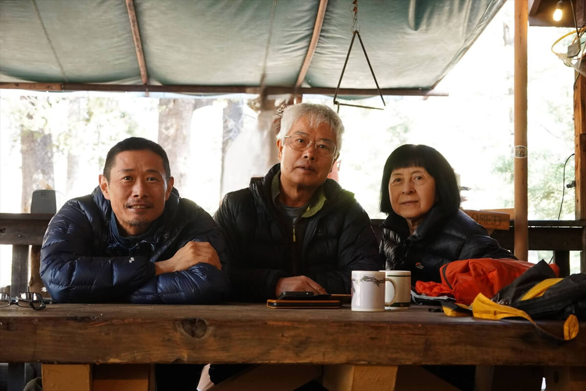
Figure 12.11: Honor student Manabu Ishikawa remembers most of the content of his Introduction to Hiking in America. Photographed in 2023
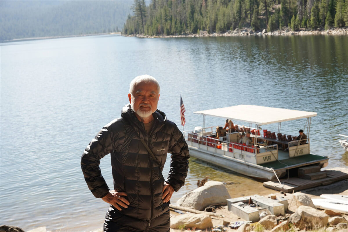
Figure 12.12: Castle Oshiro, Okinawa, with a VVR ferry in the background. Photographed in 2023
After a hamburger lunch, I returned to my tent and was brushing my teeth outside when a commotion occurred
"What's that?" said a middle-aged female hiker. I like young, pretty women, but I'm not a fan of middle-aged women
"Electric toothbrush"
"What's that, an electric toothbrush? Come over here. We're all taking a commemorative photo. You hold your toothbrush there." So, in front of the three ladies, I held my toothbrush in the air. They took several photos of me
"Amazing. It fits perfectly. Your toothbrush fits right in your mouth. Do you have an iPhone?"
Apparently, if you have an iPhone, you can share photos on a shared drive. I don't have an iPhone, and I don't like older women, so I declined. So, I don't have this photo, which could be a timeless masterpiece. As James said, it was true that "it will astound all Americans." American hikers ritually cut the handle of their toothbrush in half to make it lighter. Electric toothbrushes are out of the question
After the hustle and bustle was over, I rummaged through my hiker's box and went to the VVR reception desk to pick up my supplies. I laid out eight days' worth of food on the table, as shown in Figure 12.13. I also picked up four freeze-dried packs, each costing between $10 and $15, and three tuna packs. I also had about ten energy bars
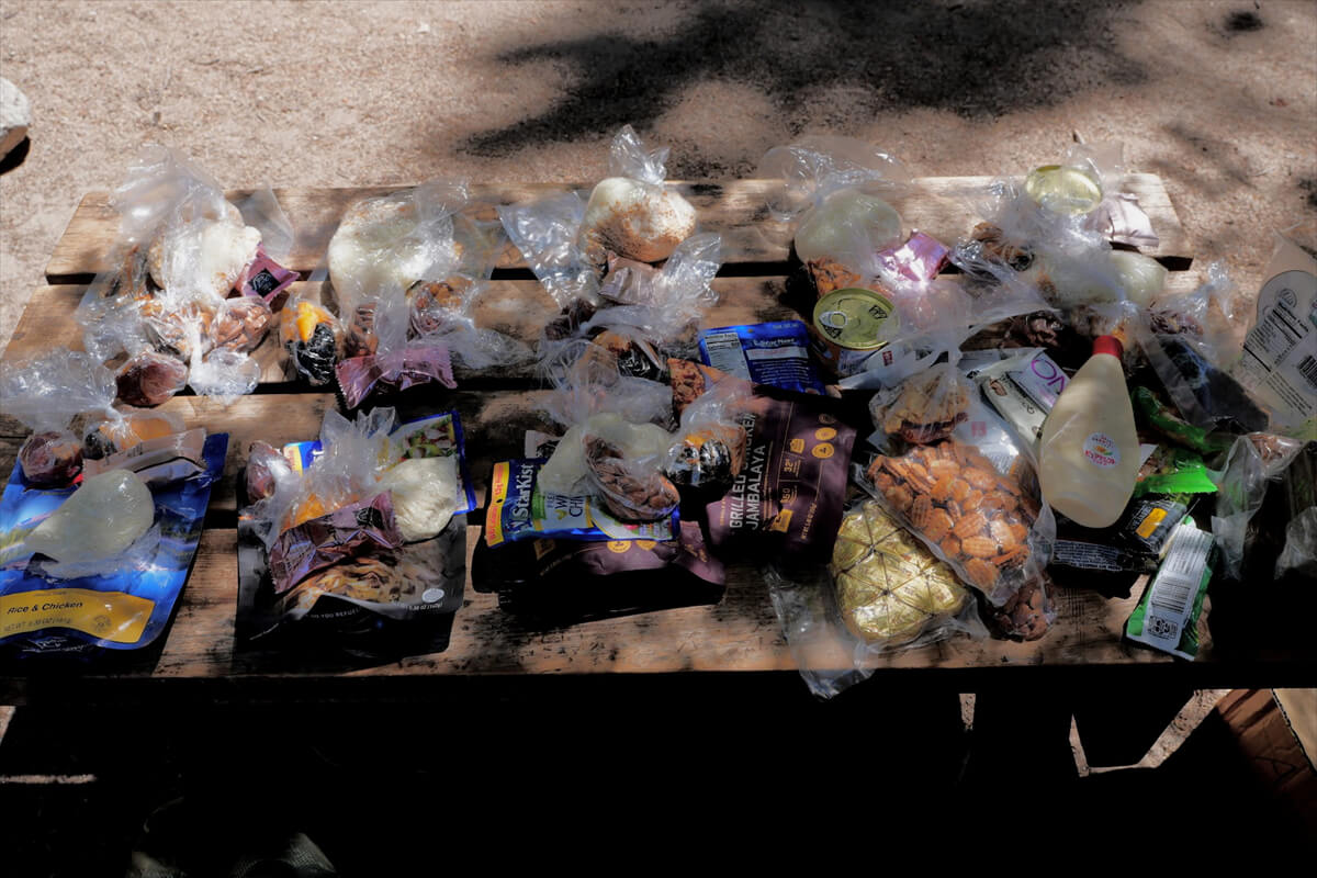
Figure 12.13: Lay out your supplies by day, this way you can be sure of the correct order
If I went all the way to Yosemite, my schedule would be a bit tight, so I thought about stopping at Tualum Meadows. Even if I went there, I could stop by Reds Meadows to stock up on food. Before leaving, I weighed my backpack and it was 28kg, which was within my tolerance
Dinner starts at 5 o'clock. I order at the front desk and then go to the dining room. There are three or four menu items. Taste is generally proportional to the price. So, even if you don't know what it is, you can't go wrong by ordering something expensive. Today I had steak. It's shown in Figure 12.14. The taste was average, not great. American dinners don't include bread or anything else; the staple food is potatoes, so the potatoes on the side are enough. There's no soup or anything extravagant. I had a hamburger for lunch today, so that was enough for dinner
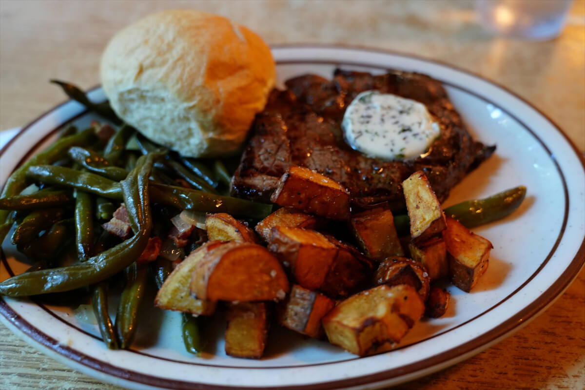
Figure 12.14: Steak at VVR. Dinner at VVR is small
This year I got to know some Japanese hikers. Japanese people are easy to understand. Most of them typically use ultralight tents, with a sacoche bag hanging from the front, a lightweight backpack, and camping under a tarp. This is something you rarely see among American hikers. Tarps are often attacked by mosquitoes, so they have long since switched to ultralight tents. The most common backpack they use is the Osprey. Ultralight lightweight backpacks are typically used by wealthy older people
Yuta Yamazaki (Figure 12.16) was easily recognized for his Locus Gear trekking poles and pyramid-shaped tarp. I'm a rather unsociable person, so I don't often initiate conversations with Japanese people. I happened to meet him at breakfast, so we took a commemorative photo and chatted for a while
When I first came to America, I ate bread and cakes for breakfast, but recently I've been eating mostly burritos. My breakfast is shown in Figure 12.15. For pancakes and other breakfasts, see Yamazaki's photo. Calories are a major consideration, so pancakes, bread, greasy potatoes, salty crispy bacon, and scrambled eggs are the standard. Once you eat breakfast, you don't need lunch. If you stay for a few days, you won't want to eat it from the second day onwards. By the third day, you'll be looking for even lower-calorie options
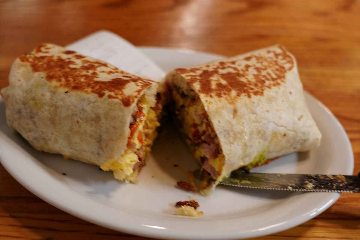
Figure 12.15: A VVR burrito. It's a little thinner than usual, but hiker-sized
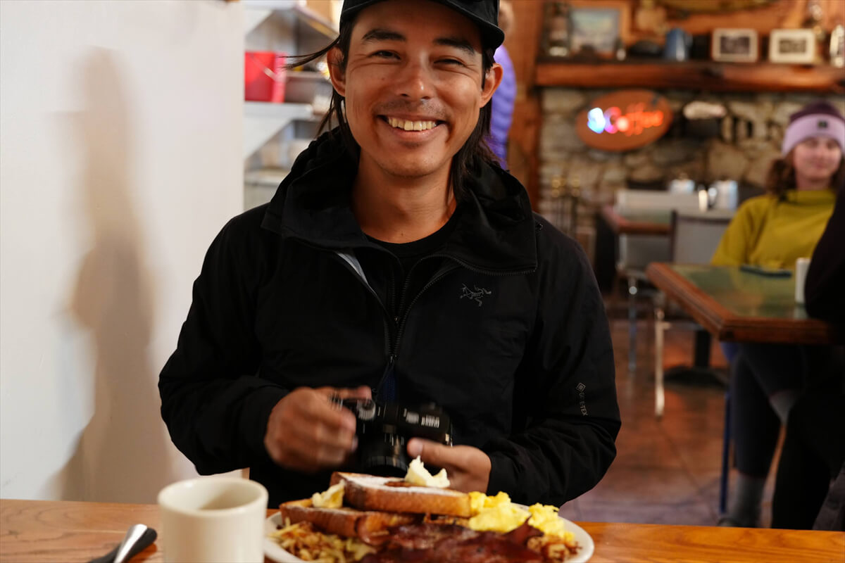
Figure 12.16: Yuta Yamazaki, UL hiker
Around 8:30, Captain Painted's loud voice can be heard. It sounds like the call to action in a sumo match. He gives clear instructions about the departure time and reminds us to not leave anything behind. This year, the VVR ferry broke down, so hikers had to make two trips back and forth in a small boat. I was part of the second group
VVR to Silver Pass Lake
We boarded a small boat and arrived on the other side of Lake Edison at 9:00 AM. We were late because we were the second group on the piston transport. Our backpacks were carrying the maximum load of 28 kg, so we carefully walked behind everyone else. We arrived at the meeting point with the JMT at 10:00 AM. We had trained with a 30 kg pack, so this weight only slowed us down a little
The trail climbs gently along Mono Creek for a while. There is a point where it intersects with the North Fork, so we have to wade through. This year it was easy, but in years with a lot of snow it gets difficult. This year we passed this point at 11:00. We were the second boat to cross, and we were almost at the back of the pack, so there were no hikers to catch up with us. The trail gets a little steeper and makes many switchbacks. At the same time, we move away from the river. There has been little rain this year, so the river is dry and there is no water available. It is still quite a distance to our lunch spot
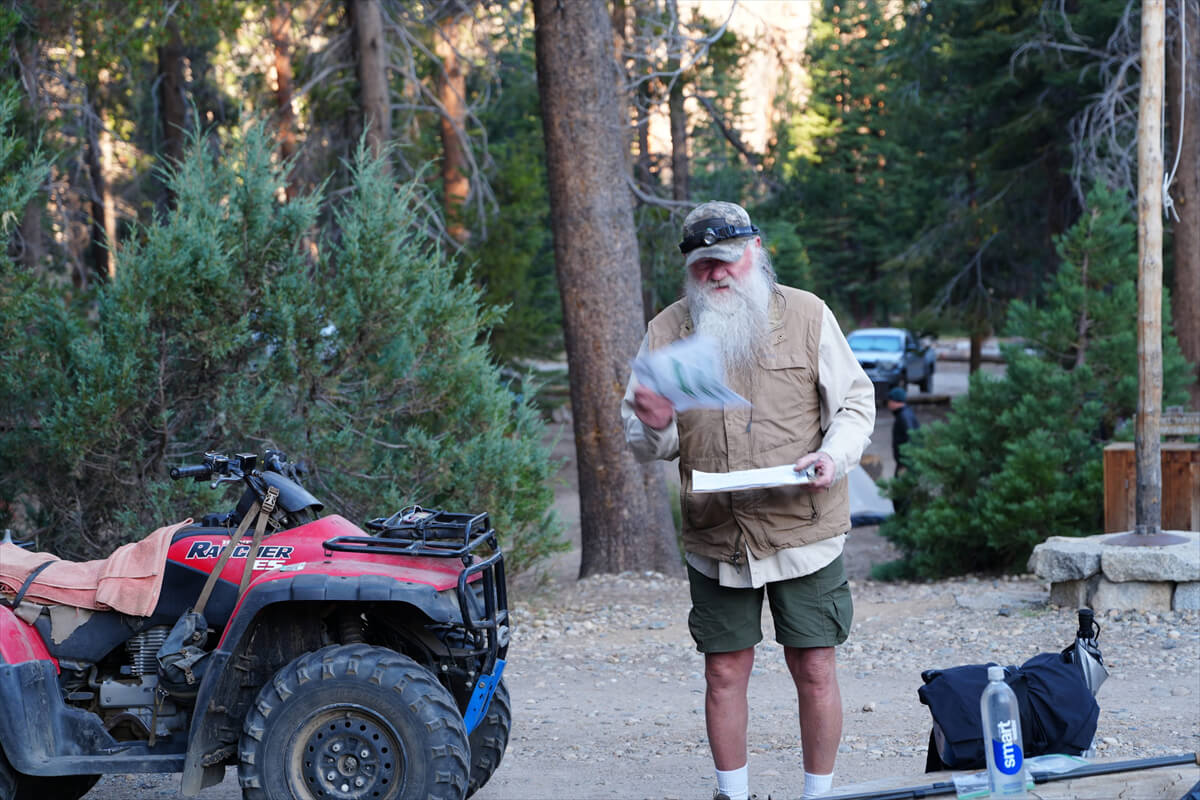
Figure 12.17: Captain Painted
I found a bear scare buzzer lying on the side of the road. It belonged to the woman who had made a fuss over the electric toothbrush. Experienced hikers don't carry bear scare buzzers like this because they're not necessary. I tried sounding it, and a tremendous sound echoed through the valley. If they could hear me, they'd probably wait a bit. My pack was heavy, so I couldn't walk fast
Finally, we arrived at our lunch spot, as shown in Figure 12.18. It was 1:00 p.m., a little late. A couple was getting ready to leave. One of them was the same woman who I had given the bear scare buzzer to. She said she had heard the sound. When I told her I was late,
"Throw away your electric toothbrush," he said, his usual foul mouthed self
"No. I want power."
We exchanged final goodbyes, and the couple set off. I put my backpack down in the shade, went to get some water, and set up the water purifier. While the water was being purified, I had lunch of JMT bread and instant coffee. This way, I didn't have to take separate time to purify the water
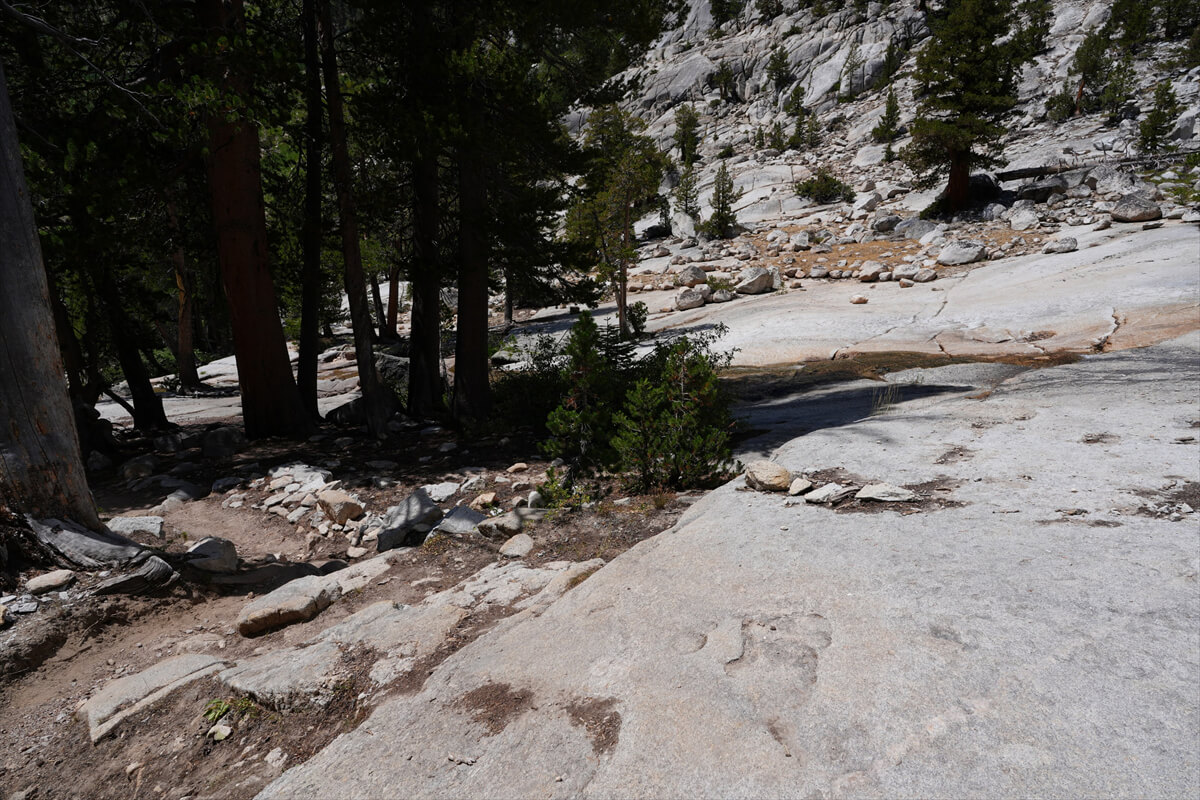
Figure 12.18: Lunch spot at Mono Creek. The rocks are spread out and water is easily accessible
Lunchtime lasts about 30 minutes. About 30 minutes into the walk, the trail begins to get steep. The trail continues to switchback around the rocks ahead, and reaches a narrow meadow along the river. This is the pocket meadow in Figure 12.19
After passing the fork to Mott Lake, we immediately crossed the river. The difficult ford of Mono Creek is located both upstream and downstream, where we have already crossed. This year, fording is hardly a problem, but in June, the water level is quite high and it can be dangerous
Soon we began to encounter some steep switchbacks, like a smaller version of the Golden Staircase. The switchbacks were neatly carved into the rock face. This is the location shown in Figure 12.20, where the trail also intersects with Silver Pass Creek, another tributary of Mono Creek. Normally, there's a waterfall-like stream flowing from the upper left, but this year it was completely dry
There is a magnificent pine tree above the switchback. It is a pine tree that you will encounter frequently. If you pass this tree and bear with it for a while, the slope will become gentler and the switchback will end. The familiar pine tree is shown in Figure 12.22
After climbing the tough switchbacks of Silver Pass Creek, a large meadow spreads out before us. For some reason, the name of this meadow is not listed on the map. Figure 12.23 shows a photo from the usual rest stop. The water is nearby, but flows slightly below
As we walked along the gentle trail, the altitude gradually increased. After briefly crossing a creek, we reached an altitude of 3,000 m and the time was 3:40. Because of my age, I thought I wouldn't be able to make it to Silver Pass Lake this year, but it looked like I could. There was a campsite along the creek, but I decided to go straight ahead
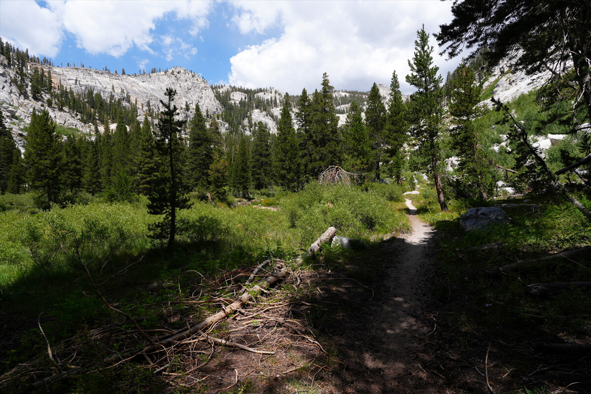
Figure 12.19: Pocket Meadow. Climb the rock wall on the left ahead
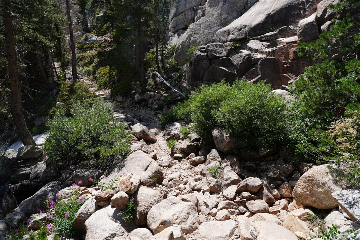
Figure 12.20: Silver Pass Creek Falls, which was dry this year

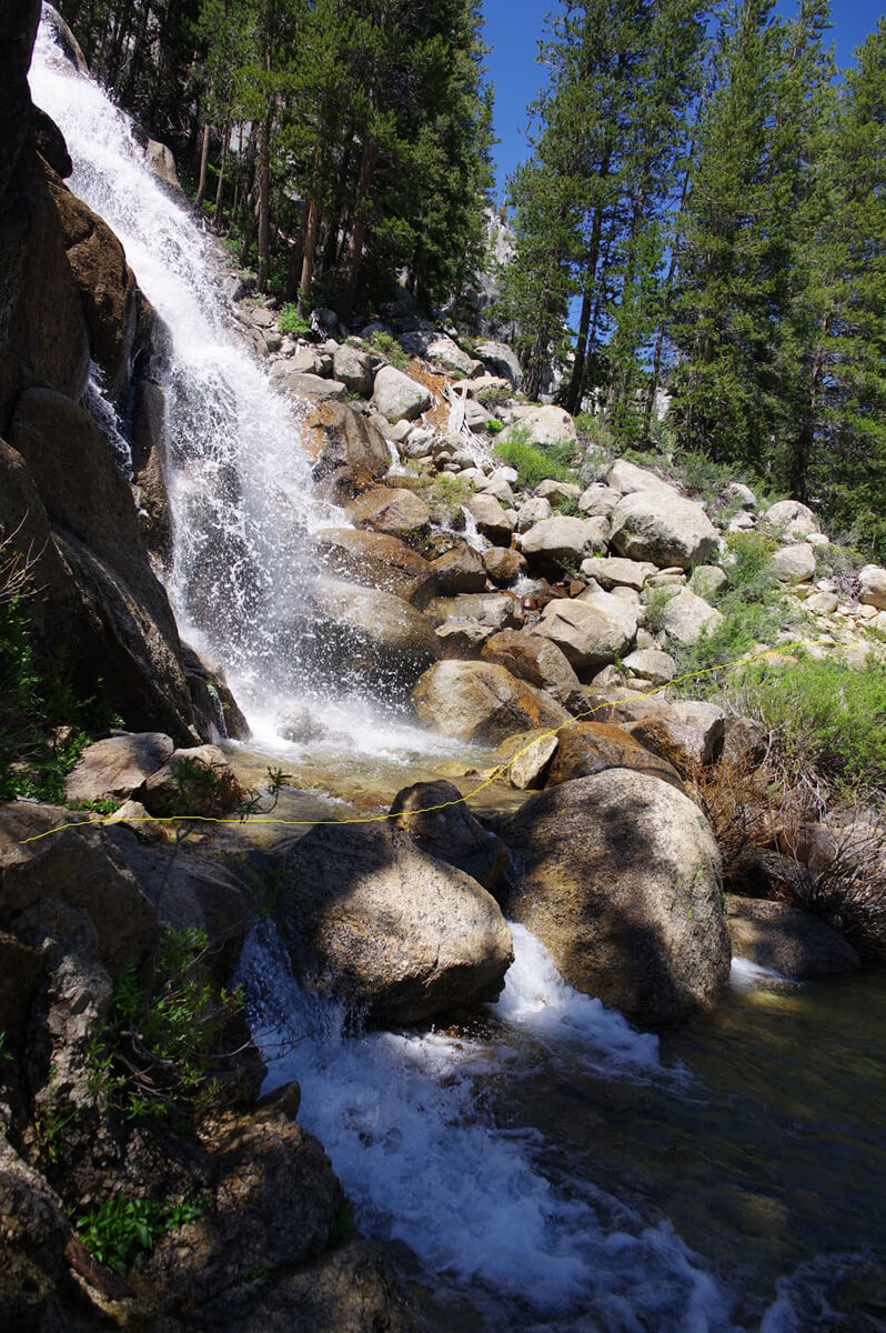
Figure 12.21: Silver Pass Creek Falls. Due to the snowy season, the water level would have been difficult to pass through in June and July. Photographed August 12, 2017
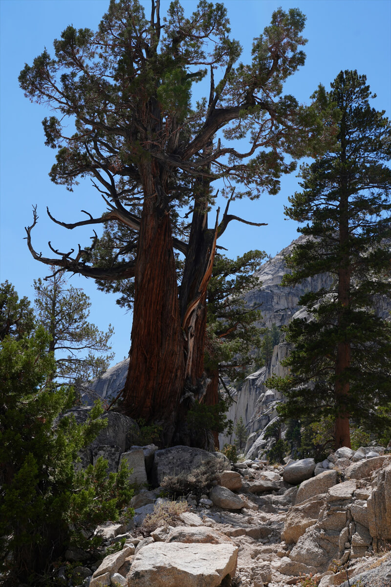
Figure 12.22: The familiar pine tree
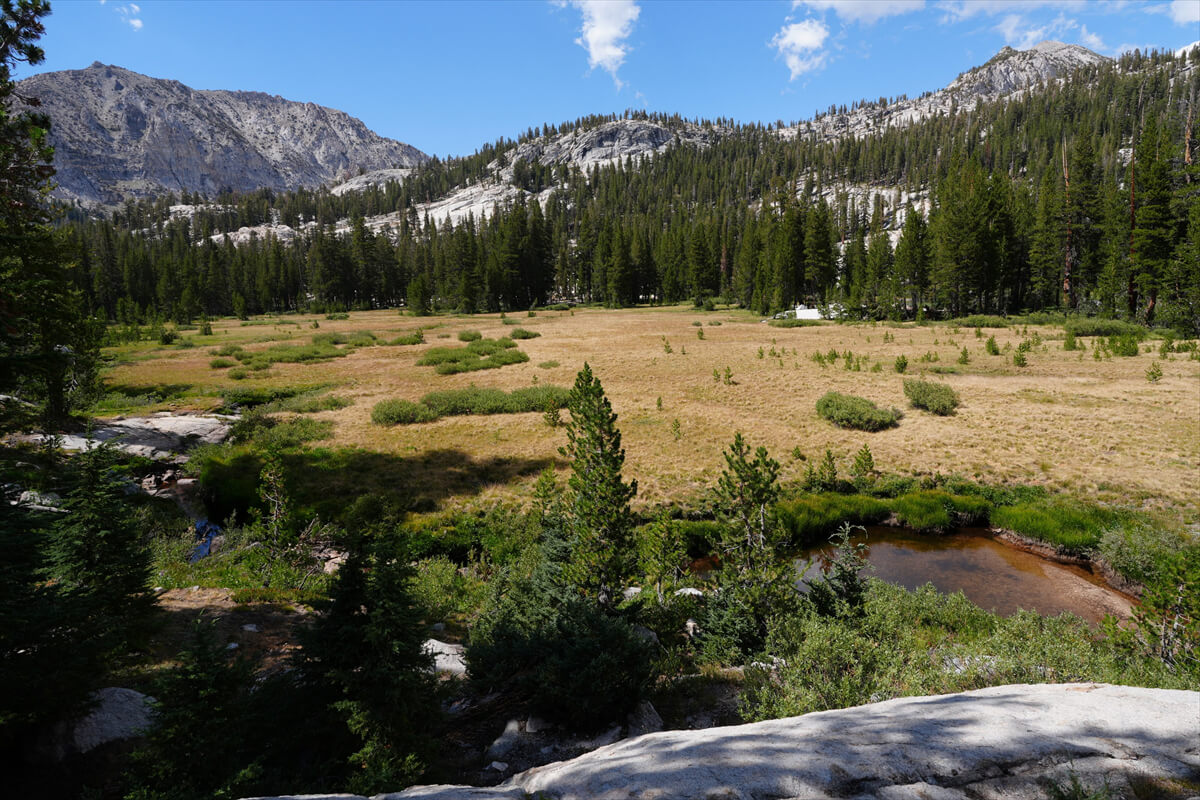
Figure 12.23: There is a large meadow, but it has no name
We climb again using switchbacks, but the slope is gentle and doesn't last long. Along the way, we saw three hikers taking a break, but they seemed to be descending. We exchanged a quick greeting and continued on. It was a completely dry summer, so the water sources along the way had dried up. The trail leveled out and headed towards Silver Pass Lake, but it was far away and we couldn't see the lake
I could see Silver Pass Lake. It was a little after 5 o'clock. Unfortunately, someone was in my favorite spot. It was a real pain when that nasty lady was there. Looking to my right, I saw the lake at the top of the mountain, with a shady spot nearby. Although it was a bit close to the trail, I didn't expect anyone to pass by, so I set up my tent. This is shown in Figure 12.24. My tent was in the shade
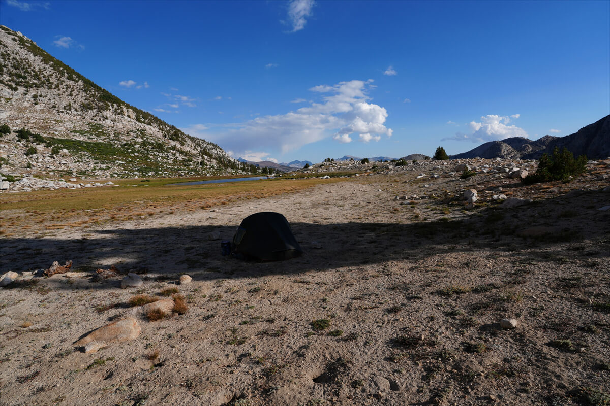
Figure 12.24: Near Silver Pass Lake
Silver Pass Lake is shaded in the morning and evening, and you need to choose the right spot to take a good photo. A photo from 2019 is shown in Figure 12.25. The hill in the foreground is my favorite spot. There's no point in pitching a tent here unless you're alone

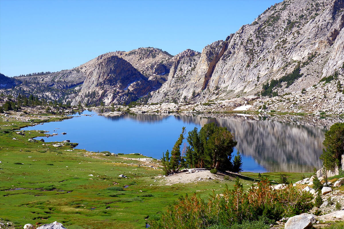
Figure 12.25: Silver Pass Lake, 2019
I arrived at Silver Pass Lake as planned. For dinner, I decided to get rid of the heavy canned goods early, so I had the canned mackerel set meal shown in Figure 12.26. After dinner, I had some free time, so I put the camera on a bear canister and took some remote-controlled photos of the starry sky. Even in program auto, the image looked good at about -4 stops. I'm not particularly interested in stargazing, but I chose this option because it was easy and I had some free time
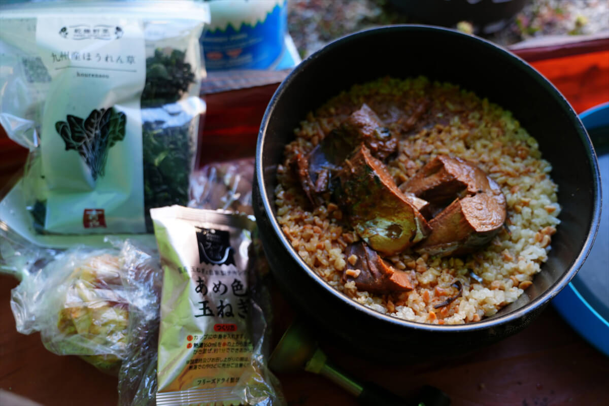
Figure 12.26: Canned mackerel set meal
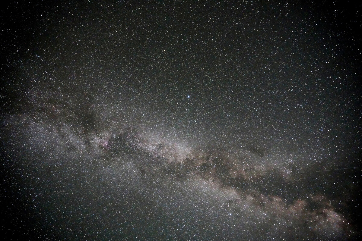
Figure 12.27: A random starry sky photo
The next day, I set off at 7am as usual. I sent a message to James and Chieko via inReach to let them know that the headlamp I bought at VVR was working fine
The sun is not yet shining on Silver Pass Lake. The climb up the pass is gentle and divided into two stages. After climbing for a while from the campsite, the slope becomes gentler and there is usually a snowfield remaining. This year it was dry. After that there is a short climb and on the left there is an unnamed lake. This year it is not dry, but there is very little water. I took a photo, but it looks dull compared to previous years
We arrived at Silver Pass at 7:30. There was one hiker there. He had climbed to the highest point and was taking photos, so I went to the same spot and asked him to take another photo for me. The view north of the pass is shown in Figure 12.27. The jagged mountains are the Minaret Mountains. We were about to walk very close to them, but I wondered what would happen
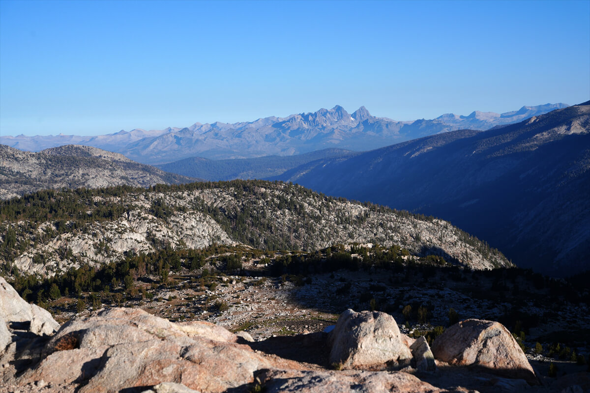
Figure 12.28: From Silver Pass. The sharp peaks in the distance are the Minaret Mountains
VVR to Goodale Pass
In years with heavy snowfall, the route from VVR to Silver Pass can be dangerous due to the fords over North Fork Mono Creek. There are fords about 1 km from the JMT junction, another ford near the Mott Lake fork, and a waterfall of Silver Pass Creek cascading down the side of a steep switchback. Furthermore, when snow is present, it is dangerous and impossible to cross without an ice axe and crampons. Most PCT hikers pass through this area in June and July, so it is best to avoid this area
Even in the summer of 2023, the wading was extremely dangerous. My wife and I were traveling southbound on the JMT. We decided to bypass Silver Pass and cross Goodale Bass. We had already hiked this route once before in 2012. It was a completely dry summer, and Lake Edison was dry, so the ferry was not running
If you can't take the ferry, the closest option is via Goodale Pass
I will explain the north-facing JMT, but the photo I will insert is of the south-facing JMT, so please be aware that the direction of the photo is different
From VVR, follow the signs and walk along the trail. After a while, you will join a forest road and arrive at the trailhead. This is Ansel Adams Wilderness. The trail splits into two. Walk along the trail that runs along the lakeshore. For a while, you will walk through pine trees. There are also meadows scattered around
At the impressive bridge shown in Figure 12.29, the trail splits into two. The mountain trail leads to Goodale Pass, and walking along the shore, it passes the Lake Edison ferry landing and joins the JMT
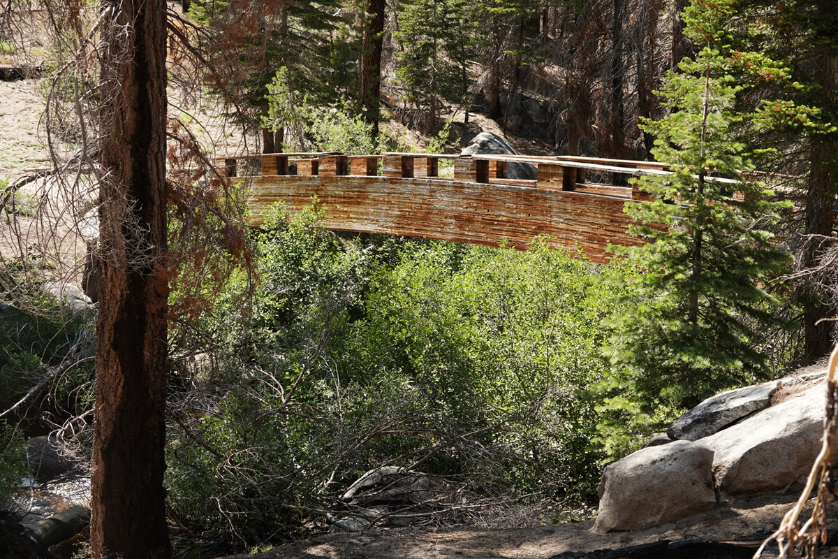
Figure 12.29: The impressive footbridge. Photographed in 2023
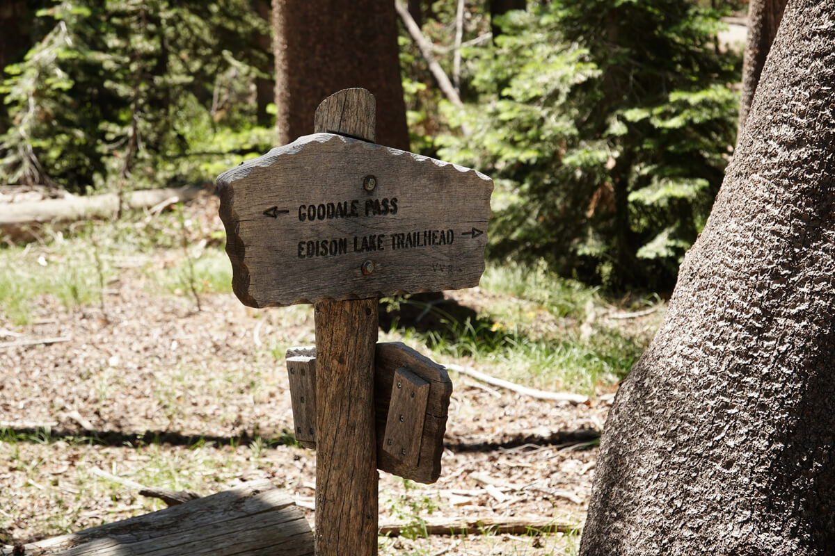
Figure 12.30: Turnoff sign for Goodale Pass and the ferry landing.
Photographed in 2023.
From the fork, the trail heads up the mountain, climbing quite steeply. Finally, there are switchbacks and, after crossing a hill, a large meadow is reached. The trail then descends a little and the first river crossing is reached. In dry summers, there is almost no water, but in the summer of 2023, the water level was at its highest. It was still below knee-level (Figure 12.31)
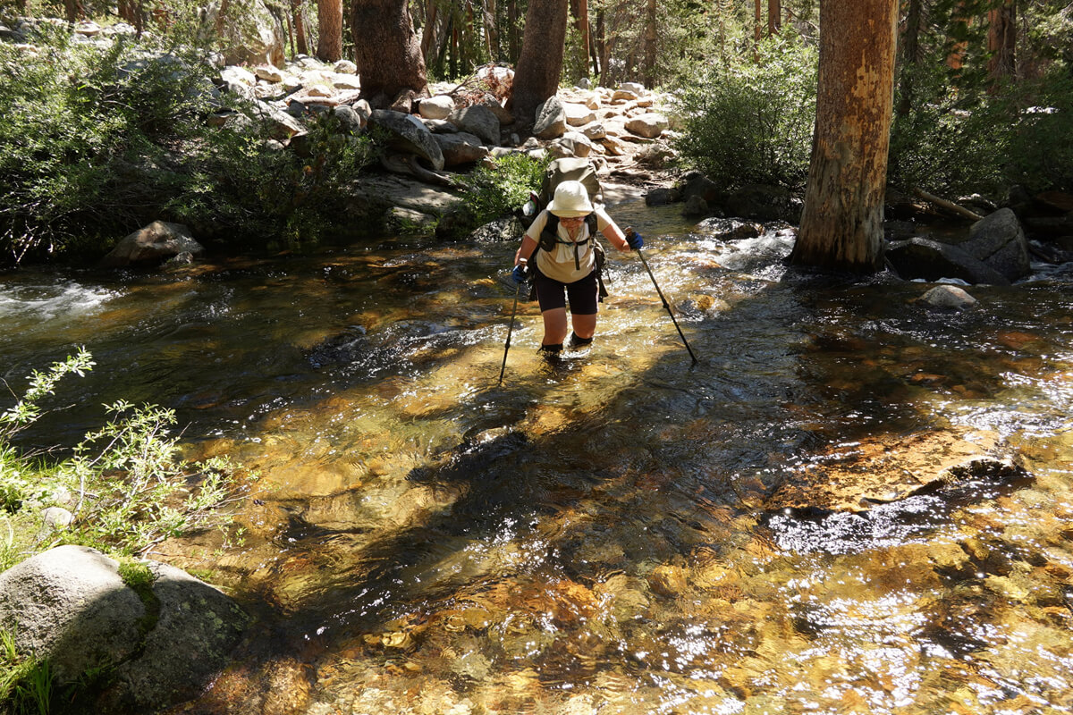
Figure 12.31: Cold Creek, first fording. Heavy snowfall in 2023
There is a trail along Cold Creek that leads to Devil's Bathtub. I didn't walk it. The names around here, like Devil's Bathtub and Graveyard Lakes, don't give off a good impression. I guess people have been lost there in the past
The trail leaves Cold Creek, but there are meadows here and there
Figure 12.33 shows part of a shooting star colony
The second ford is shown in Figure 12.32. There was a heavy snowfall in 2023, so there was a lot of snow on the pass. They were equipped with ice axes, so they were probably part of a snow mountain training group
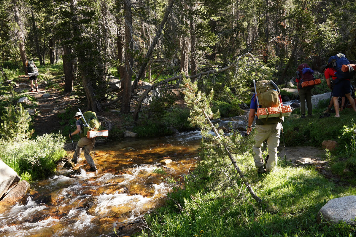
Figure 12.32: Cold Creek, second ford. Heavy snow, 2023
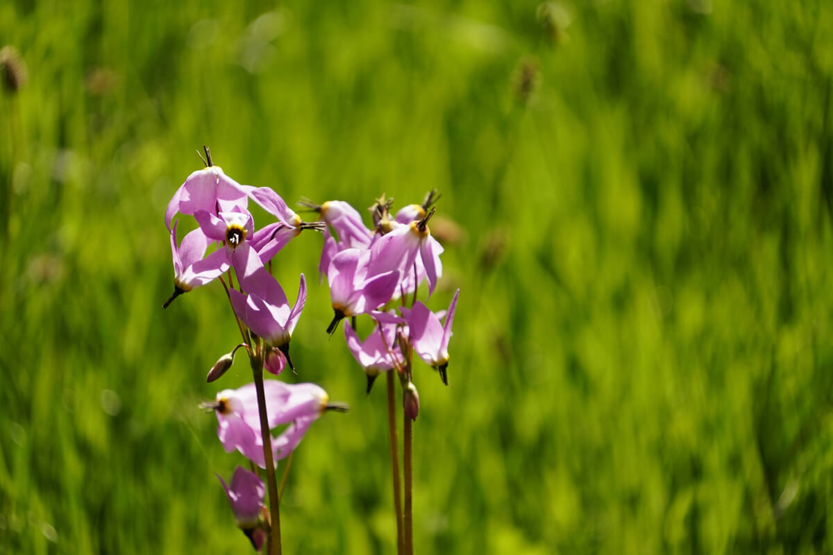
Figure 12.33: A meadow filled with shooting star lilies.
Photographed in 2023.
There are two places where you have to wade ahead, but they are not much of a problem
Grapeyard Meadow looks like Figure 12.34. Does it look like a graveyard?
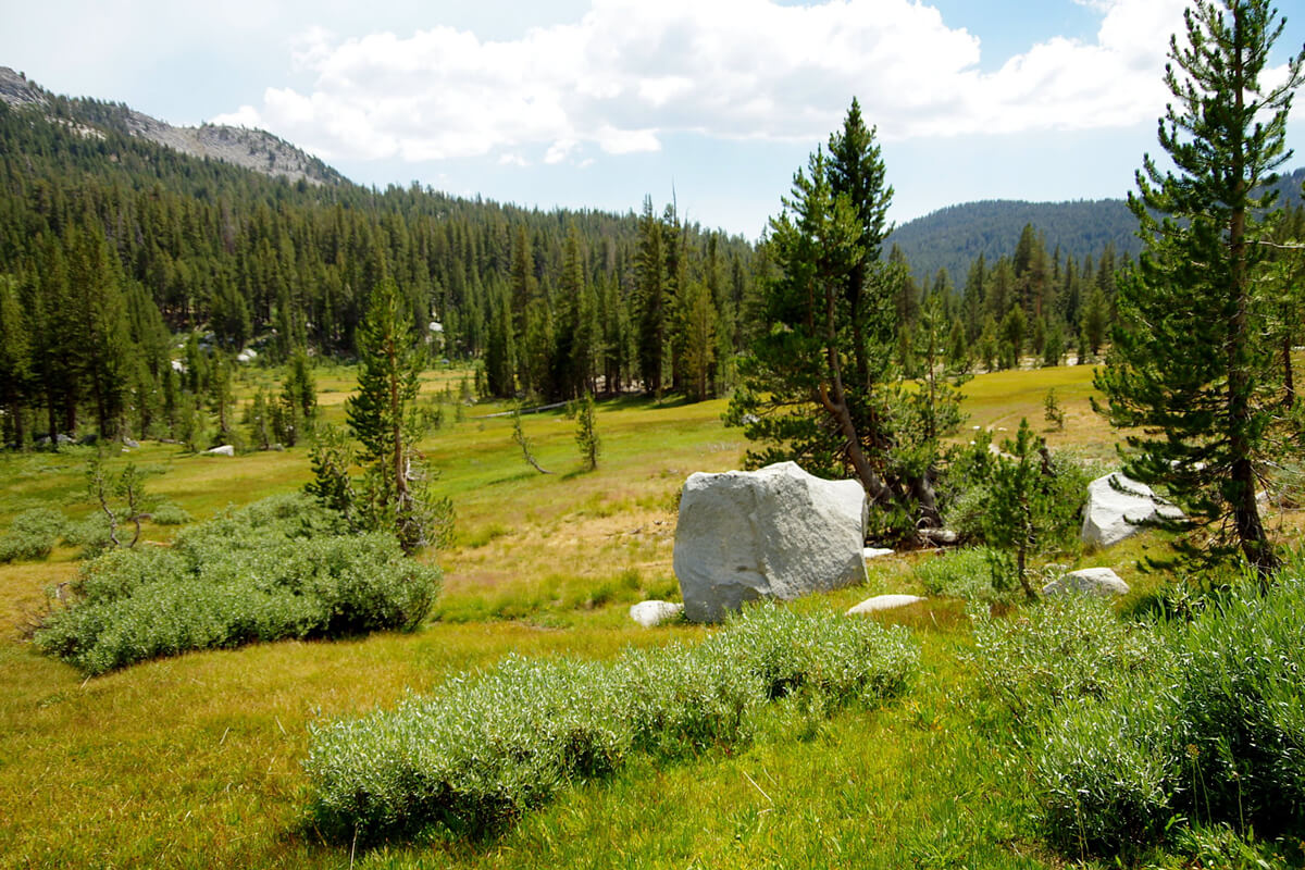
Figure 12.34: Graveyard Meadow, 2012
The trail leaves Cold Creek and heads up the pass, occasionally making switchbacks, as the pine trees disappear and are almost non-existent on the pass
Goodale Pass is a wide, gently sloping area, and Figure 12.37 shows the pass photographed from its north slope. However, the altitude drops sharply from this point onward. After a while, Purpoose (Baby Indian) Lake appears directly ahead, and Lake of Lone Indian Lake appears to the left
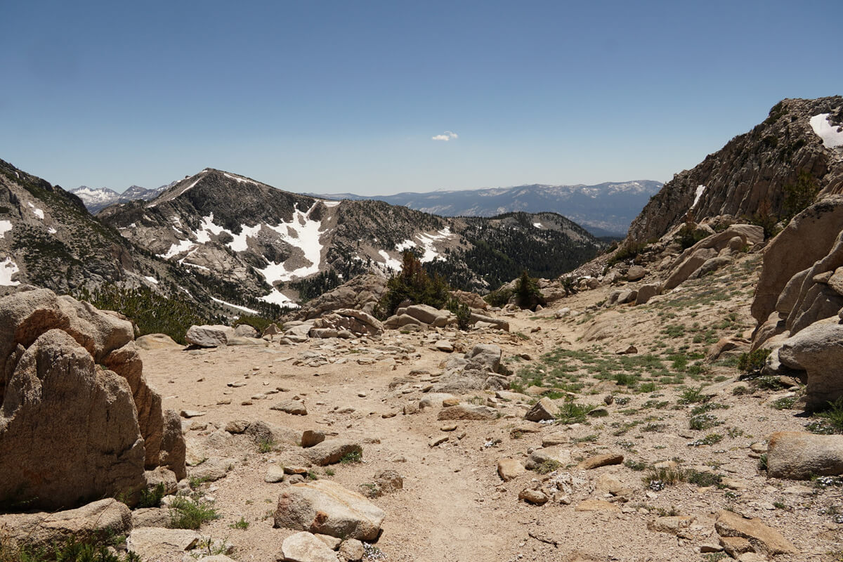
Figure 12.35: South of Goodale Pass, photographed in 2023
Figure 12.36: Goodale Pass, photographed in 2023
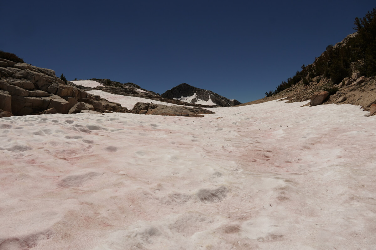
Figure 12.37: View of Goodale Pass from the north slope, taken in 2023
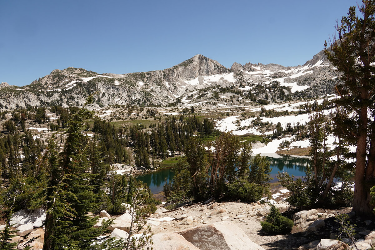
Figure 12.38: Purpoose Lake, 2023
Purpoose Lake is a saddle point, with easy access to water and a good lunch spot. The trail gains a little elevation and connects with the JMT below Chief Lake
<Continued in Chapter 13>
Nobuhiro Murakami's new hiking guide, "The Science of Hiking, 5th Edition," is now available on Amazon (Kindle edition is 100 yen)
Nobuhiro Murakami, a former professor at a national university and an experienced through-hiker who continues to share rational solo hiking know-how from a unique and profound scientific perspective in books such as "Hiking Handbook" (Shinyosha) and "The Complete Guide to Hiking in the United States" (Ei Publishing), has released his new book, "The Science of Hiking," which is now available on Amazon. This compelling and logical hiking textbook is based on his accumulated experience dating back to the dawn of long trails in Japan, as well as objective sources such as academic papers on hiking, exercise physiology, and a wide range of other fields
Consider a paid membership for access to premium content and events!
Nobuhiro Murakami


Related reading