Following on from our last article, we will be introducing trails in the water city of Shasta. Shasta is dotted with many crystal clear bodies of water, such as lakes and streams, and this time we will be introducing a trail that also features a beautiful lake
What's more, if you walk this trail in the summer, you can even swim in the lakes. Both lakes are truly beautiful, with few people around, making them the perfect place to cool down and relax. Be sure to walk and swim in them. They are private lakes in the middle of nature


This course is for beginners to intermediate hikers. The trail has little elevation change and many great views, making it a casual half-day hike. You can also enjoy swimming in the lake, bird watching, and nature trips
This trail is relatively quiet on weekdays, allowing you to fully enjoy nature and your own space. If you are going to Shasta and want to experience nature on foot, I highly recommend this trail
This trail leads to the Seven Lakes and Lake Helen, and along the way there is a branch that leads to the famous PCT (Pacific Crest Trail)
The Pacific Crest Trail (PCT) is a long-distance trail in the United States that stretches from the Mexican border in the south to the Canadian border in the north, connecting the states of California, Oregon, and Washington on the West Coast. It's one of the three major long-distance trails in the United States, along with the Appalachian Trail and the Continental Divide Trail, and is a coveted trail for hikers. With a total length of 2,650 mi (4,260 km), it takes four to six months to complete the entire journey, and it's said that only about 60% of people complete it successfully
This trail also connects to the PCT, so walking along this trail will give you a glimpse of the PCT. When walking along the trails in the Shasta area, you will occasionally come across backpackers carrying large loads, and they are surely hikers attempting the PCT Pacific Crest Trail

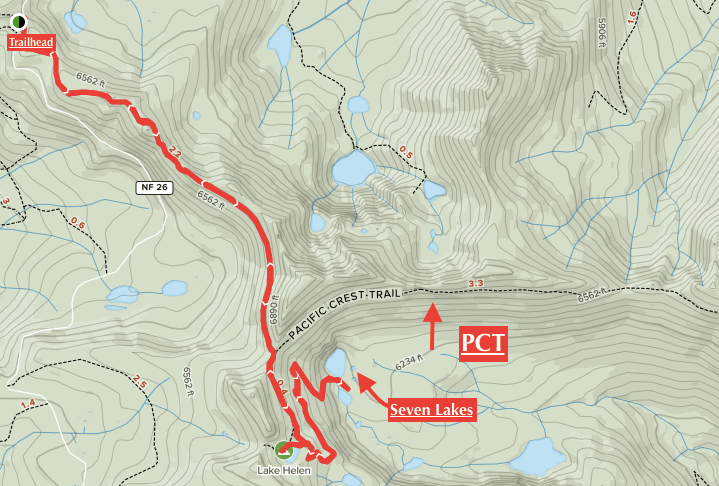
The red line is the trail we will be walking on this time. The black dotted line is the PCT
table of contents
Recommended trails near Shasta: Seven Lakes/Lake
Helen hiking guide
data
- For beginners, intermediates and above
- Season: May to October (trails open from March)
- Trailhead elevation: approx. 1860m
- Round trip: Approximately 12.5 km (7.8 miles)
- Height difference: 398m (1,309 ft)
- Course time: 3 to 5 hours round trip (including breaks)
Useful items to bring with you on a hike
- Drinks (larger in summer, about 2 liters)
- Warm clothing that can adjust to the temperature (it can get cold on windy days)
- hat
- sunglasses
- sunscreen
- Snacks to eat during the hike
- If you have any regular medications, bring first aid such as medicines and bandages
- Swimsuit (You can swim in the lake in the summer. There is no place to change clothes, but please bring your own if necessary.)
- Other normal hiking gear
How to get to Mount Shasta (by car)
- Drive north from San Francisco on I-5 for about 5 hours. The distance is about 245 miles (392 km) as the crow flies
- It takes 3 hours from Sacramento. Just drive north on I-5
- The closest airports to Shasta are Redding or Medford, which are about an hour to an hour and a half drive away (via I-5)
Trailhead
Address: Mumbo Summit (Gumboot PCT Trailhead) Mt Shasta, CA 9606 (Enter this address into your GPS and you will arrive at the trailhead.)
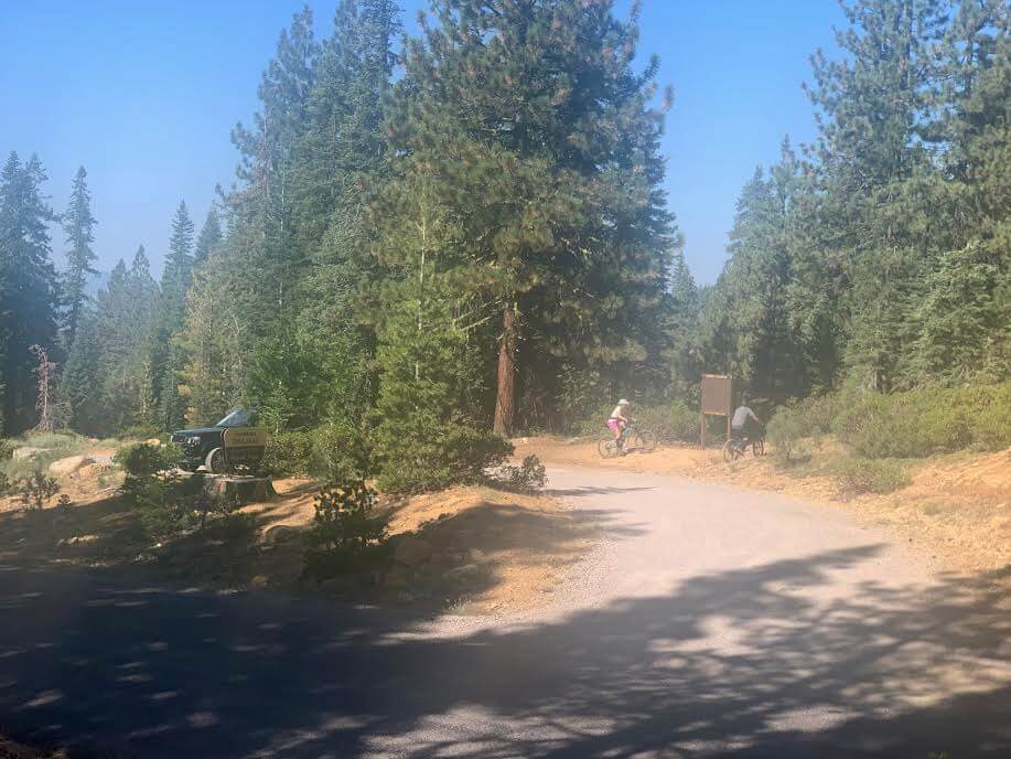
There is a parking lot at the trailhead, but no restrooms. Two trails extend from the parking lot, each with two separate trailheads
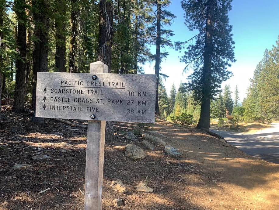
The Gumboot Trailhead starts immediately to the right as you enter the parking lot, and the trailhead heading towards the PCT (Pacific Crest Trail) is located across the road from the parking lot. This time, we will start from the PCT (Pacific Crest Trail) trailhead located across the road
Start hiking
The photo was taken at the beginning of September, and there were hardly any cars around at 10am, so there was plenty of space. It may be September, but the temperature is still summery! It was a very hot day
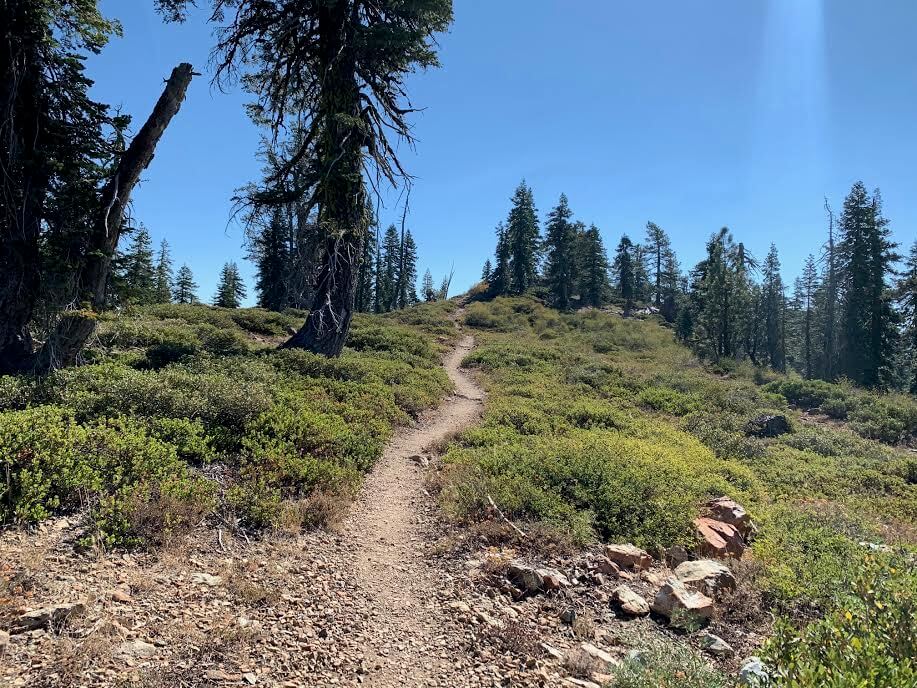
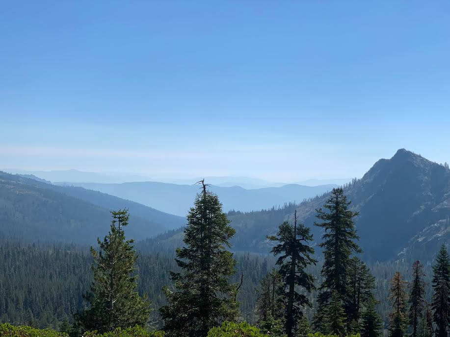
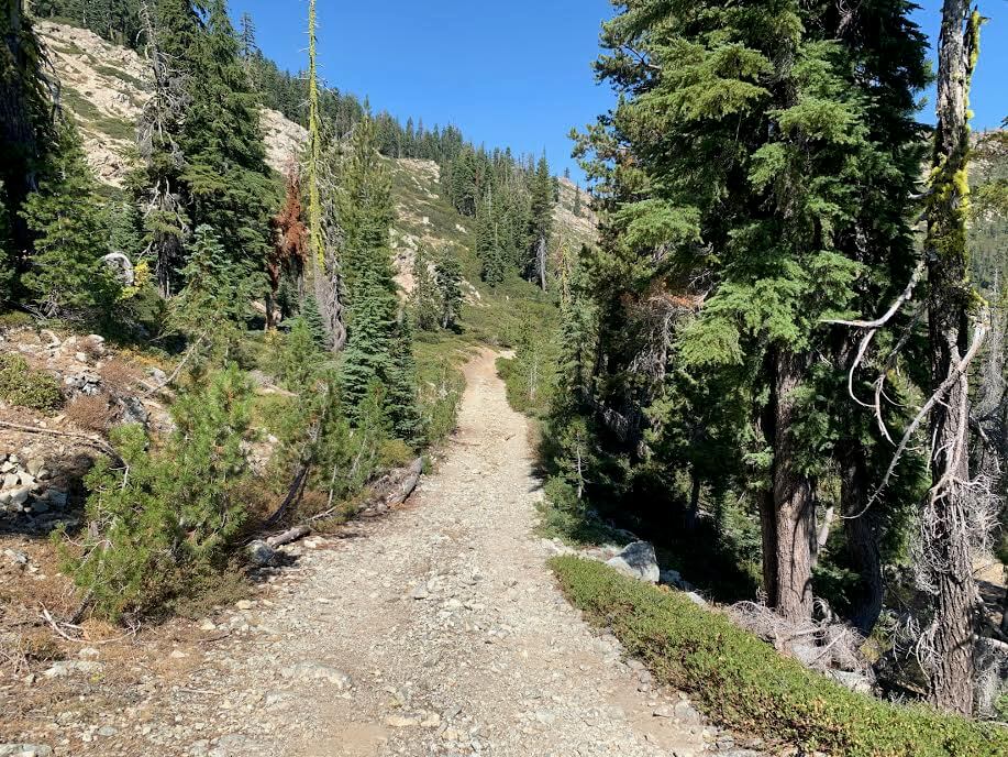
At first, the trail is a gentle slope, then fairly flat. The trail is surrounded by trees, so there is shade. After 10 to 15 minutes, the view gradually opens up and the surrounding mountains come into view
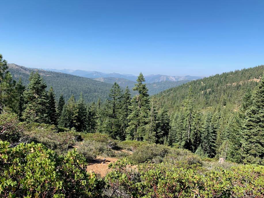
This photo was taken in early September, when California fires were raging everywhere, but the view was still spectacular! The air was less clear than usual due to the smoke, but it was still beautiful
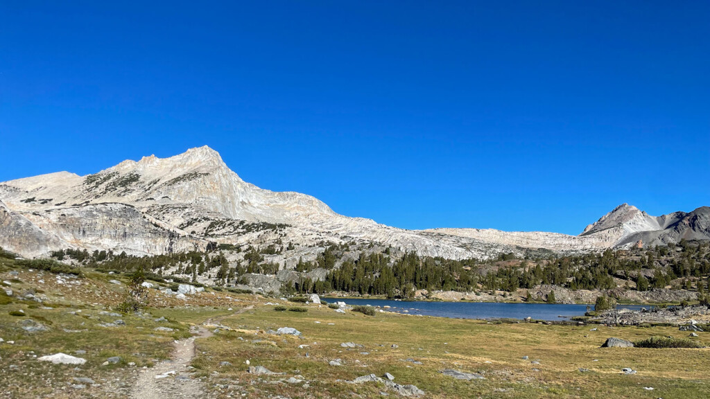
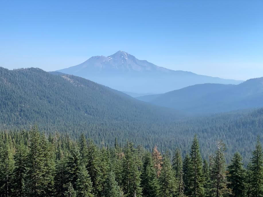
The slope gradually starts to slope, but the beautiful scenery continues. Gradually, Mount Shasta comes into view on the left, as do Gumboot Lake and Upper Gumboot Lake
The leaves are starting to turn red and yellow little by little, making us feel like summer is coming to an end. But it's still so hot. The temperature is still just like summer. Lol
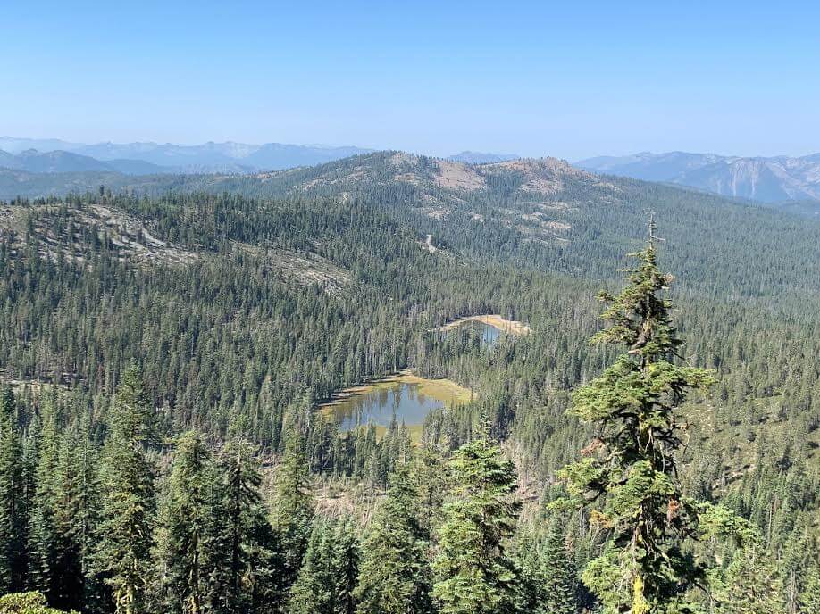
If you go further, you will see Mumbo Lake and Upper Mumbo Lake on your right. As you walk along the trail, you will notice that there are lakes everywhere

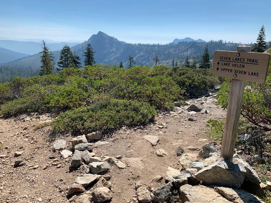
About an hour after setting off, we came to a fork in the road to the PCT Pacific Crest Trail. If we went straight, we would head towards Seven Lakes/Lake Helen, our destination. The trail to the left leads to the PCT. This trail stretches through beautiful scenery. With the feeling that I would like to try the PCT someday, I continued on towards my destination for the day
You can see the PCT continuing all the way up the mountainside, and the view is spectacular
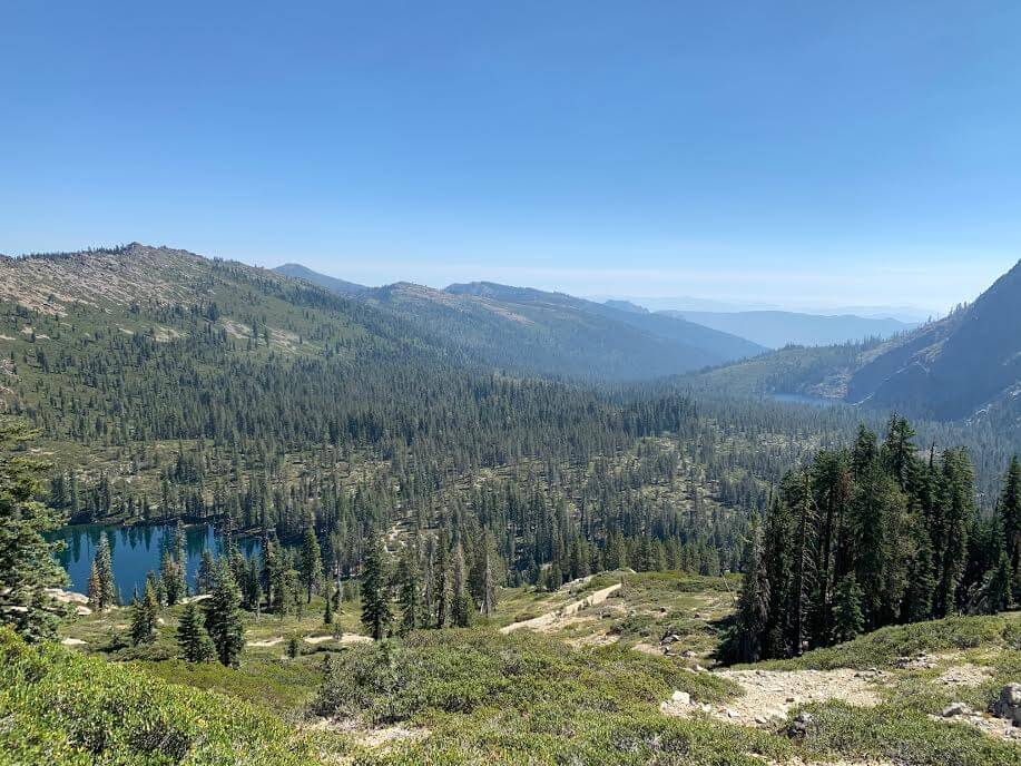
After passing the fork and continuing on, we could see Seven Lakes, which we would visit later, below us on the left
If you continue along the trail, you will see Lake Helen on your right (Lake Helen is also located before Seven Lakes). Lake Helen is not visible from the main trail you have been walking on, so it is easy to miss, but if you pay attention, you will find a trail branching off to the right, and if you follow that trail you will find Lake Helen. It is easy to miss, so be careful (it will be easier if you download a GPS first)
You can start from either Seven Lakes or Lake Helen, but we recommend joining the trail to Lake Helen, which is just before the finish line at Seven Lakes
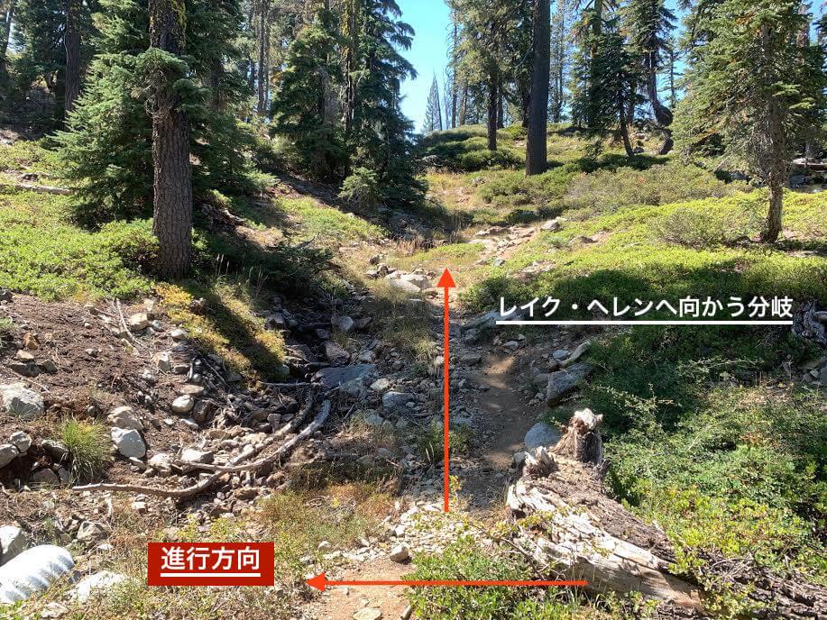
The trail is a little confusing. After climbing a small hill, you'll find yourself..
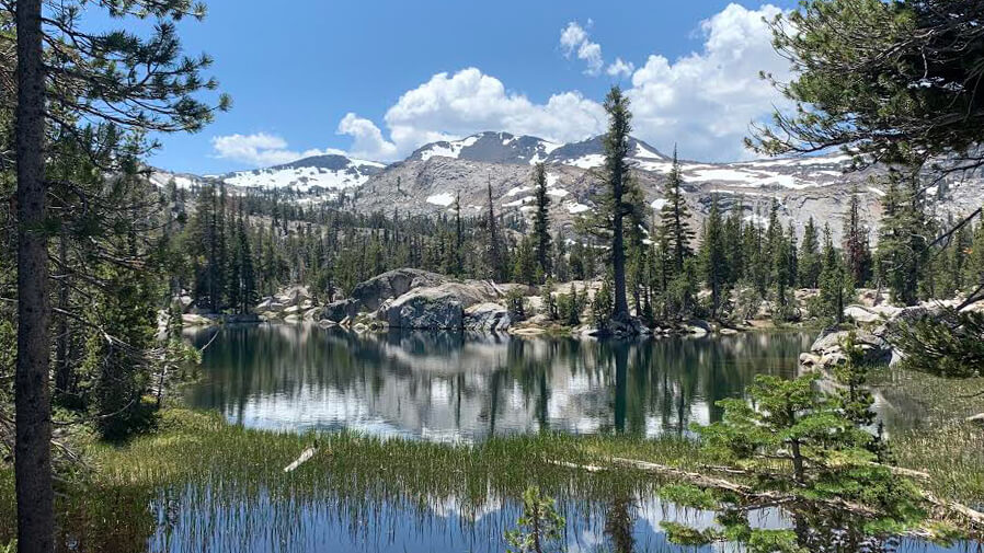
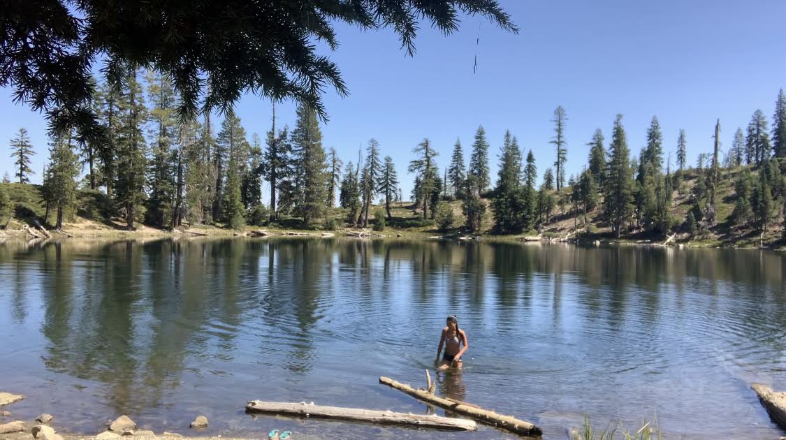
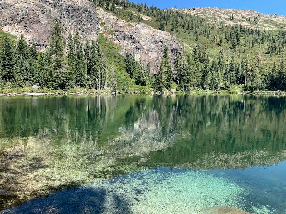
Lake Helen appears. No one is there. The lake is yours! LOL
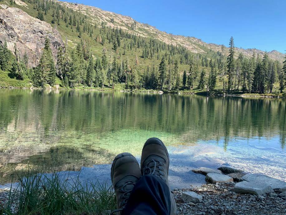
I went for a swim straight away. The water temperature was just right, neither too cold nor too warm, and it was truly refreshing
This is truly the blessing of nature. Both your body and mind will feel refreshed after swimming
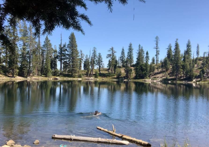

I took a nap afterwards. It was great. It was quiet and really relaxing. I think this is one of the great things about hiking trails in America. There are swimming lakes everywhere, and you can easily spend time with nature without the crowds. This is something you really feel when you come to America. After swimming and a short rest, I set off for Seven Lakes, which was my goal for this trip
After your swim, return the way you came and head back to the main trail
If you continue walking in the same direction, you will come to a fork in the road to Seven Lakes. It is quite close, about 10 minutes from the Lake Helen fork. This fork is also a little confusing, so be careful
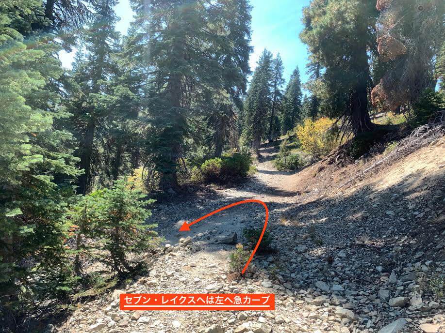
As you can see in the photo, the turnoff to Seven Lakes is a road that curves sharply to the left from the trail. It's easy to overlook it and go straight ahead, but the turnoff to Seven Lakes is actually downhill
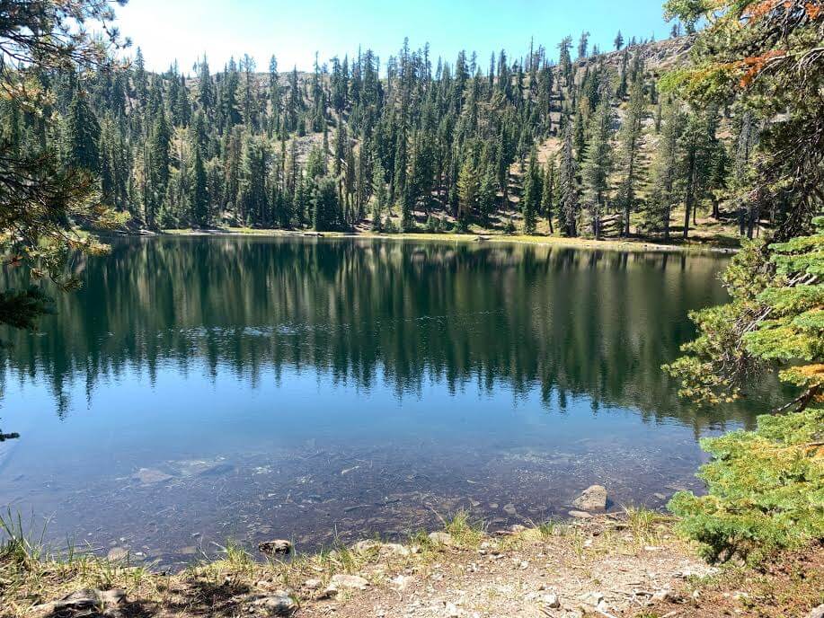
As we descended the gravel road, we came across Seven Lakes (Upper)
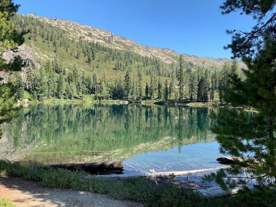
A beautiful and highly transparent lake
It is larger than Lake Helen and the colors of the lake are beautiful
Luckily, there was no one else there except me. It was a really quiet place
Of course you can swim here too, and the temperature is just right
The Lower Seven Lakes are also located close by. You can easily walk there from the Upper Seven Lakes, but the Upper Seven Lakes are more beautiful
After a good rest, we head back the way we came
This time, we took a good swim and the hike took a total of four and a half hours, including breaks. This trail is punctuated by a beautiful lake. I highly recommend it
Precautions regarding the spread of COVID-19
As of December 2020, various countries are currently imposing entry restrictions due to strengthened quarantine measures, as well as restrictions on entry to national parks and domestic travel. These conditions are subject to change without notice, so when traveling, be sure to obtain local information from each country's embassy or consulate, the Ministry of Foreign Affairs' Overseas Safety Website (Infectious Disease Risk Information), national park websites, and other sources, and check information on transit points, countries you plan to travel to, and the areas around the places you plan to visit before making reasonable plans and taking action
Sayaka Kato

Related reading