Previous article (Chapter 8)
table of contents
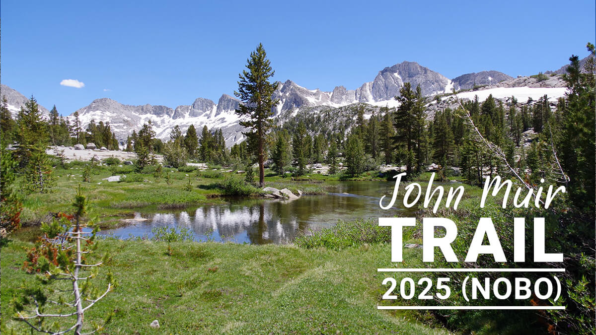
Chapter 9: Muir Pass Detour
2017 and 2023 were seasons of heavy snowfall in the High Sierra. In 2017, two Japanese and two Chinese PCT hikers died while trying to ford the mountain. I also suffered a torn muscle, which forced me to escape to Bishop and bypass Muir Pass. 2017 was recorded as the worst year
Heavy snow also occurred in 2023. No fatalities were reported, but a bridge over the San Joaquin River collapsed. The rapids were difficult to ford. As a result, Muir Pass became difficult to navigate. Many hikers opted to detour from La Conte Ranger Station to South Lake, resupplying at Bishop or Perchers Resort, then following the Paiute Pass Trail from North Lake
I happened to walk this area in 2011, 2017, and 2023. Each time, it included beautiful sights like Ducie Basin and Golden Trout Lake. It's not just a detour; some hikers even use it as a circular route
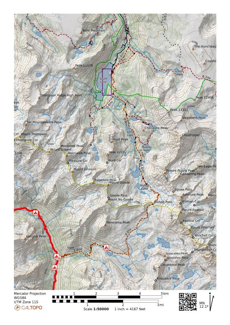
Figure 9.1: La Conte Ranger Station to South Lake
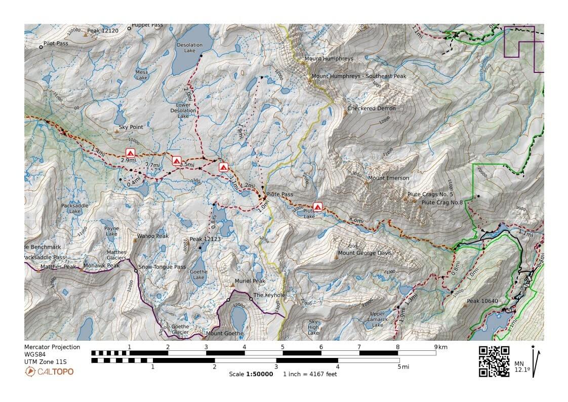
Figure 9.2: Paiute Pass Trail
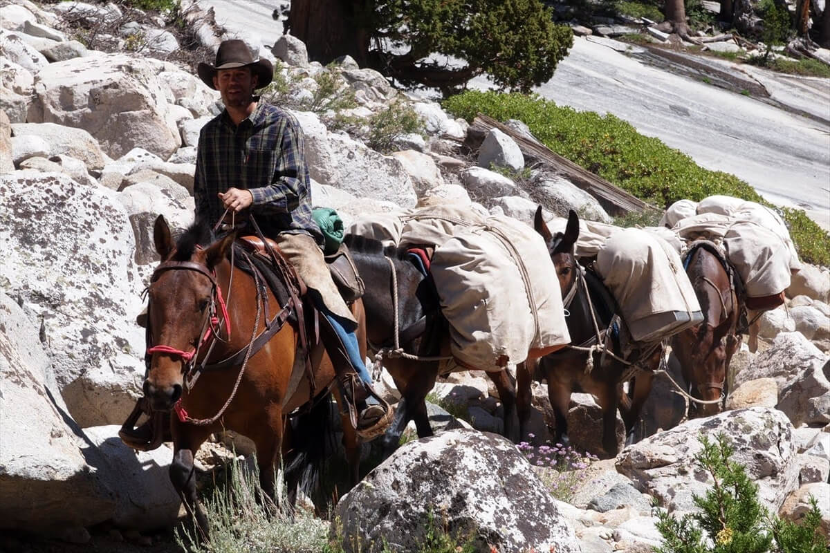
Figure 9.3: A pack train heading to South Lake, 2011
La Conte Ranger Station to South Lake
If you're heading north on the JMT, there's a fork to the right near the La Conte Ranger Station. I hiked this route in 2011 and 2017. Along the way, you'll find a wonderful spot called Duchy Basin, which is worth visiting if you have the chance
From the fork, the trail is gentle for a while, then hits a short switchback and begins a steep climb. On your right, you'll see a waterfall cascading over rock. Figure 9.3 shows a pack train heading from La Conte Canyon (probably the ranger station) to South Lake
The same climb continues even after the switchbacks are gone. As the trail becomes gentler, you cross the river on the footbridge shown in Figure 9.5. As I recall, there were two. The larger footbridge was destroyed in a heavy snowfall in 2023, but has since been repaired. Climbing up to this point offers a good view of La Conte Canyon, as shown in Figure 9.4. Muir Pass is in the direction not visible in the photo on the right
Soon, after a series of short switchbacks, the trail passes through rocks. The weather was bad in 2017, and some hikers were sheltering in the shade of rocks under tarps. They probably didn't have rain gear. 2017 was the year three American hikers were struck by lightning at Guitar Lake. We were also struck by lightning at Guitar Lake, and we were hit by thunder, hail, and rain for a long time on our descent from Mount Whitney
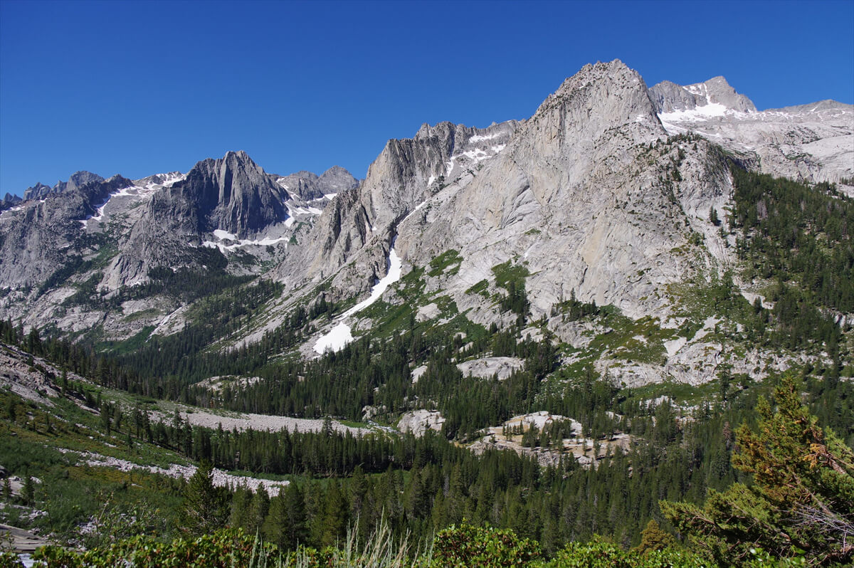
Figure 9.4: La Conte Canyon, Langille Peak. Photographed in 2017
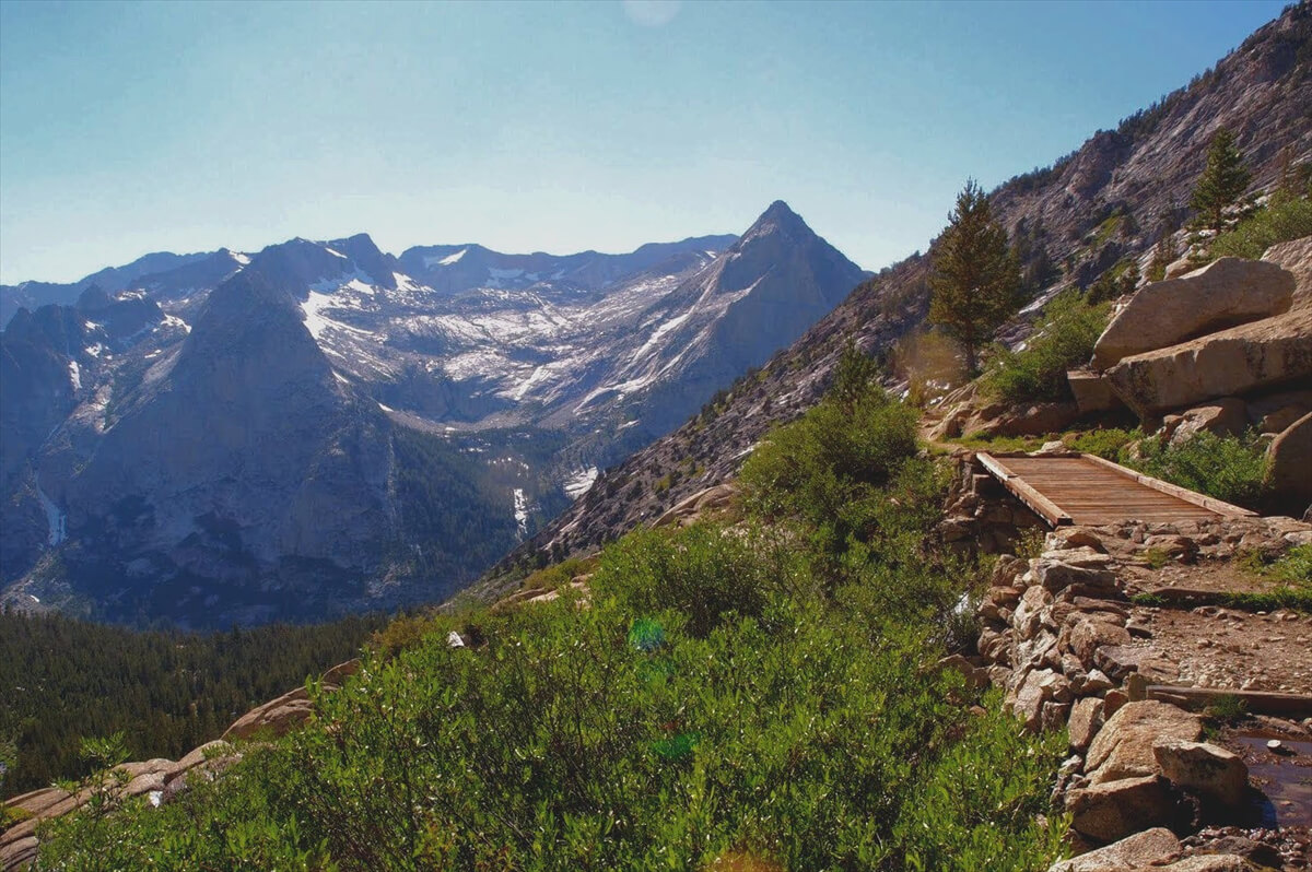
Figure 9.5: Footbridge at the midpoint. Photographed in 2011
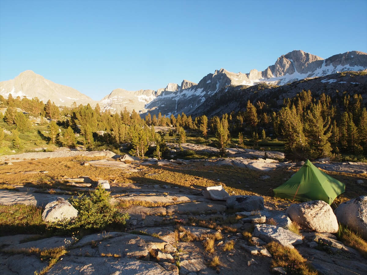
Figure 9.6: The lowermost reaches of the Lower Duchy Basin, photographed in 2011
Once you cross this point, you enter a gentle meadow. This is the Lower Duchy Basin. In 2011, Chieko got altitude sickness at Palisade Lake, so we turned back and pitched our tent here. Although it was a little downstream, there was no one there and it was a great campsite
After a short walk, you will reach Duchy Basin. The pine trees disappear and a pond appears. Campsites are scattered around the pond. The pond continues all the way to the back, but the trail continues uphill away from the pond. The slope is not steep, so there are few switchbacks. When the vegetation disappears and you come to a flat area, you will reach Bishop Pass. Looking back, you will see the view shown in Figure 9.9
Figure 9.7: Lower Duchy Basin, photographed in 2017
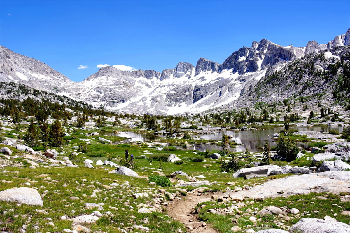
Figure 9.8: Duchy Basin, photographed in 2017
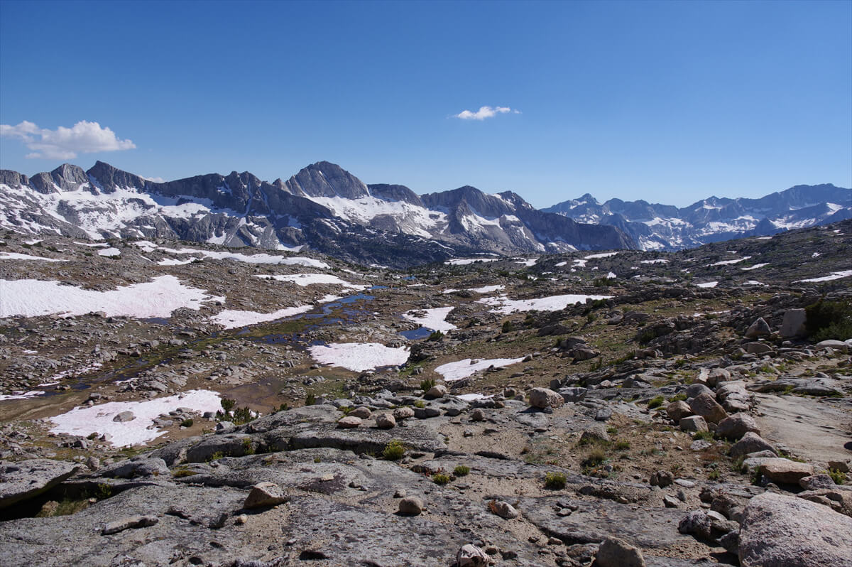
Figure 9.9: View south of Bishop Pass, 2017
In 2011, there was a lot of snow on the pass, and three women were descending. One of them slipped and stumbled. As they approached,
"You'd laugh."
"Huh? I'm not laughing."
"It made me laugh."
"I'm not laughing. I'm not laughing."
By the way, in English it's "You laughed at me." I guess it's meant to mock me. Well, I laughed, but I decided to completely deny it. When I realized they were Japanese, we became friends and took a commemorative photo. It's hard to let your guard down when three middle-aged women get together
Bishop Pass (Figure 9.11) is a rocky, flat area with Mount Agassiz in the background. During the snowy 2017 season, this was covered in snow. The elevation is 3,649 m. All the passes on the JMT are at this elevation
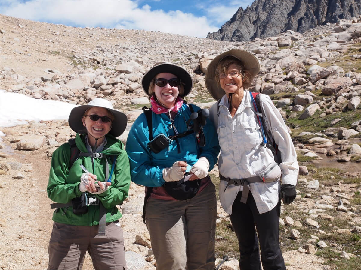
Figure 9.10: Be careful if you encounter the three ladies. Photo taken in 2011
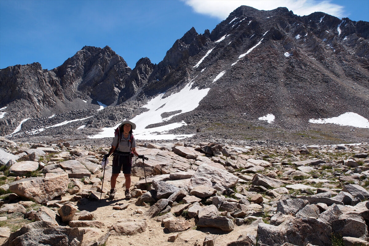
Figure 9.11: Bishop Pass, with Mount Agassiz in the background. Photographed in 2011
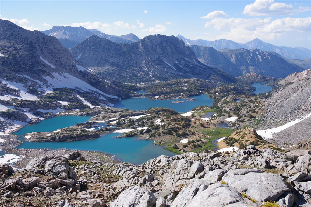
Figure 9.12: North side of Bishop Pass, 2017
Starting from the point where you start to descend from the pass, you can see Bishop Lake, Saddlerock Lake, Timberline Lake, and Long Lake, and the trail continues to weave around these lakes. The trail descends from the pass on some steep switchbacks, but it soon ends and you reach the shore of Bishop Lake. There are already many places where you can camp
Figure 9.13 shows the pass as seen from Bishop Lake. The pass is at its lowest point, and the steep descent from the pass is about 50 meters. The trail from Bishop Lake to Timberline Lake is gentle, with campsites scattered throughout. Only just before Spearhead Lake does the trail cross a steep, scree-covered area
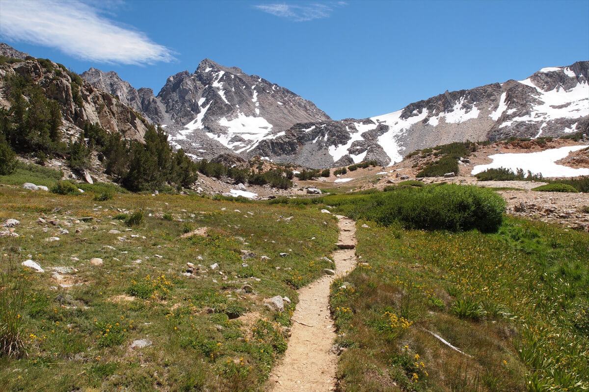
Figure 9.13: Looking back at Bishop Pass from the north, photographed in 2011
In 2011, I left the trailhead late and my backpack was too heavy for me to walk, so I camped downstream of Long Lake. There were campsites here and there, but most hikers were heading to Duchy Basin, so there weren't many people camping there. That year, I passed a group of about 10 Chinese people (probably living in the US). This year, perhaps because of the Trump administration, I didn't see any Chinese people at all
In 2017, due to a torn muscle, my walking was delayed and I arrived at South Lake at dusk. Hitching would be difficult after dark, so I found a campsite nearby and pitched my tent. This is shown in Figure 9.17. About 1 km before South Lake, there was a small marshland, and then I crossed a stream. I looked around the hill and found a large campsite
When there is a lot of snow, flowers bloom in abundance in the High Sierra. Pink alpine columbines are particularly striking at Bishop Pass and Paiute Pass. Fortunately or unfortunately, I visited these places twice during snowy summers. Figure 9.14 shows a photo of the flowers. I once went to Bishop Pass after tearing a muscle, and after recovering a little, Chieko and I went to Bishop Pass again
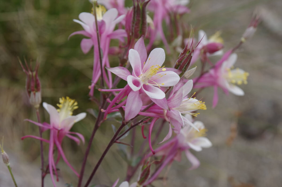
Figure 9.14: Alpine Columbine, photographed in 2017
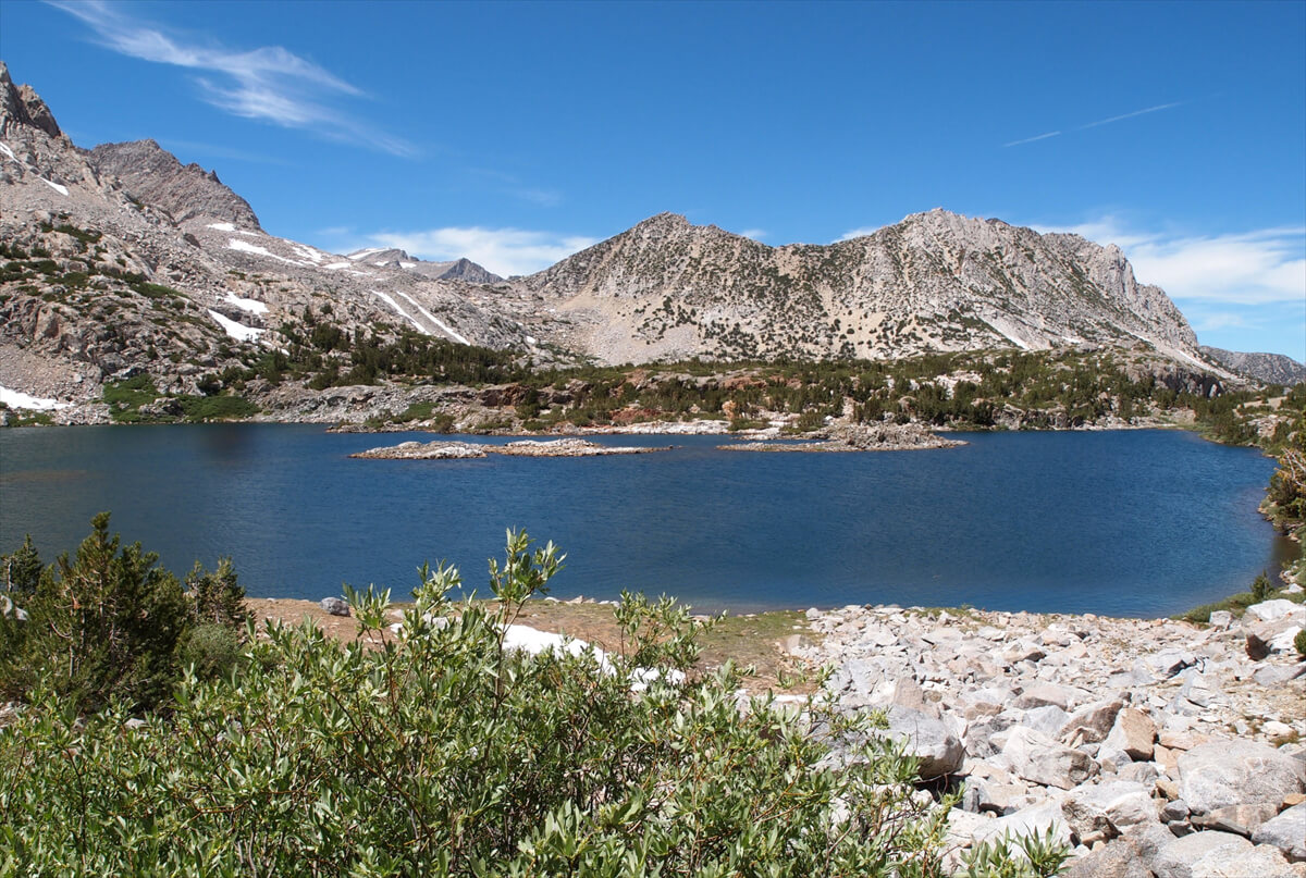
Figure 9.15: Saddlerock Lake, 2011
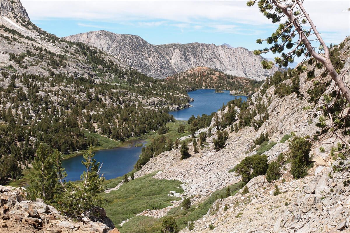
Figure 9.16: Spearhead Lake and Long Lake, 2011
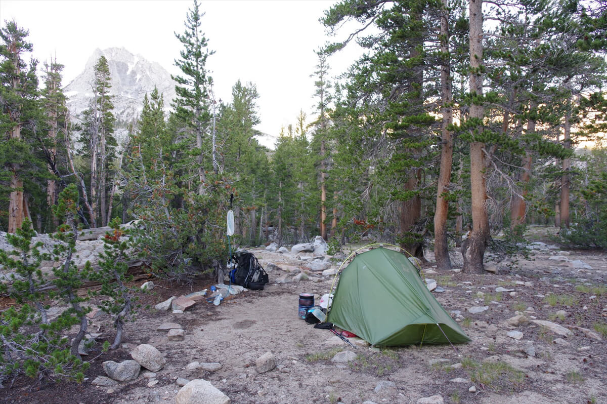
Figure 9.17: The hill in front of South Lake, with a stream nearby. Photographed in 2017
Hitchhiking and resupply
South Lake is the largest lake. The trailhead is narrow, so you can't pitch a tent nearby. I camped about an hour before the trailhead because if I arrived in the evening and hitchhiked, I would have no place to sleep
You can resupply at Perchers Resort or hitchhike down to Bishop. Perchers Resort (Figure 9.19) is a 30- to 60-minute walk from the trailhead. If you walk on the road, you'll be leaving the wilderness and your permit will be revoked. However, no one has had their permit revoked, likely because the road is not designed for pedestrians and is dangerous
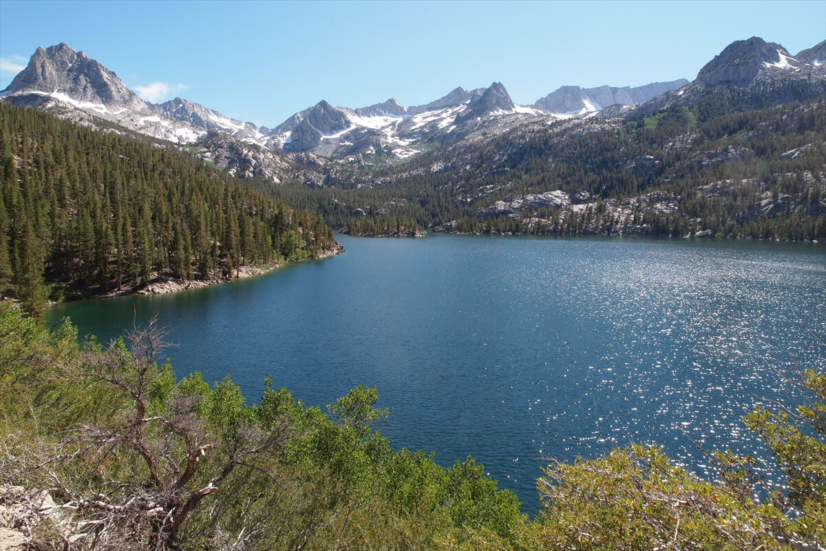
Figure 9.18: South Lake, 2011
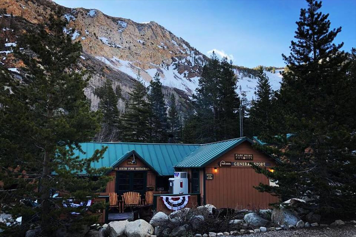
Figure 9.19: Perchers Resort, 2020, photo courtesy of the resort
During the 2024 Southbound JMT, I sent food to Perchers Resort to resupply, but because I had a broken tooth root, I caught COVID-19 shortly after and had to cancel the hike. So, unfortunately, I've never been to this resort. There are showers, but you can't stay overnight, so you need to get there by around noon and resupply
A little further downstream is Willow Campground, but it's a car camping site, so I went down a little further and joined the trail toward Lake Sabrina. There's a good camping spot up the switchbacks along the river, followed by Tea Lake and George Lake. I actually looked up hikers' photos and Google Earth in detail. It's probably best to avoid Lake Sabrina, as it's crowded. There's a road that goes up to North Lake from downstream of Lake Sabrina
The hitchhiking method is as shown in Figure 9.20. Here are the rules for hitchhiking
- Do it in a place that won't interfere with traffic. Avoid riding near corners or intersections. It's generally okay near trailheads. It may be illegal in busy towns
- A thumbs-up is a common sign for hitchhiking. If possible, indicate your destination. Bring a printed copy of your destination with you to increase your chances of success
- Place your luggage where it can be seen by the car, and it is advisable that hitchhikers stay in a visible place
- If a car stops and smells of alcohol or if the person in it seems unsafe, don't get in. Some people are okay with being drunk, but if you get into an accident, it could be troublesome
- When hitchhiking, you generally don't pay for gas or anything like that. I've hitchhiked many times, but no one has ever accepted a ride. It's a good-will act, so I don't accept payment. If I did, it would become a business
- Shuttle drivers who take hikers to and from trailheads receive special permission from the national park. If anyone other than a shuttle driver enters a national park, gives a ride, and receives payment, it is considered interference with business and is therefore illegal
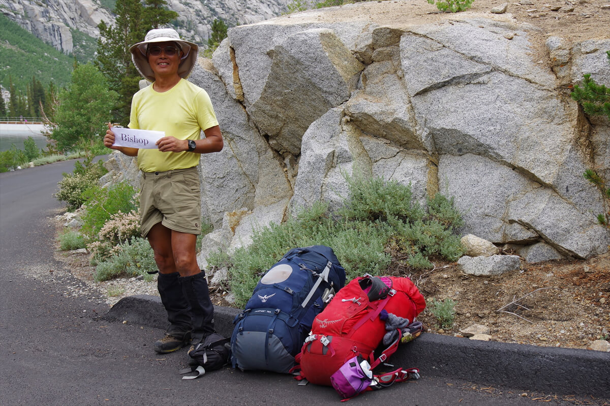
Figure 9.20: Hitchhiking to Bishop. Photographed in 2017
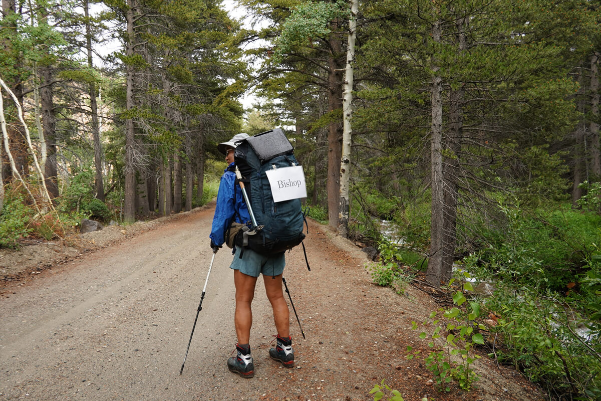
Figure 9.21: Hitchhiking while walking. Photographed in 2023
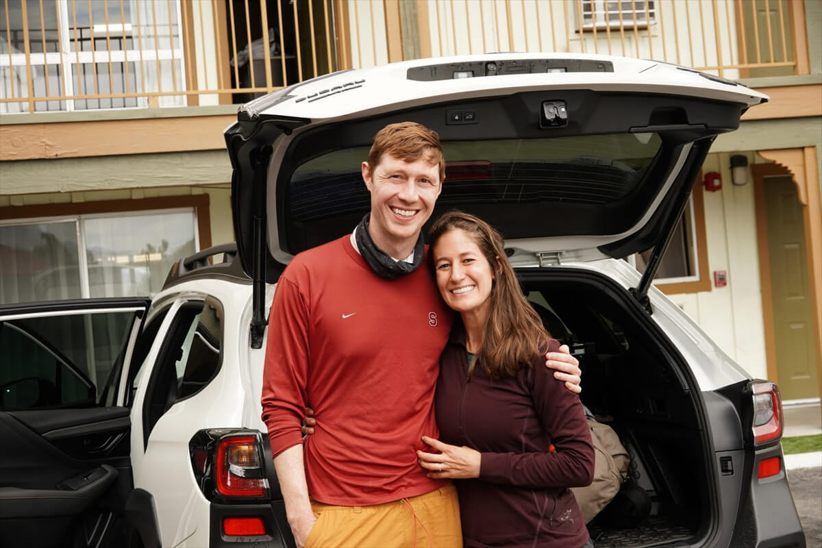
Figure 9.22: Emily and her friends. Photographed in 2023
Figure 9.23: North Lake, 2017
Since Muir Pass will be closed in 2023, Chieko and I planned to enter through Red Cones and go to Bishop via North Lake. The problem was that there was no transportation from North Lake to Bishop. There used to be a bus service connecting Lake Sabrina and Bishop, but it has long since been discontinued. North Lake has little traffic, so there are few opportunities for hitchhiking. This meant we needed to get to the road leading to Lake Sabrina. To seize the opportunity to reach that road, we decided to walk with a hitchhiking sign on our backs. This is shown in Figure 9.21
He looked like a street performer, so I got a lot of attention. Sometimes people would say "Good luck!" but they wouldn't give me a ride. A car coming up the hill stopped. It was a funny, talkative old man
"Bishop, huh? I'd love to give you a ride, but I'm off to pick up my wife. She went up into the mountains on the pack train, but she should be back soon."
He was an outfitter
"I passed him while heading for the pass."
"I see. Then I'll pick up your wife and give you a ride home. Good luck."
Unfortunately, I didn't see this person again. A few minutes later, a car stopped and I got in. It was Emily and her husband, who had entered from North Lake and were returning from camping at Golden Trout Lake. They gave me a ride to the Vagabond Inn in Bishop, where I had made a reservation. As a thank you, I took a photo of them, as shown in Figure 9.22
Paiute Pass Trail to the JMT
I walked the Paiute Pass Trail northbound in 2017 and southbound in 2023. The weather was better in 2017, so the photos are better
There is a fork in the road to Lake Sabrina onto North Lake Road. In 2017, I took the bus and was dropped off at the fork. If you take the shuttle, you can probably get to the trailhead. North Lake Road is a normal forestry road and is easy to walk on, but it does take a while because it's a continuous climb. It takes about two hours from the fork to the trailhead
North Lake is not as beautiful. The campground is on the opposite bank of the photo in Figure 9.23. The outfitter who operates the pack train is also on the opposite bank. There is a small campsite for hikers at the trailhead
The trail climbs gently through the forest. After 30 to 40 minutes of walking, you come to a ford. It's a bit uninteresting, having to cross to the other side and then back again, but there's no other way around it. After a while, the trees thin out and you walk through a meadow. In the snowy summer, you'll see many flowers, including the tiger lily shown in Figure 9.24
As the view opens up, look to your right and you'll see the brown rock face shown in Figure 9.25. Soon, the trail begins a steep switchback. After about 30 minutes of walking, you'll reach the first lake, Loch Leven (Figure 9.26). The concave area in the photo is Paiute Pass
Loch Leven is an unusual name, and I thought it was German, but it's actually a Scottish word. Old English is very similar to German. Loch means lake, and Leven means life. Perhaps the Scottish people were feeling nostalgic and chose the same name. There are no campsites, so we take a short break here and head towards the next lake. The trail becomes less steep from here onwards, making it easier to walk
Small puddle-like lakes continue along the trail. After completing the switchbacks, you will come to Paiute Lake (Figure 9.27), the largest lake on the east side of the pass. I remember eating a French bread sandwich here. The slope around the lake is gentle, so there are campsites here and there
The trail is gentle all the way up to Paiute Pass. In snowy years, there is a snowfield, as shown in Figure 9.28. The slope is gentle, so kick-stepping is no problem. The pass is a gentle hill, so the descent is also gentle. After a while, you will reach Summit Lake. It is a deserted lake and there is a campsite, but I have never seen anyone camping there
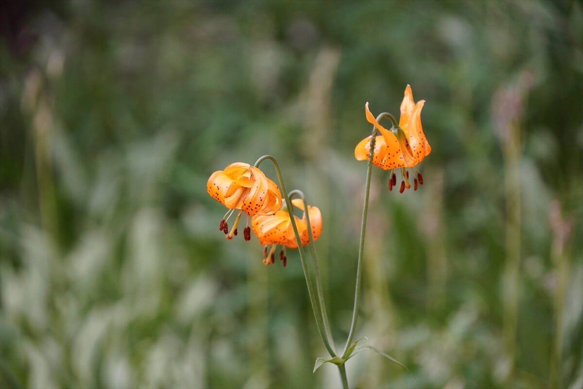
Figure 9.24: Tiger lily, found in low-lying wetlands. Photographed in 2023
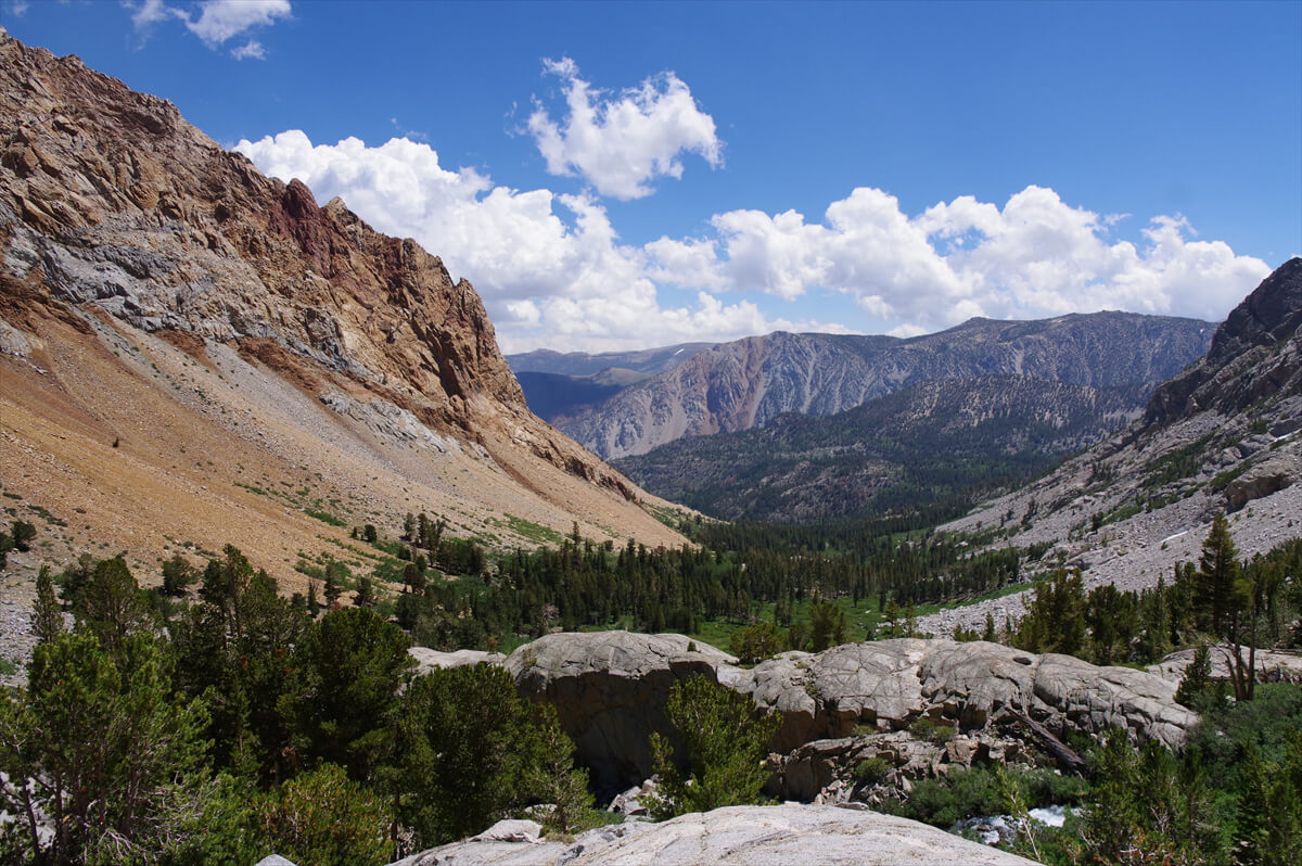
Figure 9.25: Climbing from North Lake. Photographed in 2017
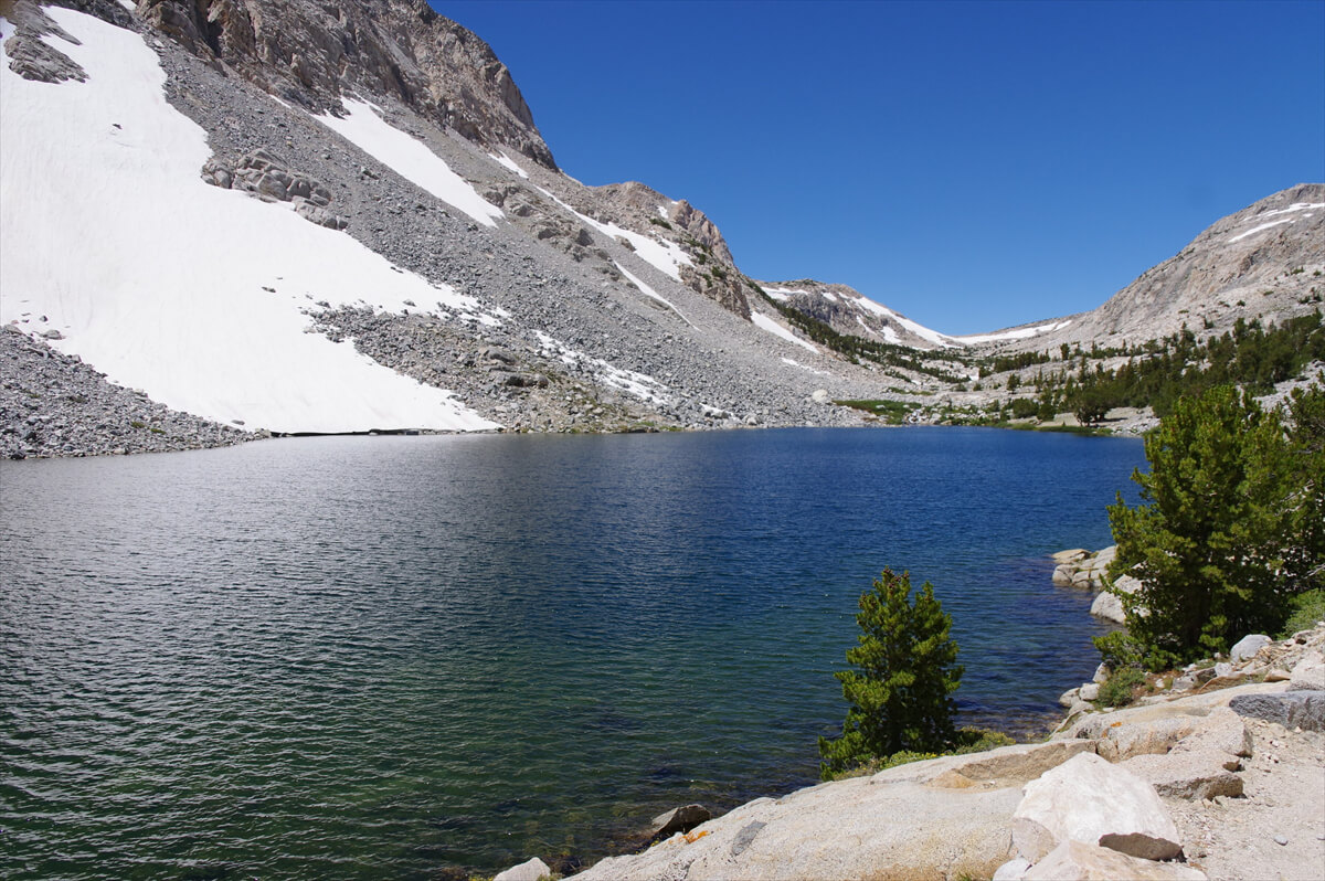
Figure 9.26: Loch Leven, photographed in 2017
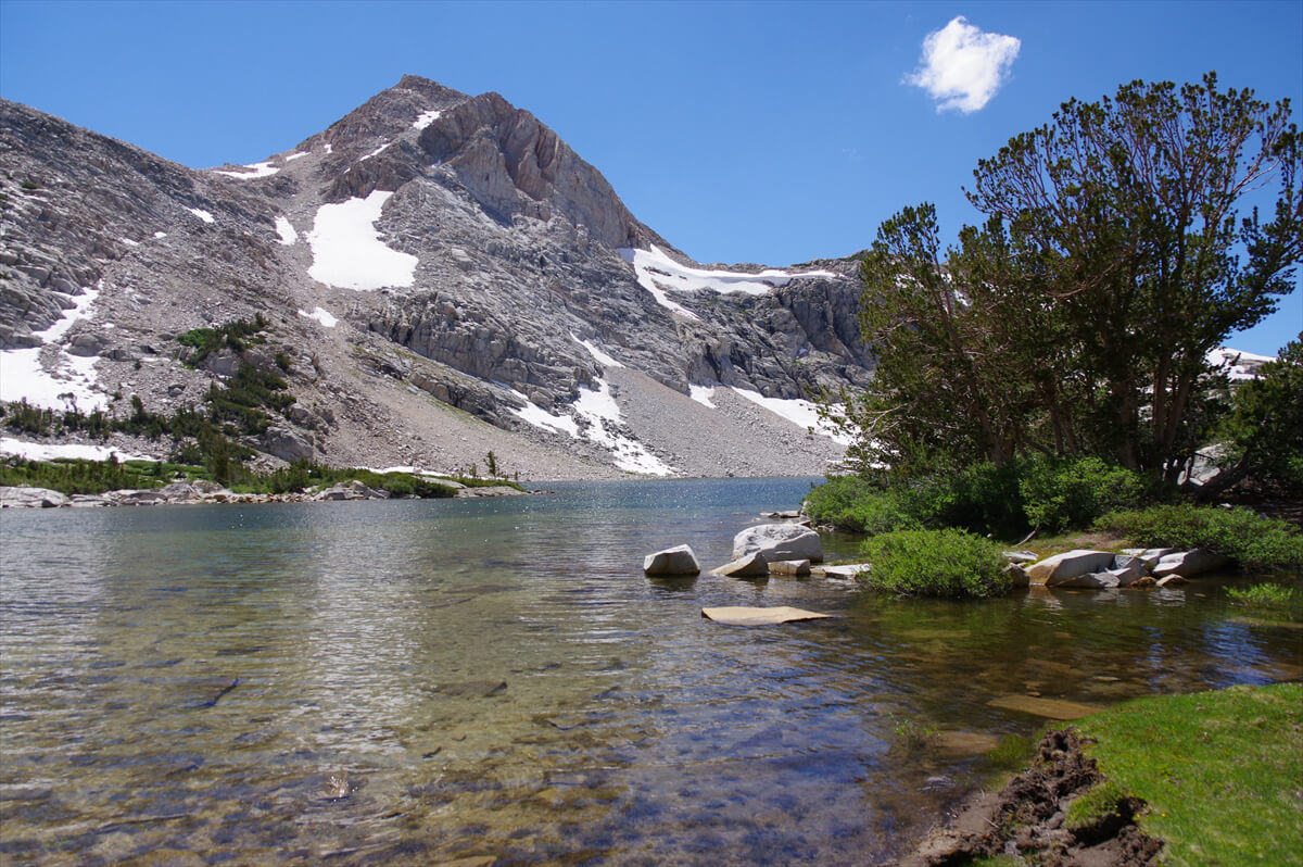
Figure 9.27: Paiute Lake, 2017
Figure 9.28: Heading towards Paiute Pass. Photographed in 2017
Once you cross the pass, you can see the plateau to the east. The trail splits into two: one that goes straight east and one that follows the lakeshore on the left side of the photo. However, these trails merge once you descend the plateau. Campers will likely take the trail near the lake
The tundra near the pass was filled with blooming alpine columpines, as shown in Figure 9.30
Figure 9.29: West of Paiute Pass, 2017
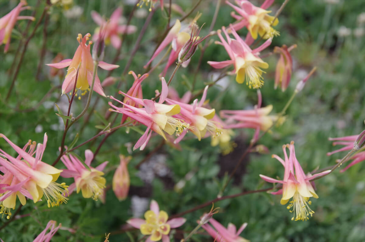
Figure 9.30: Pink Alpine Columbine. Photographed in 2017
The trail turns north and continues uphill. From here on, there are some nice campsites scattered around, including one near the Paiute Creek crossing. This is probably the best spot near the pass
The trail continues east on the plateau. Looking back, you can see Mount Emerson (Figure 9.31), a rocky mountain with an elevation of 3,998 m. There was bare ground beside the trail, so in 2023 we pitched our tent
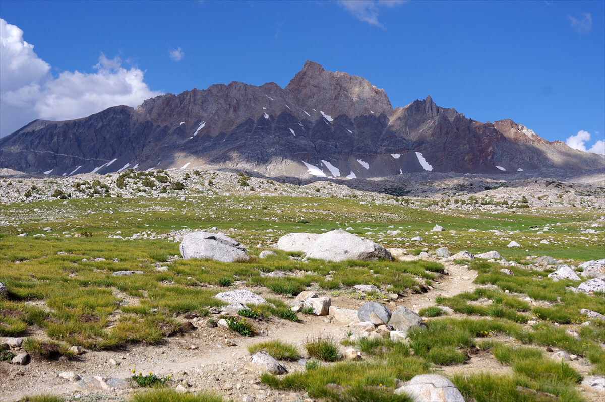
Figure 9.31: Mount Emerson, photographed in 2017
A little further down, there's a rather tricky ford, as shown in Figure 9.32. This was during a snowy season, so you should usually be able to ford without getting your shoes wet, but there are some deep spots, so you need to be careful. Figure 9.33 shows where we pitched our tent about 30 minutes after crossing this point. There was a lot of snow in 2017, so we found water nearby, but by 2023 it had dried up. It may have been a valuable spot
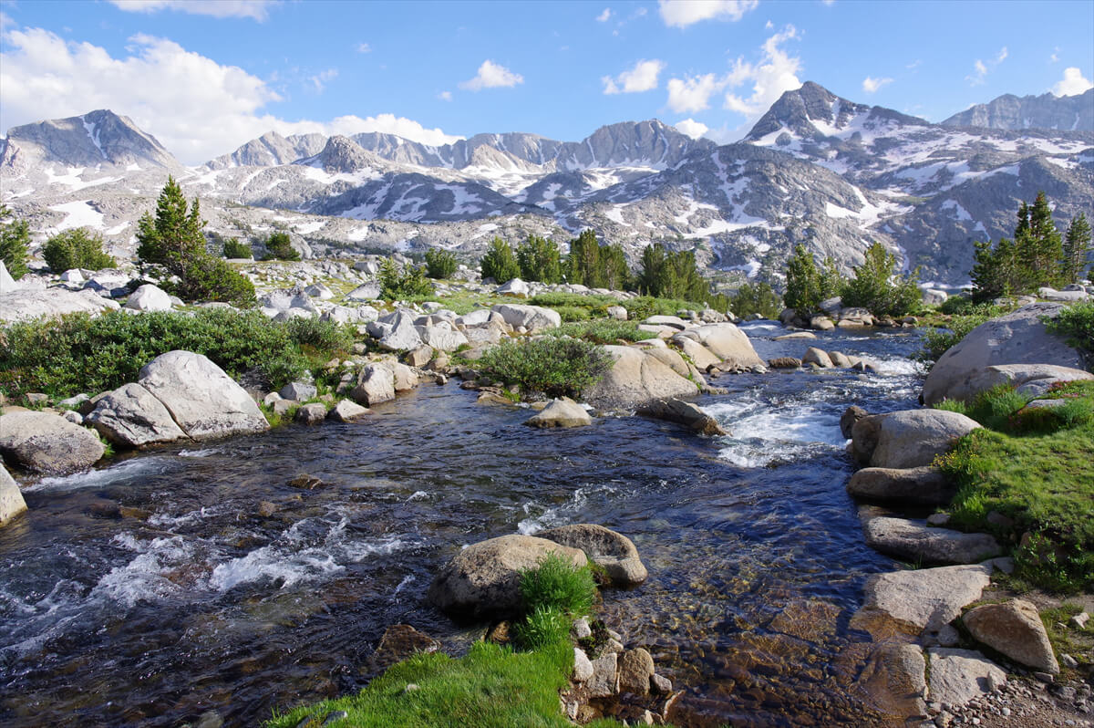
Figure 9.32: The only creek that is difficult to cross. Photographed in 2017
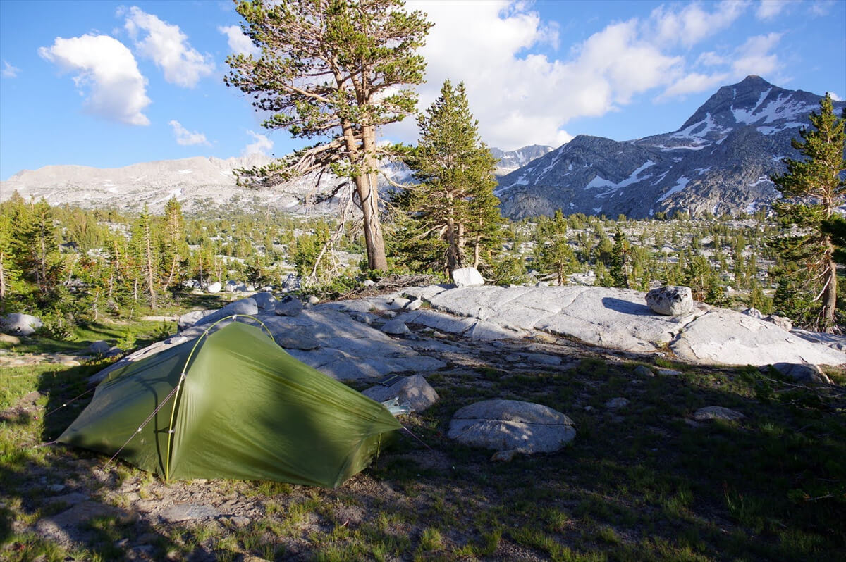
Figure 9.33: About 30 minutes across the creek. Photographed in 2017
Starting from Bishop, we plan to spend the night somewhere along the Paiute Pass Trail. When resupplying, we start with a day's worth of vegetables and delicious bread, so our breakfast is also sumptuous. Figure 9.34 shows the leftover sandwiches, and this and coffee are our breakfast
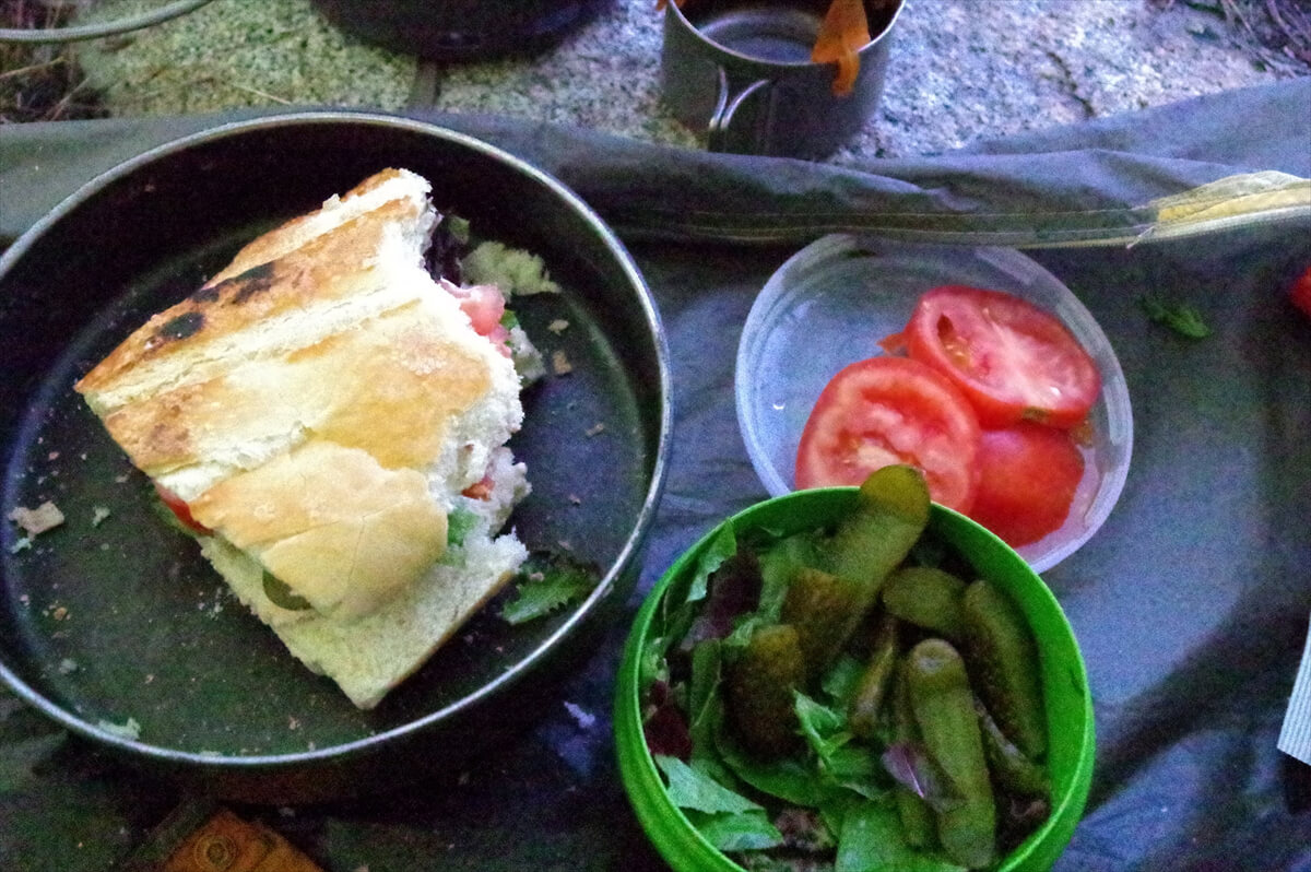
Figure 9.34: Leftover sandwich and salad. Photographed in 2017
It's a gentle descent from where we camped. The rocks are covered in bright red Panstemon (Figure 9.35). As we descend, the number of pine trees increases, and there are occasional meadows with flowers everywhere, but unfortunately, we are attacked by a barrage of mosquitoes
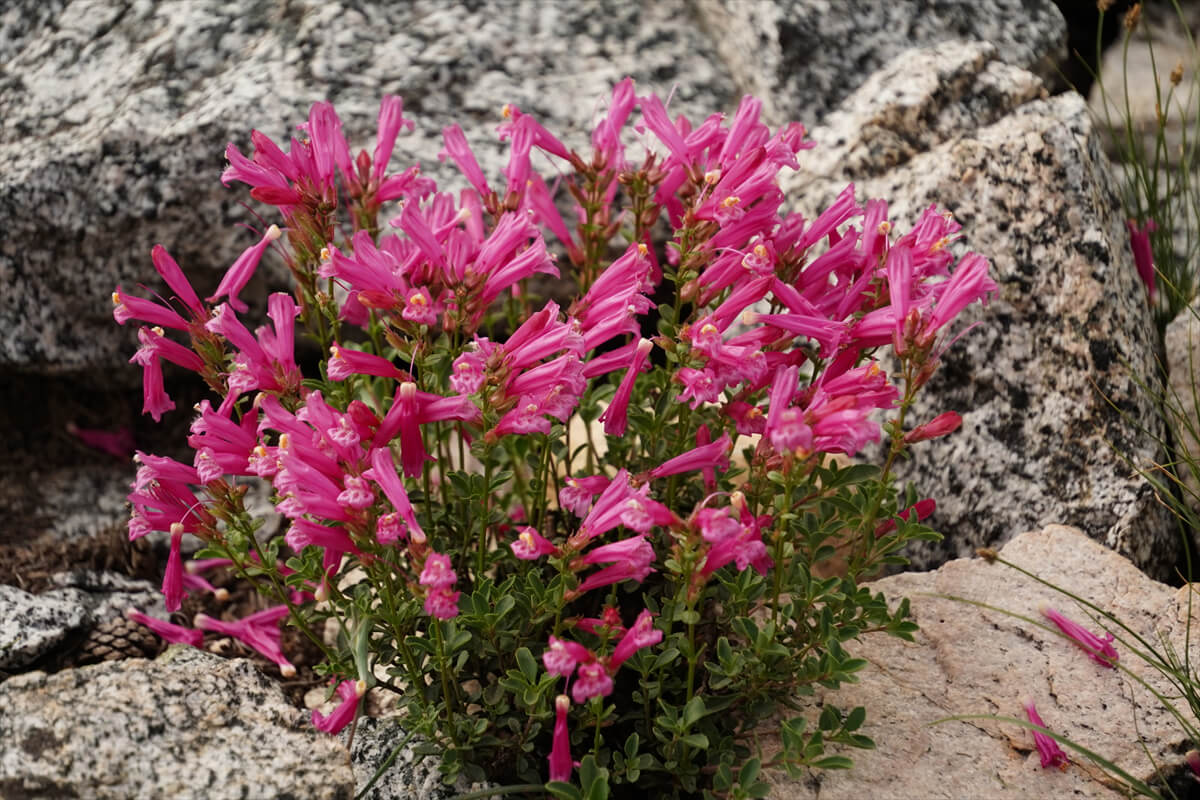
Figure 9.35: Panstemon blooms abundantly on the rocky outcrops. Photographed in 2017
After about an hour of descending, the trail meets a tributary. Because the tributaries branch off into several smaller streams, each one is shallow. It's surprisingly easy to ford. Figure 9.32 shows the southbound JMT. The rising Paiute Creek (Figure 9.38) is a rapids that makes forcing it difficult. Fortunately, the trail stays consistently on the left bank. After an hour or two of descending, the trail meets the JMT
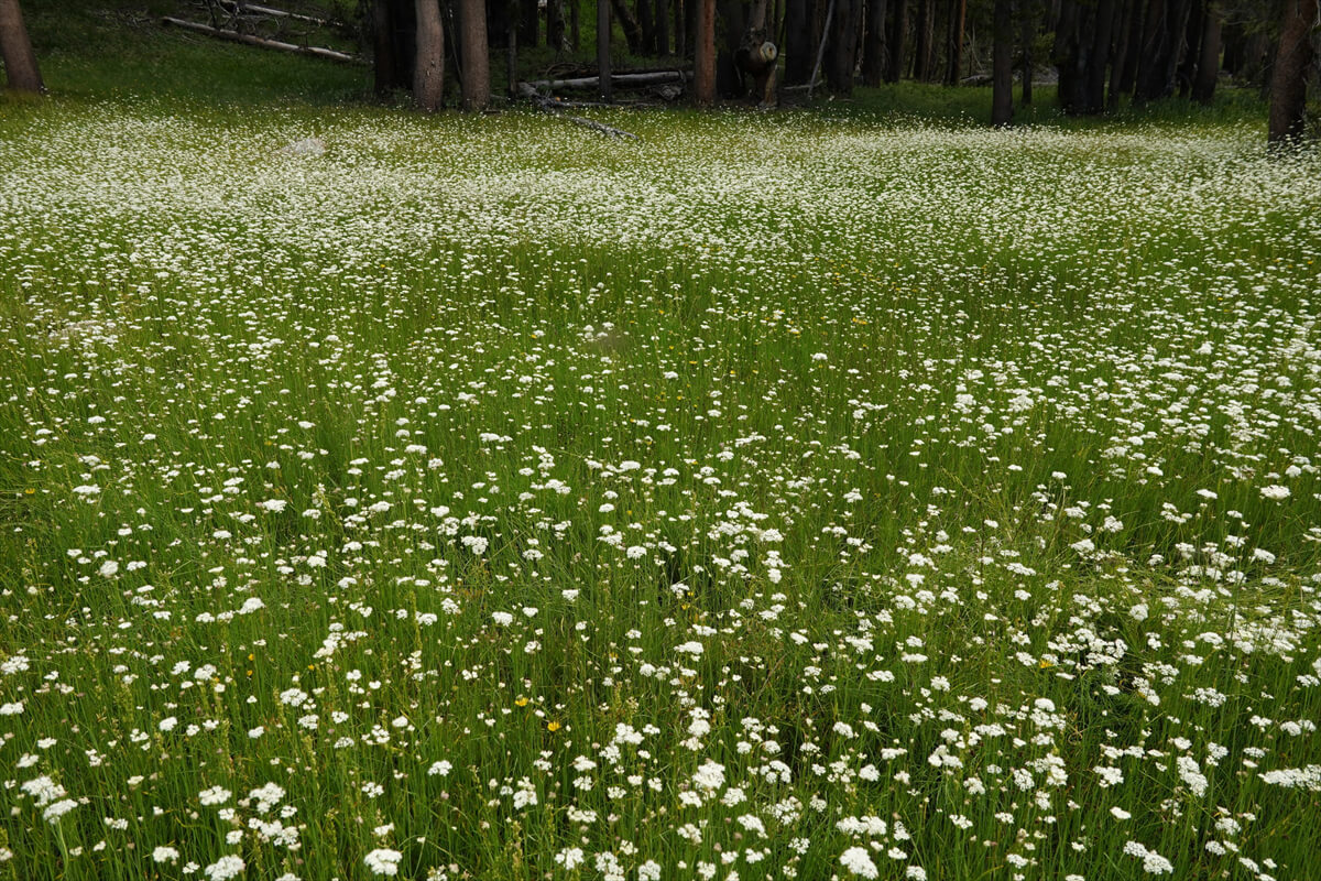
Figure 9.36: The meadow is full of flowers and mosquitoes. Photographed in 2023
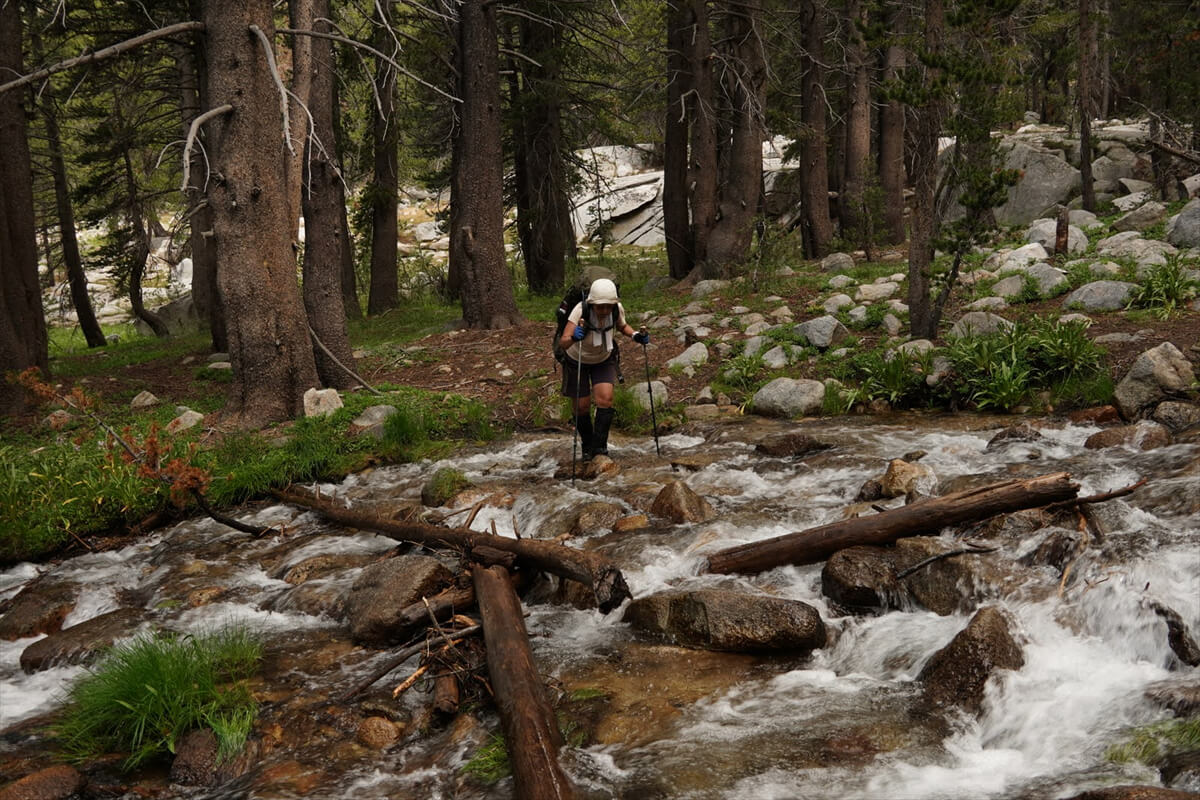
Figure 9.37: Easy ford (southbound JMT). Photographed in 2023
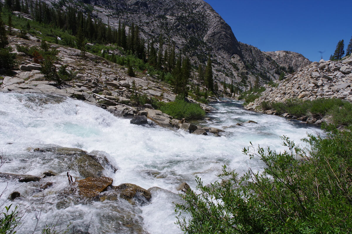
Figure 9.38: Paiute Creek, 2017
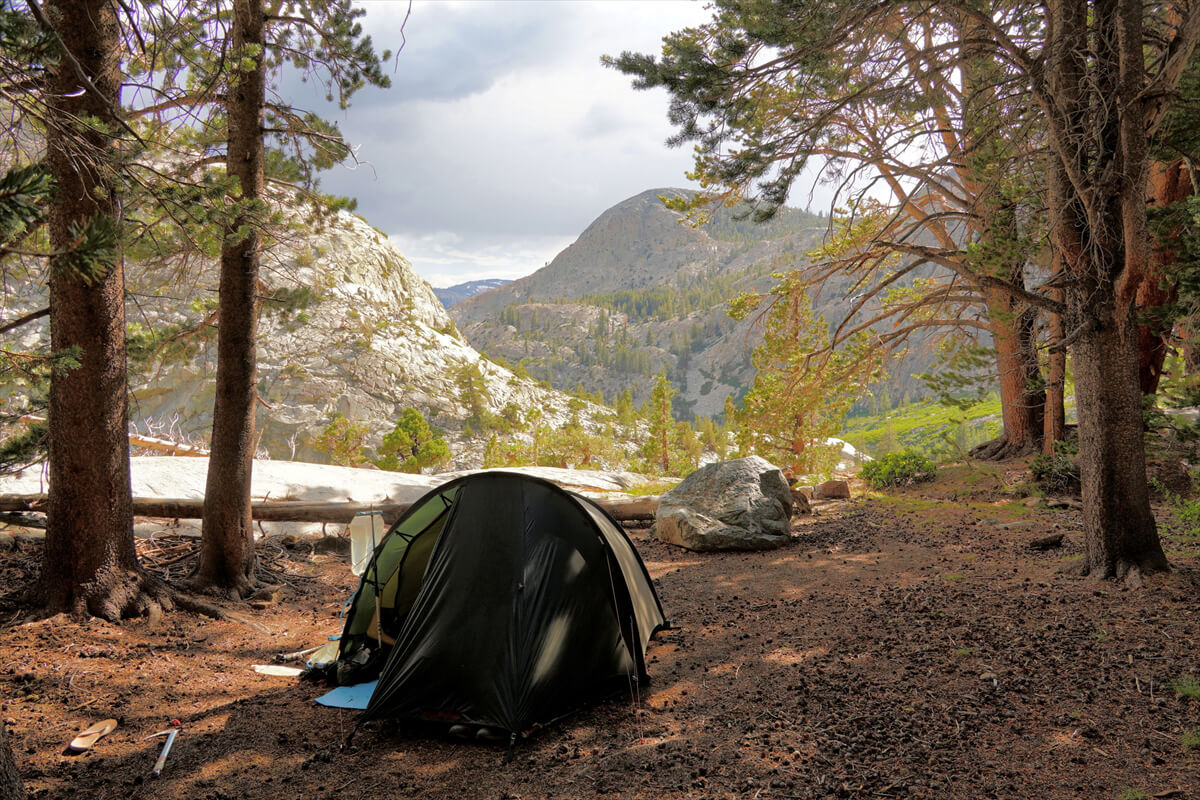
Figure 9.39: About 30 minutes from the JMT junction. Photographed in 2023
Figure 9.39 shows a campsite on the southbound JMT. There was water about 100 meters upstream, so we set up our tent. Two American hikers were with us, but they said they wanted to go further
<Continued in Chapter 10>
Nobuhiro Murakami's new hiking guide, "The Science of Hiking, 4th Edition," is now available on Amazon (Kindle edition is 100 yen)

Nobuhiro Murakami, a former professor at a national university and an experienced through-hiker who continues to share rational solo hiking know-how from a unique and profound scientific perspective in books such as "Hiking Handbook" (Shinyosha) and "The Complete Guide to Hiking in the United States" (Ei Publishing), has released his new book, "The Science of Hiking," which is now available on Amazon. This compelling and logical hiking textbook is based on his accumulated experience dating back to the dawn of long trails in Japan, as well as objective sources such as academic papers on hiking, exercise physiology, and a wide range of other fields.


Please consider paying memberships that allow you to support the site while enjoying limited edition projects and content!
Murakami Nobuhiro