Did you know that Northern California is home to ancient forests with trees that are over 1,500 years old?

Home to the world's tallest trees, Redwood National and State Parks is a forest exuding an indescribable sense of tranquility and sacredness. Located at the northernmost tip of California, it is made up of three different parks: Del Norte Coast State Park, Jedediah Smith State Park, and Prairie Creek Redwoods State Park. Stretching approximately 55 km north to south along the Pacific Ocean, the park is extremely large, covering a total area of 139,000 acres (560 square kilometers). (It was designated a UNESCO World Heritage Site in 1980.)

As soon as you step into the forest, you'll be surrounded by trees over 100 meters tall, and everything will seem so huge that you'll feel as if you've been dwarfed
It is a place where you can fully enjoy the space of the forest and yourself. The fresh air, silence, and the infinite energy emitted by the trees that have seen it all give us a very special space and time. Just as the term "forest bathing" suggests, once you enter the forest, the trees will envelop you and soothe your soul
This is a natural paradise that is home not only to ancient forests but also to beautiful beaches and oceans, unique natural scenery and an abundance of wildlife
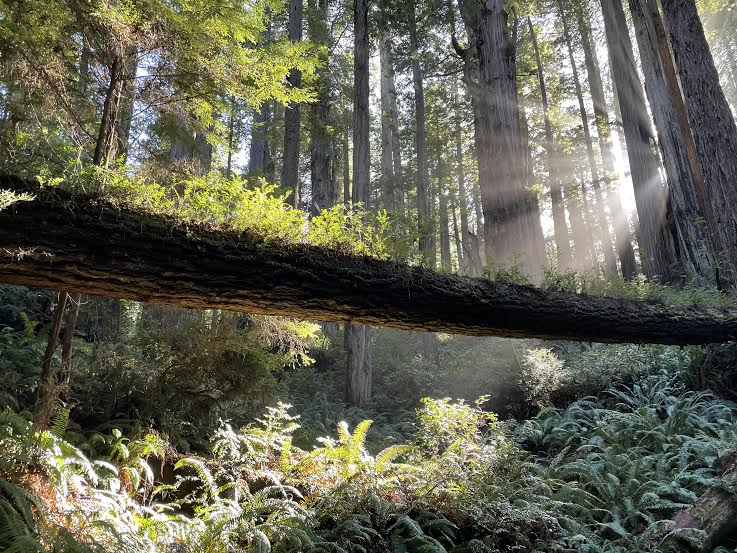

table of contents
The world's largest living thing: the redwood
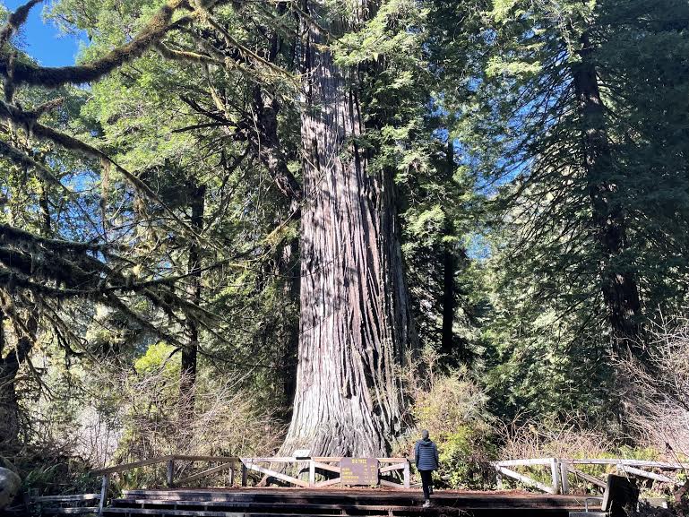
Redwoods are a type of sequoia, so named because of their hard trunks and thick red bark. They are evergreen coniferous trees in the genus Sequoia, which belongs to the Cupressaceae (or Cypress) family, and are the largest of all plants, with some reaching heights of over 110m. They are famous not only for their height, but also for their longevity, with an average age of about 500 to 700 years, and some giant trees still in existence that are over 2000 years old
It is a feeling of awe and respect for this giant tree that has survived for 2000 years and survived to this day
There is a similar area called Kings Sequoia National Park, south of Yosemite National Park in California, where sequoia trees spread out, but it is on a different scale. In addition to its size, the number of visitors here (depending on the season) is smaller than Kings Sequoia National Park, so you can observe the redwoods without the crowds and enjoy the space between you and the sacred forest
Personally, I find it to be a great place and highly recommend it
Today, redwood is truly precious
Around 1850, virgin redwood forests covered more than 8,100 square kilometers of the Northern California coastline, where Redwood National and State Parks are now located
This area was originally inhabited by Native Americans, who worshipped the forest, believing that "trees are gifts from the Creator as a token of love" and that "destroying these trees would destroy the Creator's love. And if we destroy them, it would ultimately destroy humanity." To them, trees were sacred creatures, and they were said to "stand as guardians over sacred places." However, even such sacred places are being destroyed by human ego
In the mid-1800s, gold was discovered in the Sacramento River, a little further south, and people flocked to California in search of quick fortunes. This was known as the Gold Rush, but gold is not that easy to find
Unable to find gold or make money during the Gold Rush, people turned to the area that is now Redwood National and State Parks for the exploitation of the giant trees that were burgeoning in San Francisco and other parts of the West Coast. Redwoods were prized for their durable yet easily workable lumber, and for decades they were subjected to unrestricted clear-cutting
After that, efforts to protect the forest began, and serious efforts were made to protect it, but by the time Redwood National Park was designated in 1968, nearly 90% of the original virgin forest had been cut down, making the few surviving redwoods in the park today truly precious
These trees have survived many hardships. This time, we will introduce some recommended trail routes in Redwood National and State Parks, where such ancient forests spread
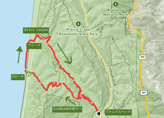
Hiking information for Redwood National and State Parks (Miner's Ridge and James Irvine Trail Loop)
Here's a summary of information about the Miner's Ridge and James Irvine Trail Loop, a diverse and spectacular trail route that takes in forest, ocean, and fern-filled valleys
Useful items to bring with you on a hike
As for what to bring, as always, you should prepare the same equipment as you would for a typical hike in the U.S. Winter, from October to April, is the rainy season, so it's a good idea to bring non-slip trekking shoes, a raincoat, and sandals (as you may get soaked)
- Drinks (larger in summer, about 2 liters)
- Temperature-adjustable winter clothing
- hat
- sunglasses
- sunscreen
- Snacks to eat during the hike
- If you have any regular medications, bring first aid such as medicines and bandages
- Other than that, your favorite hiking gear
Trail Data
- For intermediate and advanced players
- Season: Hiking is possible throughout the year, but the rainy season is usually from October to April, so if you go during that time, the ferns will be very lively after absorbing moisture. It's best to choose a day with good weather. Summer and autumn from April onwards are also wonderful. I think it's a very pleasant season
- Round trip: Approximately 20.8 km (13 miles)
- Height difference: approx. 490m (1,614 ft)
- Course time: 5 to 7 hours round trip (including breaks)

Access (by car to the trailhead)
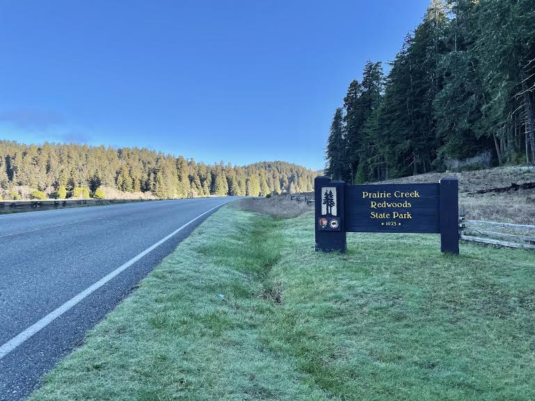
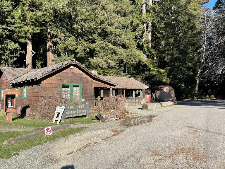
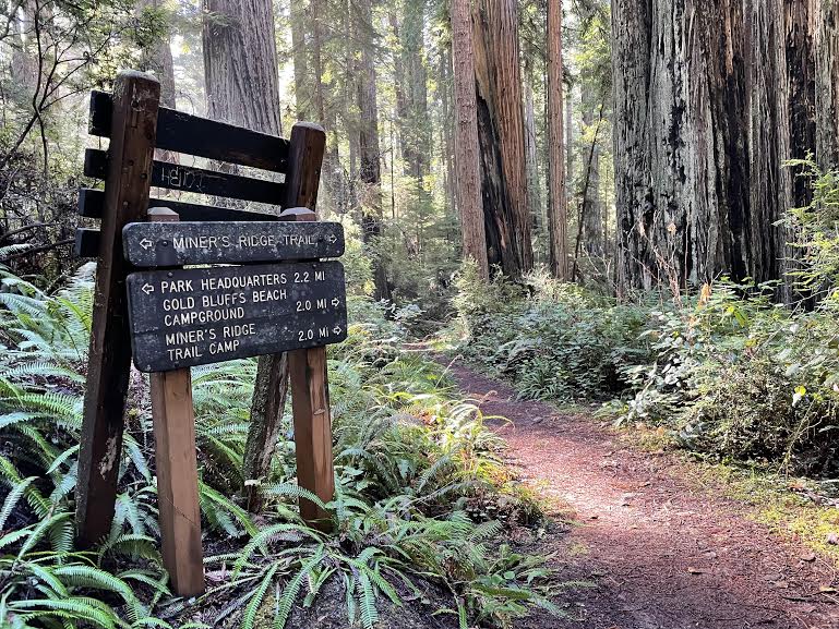
Trailhead Address: Prairie Creek Visitor Center: Newton B. Drury Scenic Pkwy, Orick, CA 95555 (1 on the map above)
It's about a 5.5 hour drive from San Francisco, California. Head north on Highway 101 from San Francisco (5.5 hours south from Portland, Oregon)
It's difficult to make a day trip from San Francisco, so we recommend staying overnight. Camping is available within the park, and there is a town called Eureka south of Redwood National and State Park, known as the southern gateway. There are plenty of hotels, restaurants, and Airbnb options there
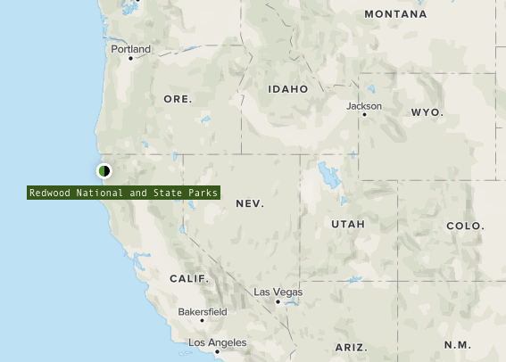

It is located in northern California, near the Oregon border
Start hiking from the trailhead
The Prairie Creek Visitor Center is located at the same location as the trailhead, and also has parking and restrooms
This photo was taken when I visited in late February, but I recommend bringing a spare pair of shoes or sandals or other shoes that you don't mind getting wet. Due to the time of year, there were some areas along the trail where you had to wade through water

We got ready and set off. In the field in front of the parking lot, deer were enjoying the morning light and eating breakfast
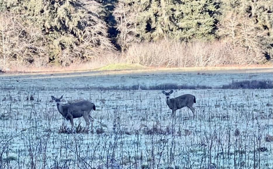

If you're lucky, you may even encounter elk (big-antlered deer) in this area
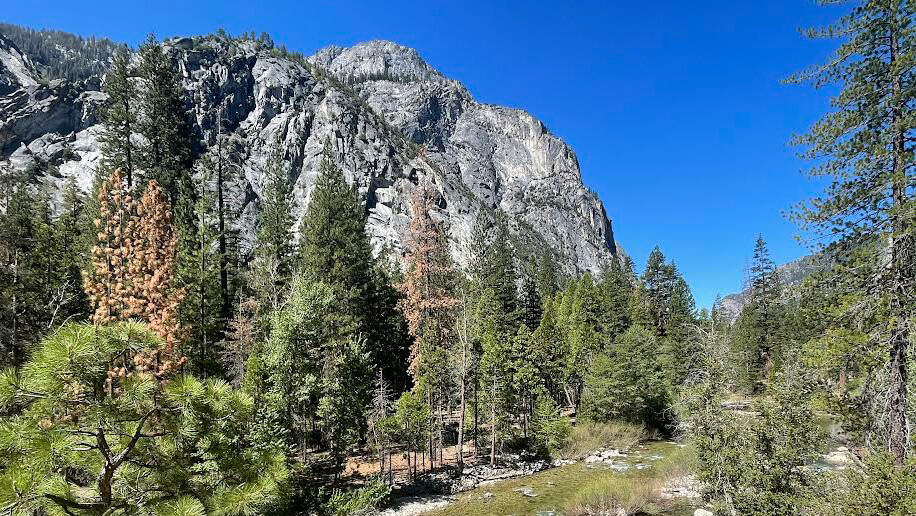
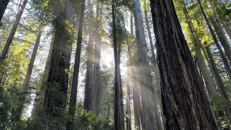
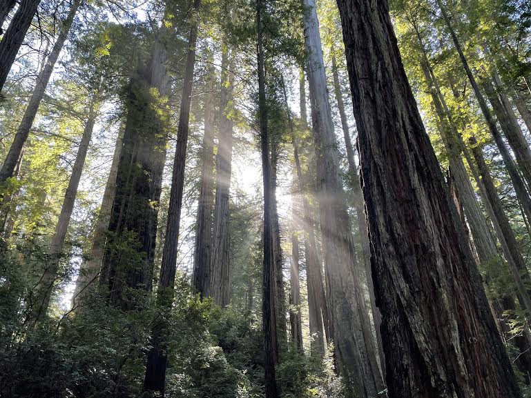
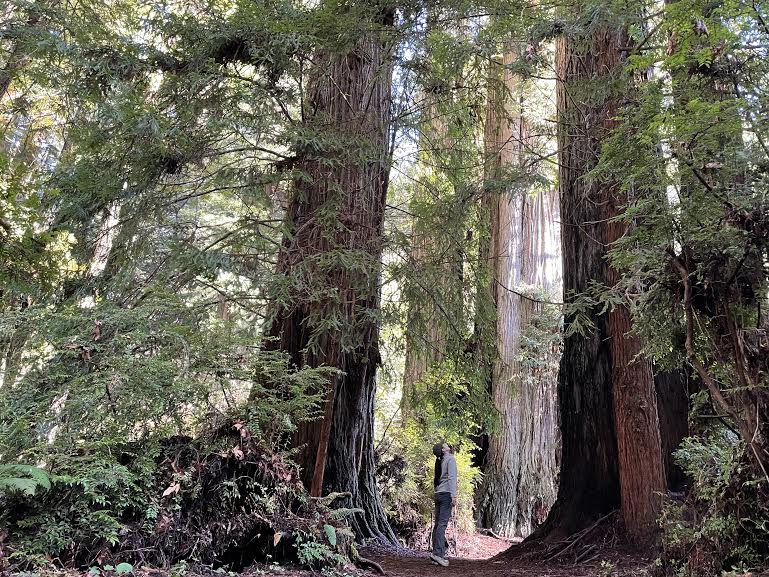
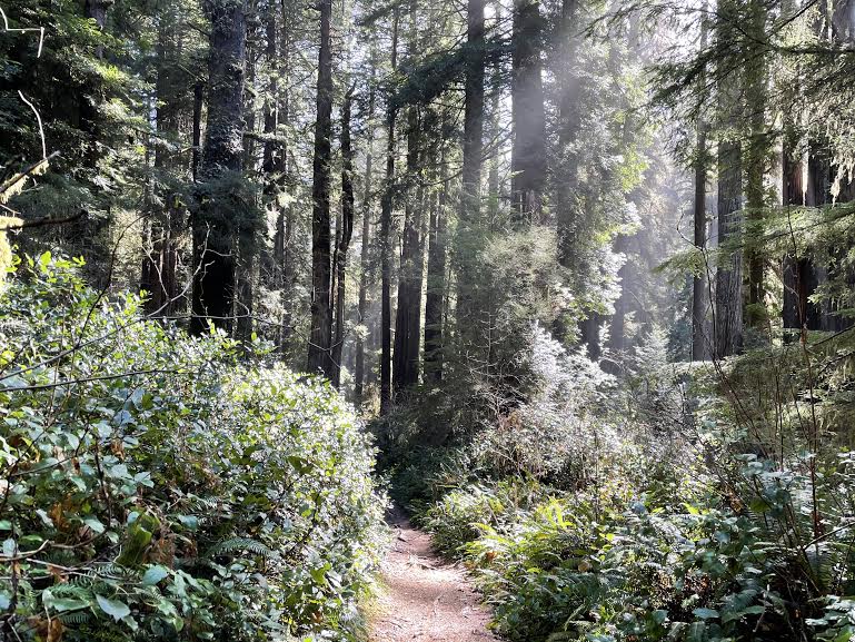
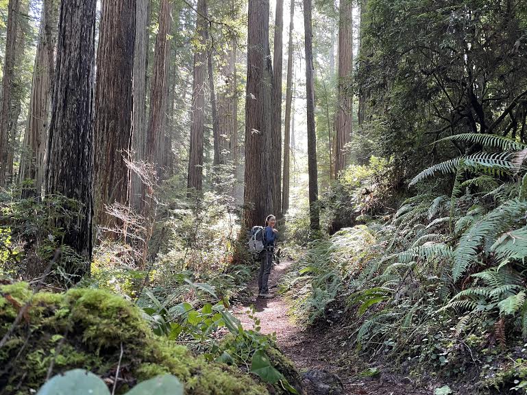
The moment you step onto the trail, it's already a spectacular sight! You'll be greeted immediately by giant trees that you don't normally get to see. The sight of them stretching endlessly into the sky is truly breathtaking. As soon as I entered the trail, I stopped in my tracks and started taking photos of this dynamic sight... I was worried about how long the hike ahead would take. Lol
The trail is fairly flat and easy to walk
About 1.5 hours after starting the hike, you will come to a fork in the trail. Since we are going clockwise, take the left trail (Miner's Ridge Trail). (2 on the hiking map above)
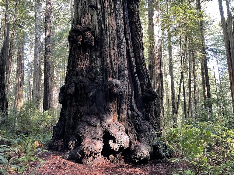
Everything here is big. Even the clovers are a size larger than the ones you usually see in Japan. This is proof that the environment here allows the plants to grow freely
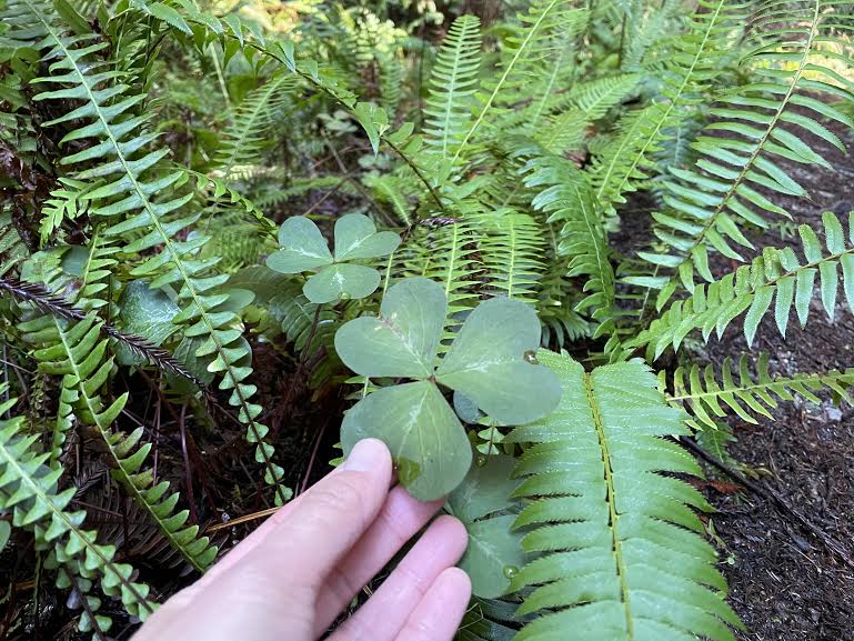
This area has a humid environment that is ideal for tree growth, and the proximity of the sea and mountains means there are many foggy and cloudy days, so it's said that the trees have grown so large because they compete to catch as much sunlight as possible. However, it's certainly not easy to live for over 1,000 years. I'm filled with respect, amazement, and wonder at the trees that have overcome so many obstacles to grow to this size
The thick bark of redwood trees, about 30 cm thick, is said to protect the interior of the tree even in the event of a wildfire, with only a small amount of charring. The interior also contains a lot of moisture and fire-resistant tannins, so it doesn't burn up. This is why they've been able to survive in California, where fires are common
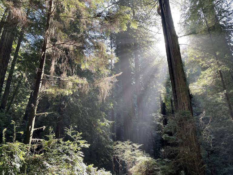
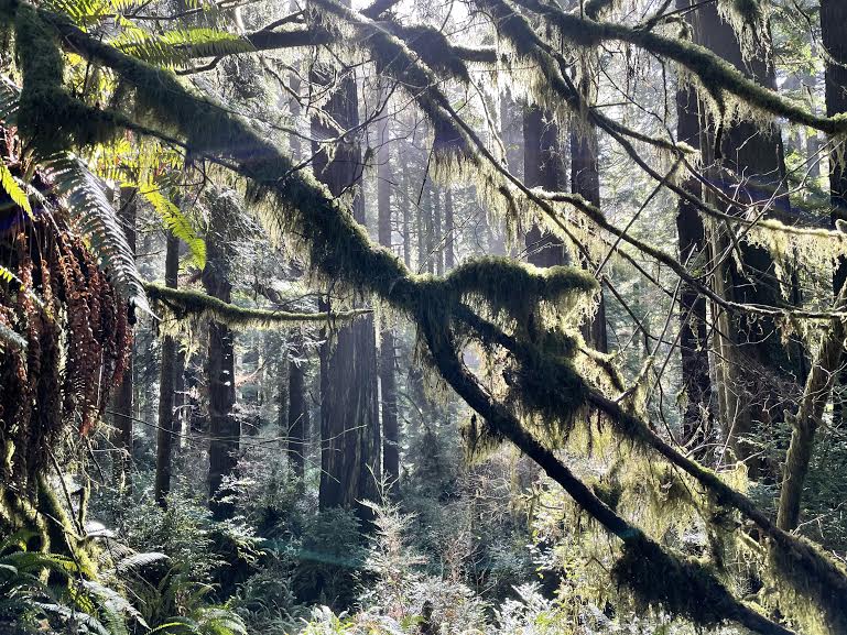
We continue walking, watching the beautiful sunlight filtering through the trees
After walking for about an hour, you will gradually start to hear and smell the ocean. This is a sign that you are nearing the beach. Once you leave the forest, you will come across a campsite and parking lot (with restrooms)
Further ahead there are some tables where you can take a break

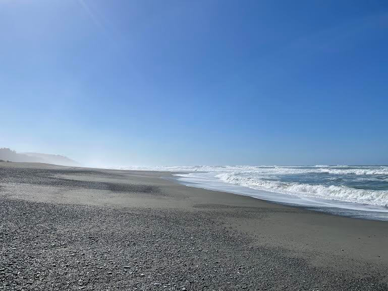
The scenery is completely different from what we had seen before, with blue skies and blue ocean
What an amazing trail! You'll pass through lush, ancient forests and then find yourself in the blue ocean. Both are beautiful and soothing in their own way
After taking a break, continue along the trail that leads to the beach (Hiking Map 3 above)
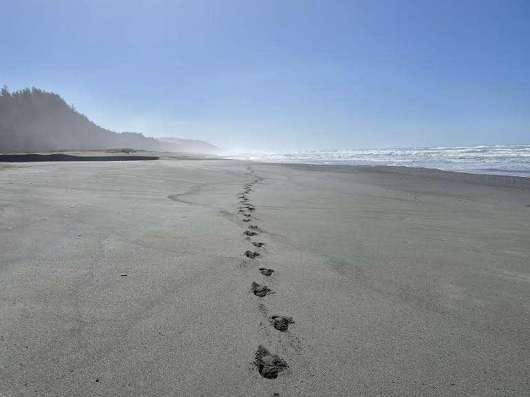
The beach! There's no one here either. This beautiful sandy beach stretches on forever, and it's yours alone in a completely private space
It was such a beautiful space that we spent a little time here. We took photos as we walked, so at this point 3.5 hours had passed since we started
From the beach, we headed towards Fern Canyon. There was a small creek when we left the beach towards the Fern Canyon parking lot. In the summer, the creek had less water and we could walk to the other side, but since it was still February and it was raining a lot, the water was high and we had to walk through the water to get to the trail that leads to the parking lot. It was impossible to cross without getting our shoes wet. (It would be a good idea to bring sandals.)
Once you cross the creek, you will see the Fern Canyon parking lot (with restrooms)

From the beach, enter the parking lot and the trail to Fern Canyon begins at the back left
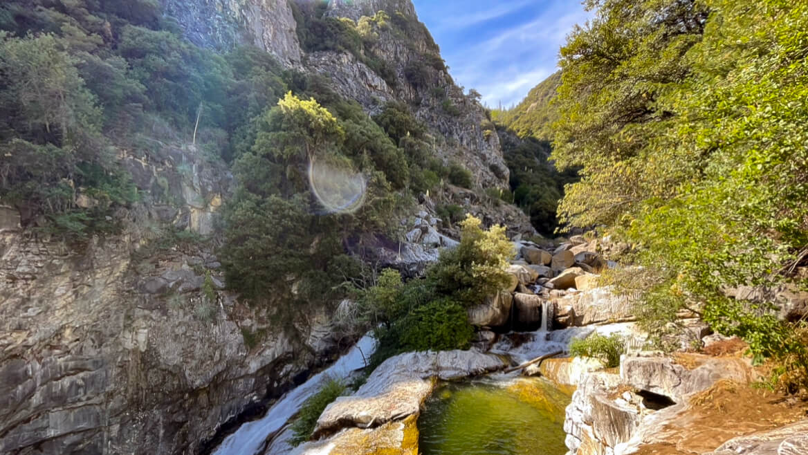
Just a few minutes' walk from the trail, you will come across a narrow valley covered with ferns, creating an indescribably lush space (hiking map 4 above)

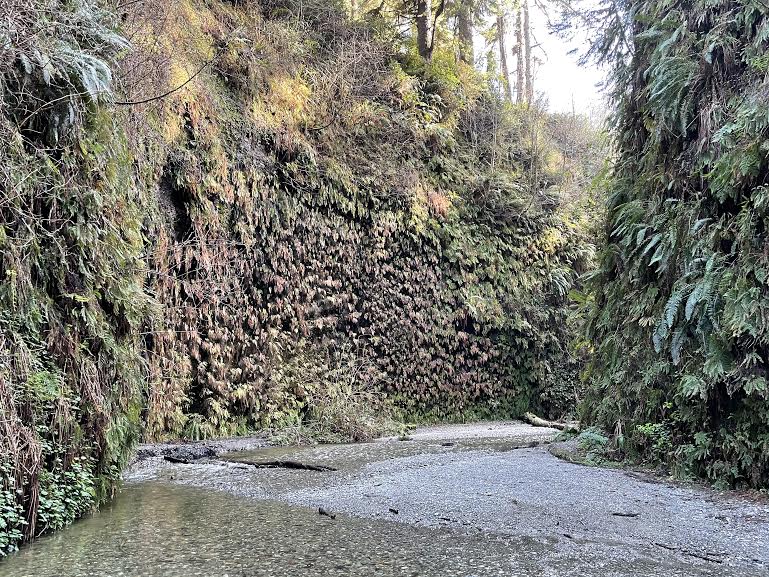

The water level here is higher than in summer at this time of year, and in February it was difficult to avoid the water, so we had to wade through the creek. However, this actually felt really good and refreshing
Ferns cover the entire canyon wall, and water constantly trickles down from the mountains. This is where "negative ions" really come into play. This is also the location where the movie "Jurassic Park 2" was filmed
As you travel, every turn brings with it a view you'll want to snap a photo of and share on Instagram
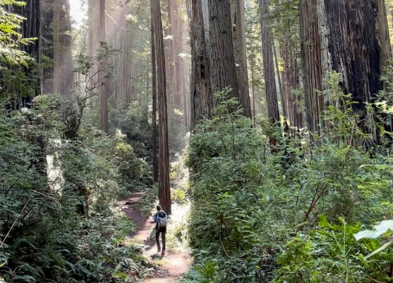
There is a parking lot here, so you can of course come by car. You can enjoy just this area, but I prefer to continue on the trail towards the trailhead. The trail is easy to follow, but there are many branches, so it's best to download a map onto your GPS in advance to make the journey smoother
Now, for the second half, we will continue our journey through the ancient forest
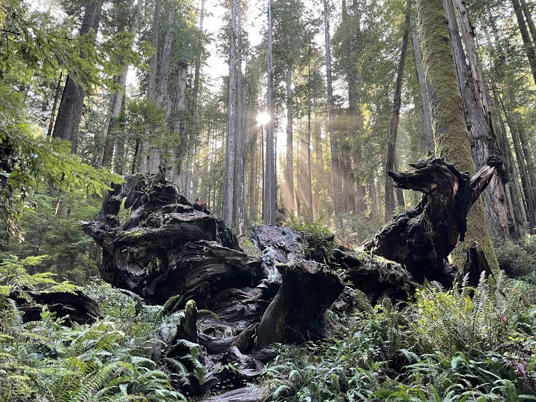
Along the way, there was art of fallen trees, and the trees and forest lit up by the light were so beautiful that I imagined there must be fairies or forest spirits there
By walking slowly, I spent time in the forest and enjoyed forest bathing. It took me 6.5 hours to get back to the trailhead where I started, taking photos along the way
This time we chose the long, one-day loop, but there are many other hiking trails within the large park, as well as shorter options
You can choose the trail length and the points you want to visit depending on your level and mood. Every trail is beautiful and greets you with the ancient forest
Precautions regarding the spread of COVID-19
As of May 2021, various countries are currently imposing entry restrictions due to strengthened quarantine measures, as well as restrictions on entry to national parks and domestic travel. These conditions are subject to change without notice, so when traveling, be sure to obtain local information from each country's embassy or consulate, the Ministry of Foreign Affairs' Overseas Safety Website (Infectious Disease Risk Information), national park websites, and other sources, and check information on transit points, countries you plan to travel to, and the areas around the places you plan to visit before making reasonable plans and taking action
Sayaka Kato

Related reading