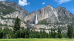
Did you know that Yosemite Valley has a place called its twin that looks just like it?
There is an area in the northwestern part of Yosemite National Park called "Hetch Hetchy," which once contained a valley almost as beautiful as Yosemite Valley
Long ago, San Francisco's population boomed, and concerns about water shortages led to the construction of a dam here
Before the dam was built, there were actually two beautiful valleys around Yosemite. One was used for tourism, conservation, and economic development, and the other was used as a dam. In 1925, O'Shaughnessy Dam was built, submerging about half of Hetch Hetchy Valley under the lake
Of course, at the time, there was a huge debate between conservation groups over whether to develop or protect the dam, but the 28th President Wilson signed the dam's construction, and it was built. This is said to have led to the establishment of the National Park Service in the United States
There was apparently considerable opposition to the dam's development on the grounds of environmental conservation, but the development of cities such as the San Francisco area, home to Silicon Valley, which is now the economic center of the United States, was possible only thanks to the water from Hetch Hetchy and the electricity generated by hydroelectric power
This water is said to be some of the most beautiful in the United States
The current Yosemite Valley and the Hetch Hetchy area are truly twin landscapes. If Hetch Hetchy Valley still existed, it would surely be an even more popular spot than the current Yosemite Valley. Hetch Hetchy has been dammed and is less well known than Yosemite Valley, so very few people visit. That's why it's a hidden gem with few visitors, and a truly beautiful, unexplored place
Both Yosemite Valley and Hetch Hetchy Valley are beautiful V-shaped valleys carved by glaciers. Hetch Hetchy was more glaciated than Yosemite Valley, so the surrounding rocks were eroded even more, resulting in a more rounded landscape
The waterfall is especially impressive during the snow melting period from April to June, making it a must-visit spot
This time we will introduce some of the most famous trails in Hetch Hetchy
table of contents
Rancheria Falls Trail Information
Access (by car to the trailhead)
Hetch Hetchy Trailhead, California 95321 (Due to poor signal quality, it is recommended to download the map in advance.)
It's about an hour's drive from Yosemite Valley. The Hetch Hetchy parking lot is 38 miles (1 hour 15 minutes) from Yosemite Valley
Hetch Hetchy Road begins just outside the park on Highway 120, near the Big Oak Flat entrance. There is also a separate entrance to the park
There is also a parking lot and restrooms right next to the Hetch Hetchy Trailhead
What to bring
As for useful items to bring on a hike, as always, prepare the same equipment as you would for a typical hike in the United States
- Drinks (larger in summer, about 2 liters)
- Warm clothing that can adjust to your temperature (you may get wet from splashes when the waterfall is powerful, so bring a rain jacket if necessary)
- hat
- sunglasses
- sunscreen
- Snacks to eat during the hike
- If you have any regular medications, bring first aid such as medicines and bandages
- Other than that, your favorite hiking gear
Trail Data
- For intermediate to advanced players
- Season: The best season is from April to November (depending on the amount of snowfall that year. The recommended hiking season is from April to June. The photo was taken in April.)
- Trailhead elevation: Approximately 1120m (3,730 ft)
- Round trip distance: 20km (12.76 mi)
- Elevation gain from trailhead: 800m (2,625 ft)
- Course time: 6 to 8 hours round trip (including breaks)
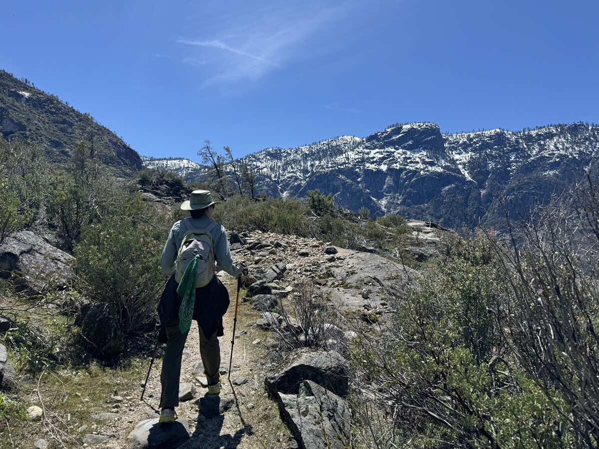
Start hiking from the trailhead
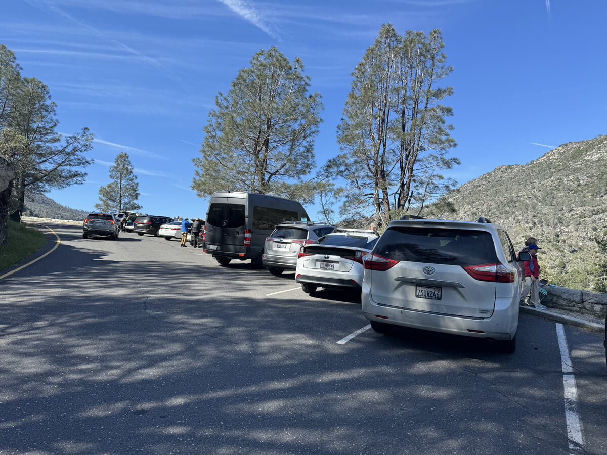
The trailhead is on the south side of O'Shaughnessy Dam. Parking is available there, but it's limited. If it's full, you may need to park in the backpacker campground parking lot a little further away (there are restrooms there, too)
It was 10:00 AM on April 16th, but there was still plenty of parking space available. There are only portable toilets in the parking lot area, but there are flushing toilets at the campsite a little further ahead
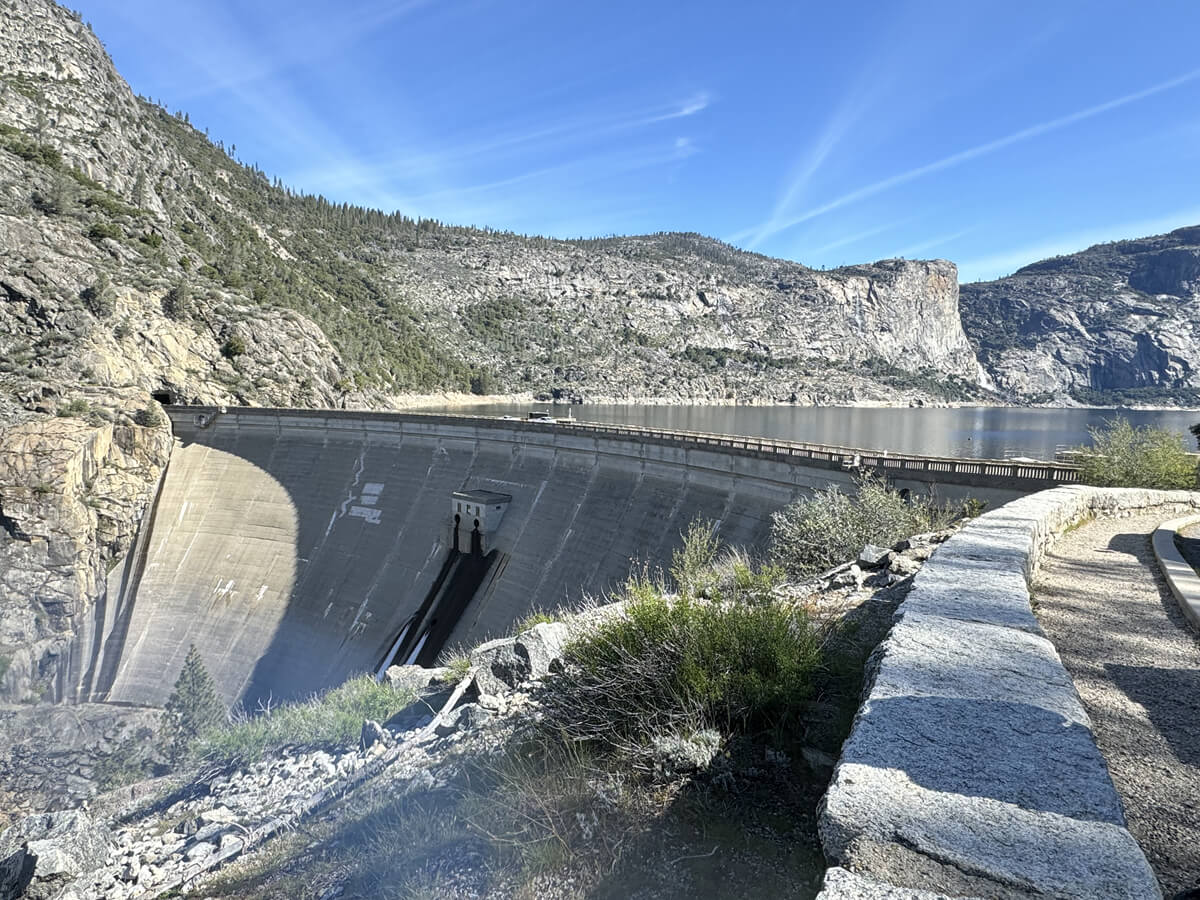
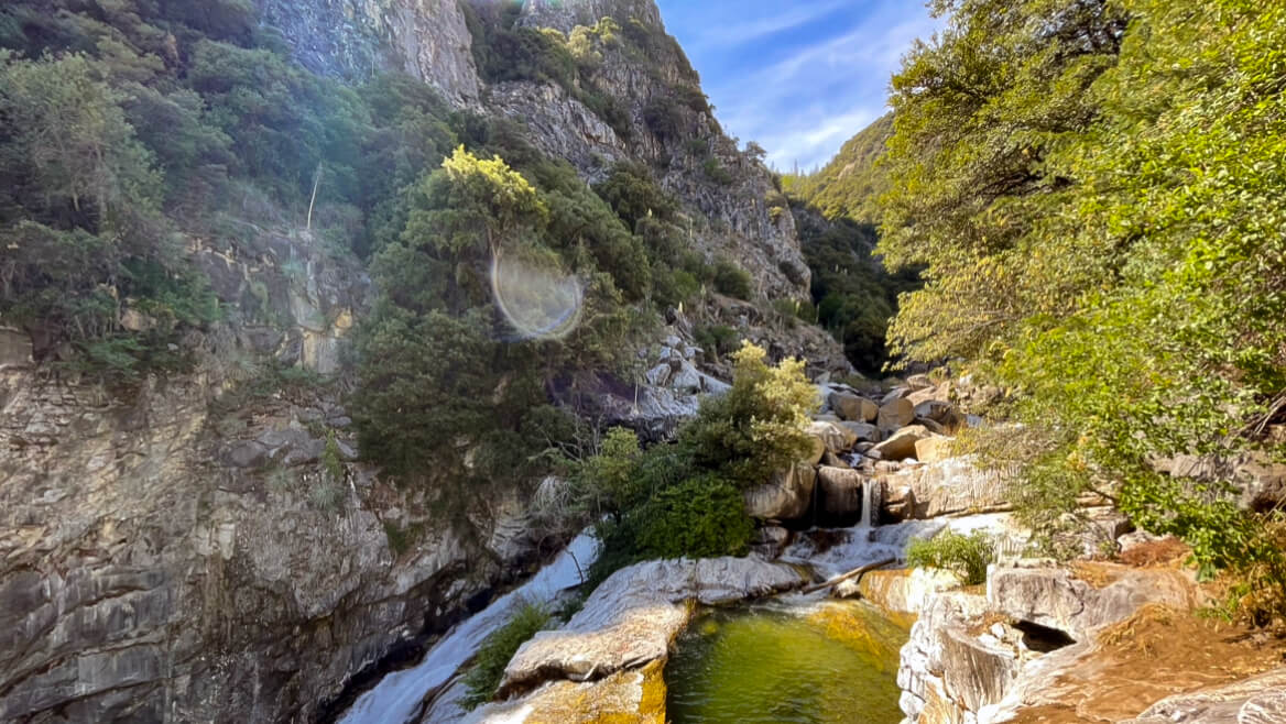
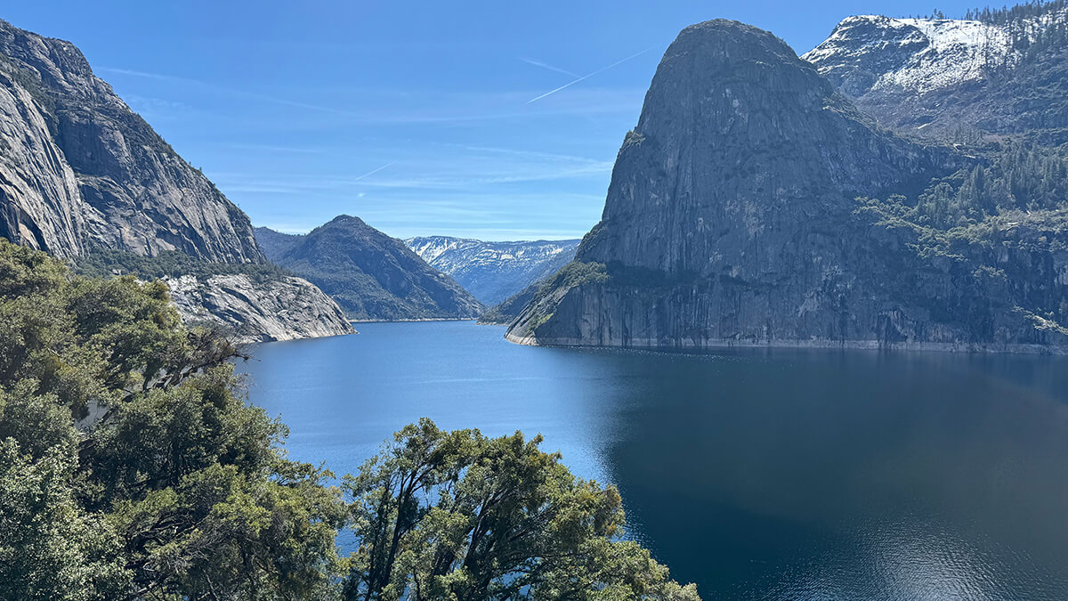
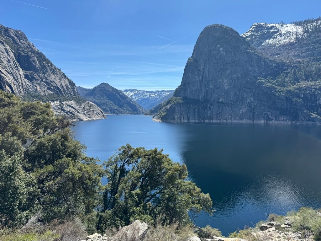
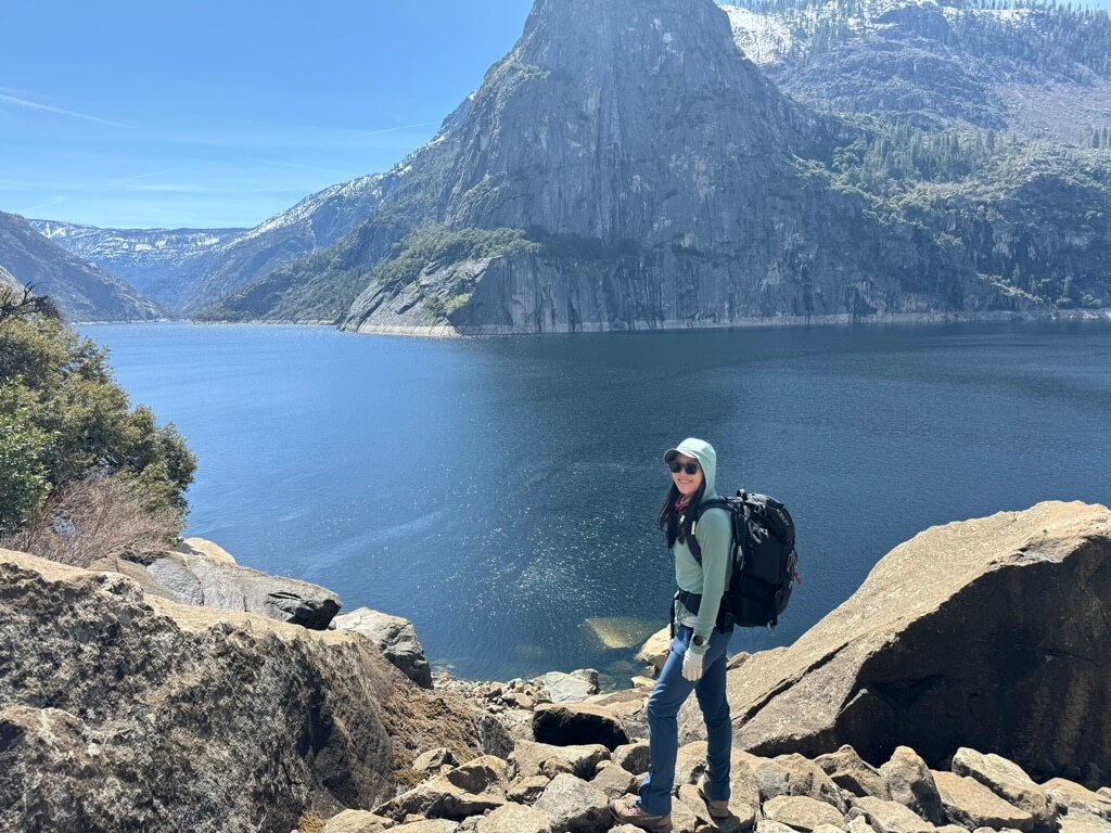
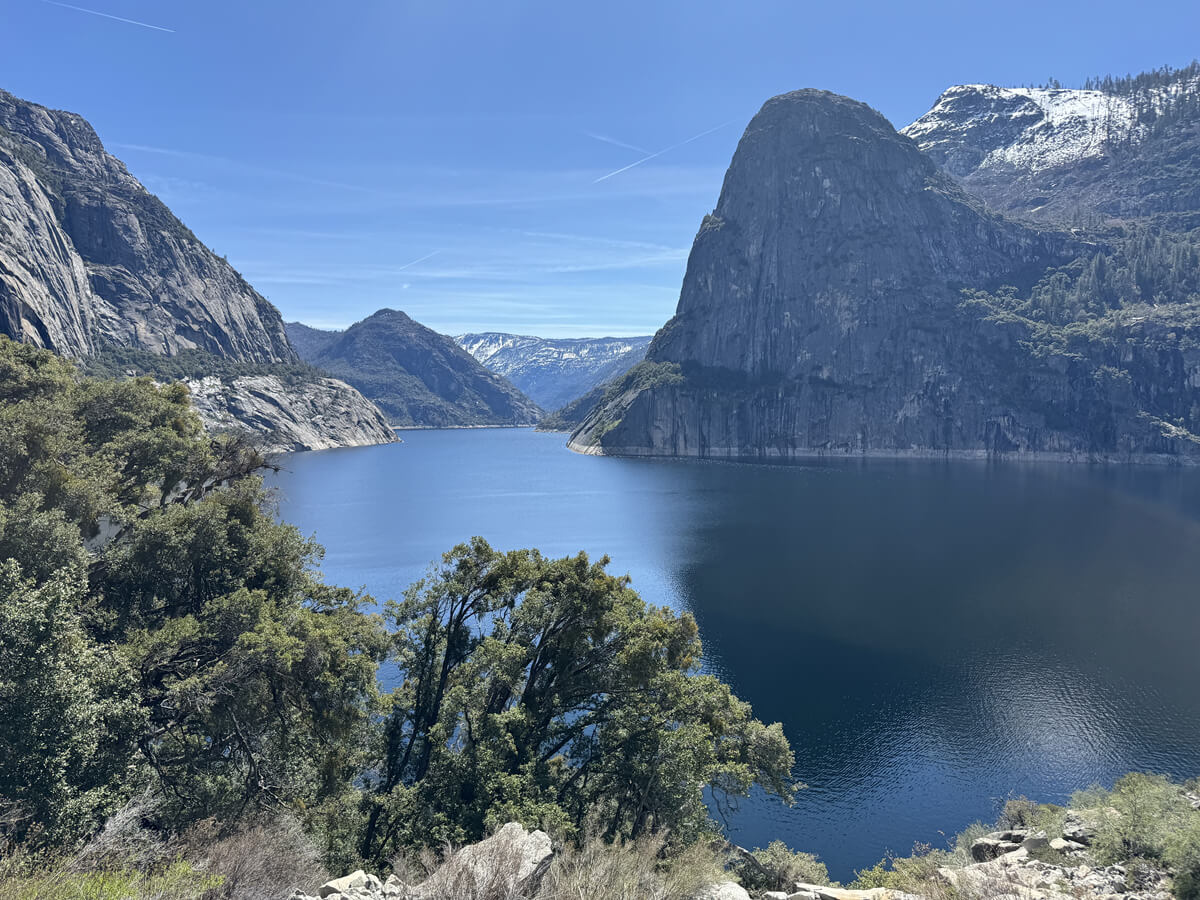
The dam creates the Hetch Hetchy Reservoir, which fills the Hetch Hetchy Valley and provides water to thirsty San Francisco. Along the canyon walls in the distance, you'll see Tueulala Falls and Wapama Falls, both of which you'll pass on this hike. This time of year, it's truly a water city
There are three named waterfalls along the trail (Tueeulala Falls, Wapana Falls, and Rancheria Falls), and throughout the snowmelt season (roughly April through June), water can be seen gushing down the rock walls, onto the trail and into the reservoir below
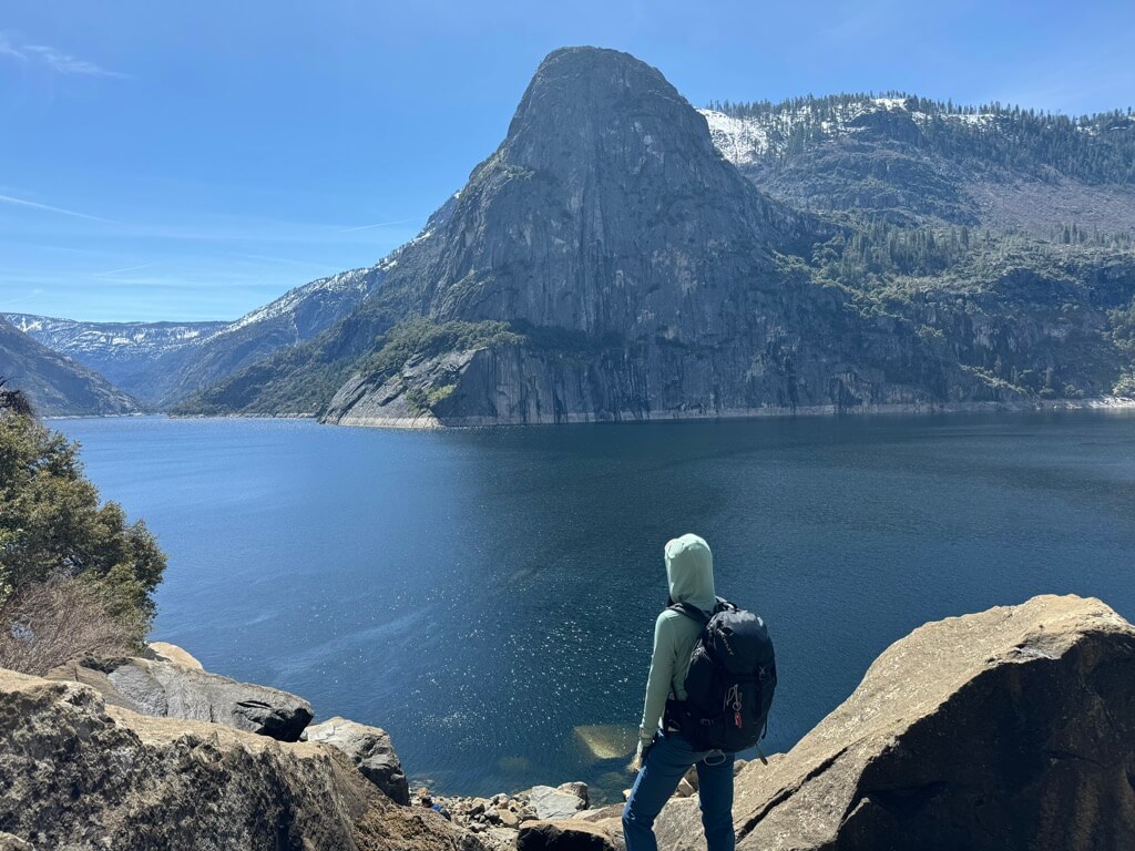
The view from the trailhead is already spectacular
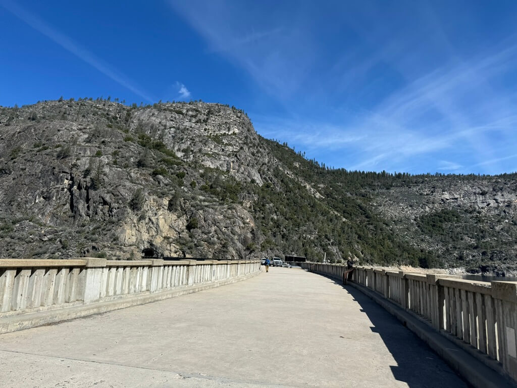
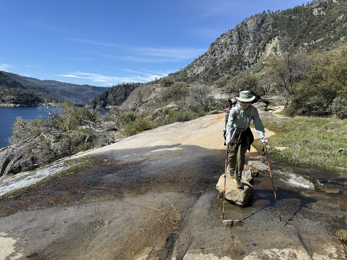
First, cross the dam,
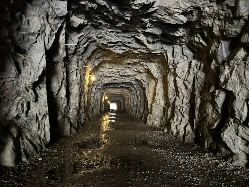
The trail passes through a long tunnel carved into the granite walls of the canyon, so be careful of drips and puddles
The road continues flat after the tunnel, and the scenery is spectacular
As we walk, we imagine the entire Hetch Hetchy Valley, half of which has disappeared due to the dam
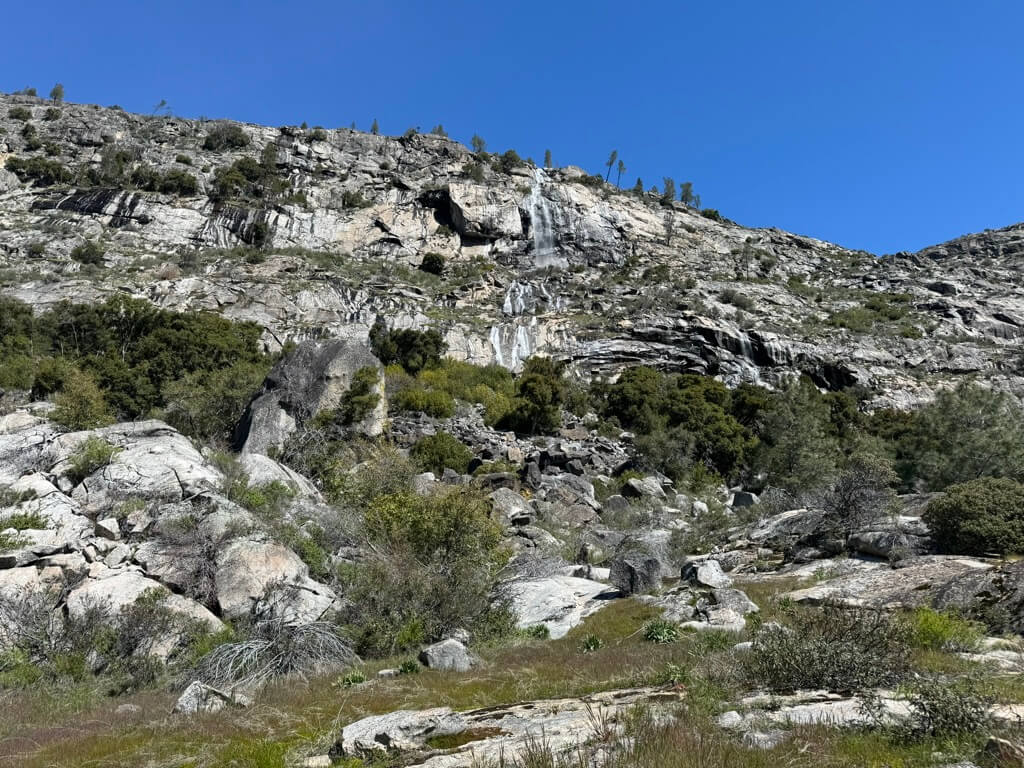
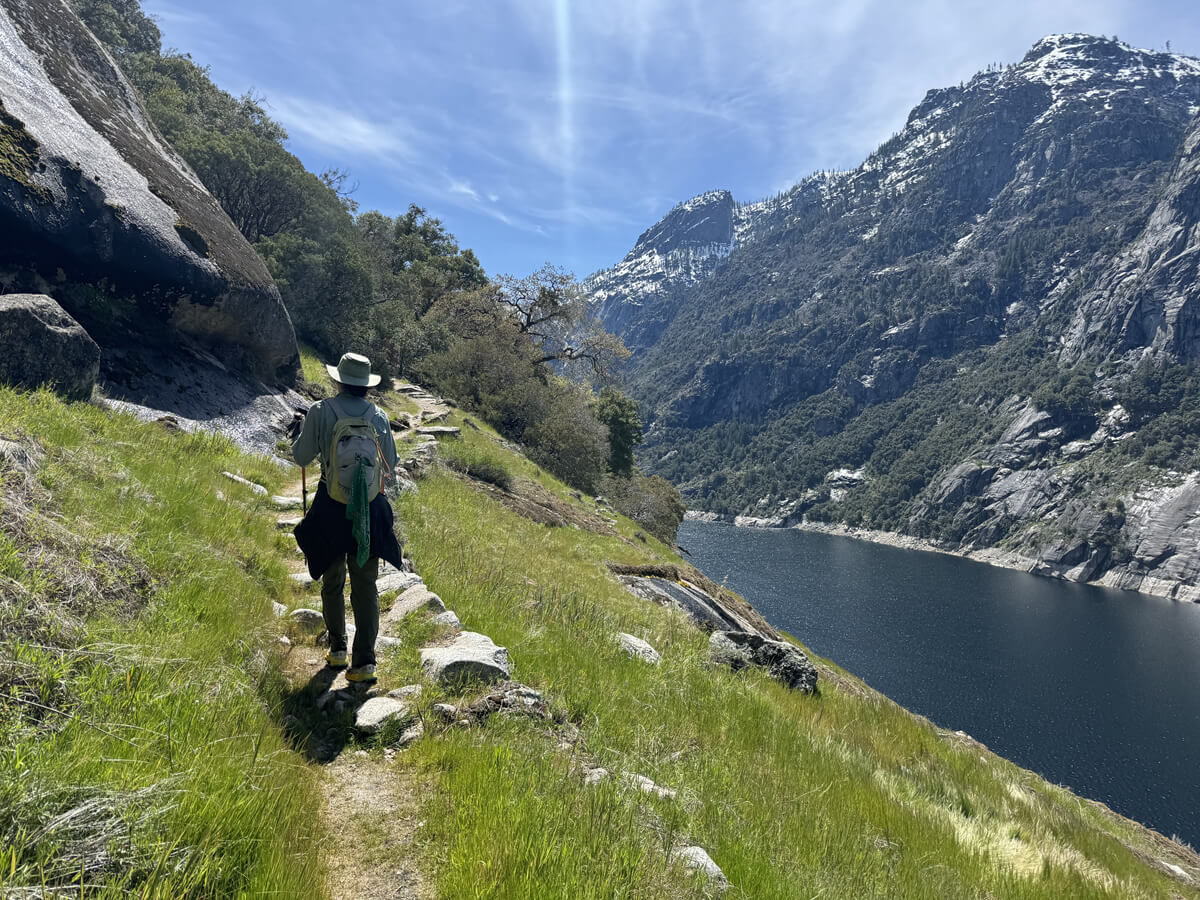
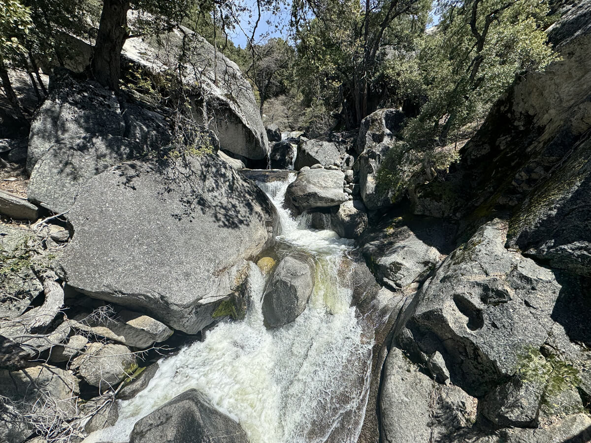
The trail winds along the canyon wall, and about 20 minutes into the hike, you'll come across one of the seasonal waterfalls cascading down the walls of Hetch Hetchy Canyon
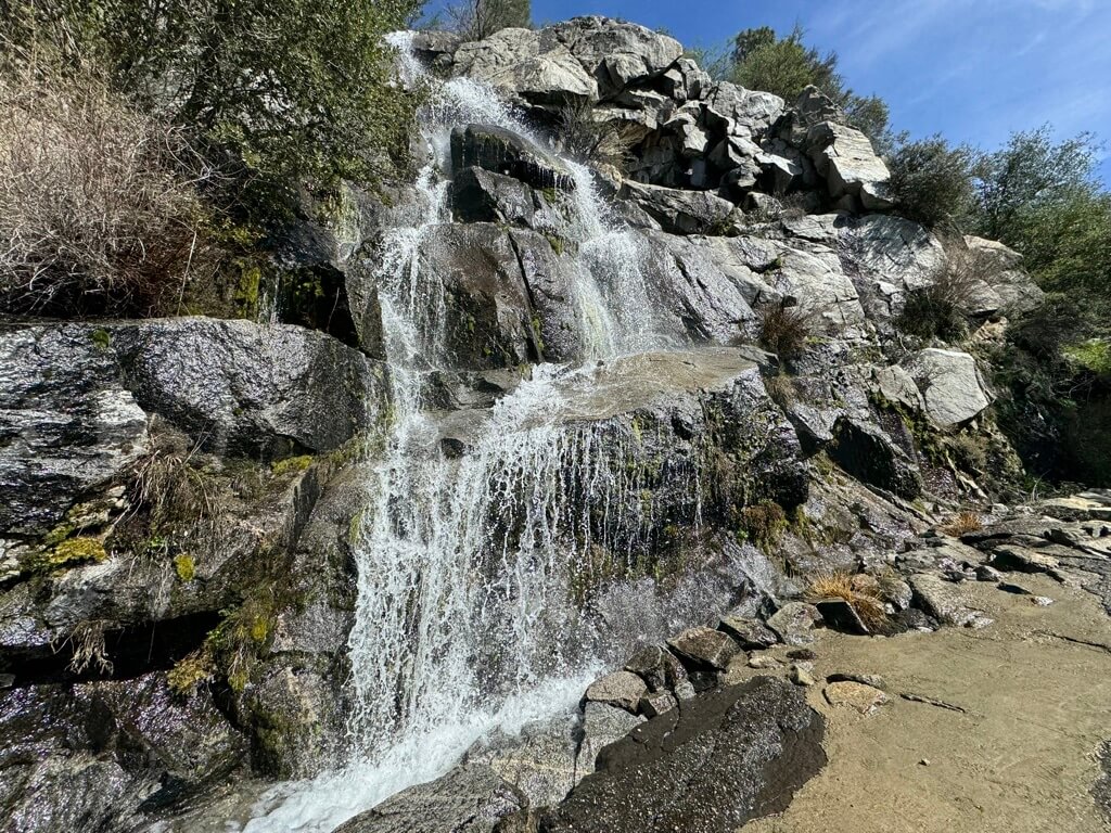
From April to June, meltwater flows out in large quantities, creating seasonal waterfalls here and there. Continuing on, you'll come to the first fork in the road, about 1.6km from the start
It's an easy fork to get lost at, but go downhill to the right
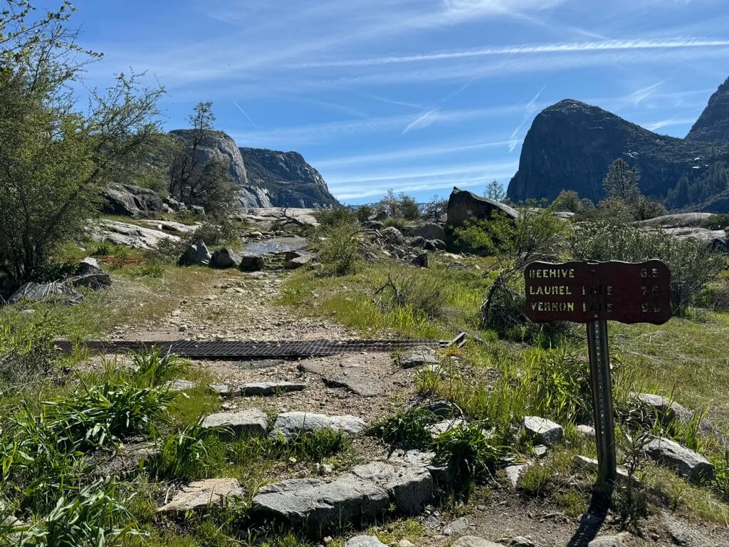
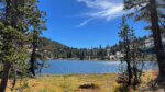
At the fork, you can choose to continue along the valley wall or head right and drop off to Miguel Meadows or Laurel Lake
Let's go to the right
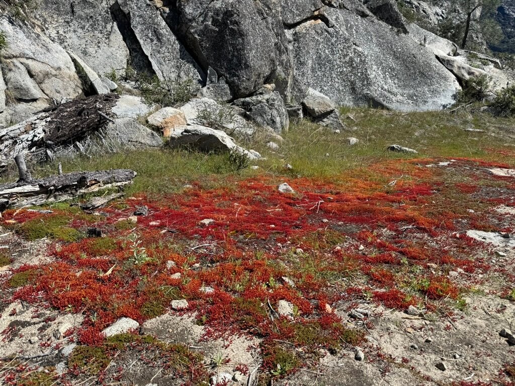
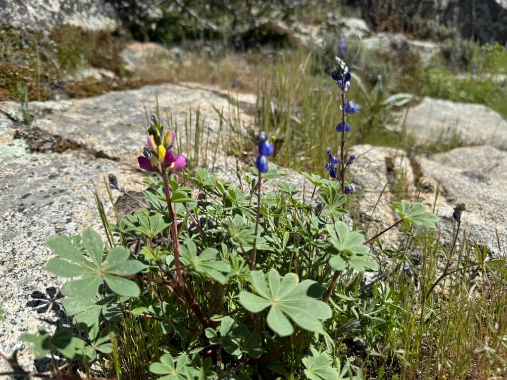
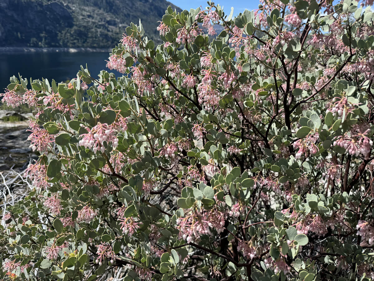
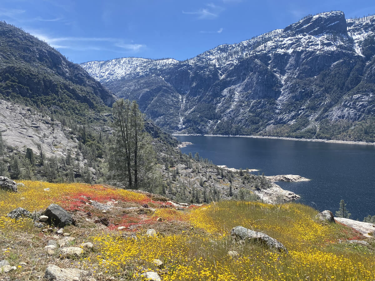
There are flowers, moss and other plants everywhere along the trail
You can see waterfalls flowing from all over the rock face in the upper left. The photo below is Tueurara Falls
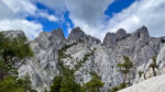
A magnificent view spreads out to the right. A rocky mountain spreads out to the left. The magnificent scenery continues on and on
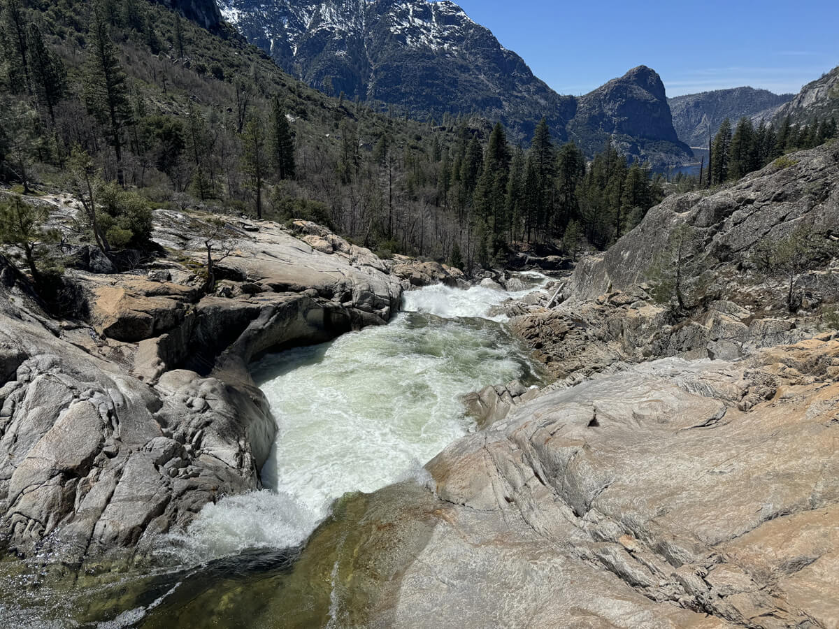
As we went further, we came across Wapama Falls
This is the largest waterfall on the route, and during periods of heavy snowmelt, it can feel like rain. The trail passes right next to the waterfall, and there are many lookout points around it
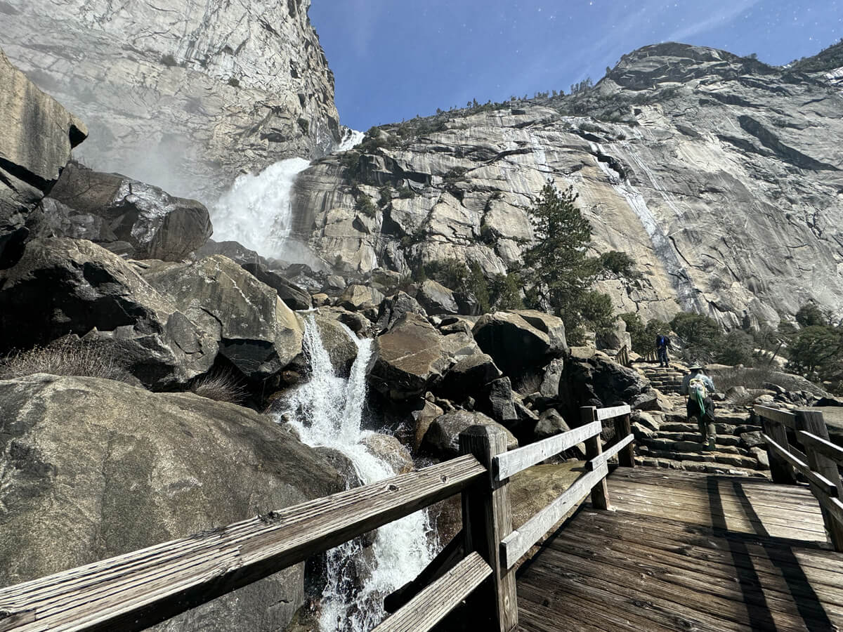
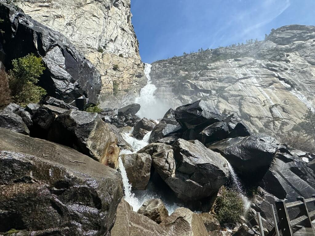
We refresh ourselves by splashing with water and continue on
The surrounding area was filled with purple lupine and other flowers, and in some places it looked like a red carpet, and the scenery created by the blue and green of the lake and the plants was colorful and very beautiful
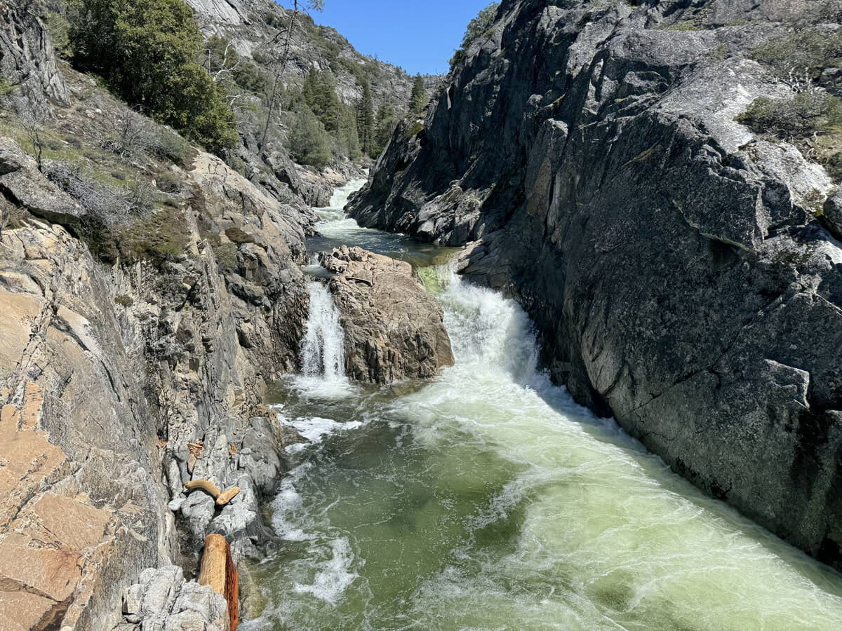
After Wapama Falls, the trail enters the forest and gradually rises and falls until it crosses Tiltil Creek Falls, where it begins the final climb to Rancheria Falls
The view is really beautiful
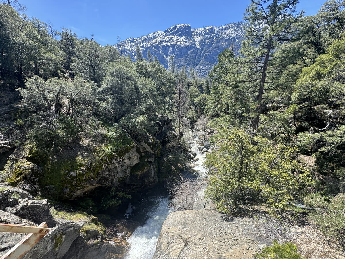
Tiltil Creek Falls
About three hours after we started walking, we could see Rancheria Falls, our goal for the day
We continue walking for about 15 minutes, past the waterfall, and take a rest stop for lunch, then head back along the same trail
The trail is simple, but it is long and has ups and downs in the latter half, so it is a trail that will require a lot of physical strength
This is a hiking route that takes you into another dimension with spectacular views
Please come and visit us
Sayaka Kato

Related reading