Click here for the previous article (Chapter 1)
table of contents
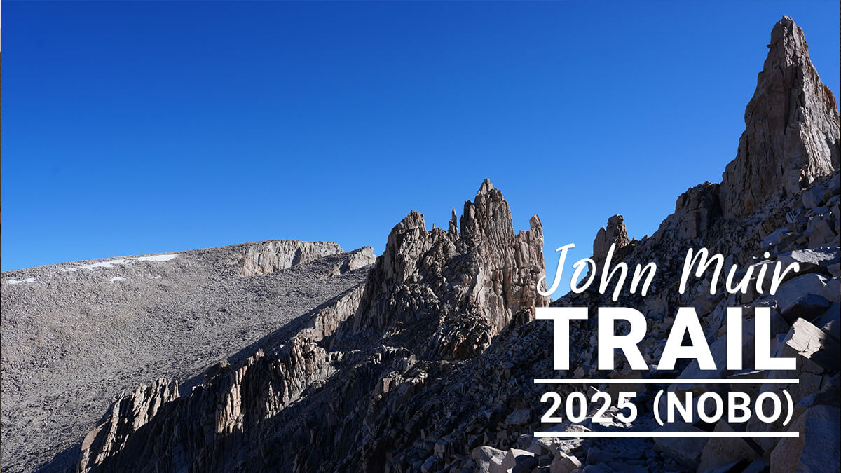
Chapter 2: From Horseshoe Meadow to Mount Whitney
There are two routes to Mount Whitney from Horseshoe Meadow via Cottonwood Pass. One is to cross the pass, walk straight along the PCT route, descend to Rock Creek, and go to Crabtree Meadow via Gooyot Pass. The PCT route is not popular with American hikers because it is on a plateau and has little water. However, I personally prefer this route
Another route is to leave the PCT route after the pass, go straight to Rock Creek, and walk along the river to Gwoot Pass and Crabtree Meadow. There are food lockers scattered along the creek, and there are plenty of campsites. However, it is a long route. I only walked it once in 2018
Horseshoe Meadow Campground
The Horseshoe Meadow campground is a little high, at 3,048 meters above sea level. Spending a day here before heading out helps you acclimatize and reduces the risk of altitude sickness. However, those who are sensitive to high altitudes may experience symptoms of altitude sickness here. In that case, it would be better to spend a few days in Mammoth Lakes (at about 2,400 meters above sea level). I've been there many times, so I know that 3,000 meters is fine. However, just to be safe, I planned to stay two nights here. The camping fee is only $6. Horseshoe Meadows has a one-night rule, and staying two nights would be a violation. However, because it's a first-come, first-served system, it might be okay if you leave once. However, there's no one checking in. It's usually empty from late July to early August
At Horseshoe Meadow
We arrived at Horseshoe Meadow. I picked up my backpack from Kurt's car, put it on, and headed to our usual spot with two days' worth of food in one hand
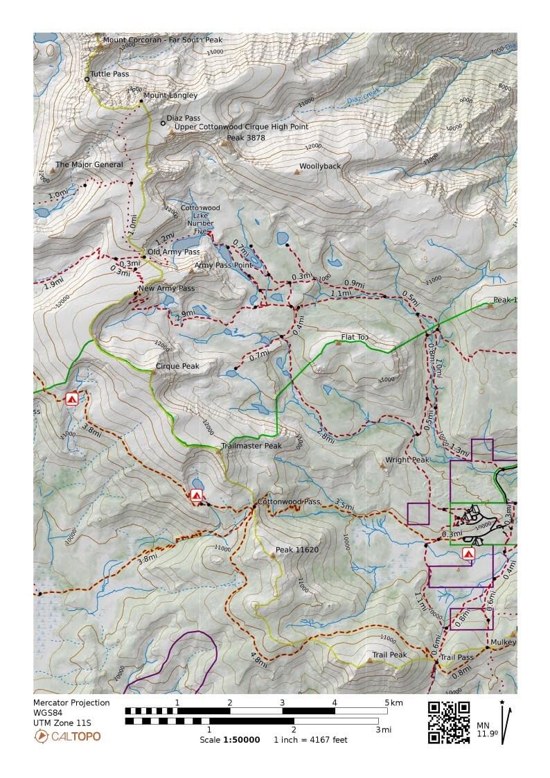
Figure 2.1: Trail from Horseshoe Meadow. Route connecting tent markers
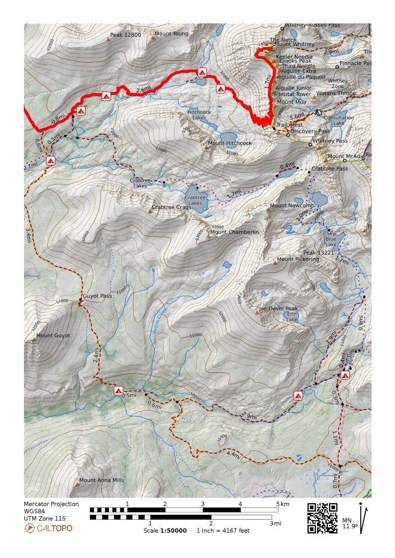
Figure 2.2: Mount Whitney is in the upper right. The JMT is the red line route. From Cottonwood Pass, there is the PCT route and a route north along Rock Creek
It's spacious and not crowded, but when I went to a shady spot, there was a sign saying "No camping." Even when I went to other places where I had slept before, there were still signs saying "No camping." It was a bit of a problem
I had no choice but to go to a rectangular site and pitch my tent. It seems that camping is prohibited outside of the rectangular sites. The number of sites had also been halved. There was a hiker packing up, but I didn't want to talk to anyone, and this hiker seemed like he wanted to say something. I kept as far away as possible and pretended not to notice him as I pitched my tent
After setting up my tent and taking $6 with me, I went to the notice board and saw that the camping fee was $24. I was surprised and tried to get some water, but the pump wouldn't come out, so I went to the toilet at the trailhead, got 6 liters of water, and returned to my tent
As I was daydreaming, a hiker across from me started talking to me from a distance. He was carrying a Kelty frame pack, so I assumed he was a Kelty hiker. I didn't ask his name
"You pay the camping fee there. It's ridiculously expensive, like $24, since Trump took over, as you probably know. All the rangers were fired. There are no rangers anywhere. It's quiet. The campground above (Cottonwood Lakes Trailhead) is $11, so everyone camps there. It's quiet because it's expensive. I stayed here for two nights because it's quiet."
After lunch, I had no choice but to take the $24 to the bulletin board, put it in an envelope, and pay. I returned to my tent, and after a while, what I think was a peregrine falcon suddenly swooped down, killed a ground squirrel, and flew away. It took less than 0.1 seconds. The squirrel had just emerged from its hole in the ground. The poor, large ground squirrel instantly turned into a corpse and rolled away. It seemed the falcon had killed it without any intention of eating it. Was it for fun, practice, or was it just an eyesore? I was a little surprised. Ground squirrels seem to live a long life, but they are easily killed
"See? It's dead," Kelty's hiker said, pointing with his foot as he approached. And, much to my dread, I ended up having a long, drawn-out story
He's a truck driver who comes here three times a year to hike for a few days. His hobby is fishing, so he goes cross-country from the trail to less crowded areas. He seems to have been around Cottonwood Lakes quite a bit
*1: As of September 2025, the price has been reduced to $22 on the website. Perhaps there were complaints?
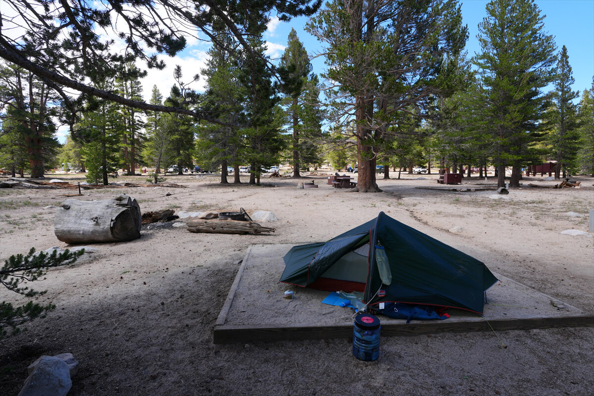
Figure 2.3: The number of square sites has drastically decreased. In other areas, there are many signs prohibiting camping. There was a hiker at the site in the center of the photo, and he was currently clearing away
"This is the biggest golden trout," he said, searching for a photo on his smartphone and showing me. Sure enough, it was a huge, shining golden trout
"The guys on the PCT just take supplies every four or five days and walk. They have someone to provide them for them. I'm afraid of starvation, so I carry a lot of stuff with me. Packing fear," he said with a laugh, posing for me with his Kelty pack. Since I was there, I let myself wear it. When you tighten the belt, the weight is on your hips, but surprisingly, it doesn't restrict hip movement. I expect it to be a popular item
He had come by car, so he had a mountain of camping gear. He carried it slowly, piece by piece, into the car. When I offered to help him a little, he said it was fine because it was training. So I helped him carry only the small, light items he could hold in one hand. He didn't seem to mind, and was happy. We chatted, and it took him about two hours to pack up before he left in his car
Dinner was half a steak, boiled vegetables, bread, and soup (Figure 2.5). The bagels were delicious; I should have bought another bag. Since I might not have enough for the day, I took about 20g out of a bag of alpha rice and dried natto blend, turning 10 bags into 11. There were side dishes like beef jerky, and for breakfast and lunch, JMT bread and cookies were available, so it wasn't a problem
After Kelty's hiker, a young couple arrived. It was quite noisy for a while. I thought it would be quiet once I went to sleep, but I could hear their horrible snoring, even though they were about 20 meters away. I shoved my earplugs in tightly and went to sleep
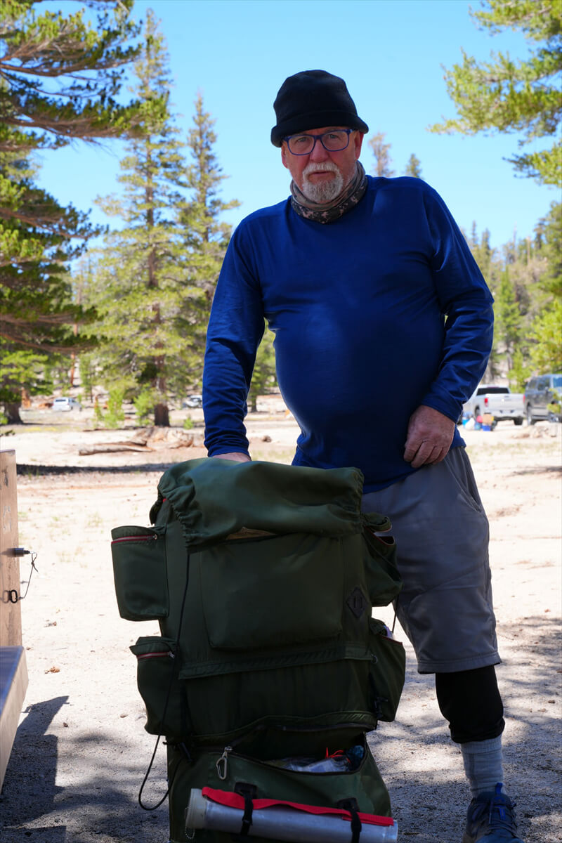
Figure 2.4: A hiker with a Kelty frame pack proudly announces, without any further question, that he spent two nights here
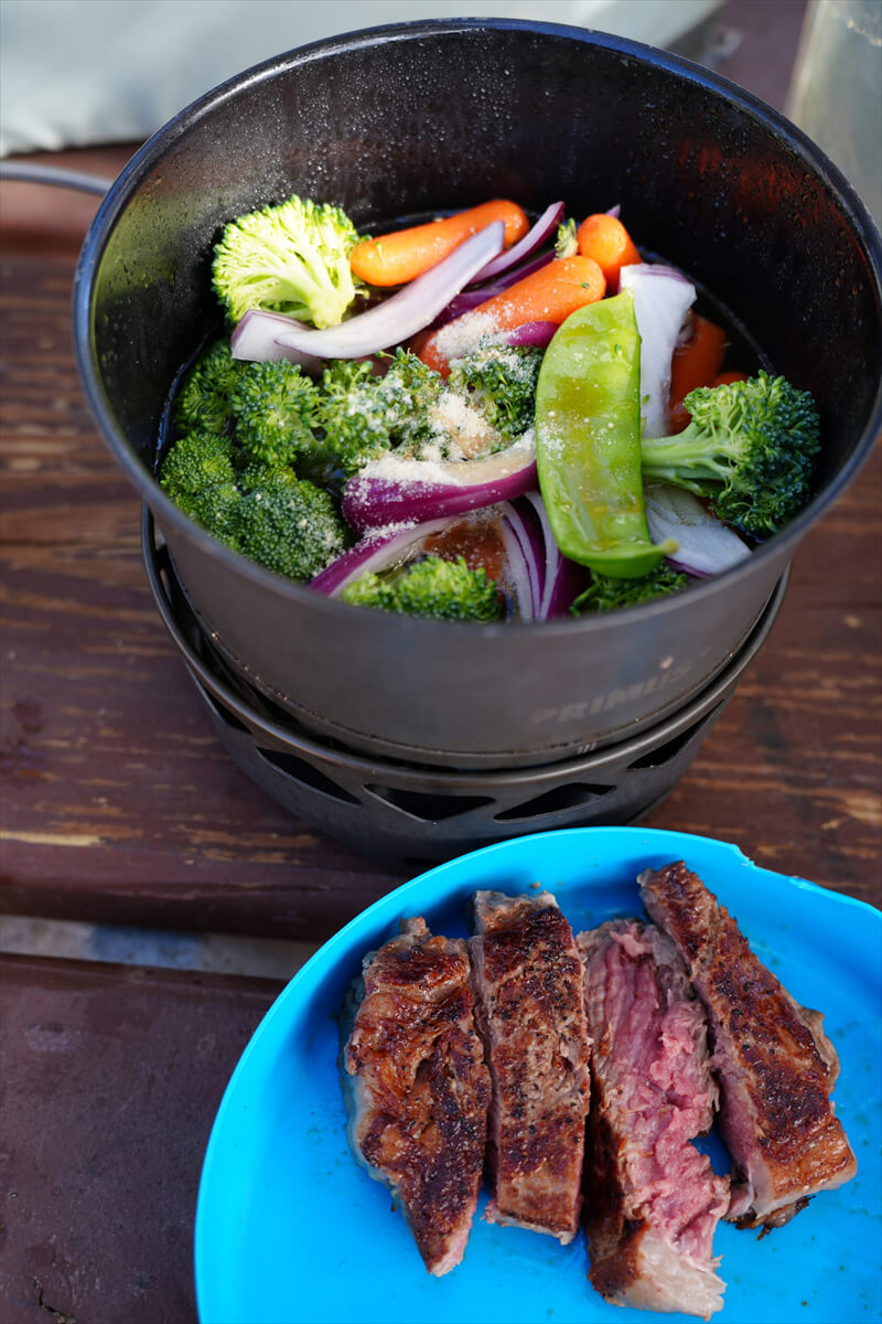
Figure 2.5: Dinner at Horseshoe Meadow, with bread, soup, and fruit
On the 24th, I woke up at 6am and had a bagel, banana, and yogurt for breakfast. I had planned to stay another night, but I didn't want to be confronted by another loud snorer next door, and since all the rangers had apparently been fired, there was no one to check on me. I changed my mind, quickly packed up, and left just after 8am
Chicken Spring Lake to Rock Creek
Once on the trail, you walk through giant pine trees for a while. It's mostly flat, so it's easy to walk. It might be nice to camp a little upstream rather than staying at the campground, but I've never done it. To begin with, a Cottonwood Pass permit requires you to cross Cottonwood Pass on the permit date. Camping along the way would probably be illegal
Figure 2.6 shows the view of the area where the pine trees have been slightly cleared. After this, the trail re-enters the area between the giant pine trees. After walking slowly for about an hour, you cross a small stream. This is the upper reaches of Cottonwood Creek. The trail continues west for a while. The elevation gradually increases, and small switchbacks appear. After completing these switchbacks, you cross the uppermost part of Cottonwood Creek. Due to the lack of rain this year, the stream is completely dry
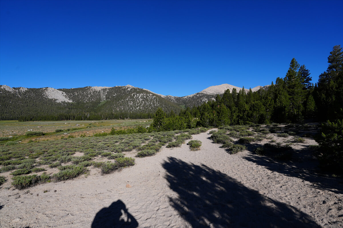
Figure 2.6: Upper Horseshoe Meadows. The lower section in the distance is Cottonwood Pass
The trail then turns north and enters a series of large switchbacks. After the first large switchback, you reach Cottonwood Pass. In snowy years, there is a snowfield just before the pass. A sign for the pass is located at a lower elevation a short distance past the pass (Figure 2.7)
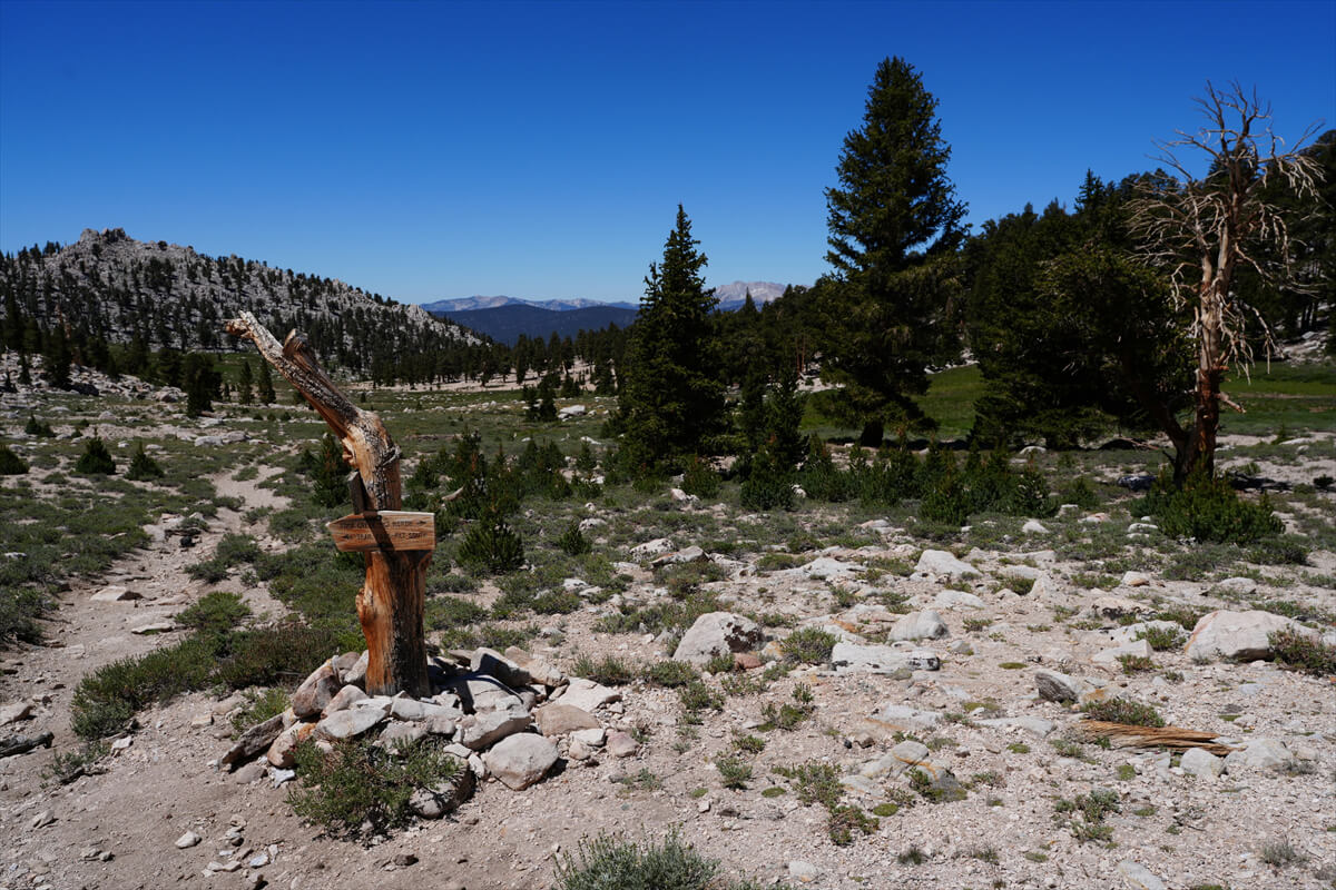
Figure 2.7: Just past Cottonwood Pass, the trail splits into three. Just before that, you'll see this sign
We arrived in the afternoon, so there was no one around. The Cottonwood Pass sign was a little further north. At the junction of the PCT and Theodore Salamands Trail, we made a sharp right turn to head to Chicken Spring Lake. In rainy years, you can see the spring water, but this year it was completely dried up
The trail is a gentle, nearly level climb, making for an easy walk. It's about 1 km to Chicken Spring Lake. At times, you'll cross a small creek, but because I left a day early and the weather was dry with little rain, I was worried about finding a water source further ahead, so I turned north and headed to the shore of Chicken Spring Lake. Several hikers were resting there. A large campsite was located south of the lake, but I don't like crowded places, so I searched west of the lake. I found a nice spot in the shade, close to the trail. I pitched my tent and had a late lunch, but then the sun came out, so I moved a little. Chicken Spring Lake is shown in Figure 2.8. It's a slightly merged version of two previous photos
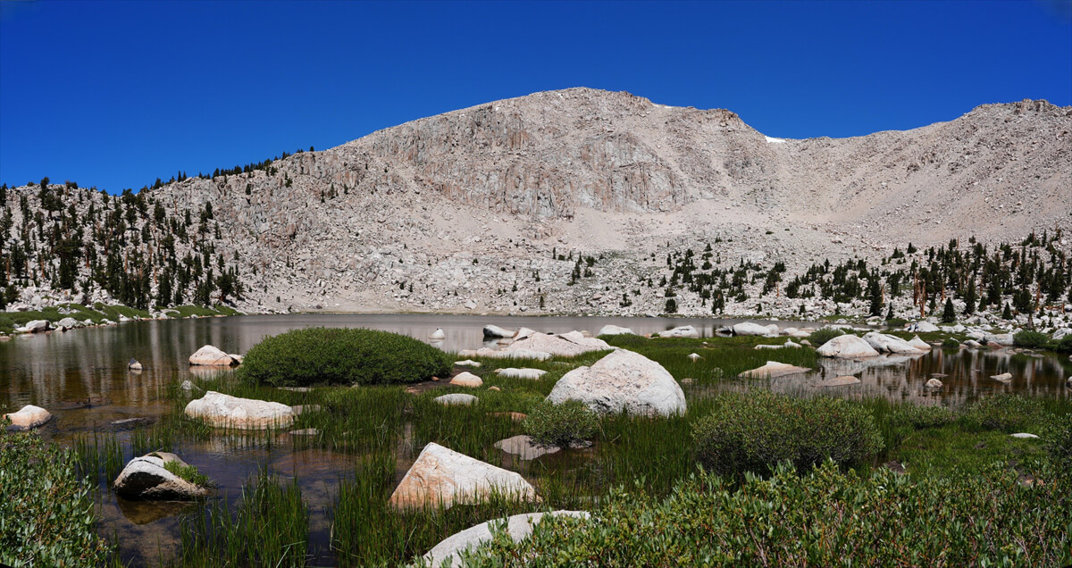
Figure 2.8: Chicken Spring Lake
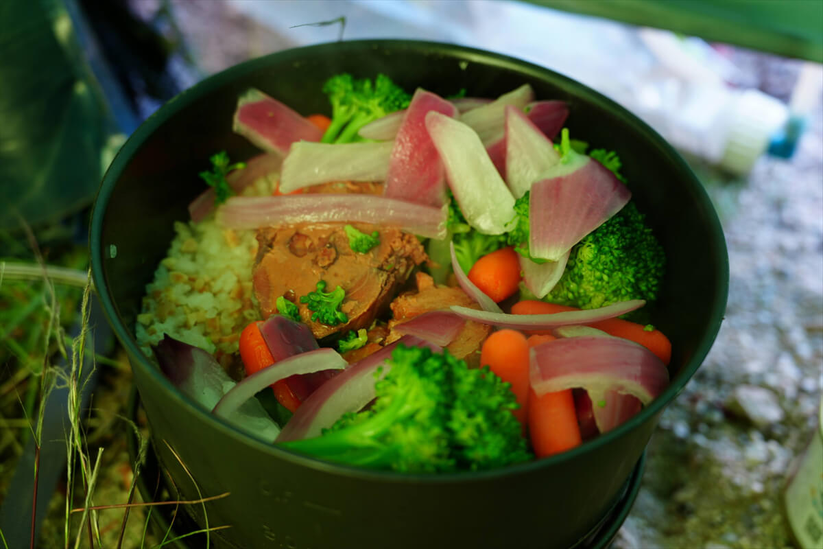
Figure 2.9: Dinner at Chicken Spring Lake: boiled vegetables and canned mackerel served over alpha rice and dried natto rice
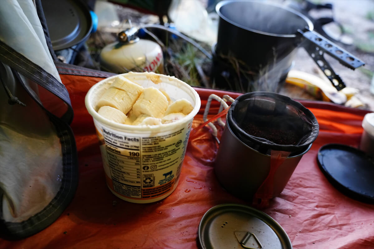
Figure 2.10: Breakfast: bagel, banana, yogurt, and coffee. I planned to eat it at Horseshoe Meadow
To Rock Creek
From Chicken Spring Lake there are some steep switchbacks and we climb slowly. We've been here many times before, so there are familiar pine trees and rocks. There is also a flat area where we can pitch a tent. After going through the switchbacks, the trail becomes level again and the view opens to the south. It's dry this year, so there is no flowing water. After walking slowly for about two hours, we see a green marsh on the left. We walk along a sandy trail and come to a place where water flows
However, this year there was no water flowing at all. I took a break and looked around. I found a plastic toilet shovel lying on the ground. A little further on I came to a grassy area where water had sprung up and pooled. Below this was the campsite, where I stayed overnight in 2016. It seems that the water source here never dries up, even in the dry summer. I took out my water filter and secured 1 liter. There was no water from here until I got close to Rock Creek
As we went around the huge rock, the trail gradually became gentler. We left the trail to the north on a plateau-like area and arrived at the location shown in Figure 2.13. It was 30 to 40 minutes from the water source mentioned earlier. In rainy seasons, it forms a large lake, with beautiful views and a good spot for camping. Unfortunately, as predicted, it was dried up this year. Since the view was beautiful, we decided to have lunch. By lunch, I mean just a bite of JMT bread and instant coffee. Recently, cheese has been putting a strain on my digestion and making me feel unwell, so I only eat it in the morning
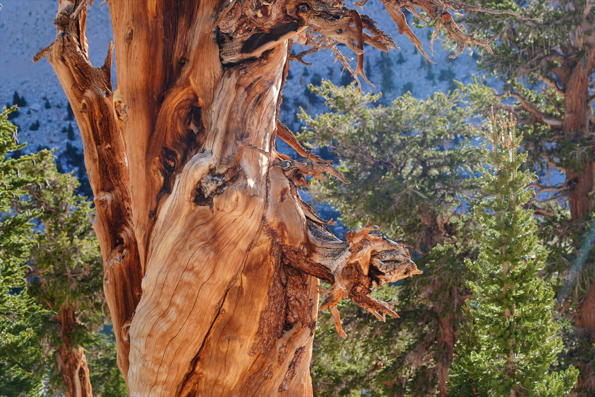
Figure 2.11: Dead pine tree
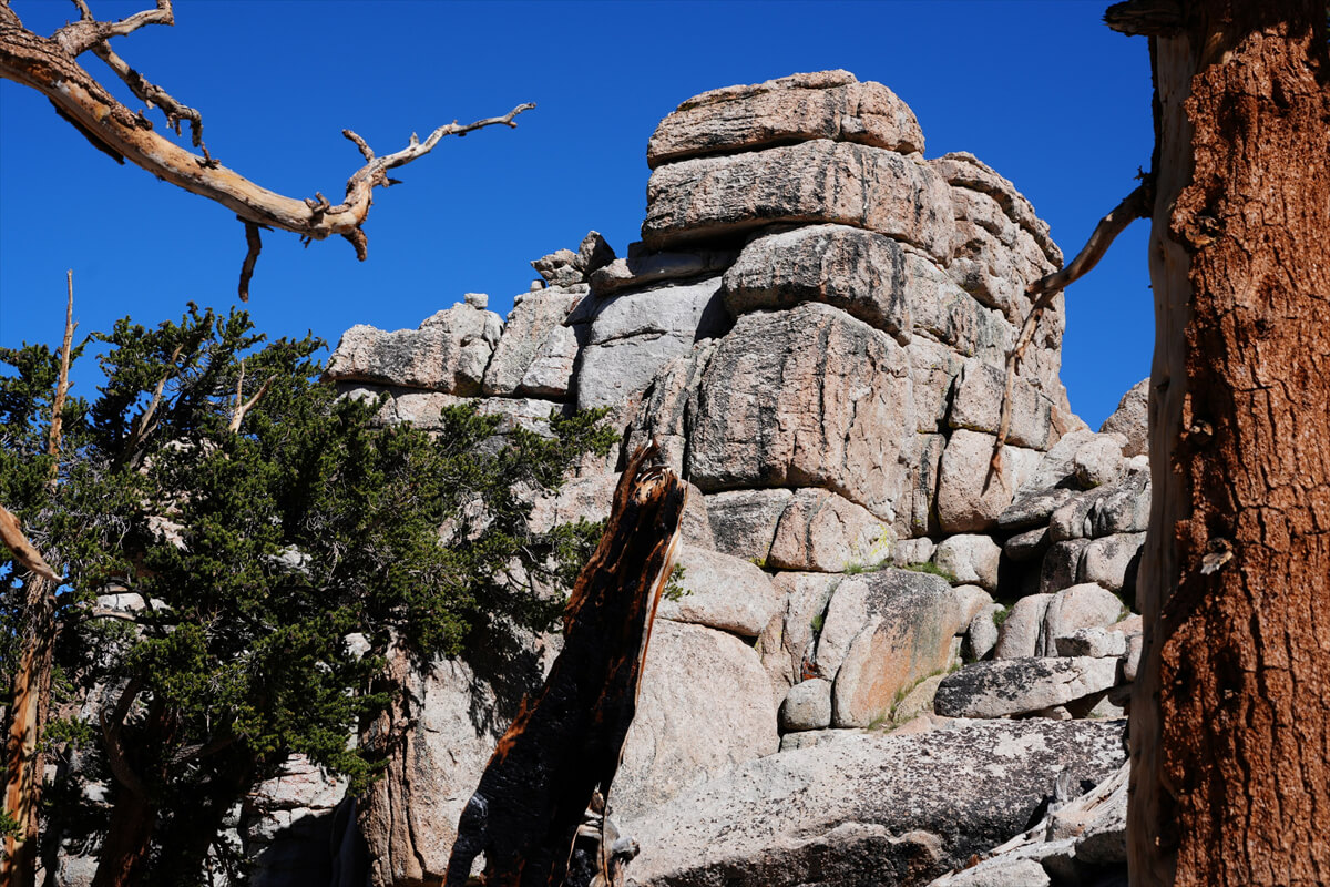
Figure 2.12: A large rock is a landmark. The trail circles around it on the south side
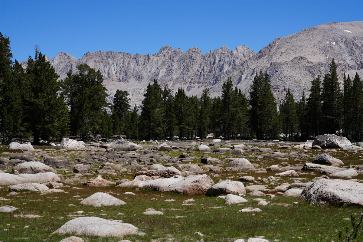
Figure 2.13: In rainy years, a large lake forms here. This year, it was dry
After walking about 2km along the plateau-like trail, the altitude finally begins to drop and you head north. Siberian Pass Creek flows through the low plains on the left. If you need water, you can easily cross-country a bit to get some. I once had to camp there because I was short on water. However, it's only about an hour to Rock Creek, so there's no need to go out of your way to find water
There is a small stream about 30 minutes before the Rock Creek crossing. Camping is possible, but it was a little early, so we just took a break here. It took a while to get to Rock Creek. The water level was low, so crossing was easy; we just had to walk along the stones. Once we crossed, there were about 10 hikers taking a break. It was about an hour's climb up to Gooyot Creek. Tired, we went to the campsite above where the hikers were resting. It was 4 o'clock. We set up our tent
I went down to the river to get some water. The other hikers were only taking a break, so I started to set off. There was still light for another 2-3 hours, so I thought I could walk. If I hadn't packed food, I would have had no choice but to walk. Thanks to that, I ended up camping alone. Actually, I always pitch my tent a little distance away from the water source. This is for two reasons: I don't like pitching it with other hikers, and the humidity drops when I'm away from the river, so there's less condensation in the tent. For dinner, I had mirin-dried fish, but I only put it in just before cooking. It wasn't very tasty. From then on, I decided to grill it, put it on a plate, and then cook rice and put it on top
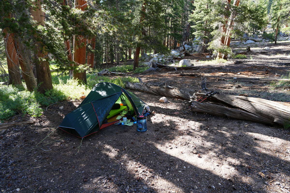
Figure 2.14: Rock Creek camp site
Goujot Pass to Crabtree Meadows
I got up around 5am and set off at 7am. The switchbacks were gentle, but long, so it took nearly an hour. In snowy years, I would see bright red snow plants along the trail, but this year is dry, so I didn't see any flowers. After going through the tedious switchbacks, I came to a plateau with large pine trees scattered here and there. Mount Gooyot can be seen on the left. The familiar pine tree is shown in Figure 2.15. Gooyot Creek is a little further ahead
There was no one at Gooyot Creek. As usual, the water was clear and clear. I took a break and added more water to bring my total to 1 liter. There are plenty of water sources on the JMT, so you rarely need to carry more than 1 liter. The trail is nearly level, but there is a slight climb near Gooyot Pass. The elevation difference is small, so it ends quickly. I arrived at the pass at 10 o'clock, and since there was no one there, I used a small tripod to take a commemorative photo
Descending from the pass, the trail levels out, then curves around a slope. After an hour of walking, I get tired of it and stop for lunch in the shade. I make instant coffee and nibble on some JMT bread. As the trail levels out, I come across a very low pass. It has no name or anything. It's the uppermost part of a creek, but there's no water. I'd looked for it before
Shortly after crossing this low pass, the trail becomes a little rougher, and you begin the descent to Crabtree Meadow. After a considerable distance, the meadow and Mount Whitney come into view. (Figure 2.16)
Figure 2.15: A forked pine tree makes a good landmark
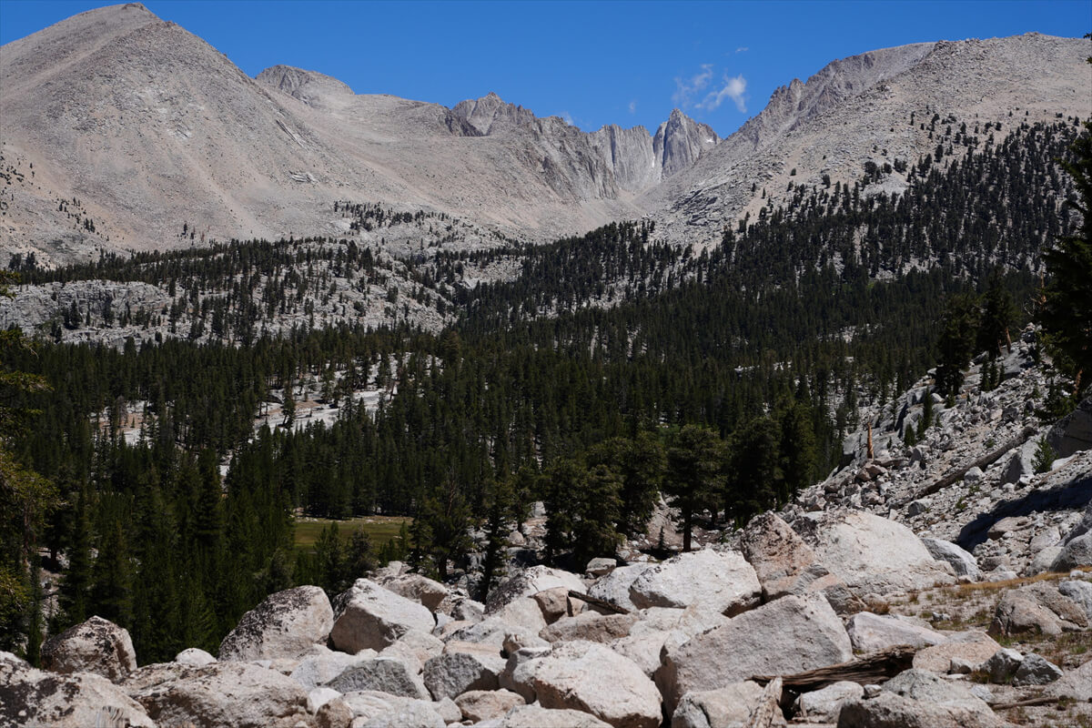
Figure 2.16: The sharp mountain in the center is Mount Russell, and Whitney is the rounded rocky mountain on the right
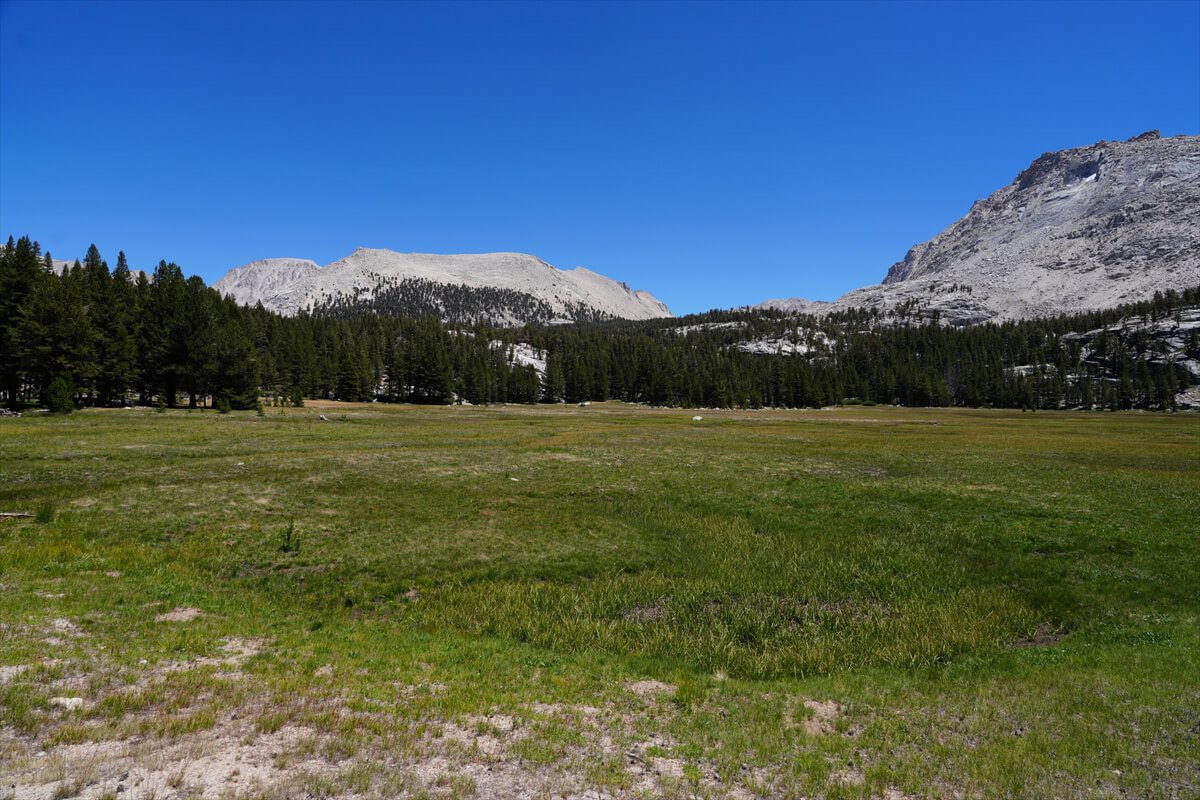
Figure 2.17: Crabtree Meadow
Going down after passing the cattle gate, we arrived at the meadow. After a short walk, we found a small campsite and a food locker. This time, it was still before 2 o'clock, so we had plenty of time. In 2016, we were accompanied by a photographer, so we couldn't cover the distance, and instead did a round trip to Mount Whitney from here. Even though we started in the dark, it was already pitch black by the time we returned, which was a disappointment. After that, we decided to go to Upper Crabtree
Crossing Whitney Creek was no problem at all. There were rocks lined up, so we just walked over them. The meadow soon disappeared, and the trail climbed up the left side of the creek. After just under 1 km, we crossed to the other side. There were several footprints, so it was difficult to find
When I arrived at Upper Crabtree Meadow, I saw five or six hikers taking a rest. There are food lockers here, and many people camp here because it's a safe place to go to and from Mount Whitney. There's also a very open pit toilet with no fences. There should be a ranger on duty, but I didn't check
Since I planned to go another kilometer and camp, I took a break, grabbed a liter of water, crossed the river, and climbed up to join another trail. This is a trail that leads to Mount Whitney, which is a gentle climb. Camping is prohibited at Timberline Lake, but looking at the map, I saw a sign for a campsite at the start of the climb just before it. As expected, the site was located away from the trail. I arrived at 3 o'clock and set up my tent. A little further down the road there was a river. I was camping alone. For dinner I had a beef jerky bowl. The jerky was delicious, so there was no need to soak it in water
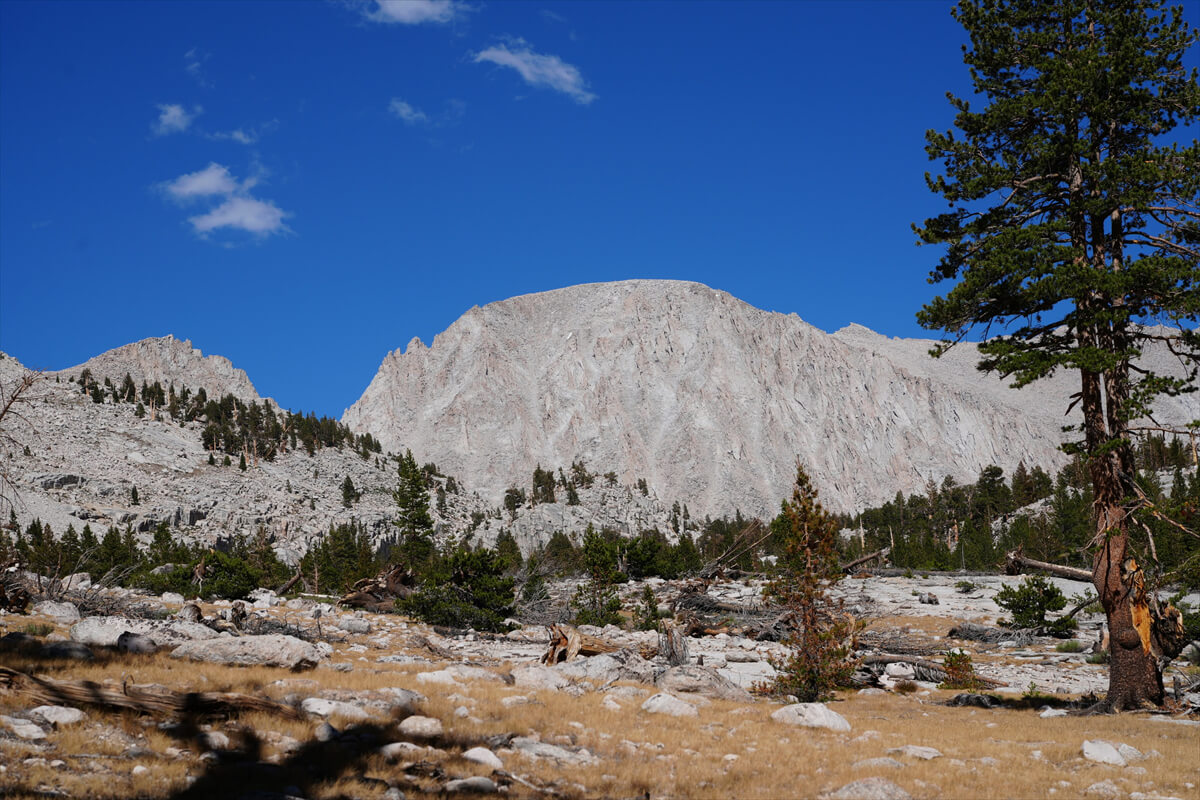
Figure 2.18: View from the campsite. The tent was pitched in the shade
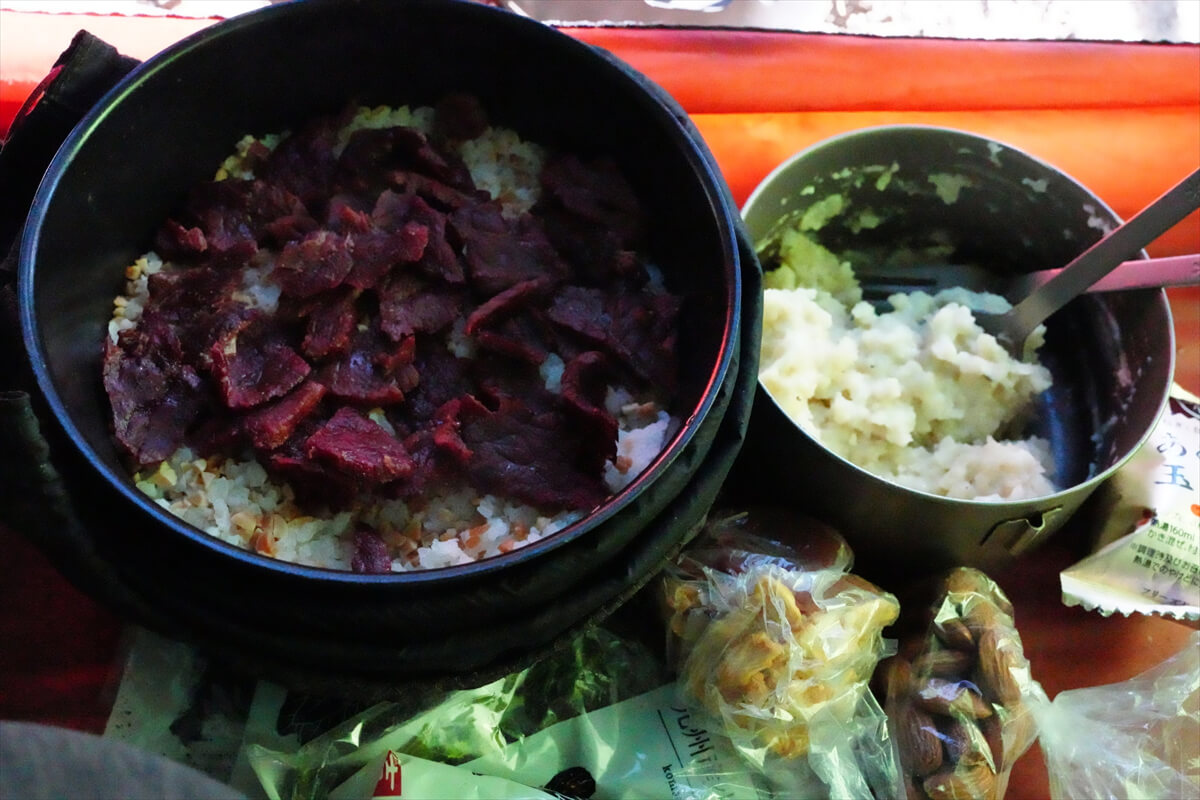
Figure 2.19: Beef jerky bowl. The beef jerky was delicious just as it was
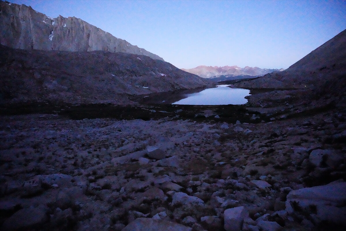
Figure 2.20: Guitar Lake before dawn, with only a single tent light visible
After dinner, I prepared for tomorrow's round trip to Mount Whitney. I removed the two front pockets and connected them to a spare daypack. The left pocket held my camera, and the right pocket held my lunch, an energy bar, a headlamp, and a spare battery. The connected daypack also held my rain suit, water filter, and 1L of water. The rest of my food fit into the Bear Canister, so I didn't need the string I'd brought with me
*2: Any remaining food should be placed in a pack and hung up. There is a greater chance that it will be nibbled by ground squirrels than by bears
Mount Whitney round trip
I woke up a little after 2:00. I couldn't calm down, so I had breakfast. I set off at 3:15 and there was no one else walking. My headlamp was cheap and dim, but the trail was clear, so it wasn't a problem. Around Guitar Lake, it got a little brighter and I could see the scenery. There was only one tent light and no headlamp was visible. This was probably because there were few hikers
Perhaps because there were few hikers around, a pika was making a loud noise nearby. It didn't run away for a long time, so I approached and took a photo. Since I was walking slowly, a hiker came up behind me, so I let him go ahead. It was just when a long switchback began
I took some photos of the hikers as we passed them. The man at the top had a frame pack, a Carson 60 like the one I was carrying, so he must be the father. Next was an unknown backpack, but it was probably the son. The last man was carrying a women's Osprey, likely an Aura AG 65, so they were a family hiking the JMT, climbing Mount Whitney, and descending to Whitney Portal. Japanese people probably think that you should pack an ultralight on the JMT, but when it comes to ultralight hikers on the JMT, it's Japanese people. In reality, there are more hikers carrying frame packs than ultralight hikers
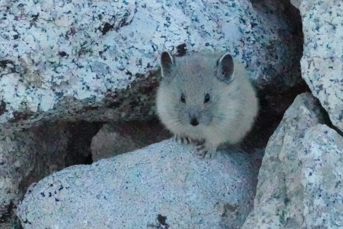
Figure 2.21: The pika was making a lot of noise, but it didn't run away
The weather has been good this year, but the summer of 2012 was terrible. Chieko and I were camping at Guitar Lake. Lightning began at 2 a.m., followed by a thunderstorm at 3 a.m. It stopped, so we set off at 4 a.m. However, around 6 a.m., the interval between the lightning and the thunder became five seconds, creating a dangerous situation. We temporarily took shelter in the shade of a rock on a switchback. The thunderstorm subsided for a while, allowing us to summit Mount Whitney. However, on our descent, lightning approached at Trail Crest, causing hail to pound (Figure 2.23). We hurried down the mountain. As we descended, rain began to fall, and many hikers fell in puddles. I was surprised to see so many people heading for the summit despite the bad weather. It must have been related to their permits. I later learned that on August 14, three hikers camping at Guitar Lake were struck by lightning. This happened around the time we set off from Bishop. According to the BBC, 21 people have died in the US since that day
*3: https://www.bbc.com/news/world-us-canada-19326042
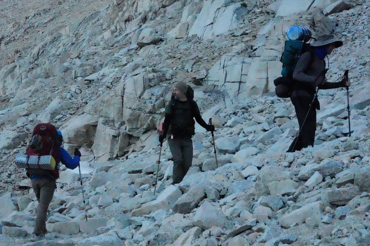
Figure 2.22: A typical JMT hiker, typically carrying a 60L backpack
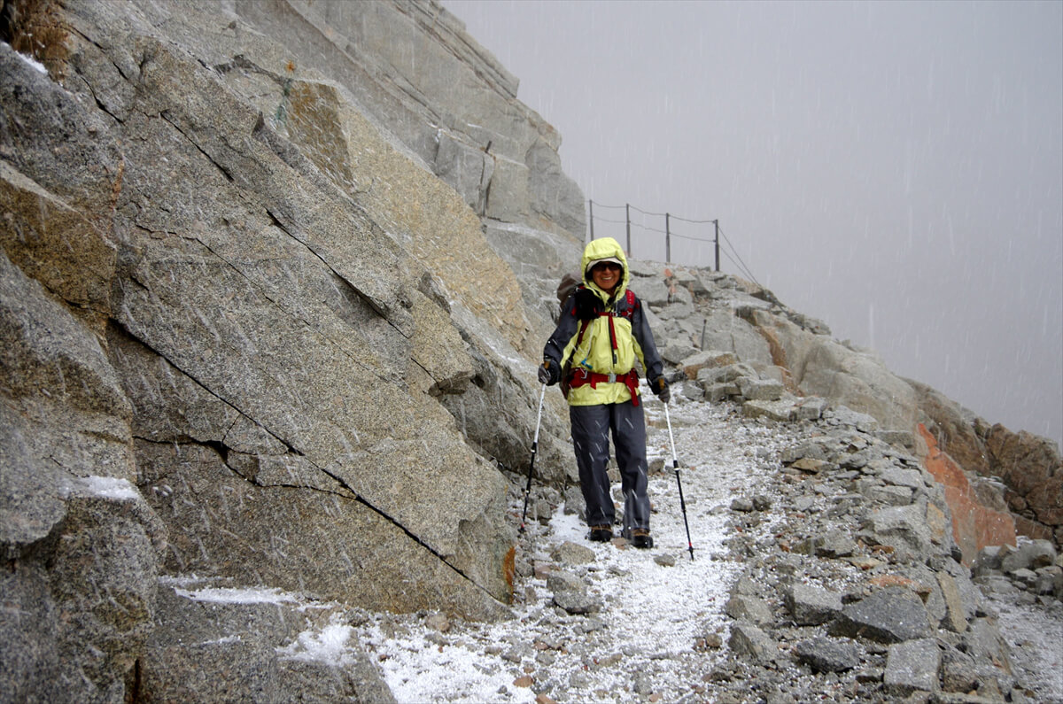
Figure 2.23: On the switchbacks descending past the trail crest. Lightning has been a frequent cause of death on Mount Whitney. Be careful. Photo taken August 23, 2012
After a long series of switchbacks, Mount Hitchcock (Figure 2.24) comes into view. The switchbacks never seem to end. The trail junction with Trail Crest is near a sheer rock spire. There's also a small campsite nearby. It's not a suitable spot for me, as I need 5 liters of water for an overnight stay. On the trail to Mount Whitney, there's a sign that warns of "Extremely Dangerous During Thunderstorms." In the summer of 2012, one or two people may have died. The trail junction is a little wide, so many people leave their large backpacks there and make the round trip to the summit. While there's no theft, marmots do occasionally sniff out food and target backpacks. This is also where hikers from Trail Crest meet up
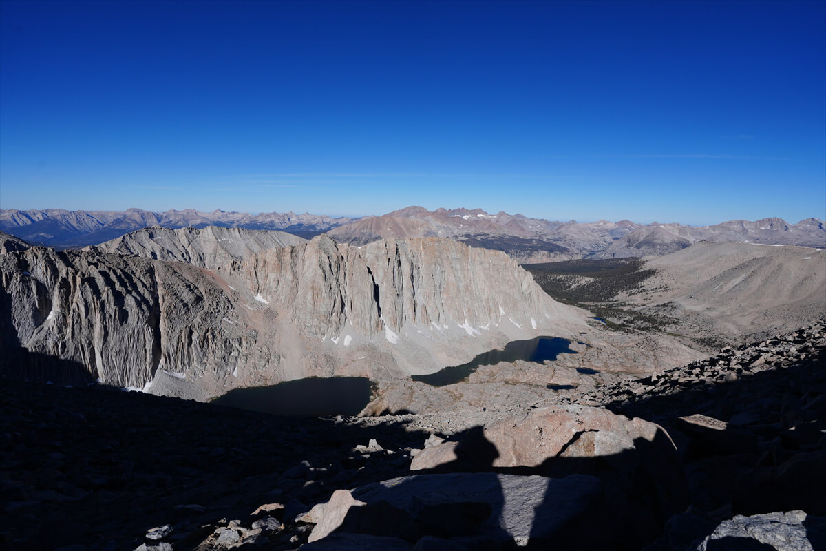
Figure 2.24: Mount Hitchcock
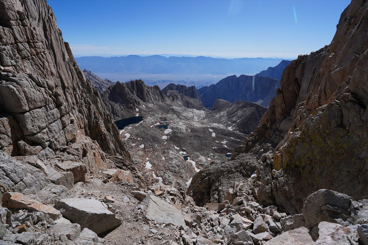
Figure 2.25: The gap just before S. Brutal Tower, with the plains of Lone Pine visible in the distance
After this, the trail becomes gentler, but you can't walk quickly as the altitude is over 4,000m. The trail runs along the side of a rock spire, and in two places you can see the direction of Lone Pine through the gaps in the rocks. This is also a good photo spot. After a while, the trail collapses a little and there are rough spots. After carefully crossing these two spots, the trail is mostly flat all the way to the top of Whitney
Among the rocks along the trail, you can see Sky Pilot (Figure 2.27) and Chrysanthemums (Figure 2.28). Looking back from near the summit of Whitney, you will see a formidable landscape. The panoramic composite is shown in Figure 2.29
We reached the summit at 10:00 AM, a success. Because we had started early, we arrived in the morning, even though we were slow. If the weather worsens, hail and lightning can strike. It is best to climb Mount Whitney in the morning. Since last year, a stainless steel relief has been installed at the summit for commemorative photos. I tried lifting it for the first time, and it seemed to weigh about 1 kg (Figure 2.30)
At the top of Whitney, the only place with cell phone coverage was the area overlooking the town of Lone Pine. I managed to connect, uploaded some photos to Facebook, and had bread and coffee for lunch. I stayed on the summit for about an hour, thinking that this was probably my last time
I checked my records and found that I had descended to the junction of the Whitney Trail at 1:30 pm, which meant it had taken me two hours from the summit. There were a lot of hikers, so there was a traffic jam. Along the way, I found a headlamp that looked very similar to mine on a rock. I thought it looked similar, but that was it, and I didn't realize it was mine. My brain must have been completely deprived of oxygen
We passed Guitar Lake around 3:00 p.m. There was a slight breeze, rippling the lake surface and reflecting sunlight. Because Guitar Lake is so crowded, since I met Kevin (Figure 2.32) in 2010, I always pitch my tent on the smaller lake above when hiking the south-facing JMT. Kevin is a friendly guy, and I've met him many times since the VVR. He's a 26-year-old engineer and currently a student. He lives in Michigan, but he lived in California as a child. He told me the JMT was tough and ruined his stomach. We finally met again in Lone Pine, and we went to a restaurant called Seasons for steak. He taught me how to use a credit card. I paid for the meal because he was my professor, but I regretted it a little when I saw the bill. Incidentally, the majestic Crazy Dock is shown in Figure 2.35. The location was Guitar Lake. I was very surprised to hear that dinner consisted of just one cup of instant ramen. I thought "dinner" meant a luxurious dinner in English, but I was completely wrong. If you eat something in the evening, that's dinner
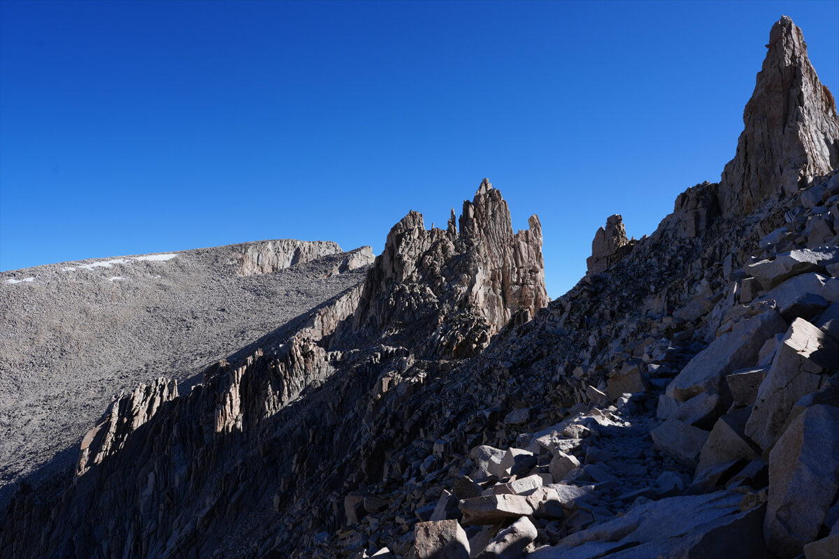
Figure 2.26: Mount Whitney is the rounded part at the end
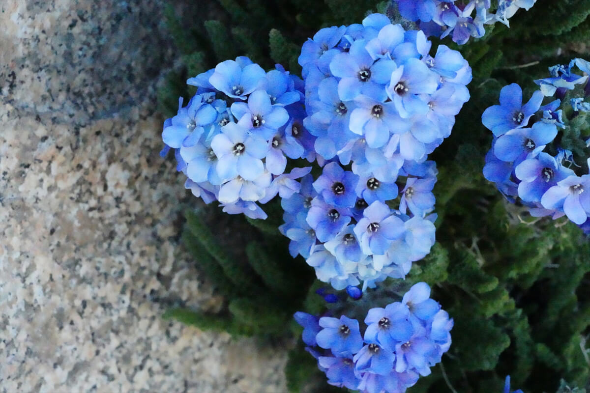
Figure 2.27: The spherical Sky Pilots are unique to Mount Whitney. They don't form such beautiful spheres anywhere else. White ones are also found, but their numbers are somewhat reduced
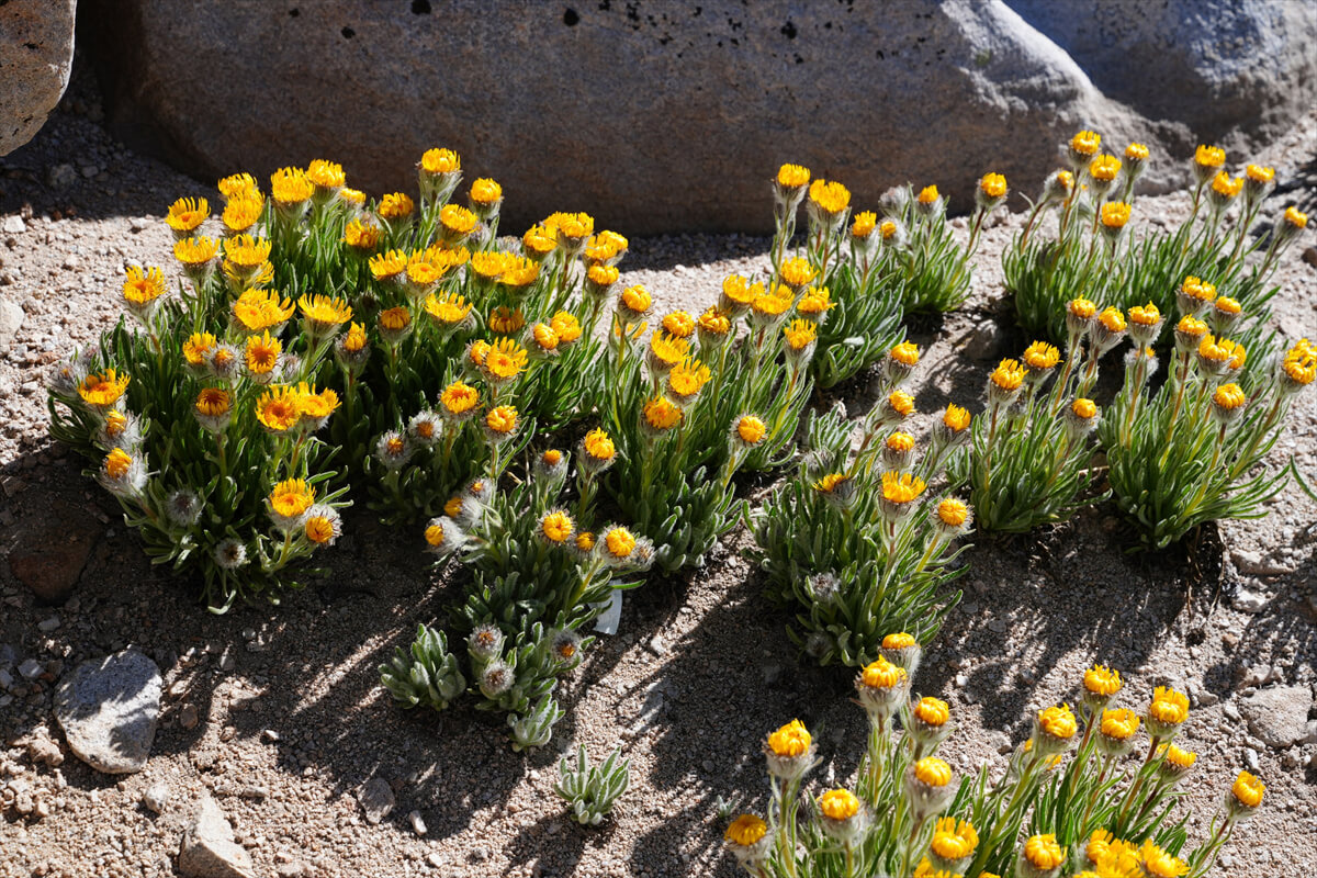
Figure 2.28: The distinctive flowers of the Chrysanthemum family at Mount Whitney. They were early and not in full bloom
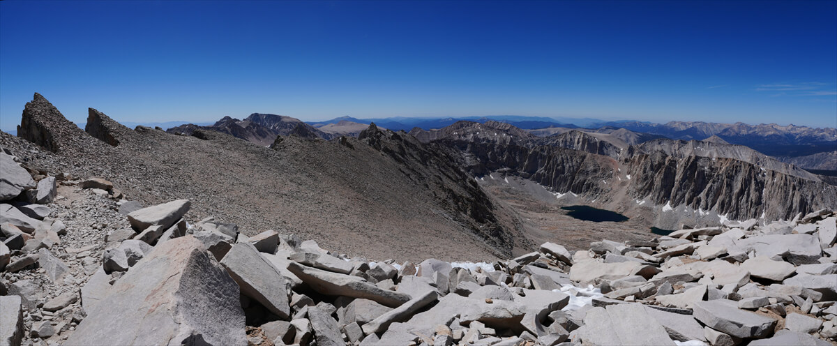
Figure 2.29: Looking back from near the summit of Whitney. Panoramic composite
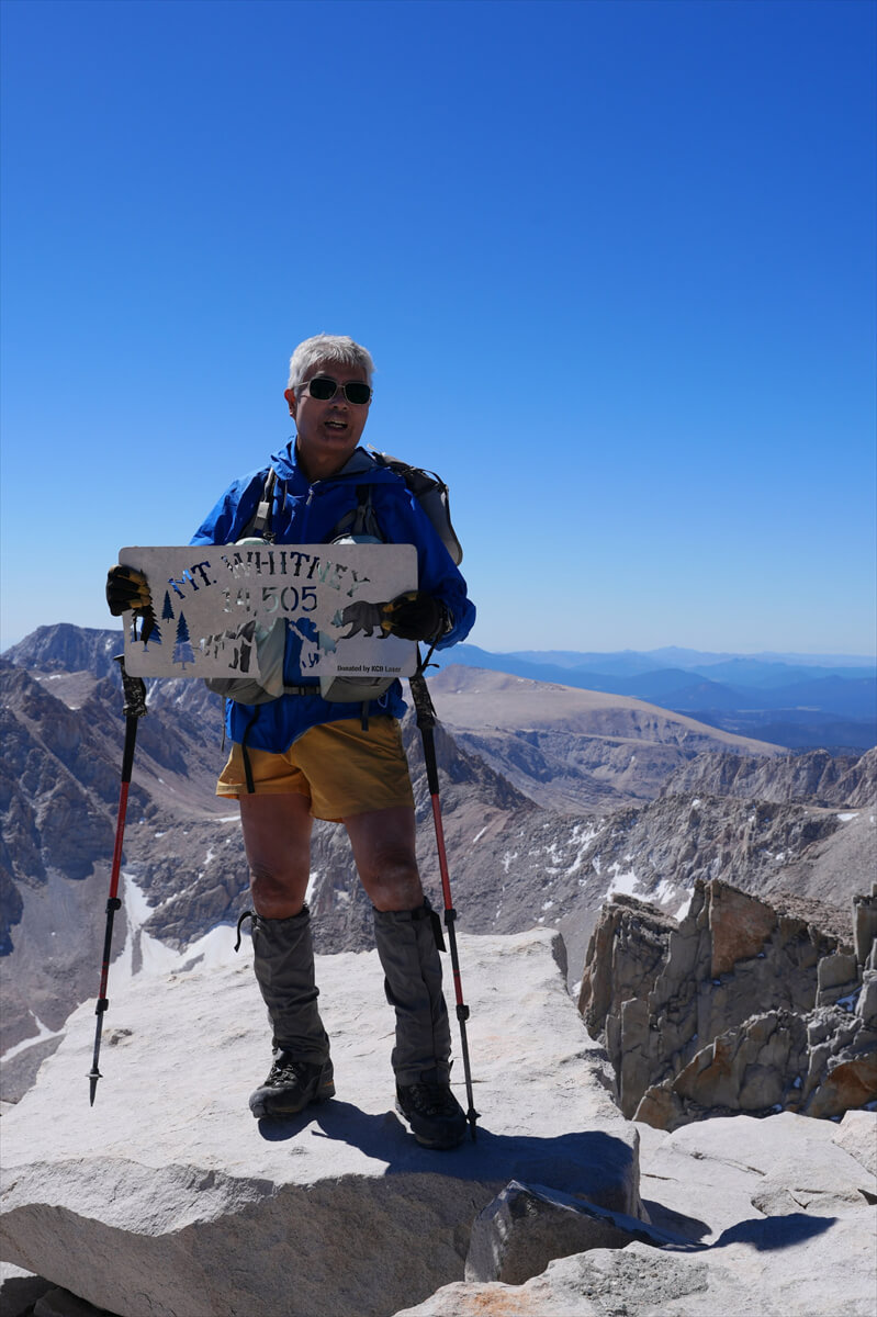
Figure 2.30: At the top of Mount Whitney. He looks fine, but his face is swollen from the altitude sickness. His brain appears to have been damaged as well
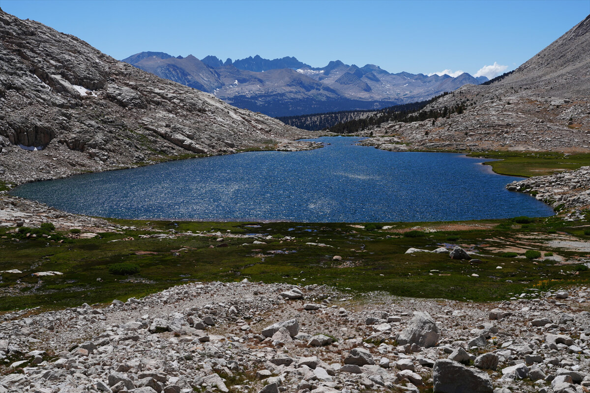
Figure 2.31: Guitar Lake in the afternoon. The lake surface was rippling. There were no people around
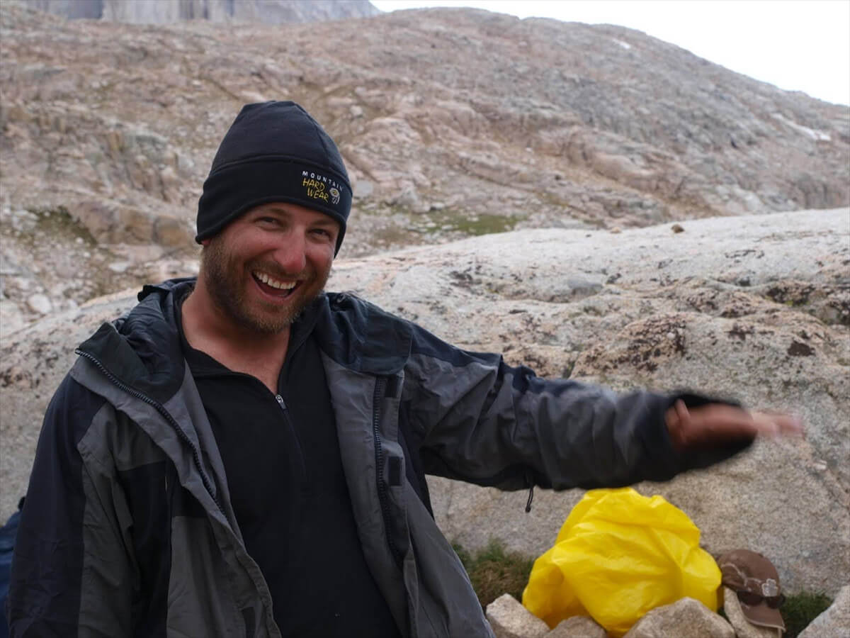
Figure 2.32: Kevin walking back and forth from VVR to Lone Pine. Photo taken in 2010
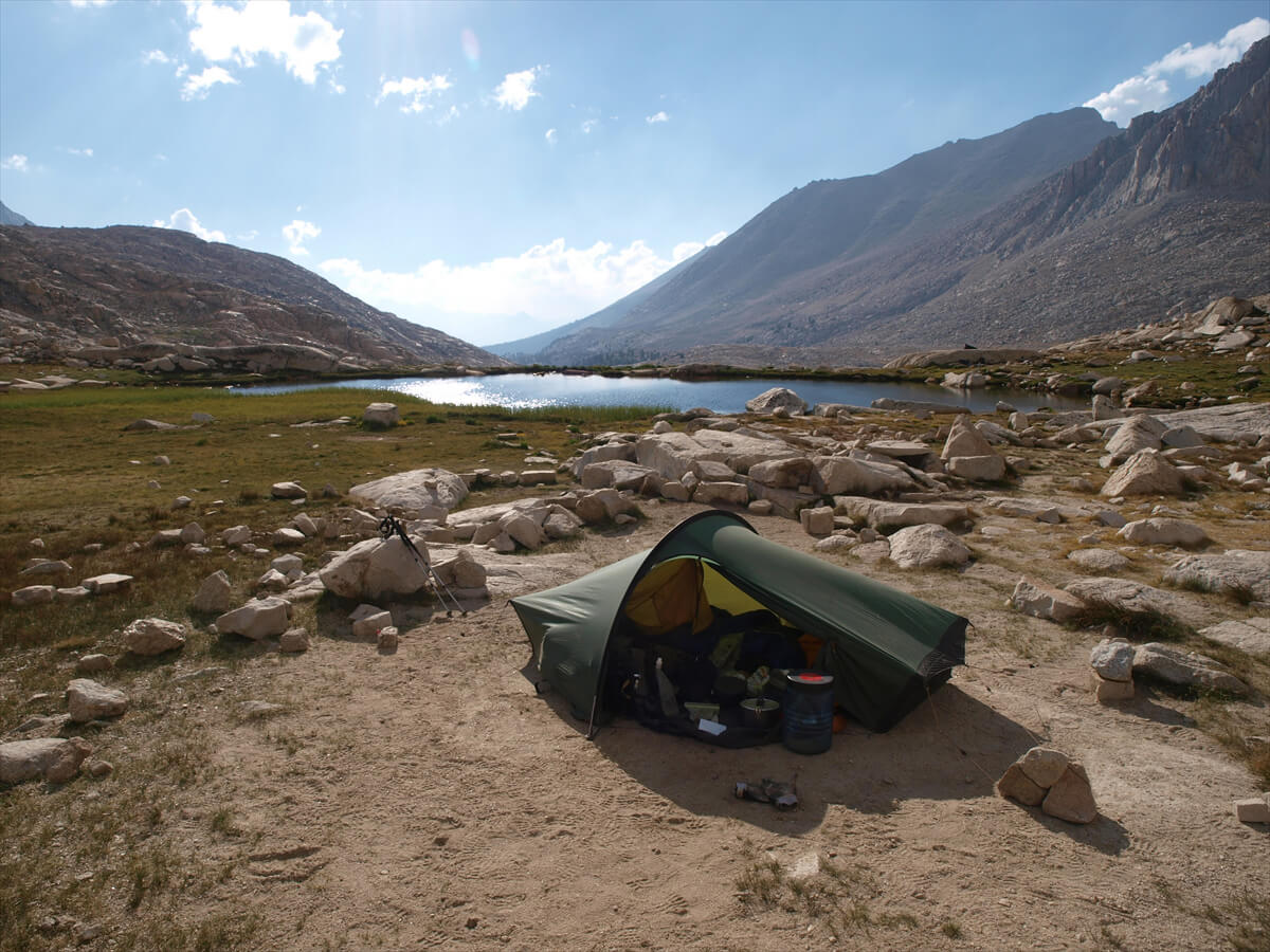
Figure 2.33: The pond above Guitar Lake. The tent is a Hilleberg Act. Photographed in 2010
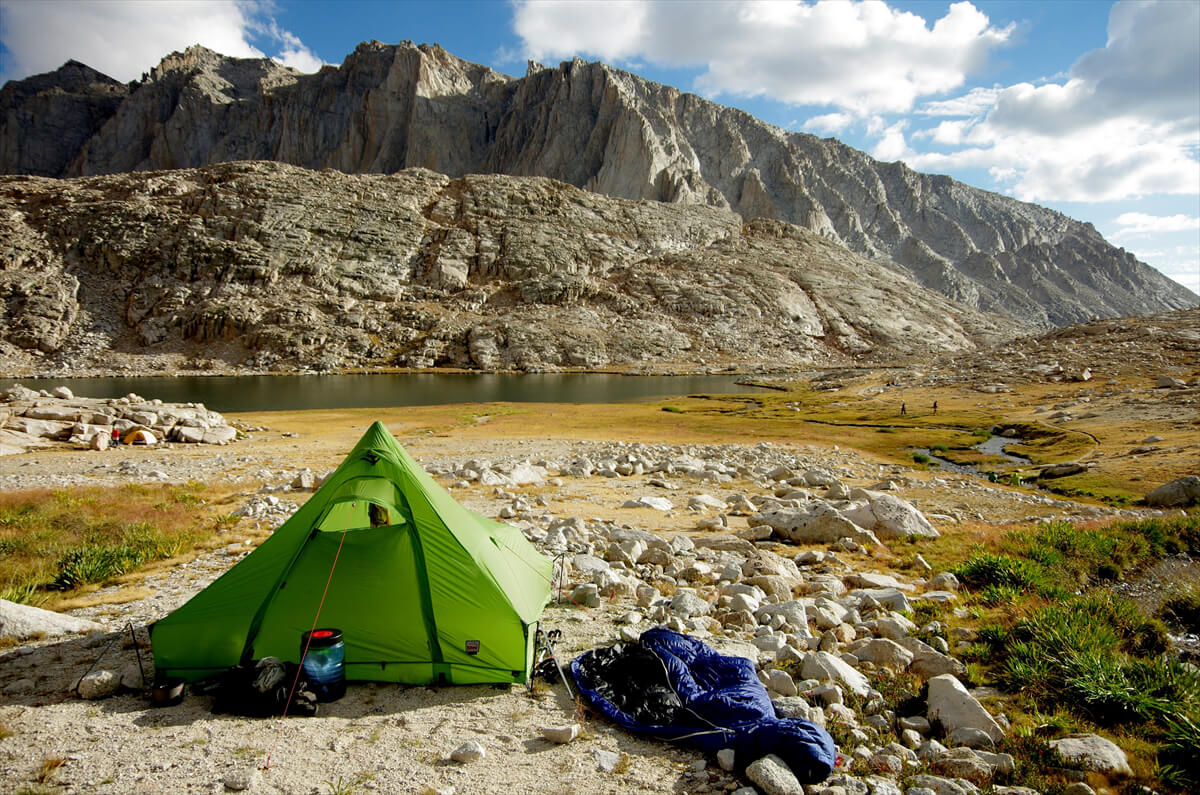
Figure 2.34: At Guitar Lake. The tent was a Robens Stratos, a one-pole tent with a floor. There was a terrifying thunderstorm in the middle of the night. With the ball stretched upwards, it was like sleeping under a lightning rod. I stopped using this tent after that. Photo taken in 2012
Figure 2.35: Crazy Dock at Guitar Lake. The tent was an ultralight shelter. The hikers were advanced ultralight hikers. Photographed in 2009
I arrived at the campsite at 5 p.m. It had taken me 14 hours round trip. I was still exhausted. I had left the bear canister a little distance away from the tent. There was no change in the tent. There was no sign of people or animals. I got some water and started preparing dinner. However, I couldn't find my headlamp. After searching for more than five minutes, I finally realized that the headlamp I had seen on the Whitney Trail was my own. I must have dropped it when I was taking out an energy bar from my right pocket
In such cases, American hikers place the found item in a conspicuous place, assuming that the person who dropped it will retrieve it on their way back. However, when I found a similar-looking headlamp, I never considered it to be mine. Perhaps my brain cells were in a state of suspended animation due to the low oxygen levels. Fortunately, I never used a headlamp again. I had a lantern with a built-in solar panel, so I decided to use it for light in the mornings and at night
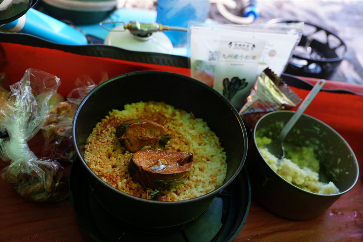
Figure 2.36: Canned mackerel set meal. Eat the heavy items as quickly as possible. This is high-quality canned mackerel, so it's quite delicious. The white dish is potato salad. Add dried fruit and almonds for dessert
I made another mistake. The tip of my left trekking pole was missing. It must have gotten caught on a rock somewhere and come off. Fortunately, it wasn't bent or broken. As I walked, the aluminum pole tip gradually wore down, but that wasn't a problem. However, the damage from the low oxygen level was significant, and the effects continued for a while after this
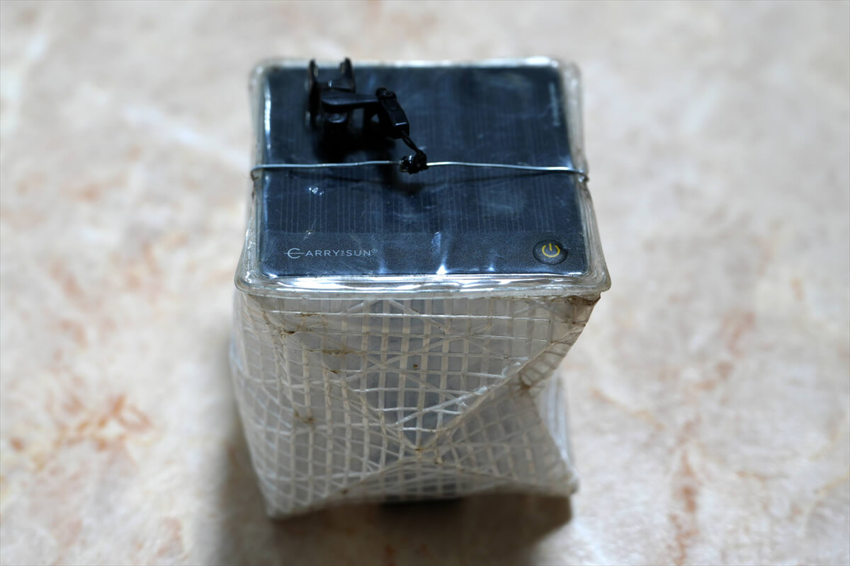
Figure 2.37: Solar lantern. The hanging strap breaks easily, so I connected it with a wire, hook, and string. I didn't expect it to last, but it lasted for nearly two weeks. Since it was sunny all day, the battery lasted forever. The downside is that it has unnecessary modes other than ON/OFF
<Continued in Chapter 3>
Nobuhiro Murakami's new hiking guide, "The Science of Hiking, 5th Edition," is now available on Amazon (Kindle edition is 100 yen)
Nobuhiro Murakami, a former professor at a national university and an experienced through-hiker who continues to share rational solo hiking know-how from a unique and profound scientific perspective in books such as "Hiking Handbook" (Shinyosha) and "The Complete Guide to Hiking in the United States" (Ei Publishing), has released his new book, "The Science of Hiking," which is now available on Amazon. This compelling and logical hiking textbook is based on his accumulated experience dating back to the dawn of long trails in Japan, as well as objective sources such as academic papers on hiking, exercise physiology, and a wide range of other fields
★★Free downloads available for 5 days starting at 5pm on February 3rd★★
Please consider a paid membership to support the site while enjoying exclusive offers and content!
Nobuhiro Murakami


Related reading