When you think of California, you think of blue skies, endless beaches, and blue oceans
Point Reyes National Seashore, located about an hour and a half from San Francisco, is a place that is truly CA-esque and beautiful
There are also many trails, making it a recommended place for those who want to experience nature and go hiking on a day trip from San Francisco. Just stepping foot in the area will fill your soul with the extraordinary beauty, and even if you don't hike, you can still enjoy just going to see nature while driving
Especially on sunny days, you will be greeted by a truly stunning blue sky and blue ocean
This time, we will introduce a trail in Point Reyes National Seashore that combines all the best things about California: forests, lakes, beaches, the ocean, and even waterfalls, all while hiking
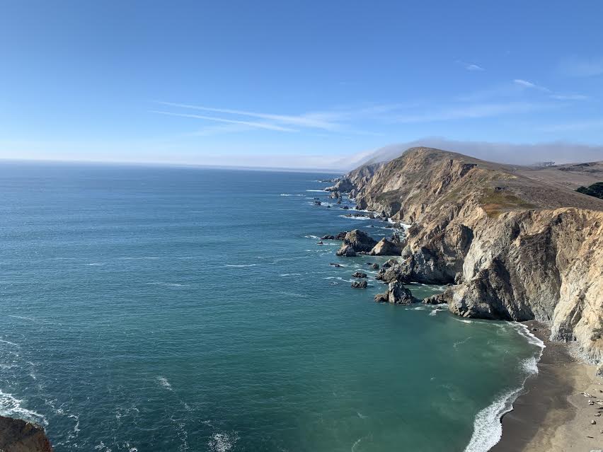

table of contents
What is Point Reyes National Seashore?
Point Reyes National Seashore is not a national park, as its name suggests. It's also not a particularly well-known tourist destination, so many people may not have heard of it. However, it's a well-known spot among locals, and a favorite spot for locals to visit often. And best of all, it's close by
It's about an hour's drive from the Golden Gate Bridge to this vast nature reserve, where you can encounter wild animals such as elk, deer, coyotes, and hares, and have the endless, secluded beach all to yourself. There are plenty of viewpoints and photo spots in various locations

Getting to Point Reyes National Seashore
The best way to get to Point Reyes is by car from San Francisco. There is no public transportation, so we recommend going by car
Cross the Golden Gate Bridge and head north on Highway 1 along the Pacific Ocean. After about 30 miles (48 km), you will see a small sign indicating the entrance to the preserve (there is no admission fee)
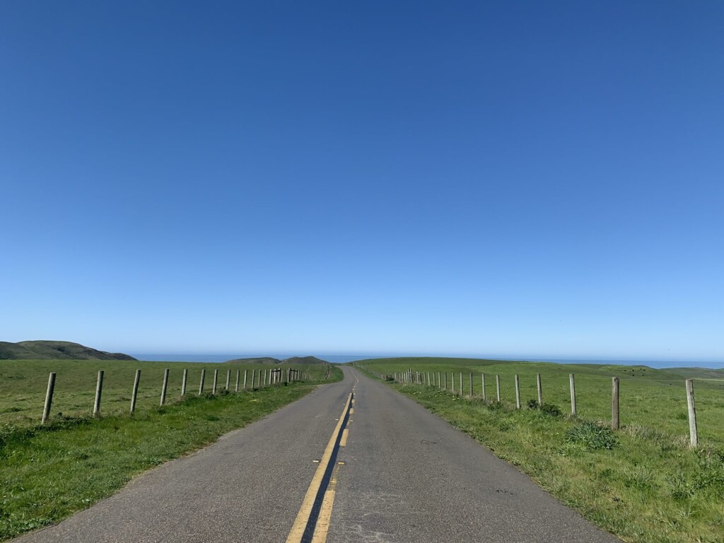
Highway 1 runs along the coastline, so the scenery is truly beautiful and the drive is very enjoyable. On a sunny, stable day, we highly recommend taking Highway 1. It's a drive with the blue sky and ocean of California in full view
If the weather isn't so good, take Route 101, which has few curves! You can go over the Golden Gate Bridge or from the Bay Bridge, but there's also another route: head north inland from San Francisco on Route 101, then head west from San Rafael to Point Reyes. You can enjoy a drive through greenery, a stark contrast to Highway 1. This is a very beautiful driving route (the destination route, including parking lots, will vary depending on your destination, so it's a good idea to enter the address into Google Maps beforehand)
Point Reyes is a vast cape that covers an area of 28,732 hectares, so you'll need to decide where you want to go first
Depending on your purpose, such as "I want to go hiking" or "I want to go for a drive and visit some viewpoints," the parking lot, the direction you go, and the driving route will change. Because it is so large, it is much easier and smoother if you decide on your destination in advance in a place with signal and enter the location you want to go to into a GPS such as Google Maps
First, stop at the Point Reyes Visitor Center, located just before the entrance, for a restroom break and to pick up a map. After that, head to the photogenic Point Reyes Shipwrecks

Recommended viewpoints for driving around Point Reyes National Seashore
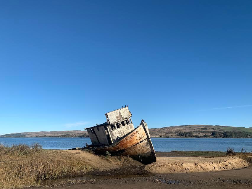
Point Reyes Shipwrecks
Address: 12783 Sir Francis Drake Blvd, Inverness, CA 94937
This abandoned shipwreck is a popular spot where you can get up close and take photos
The Point Reyes area, with its foggy weather and treacherous cliffs, has been a place feared by generations of sailors. These shipwrecks and sunken ships are more than just reminders of past tragedies; they are time capsules of maritime history. They offer a charming, retro feel
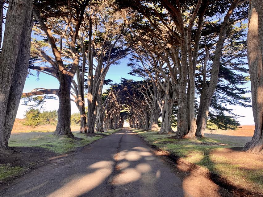
Cypress Tree Tunnel
Address: Inverness, CA 94937
This place often appears on Instagram. It's a picturesque spot, located just before the Point Reyes Lighthouse, so be sure to stop by. Depending on the time of day, light spills through the trees, creating a fantastical, artistic atmosphere
Point Reyes Lighthouse jutting out into the Pacific Ocean
If you're lucky, you can see whales from this observation deck (usually from January to mid-April)
It's a historic observation deck, and it takes a bit of a walk from the parking lot to get to the deck. If you want to go inside, you'll have to go down a long flight of stairs. So, on the way back, you'll have to go up a long flight of stairs. It's a bit of a distance to get to, but it's a very picturesque place

■Go see wild elephant seals near the observation deck (Elephant Seal Overlook)
Let's go see wild elephant seals lying on the sand. This is a sight you can only see in Northern California, where the seawater is cold. It's not often you get to see wild elephant seals in your everyday life!
To get there, start from Point Reyes Lighthouse and take the first right turn. At the end of the trail is a parking lot and a trail to Elephant Seal Overlook (note that although there is a Chimney Rock Trailhead nearby, this is not the one)
The viewpoint is about a 10-minute walk away. It's a short drive from Point Reyes Lighthouse, so be sure to stop by

Point Reyes National Seashore Hiking Information
Up to this point, we have explained the viewpoints for driving around Point Reyes National Seashore. From here on, we will provide information on hiking
This time, we'll introduce a trail to Alamere Falls, a beautiful waterfall along the beach. Along the way, you'll encounter a variety of scenery, including forests, lakes, beaches, ocean, and waterfalls! It's a very peaceful and beautiful trail
Above all, this trail is attractive because it doesn't have many ups and downs and the altitude is not high, so it puts less strain on the body
- Distance: 13.8 miles (22.08km) (there is a shortcut to Alamere Falls)
- Height difference: 1,955 feet 595.884m
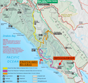
There are two trailhead options
- Palomarin Trailhead has restrooms. The address is Palomarin Trail Head, Bolinas, CA 94924
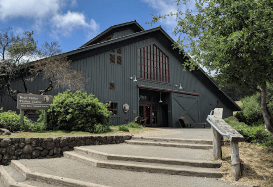
- There is a visitor center with restrooms near the Bear Valley Trailhead. The address is Bear Valley Visitor Center Access Road, Point Reyes Station, CA 94956
The two trailheads above are the closest to Alamea Falls, but this time we will introduce the route from the first of them, Palomarin Trailhead
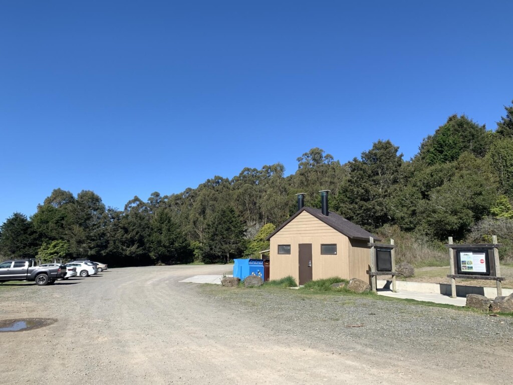
There is a parking lot and restrooms at the Palomarin Trailhead. Once you're ready, it's time to start hiking
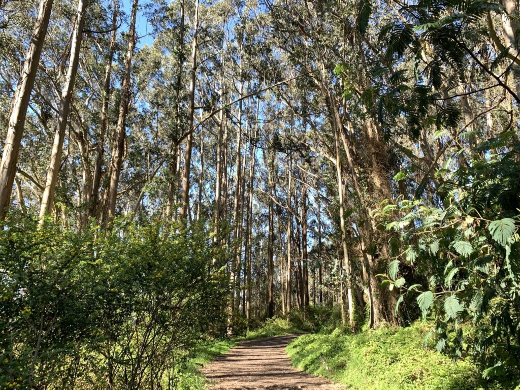
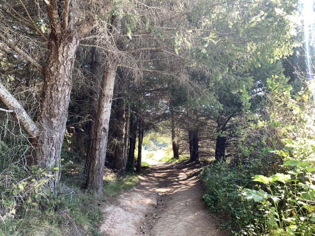
Pass the gate in the photo below and walk through the eucalyptus forest
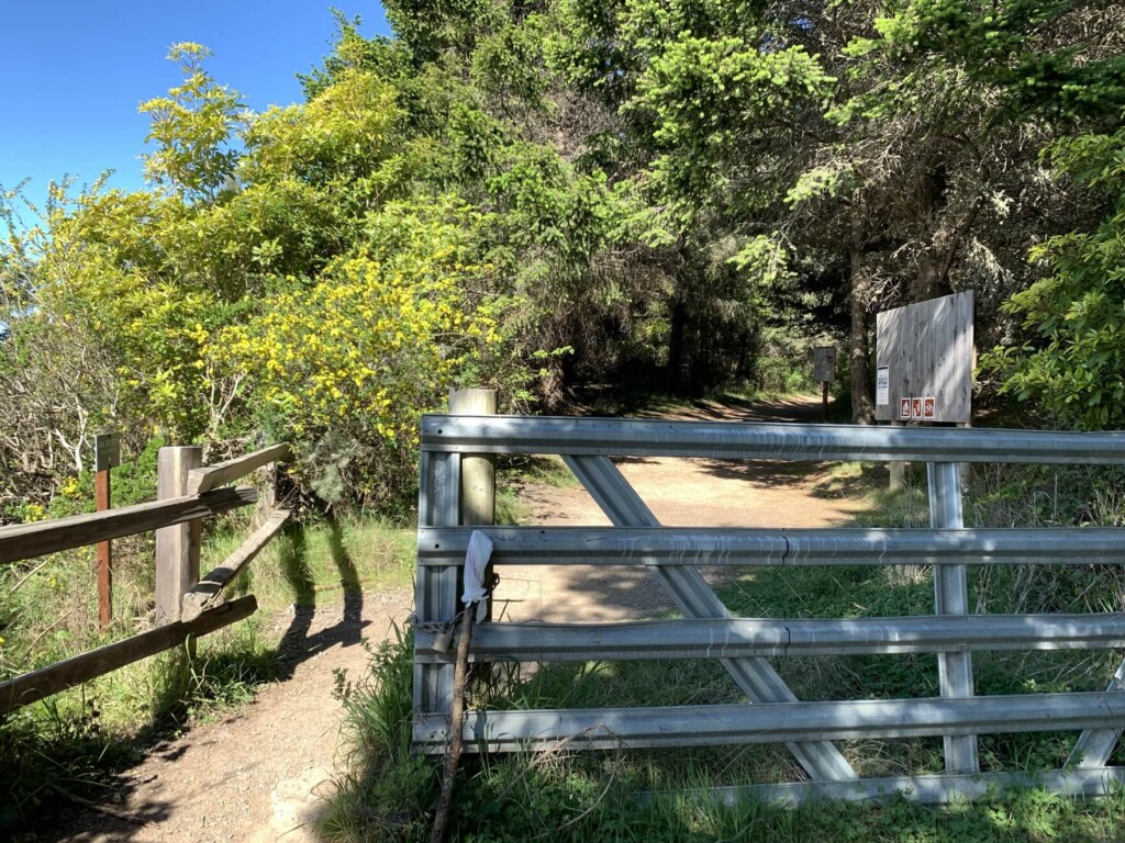
The fresh scent of eucalyptus makes walking very pleasant
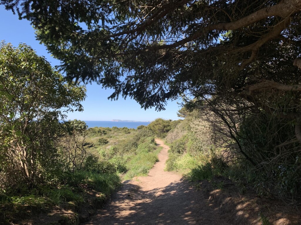
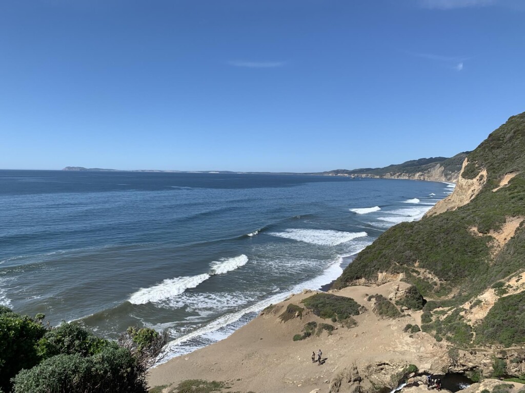
After walking a little further, you will see the first sign. We are going to Alamere Falls via the Coast Trail, so after walking towards the Coast Trail for about 5 minutes, the scenery changes and you can see the ocean
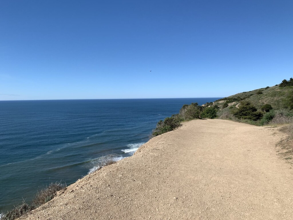
The blue sky and blue sea are very beautiful
Not only are the views never boring, as you might find yourself walking through a forest only to suddenly see the ocean, but the changes in the air you can feel on your skin and smell, and the soothing sounds of birdsong make this a truly pleasant trail to walk
The photo was taken in March, so flowers were in full bloom and you could feel the spring in many places
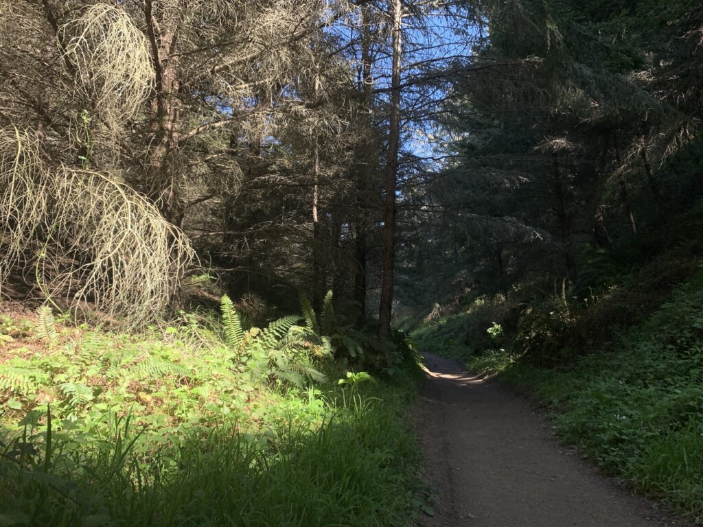
After the first 30 minutes or so of walking, you will come across a downhill section, with repeated uphill and downhill sections followed by flat sections
After passing the second bridge, about 10 minutes later, the road begins to slope. There are many beautiful tree tunnel-like areas
About an hour after we started walking, we came across a shady area and it suddenly became cooler. It was so comfortable that we decided to take a short break
There is another downhill section, and then you will see the second sign (pictured below). Here too, head in the direction of the COAST TRAIL
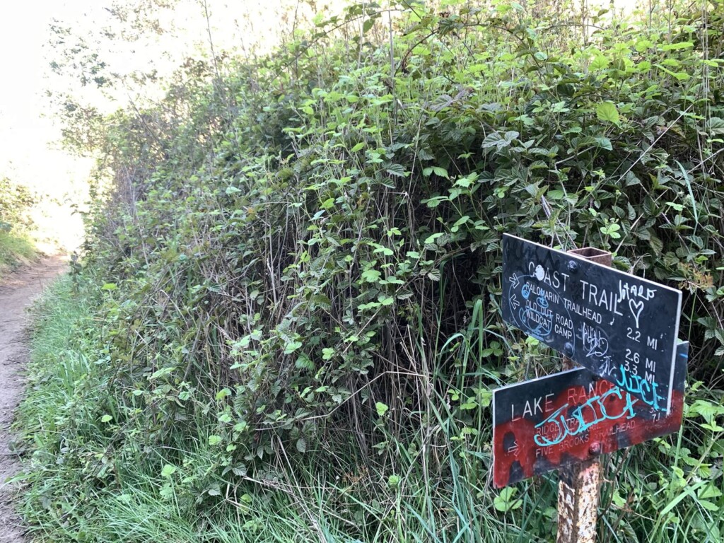
After walking for about 10 minutes from the second sign, you will see Bass Lake on your left. After passing the quiet lake, you will begin walking through the forest again
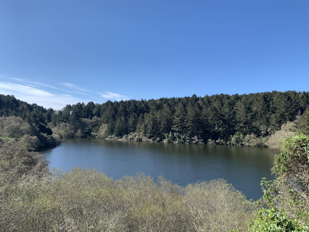
Then you'll see another lake, Oerlikon Lake, on your left. At the same time, you'll also see the ocean ahead. There's so much to see on this trail, it's truly packed. You'll come across three lakes along the trail
At this point, we are more than halfway through the trail
- Take a shortcut to Alamere Falls
- Take the detour along the beach to Alamere Falls via the Coast Trail
You can choose from these two options

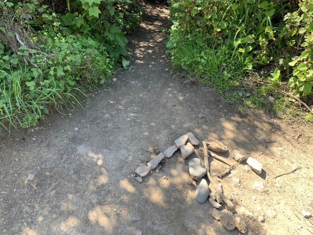
Route 1 is a shortcut that saves time and is an easy way, but the final unpaved trail to Alamere Falls is very steep, and you will have to descend a cliff-like area with unstable footing. Most people choose this route, but even those with good walking skills should be careful, as it is a dangerous area, so if you are willing to take that into consideration, then this is the route to go
There is a stone arrow at the entrance to the shortcut, so just use it as a landmark and you'll be fine (note that there is a similar narrow trail just before the shortcut, but that is the Pelican Trail, and not the one you're looking for)
Route 2 takes a detour to Alamea Falls via the beach, then takes a shortcut back. This is the route I personally recommend
One idea would be to take the original Route 2 on the way there via the Coast Trail and then take a shortcut on the way back. Because even though it is the same cliff, climbing up is more stable and safer than descending, I think this will introduce the route to Alamela Falls via the Coast Trail on the way there
We pass the shortcut trail on our left and continue on the main Coast Trail
About an hour and a half after we started walking, the third bridge came into view
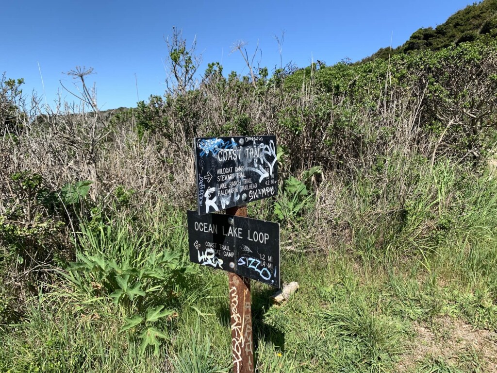
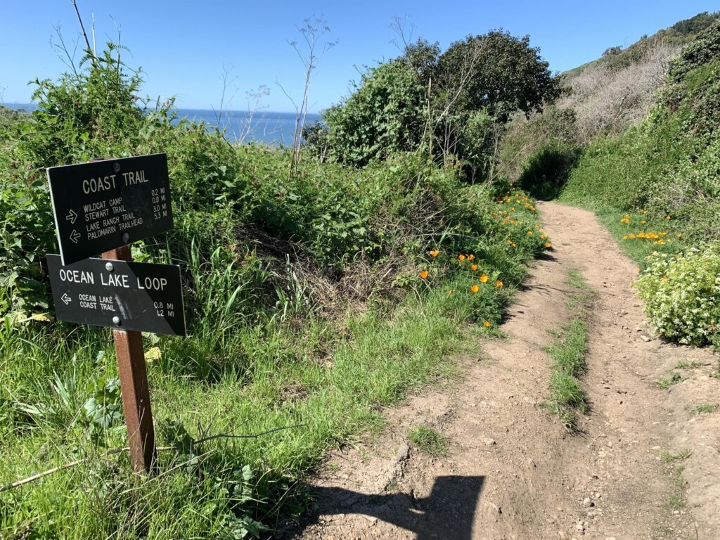
After that, you will see the third sign. Here, the trail splits again, with one trail going left to the Ocean Lake Loop and the other continuing on the same Coast Trail you came from
It doesn't matter which route you take, as even if you walk the Ocean Lake Loop starting on the left, it will eventually connect to the Coast Trail, but we decided to continue on the Coast Trail as planned
March is the rainy season in California, so the greenery along the trail was full of moisture and truly vibrant. We walked along the trail surrounded by this fresh greenery
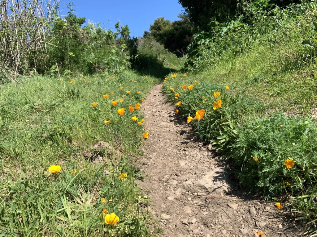
Flowers are everywhere. Flower lovers will love it. These orange flowers are California poppies, the state flower. The fourth sign leads you straight towards the Coast Trail
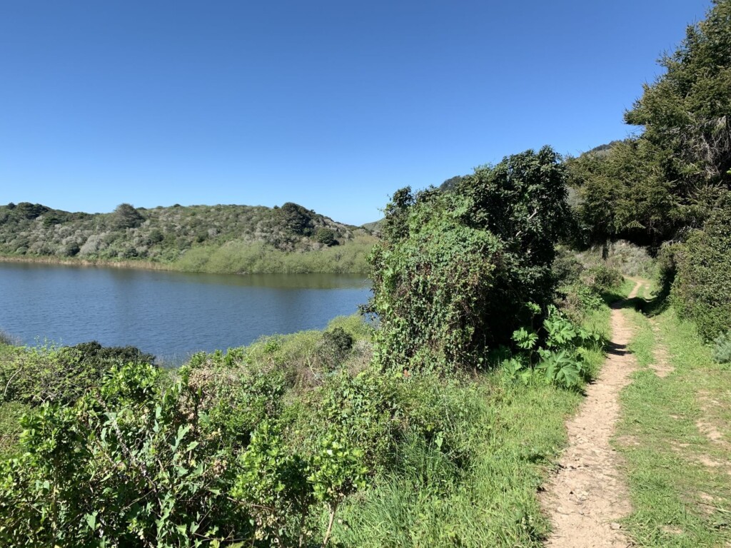
About five minutes from the sign, you will see the third lake, Wildcat Lake, on your left
Further ahead is the point where the Ocean Lake Loop, which we had previously walked, and the Coast Trail we had been walking on meet, and there is another sign there (the fifth sign)
Ahead of us we can see the beautiful blue ocean again, and as we get closer to the beach we can see the last bridge
After crossing the bridge, you will come to an intersection where the road to Wildcat Campground and the road to the beach intersect, so head towards the beach (turn left at the end of the bridge)
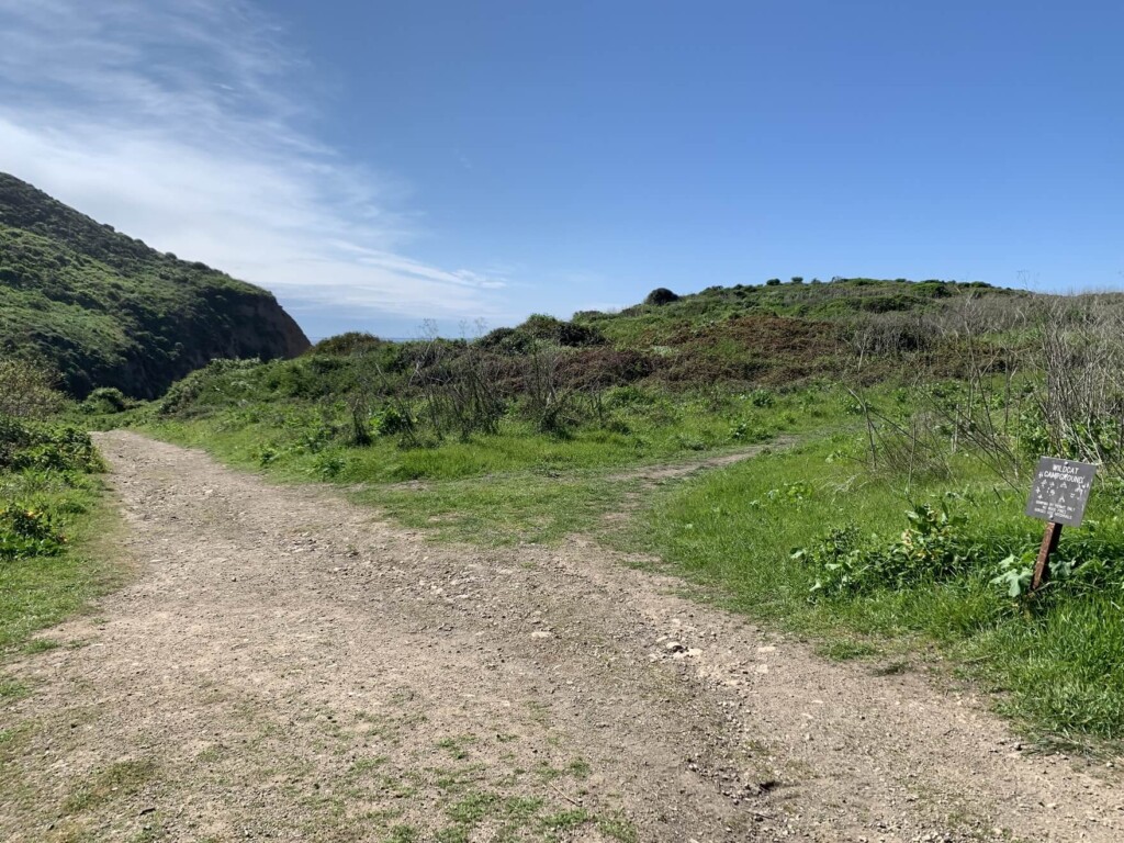
As I smell the ocean, I take another deep breath, taking in the scenery, wind, scents, and sounds that are completely different from before
It's amazing how the energy of the mountains changes in an instant to the beach. After this, we continue walking in the direction we were heading, with the mountains on our left
A deserted beach. The sound of the waves and the beach are all yours!
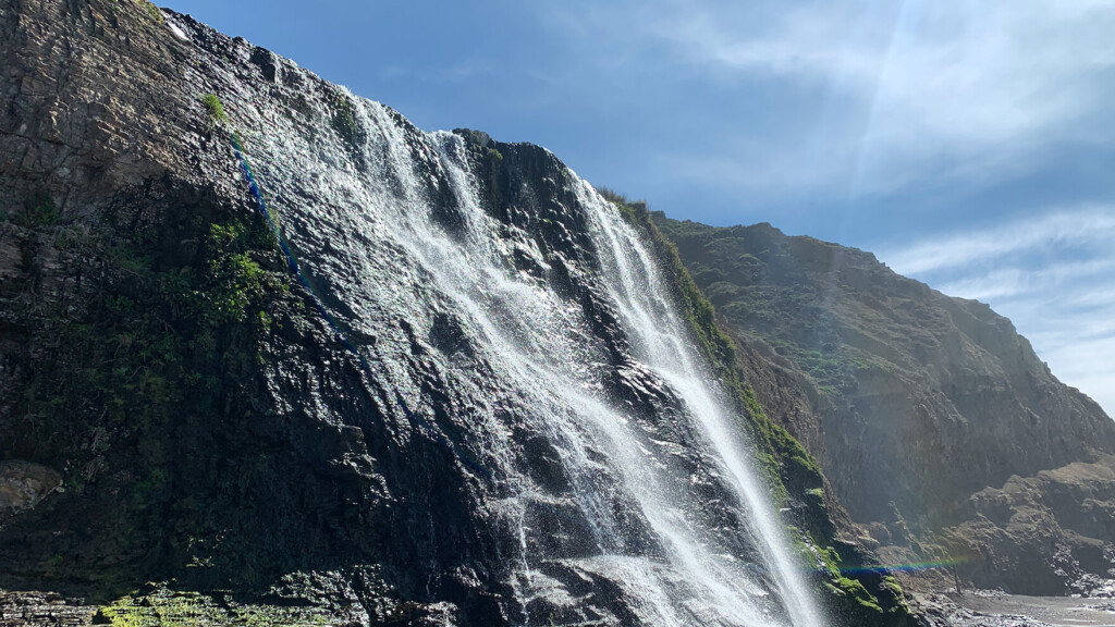
As I walked along the beach listening to the sound of the waves, I saw a waterfall in the distance
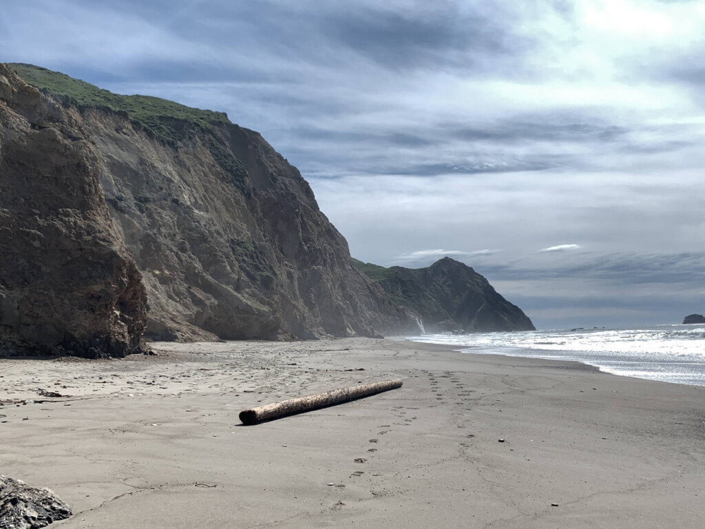
We continued walking and finally arrived at Alamela Falls, about two and a half hours after we started
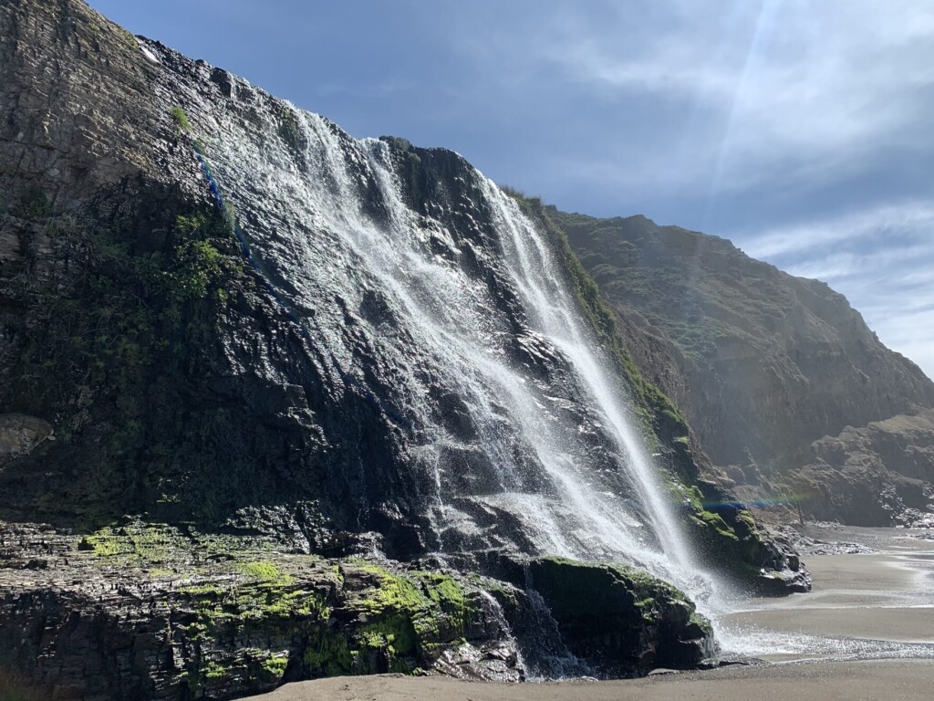
Lots of negative ions!
It is the place where the water blessed by the mountains meets the vast ocean
If you want to take a break for lunch or something, you can go to the beach near the waterfall, but there is a nice resting space just up the shortcut trail on the way back, so I recommend taking a break there
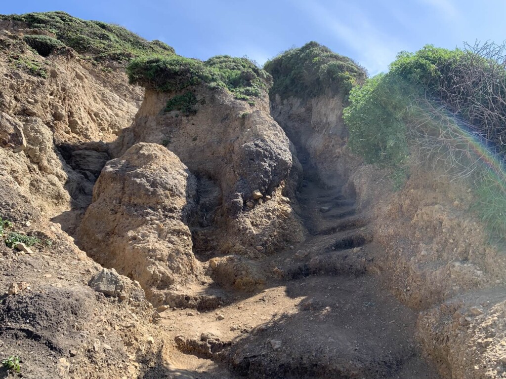
After refreshing yourself with the negative ions of the waterfall, you can take a shortcut back. Just before the waterfall (from the path you came from), there is a cliff-like depression between the rocks, and you will walk through it
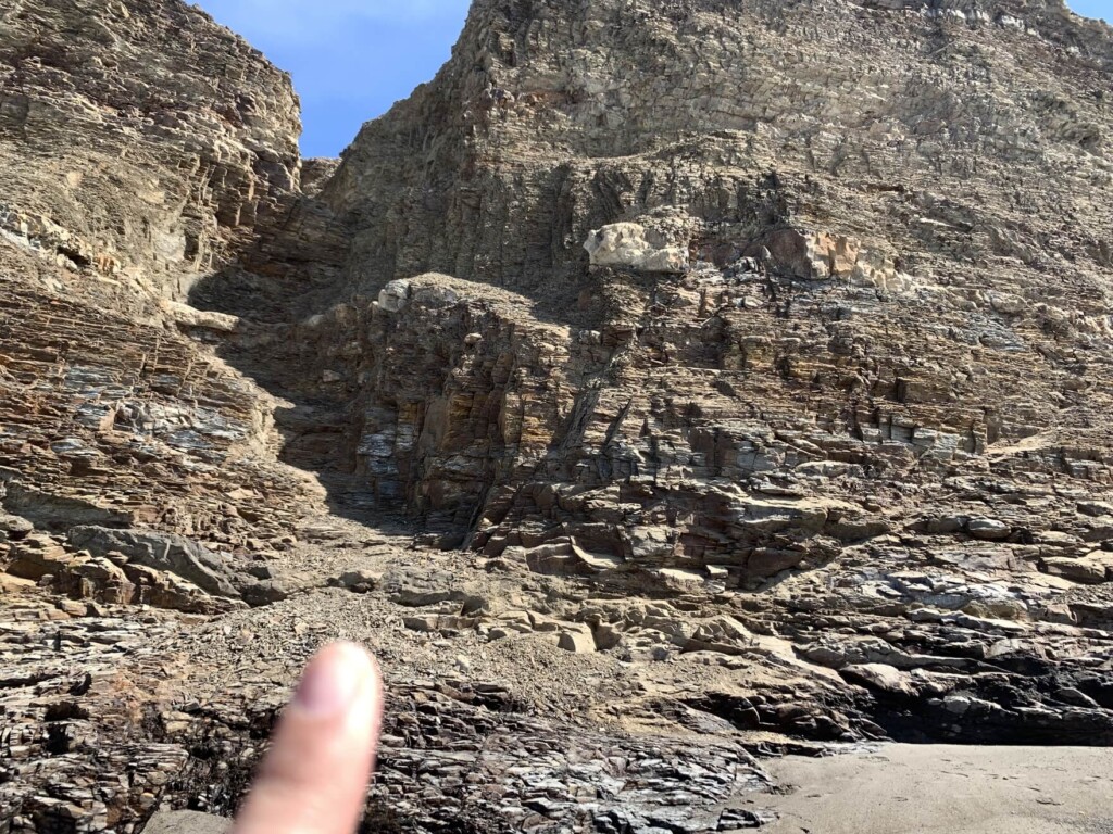
The trail is very steep and the footing is unstable, so if you are not confident, it is best to return via the same Coast Trail you came up
What a surprise! After climbing the cliff, you'll be greeted by another waterfall. This waterfall is divided into three stages, and it's also amazing. It's small, but the view is beautiful
It's a good idea to take a break here or in the space a little further up the trail for lunch
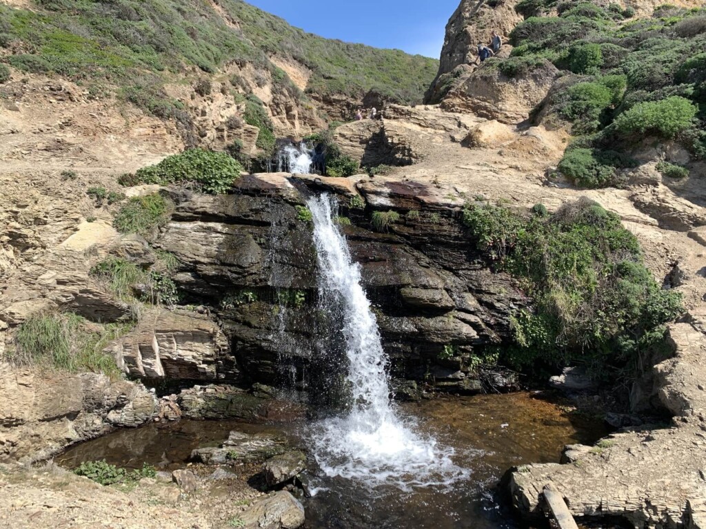
There was a view here that I wouldn't have been able to see if I hadn't taken a shortcut lol
The trail continues to the right of the waterfall, so we continue past the waterfall
After walking along the trail surrounded by trees like a tree tunnel, you will arrive at the point where it joins the Coast Trail, the way you came. It's a great shortcut, and taking this trail will save you a lot of time and energy
After that, just go back the way you came. If all goes well, you can get back to the trailhead in about an hour and a half
It was a beautiful day, with blue skies, blue ocean, vibrant greenery and flowers, and a sparkling waterfall. It's a foggy area, so be sure to check the weather forecast before you go. The colors of the area are even more beautiful on a clear day
Precautions regarding the spread of COVID-19
As of August 2020, various countries are currently imposing entry restrictions due to strengthened quarantine measures, as well as restrictions on entry to national parks and domestic travel. These conditions are subject to change without notice, so when traveling, be sure to obtain local information from each country's embassy or consulate, the Ministry of Foreign Affairs' Overseas Safety Website (Infectious Disease Risk Information), national park websites, and other sources, and check information on transit points, countries you plan to travel to, and the areas around the places you plan to visit before making reasonable plans and taking action
Sayaka Kato

Related reading