Can you die without walking? A Journey to the American National Parks (8) Canyonlands National Park, the Island in the Sky
Written by Sayaka Kato
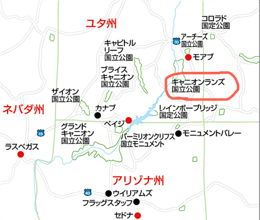
If you drive north from Monument Valley for about 2 hours and 30 minutes, you will reach Canyonlands National Park, The Needles
More than just magnificent, the scenery here is so extraordinary that it almost makes you feel as if you've come to another planet or star. Endless straight roads, various topography, rock formations with interesting formations, and an incredibly large space

Canyonlands is the largest of Utah's five national parks, covering an area of 337,598 acres (approximately 1,366 km2). You can't really appreciate its size until you step inside and see it for yourself. This national park is so vast and majestic that it is divided into three parts by the Colorado River and Green River, which flow through the park. You can enter all three areas with the same admission ticket
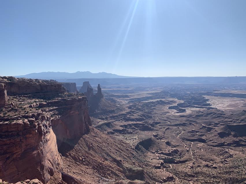
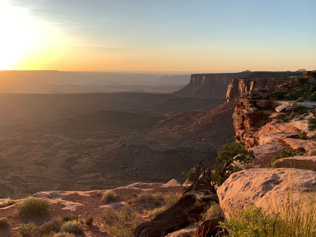
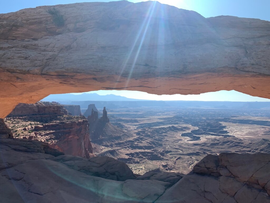
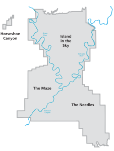 Island in the Sky is an area with many viewpoints that can be easily reached by car. As the name suggests, there is an island floating in the sky
- The Needles: A quiet area with lots of hiking trails
- The Maze: Accessible only by 4WD or mountain bike

These three parts are not connected within the park, so the only way to see them is to exit the park from each entrance, drive to the entrance of each part, and then re-enter. Because it is so large, it is not easy to see everything in one day; it takes time
Island in the Sky is a long stretch of paved road with several viewpoints and parking lots along the way, allowing you to enjoy the view without having to walk much. This is the most popular area with tourists, and it's easy to see why it's called "Island in the Sky."
(There are also various hiking trails in this area.)
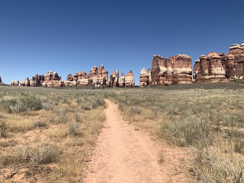
The Needles has many trails, making it a recommended area for those who want to do a serious hike! Best of all, once you step onto the trail, there are almost no other people around, so you can enjoy the space between you and nature
The Maze is difficult to access, and is rarely visited by ordinary tourists, but it's perfect for those who love adventures and off-roading, such as mountain biking. Even today, the maze-like terrain is considered uncharted territory. Access is limited to foot, mountain bike, and four-wheel drive vehicle. (Mountain bikes can be rented from sports shops in the nearby town of Moab.)
table of contents
How to get to Canyonlands National Park, the island in the sky
Travel time
- It's about a 4-hour drive from Salt Lake City International Airport to Canyonlands Island in the Sky (an additional 2.5 hours to The Needles)
- Approximately 7 hours by car from LAS McCarran International Airport (Las Vegas) to Canyonlands Island in the Sky
- It's about a 2.5 hour drive from Monument Valley to The Needles (an area with many hiking trails)
- It's about a 3.5 hour drive from Monument Valley to Island in the Sky
- It's about a 40-minute drive from Moab to the Island in the Sky entrance to Canyonlands National Park (it takes 2.5 hours to get to The Needles)
Example of a tour plan
The nearest international airport is Salt Lake City International Airport (SLC)
- Starting from (SLC): Visit Arches National Park, Canyonlands National Park, Dead Horse Point State Park, Monument Valley, etc. before returning to (SLC)
- Starting from (LAS): Visit Grand Canyon National Park, Antelope Canyon (Horseshoe Bend), Monument Valley, Canyonlands National Park, etc. before returning to (LAS)
There are many ways to combine it with nearby national and state parks
Accommodation
The small town of Moab is nearby, providing access to Arches National Park, Canyonlands National Park, Dead Horse Point State Park, and other national parks. It's best to stay two or three nights in Moab and explore the surrounding national parks. Outdoor enthusiasts can book mountain bike tours, four-wheel drive tours, river rafting, and other tours in the Colorado River area here. Moab is a convenient base for finding everything you need, with many Airbnbs, motels, resort hotels, restaurants, supermarkets, and gift shops. During peak seasons like summer vacation, Moab can get crowded. If you can't stay in Moab, Grand Junction, Colorado, is about an hour and a half away, and Monticello and Blanding are both nearby. While Moab is convenient, it's also convenient for exploring the surrounding areas
Admission fee (as of March 2020*)
There is no need to go through any formalities beforehand to enter the park, just pay the admission fee at the entrance
- Regular car (private car) $30.00 (valid for 7 days)
- Bike $25.00
- $15.00 per person for non-vehicle bicyclists and hikers
Opening hours
The entrance is open 24 hours a day, all year round
Visitor Center (may have special opening hours on public holidays)
Each area has a visitor center, but opening hours vary
Island in the Sky
- November to March: 8am to 4pm
- April to October: 8am to 5pm
The Needles (Hiking Area)
- Winter: Closed
- March to April: 8am to 3:30pm
- May to October: 8am to 5pm
- November: 8am to 4pm
The Maze (Hans Flat Ranger Station)
- Open all year round: 8am to 4:30pm
weather
Canyonlands is a desert region, and temperatures can fluctuate dramatically, sometimes exceeding 40°C in a single day, depending on the season.
The most popular warm seasons are spring (April to May) and autumn (September to October), with daytime highs averaging 15 to 25°C and lows averaging 0 to 10°C.
Summer temperatures often exceed 35°C, making it very hot and hydration is essential.
Winters are cold, with highs averaging 0 to 10°C and lows averaging 0 to -5°C.
Because the area is dry in all seasons, hydration is essential. Summer, in particular, can be challenging for hiking due to the desert heat. The recommended hiking seasons are April to June and September to October.
Where are the information centers at the parks? Can I replenish my food and equipment?
There are three visitor centers in each area, where you can get maps and other information, but it's difficult to purchase food and drinks anywhere other than Island in the Sky, so be sure to prepare in advance. It's a long drive, so be sure to fill up your gas tank before you go
Island in the Sky
As for food, there is a shop right next to the Island in the Sky visitor center where you can get food and other items
The Needles
The Needles Visitor Center does not sell food, so you will need to prepare it in advance. There is a campground called Needles Outpost where you can purchase food, but it is outside the park, and it is quite far away and may not be open depending on the season, so be sure to prepare water and food in advance when hiking
The Maze
There are no shops nearby The Maze, so you will need to make arrangements in advance
Useful items to bring with you on a hike
- Drink (more in summer) I think you need about 4 liters of water when hiking in summer. It's really dry
- Temperature-adjustable winter clothing
- trekking shoes
- hat
- sunglasses
- sunscreen
- Snacks to eat during the hike
- If you have any regular medications, bring first aid such as medicines and bandages
- rain gear
Canyonlands National Park (The Needles) Hiking Information
Chesler Park ViewPoint 6 miles (10km) 3-4 hours
Optional: Chesler Park Loop Trail 11.6 miles (18.56km) Elevation Gain: 1,935 feet (approximately 590m elevation difference) 5-7 hours. *At least 4 liters of drinking water is required
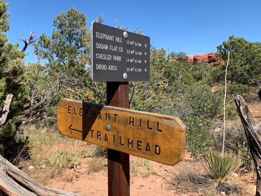
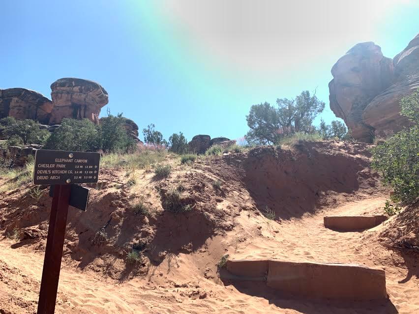
Trailhead: Elephant Hill
There are many trails in The Needles, but this time we will introduce a 10km round trip hiking route from the Elephant Hill trailhead to Chesler Park Viewpoint
My original plan was to hike the Chesler Park Loop Trail, a long loop hiking route, but since I hiked it in August in the middle of summer, I realized that the 2 liters of water I brought with me wouldn't be enough, so this time I stopped at the Chesler Park Viewpoint along the way and returned the same way I came
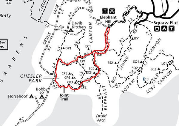
This red line is the Chesler Park Loop Trail, 11.6 miles (18.56km). I only went halfway to Chesler Park, 6 miles (10km), and then returned the way I came
Note: We recommend bringing at least 4 liters of water (more in summer)
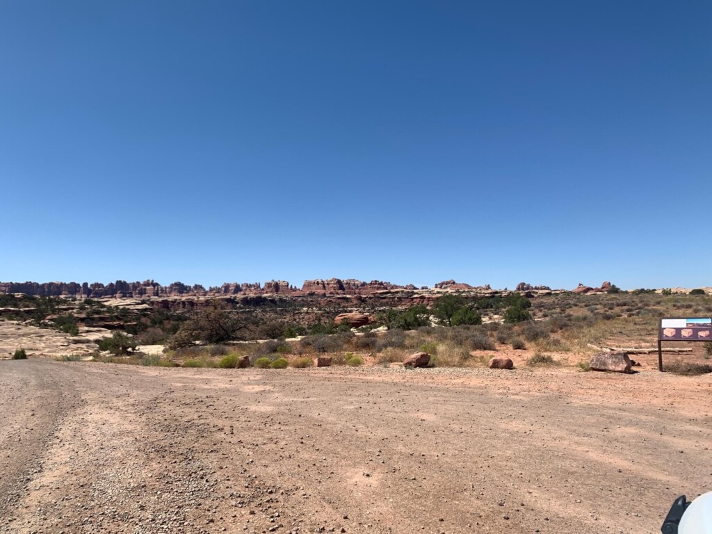
By car, take Highway 191 from Moab or Monument Valley and turn onto US-211, which is the road to The Needles
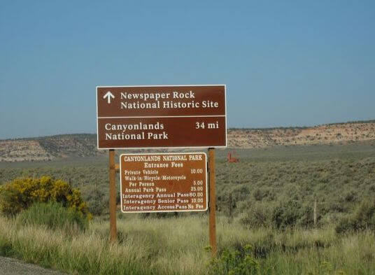
There is a sign at the entrance, but it is another 34 miles (about 55 km) from here to enter Canyonlands NP. America is vast. The driveway is filled with spectacular views and is a very pleasant experience

When you arrive at the Needles District, head to the Visitor Center (about 50 minutes after turning onto US-211) where you can get maps and other information. There are also restrooms available

To the trailhead
To the Elephant Hill trailhead, drive about 30 minutes from the visitor center. You will be driving on a dirt road for the last mile or so to the Elephant Hill trailhead
The road is smoother than I expected, but there are many curves and the road is just wide enough for two cars to pass each other, so be careful of oncoming vehicles. Passenger cars and four-wheel drive vehicles are fine, but large vans with more than 12 passengers are prohibited from passing
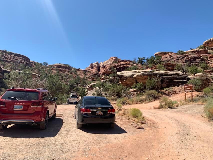
There is a parking lot at the Elephant Hill trailhead, so we parked our car there and set off on our hike. (The Elephant Hill trailhead has a parking lot for hikers, and a trail for off-roaders continues from there. Hikers should park their cars here.)
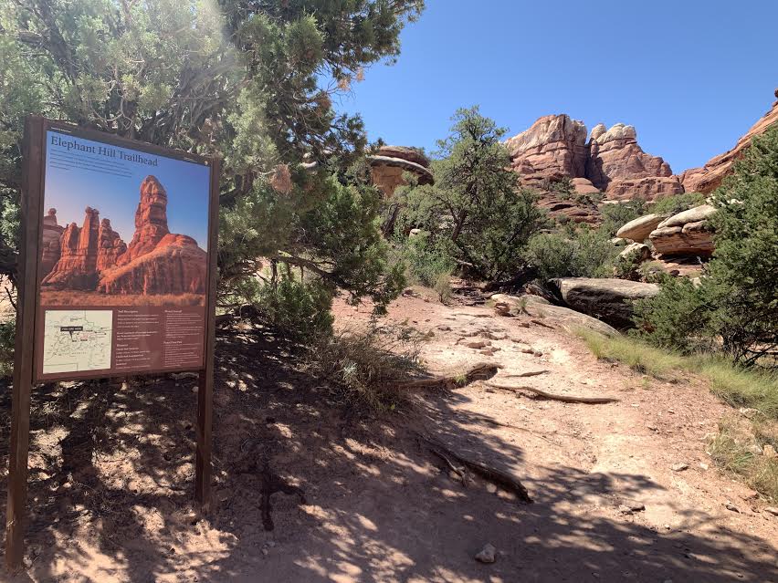
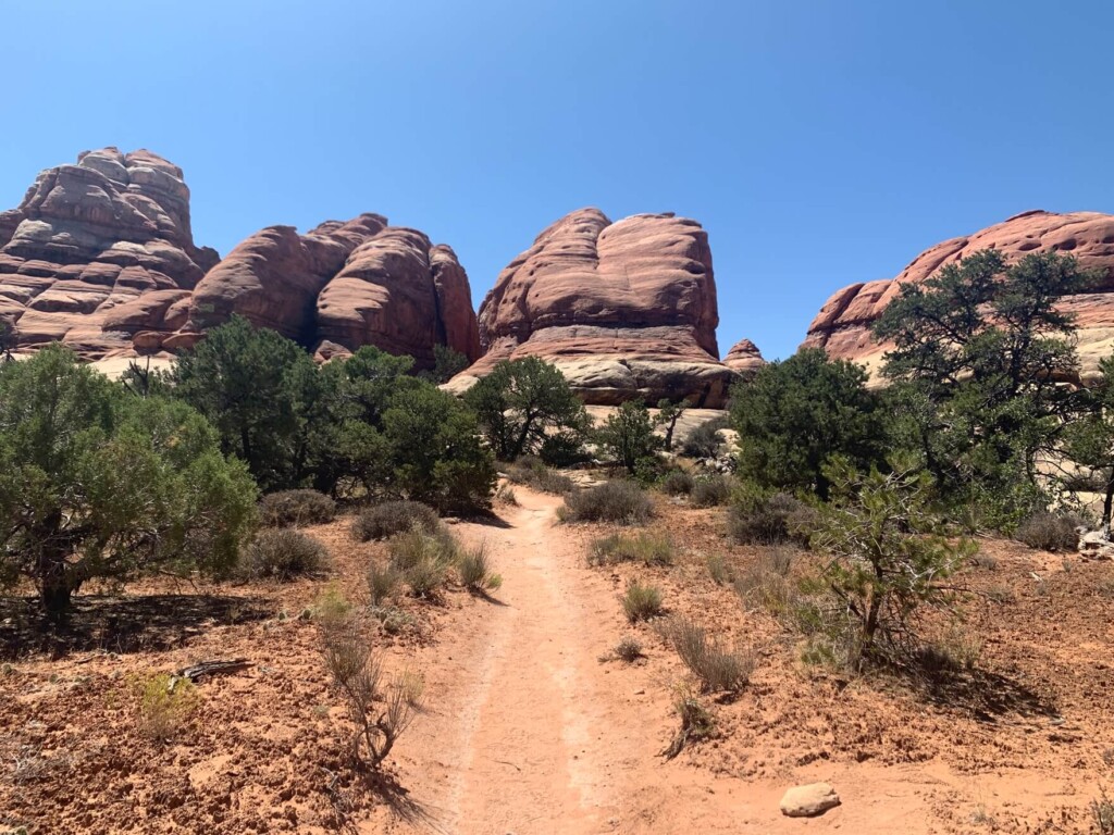
Set off on a trek
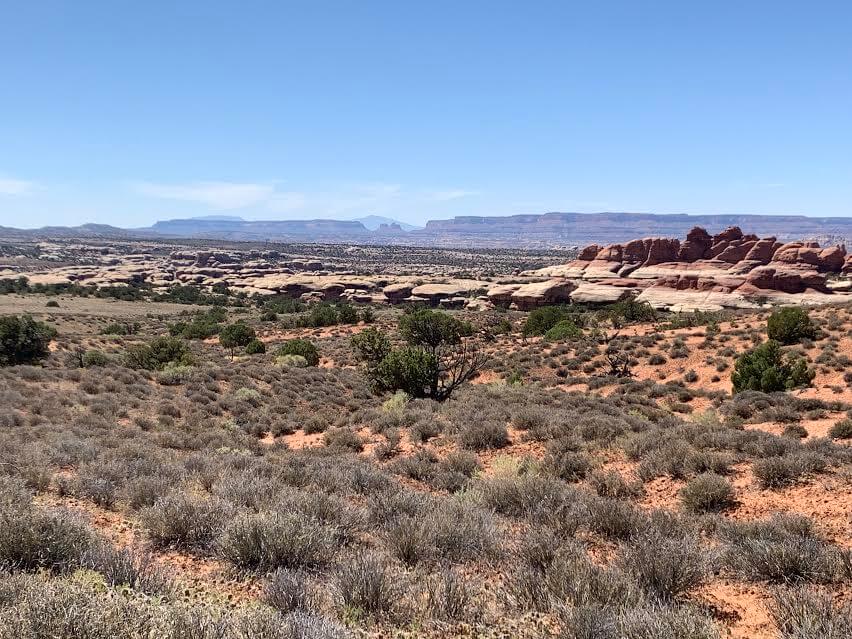
The first 10 minutes or so are a continuous climb, after which you walk on a fairly flat plateau
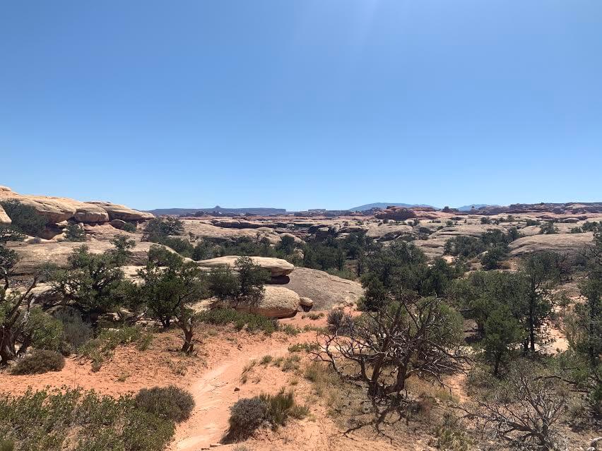
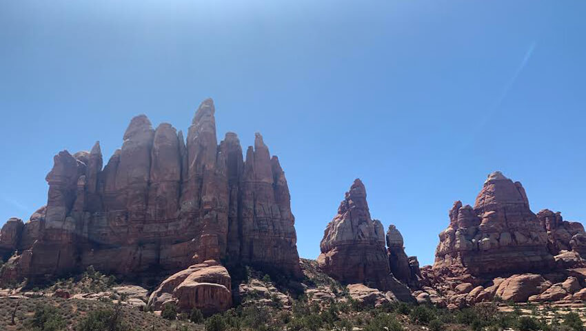
The area is surrounded by uniquely shaped rock formations, creating a truly unique world. The rocks resemble the legs of an elephant, are cylindrical, and have sharp points resembling mountains - a sight you don't often see in Japan.
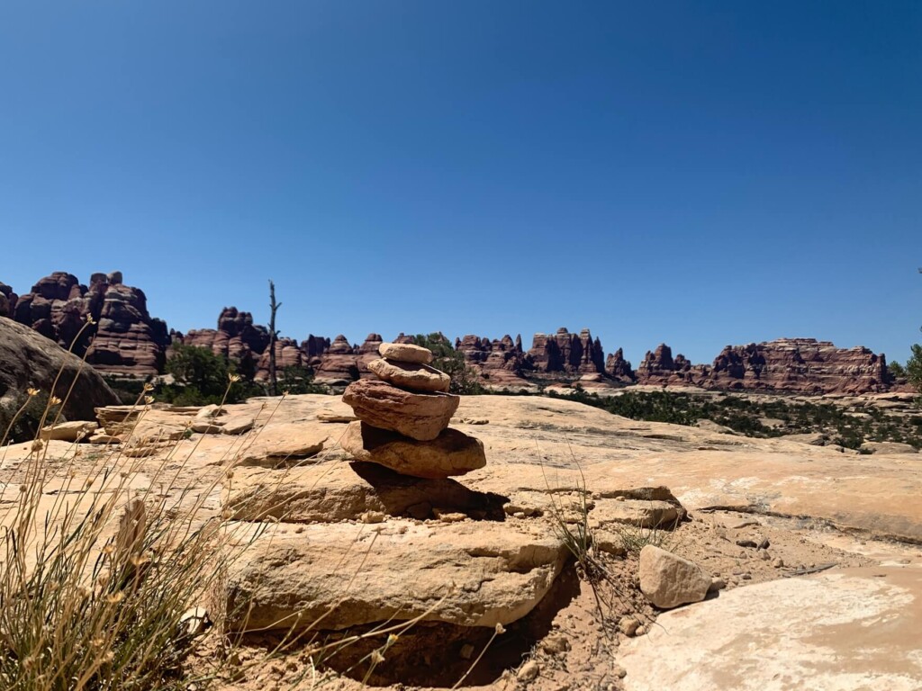
Thankfully, there are cairns everywhere to guide you.
While walking, look for cairns and take frequent breaks in the shade. It's drier than you'd imagine, so when I walked, no matter how much water I drank, it never seemed to be enough, and I was getting nervous halfway through as the water kept disappearing
The altitude is high, so be careful not to go too fast from the beginning. About 45 minutes into the walk, we came to the first fork in the road
1.4 miles (2.3 km) one way to Chesler Park
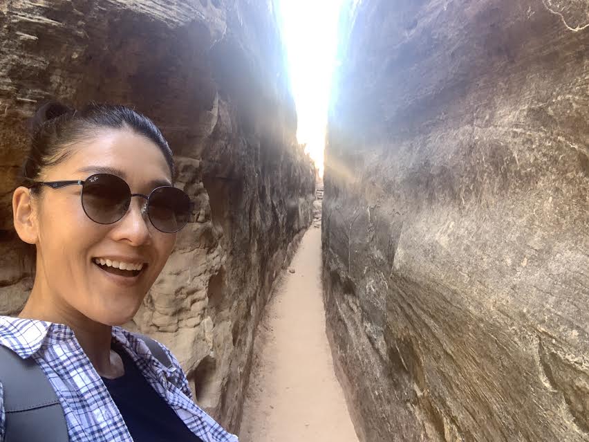
There are cairns in places where it's easy to get lost, and signs at forks in the trail, so it's easy to find. There are also places like this one, surrounded by rocks (shady and cool)
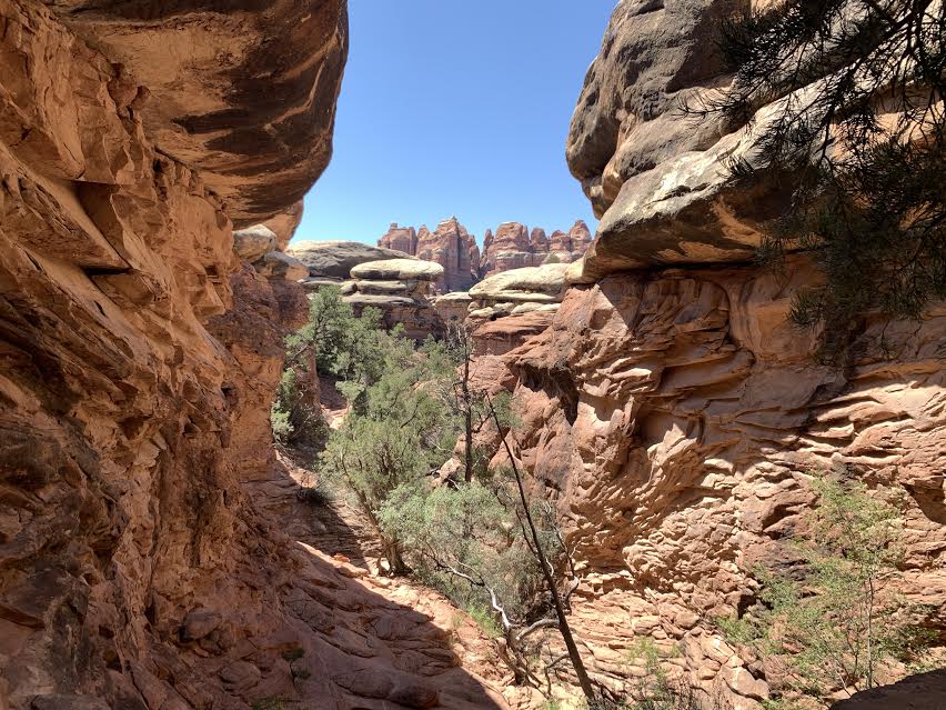
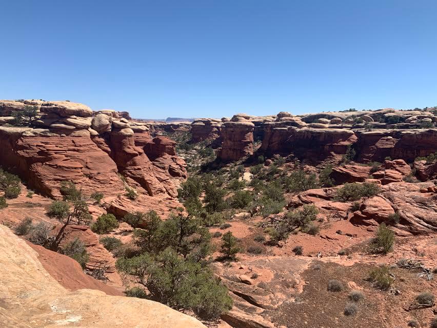
If you go further and walk surrounded by unique rock formations, you will come out onto a flat area again
The scenery changes constantly, so it's a trail you can enjoy while walking. From here, it's 0.8 miles (1.32 km) one way to Chesler Park
The sun was strong and it was so dry that I really needed water. I walked in August, in the middle of summer. I knew it would be hot, but it was really too hot. I kept walking, checking my stamina and my rapidly running out of drinking water. I felt like I was in good shape, but I had to stop hiking before I ran out of water. This hike really taught me that running out of water is not good for your mental health. Haha. It was a good lesson. I once again realized that I need to carry something with me, even if it's heavy

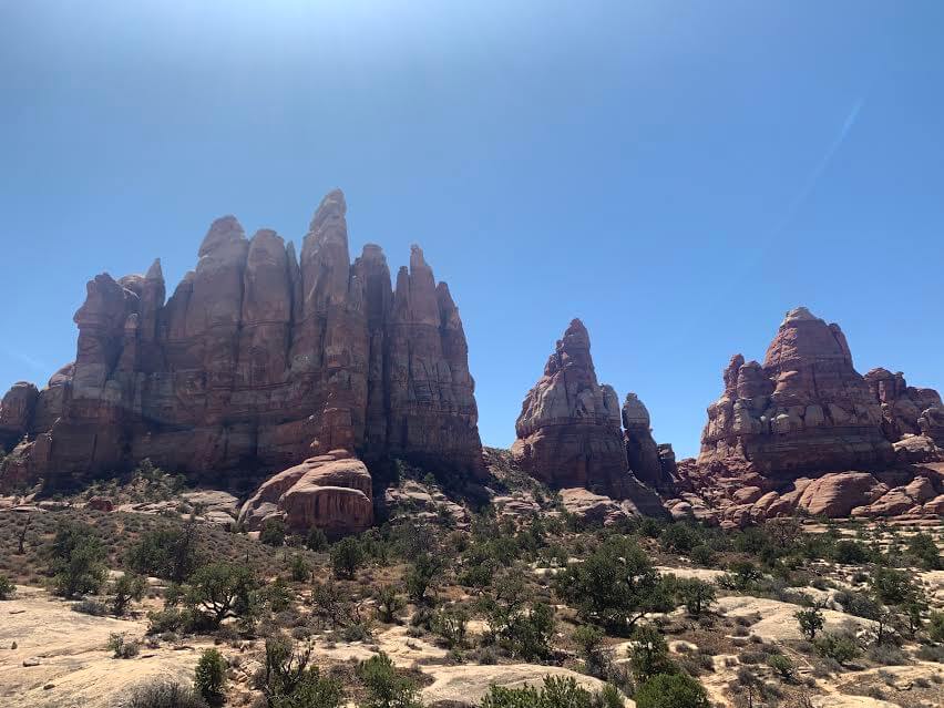
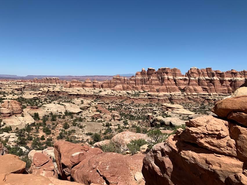
About two hours later, we arrived at Chesler Park
What surprised me was that there were hardly any hikers and it was truly quiet. I had thought that there would be hardly any people hiking here in such hot August, but on the way I only met a ranger and two couples, and other than that it was just me and nature. In this silent, quiet space, the only sound was my own footsteps. It's quite rare to live in a space where there is absolutely no sound
The scenery was so magnificent, yet the space was so quiet, it was strange, and yet I walked there feeling happy to be there
Here too, I had the illusion of being on a different planet, wondering where on earth I had come from
The best thing about this trail is the amazing views, of course, but it's also very quiet, giving you a sense of privacy in a vast space. If only we had had enough water, we would have liked to take the long loop trail, but running out of drinking water would be a disaster, so we headed back the way we came
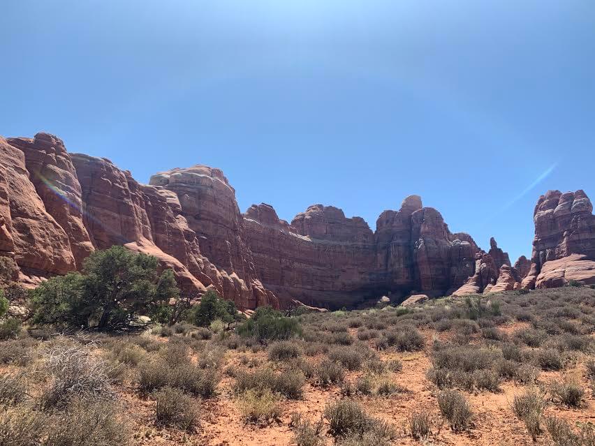
I encountered many rock formations in a quiet space and enjoyed interacting with them in the midst of nature. Next time, I'd like to bring plenty of water and come back to a different trail that continues from here.
Everyone, please make sure to bring plenty of water with you on this trail. Lol
Sayaka Kato
 Leave your hiking and travel plans for The Needles to Canyonlands National Park to us. Influenced by my father, I've always loved outdoor activities, and while living in Japan, I started hiking and touring national parks, which fascinated me with the natural beauty of the United States and Canada, ultimately leading me to my dream of moving to the United States. I currently run ANAMI TOURS, which offers local optional tours created together with customers, such as completely private hiking tours with Japanese guides. I'll introduce you to special options that I know only because I live in the area. If you're interested, please visit the website below
Related reading
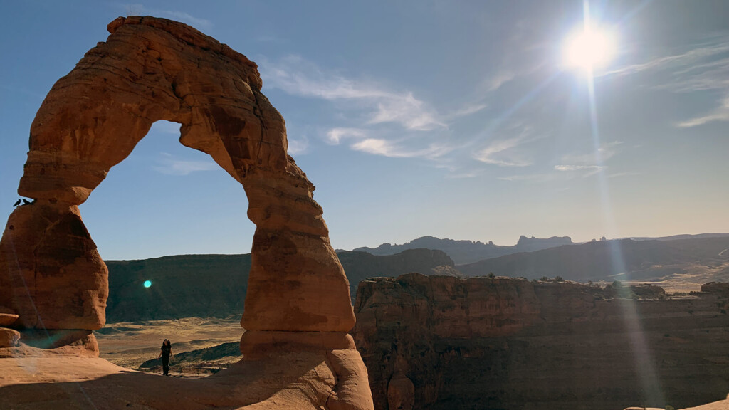 Can you die without walking? A trip to the American National Parks (10) A work of art created by nature. You should definitely visit Arches National Park before it's gone
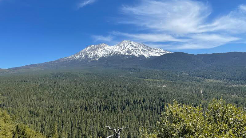 Can you die without walking? A Journey to the American National Parks (25) The Jewel of Mt. Shasta - Headwaters of the Sacramento River and Spring Hill Trail
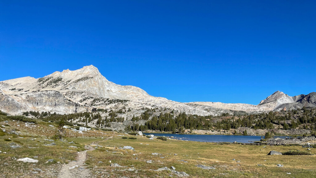 Twenty Lakes Basin Loop Trail: A wonderful trail offering spectacular views of the beautiful mountains of the East Sierra Nevada Mountains [A trip to the US National Parks (37)]
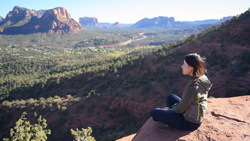 Can you die without walking? A trip to the US National Parks (3) Grand Circle Sedona Recommended Hikes