Following on from our last article, we will be introducing trails in the water city of Shasta. This time, we will be introducing trails dotted with beautiful lakes
In the summer, you can swim in the lakes along this trail. All of the lakes are truly beautiful and are the perfect place to cool down and relax. Walk steadily, and on hot days, you can even dive right into the lake! This is a hiking trail that lets you enjoy nature with your whole body
This course is for intermediate to advanced climbers. There are elevation changes and steep slopes in the second half, but the view from the top is worth it
The trail also has many spectacular views, and it's a great place to swim in the lake along the way, or go bird watching or on a nature trip
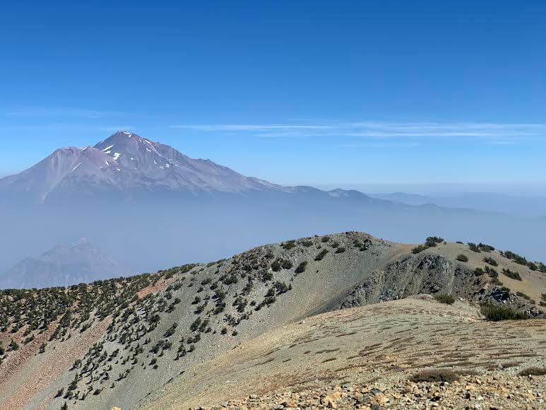

table of contents
Recommended trails around Shasta (for intermediate and advanced hikers), Mount Eddy Trail Hiking Guide
data
- For intermediate and above
- Season June to October
- Trailhead elevation: approx. 1918m
- Mt. Eddy Altitude: Approx. 2751m
- Round trip: Approx. 19.952km (12.47mile)
- Height difference: Approximately 778.46 m (2,554 ft)
- Course time: 5 to 6 hours round trip (including breaks)
Useful items to bring with you on a hike
- Drinks (larger in summer, about 3 liters)
- Warm clothing that can adjust to the temperature (it can get cold on windy days)
- hat
- sunglasses
- sunscreen
- Snacks to eat during the hike
- If you have any regular medications, bring first aid such as medicines and bandages
- Swimsuit (You can swim in the lake in the summer. There is no place to change clothes, but please bring your own if necessary.)
- Other normal hiking gear
How to get to Mount Shasta (by car)
- Drive north from San Francisco on I-5 for about 5 hours. The distance is about 245 miles (392 km) as the crow flies
- It takes 3 hours from Sacramento. Just drive north on I-5
- The closest airports to Shasta are Redding or Medford, which are about an hour to an hour and a half drive away (via I-5)
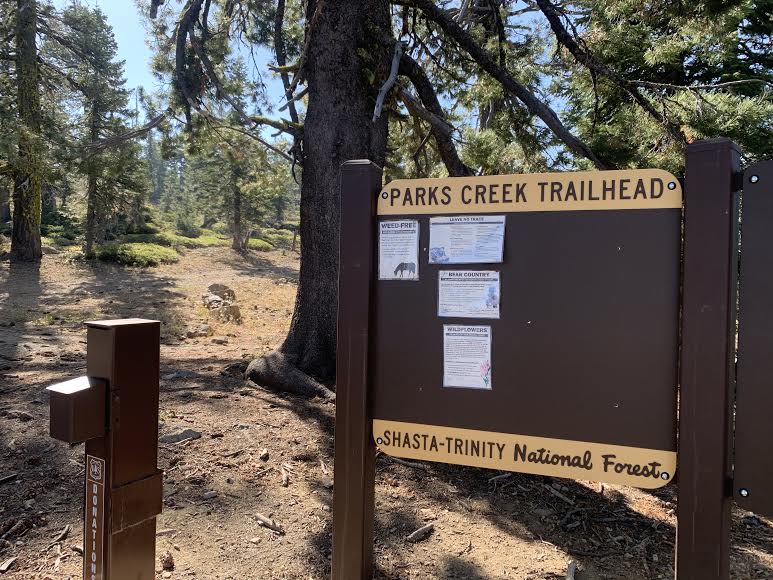
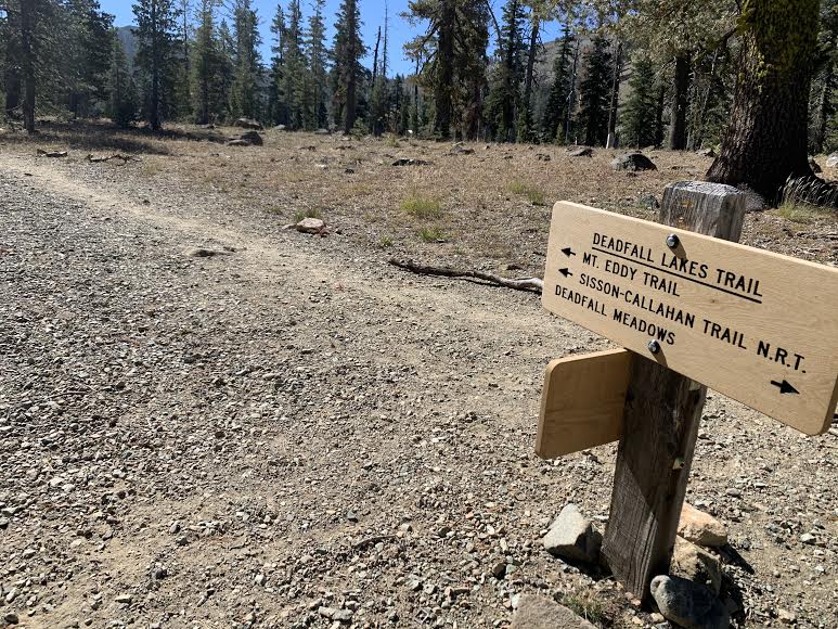
Trailhead
Address: Forest Rte 42N17, Mt Shasta, CA 96067 or Deadfall Meadow Trailhead (Enter this address in your GPS to arrive at the trailhead.)
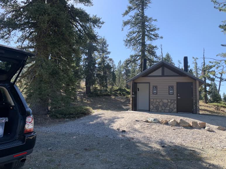
There is a parking lot and restrooms at the trailhead. The photo was taken on a weekday in early September. I arrived at the parking lot at 10:00 AM, but there was only one car parked there, so there was plenty of space
Start hiking
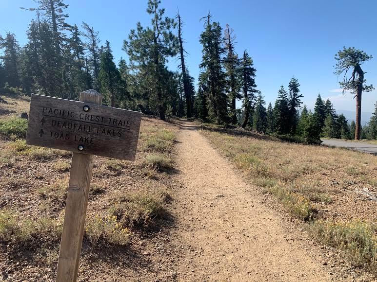
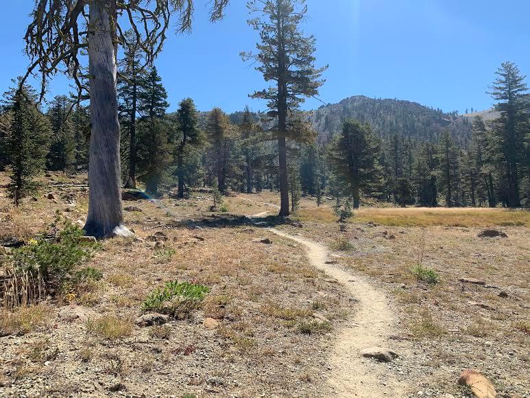
The trail starts off flat, then continues through many trees
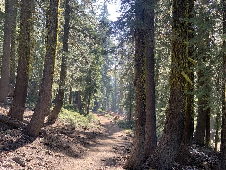
At this time, forest fires were occurring all over California, so I was worried about the smoke blocking my view, but in the morning I was able to see the surrounding scenery quite clearly. Of course, it was hazy compared to usual, but the sky was still as blue as ever
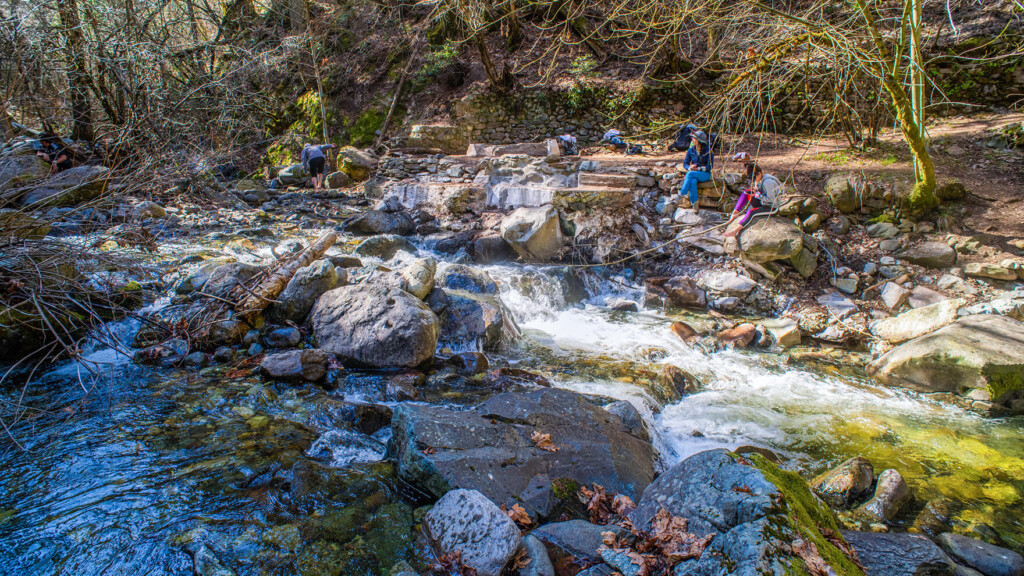
About an hour after starting, you will come to a fork in the road that leads to Dead Fall Lake
On this trail you will see several lakes and can swim in them, but the main lake is Deadfall Lake, which is divided into three lakes: Lower, Middle, and Upper
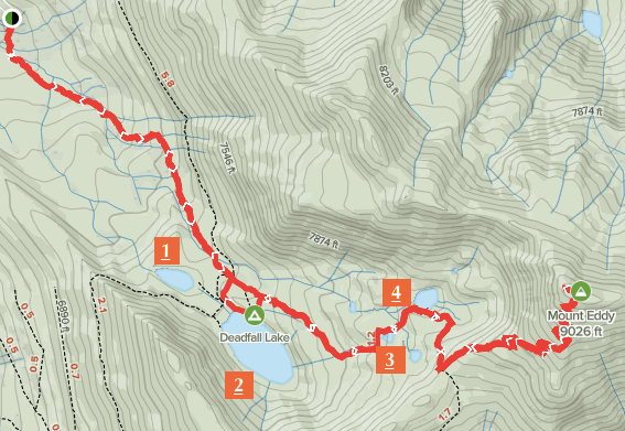

The first place we went to was Lower Deadfall Lake, which is number 1 on the map above (about 6.5km from the starting point)
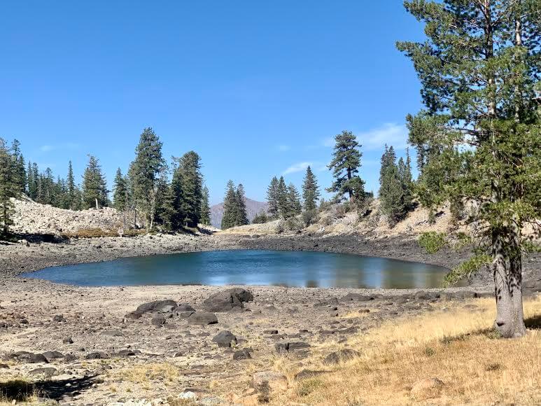
It's a very small and cute lake with crystal clear water, making it a perfect place to take a break
If you want to swim, you can swim
But the lake continues, so we leave here and head towards Middle Deadfall Lake
There is a path leading from Lower Deadfall Lake that will take you to Middle Deadfall Lake in about 5 minutes
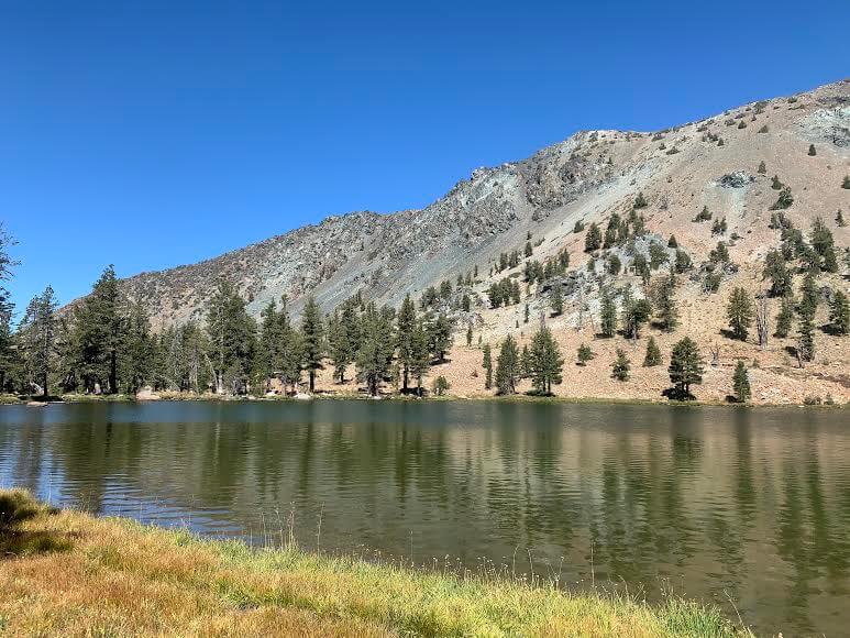
Middle Deadfall Lake is number 2 on the map
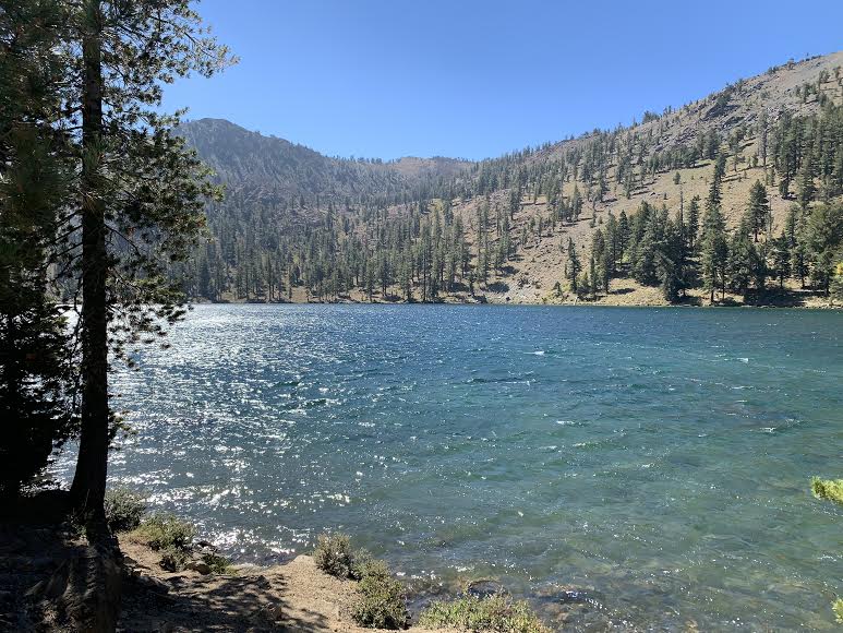
This is the largest lake on the trail. It was a bit windy and choppy, but there were no other hikers around yet, and the weather was so nice, I left my gear and went for a swim! It was amazing
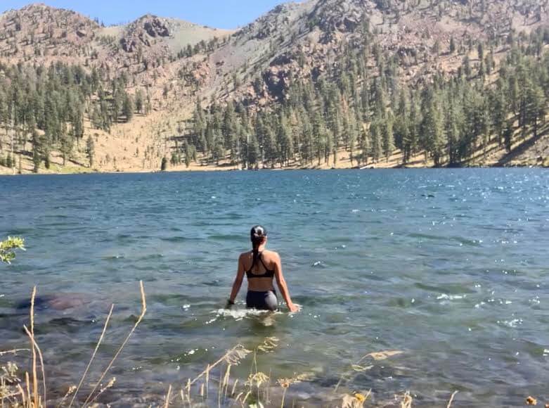

This is the true blessing of nature. The energy of Shasta permeates my entire body, leaving me feeling truly refreshed
After a quick swim, we head back to the trail and continue on. One of my favorite things about swimming in the lake is how it instantly relieves fatigue
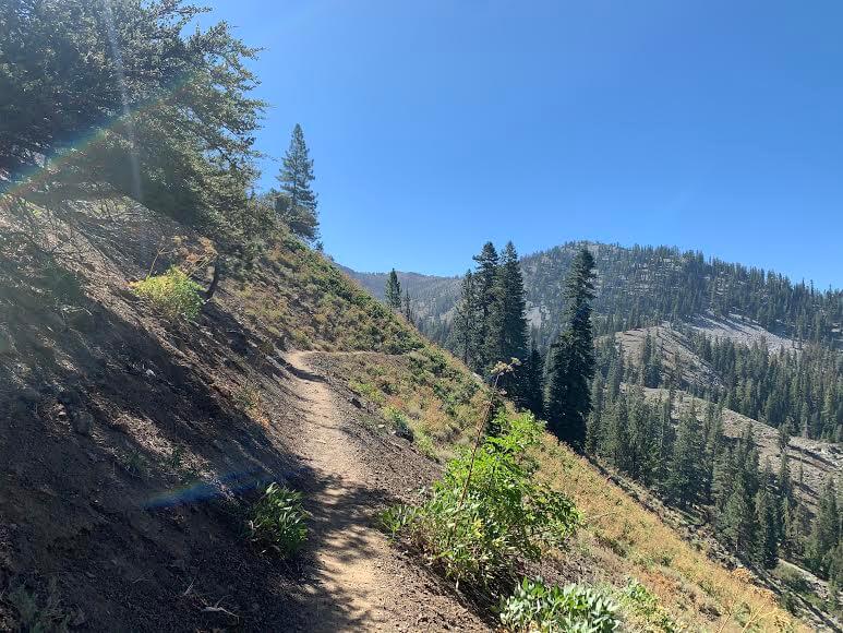
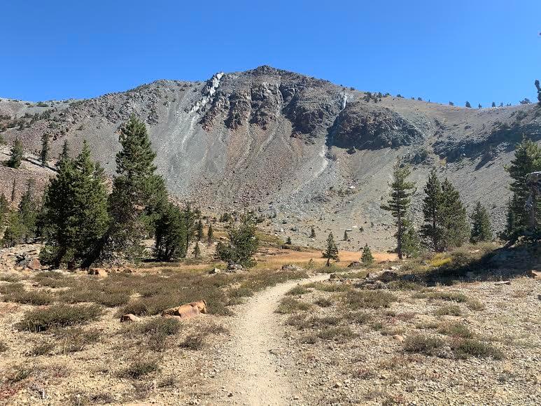
Return to the main trail. After Middle Deadfall Lake, the trail becomes steep
Gradually the trees become more mottled and we realize we are approaching the tree line. Further on we come across another lake (the third on the map)
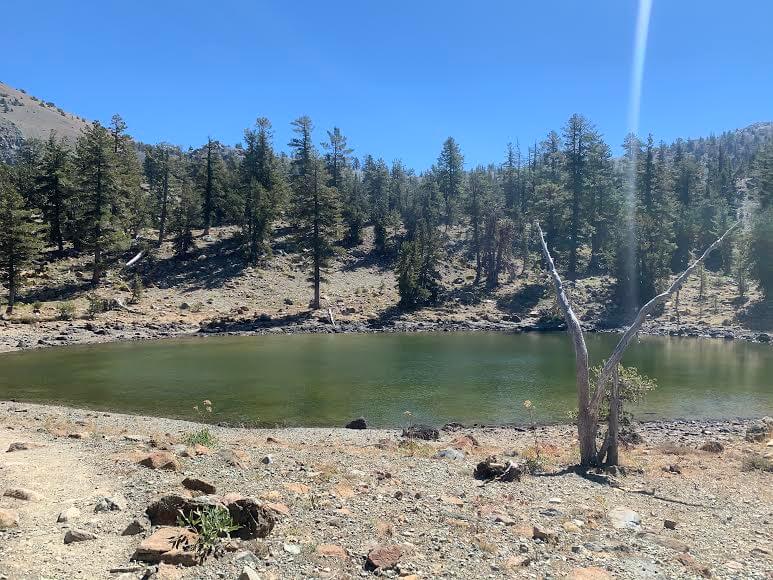
This lake is also small and calm
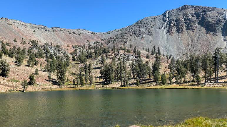
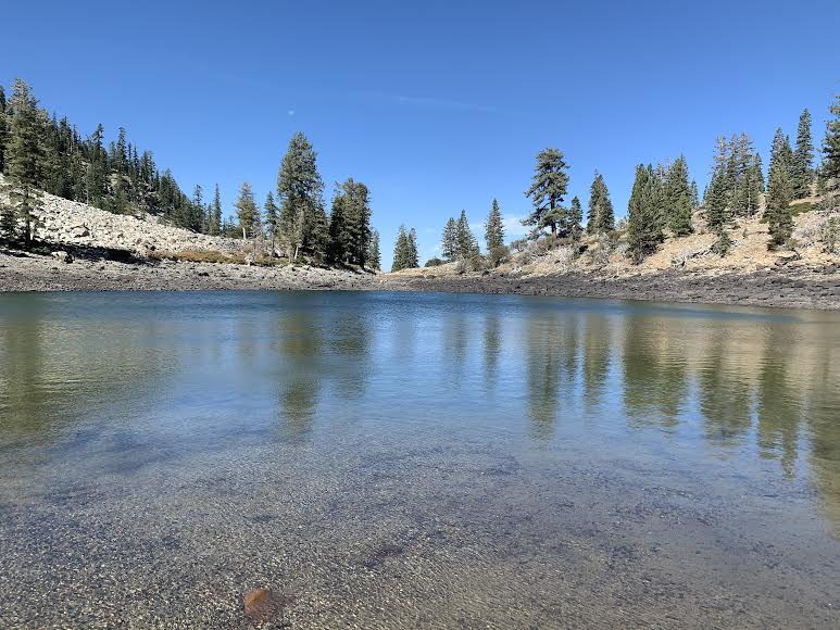
If you continue from here, you will soon come across the main lake, Upper Deadfall Lake (Map 4)
Mount Eddy can be seen in the background, and it is a very beautiful lake surrounded by mountains
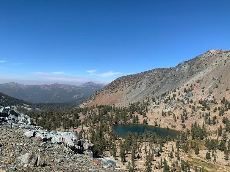
I think Upper Deadfall Lake here is the most beautiful spot on this trail, both in terms of location and atmosphere. You can go around the lake, so it's a good idea to find a spot you like and take a break. Of course, you can also swim
I wanted to just hang out at the foot of the lake forever... It was such a pleasant place that I was sad to leave, but with Mount Toeddy standing before me and the finish line in sight, I continued on with anticipation in my heart that I was going to reach that summit!
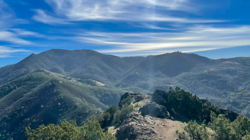
The slope continues from here. It's the final sprint. There are great views here and there, so you can take a break and enjoy the scenery
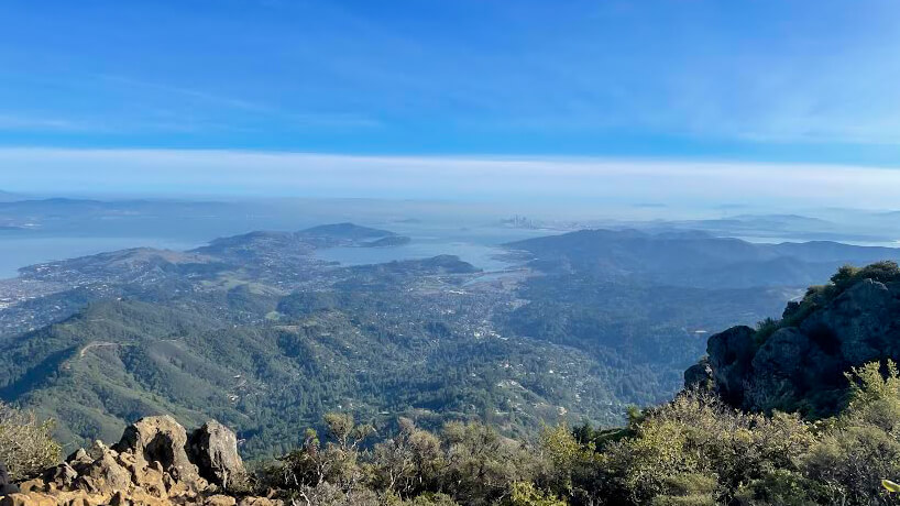
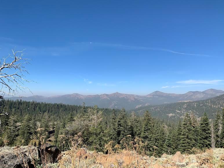
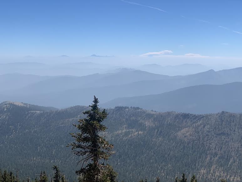
As the altitude increases, the landscape expands and you can see smoke rising from forest fires everywhere
At the end there is a steep zigzag slope, and once you reach the top you will arrive at the summit about three hours after setting off
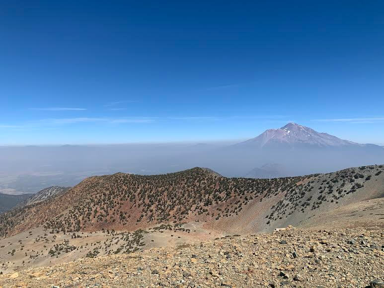
The smoke made the surrounding mountains look like a sea of clouds. It was a challenging hiking route, and the combination of the spectacular views from the summit and the lakes along the way was amazing, making it one of my personal favorites
We took a good rest here and headed back the same way, but on a hot day we recommend taking a dip in the lake. It's really refreshing and relaxing
This time, it took a total of 5 hours and 40 minutes, including breaks. This Shasta hiking route is recommended for those who want to walk steadily
Precautions regarding the spread of COVID-19
As of January 2021, various countries are currently imposing entry restrictions due to strengthened quarantine measures, as well as restrictions on entry to national parks and domestic travel. These conditions are subject to change without notice, so when traveling, be sure to obtain local information from each country's embassy or consulate, the Ministry of Foreign Affairs' Overseas Safety Website (Infectious Disease Risk Information), national park websites, and other sources, and check information on transit points, countries you plan to travel to, and the areas around the places you plan to visit before making reasonable plans and taking action
Sayaka Kato

Related reading