Bringing the magic of smartwatches to tough adventures... In a field where the focus is primarily on everyday life and fitness, Casio is currently the only manufacturer in the world trying to realize such an ambitious dream. For example, high-end models such as Suunto's Spartan and Garmin's Phoenix series have each formed their own unique, highly developed ecosystems as fitness wearable devices. However, for now, there is still no paradise for outdoor enthusiasts who enjoy mountain climbing
It was against this backdrop that Casio released the WSD-F10 last year, an ambitious attempt to carve out a new market for outdoor smartwatches. While it faced the hardware limitations of many smart devices and the low level of Android Wear, it was undoubtedly a device that gave mountain enthusiasts great hope, as it packed a sophisticated application into a tough body that could withstand tough environments
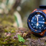
Just one year after the release of the first model, on April 21, 2017, the successor model, the WSD-F20, was released. It finally bears the "PRO TREK" name, the flagship of the company's outdoor watch series. Building on the solid response achieved with the first model, this is nothing less than a sign of the company's determination and confidence to lead the way in the field of "smartwatches for mountain use." At the very least, this enthusiasm is palpable
about this new model the enhanced map function that can be used offline without relying on a smartphone , but there are also several other attempts to surpass the original model. Despite its rich features and rugged performance, the price is kept very competitive , making it a very attractive wearable device for many people who want to enjoy the convenience of a smartwatch both in their daily lives and outdoors.
Following on from last year, Casio has provided me with the WSD-F20 for a free review. So, I'd like to share my initial impressions of using it on a hike and trail run shortly after its release, as well as a rough feel for how it feels to use
table of contents
- table of contents
- First Impressions
- A more refined design without compromising the beauty and texture of the "machine"
- Stress-free weight for its size
- Simple button configuration, just like the previous version
- Enhanced durability that lives up to the "PRO TREK" name
- Magnetic charging terminals require some caution
- The original watch face "Traveler" is lovely
- Let's try it out on a hike - How it works and how it feels
- Summary: A smartwatch that can be used in a unique way depending on how you use it, and is great for outdoor activities
table of contents
- First Impressions
- A more refined design without compromising the beauty and texture of the "machine"
- Stress-free weight for its size
- Simple button configuration, just like the previous version
- Enhanced durability that lives up to the "PRO TREK" name
- Magnetic charging terminals require some caution
- The original watch face "Traveler" is lovely
- Let's try it out on a hike - How it works and how it feels
- Summary: A long-awaited, "smart" outdoor watch that can be used in a unique way depending on your ingenuity
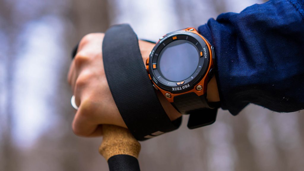
First Impressions
A more refined design without compromising the beauty and texture of the "machine"
The basic concept of the design and coloring is almost the same as the first model. I didn't dislike the previous model, but looking at the new model, I feel that the newly added matte black bezel and the shining "PRO TREK" lettering at the top give it a much sharper look. Smartwatches tend to look cheap because of their digital display, but the polished buttons and screws give it a mechanical beauty that is truly Pro Trek
Stress-free weight for its size
Despite the increased functionality, the watch's dimensions (approximately 61.7 x 57.7 x 15.3 mm) have been kept to a minimum, making it slightly larger than a regular watch, and may feel strange to first-time wearers. However, as you quickly get used to the various information displayed on the dial and operate it as a touch panel, it won't be such a big deal (for reference, see the photo below for a comparison with the PRW-7000, also from Pro Trek)
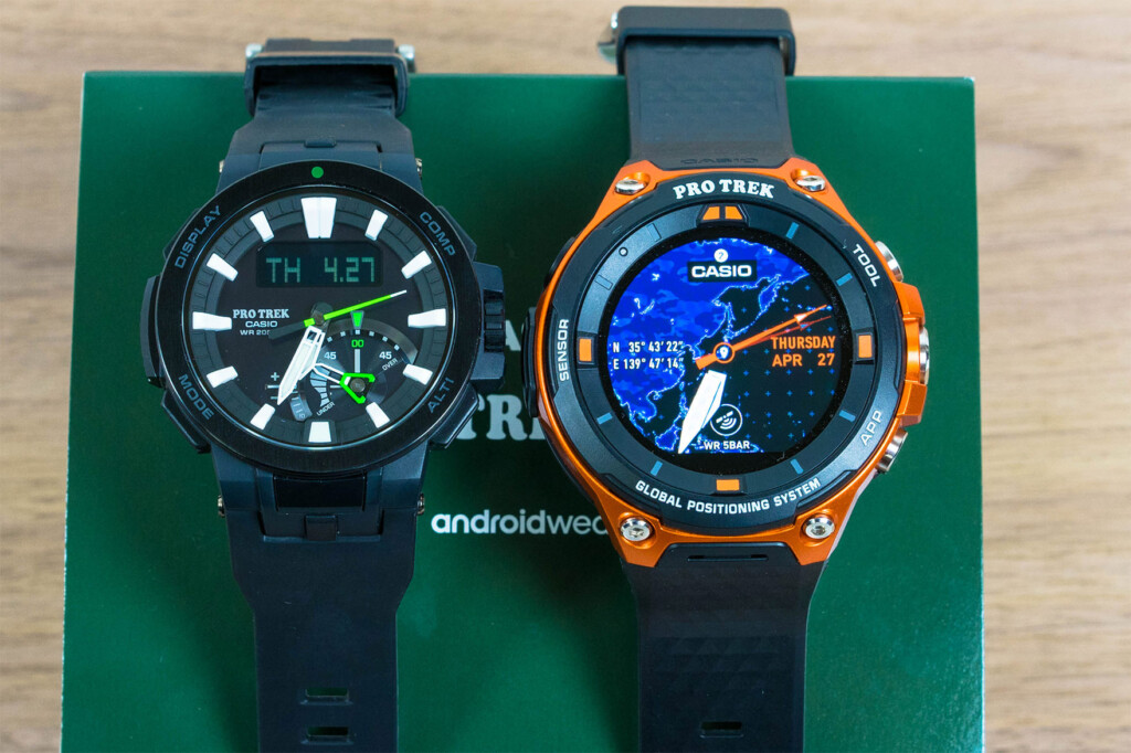
However, as I mentioned in my review of the previous model, the thickness (15.7mm, the same as the first model) gets caught every time you put on or take off your backpack or clothing, so I hope they continue to improve this. On the other hand, despite its bulky appearance, I was surprised that it is lighter than other Pro Treks (in this case, the PRW-7000)
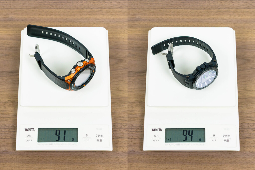
Although it is slightly larger than the previous Pro Trek model, the weight is slightly lighter, so you won't feel much strain when wearing it
Simple button configuration, just like the previous version
The watch has a simple design with only three buttons on the right side (see photo below). They are large enough to be pressed easily even when wearing gloves. The large button in the middle of the side takes you to a menu for launching various apps installed on the watch, while the "TOOL" button on the top side allows you to access various gauges such as altitude and barometric pressure. The "APP" button on the bottom side can also be used to freely set the app to launch, allowing you to quickly launch the app you have set with a single button press
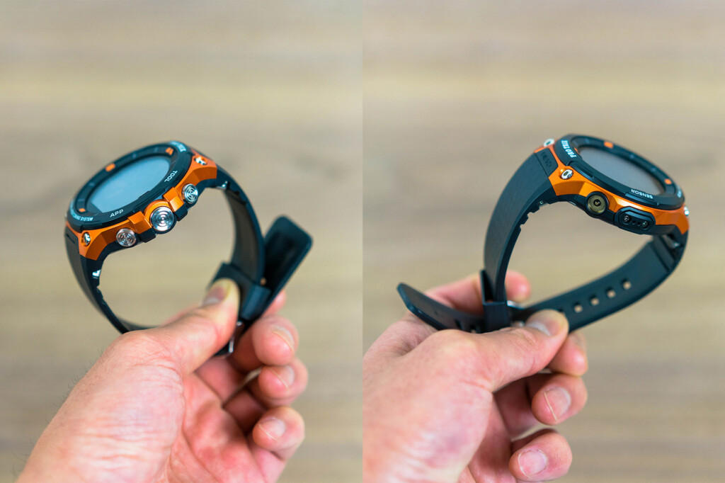
The buttons are concentrated into three on the right side, while the left side has a simple configuration with only a sensor and charging terminal
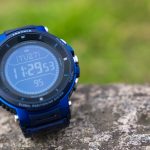
Enhanced durability that lives up to the "PRO TREK" name
Continuing from the first model, the new model is water resistant to 5 ATM and meets US military MIL-STD standards, making it comparable in durability to other outdoor watches. And what's even more exciting is the minimum operating temperature has been increased from 0°C to -10°C on the first model . Now you can take it to the snowy mountains without worry.
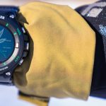
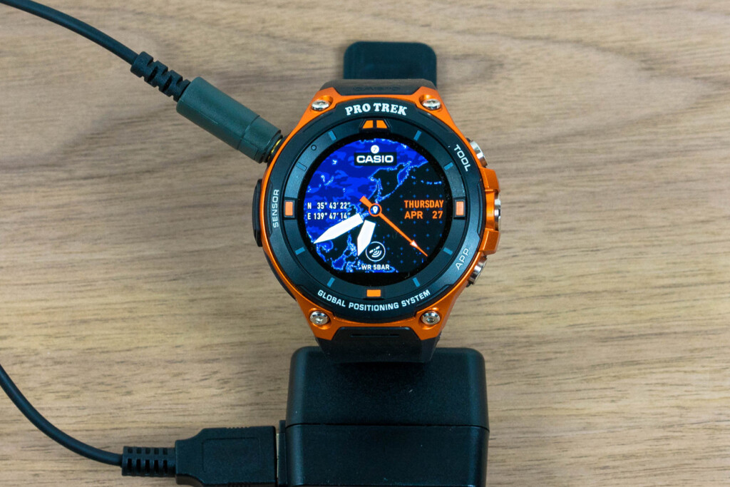
Magnetic charging terminals require some caution
To charge, a dedicated cable is used, with a magnetic connection to the watch. This cable is sensitive to force from both sides, and can easily come off even while charging (see photo below). While this isn't a problem if you leave it on a desk or somewhere else, it can be quite difficult to charge inside a tent or backpack, so you need to be careful
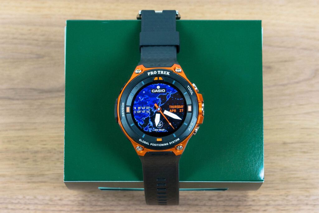
The original watch face "Traveler" is lovely
One of the attractions of smartwatches with color LCD dials is the wide variety of watch faces available. One that deserves special mention is the new, original "Traveler" watch face added specifically for the F-20. It almost perfectly replicates the Pro Trek flagship model, the MANASLU PRX-8000, and allows you to instantly switch between information that would normally be switched with the "TOOL" button by tapping the LCD screen. The addition of a face that combines ease of use and design is irresistible
Let's try it out on a hike - How it works and how it feels
Before the hike: Preparation
That's enough about the appearance, so let's get straight to reporting on how easy it is to use outdoors, especially when hiking
To start using the watch, you still need to install the Android Wear app on your smartphone and pair it with your watch via Bluetooth. It's also a good idea to install CASIO MOMENT SETTER+, which allows you to change the settings for MOMENT SETTER, a convenient outdoor notification feature, and other advanced settings for tool apps on your smartphone
Next, in order to use offline maps, which is our goal here, it's important to remember to download maps of the area around your destination before each mountain hike . If you don't do this, you won't be able to display the map even if you're in an area with no signal. You can freely set the area of the map to download by adjusting the scale, but there seems to be a capacity limit, and if you specify too large an area, detailed maps won't be downloaded, so to limit the area setting to your range of movement (preferably an area with no signal) .
Please note that the map download function will not work unless you update the "Location Memory App" installed on the watch to the latest version, so if you haven't updated any of the apps on the watch since you bought it, don't forget to do that
At the trailhead: Launch the activity app or other app you want to measure
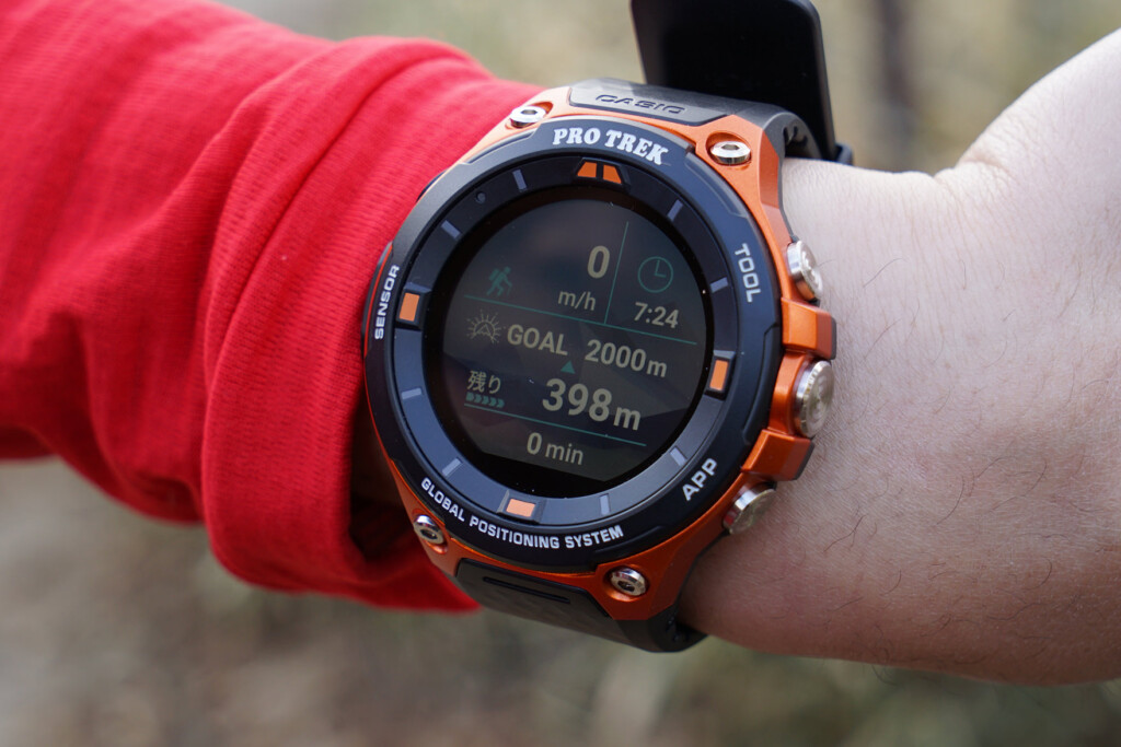
your activity progress in real time and measure your progress towards your set goal. Starting with the F20, in addition to the three existing options of trekking, cycling, and fishing, new options have been added, including "Paddle Sports" (canoeing, kayaking) and "Snow" (downhill skiing), making it convenient for a wider variety of outdoor activities.
Select "Trekking" and tap "Start" to begin measurement. When you start the app, the altitude difference per hour, current time, target altitude and remaining altitude (the target altitude is set in advance), and measurement time will be displayed on one screen
As an Android Wear device, the F20 can of course use not only pre-installed activity apps, but also third-party fitness and outdoor management and recording apps. Another big attraction is that you can use the apps you've been using on your smartphone (if they're compatible) right on the watch
While hiking: Check the various meters
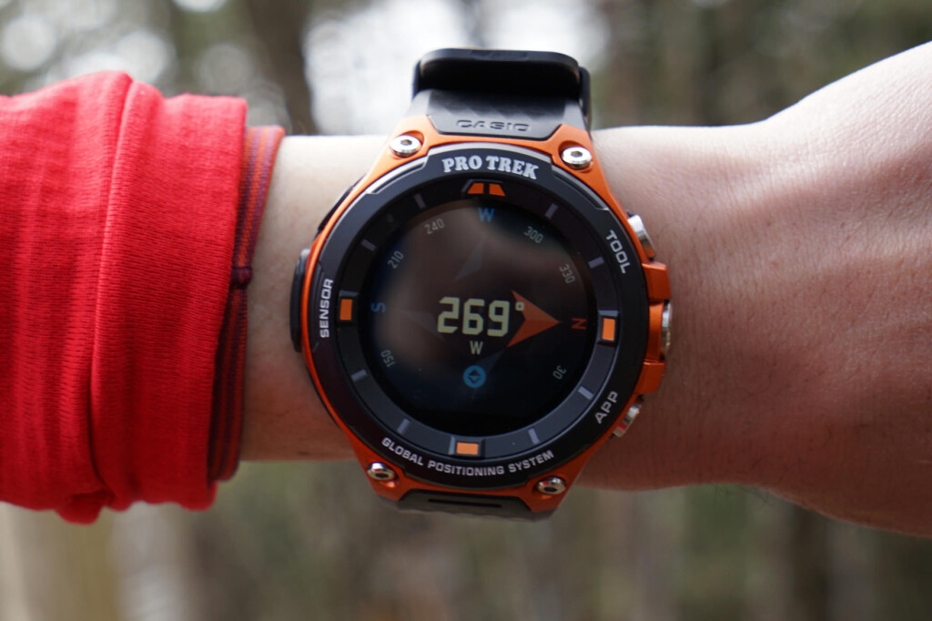
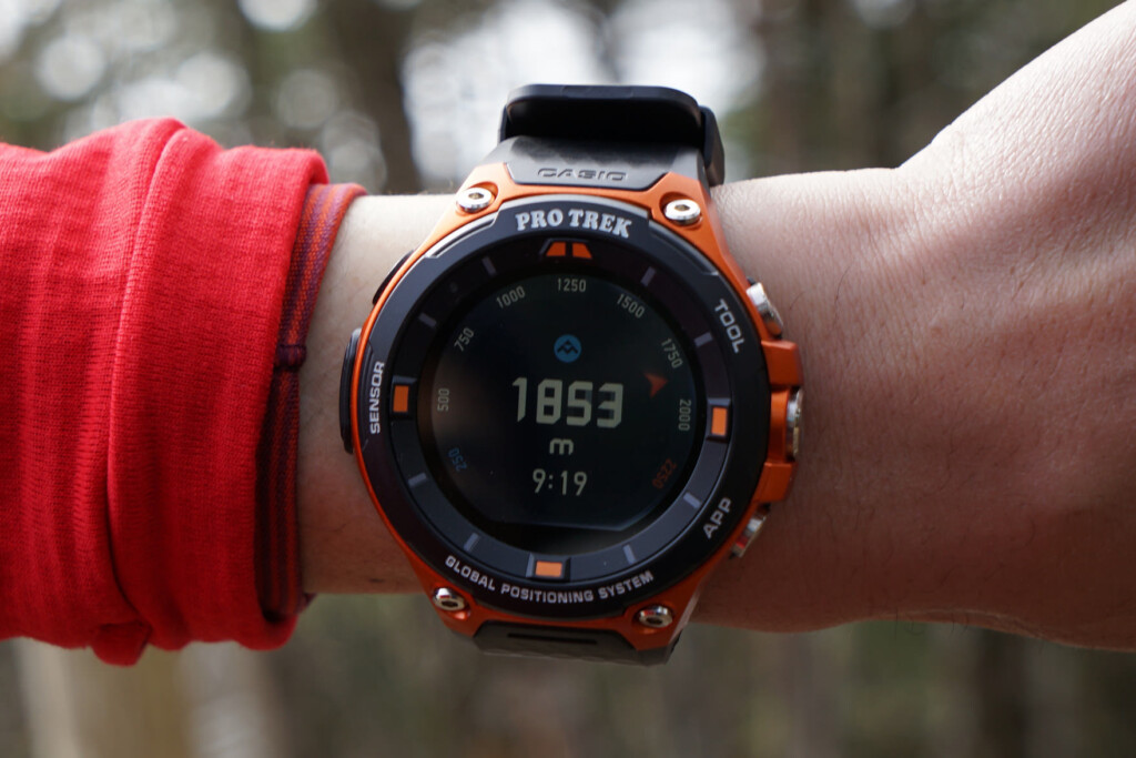
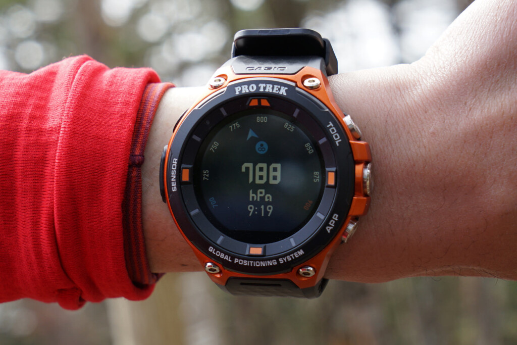
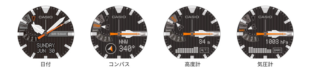
The compass, altimeter, barometer, sunrise/sunset, tide graph, and activity graph can all be viewed in real time using the "TOOL" button on the top right of the side of the watch. Instead of a small window like traditional watches, the display is graphically displayed across the entire screen, making it easy to read
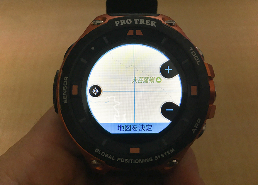
Check your current location and route on the map
While an altimeter and compass are obviously useful for hiking and mountain climbing, what's even more useful are topographical maps and current GPS display. Until now, maps could only be displayed in areas with signal reception or using specific apps like YAMAP, but this model finally comes with offline maps as a standard feature. The maps are made by Mapbox, which covers areas around the world. While they don't offer the same comprehensive information as hiking maps in Japan, they're easy to read in full color, and even include contour lines and hiking trails, which is reassuring (though I haven't checked every area in detail, so I'll wait and see). The current location tracking is also accurate enough, thanks to Japan's Michibiki satellite
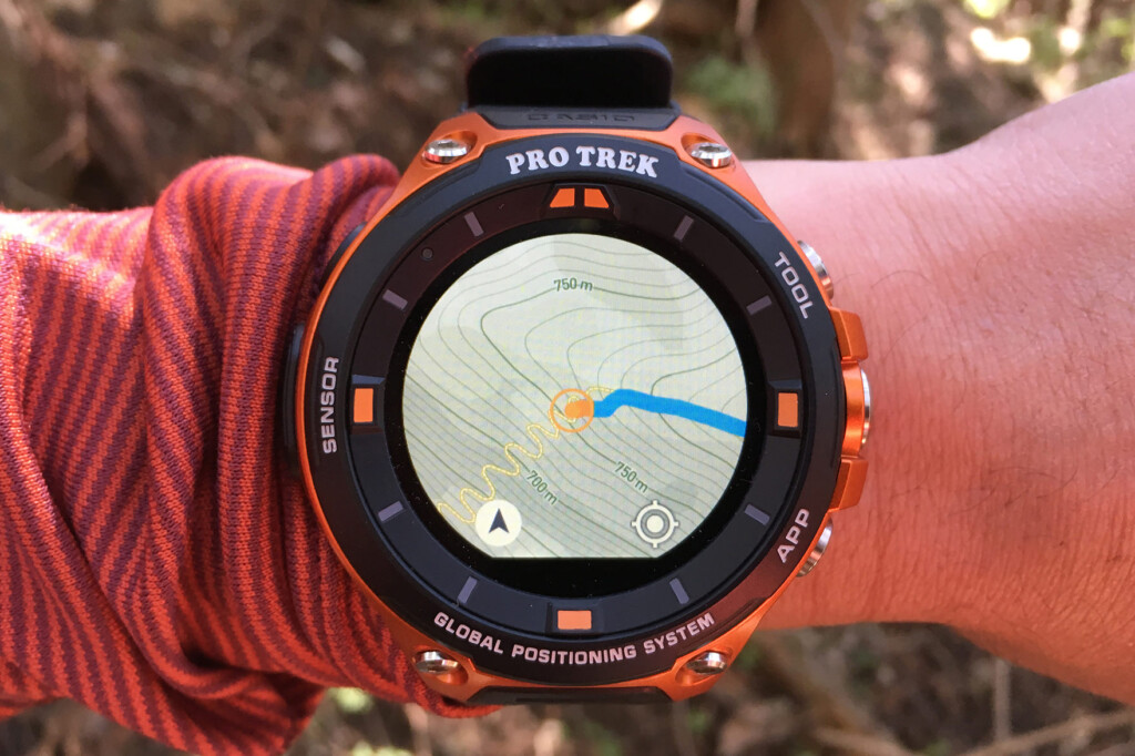
The map made by Mapbox is easy to see in color and with contour lines, so it's okay for a quick look. However, some parts are written in English, which is something I hope to improve in the future
As soon as I went deep into the mountains, I lost signal, but the downloaded map was displayed without any problems
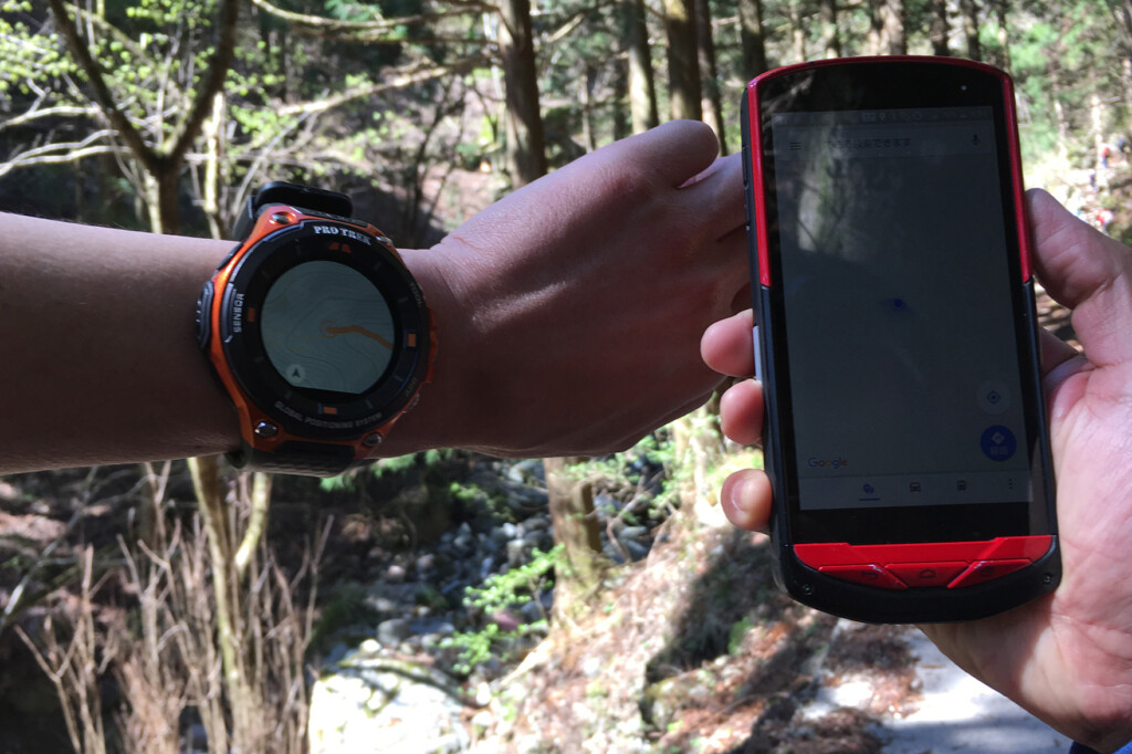
The photo is dark and a little hard to see, but in areas where there is no signal, the map on the smartphone on the right does not display, but on the F20 on the left, the downloaded offline map and current location are clearly displayed
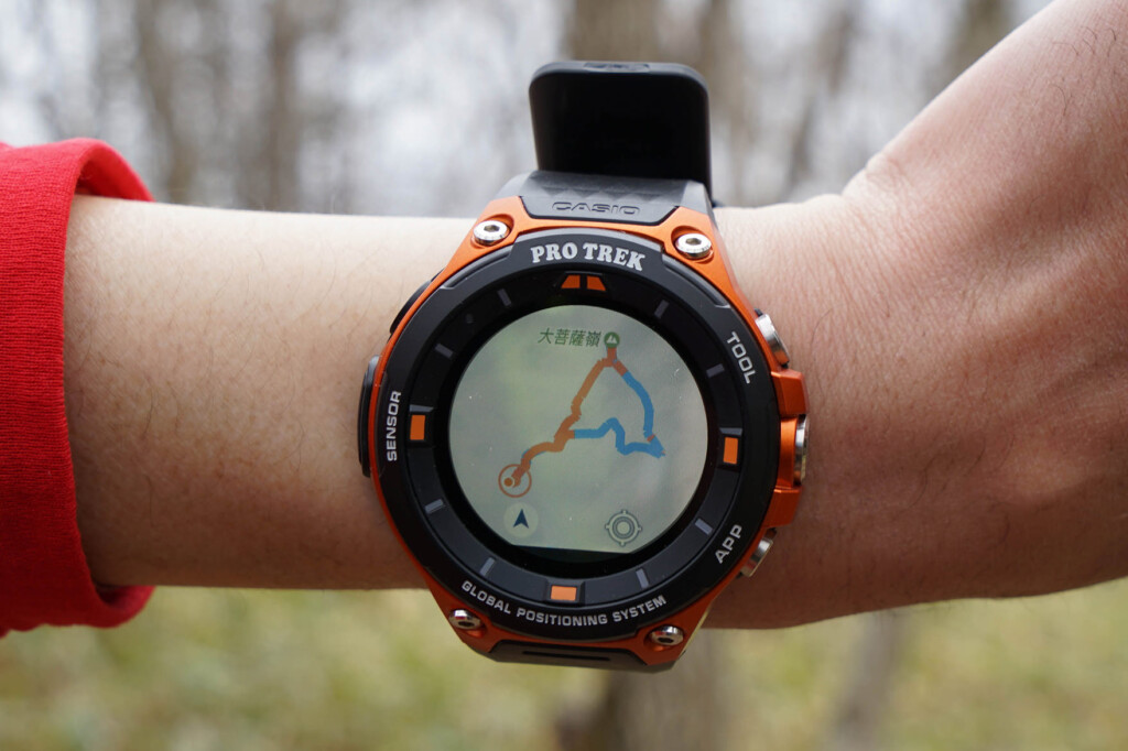
After finishing the hike, you can check the path you took. The ascents are shown in orange and the descents in blue
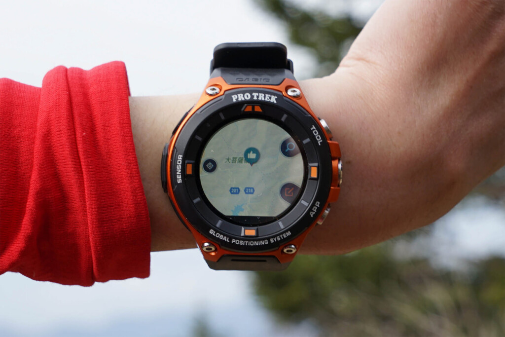
Another interesting feature is the "Location Memory" app, which lets you leave check marks and voice memos on a map. I haven't tried this yet, but apparently you can upload that information to Google Drive and view it in Google Earth. It's Google after all, so if they can integrate more and more of these features, they'll be unbeatable
I decided to check out the "Raiwa" spot just before Mt. Daibosatsu myself
CASIO MOMENT SETTER keeps you updated on your activities
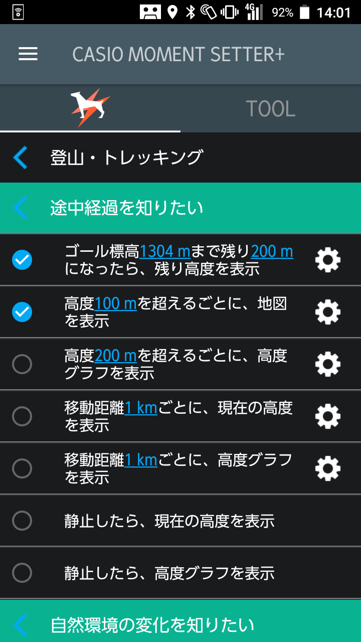
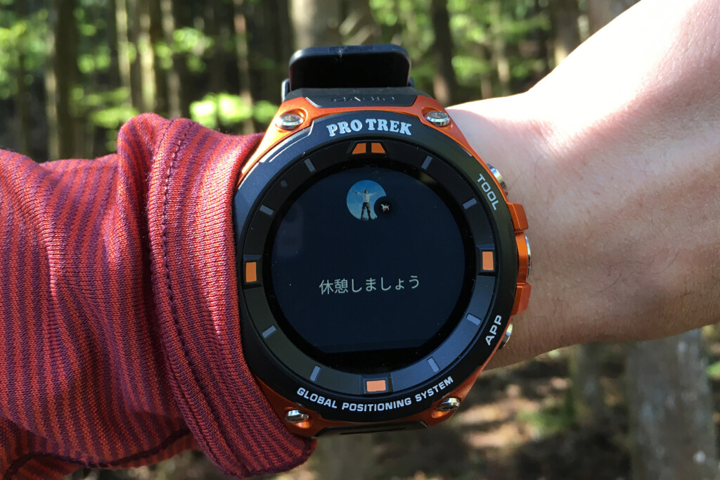
If you set it using "MOMENT SETTER," it will notify you when it's time to take a break at regular intervals
Are you wondering how long the battery lasts?
As for battery life, which everyone is curious about, I still need to test it a bit more before I can reach a final conclusion. Because Android Wear can do so many things, I haven't yet figured out what causes power consumption and what settings are wasteful (and conserving). When I first started using the features haphazardly, the battery quickly drained to the brink of depletion within about half a day. So, I tried some (obvious) tweaks, like setting the tracking accuracy to "battery priority" and setting the screen to immediately turn off when not in use, and I feel like I've managed to extend the battery life by a few hours. Incidentally, it lasts for one to two days with everyday use, so I know it's not that critical
However, as of now, we have not yet narrowed down which settings are essential for battery life, so going forward we would like to test from various angles how much longer the battery lasts by adjusting the tracking accuracy, screen brightness, whether or not it is connected to a smartphone, and the number of apps running
Summary: A smartwatch that can be used in a unique way depending on how you use it, and is great for outdoor activities
The WSD-F20, with its sturdy body and a wide range of apps including offline maps, has evolved steadily from its predecessor without cutting anything out, making it a device that is firmly at the forefront of the market as an ideal outdoor wearable device. In addition to its beautiful and reliable body, the Android Wear inside it offers a unique appeal: the ability to customize settings and apps to suit a variety of uses, from everyday use to serious outdoor activities. This experience once again demonstrated that this is still a major advantage
However, there are still many hurdles that all manufacturers must overcome before users can enjoy the latest features in a stress-free manner, and it's true that even the WSD-F20 hasn't quite reached that level yet. After all, each user needs to have some skill to use it comfortably
Addendum: I have since done some more testing, focusing on what the best settings are for using this device comfortably while trekking, such as hiking, and what apps are fun and convenient to use, so if you're interested, please see this article .


For details on the lineup, main specifications, accessories, etc., please here (official product page) . In addition, useful information and the latest information from the manufacturer can be found on the PRO TREK Facebook page
Related reading