Review:カシオ PRO TREK Smart WSD-F30 が登山・ハイキングでどれだけ使いやすくなっているのか確かめてみた
ついに発売されたカシオ計算機のアウトドア向けスマートウォッチPRO TREK Smartシリーズの最新モデルWSD-F30。先日は前モデルF20 との違いを中心に紹介しましたが、今回はさらに実際の登山やハイキングでの使い心地についてレビューしてみます。
目次
目次
WSD-F30 特徴のおさらい
CASIOのスマートアウトドアウォッチWSD-F30 の基本的な特徴を一言でいうと、アウトドアで十分使える耐久性と各種センサー・地図機能を備えたスマートウォッチであるということ。
アウトドアで十分使えるという部分では、まず落下や振動などのハードな使用に耐えるMIL-STD-810G (米国防総省が制定した米軍の物資調達規格)準拠、5気圧防水、そして耐低温仕様(-10℃)といった耐久性。そしてもちろんコンパス・気圧計・高度計等のアウトドアウォッチに不可欠なセンサーの内蔵。WSD-F30 はそれらに加えて、電波が通じない場所でもオフラインで閲覧可能なアウトドア地図が使えるということが大きな特徴といえます。
もう一つの側面、スマートウォッチとしての利便性について。カラー・モノクロ二層構造のタッチパネル式ディスプレイは、ボタン操作のわずらわしさを軽減しながら、同時に電力消費を抑えたスマートな設計です。さらにWear OS by Google(Android Wear)によるさまざまな機能と、バラエティに富んだサードパーティアプリによって日常使いも便利な機能が備わり、平日と週末をシームレスにつなぐまさにアウトドア愛好家のための腕時計です。
そんなPRO TREK Smartシリーズの最新作でなにより大きく進化したのは、何よりまずより軽量・コンパクトになったこと。これまでイカツい、ゴツいと敬遠していた人にも確実に受け入れやすくなりました。さらに画質・発色・コントラスト…すべてが進化した有機ELディスプレイを採用したことで、小さくなった画面のハンデをカバー。その他、3つのバッテリー節約モードを新たに搭載することで、用途に合わせて効率的に電池を節約できるようになったといいます。
他にもある細かい点が気になる方は前回のレビュー記事を参照していただくとして、今回は実際にサンプル機をハイキングでここ1カ月ほど使わせてもらい、それら新しい機能がどの程度使えるのか、登山でじっくりと検証してみました。
さっそくWSD-F30 を登山で使ってみる
登る前にやっておくこと ~地図ダウンロードの手間が軽減~
WSD-F30 で電波の届かないところでも地図を利用するためには、何はともあれまず登るエリア周辺の地図を時計にダウンロードしておく必要があります。この操作自体は前モデルから相変わらずですが、今回のWSD-F30 ではダウンロードした地図を5つまで保存しておくことができるようになりました。
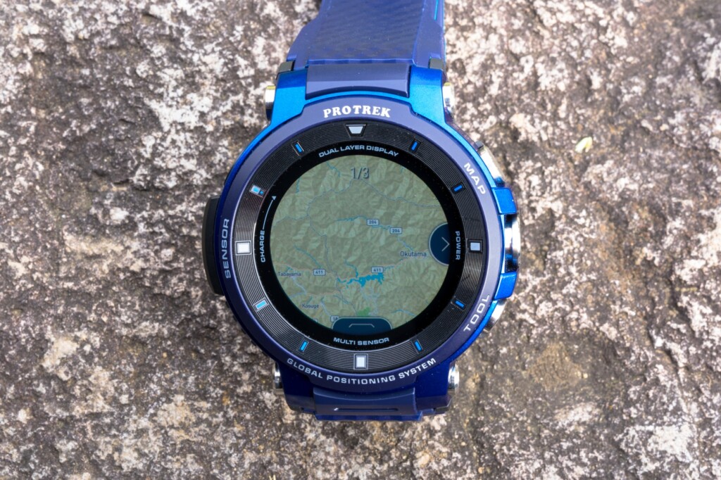
地図の保存が可能になったことでダウンロードの手間は大幅に減った。
この進化は、例えば日本全国の百名山を巡る人にとっては意味のない変更かもしれませんが、よく行くエリアが決まっている自分にとっては地味に嬉しい進化でした。普段ギアのテストなどで訪れるエリアは奥多摩・丹沢・奥秩父など多くても3~4エリアなので、一度それらをダウンロードしたら、その後ほとんどダウンロードの必要がなくなります。
ちなみに、登る前に地図をダウンロードしておく必要があることはもう一つの地図アプリであるYAMAPを使う場合でも変わりません。ただこちらは以前から地図を保存しておくことができていたので、こちらを常用している人にとっては最新機種になっても使い方に変化はありません。
山登りでの基本的な使い方
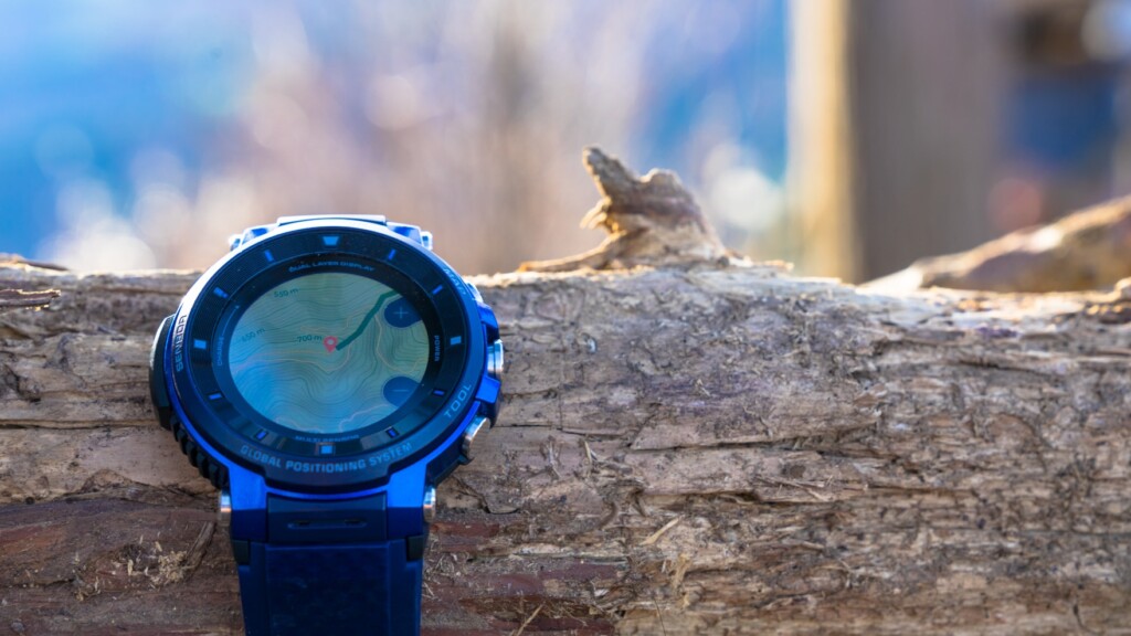
登山中に最も利用する機能としては、高度やコンパスの表示、そしてもちろんダウンロード済みのオフライン地図と現在地の閲覧です。上下のボタンひとつで、相変わらず視認性が高くグラフィカルなセンサーや地図が表示されます。
相変わらず各種センサーへのアクセス・視認性は抜群。
はじめてアウトドアスマートウォッチを使う人は、このまま必要な時に地図を見るだけでもその便利さを実感できると思いますが、せっかくなのでセンサーを使った便利な機能を利用してみてもいいでしょう。純正の「アクティビティ」アプリを使うと、ルートの軌跡を眺めつつ高度、移動距離、消費カロリー、天候の変化など一定の条件でお知らせしてくれるなど、これまでの山登りを少し便利に、楽しくしてくれます。
自分の場合はこれまで行動中の使い方としてはYAMAPアプリを立ち上げ、行動を記録しながら現在地のチェックに使用していました。YAMAPで採用されている2万5千分の一地形図をベースとしたオフライン地図は、現状最も分かりやすいのと、スマホなしで行動記録がとれること、アプリの動作も以前より安定してきたことなどがその理由です。またここでログを取得しておけば、GPXデータとしてあとからさまざまなサービスにもエクスポートが可能という点も大きい。
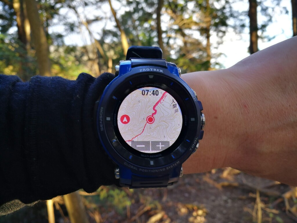
YAMAPの2万5千分の一地図表示は、使い始めた頃に比べてかなり見やすくなってきて、今では手放せない。
進化した2層ディスプレイはフィールド使いで真価を発揮
小さくなっても視認性が向上した有機ELディスプレイ
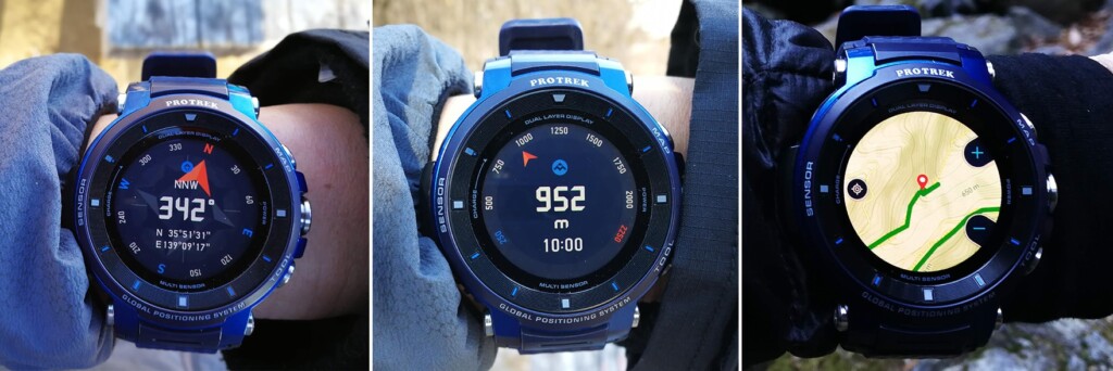
今作から新しくなった有機EL液晶の性能を確かめるべく、朝日を直に受けながら地図を表示してみます。下写真を見ればわかるように、クッキリと地図を閲覧することができ、想像以上に画質・明るさともに向上していることが分かりました。
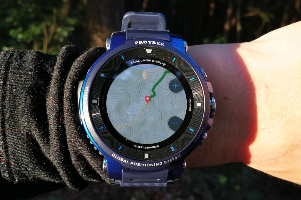
日なたでも相変わらず視認性の高いディスプレイと地図表示。
見やすく、便利になったモノクロ表示
また、F20までは日付と時間のみ、カラーも変更できず無味乾燥な表示だったモノクロ表示モードは、F30になってかなり機能的になりました。カラーが選べるようになり、以前からあった反転表示と合わせて非常に見やすくなりました(下はモノクロ表示時。自分が見やすい方を選べる)。
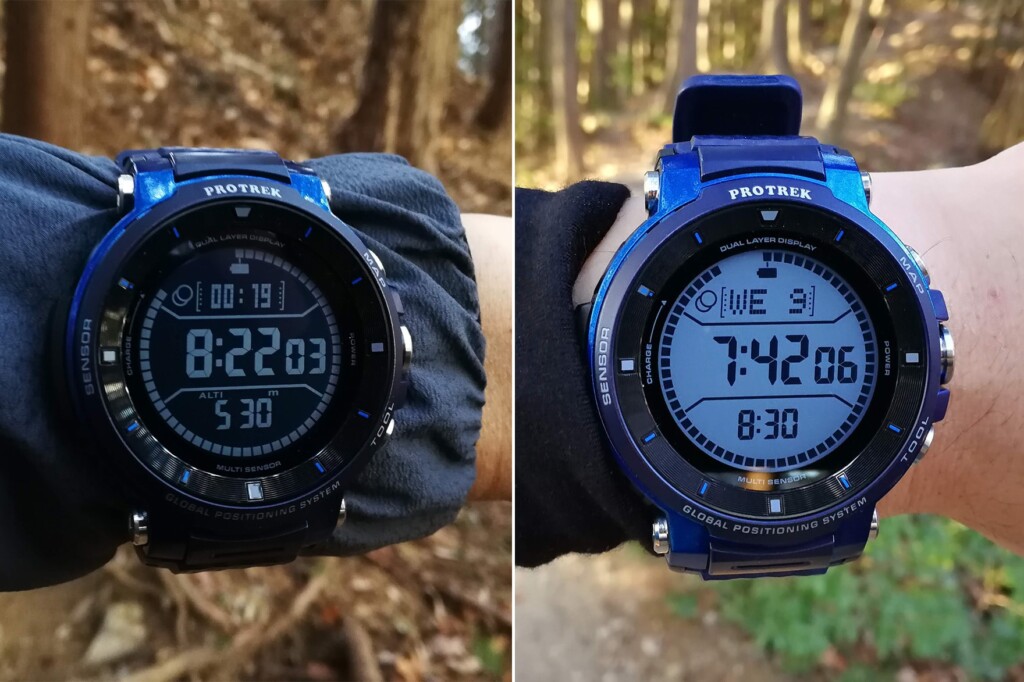
写真左はダークモードでのモノクロ表示(エクステンドモード起動中)、写真右はブライトモードでのモノクロ表示(エクステンドモード一時停止中)。
モノクロ時に表示できる項目も劇的に増加。たとえば高度・気圧・方位の一括表示、あるいは電池残量や歩数計など。これによっていちいち液晶画面を起動する必要がなくなり、便利になっただけでなくバッテリーの節約にも大きく貢献してくれます。ただ、電子コンパスだけはモノクロ表示で確認することができず、それだけは残念です(下写真)。

消費電力が低めで常用しているウォッチフェイス「2レイヤー」でのモノクロ(左)・カラー画面(右)。モノクロ時にコンパスが表示されないのが惜しい。
エクステンドモードを使う
そこでエクステンドモードは実際のところどうなのか、使いやすさやバッテリーの消費量などをハイキングで試してみました。
エクステンドモードとは簡単にいうと、行動中は機能を最低限に抑え、さらに宿泊地に到着して行動しない時間帯にはモノクロ時計表示のみにすることで確実にバッテリーを節約するという「アウトドア自動バッテリー最適化機能」。
基本的な使い方ですが、アプリ一覧からエクステンドモードをタップして「計画立てる」ところから始まります。計画とは具体的には「ログ開始」「一時停止」「再開」の時間を指定することです。

エクステンドモード開始時の設定画面。
自分だけかもしれませんがこの設定、一見して理解するのに手間どってしまいました。日帰り登山の人と長期縦走の人にとって、一時停止という概念はそれぞれ違うからです。「一時停止」って、小休憩のこと?それともテント場に着くこと?
要するにこれらは以下のようなことを示しています。
- 「ログ開始~一時停止」の時間帯には最低限の地図表示機能(とGPSログ)のみを可能にする
- 「一時停止~再開」までの時間帯はOSもシャットダウンして時計が閲覧できるだけにする
- 「再開~」はまた地図表示機能のみのモードで起動
計画ではこれらのタイミング(予定時刻)を指定する必要があります。
つまりこの流れは、あらかじめ1泊2日の登山を想定している人にとっては理解しやすいのですが、それ以外のケースにはそもそもこの行動計画がハマりません。その辺が理解に時間がかかった原因だと思われますが、そこを理解しつつ、今回のように日帰り登山で使うならば、そもそも一時停止時刻を指定する必要はないため、一時停止=ゴール予定時刻として読み替えて設定します。ログ再開時刻は一時停止時刻以降であればいつに設定しても構わないでしょう。
エクステンドモード利用中は基本的にモノクロ表示と、真ん中のボタンを押して現れる地図表示しか見ることができません。通信に関しても強制的に機内モードとなるため、通知関係もすべてなくなりますが、登山に利用する機能以外を漏れなく停止するため、その分バッテリーの消費が格段に抑えられます。計画で設定した「一時停止」時刻になると通知があらわれ、予定通りOSを終了して時計表示のみになるか、1時間延長するかを選ぶことになります。これでうっかり電源を切り忘れるといったことを防ぐことができます。
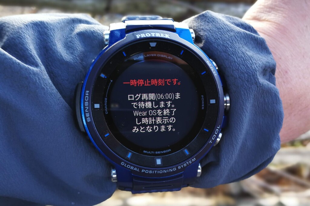
エクステンドモードで一時停止時刻になると、画面のような通知が来て、シャットダウンを促され、時計を停止し忘れるといった心配がなくなる。
エクステンドモードでのバッテリー節約効果は?
最も気になるバッテリー消費量についてはここ1ヵ月、さまざまな条件でこのモードを計測し続けてみました。
その結果、前モデルF20(YAMAP使用、通信あり)では1日6~7時間の行程を終えると少なくとも50%以下には落ちてしまっていたバッテリーが、エクステンドモードの利用では最小で80%台、最もGPS取得間隔の精密な1分間隔でも平均して60後半~70%台に改善されていました。機内モードの有無ということを考慮に入れても確かにこのモードでの節約効果は感じられました。
ただ、自分はできることならYAMAPでもログをとりたい。そう思って「YAMAPを起動しながら、同時にエクステンドモードで節約できるか」という欲張りなパターンも試してみました。はじめにYAMAPでログ取得を開始し、そのままエクステンドモードを起動します。すると、表面的にはエクステンドモードが起動中ですが、あとで確認してみると確かにYAMAPでもログが記録されていました。併用は可能のようです。ただ、気になるバッテリー消費量は何度か試した限り、普通にYAMAPを機内モード利用した場合での消費量とほとんど変わりませんでした。このことから、あくまでも今回試した限りにおいては、エクステンドモードでの電力節約効果を期待するのであれば、他のアプリなどは併用しないのが前提のようです。※個々人の状況により結果は変わる可能性がありますので、あくまでも参考としてお考えください。
ちなみにOSをシャットダウンしてしまう「一時停止」中には当然のことながらYAMAPでのログ取得はできませんが、活動記録は継続しているため、再び電源が入ると引き続き同じトリップでのログ取得が可能となります。
まとめ:ハード面では着実に使いやすく。エクステンドモード使い方次第で便利な節約モード
よりコンパクトに、見やすく、使いやすくなったWSD-F30は、アウトドアの現場でも前回のファーストインプレッションと変わらない進化を実感することができました。特にモノクロ表示の多機能化は、ボタン操作を軽減し、さらにバッテリーの消費も抑えられと、さまざまな点で今回最もクリティカルな進化だといえます。アウトドアから日常生活と、アウトドア好きが常に着けていられる便利なスマートウォッチというコンセプトでの着実な進化が実感できました。
ただすべての追加機能が文句なしというわけでもなく、エクステンドモード等のソフト面については、その操作方法について多少のとっつきにくさと汎用性の低さが気になりました。なぜ毎回計画(それも1泊2日限定)を立ててから始めなければならないか、ちょっとしたことですがさらなる洗練が求められます。ただそこを除けば「効率的な電源マネジメントをワンアクションで」というコンセプト自体は間違っていないと思います。その意味で自分の中ではあれこれ設定をいじらずに、1アクションでミニマム電力消費量設定にしてくれる「便利な節約モード」として、普段の使い方に取り入れていけばそれはそれで使える機能だという気がしています。
今回はハイキングについて見てきましたが、次回はスキー場やバックカントリーでの使い勝手についても細かくチェックしていきたいと思います。
詳細についてやお問い合わせははこちら(公式製品ページ)へ。さらにメーカーによるお役立ち情報や最新情報などはPRO TREKのFacebookページで発信中です。
あわせて読みたい
 Review:一期一会の滑走を刻む幸せ。カシオ PRO TREK Smart WSD-F30はウィンタースポーツにも相性抜群
 Review:冬仕様のカシオ PRO TREK Smart WSD-F20Xで冬のアウトドアを遊び尽くす
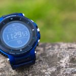 First Look:カシオ PRO TREK Smart WSD-F30最速レビュー 前モデルから何が新しくなったのか?
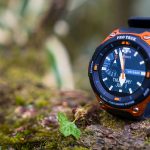 Review:気がついたら手放せない、カシオ PRO TREK Smart WSD-F20をアウトドアで100%使いこなすためのコツとポイント