A journey to the US National Parks (27): A spectacular trail overlooking the forests of giant trees and the beautiful Sierra Nevada mountain range. Sequoia and Kings Canyon National Parks
Written by Sayaka Kato
Following on from our previous hiking route in Kings Canyon National Park, this time we'll be introducing some beautiful hiking trails in Sequoia National Park, which is located in the same area
Sequoia National Park is located adjacent to Kings Canyon National Park, which we introduced last time, and this area is also a national park with equally wonderful hiking trails
Last time, we walked along a beautiful river and through a valley to see a waterfall, but this time we'll walk while looking at the beautiful Sierra Nevada mountain range
Just before the trailhead, there is a spot where many famous giant trees, giant sequoias, grow, so if you have time, it's a good idea to check them out as well. The General Sherman Tree (31 meters in diameter, 84 meters in height, etc.)
This course is a day hike, but it is long and has a lot of elevation change, so it is recommended for those with good stamina, and at an intermediate level or above
This course is also full of highlights!
You'll start in the forest, then move on to an area overlooking the beautiful Sierra Nevada mountains, and eventually reach the peak of the High Sierra Nevada.If you're lucky, you might encounter wild animals such as deer and marmots, as well as a variety of alpine plants along the way
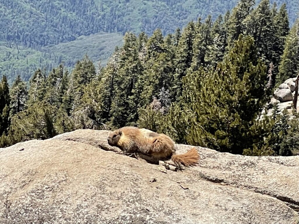
table of contents
Sequoia National Park Alta Peak Trail Hiking Information
How to get to the park
Approximately 5 hours (approximately 380km) from San Francisco and Los Angeles
If you are heading from San Francisco, the route to the entrance to both Kings Canyon National Park and Sequoia National Park is almost the same
After the entrance gate to the national park, the road splits into two. If you go left, you will head towards Kings Canyon, and if you go right, you will head towards Sequoia
There is no signal within the park, so it will be easier if you download the places you want to go to your GPS in advance
Useful items to bring with you on a hike
As for what to bring, as always, prepare the same equipment as you would for a typical hike in the United States
- Drinks (more in summer, 4 liters or more recommended)
- Temperature-adjustable winter clothing
- hat
- sunglasses
- sunscreen
- Snacks to eat during the hike
- If you have any regular medications, bring first aid such as medicines and bandages
- Other than that, your favorite hiking gear
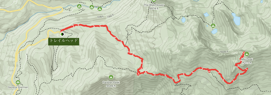
Trail Data
- For intermediate and above
- Season: March to September
- Trailhead elevation: Approximately 2,220m
- Round trip: Approximately 24km (15 miles)
- Height difference: Approximately 1,240m (4,064 ft)
- Course time: 8 to 10 hours round trip (including breaks)
Access (by car to the trailhead)
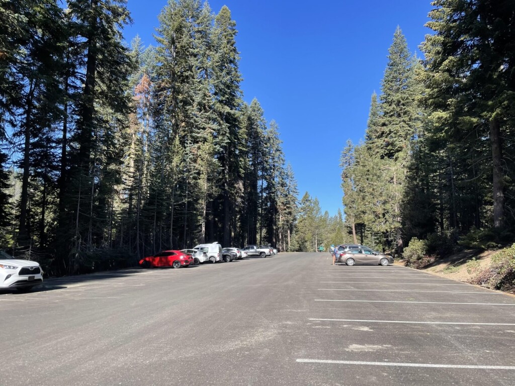
ALTA PEAK TRAILHEAD or WOLVERTON PICNIC AREA (large parking lot available)
Enter this into your GPS and you'll arrive at the trailhead
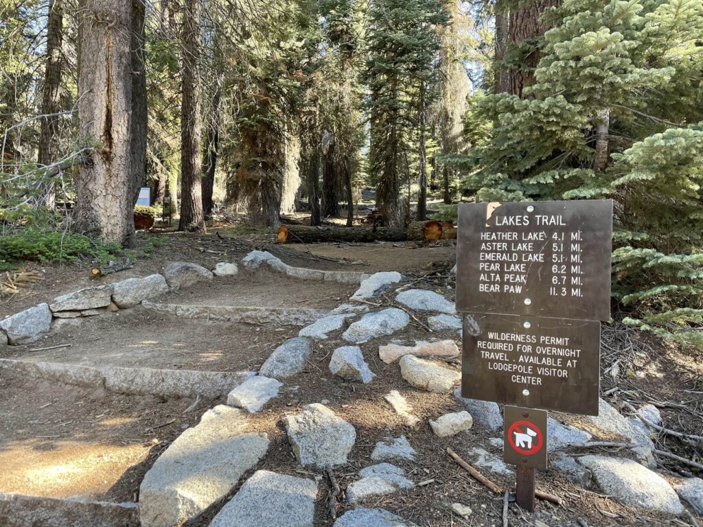
There is a large parking lot and restrooms at the trailhead. Some backpackers use this parking lot as their base, so you can see people eating breakfast at the tables in the parking lot and hikers preparing for their long journey
The photo below was taken at 8:30am on a weekday in late May. There was plenty of space in the parking lot
Start hiking from the trailhead
The trail starts right next to the parking lot. Once you're ready, it's time to head out
The fresh greenery is vibrant and it's a really pleasant trail
A fast and powerful hiker behind me passed me!
I'm always impressed by how fast the pace is, but today's trail is long and the second half is steep, so I'll enjoy hiking at my own pace without breaking my pace
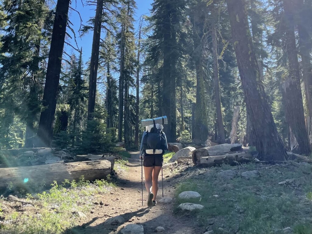
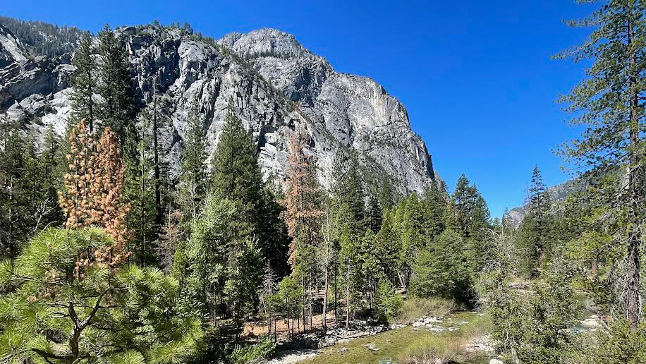
The first half of the walk will take you through a forest full of trees
We even met a family of deer along the way. It was a very peaceful space
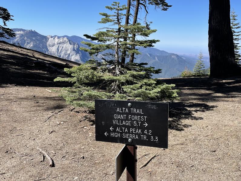
About 40 minutes after starting, you will come to a fork in the trail. Continue towards ALTA PEAK
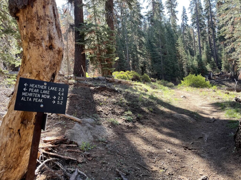
An hour after starting, you will come across a second fork, also heading towards ALTA PEAK
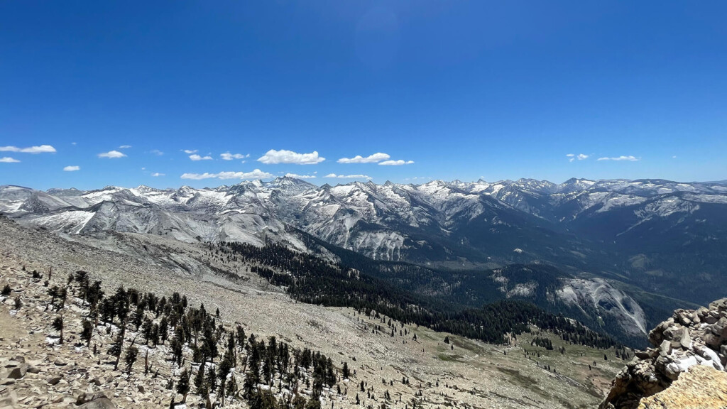
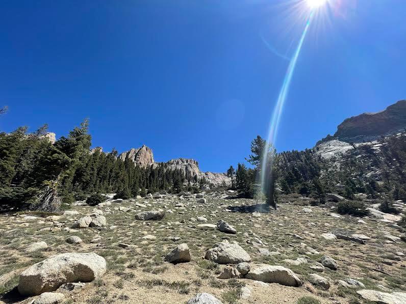
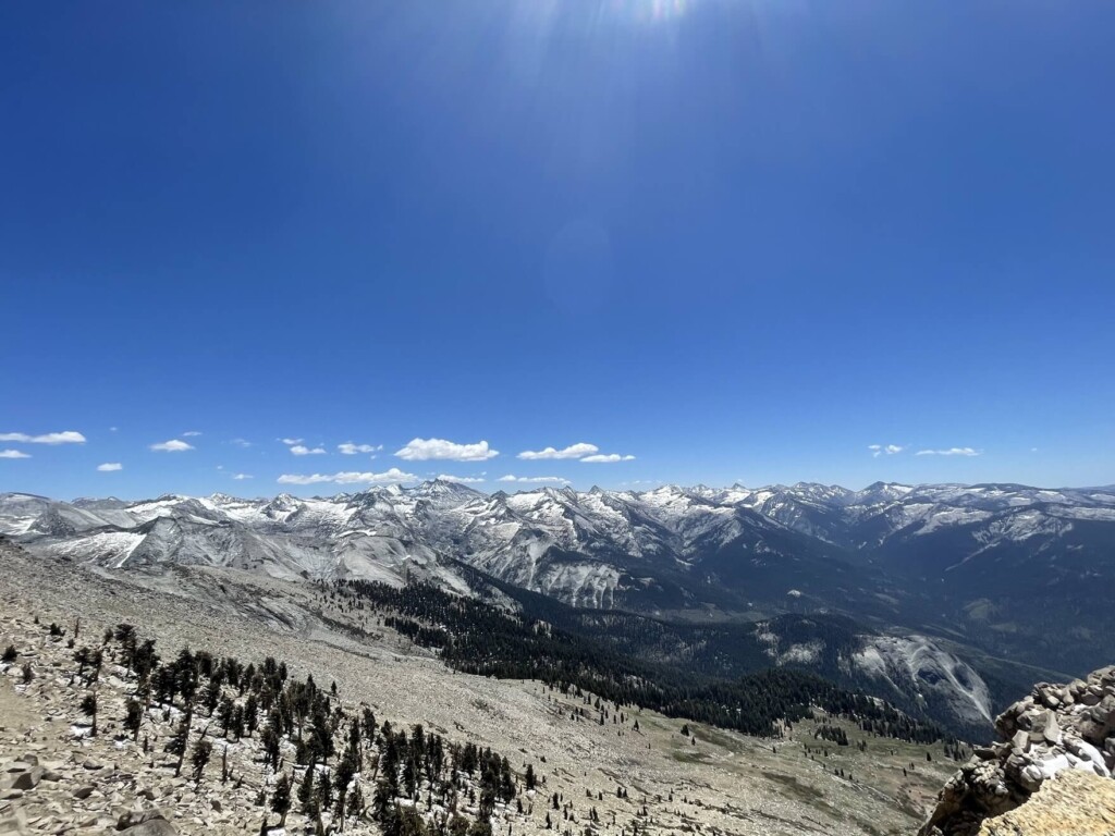
From this point on, the view opens up and the forest scenery changes to a panoramic view of the Sierra Nevada Mountains
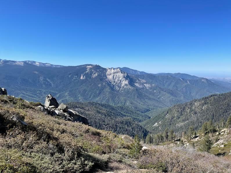
The fresh air is soothing and the beautiful scenery refreshes the soul
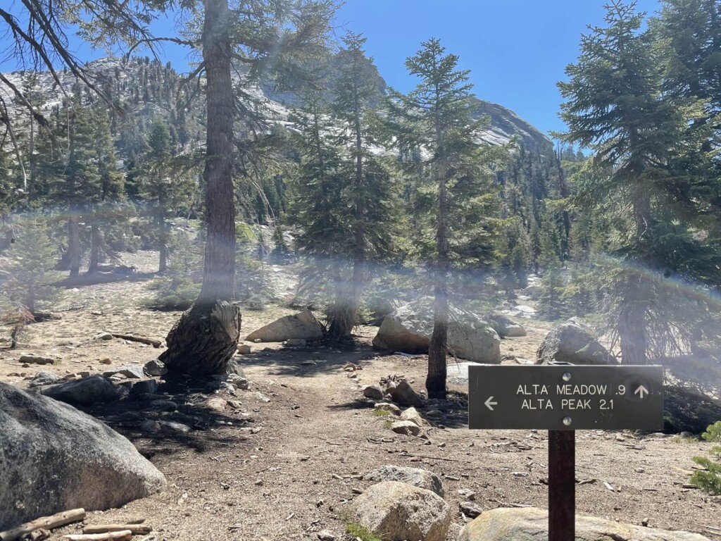
Continue on, admiring the beautiful snow-capped Sierra Nevada Mountains, and about two hours after starting, you'll come to another fork in the road. Head left towards ALTA PEAK
From here, there are 2.1 miles (3.36 km) left
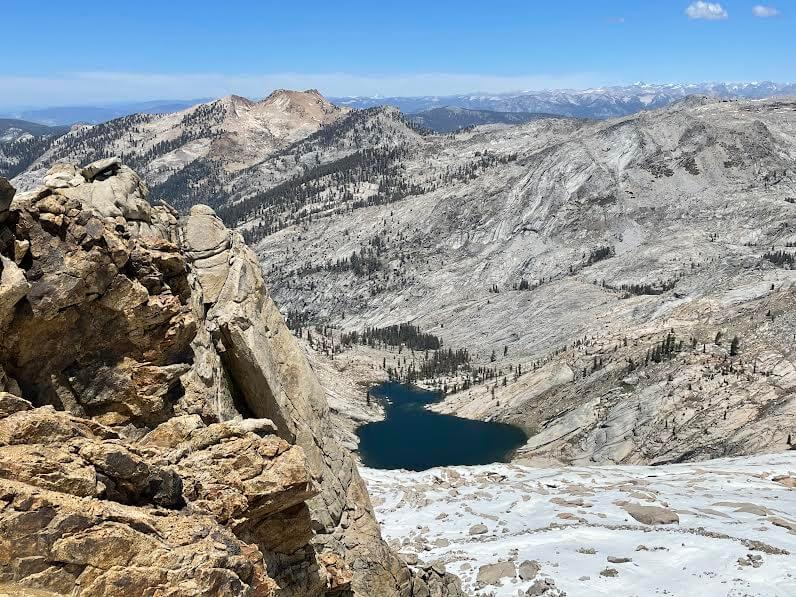
The scenery gradually changes to a rocky landscape, and the summit comes into view
This is the crucial moment. The slope continues
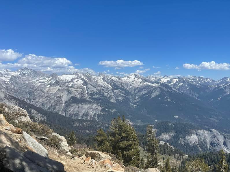
The beautiful mountain scenery is quickly replaced by cliffs of rock
We were also able to see marmots, which live in high altitude areas, basking in the sun in front of the magnificent view
Meltwater from the mountains flows down everywhere, and the crystal clear, sparkling water is truly a blessing from nature
We continue on, soothed by the clear water of the river, the sound of the babbling brook, and the sounds of the birds
You will hardly encounter any other hikers and will feel completely immersed in nature
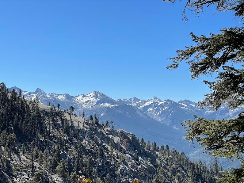
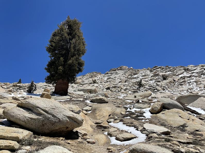
As we continue to climb higher, we approach the tree line and the trees almost disappear, and we can still see some snow remaining
Although you are surrounded by beautiful scenery, the air is thin, so even while enjoying the view, you may find yourself out of breath

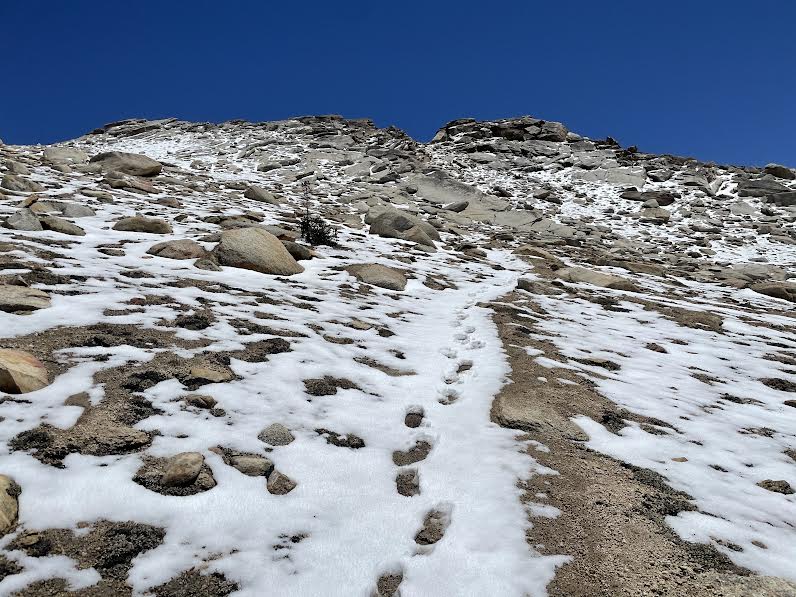
The last mile is where the real effort comes in
It's the steepest slope I've ever climbed. The air is thin! I take breaks as I climb
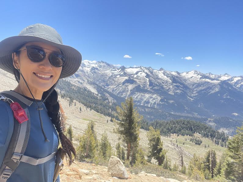
After climbing the last crazy hill, we arrived at Alta Peak about four hours after starting
Altitude approximately 3,420m
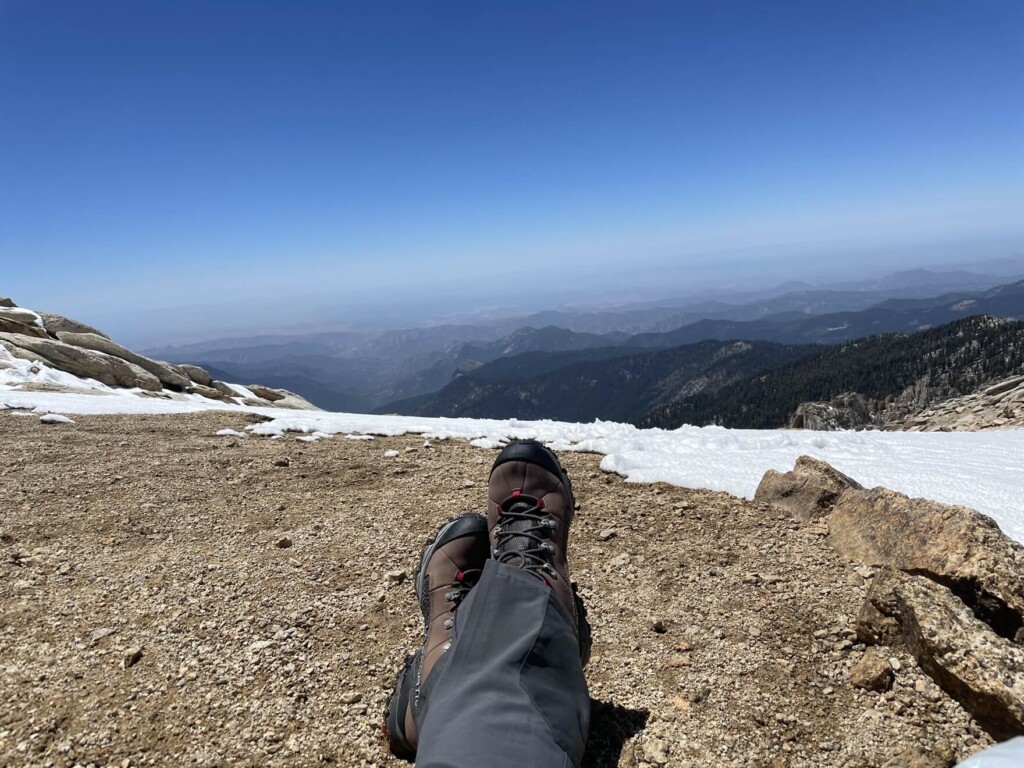
There is no one at the summit, so you have it all to yourself! A spectacular 360-degree view
But first, a break. I took a deep sleep for about 20 minutes to regain the energy I used up on the last sprint up the crazy steep slope after arriving
Very refreshing. It's the best
Twenty minutes later, two veteran hikers, Kevin and Kurt, came up the mountain and greeted me with typical American friendliness, saying something like, "Hello, friend! You came alone? You're doing great!"
Not just on this trail, but many hikers I meet while hiking in America are very friendly and will talk to me casually. We share our love of the outdoors, so I feel a sense of closeness, and sometimes we have lively conversations as we share our experiences and situations. I think moments like these are also part of the fun of hiking
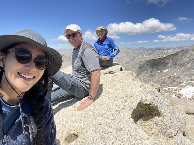
When you reach the summit of Alta Peak, there is a large rock, and if you climb it, you will have "summited." Kevin and Kurt told me this. So I climbed the rock right away, and there was a small green box with a notepad inside. You can leave your signature or a message of your choice there. Once you do that, you will have completed your summit
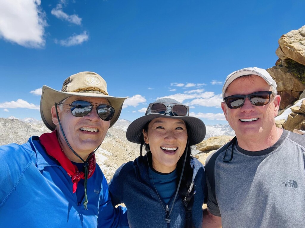
This time, we had a great conversation with the two people we met at the summit and rested for an hour and a half, then said our goodbyes and headed back down the way we came. It's a full-day course that takes more than eight hours including breaks, but it's a full-scale hiking course perfect for summer. On the way back down, it took nearly three hours. It's a wonderful trail that gives you a great sense of accomplishment
It's less well-known than Yosemite National Park, but that's its charm. There are fewer people and there are plenty of hiking trails where you can enjoy the beautiful scenery. It's a great place for outdoor enthusiasts and hiking fans. It's also a great location for spending two or three days in nature, camping or backpacking
Precautions regarding the spread of COVID-19
As of November 2021, various countries are currently implementing various restrictions, including entry restrictions due to strengthened quarantine measures, restrictions on entry to national parks, and domestic travel restrictions. These conditions are subject to change without notice, so when traveling, be sure to obtain local information from each country's embassy or consulate, the Ministry of Foreign Affairs' Overseas Safety Website (Infectious Disease Risk Information), national park websites, and other sources, and check information on transit points, the country you plan to travel to, and the areas around the places you plan to visit before making reasonable plans and taking action
Sayaka Kato
 Leave your California hiking and travel plans to us. Influenced by my father, I've always loved outdoor activities, and while living in Japan, I started hiking and touring national parks, which fascinated me with the natural beauty of America and Canada, ultimately leading me to my dream of visiting the United States. I currently run ANAMI TOURS, which offers local optional tours created together with customers, such as completely private hiking tours with Japanese guides. I'll introduce you to special options that I know only because I live in the area. If you're interested, please visit the website below
Related reading
 Can you die without walking? A Journey to the American National Parks (26) A breathtaking valley in the depths of a forest of giant trees Sequoia and Kings Canyon National Parks
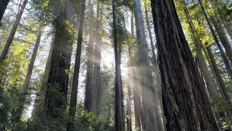 Can you die without walking? A Journey to the American National Parks (20) Redwood National and State Parks: An ancient forest with trees over 1,500 years old
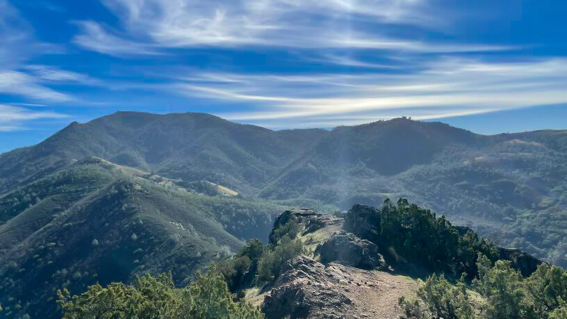 Can you die without walking? A Journey to the US National Parks (19) Mount Diablo State Park, a Famous Peak in the Bay Area of California
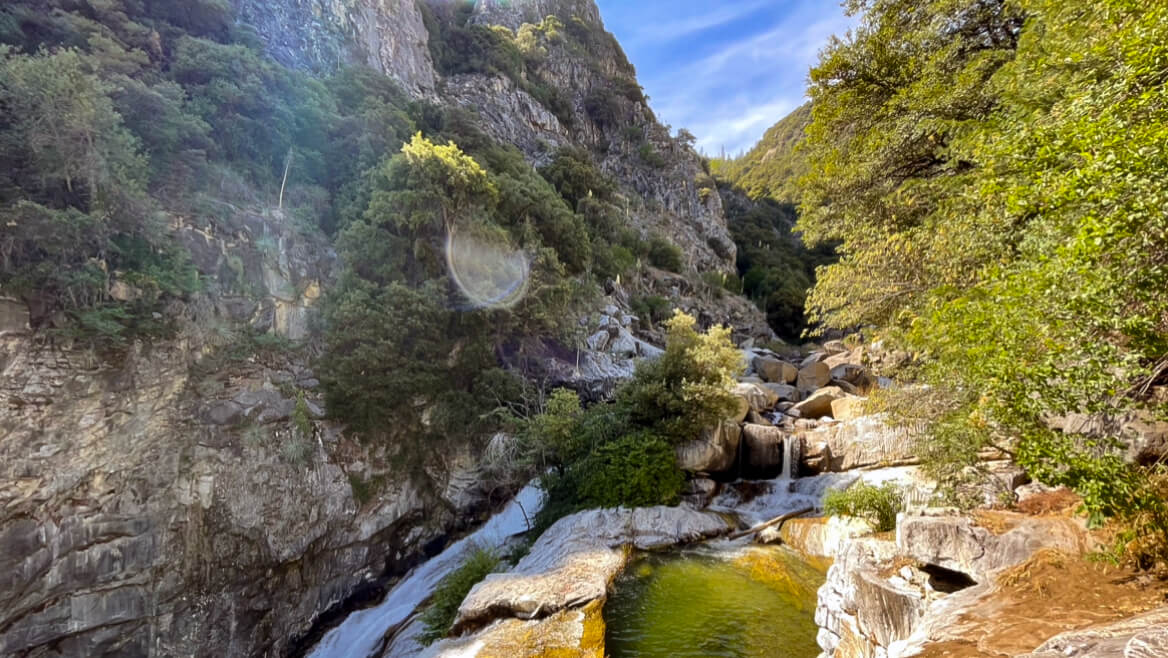 Can you die without walking? A trip to the US National Parks (28) See the waterfalls flowing through the glittering marble (Sequoia National Park)