Can you die without walking? A trip to the US National Parks (29) Paradise Trail with swimming in the lake, a scenic hiking trail in the Lake Tahoe area
Written by Sayaka Kato
Lake Swimming Paradise Trail
This time, we'll be introducing hiking routes in the Lake Tahoe area for the first time in a while
Lake Tahoe is a popular and well-known local destination, offering hiking and water activities in the summer and skiing and other winter activities in the winter
Lake Tahoe itself is a beautiful lake, but the countless hiking trails surrounding it continue to attract hikers
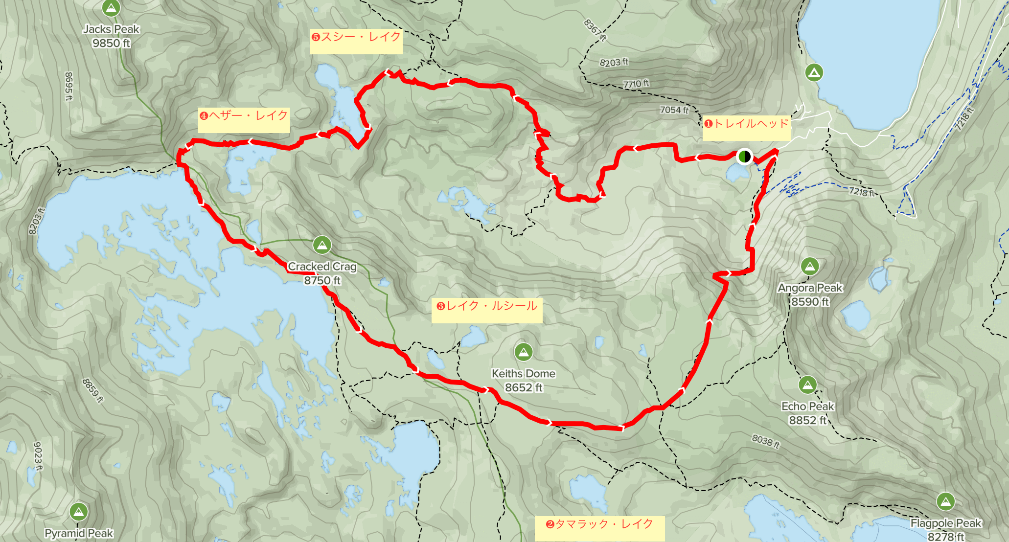
This time, we will introduce the hiking trail "Glen Alpine Loop" in South Lake Tahoe
This trail is a hiking route that takes you to beautiful lakes including Lake Aloha, Heather Lake, and Susie Lake, as well as magnificent scenery

table of contents
South Lake Tahoe Glen Alpine Loop Hiking Information
Trail Data
- For intermediate and above
- Trailhead elevation: 1814m
- Round trip: Approximately 21 km (13.5 miles)
- Height difference: approx. 697m (2,290 ft)
- Course time: 7 to 10 hours round trip (including breaks)
The route we will introduce is a trail for intermediate to advanced runners with good physical fitness, but you can adjust the length and level of your hike by adjusting the distance
Useful items to bring with you on a hike
As for what to bring, as always, prepare the same equipment as you would for a typical hike in the United States
- Drinks (more in summer, 3 liters or more recommended)
- Temperature-adjustable winter clothing
- hat
- sunglasses
- sunscreen
- Snacks to eat during the hike
- If you have any regular medications, bring first aid such as medicines and bandages
- Other than that, bring your favorite hiking gear (swimsuit and sandals are useful if you plan on swimming)
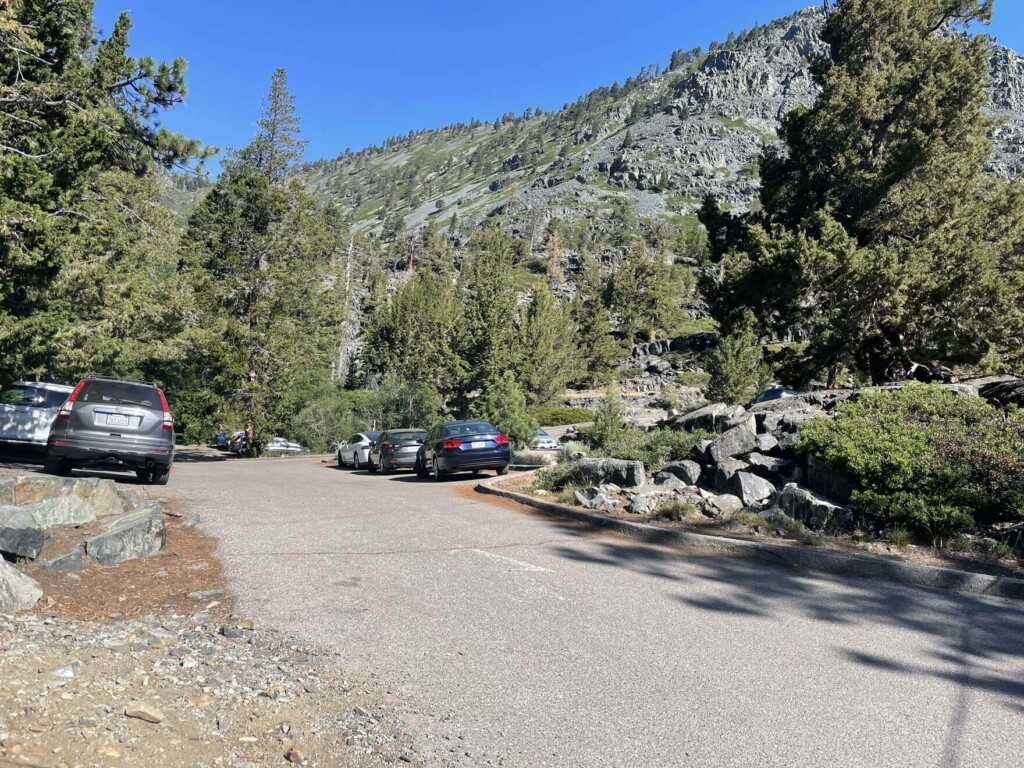
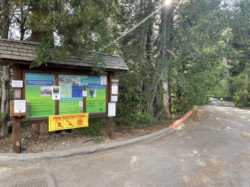
Access to the trailhead (by car)
Fallen Leaf Lake, Glen Alpine Rd, South Lake Tahoe, CA 96150
Enter this into your GPS and you'll arrive at the trailhead
Just a tip: You'll be driving on a gravel road for a few kilometers before the trailhead, so a 4WD is recommended. It's perfectly fine if you don't have a 4WD, but the road conditions are poor and the roads can get narrow, so it's best to go slowly
Several hiking routes start from this trailhead, so the parking lot fills up quickly, especially in the summer. I was able to park when I arrived around 9am on a weekday at the end of June. There were also several cars parked on the side of the road nearby. There are restrooms available
Normally, we recommend going counterclockwise from the trailhead, but this time we will write about the clockwise route. (You can go either way.)
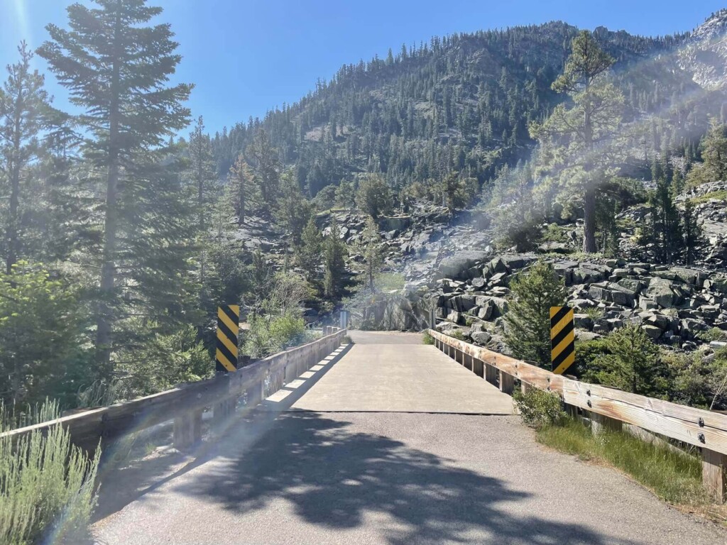
Returning to the parking lot entrance, you will soon come across a bridge, with Lily Lake on your right
After crossing the bridge, continue a short distance to the trailhead on the right. There will be signs pointing you in the direction of the Tamarack Trail. Today, we will start on the Tamarack Trail and head toward Tamarack Lake (Map 2)
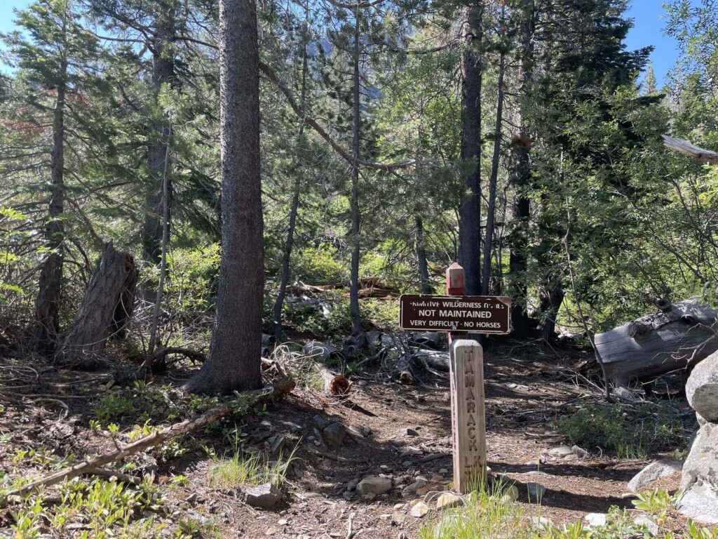
(The first few kilometers of this clockwise route are on an unmaintained trail with poor footing and narrow paths, so we recommend downloading the route in advance onto a GPS or similar device.)

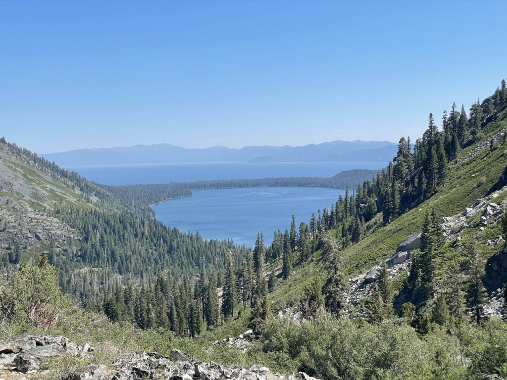
As you continue to climb, the trail gradually becomes more stony and steep. This area requires some physical strength, but if you look back, you'll see beautiful views of Lake Tahoe and Fallen Leaf Lake just before it
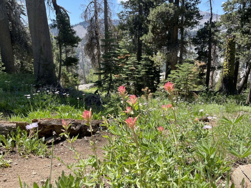
We continued on, taking breaks along the way. It was the perfect time to visit the beautiful alpine plants
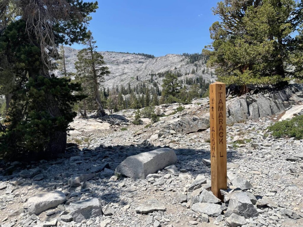
If you go further, you will see a sign for the Tamarack Lake turnoff. Head towards Tamarack Lake
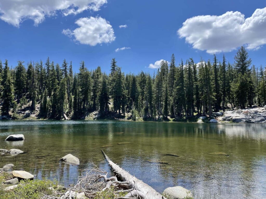
First, we will visit Tamarack Lake (Map 2), one of the many lakes
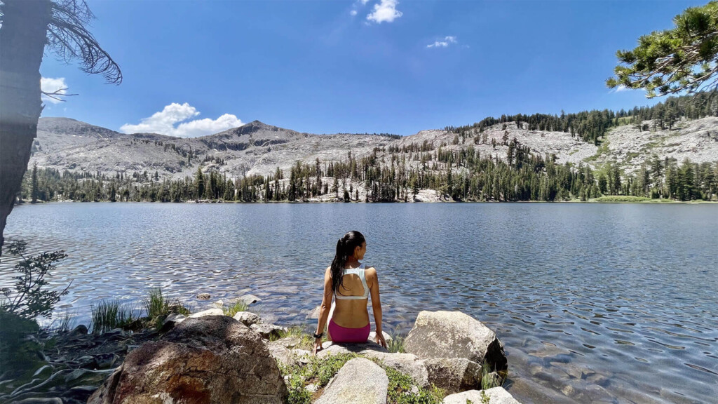
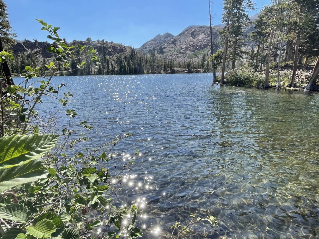
As we headed towards Tamarack Lake, we came across a beautiful, crystal clear lake at the end of the road
And there were hardly any people there, so it was almost like we had the place to ourselves
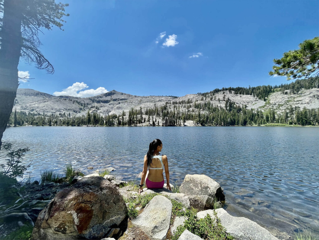
With such a beautiful lake, there was no reason not to take a swim, so I decided to take a dip
It's a truly precious space where you can blend into nature. It's the perfect activity for a hot summer day, especially as a break during a hike. It's a must-try for anyone who loves swimming. It's also a good idea to bring sandals or water activity shoes, as well as a small towel that won't become too bulky
After a quick swim and a rest, we headed back down the trail, returning to the fork where we came in and continuing in the direction of Lake Aloha
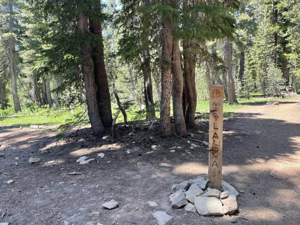
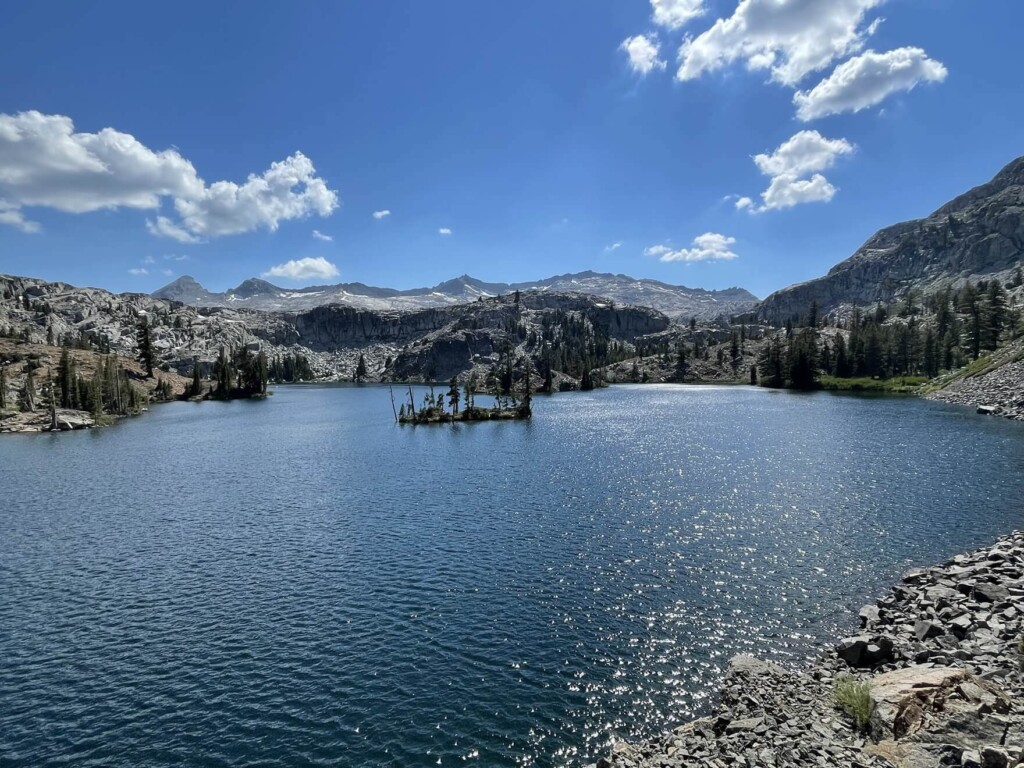
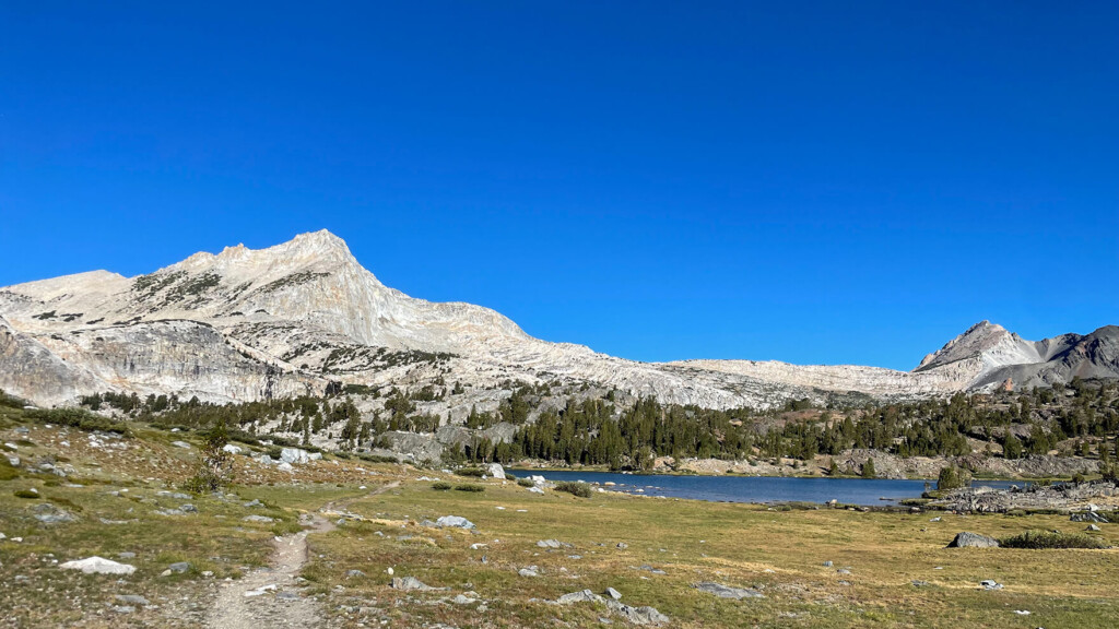
There are forks in the road along the way, but the halfway point and highlight of the day is Lake Aloha. Whenever you see signs, always head toward Helei Kualoha
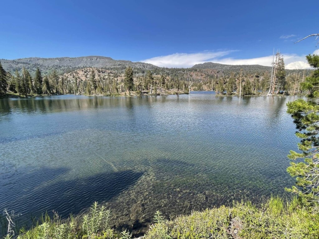
There are lakes of various sizes everywhere, so where to go depends on your energy and time on that day, but I wanted to see and swim in as many lakes as possible, so I decided to stop by Lake Lucille (Map 3), just before Lake Aloha
It is located at the far right of the trail, so be careful not to miss the entrance and turn right at the fork (taking the Margery Trail). Continue down the trail and you will see it
Lake Lucille (Map 3)
There is no one here either. It is just us and nature. We take a break in a quiet space surrounded by nature, and in a beautiful, crystal clear water
Of course, we swam here too
After enjoying the quiet time, head back to the main trail to Lake Aloha. On the way back, you'll see the slightly smaller Lake Margery along the Margery Trail
This is also great
There is no one here
If I wasn't in a hurry I would have liked to swim, but I'm not even halfway there yet so I move on
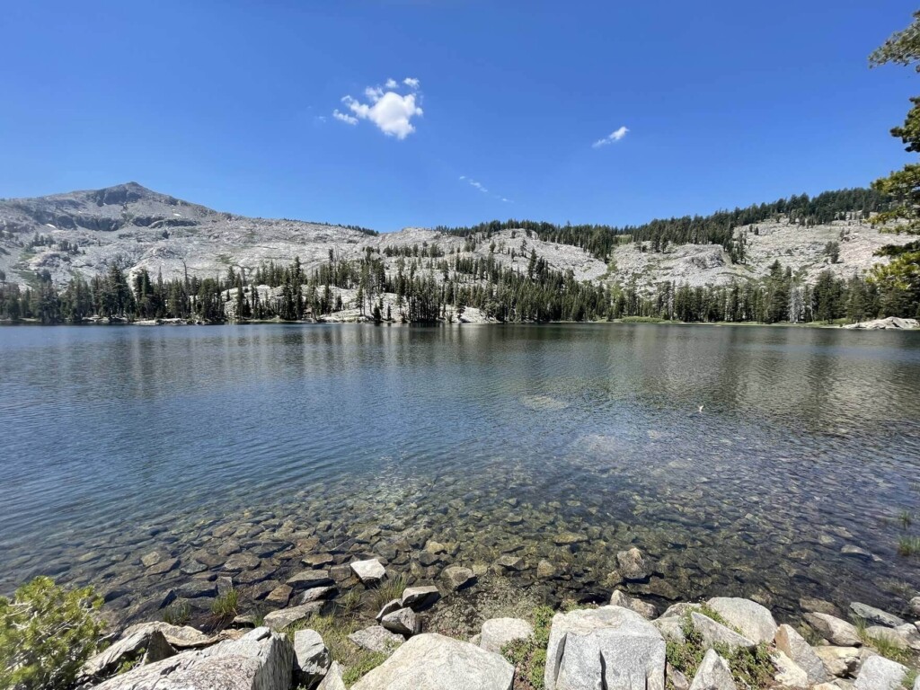
Return to the main trail and continue a little further until you see Lake Aloha on your left
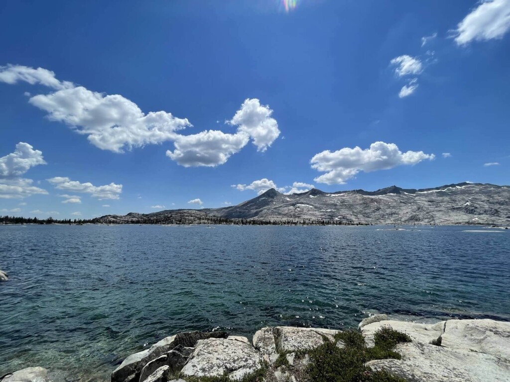
It is by far the largest lake compared to the other lakes on the trail, and its sparkling emerald green color is truly beautiful
There are many areas to rest along the lake, so find your favorite spot and have lunch there
Many people were swimming and sunbathing in the lake, and we could see people camping by the lakeside in tents
It's the perfect place for a hot day, an oasis in the mountains
In August, the meltwater decreases and the water level drops, so although it depends on the year, I think the best season is from May to July when the water level is high
Surrounded by beautiful mountains, it's a place you can only reach by walking, so it's not an easy view or place to see. That's what's great about it. Even though there are a lot of people, the lake itself is large, so you can easily find a quiet spot or a place to rest
This location and atmosphere is hard to find in Japan. I took a leisurely rest here and decided to continue on once I had regained my strength. I was still at the halfway point, so I still had a lot of walking to do
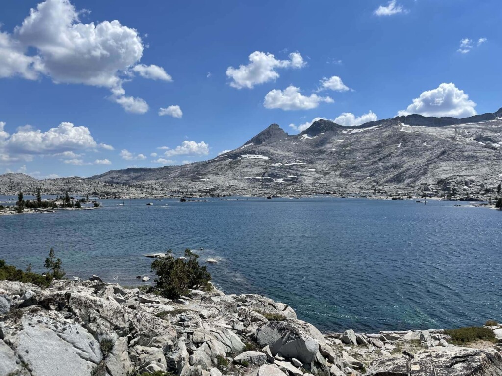
Keep walking along Lake Aloha on your left, then descend until you come across another lake on your right, Heather Lake (Map 4). The views from here are also amazing
The lake is surrounded by mountains and the sunlight reflects off the lake surface, creating a truly beautiful sight
No matter which lake you visit, you always hear the words, "It's beautiful." It's truly a luxury to be able to see so many lakes in one hike
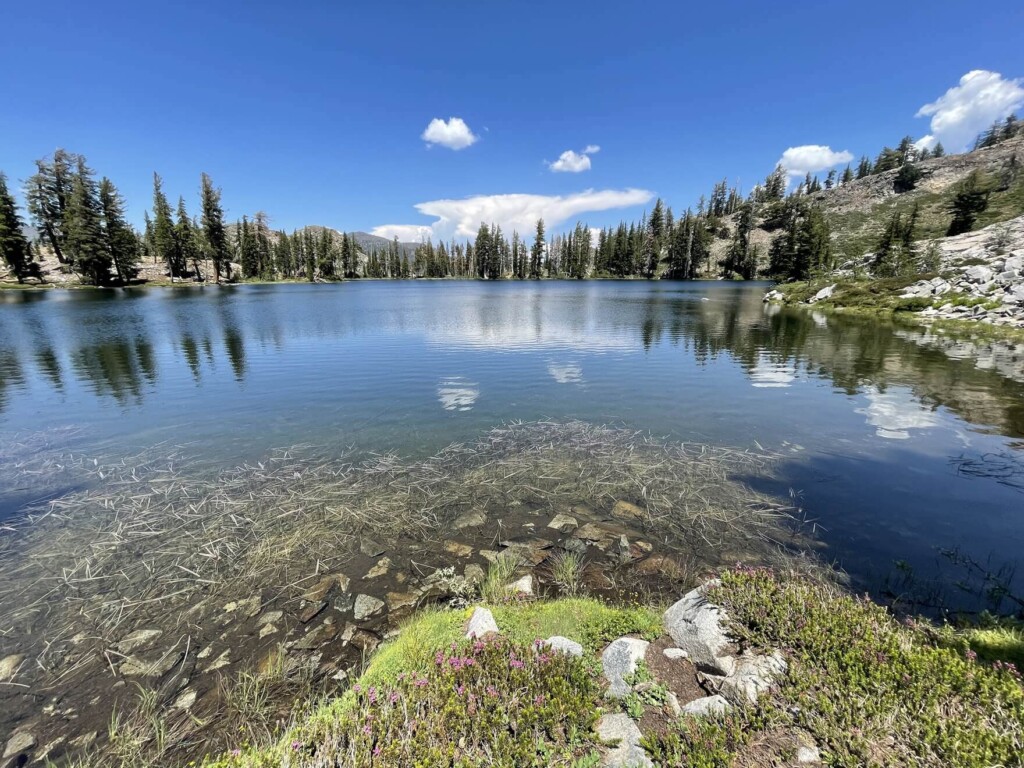
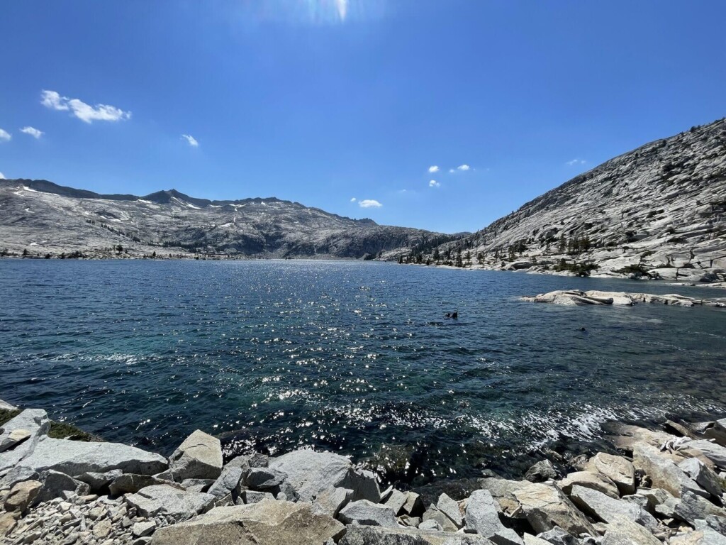
If you go down further, you will see Susie Lake (Map 5) in the distance on your left
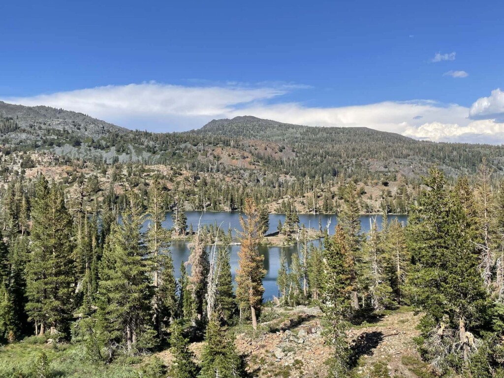
As you walk along the trail and approach the lake, you will see something like this. This is also a large lake
I felt like swimming here too, but due to time constraints I decided to move on
It's a very quiet space, with only the sounds of birds and the wind. There were some people camping by the lake, and it would be amazing to camp in a place like this
As we left Sussie Lake (Map 5), we imagined how beautiful the starry sky must be
This Sussy Lake is the last lake on the trail today, and from there we just keep going to the trailhead
This trail has many beautiful spots where you'll want to spend time, including swimming, during the hike, so it's best to set aside plenty of time.If you visit during the summer months of June to August, the days are long and you can spend the whole day hiking from morning until night
It's best to start hiking early in the morning and spend plenty of time at the lakes. I swam in two lakes and took a few breaks, which took me a total of nine hours. Make sure you give yourself plenty of time
We returned safely to the trailhead
Although it's not a short day trip, it's a wonderful trail with spectacular views that can only be seen by walking, and beautiful lakes quietly scattered among the mountains. I hope you'll join me on a hike someday. There are also many other paradises that are difficult to reach on regular tours, and are only accessible to locals
Precautions regarding the spread of COVID-19
As of February 2022, various situations may be in place in various countries, including entry restrictions due to strengthened quarantine measures, restrictions on entry to national parks, and restrictions on domestic travel. These conditions may change without notice, so when traveling, be sure to obtain local information from each country's embassy or consulate, the Ministry of Foreign Affairs' Overseas Safety Website (Infectious Disease Risk Information), national park websites, and other sources, and check information on transit points, countries you plan to travel to, and the areas around the places you plan to visit before making reasonable plans and taking action
Sayaka Kato
 Leave your California hiking and travel plans to us. Influenced by my father, I've always loved outdoor activities, and while living in Japan, I started hiking and touring national parks, which fascinated me with the natural beauty of America and Canada, ultimately leading me to my dream of visiting the United States. I currently run ANAMI TOURS, which offers local optional tours created together with customers, such as completely private hiking tours with Japanese guides. I'll introduce you to special options that I know only because I live in the area. If you're interested, please visit the website below
Related reading
 Twenty Lakes Basin Loop Trail: A wonderful trail offering spectacular views of the beautiful mountains of the East Sierra Nevada Mountains [A trip to the US National Parks (37)]
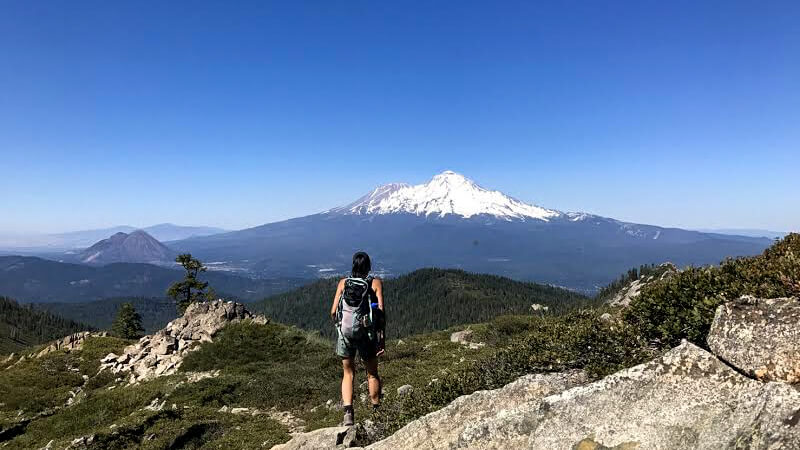 Can you die without walking? A Journey to the American National Parks (23) The Jewel of Mt. Shasta ~Castle Lake~
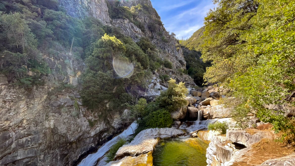 Can you die without walking? A trip to the US National Parks (28) See the waterfalls flowing through the glittering marble (Sequoia National Park)
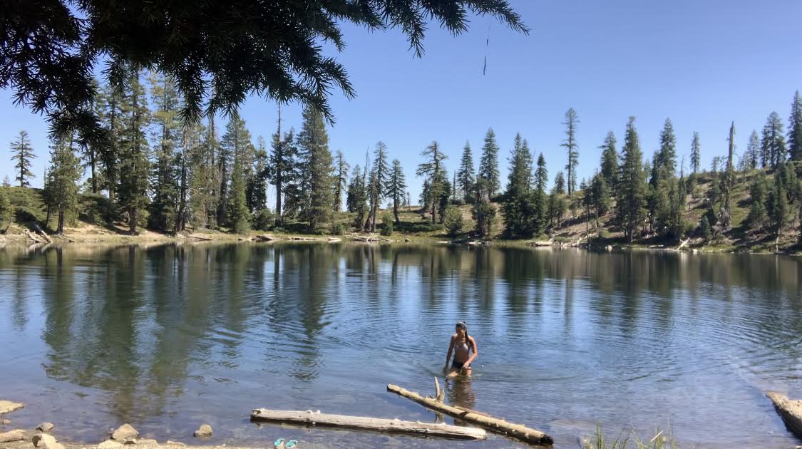 Can you die without walking? A trip to the US National Parks (15) Enjoy the crystal clear lakes with your whole body. Seven Lakes/Lake Helen Hike