Can't die without walking? A trip to the US National Parks (9) A full-on experience! Clouds Rest Trail: Enjoy the 360-degree panoramic view of Yosemite right before your eyes
Written by Sayaka Kato
This trail is called "Clouds' Rest" or "Clouds' Rest Area." Perhaps it was named this way because it's a place where the clouds floating across the vast sky want to stop and take a rest
Among the many trails in Yosemite, this trail is famous for its beautiful 360-degree mountain views and wide-ranging views of the rocky mountains of Yosemite National Park. It continues to attract many hikers from all over the world, and is known for having many repeat visitors
It's not an easy trail, taking about four hours to go there and three hours to go back, and it's over 3,000m high, with a thrilling cliff at the climax. However, experienced hikers can complete it as a day hike of about ten hours. This is a trail that is definitely worth taking on if you're in good shape
table of contents
The Clouds Rest is a day hiking course packed with the charm of Yosemite
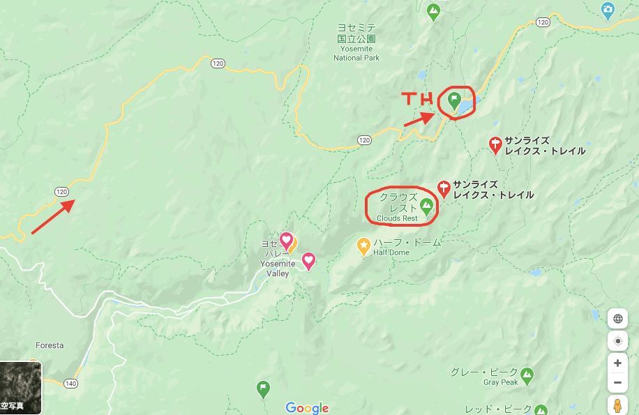
Directions to Yosemite National Park's Clouds Rest Trail
This trail starts from a trailhead along Tioga Road, not towards Yosemite Valley
Compared to Yosemite Valley, this area has fewer tourists and offers a different side to Yosemite. Around June, when the snow melts and the road becomes safe to pass, Tioga Road (California State Route 120) opens, and you can enter this trail
The trails are open and hiking is possible from around June to October (depending on the amount of snowfall that year). For basic information such as an overview of Yosemite National Park, how to get there, and what to bring for hiking, please refer to this past .
Trailhead: Sunrise Lakes trailhead along Tioga Road ("TH" in the photo below)
There is a parking lot at the trailhead, so you can park your car there and start hiking. The parking lot is small and limited, so we recommend arriving at the trailhead early (we recommend arriving by 9:00 AM). There are also restrooms
From San Francisco
- If you enter from the Big Oak NP Flat Entrance on Highway 120, it's about a 55-minute drive to the trailhead
- If you enter from Highway 140, it's about a one-minute drive to the trailhead
Clouds Rest Trail Data
- Distance: 14.5 miles (23.3 km) round trip
- Trailhead elevation: 8,150 feet (2,450 m)
- Clouds Rest Elevation: 9,926 feet (3,025 m)
- Elevation difference: 1,775 feet (540 m)
- Course time: 8 to 10 hours round trip
*If you are hiking in the summer, please bring at least 3.5 to 4 liters of water
Yosemite National Park Clouds Rest Trail Hiking Information
This trail is quite high in altitude, climbing up a rocky mountain at over 3,000m. The closer you get to the summit, the thinner the oxygen becomes, so we recommend walking slowly and taking plenty of water
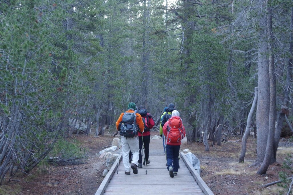
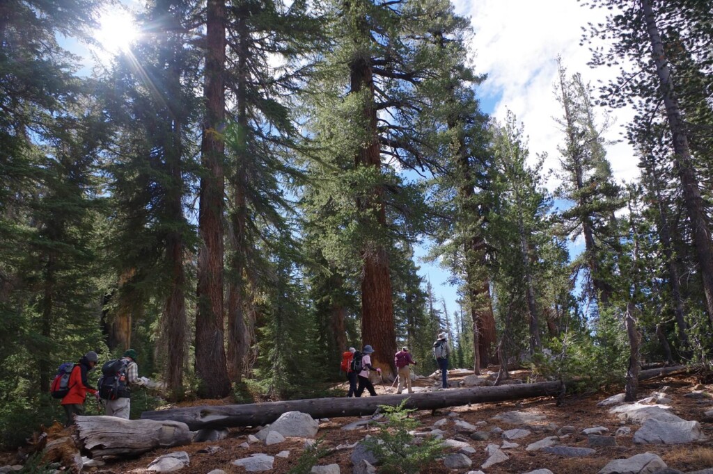
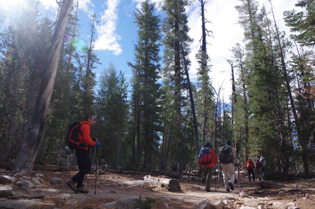
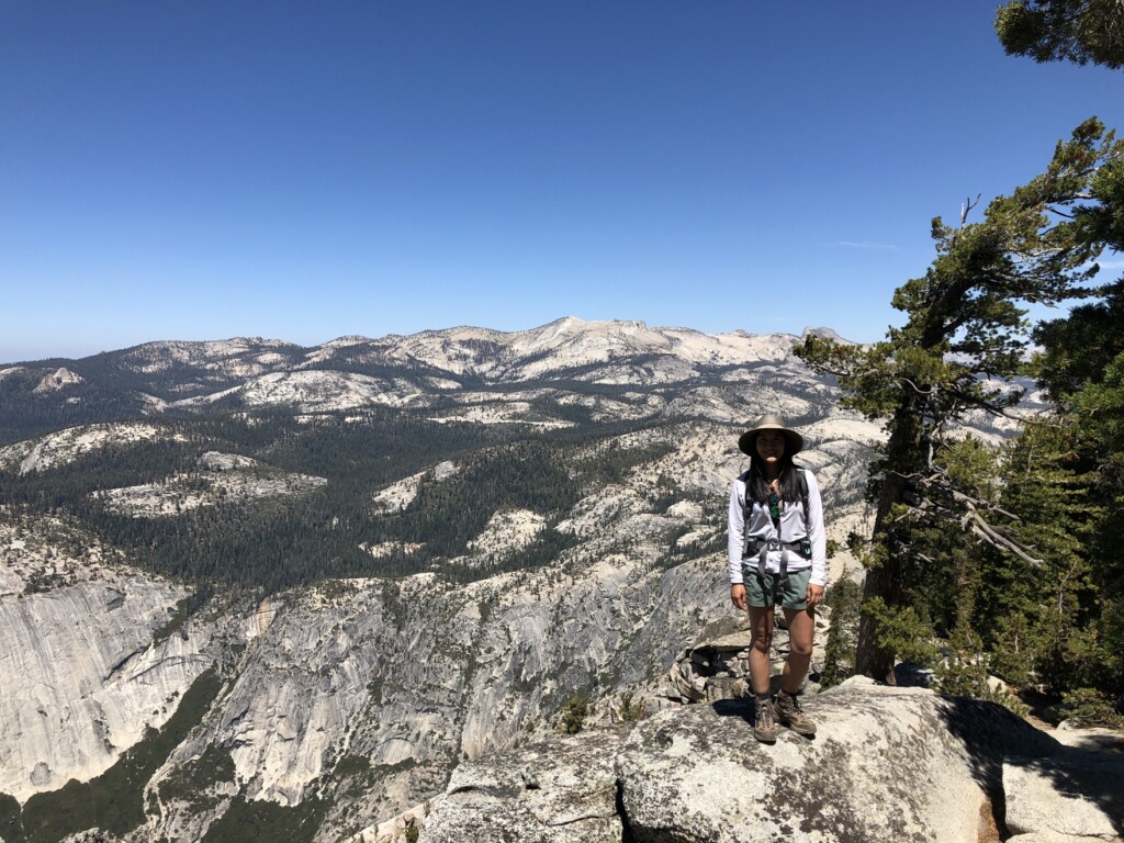
We got ready at the trailhead and were ready to set off (the photo above was taken at 8am in October. The trailhead is at an altitude of 2,450m, so it was cold. We dressed warmly before setting off)
The first 30 minutes are flat and very easy to walk on. But that's where the ease ends
After about 30 minutes of walking, the trail suddenly becomes steep. It's an uphill climb until you reach the fork in the road that leads to Sunrise Lake. This is the most difficult section of the outbound trail
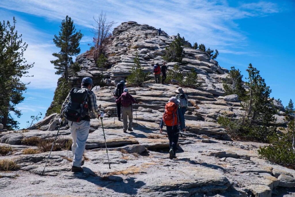
We climb up the zigzag trail
This zigzag route is quite long and quite tough, so be sure to take breaks as you go. The stone steps in the latter half of the route are particularly taxing on your legs
As the altitude increases, you can feel the oxygen getting thinner. If you hurry, it becomes difficult to breathe. So, walk slowly and with control
To reach Clouds Rest, you just have to climb to the top
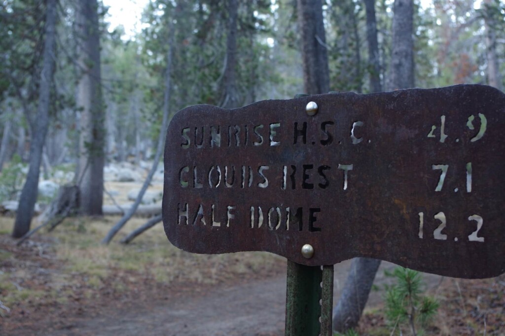
After about two hours, you'll reach the forks to Clouds Rest and Sunrise Lake. There are always signs at the forks, so it's not difficult to get lost
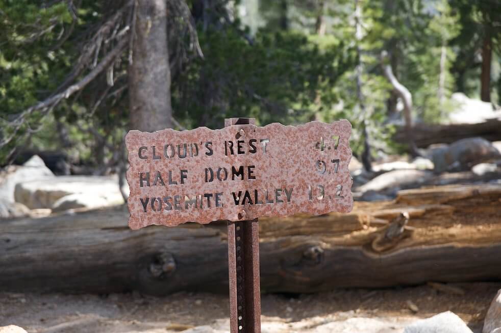
4.7 miles (7.52 km) to the summit
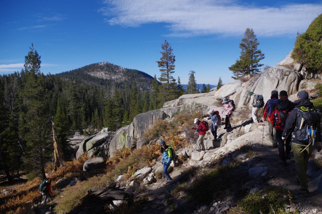
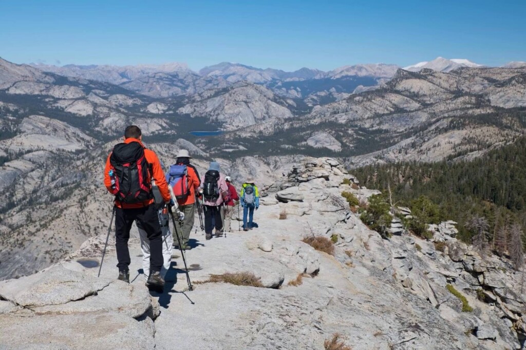
The climb continues, but then there is a long downhill and flat stretch. We start descending along the ridge in the opposite direction
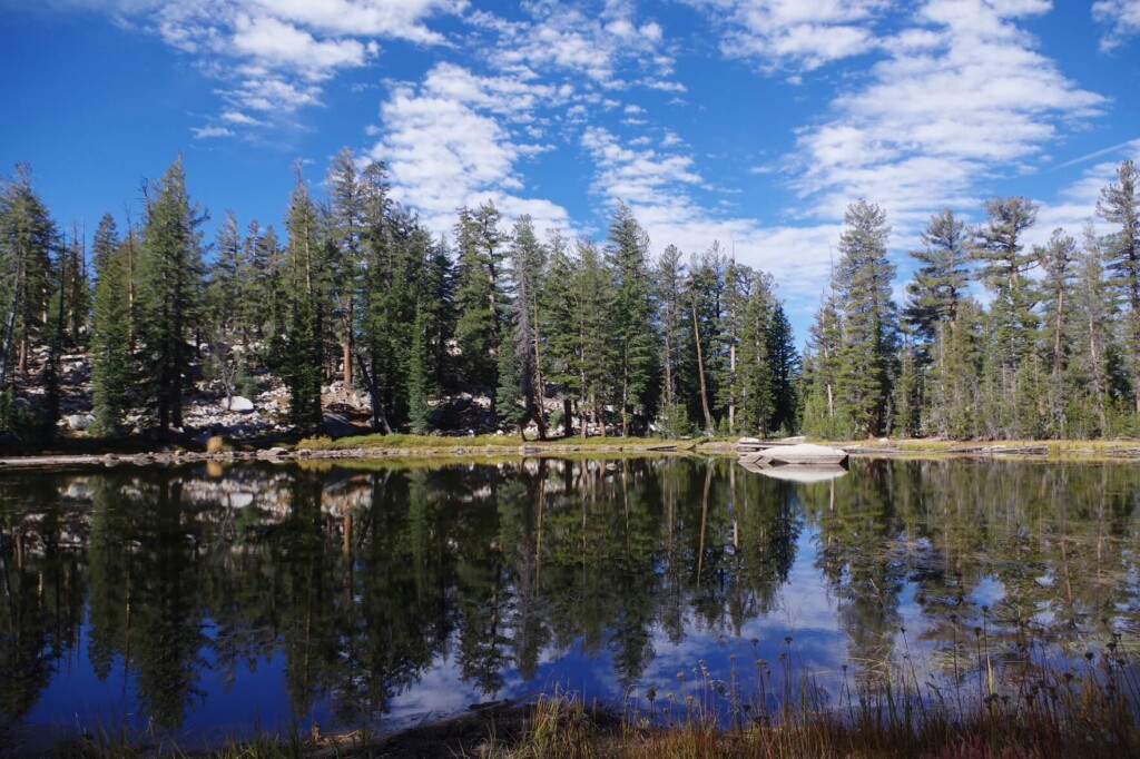
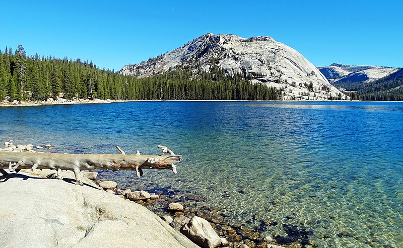
A beautiful lake appears along the way, exactly halfway between the trailhead and the summit, and can be seen on the right side as you move forward
When there is no wind, the water is calm and the surrounding scenery is reflected on the surface like a mirror lake, creating a beautiful scene. Many people take a break here while taking photos
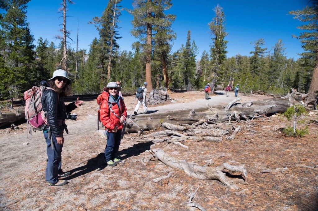
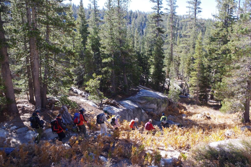
The trail takes you through a forest, and it takes about an hour to get through the forest
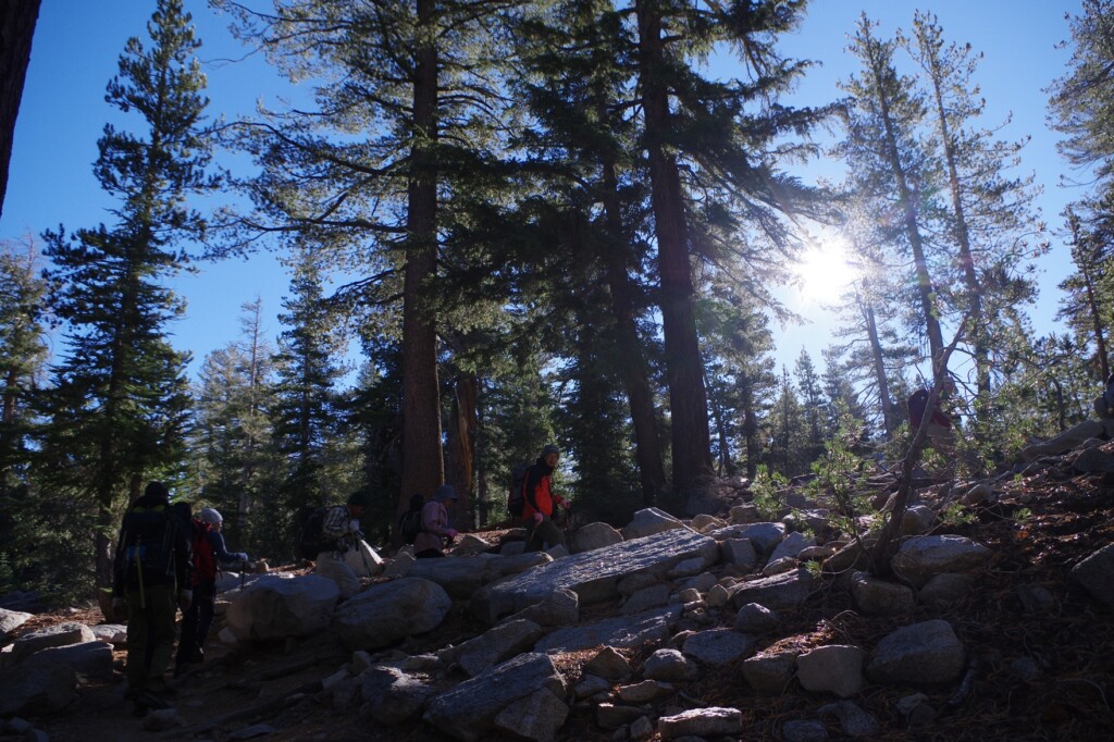
With 2.5 miles remaining, the trail begins to climb again, again on a zigzag path
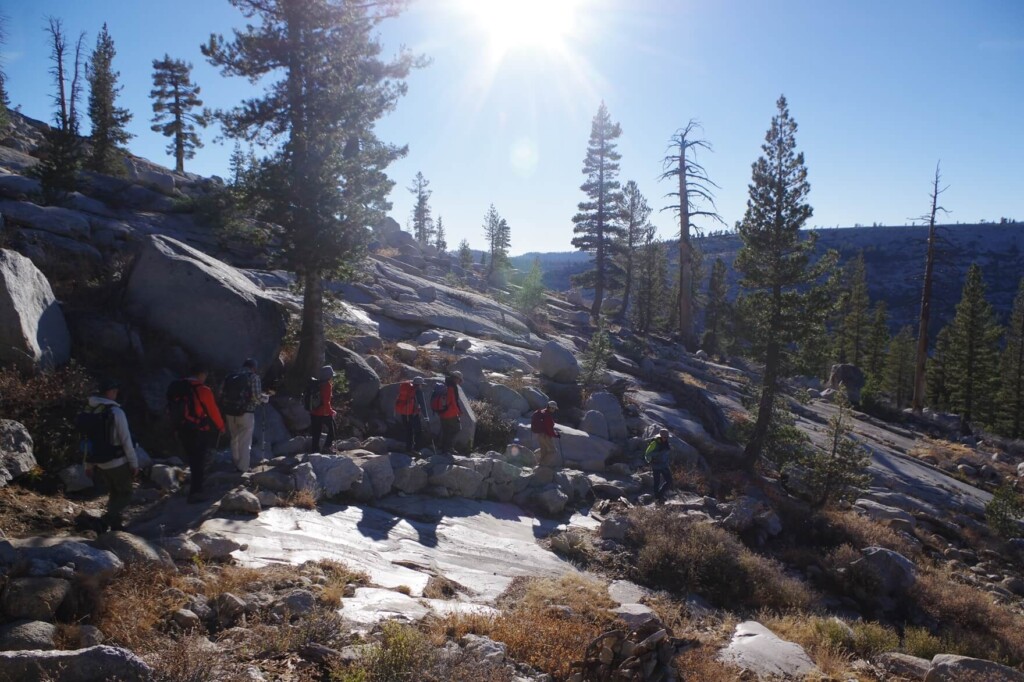
I felt the air getting thinner and the sky gradually widened
Walking slowly and controlled without rushing will help you acclimatize to the altitude and avoid altitude sickness such as headaches and nausea, so try to walk at a slow, steady pace. Halfway through, you will leave the forest and emerge onto rocks, so although it is an uphill path, the summit is in sight
The goal getting closer and closer is motivating
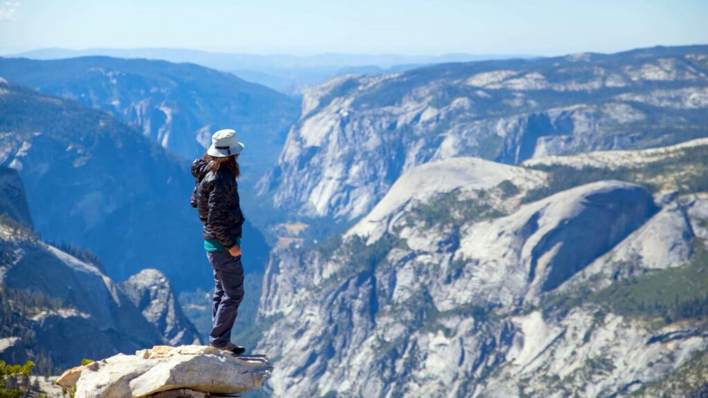
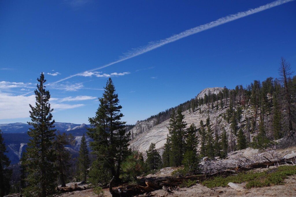
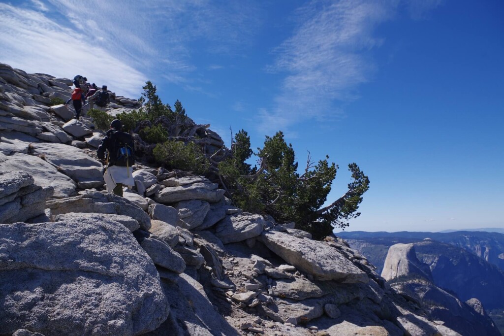
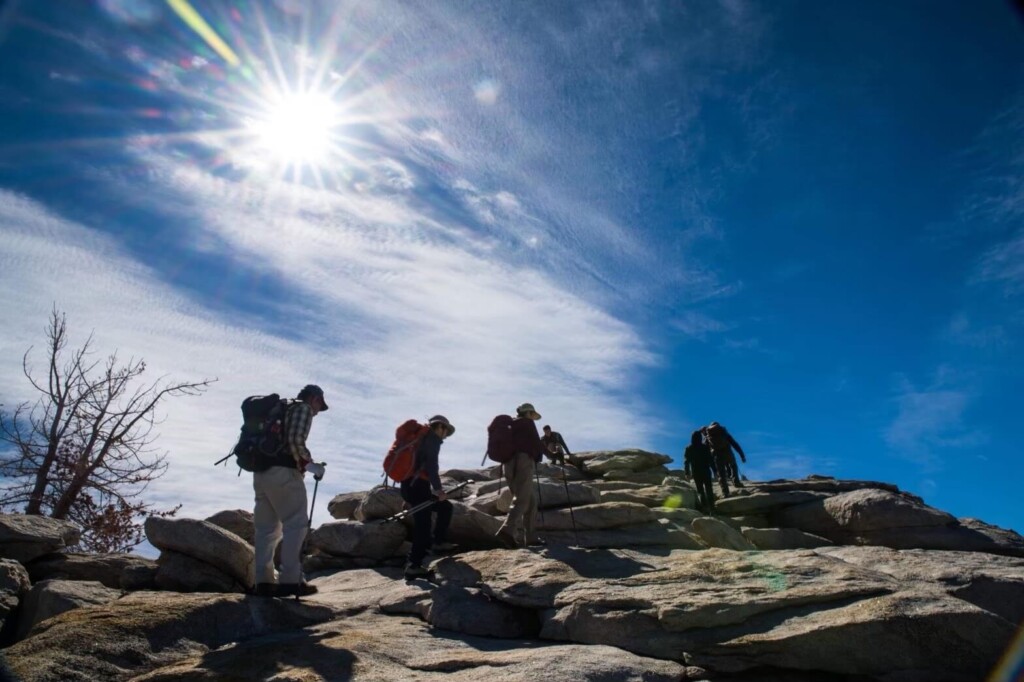
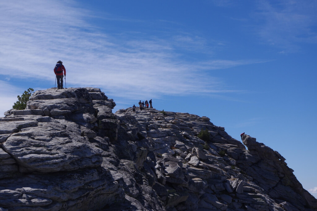
The climax of Clouds Rest is the last kilometer
You will walk along a narrow cliff. The view is spectacular, but it's also a thrill for those with a fear of heights
When I first saw it from a distance, I was a bit scared, wondering if I really had to climb up there, but once I actually walked up it, I realized it was quite spacious, so there was no need to worry too much
But you should never let your guard down. Of course, if you step off and fall, your life will be in danger, so please be extremely careful, especially on windy days
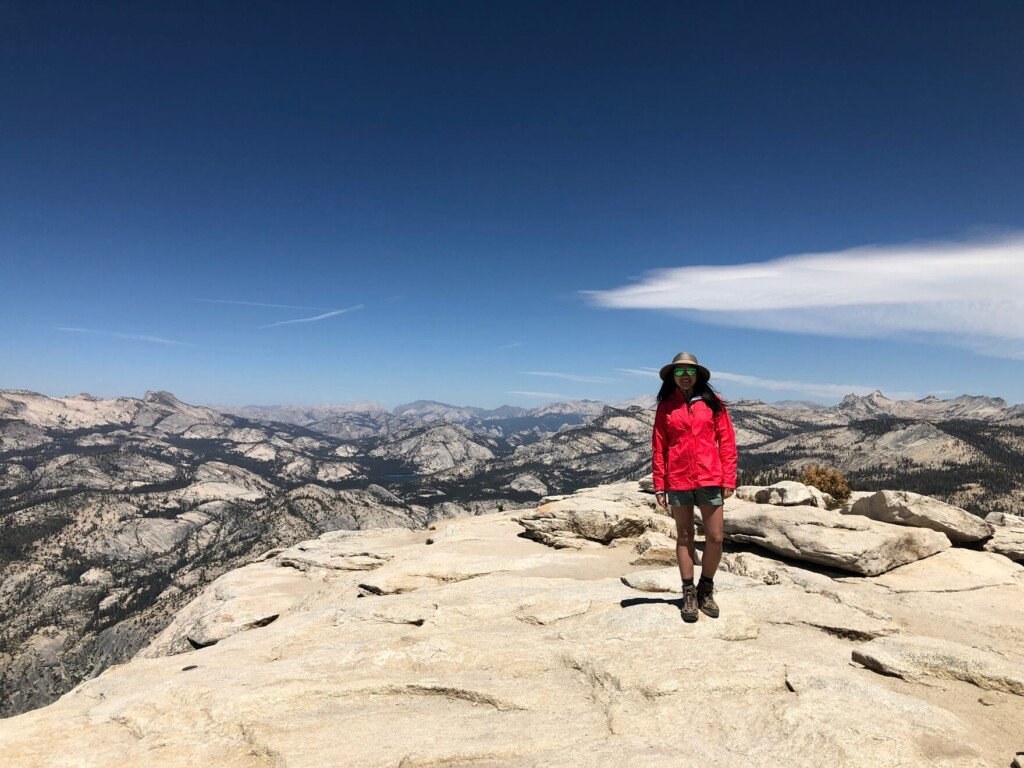
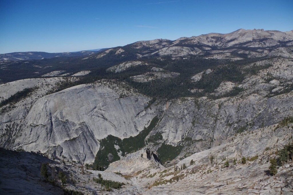
Finally, we reached Clouds Rest (3,025m)
Spectacular view. Spectacular view. Spectacular view
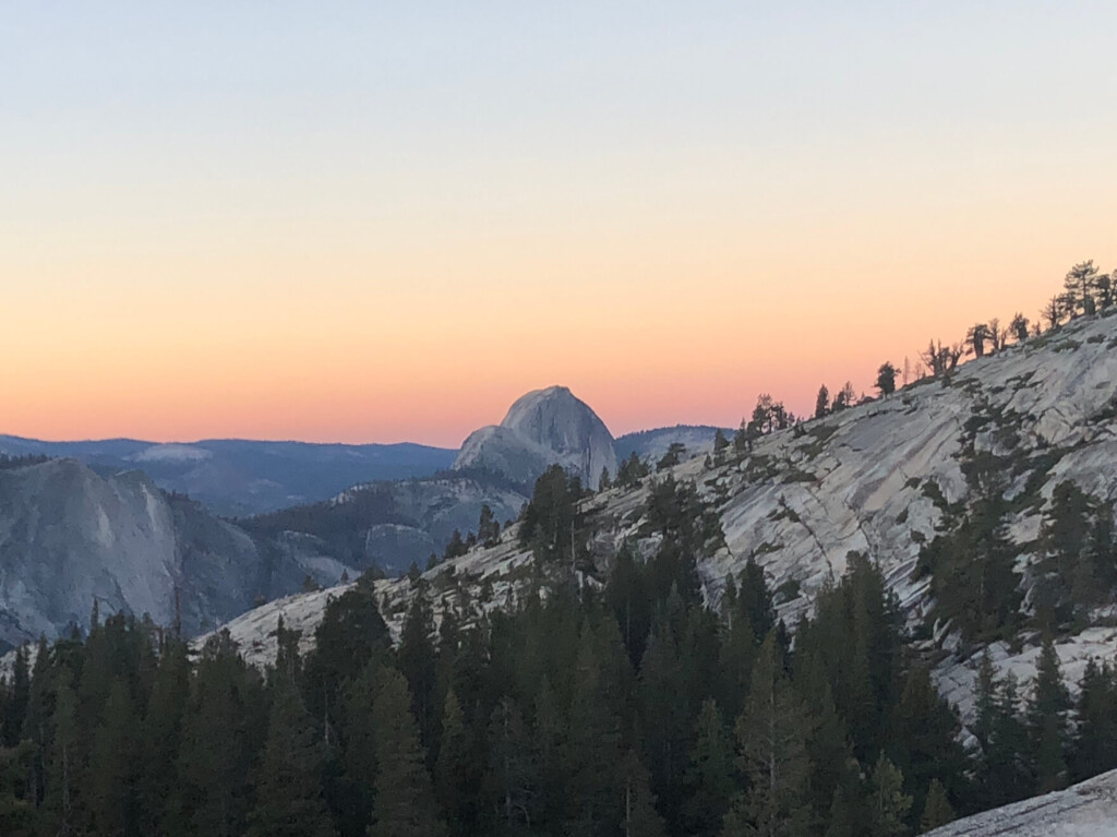
You can see Half Dome below. This place is higher than Half Dome, so you can see a view that you don't normally get to see
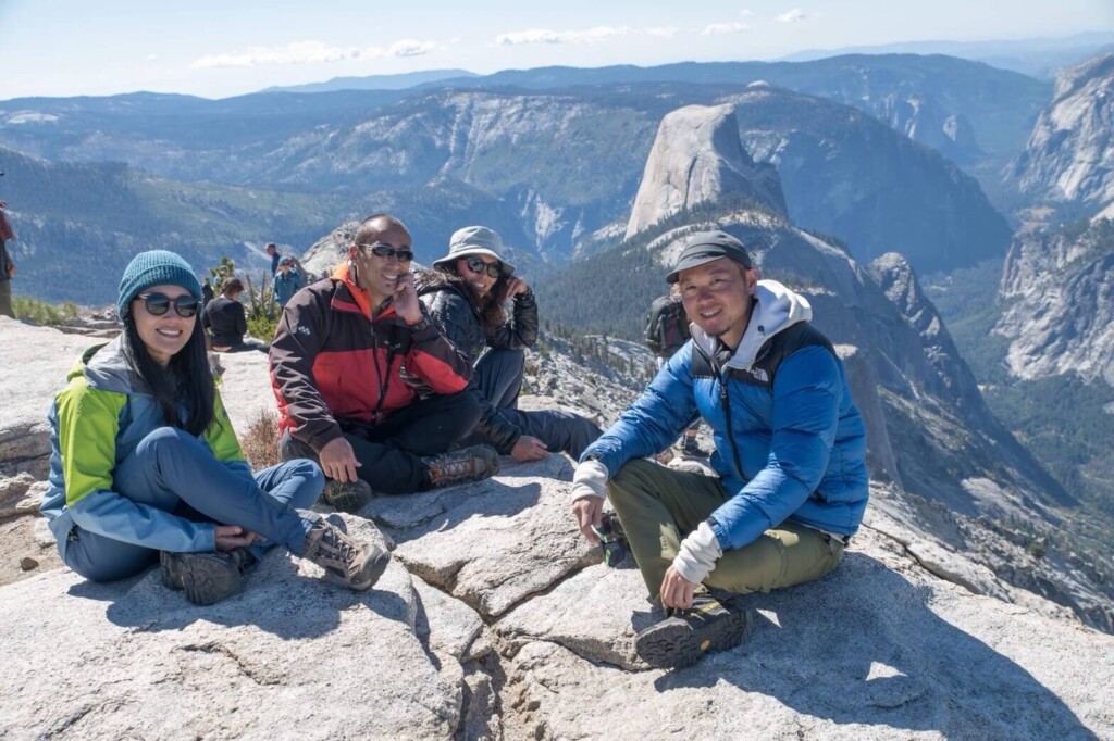
Seeing this view makes the walk worthwhile and fills me with a sense of accomplishment
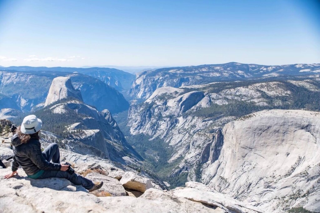
We took a break at the Cloud Rest Area, which offers a spectacular 360-degree view, and then it was time for lunch. The blue sky was wide and the clouds were close by. It really seemed as if the clouds were stopping here to take a break..
After resting for a little over an hour, we finally said goodbye to the clouds and left the sky to head down below
We will go down the same path. On the way back, our luggage will be lighter because we will have less water, but the descent will put strain on our knees. We need to be careful and stay alert
Half of the way back is uphill, so this trail is not easy
The descent took about 3 hours
If you continue on your way back and go right just before the trailhead, you will come to Tenaya Lake. You can go there and take a break by the water. It is a very clear and beautiful lake. The water is very cold, but it feels great to cool down your lower body. Your legs will feel refreshed and your fatigue will disappear in an instant
By the time we left, it was sunset. The view of Half Dome on the way back was also beautiful
Clouds Rest Trail is one of the most satisfying hikes among the many spectacular views in Yosemite, so if you're interested, be sure to give it a try
Kato Sayaka
 Leave your hiking and travel plans for Yosemite National Park to us. Influenced by my father, I've always loved outdoor activities, and while living in Japan, I started hiking and touring national parks, which fascinated me with the natural beauty of America and Canada, which ultimately led me to my dream of visiting America. I currently run ANAMI TOURS, which offers local optional tours created together with customers, such as completely private hiking tours with Japanese guides. I'll introduce you to special options that I know only because I live in the area. If you're interested, please visit the website below
Related reading
 Mt. Shasta Castle Craggs Trail is a sight to explore the majestic spires that rise over the area. [Can you die without walking?] Trip to American National Parks (43)]
 The Upper Yosemite Falls Trail is the most spectacular trail filled with all the charms of Yosemite. [Can you die without walking! Trip to American National Parks (41)]
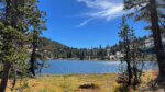 The Cathedral Lakes Trail is a special trail where you can enjoy quiet Yosemite. [Can you die without walking?] Trip to American National Parks (40)]
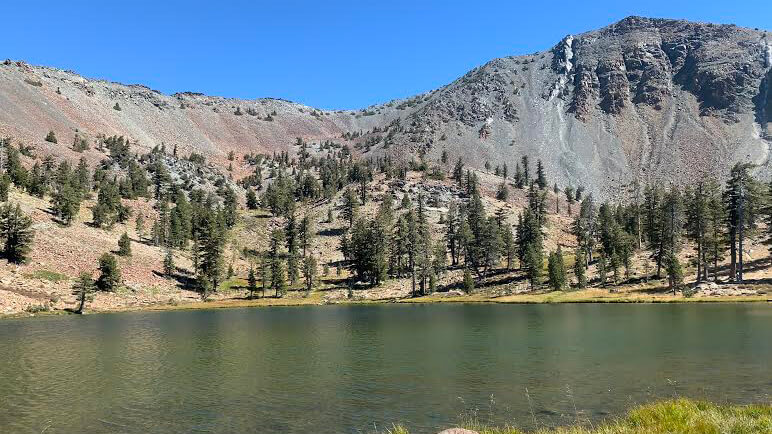 Can you die without walking? Trip to American National Parks (16) A huge panorama from the flowers and greenery, the lake and the summit. Mount Eddy Trail, the all-in-one Shasta peak