A hiking trail through Death Valley National Park! Golden Canyon Trail [Can you die without walking? A trip to the US National Parks (44)]
Written by Sayaka Kato
Death Valley
A vast desert area with a very impactful name on the border between California and Nevada
Just as the name suggests, once you step inside, you will be faced with the endless barren wasteland, desert, and harsh environment, and you will understand why it was named Death Valley, and you will be left speechless
The name originates from the time of the California Gold Rush in 1849, when pioneers searching for gold accidentally wandered into the valley and found themselves in dire straits. At that time, a woman said, "Goodbye, Death Valley." This is said to be the origin of the name
The park is also home to the lowest point in the United States: Badwater Basin, located within the park, is approximately 86 meters below sea level, making it the lowest point in all of North America
Death Valley is also famous for being the hottest place in the United States. Death Valley is officially the hottest place on Earth, not just the United States. The temperature recorded on July 10, 1913, of 56.7 degrees Celsius (134 degrees Fahrenheit), is considered one of the highest temperatures ever recorded. A recent record of 54.4 degrees Celsius (130 degrees Fahrenheit) was recorded in July 2021
Death Valley is known as the "hottest place in the world" because temperatures can exceed 50 degrees every day in the summer. The best season for sightseeing and hiking is said to be from autumn to spring, from October to April, and it becomes dangerous after that. Please be careful when hiking in the summer as it is too hot
Starting from today, I will be sharing hiking information about Death Valley Park in three posts (I will share the history of Death Valley in the next post)
This time, we would like to introduce a recommended hike called the Golden Canyon Trail Loop to Zabriskie Point, where you can enjoy the unique scenery of Death Valley
table of contents
Best time to hike Death Valley
- October to April: Relatively mild temperatures make sightseeing and hiking comfortable
- December to February (Winter): Daytime temperatures are comfortable at around 20°C, but there is a large temperature difference between morning and evening. It gets chilly in the mornings and evenings, so you should take precautions against the cold and pay attention to your clothing
- March to April (Spring): This is a particularly beautiful time of year, especially in rainy years, when wildflowers bloom and the scenery is beautiful
*Death Valley from May to September (summer) is one of the hottest places in the world, and the risk of heatstroke is extremely high, so sightseeing and hiking are dangerous, so please be careful. If you are hiking between March and May, we recommend early in the morning or in the evening. Please refrain from hiking here in the summer
Golden Canyon Trail Loop to Zabriskie Point Trail Information
Access (by car to the trailhead)
Death Valley is located on the border between California and Nevada, so it's usually most convenient to travel via Los Angeles (4-5 hours by car from LAX to Death Valley) or Las Vegas (2-2.5 hours by car from LAS to Death Valley)
Trailhead address: Golden Canyon Trailhead
Or, enter "Badwater Rd, Death Valley, CA 92328" into Google Maps. (Note: The signal is poor, so we recommend downloading the map in advance.)
What to bring
As for useful items to bring on a hike, as always, prepare the same equipment as you would for a typical hike in the United States
- Drinks (a generous amount, about 3 liters, is recommended)
- Warm clothing that can regulate your temperature (a windproof shell is helpful)
- hat
- sunglasses
- sunscreen
- Snacks to eat during the hike
- If you have any regular medications, bring first aid such as medicines and bandages
- Other than that, your favorite hiking gear
Trail Data
- For beginners and intermediates
- Best season: October to April (This photo was taken in March.)
- Round trip distance: 9.6km (6mi)
- Altitude difference approximately 324m
- Trailhead elevation: Approximately 79 m
- Average hiking time: 2.5 to 3.5 hours
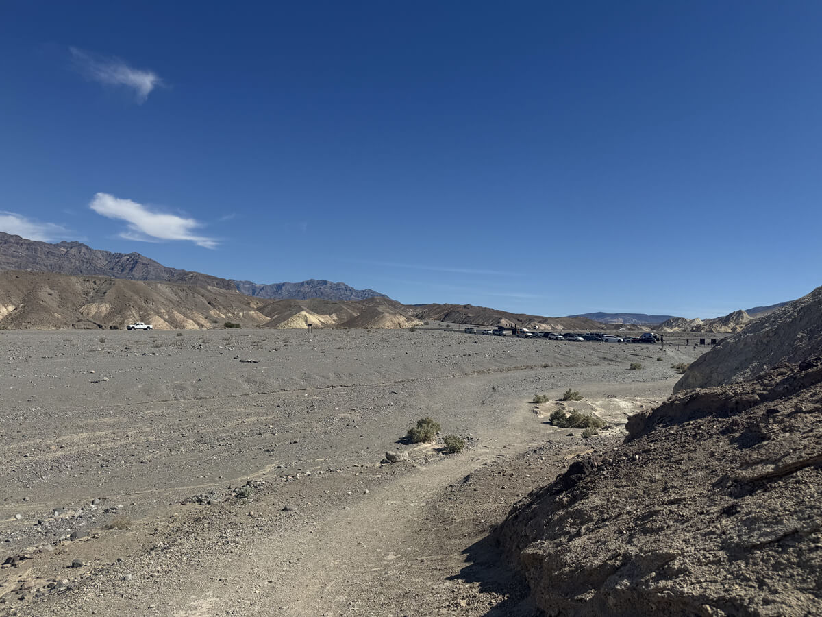
Starting the hike from the trailhead (12 noon in early March)
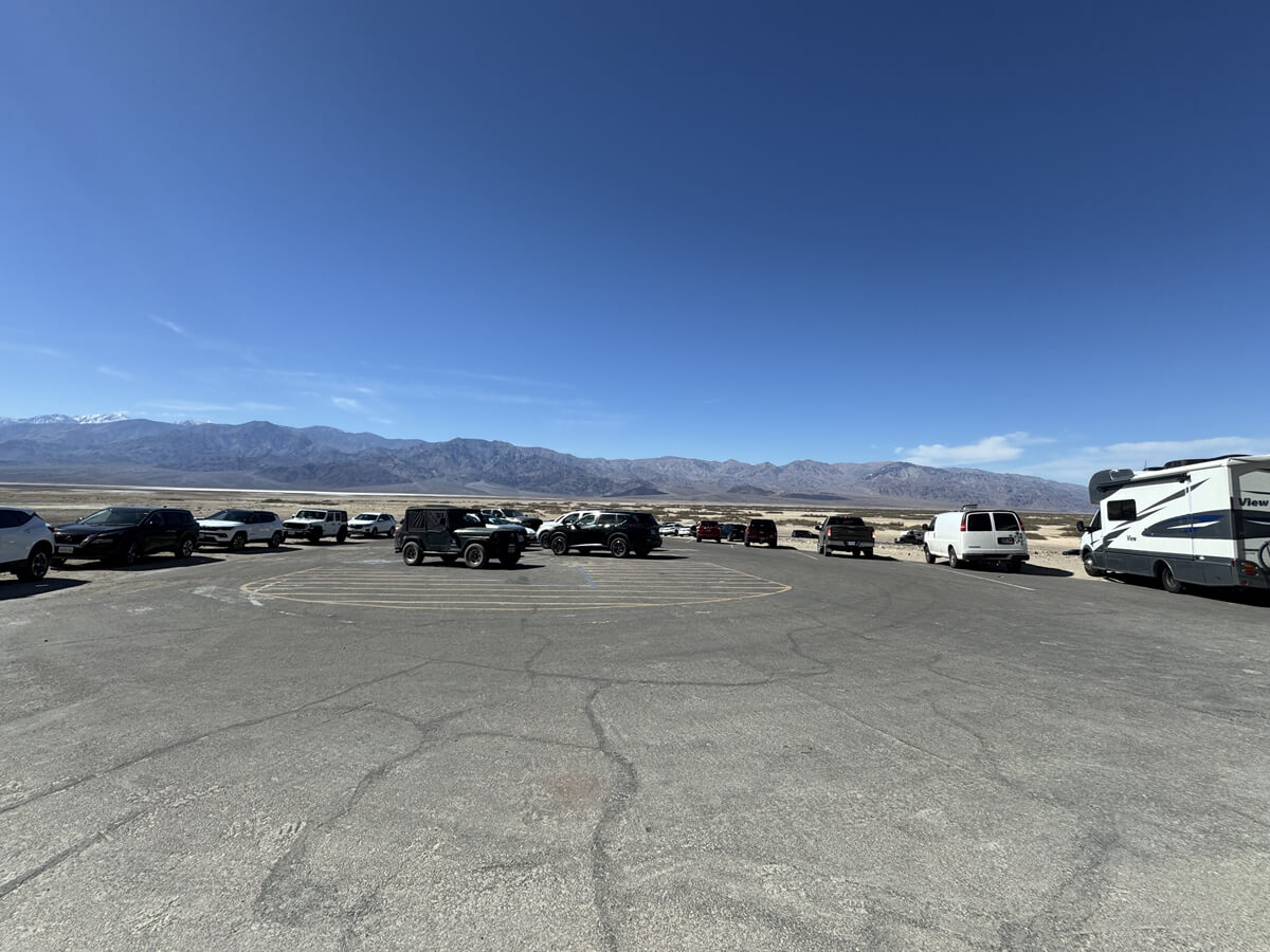
The parking lot was crowded, but there were still spaces available even at this time of day. There were many groups of people who walked to nearby places and then came back, so there was a lot of traffic
The restrooms are also located here
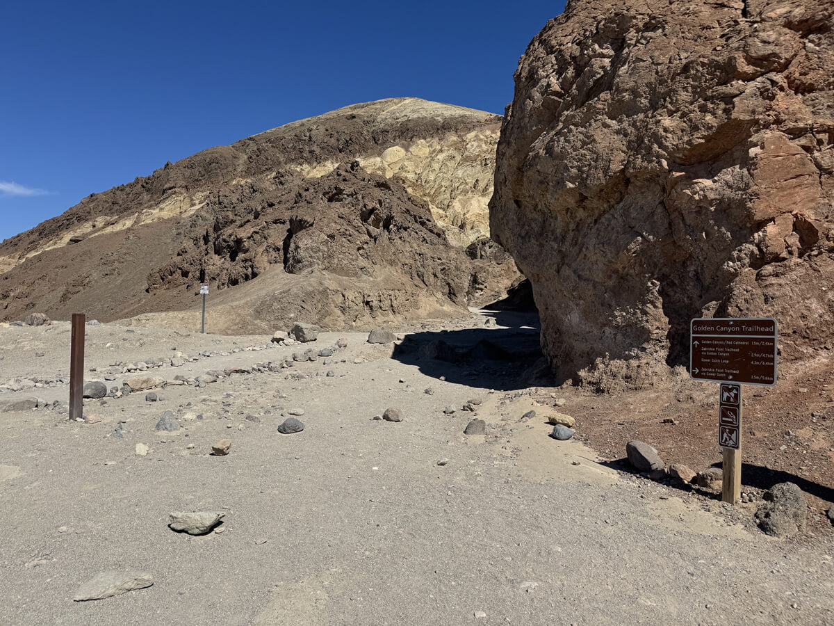
We started from the trailhead. The temperature on this day was probably around 24 degrees Celsius. By the end of the hike, it must have risen to around 27 degrees Celsius
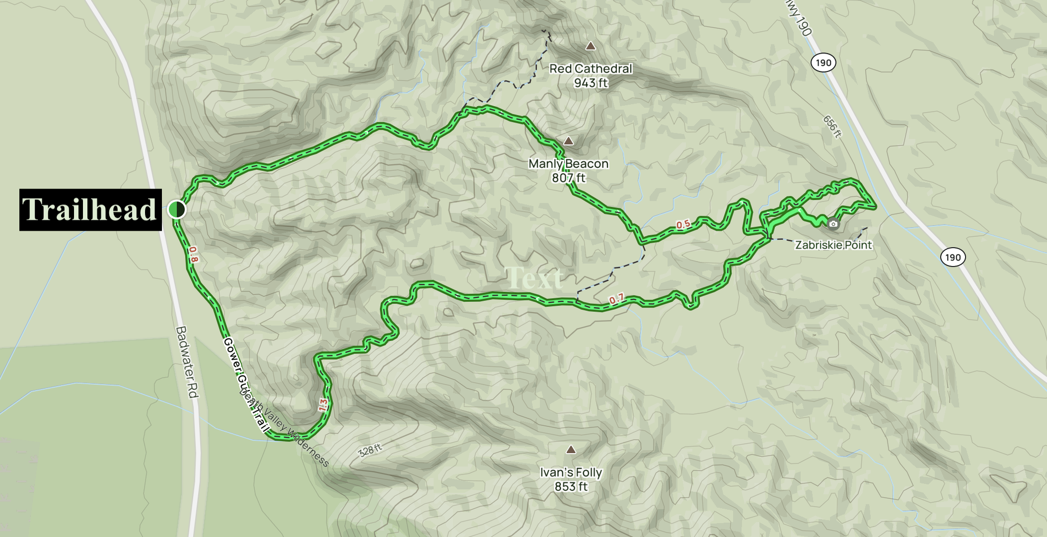
This trail is a loop, so if you walk clockwise you will return to the same starting point
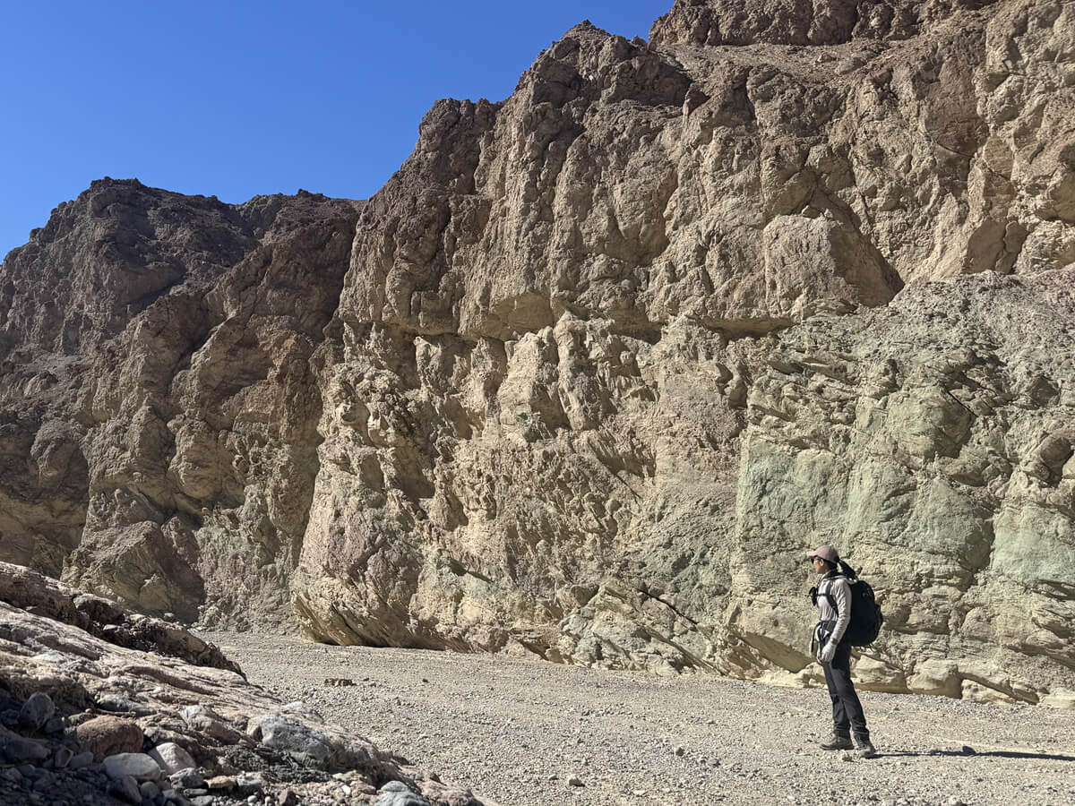
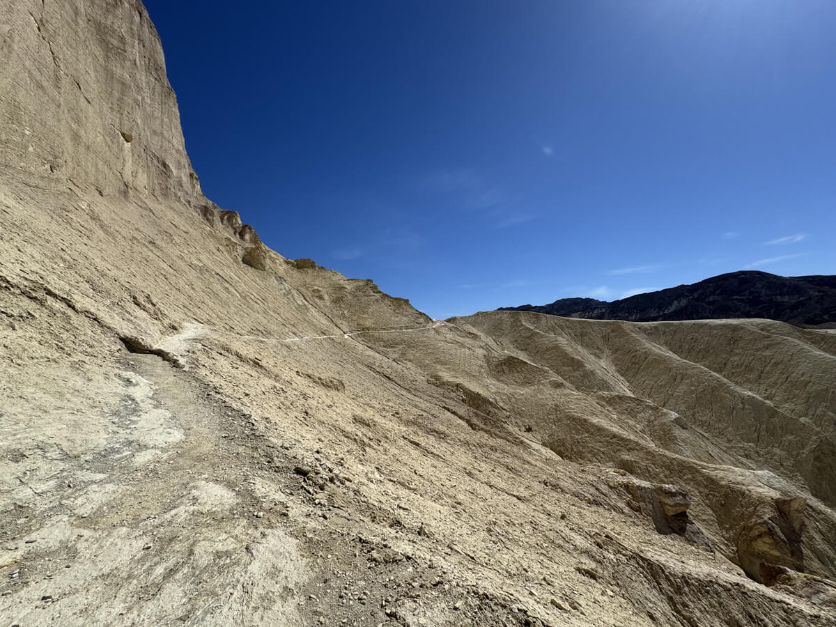
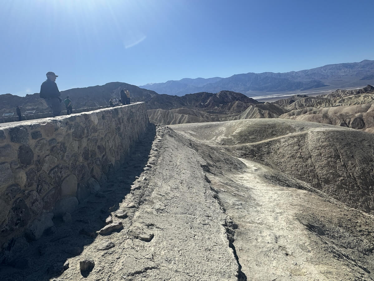
The first thing that greets you is a rock wall
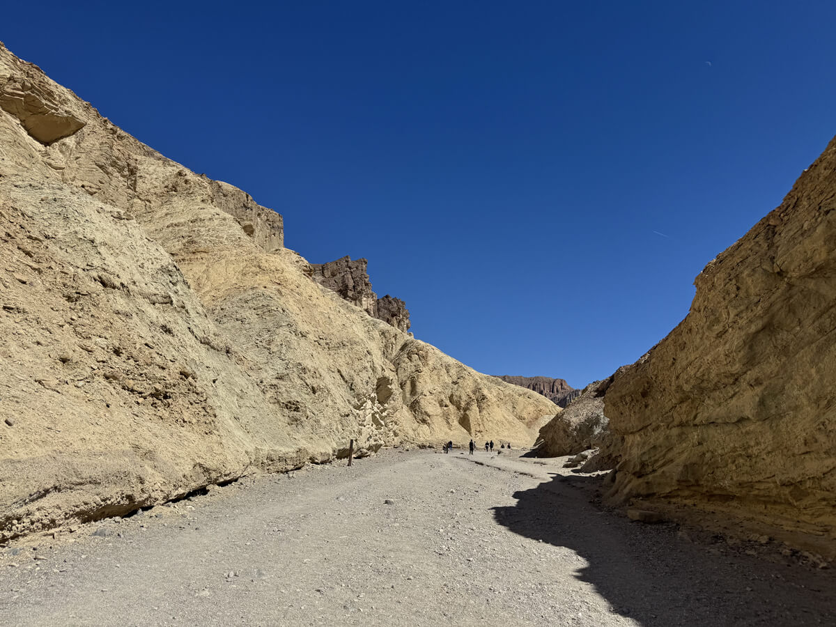
Maybe because it was the best season, there were a lot of people around the starting point even though it was a weekday. By the way, this trail has almost no shade and is very dry. But at the beginning it was pretty flat and we made good progress
The contrast between the blue sky and the skin-colored rocky mountains is a sight you rarely see in California
If you go further, you will come to a fork in the road (about 20 minutes after departure)
We are heading towards Zabriskie Point Trailhead, so take the narrow road to the right
The observation deck called Zabriskie Point is today's halfway point, so we head there first
The trail is very easy to follow as there are arrows indicating the direction you should take. Just as you would expect from a national park
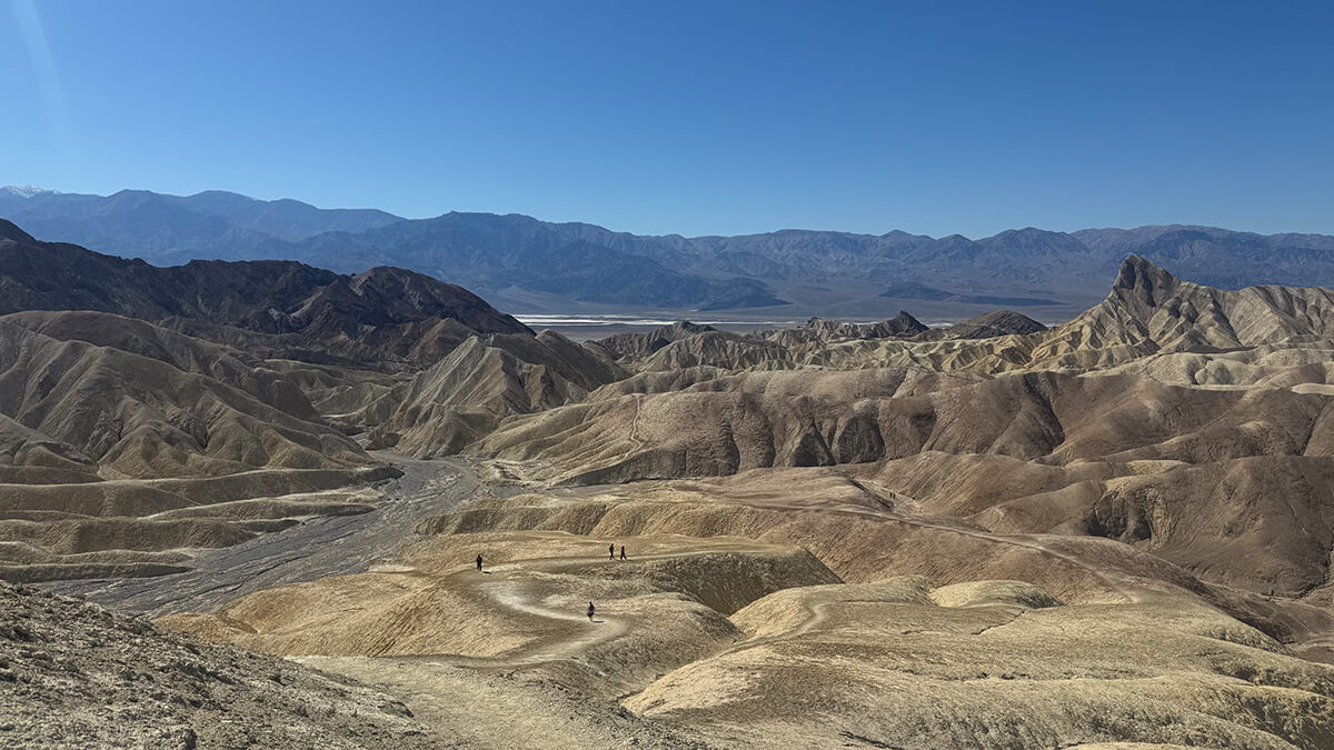
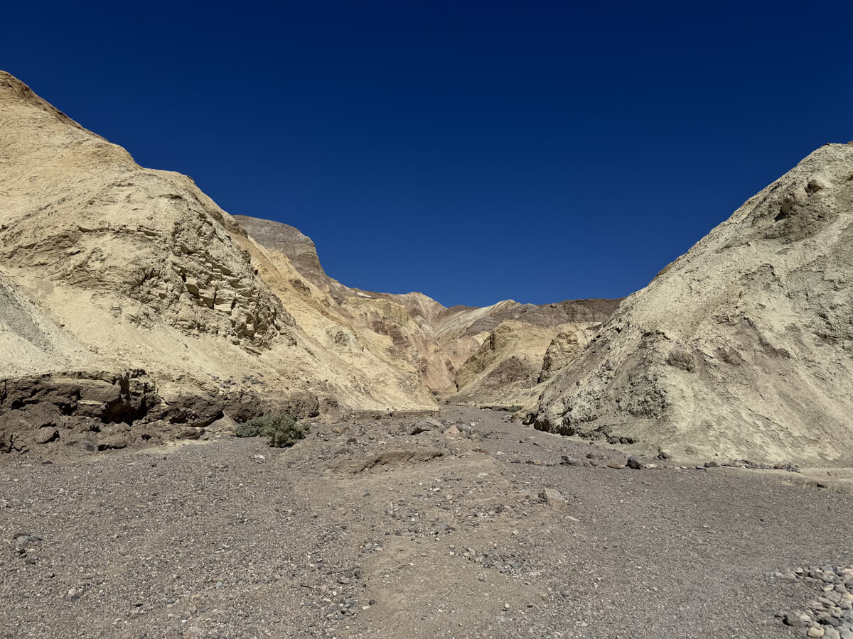
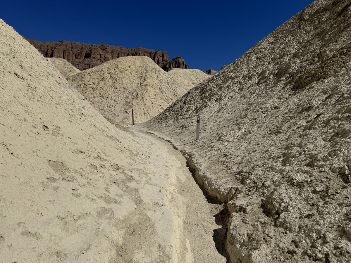
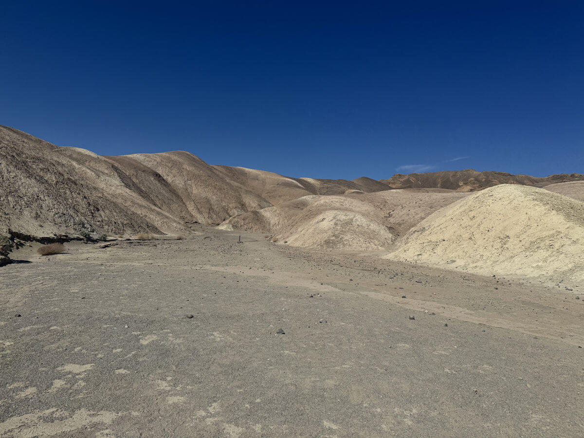
The ground is turning white. The color of the surrounding rocks and the ground are also changing rapidly
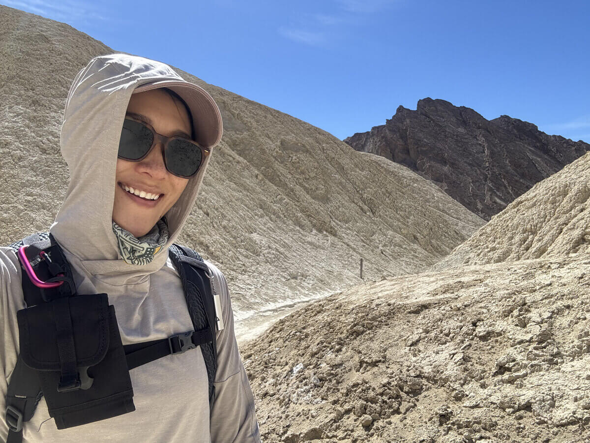
It's already so hot. After 20 minutes of walking, I was already drenched in sweat. A hat, sunglasses and sunscreen are essential!
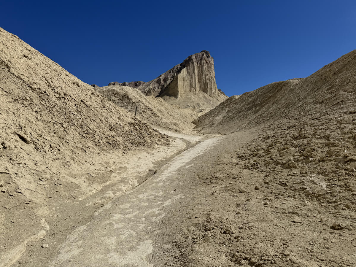
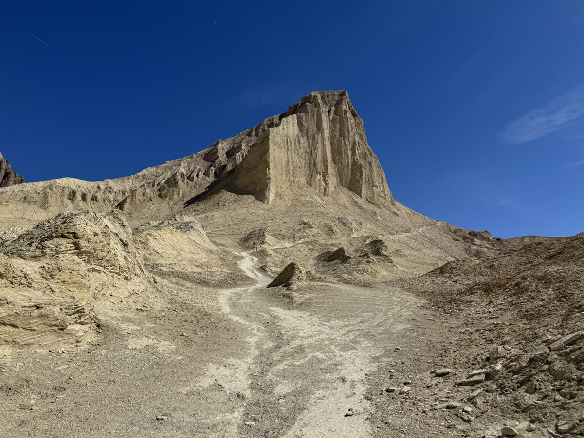
In the distance, we could see the sharp, towering golden sandstone peak known as Manly Beacon. It's a very distinctive rock formation. The slope also begins
It is named after William L. Manly, one of the pioneers who traveled through Death Valley during the California Gold Rush of 1849
The climb continues towards Manly Beacon
Views like this can only be seen up close by walking along the trail, a true hiker's privilege
The trail then continues past the sandstone peak of Manly Beacon
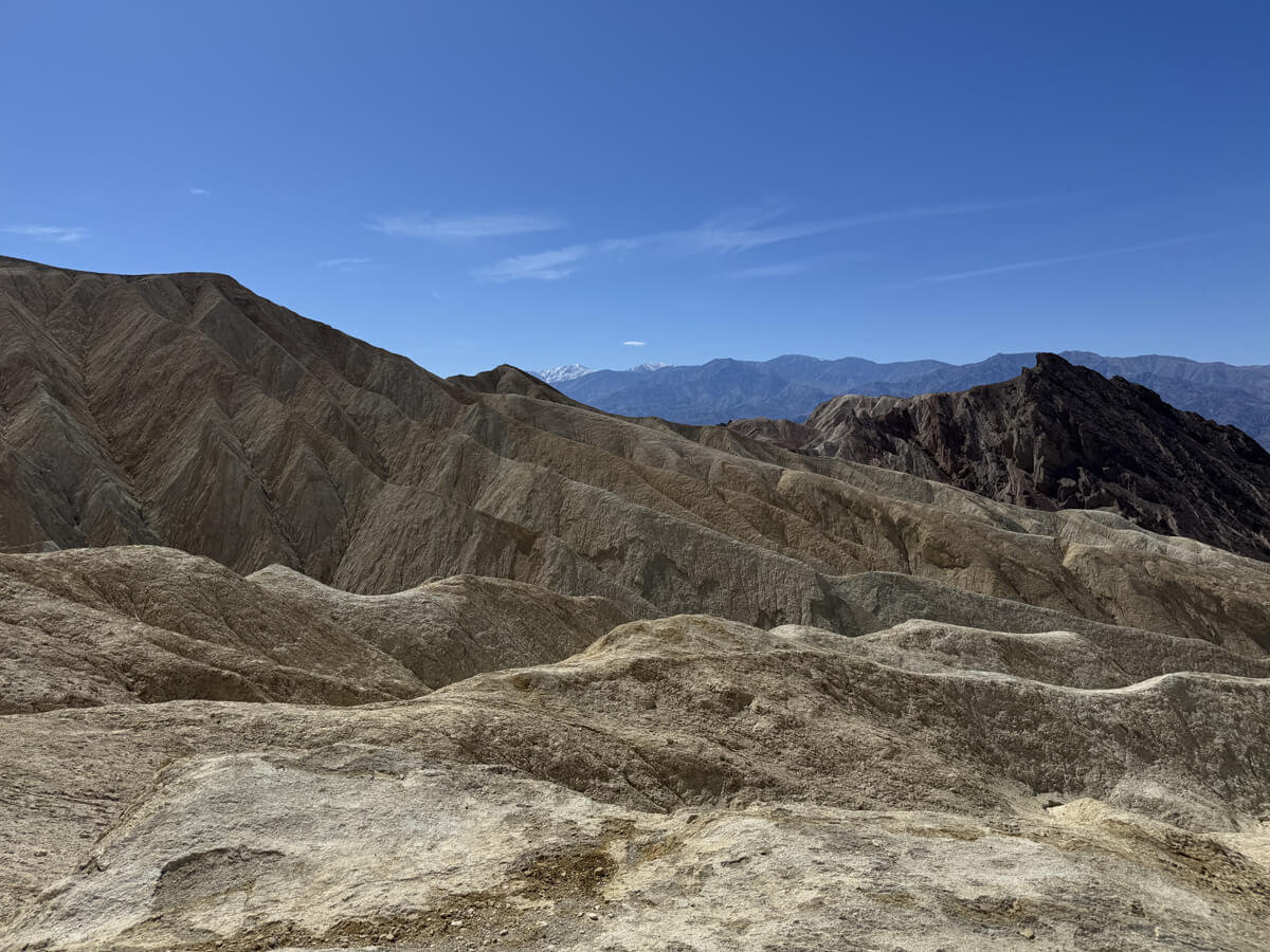
By this point, we've climbed quite a bit, and looking around, we can see snow-capped mountains in the distance
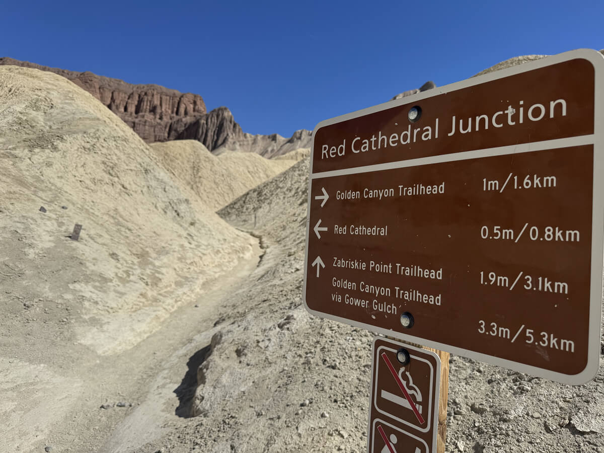
There is a slight downhill section, and then you will see a sign for the second fork
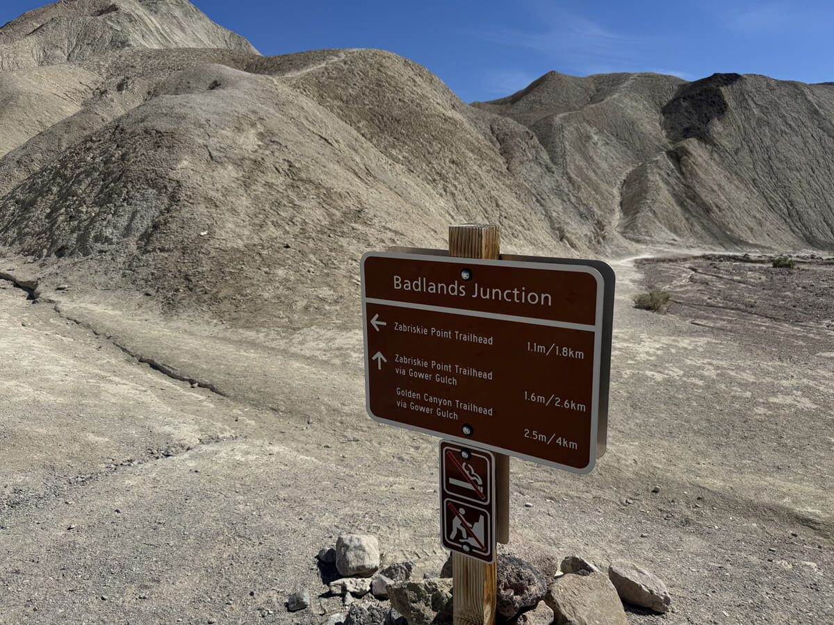
You can go either way, but instead of via Gower Gulch, head left towards Zabriskie Point Trailhead
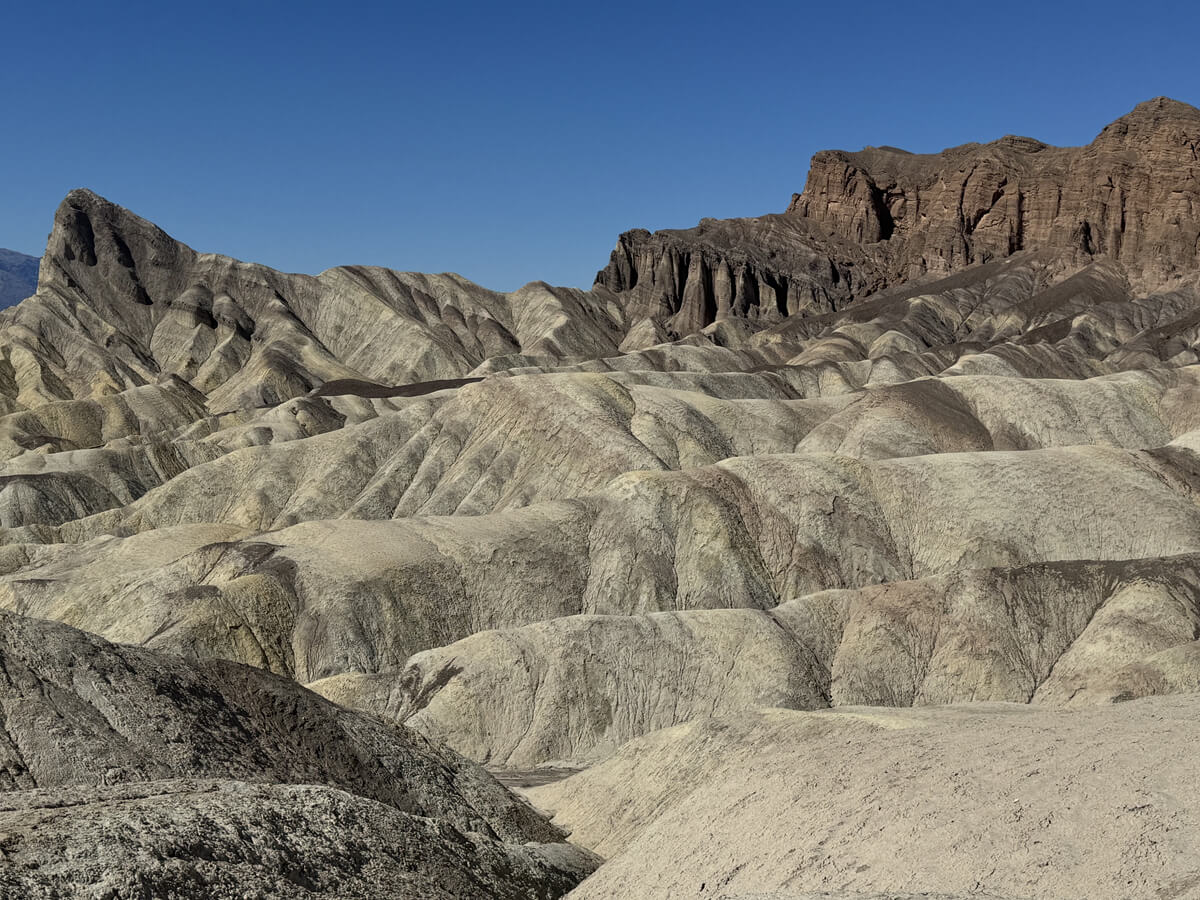
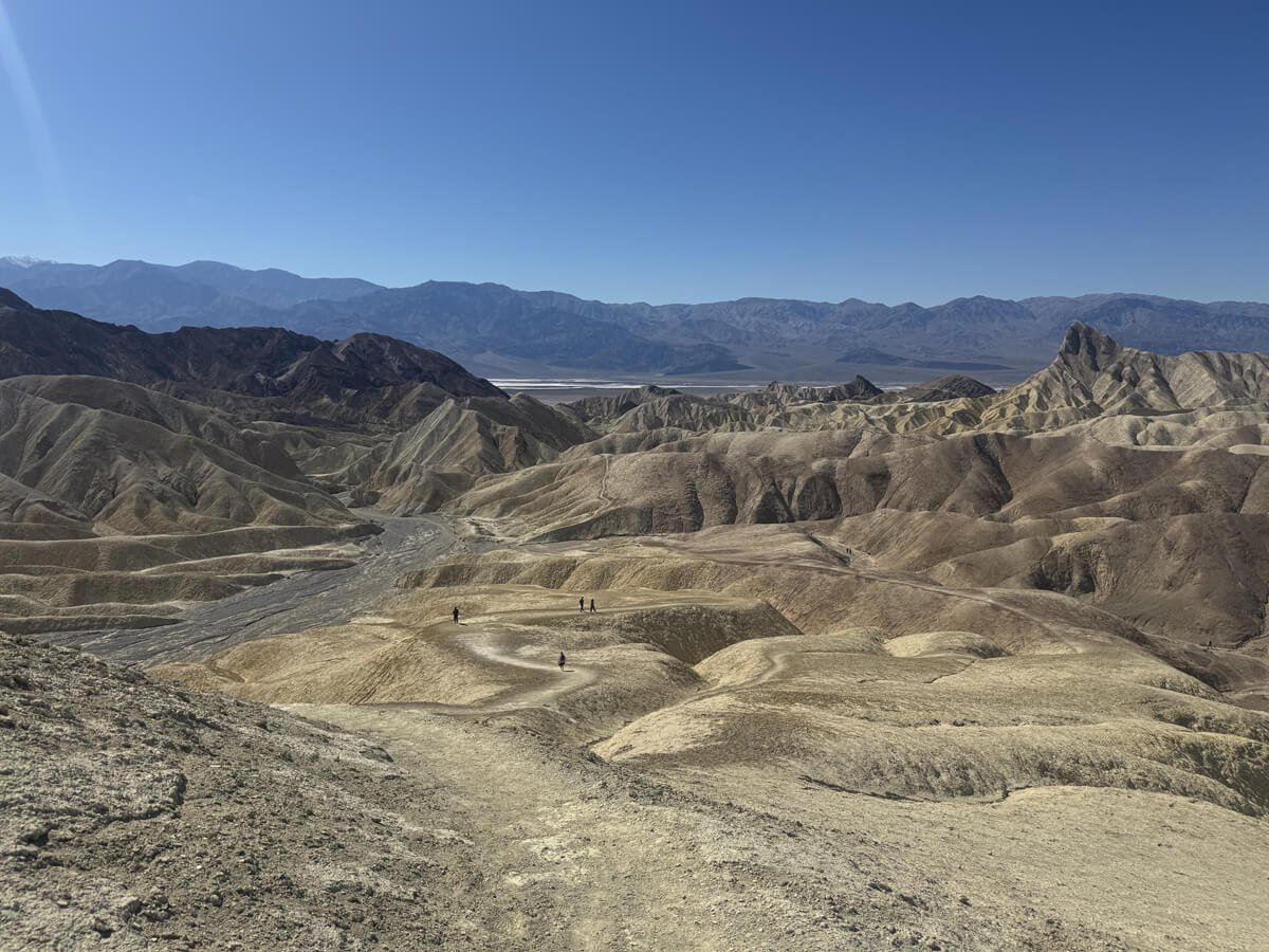
The endless scenery makes you feel like you've been lost on another planet, like something out of a Star Wars movie. There are various geological layers formed by millions of years of sedimentation and erosion, and when you look around, you can see sandstone and rock formations of different colors formed by differences in geology, mineral content, weathering and oxidation, which fascinate us hikers as art in the desert
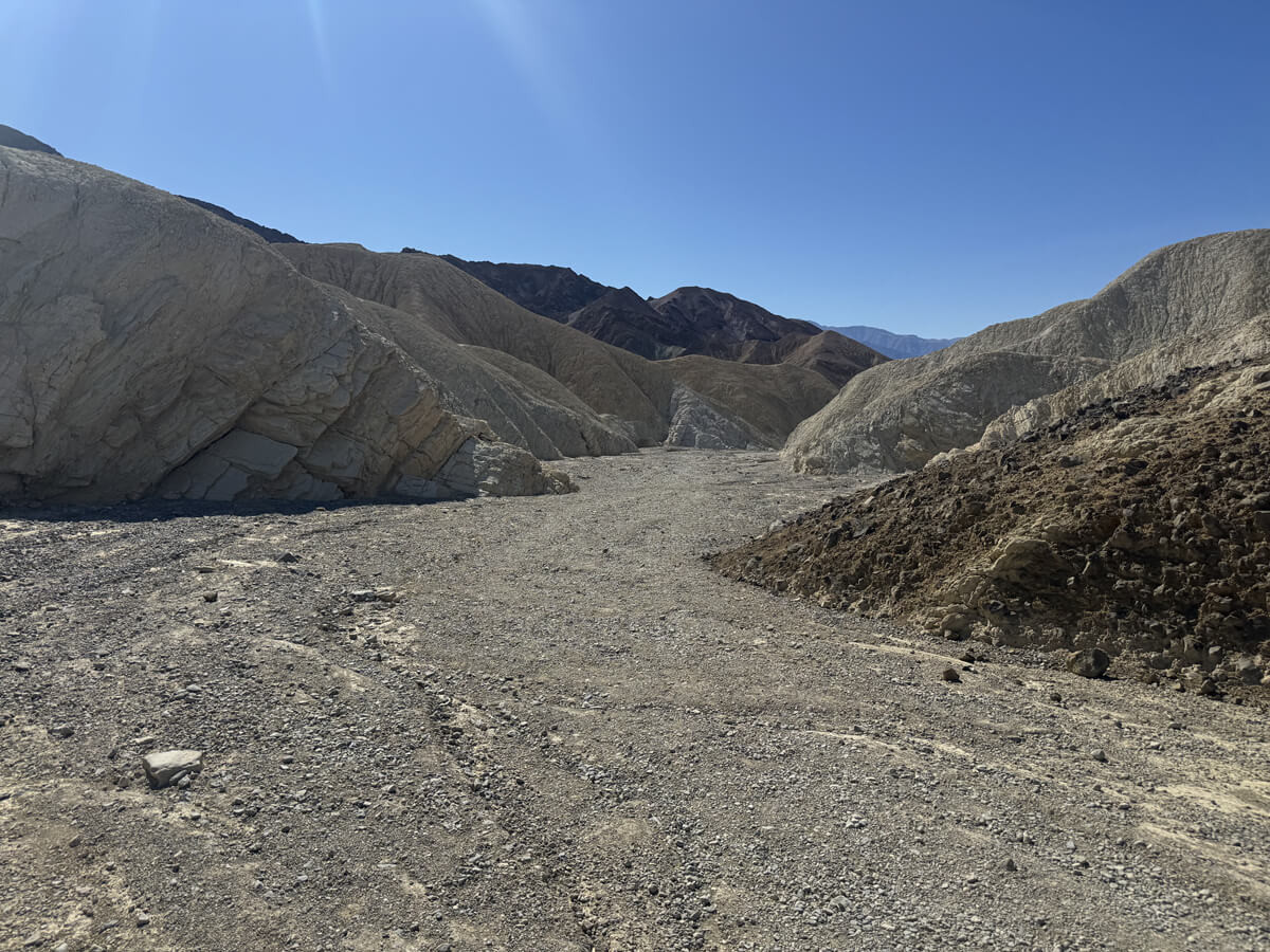
If you continue further down the trail, you will come across a sign for the third fork
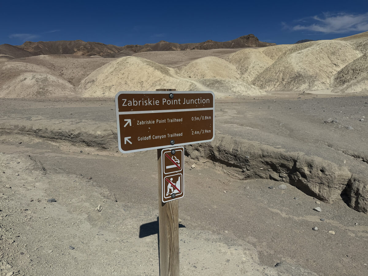
We also head left to Zabriskie Point Trailhead and finally make one more push to the Zabriskie Point lookout
The trail continues to the parking area for the Zabriskie Point lookout
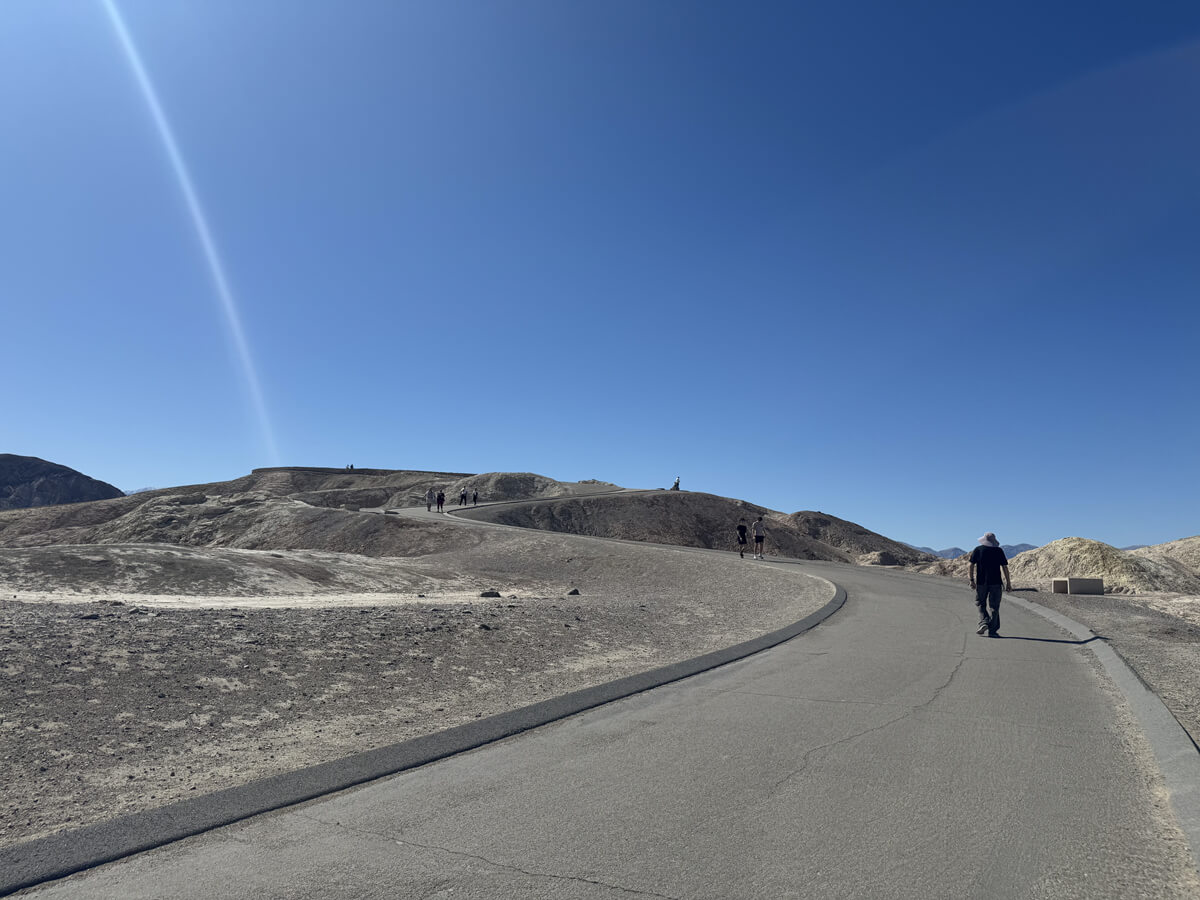
The observation deck is located up a slight slope from the parking lot. Visitors who come by car park their car and walk up the slope to see the view. At first glance it may look like a long slope, but the elevation is lower than other places, so you won't get out of breath and it's easy for those with good walking skills, so don't worry
About an hour and a half after starting the hike, we arrived at the halfway point and took a short break
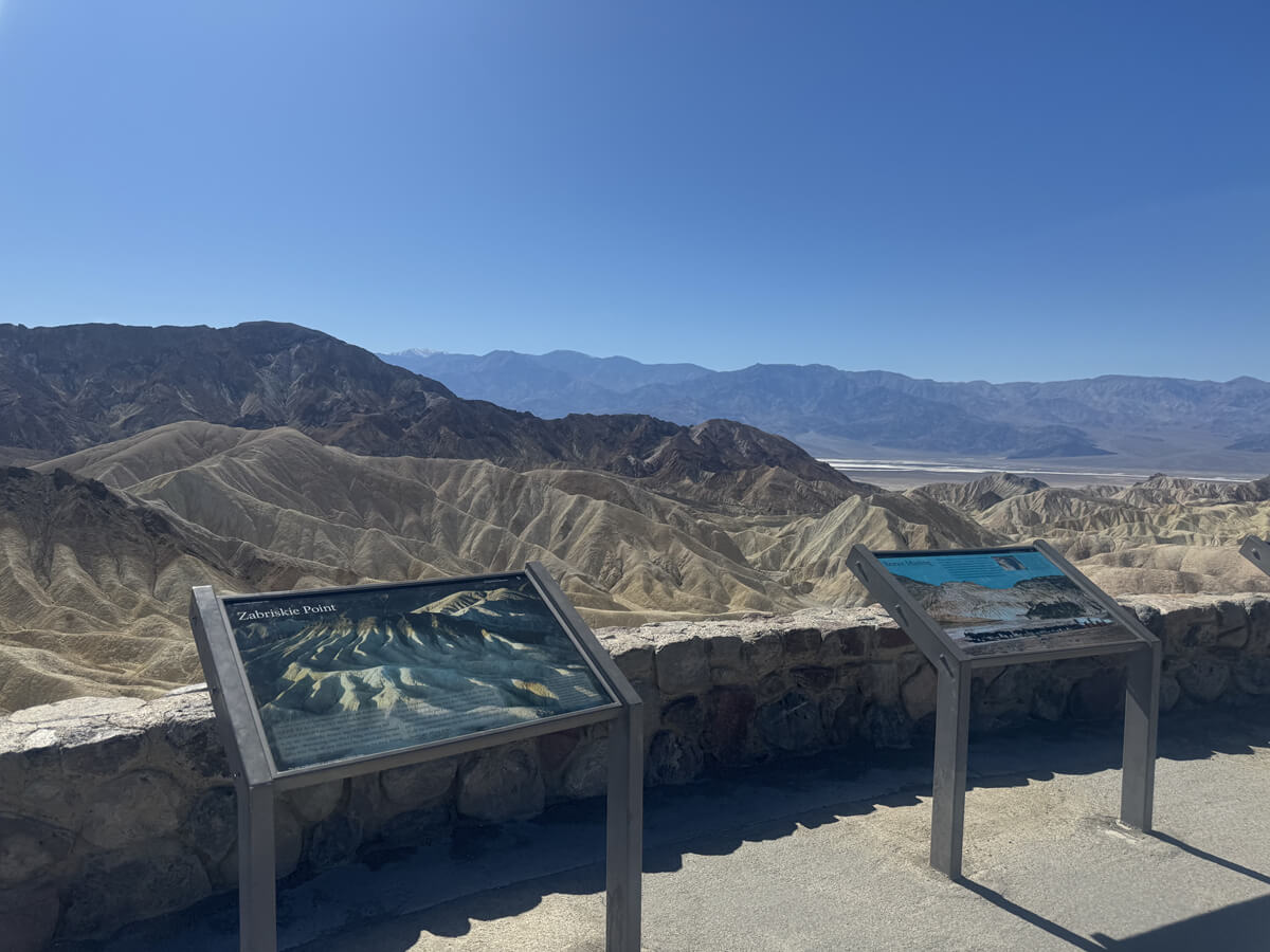
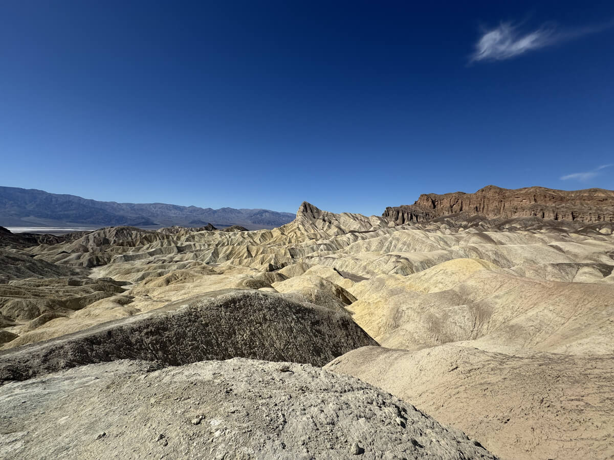
Zabriskie Point
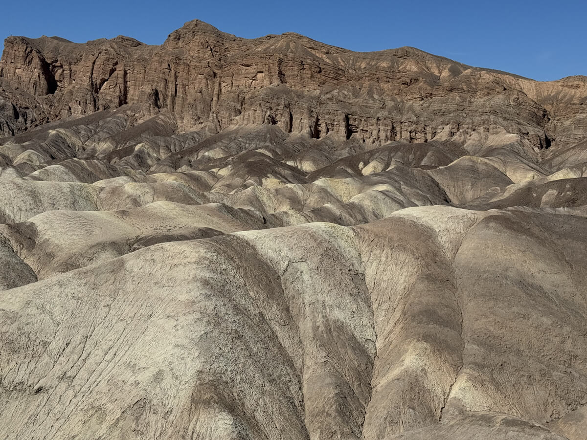
The view from here is apparently caused by the compression of ancient lake sediments, creating unique wavy patterns and colors, and the observation deck here is a popular stopping point as it offers some of the best views in Death Valley
Due to volcanic activity, Death Valley's strata contain volcanic ash and lava from ancient volcanic eruptions, which harden to create specific colors (gray, black, etc.)
The influence of climate and weathering, such as extreme temperature changes and wind erosion, has changed the rock surface, enhancing the contrast in color. Just like other national parks, you can see the evidence of nature created over a long period of time right before your eyes
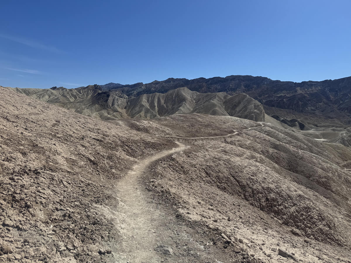
Now, the hike continues. In fact, there is a trail that continues from Zabriskie Point. The trail continues on the right just before the observation deck, and from here we descend to begin the second half of the hike
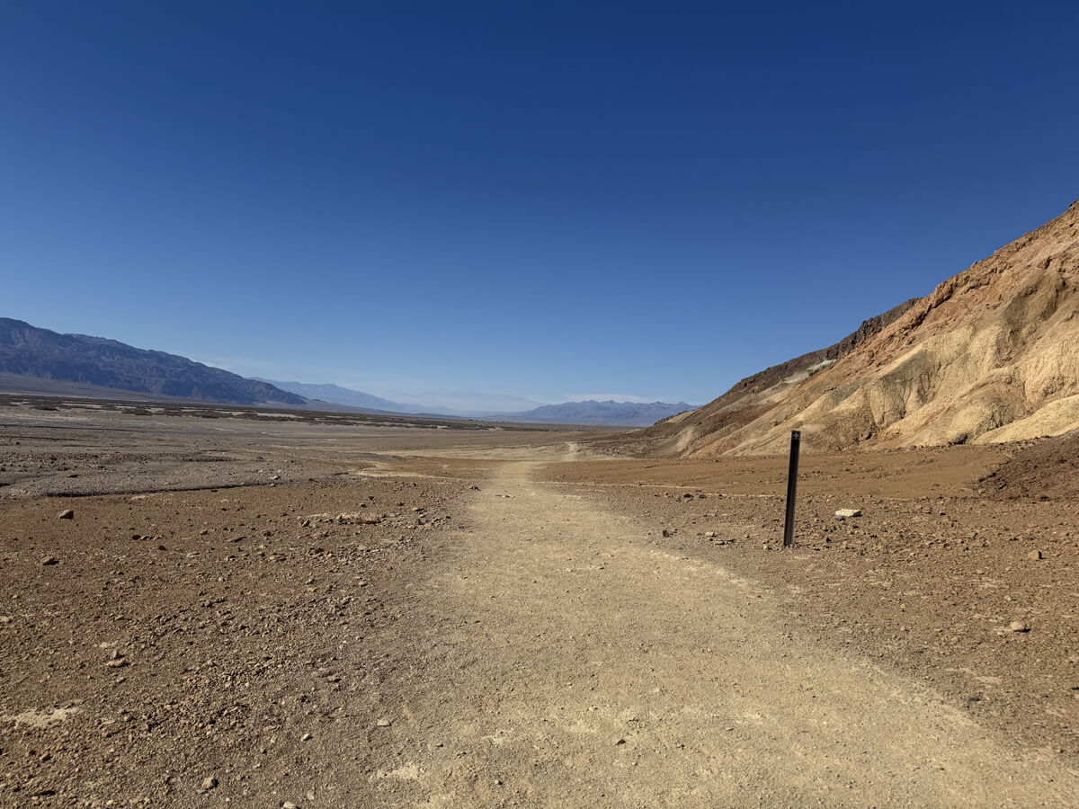
We continue to descend and now see Zabriskie Point, where we were just a moment ago, above us as we walk along the bottom of the valley
The second half is much easier. Once you reach the bottom of the valley, it's mostly flat
The scenery is as unique as ever, and even though the surrounding landscape is nothing but rocky mountains, it never gets boring
The hike ended at 2:35 p.m., about two and a half hours after it began
This trail is a hiking trail that can usually be enjoyed during the off-season in winter, and is a place that even beginners with good walking ability can enjoy
Above all, it has a different atmosphere and charm from other national parks, and I think it is a must-see for desert lovers
Please come and visit Death Valley, where you can enjoy the winter season
to be continued
Sayaka Kato
 Leave your hiking and travel plans for California, including Yosemite National Park, to us. Influenced by my father, I've always loved outdoor activities, and while living in Japan, I started hiking and touring national parks, becoming fascinated by the natural beauty of America and Canada, which ultimately led me to my dream of visiting the United States. Currently, I run ANAMI TOURS, which offers local optional tours created together with clients, such as completely private hiking tours with Japanese guides. I'll introduce you to special options that I know only because I live in the area. If you're interested, please visit the website below
Please consider a paid membership to support the website while enjoying exclusive articles and events!
Related reading
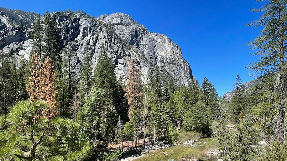 Can you die without walking? A Journey to the American National Parks (26) A breathtaking valley in the depths of a forest of giant trees Sequoia and Kings Canyon National Parks
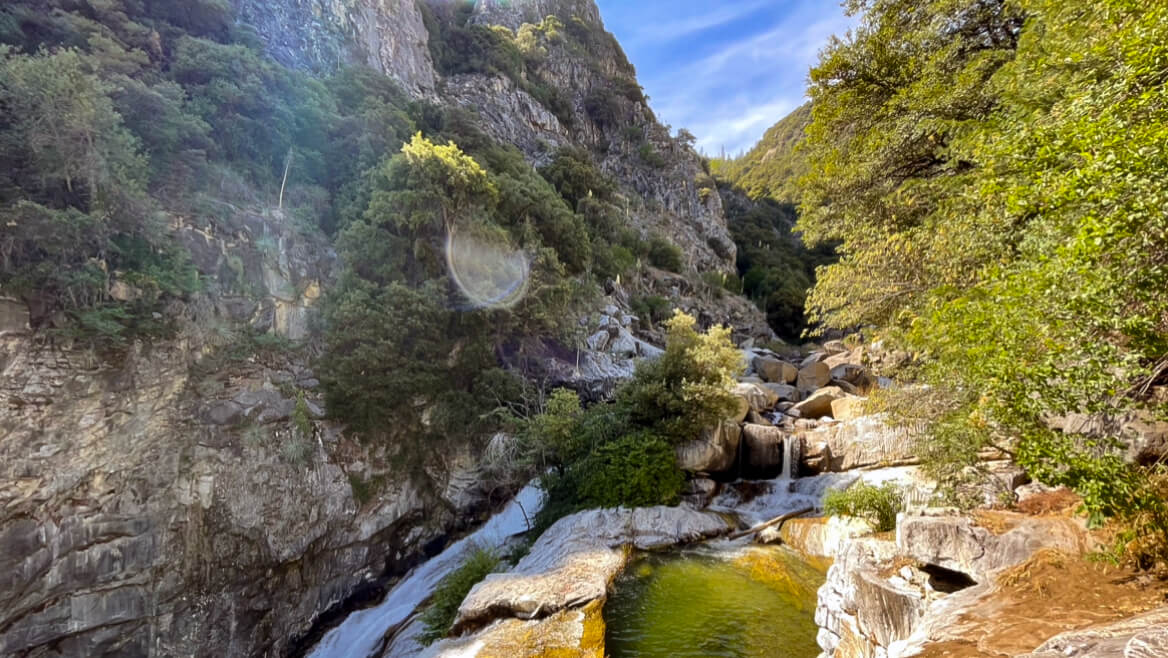 Can you die without walking? A trip to the US National Parks (28) See the waterfalls flowing through the glittering marble (Sequoia National Park)
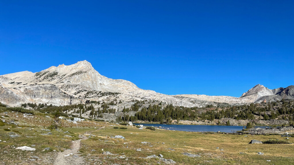 Twenty Lakes Basin Loop Trail: A wonderful trail offering spectacular views of the beautiful mountains of the East Sierra Nevada Mountains [A trip to the US National Parks (37)]
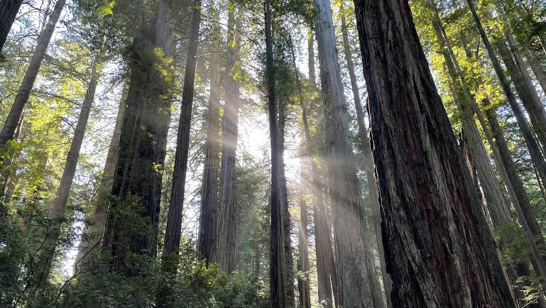 Can you die without walking? A Journey to the American National Parks (20) Redwood National and State Parks: An ancient forest with trees over 1,500 years old