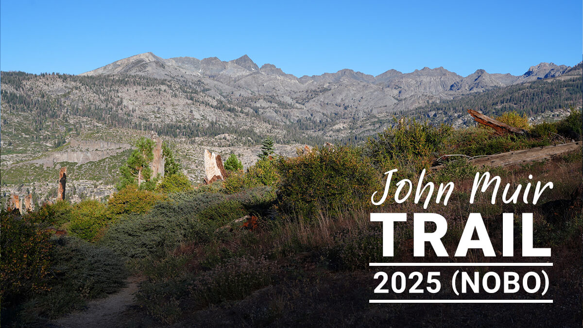
John Muir Trail Northbound Traverse (2025 NOBO) Record [Chapter 13] From Silver Pass to Reds Meadow
Written by Yoshihiro Murakami
Previous chapter (Chapter 12)
table of contents
[Chapter 13] From Silver Pass to Reds Meadow
The trek from Silver Pass to Red's Meadow takes about two days. I think the name "Silver" comes from the fact that snowfields remain there late into the season. This year the snow had melted, but even if there was snow, it's a gentle slope so crampons aren't necessary. After crossing the pass, beautiful lakes such as Chief Lake spread out before you. You descend in altitude for a while, then head upstream along Fish Creek, where Lake Virginia, Purple Lake, Duck Lake, and others follow. After passing through a dry section for a while, you arrive at the Red Cornes campsite. The Red's Meadow resupply base is a few hours away. This year there were fewer hikers, the store was sparsely stocked, and we couldn't even get into the restaurant
Although Duck Lake is not visible from the trail, it is a beautiful lake. It's worth taking a short side trip to see it. This is also a shortcut to Mammoth Lakes via Duck Pass. Getting a permit for Duck Pass and hiking the JMT from here is also recommended
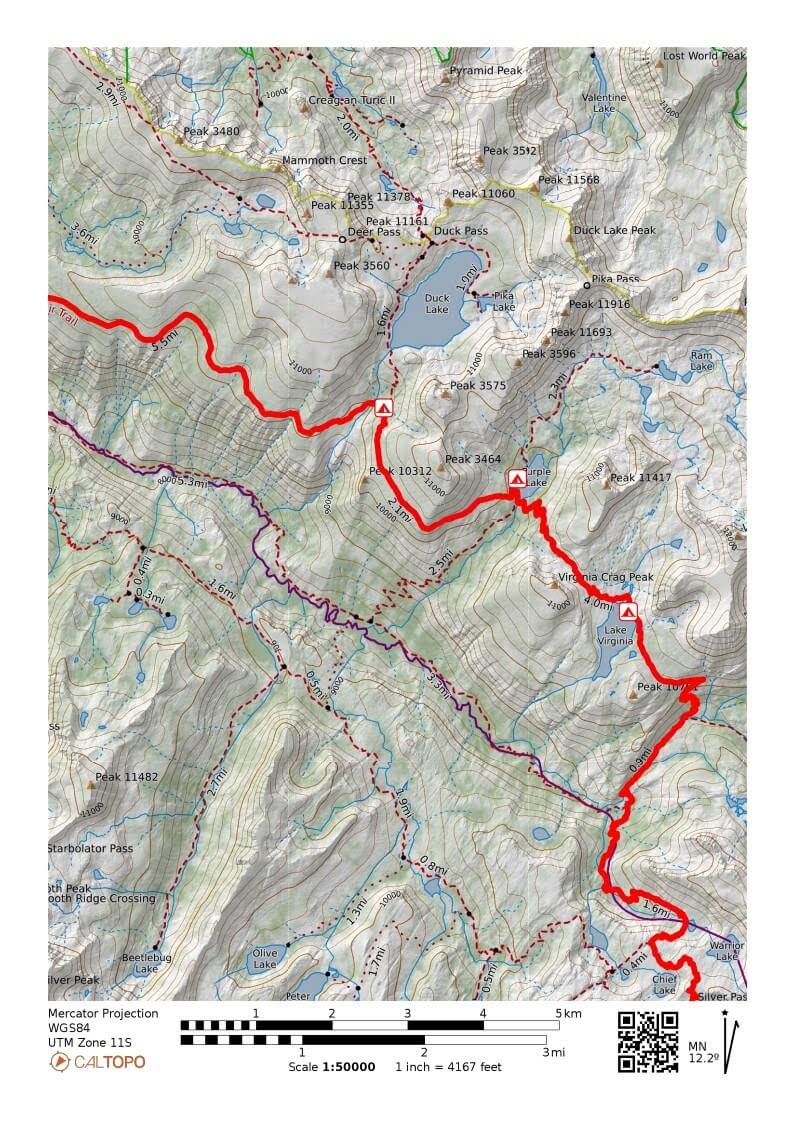
Figure 13.1: Silver Pass to Deer Creek
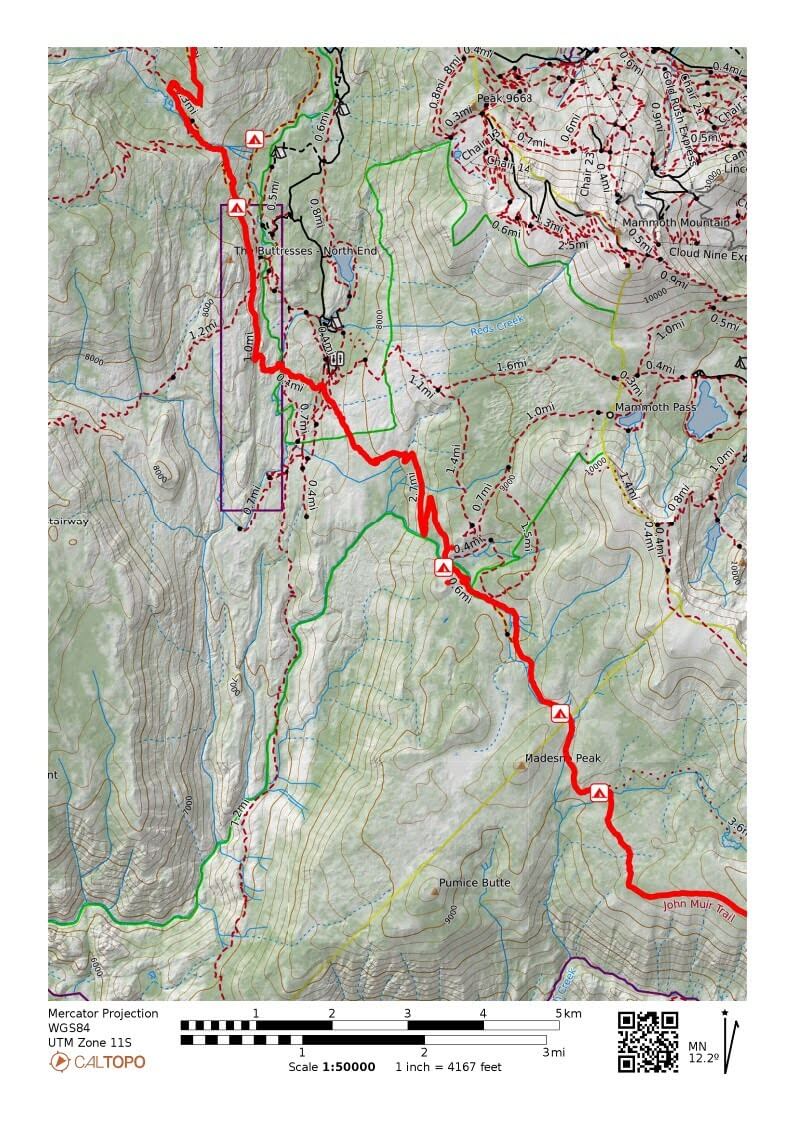
Figure 13.2: Deer Creek to Reds Meadow
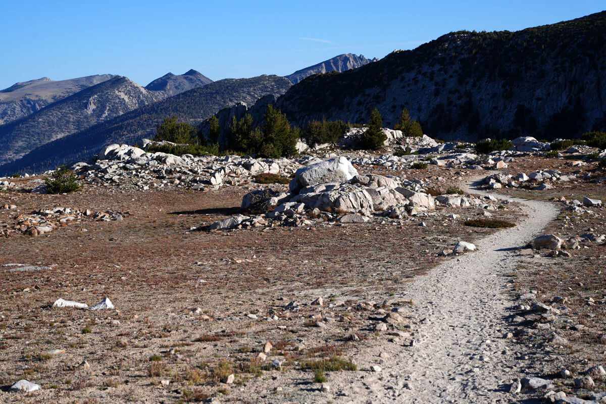
Figure 13.3: There are rocks when you go down Silver Pass
Silver Pass to Purple Lake
Even in summer, snowfields remain on Silver Pass. I think that's how it got its name, Silver Pass, but this year there was absolutely nothing there. Just past the pass, the elevation drops. Then it becomes a gentle hill for a while. What stands out here is the rock shown in Figure 13.3. It's a good spot to sit and rest
In 2010, a PCT hiker sat here. His name was David. He was a relatively elderly hiker. He said he had been hospitalized due to altitude sickness and had only just managed to get this far. Most PCT hikers head north from south towards Mount Whitney, the highest peak in the High Sierra. If they are not properly acclimatized to the altitude, they can suffer from severe altitude sickness, such as emphysema, and nearly die. He was one of them
The trail heads west, descending in elevation via switchbacks. Chief Lake gradually comes into view. Figure 13.5 was taken slightly off the trail. There are a fair number of campsites, and it's a nice spot, but it's a bit far from the VVR, and if you're taking the southbound JMT, you'll need to take a ferry, so you'll probably just push on to Silver Pass Lake. I've never camped here
After walking a short distance from Chief Lake, the trail merges with the trail from Gooddale Pass. Then, we turn east towards Nymsoohapi (Squaw) Lake, but the area around the lake is overgrown with grass and unsuitable for camping. There is a small spot before descending where water flows, making it a suitable camping spot. This is shown in Figure 13.7. I remembered this location because it was marked on the Half Mile map
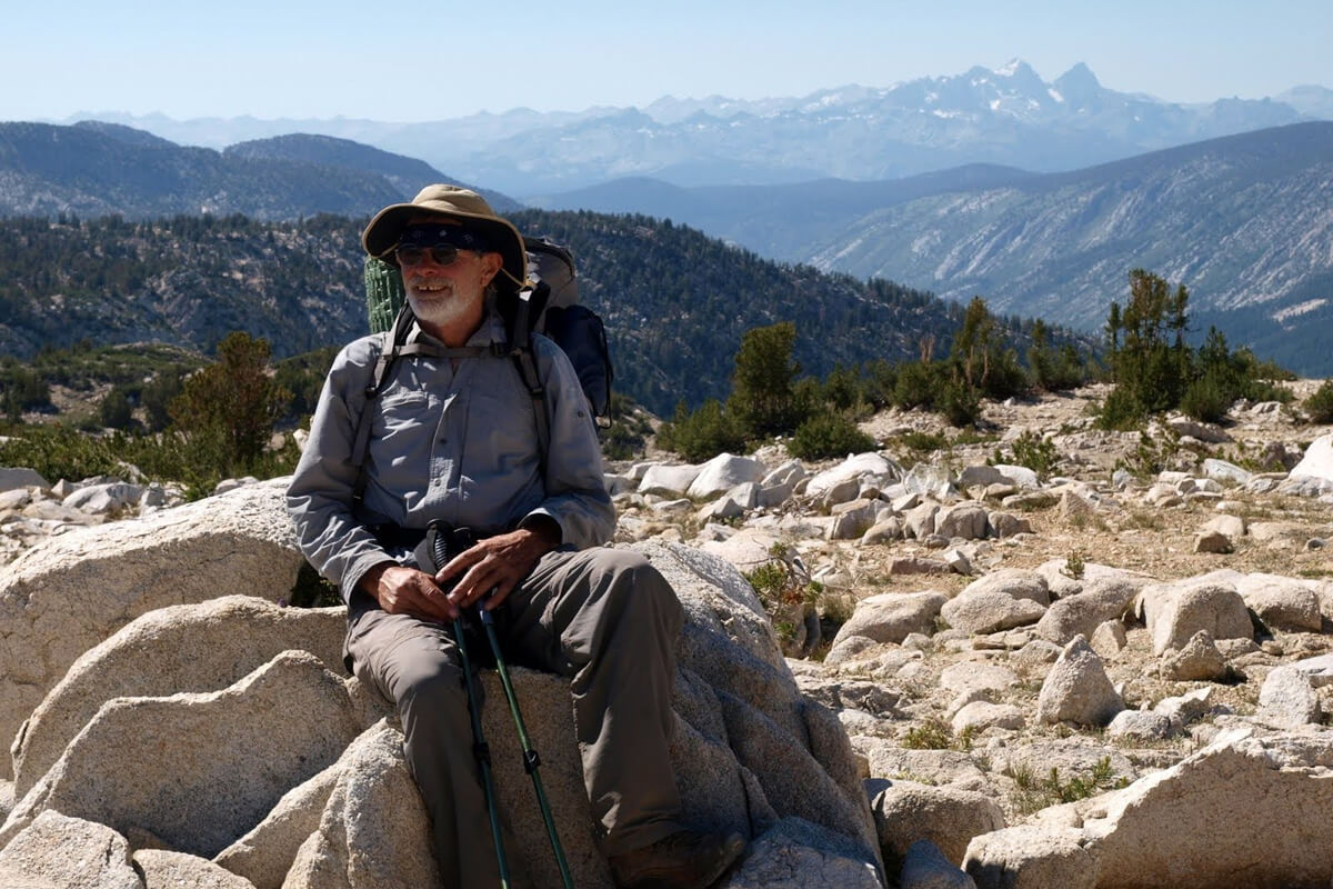
Figure 13.4: David, PCT hiker, photographed in 2010
Incidentally, this lake's name originally meant "Squaw" (an Indian woman), but it was changed to Nymsuhapi because it was considered a sexist term. I believe it's a Native American proper noun, but I don't know the details. Many maps still haven't been updated. The photo from 2019 is clearer, so I used that one
We arrived at Nymsuhapi (Squaw) Lake around 9am. We crossed to the other side by stepping on the rocks, took a break, and refilled our water bottles. After that, we descended by repeatedly switching back and forth from a rocky ledge. After a while, the view disappeared. After repeating the switchbacks once more, we came out onto a flat area between pine trees
It's a relatively large campsite, and at the edge of the site is a meadow (Figure 13.8), which you reach by crossing a stream and descending. After descending, you cross back to the other side. This is a slightly strange terrain and seems troublesome. I think it's possible to walk the shortest distance from the campsite without crossing the stream, but perhaps it's due to the rocks
After crossing the stream, the terrain becomes relatively flat, and the trail straightens out. Of course, there are places here and there where you could pitch a tent
The trail follows the river for a while, then descends via switchbacks. These switchbacks are the longest part of the trail. After descending a certain distance, the trail levels out and crosses two streams. This was a place with many fallen trees in 2019. The open areas are campsites, and I pitched my tent there several times. I once saw a bear canister filled with garbage that had been left abandoned. Americans will throw anything away if it's heavy
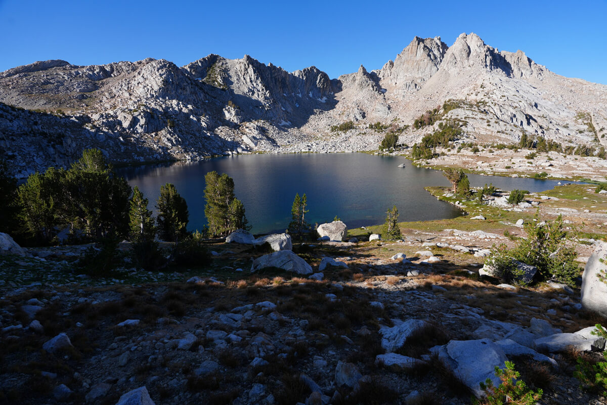
Figure 13.5: Chief Lake
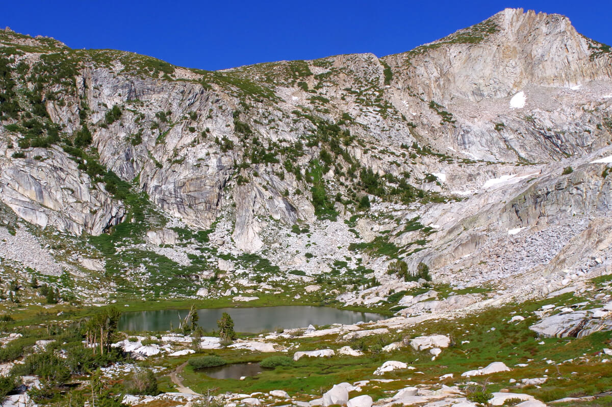
Figure 13.6: Nymsuhapi (Squaw) Lake. Photographed in 2019
Figure 13.7: On Nymsuhapi (Squaw) Lake. Photographed in 2019
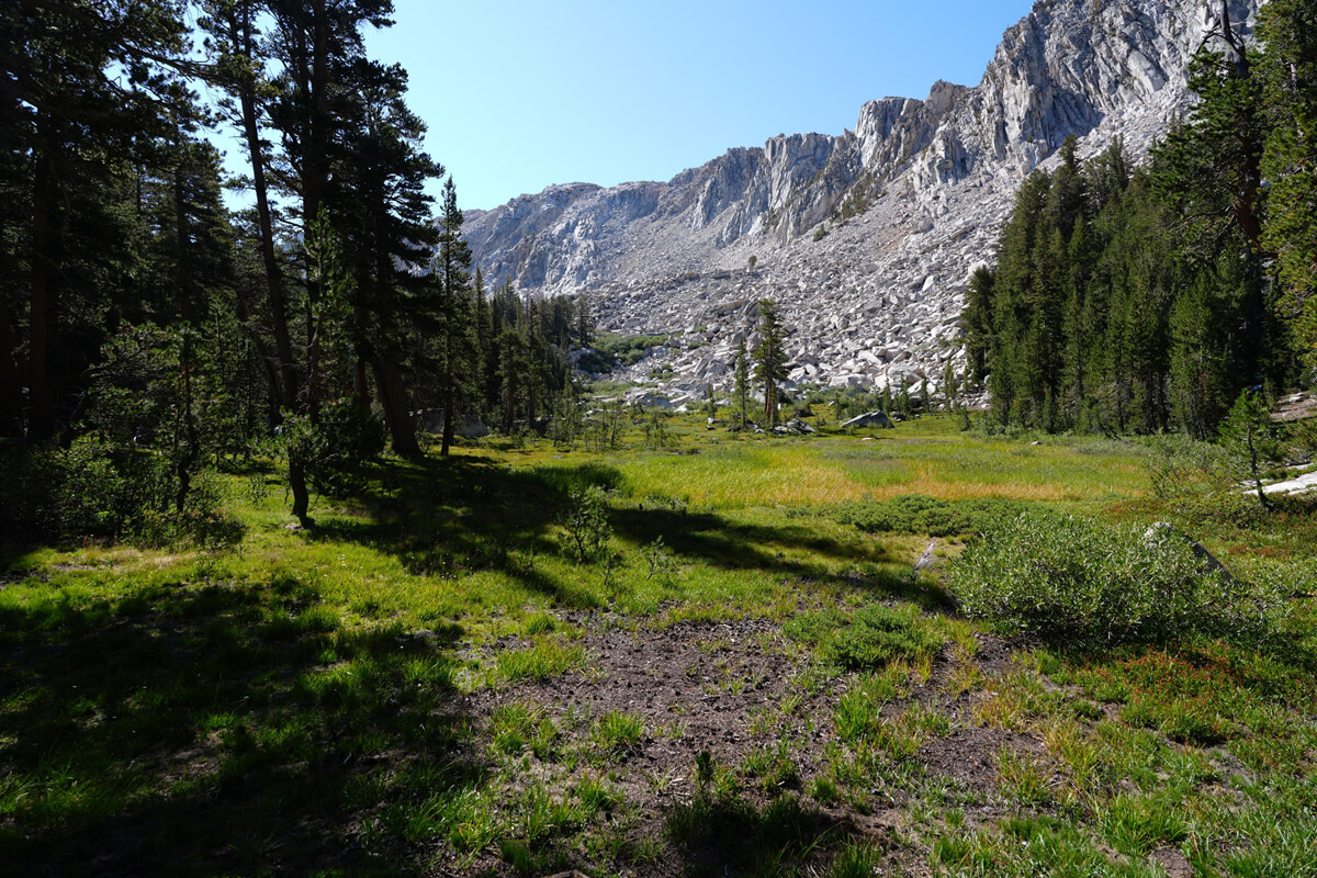
Figure 13.8: An unnamed meadow. Campsites are scattered nearby
There's a fork in the trail leading to the Fish Creek Trail. This trail runs parallel to the JMT along Fish Creek and merges with it at Red's Meadow, but there are river crossings along the way. I haven't hiked it myself, but Fish Creek has a lot of water, so it's probably best not to get a permit for it. The fact that permits are easy to obtain means it's dangerous, and I once stopped a Japanese hiker from using the VVR because they said they were going to use it on their way back
After passing through a flat, meadow-like area, you cross a bridge over Fish Creek, as shown in Figure 13.9. The river slopes steeply and flows like a waterfall. In other words, crossing this lower section requires considerable experience and physical strength
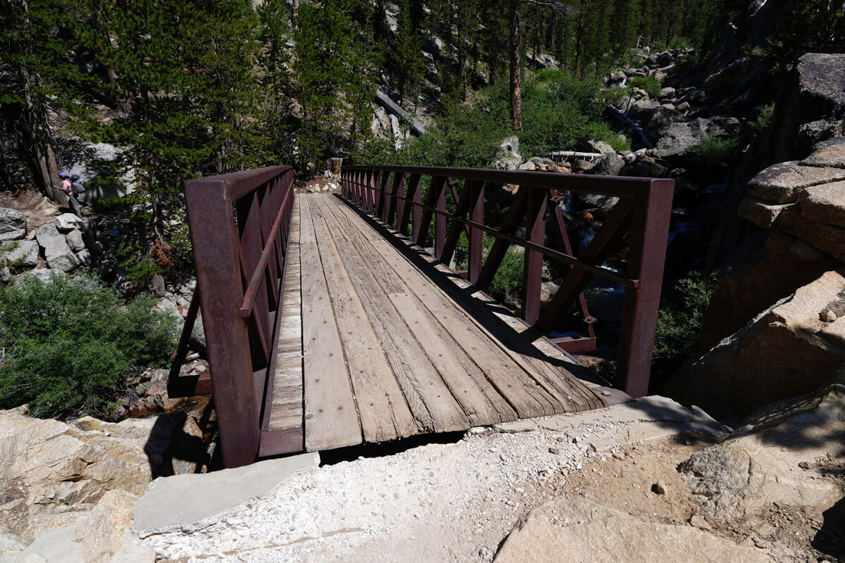
Figure 13.9: Fish Creek Bridge
The trail quickly gains altitude with switchbacks and runs along the river. The river is far away, so there's no place to get water. You don't get close to the river until you gain a certain altitude. Having hiked this trail for many years, I know my lunch spot. It's the place shown in Figure 13.10. It's a spacious site where you can pitch a tent. The river is also close. I arrived at 12 o'clock. First, I got some water, set up my gravity-fed water filter on a rock, and had instant coffee and JMT bread for lunch
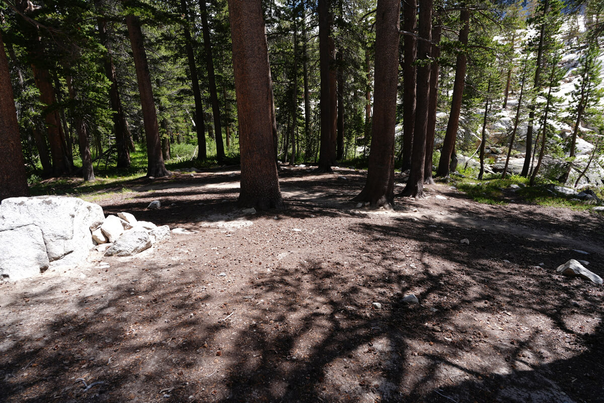
Figure 13.10: A lunch spot along the river. There is enough space to pitch a tent
2022 was a rainy year, so there was an abundance of porcini mushrooms on the JMT. Figure 13.11 shows a photograph taken here. As already explained, they are absolutely delicious when sautéed in oil with cheese. The
trail becomes gentler from the lunch spot. After passing through a small marshland, there is a fork with the McGill Pass Trail. This trail is somewhat steep and long. It eventually leads to Lake Crowley.
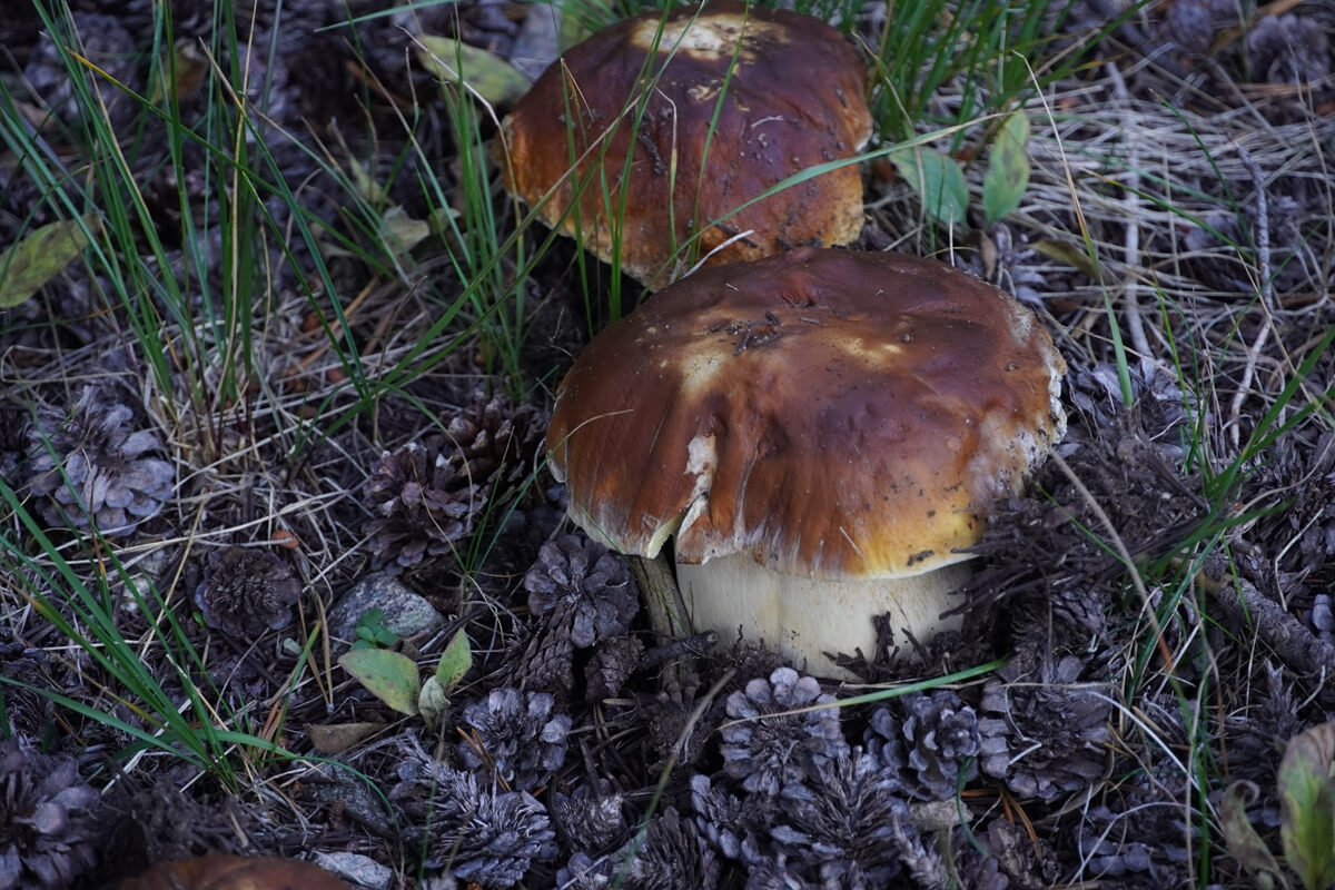
Figure 13.11: Porcini mushrooms in Fish Creek. Photographed in 2022
As the pine trees disappear, the JMT climbs towards Lake Virginia, repeatedly switching back and forth. First, you cross a stream, where wild onions are in bloom. This was a popular resting spot on the south-facing JMT
The switchbacks are exposed, but the Tully Hole meadows are obscured by pine trees and not easily visible. You have to climb quite high to get a good view, as shown in Figure 13.12. By August 18th and mid-August, clouds start to roll in in the afternoons. Even the once bright blue High Sierra was showing signs of autumn
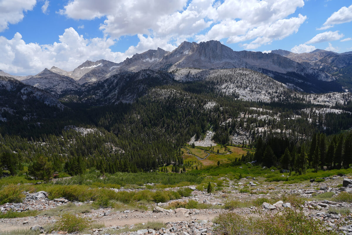
Figure 13.12: Tally Hall. Photographed after gaining some altitude
Penny Royal flowers, as shown in Figure 13.13, bloom on the slopes and emit a strong, minty fragrance. Coming here makes you feel like you've arrived at the High Sierra in summer
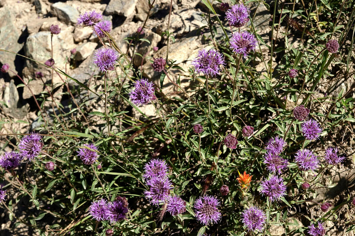
Figure 13.13: Penny Royal. Photographed in 2010
From the last switchback, the trail gradually levels out, crossing an unnamed pass. It's flat enough to pitch a tent, but water is far away. We walk for a while away from the lake, then the slope becomes steeper, and we walk along the higher ground of the lakeshore. Figure 13.14 shows Lake Virginia from my usual photo spot
I usually only go to Lake Virginia to refill my water bottles. Previously, there were hikers napping in hammocks, but this year there wasn't a single hiker. The only time I camped on the shores of Lake Virginia was during the dry year of 2012. I crossed Gooddale Pass and arrived at the VVR just before 7 pm. My heart was pounding uncontrollably. It's too far to the VVR, so I've only stayed there once
It's gotten late, around 3 PM, at Lake Virginia. Duck Lake is a bit far, so we'll probably camp somewhere around Purple Lake
Heading north from Lake Virginia, you'll encounter switchbacks and a low pass. After crossing that and walking for a while, you'll come across a landscape like the one shown in Figure 13.15
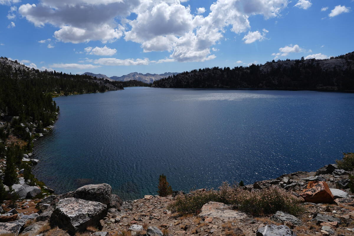
Figure 13.14: Lake Virginia
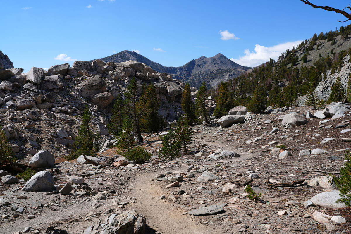
Figure 13.15: Heading from Lake Virginia to Purful Lake
To the left is a rocky mountain. After walking down to the lower part of this rocky mountain, the switchbacks begin again. This time, you descend quite a bit in altitude
Suddenly, I got a text message from James asking, "How are you?" I took out my smartphone and replied, "I'm exhausted. I'm going to pitch my tent at Purple Lake today." I can send my location and give simple replies on my watch, but I need my smartphone to write anything more. Dealing with someone so attentive is a lot of work
After navigating a large switchback, Purple Lake comes into view. The elevation difference is considerable, so it takes time to get close. At 5 o'clock, we finally reached the south side of the lake. The photo from there is shown in Figure 13.16. I remember there being a good campsite near where a stream flows out. There was one hiker, but he was empty-handed. He quickly went down the stream and disappeared. He might be camping somewhere nearby
"There's no snow north of Silver Pass," James emailed me. He was right; I must have misread my location. The timing was a little too late
For dinner, I tried the grilled chicken jambalaya I picked up at VVR. It wasn't nearly enough, so I added a chicken pack and potato salad
After dinner, I sent Chieko an email
"I'd rather go to Bishop than Yosemite. I have a printout of the Metrolink Monday-Friday schedule. Please check if there's a 2:00 AM departure from Lancaster on Saturday or Sunday. See the photo in the shared messenger with James. I had trouble falling asleep last night and had a nightmare. I feel unwell sleeping at high altitudes. I've been slow since this morning. I'm aiming for Tualum for now. If I don't run out of time, I'll go to Bishop. I'm not sure because I'm getting slower. I get emails from James every day."
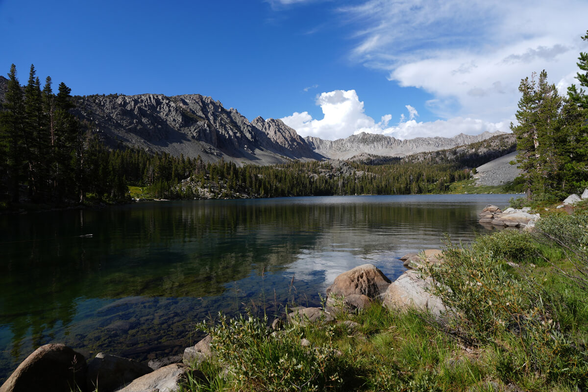
Figure 13.16: Purple Lake. It has a purple tint due to the geological layers
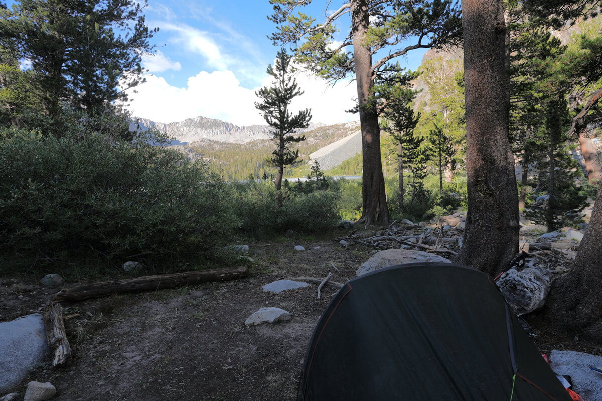
Figure 13.17: The campsite had somehow become a no-tent zone
I received an email from James
"Yesterday at Sixty Lakes Basin was fantastic. This afternoon I'm picking up a resupply (at the Charlotte Lake junction)...By the way, have you decided to go to Yosemite?"
"No, I'm not going to Yosemite. I'll stop at Tualum. Then I'll go to Merced or Bishop. My wife says I can't go to Lancaster on Sunday. That's a bit different from what I had. I'll have her check the Esta Bus schedule again."
The next day, I set off at 7:00 AM. I soon noticed a new sign, Figure 13.18. It seems that camping has now been prohibited at the end of Purple Lake. That might explain the lack of people. The hiker who had disappeared was probably camping illegally, just like me, so he quickly fled. I decided to make my escape as well
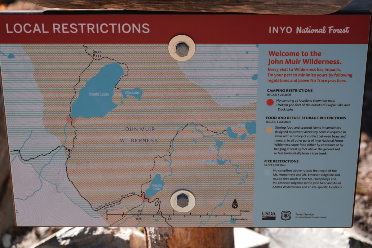
Figure 13.18: Camping south of Duck Lake has long been prohibited, but it was also prohibited south of Purple Lake
Purple Lake to Reds Meadow
The distance from Purple Lake to the lower reaches of Duck Lake is about two hours. There is no water along the way, so camping is not possible. This year in particular, it is completely dry
We emerge from Purple Lake onto the mountain slope. Unfortunately, the climb to the point where we change direction is gentle and time-consuming. However, from near this turning point, we can see Silver Pass, which we have been walking along. This is shown in Figure 13.19. The triangular mountain with its rugged, rocky surface, carved out of the mountain, is the mountain near Silver Pass. The lower area to the left of the mountain is the pass. With each pass we cross, we enter a different world
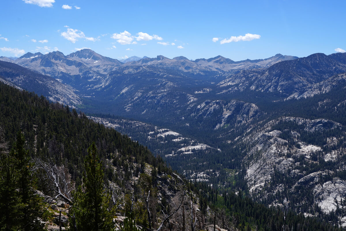
Figure 13.19: Silver Pass is to the left of the triangular high mountain
We arrived at the Duck Pass junction at 9am. While the trail appears level on the topographic map, it actually involves uphill and downhill sections, making a two-hour hike unavoidable. There were a couple of meadows along the way, but no water was visible. About 10 meters past the junction, there was a small stream. Upon checking, it was not dry. The route from here to Duck Lake and then to Mammoth Lakes offers beautiful scenery and is recommended, which I will explain later
If you take the JMT from the Duck Pass junction, you'll soon encounter switchbacks and begin to descend. There's actually a good campsite at the first switchback, where I've pitched my tent three times.
After descending the switchbacks, you'll cross a stream flowing from Duck Lake. There's a bridge made of thick logs here. Of course, the water level is low, so wading is safer. Campsites are located on the hill to the left before the wading point, or in the shade of trees after the wading point. The area around the Duck Lake stream is relatively flat, so there are many campsites.
From the lower reaches of Duck Lake to Deer Creek, about three hours later, is the second longest dry section of the JMT. If you're heading south on the JMT, it's a continuous uphill climb, which would be tough in the middle of summer. If you're heading north, it's downhill and easier to walk. At 11:00, we had an early lunch before reaching the halfway point, because there was a small meadow
I got an email from James.
"We've crossed Glen Pass."
"That's great. I've decided to go to Bishop. The Esta bus runs on Sundays too. I'm going to Los Angeles on August 25th."
James has a wonderfully healthy son who will deliver the supplies if she takes a nap at the junction. Chieko checked the ESTA bus schedule again and found that it was running on Sunday. So she traveled to Los Angeles on Sunday and changed her Miyako Hotel reservation to one night. Having a Garmin inReach device makes this kind of communication easy
Lunch is over. The terrain becomes gentler. As the elevation decreases, the scenery is no longer visible. As we approach Deer Creek, we walk along the top of a low hill. It is a distinctive terrain as shown in Figure 13.20. After walking for more than 30 minutes from here, the meadow finally appears and we arrive at Deer Creek. This is shown in Figures 13.21 and 13.22
Deer Creek is a small stream, so crossing it is always easy. I once found a pair of sandals there. I carried them around intending to keep them, but despite being a top-brand product, they were uncomfortable to walk in. So I left them on top of a trash can in Agnew Meadow. Maybe someone else will pick them up and use them
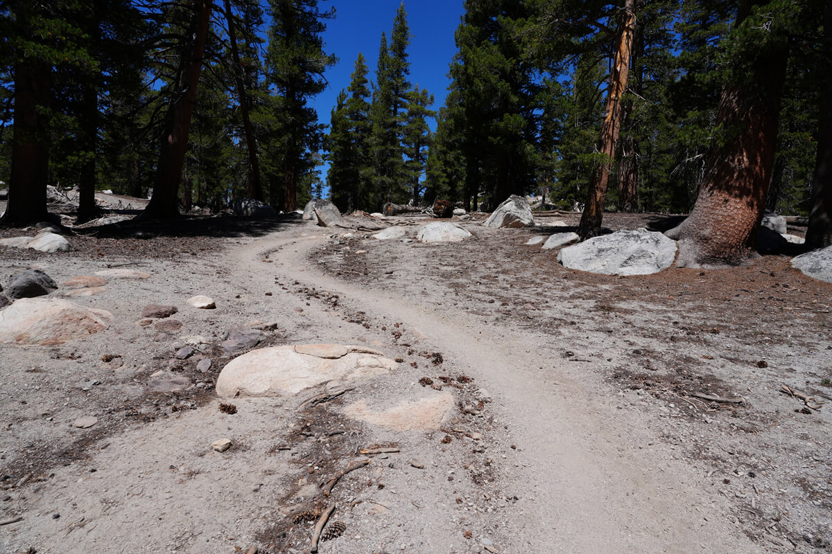
Figure 13.20: A location about 30 minutes from Deer Creek
Figure 13.21: Meadow near Deer Creek
Figure 13.22: Deer Creek
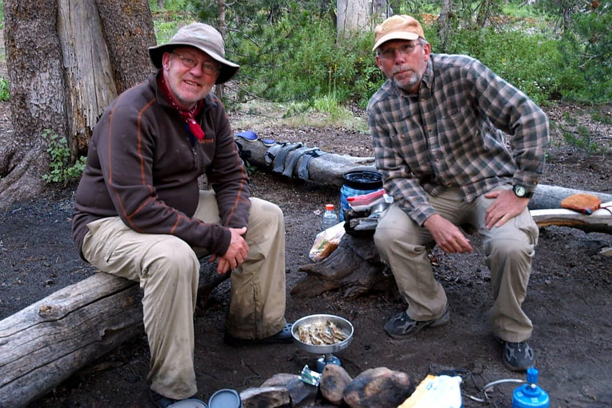
Figure 13.23: Roger Wilde and Dan Crouch. At the Deer Creek campsite. Photographed in 2009
Crossing Deer Creek, there are various campsites downstream. This is an old story, but I met two hikers back in 2009. The one on the left in the photo is Roger, and the one on the right is Dan; they said they were writers
Since we were on the southbound JMT, we started walking together near Red Corns. Dan suddenly said, "Out of gas," and sat down on a nearby rock. It was a spot where we could see the rock formation known as Sam (Figure 13.24). Roger explained, "That's Sam (Thumb)."
Actually, the name "Sam" isn't listed on the map. It might be a local nickname. Also, what struck me was that in English, "gas" refers to liquid gasoline, not gaseous gas, but in Japanese, "gas" is translated as gasoline
After setting up their tent at Deer Creek, Roger
"I'll be right back."
He then went upstream into Deer Creek with a fishing rod in hand, his neck draped with something resembling a sign. It seems the rule is to wear your permit visibly, just like the fish police I saw at VVR
Roger returned in less than 10 minutes and began to cook the trout in a frying pan. This is shown in Figure 13.23
Roger demonstrated how to remove the bones, gently massaging the cooked trout and pulling the bones out of its head. He then gave me one. As a token of my gratitude, I gave him a pack of Japanese dried vegetables
We had a lively conversation around the campfire, but unfortunately, it was my first time in America, so I couldn't participate much in the discussion. The topic was the trade of lemons and scallops. I had no knowledge of U.S.-Japan trade, so I couldn't understand much of it
Leaving Deer Creek, the trail gently descends, following the flow of Crater Creek. Where you can see Sam, there are flat, sandy hills where camping is possible. If you're camping alone in peace, you can skip the Deer Meadow campsite; I've actually camped there many times
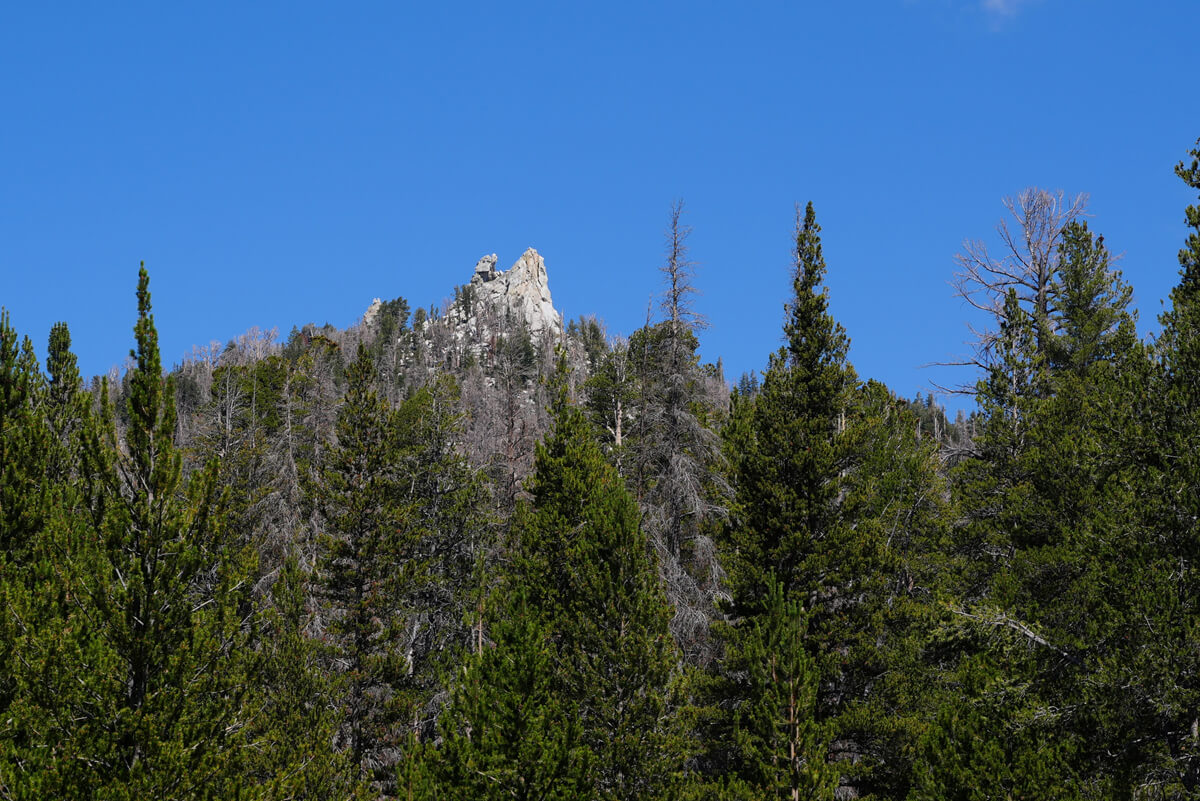
Figure 13.24: Thumb
We arrived at Crater Meadow around 3 PM. The trail briefly leaves the river but quickly returns. There is a final stream crossing about 1 meter wide
I met some Kiwis (New Zealanders) around here. I haven't seen any Kiwis at all this year. I seem to have forgotten to take pictures, so Figure 13.25 shows the Kiwis I met in Centre Basin (north of Mother Pass) in 2018
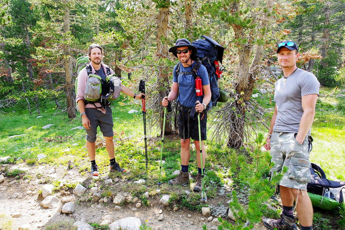
Figure 13.25: Robust kiwis. Photographed in 2018
As you can see, he has a robust physique like a bodybuilder. Another distinctive feature is that he's equipped with an Arne front pack. He looks completely different from American hikers. There's a misconception in Japan that ultralight hiking is the norm on the JMT, but it's mostly Japanese people who actually hike the JMT in ultralight gear
After passing through a narrow valley, one of the Red Corns comes into view. (Figure 13.26) The climb to the top is easy, but the view isn't much different from what you see from the switchbacks further ahead. That's why I've only climbed it once
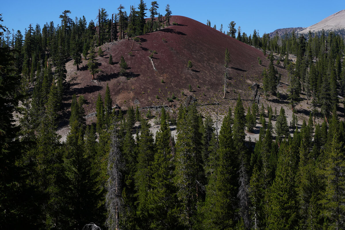
Figure 13.26: Red Corn in the South
If you go around the base of this Red Cone, you'll reach a campsite. There aren't any good campsites beyond this point until Red's Meadow. I once went down the switchback and tasted the river water, but it was volcanic spring water and tasted of sulfur. Therefore, it's impossible to purify it
I arrived at Red Corns at 4pm, but there were no suitable campsites further on. So, I pitched my tent. That's shown in Figure 13.27. I was expecting to have a nice, quiet tent all to myself, but two other people arrived. One was far away on the slope of Red Corns, and the other was by the stream; both were Chinese women, dressed in flashy clothes. They said it was their first time camping, having entered through Red Corns. We didn't get along very well, so after a brief conversation, I didn't approach them further. For dinner tonight, I had a mackerel can set meal
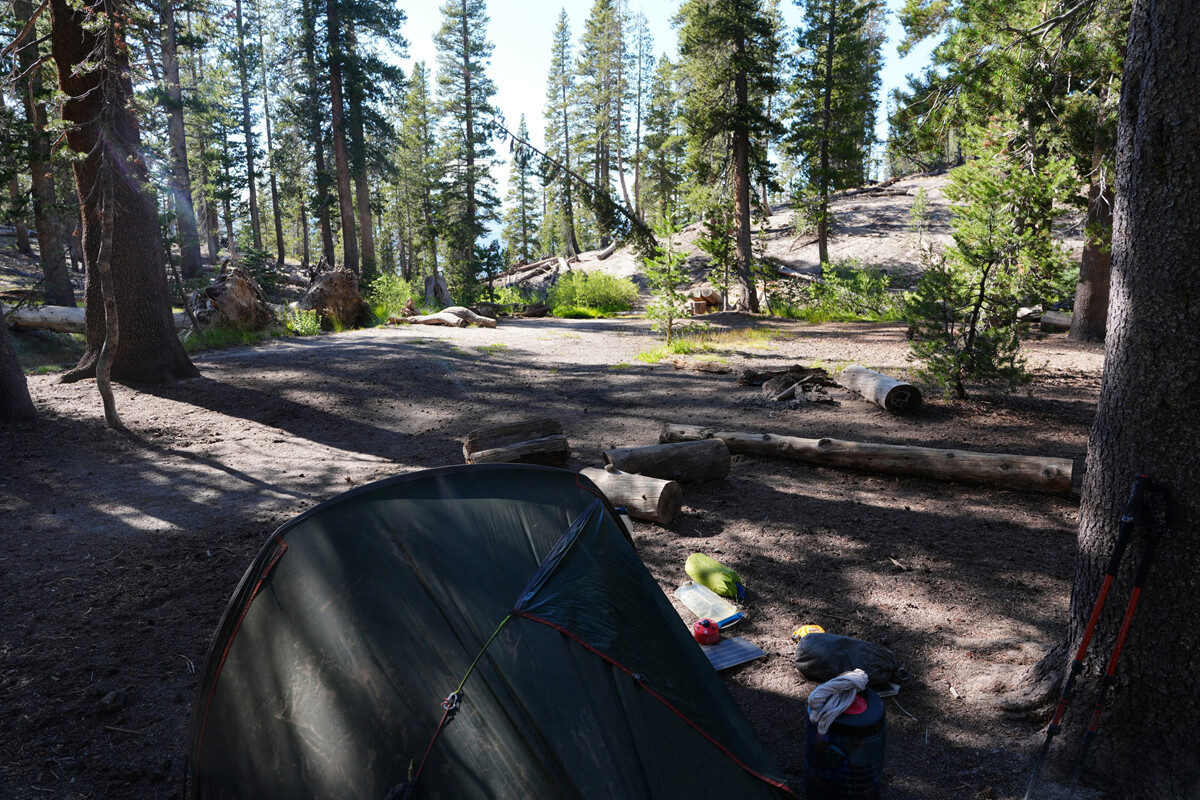
Figure 13.27: Red Cornes' campsite
The night was warm, and the temperature inside the tent only dropped to 7°C. I slept well and set off around 7am, descending the switchbacks as part of my routine work. Initially, the trail followed the river, and then the switchbacks shifted significantly to the east. Figure 13.28 shows the switchbacks quite far down
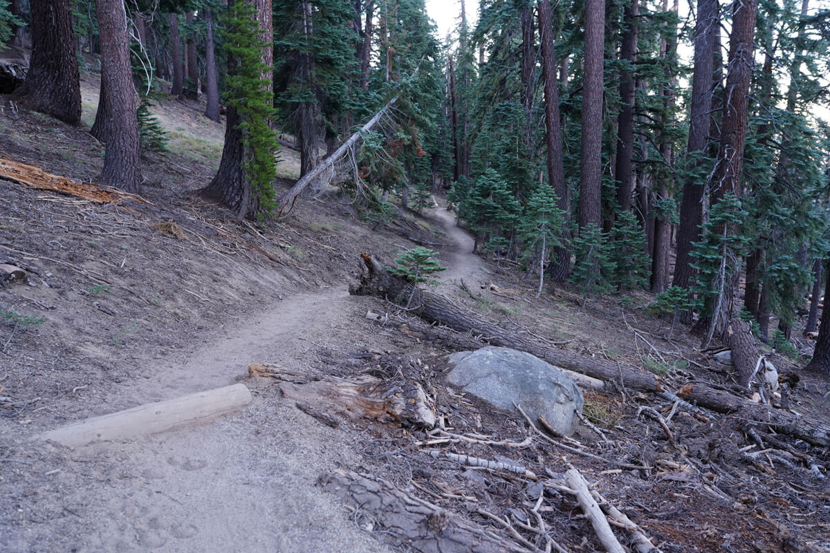
Figure 13.28: Switchback from Red Cornes
I have a little memory associated with this switchback. I think it was in 2016 when I met a woman like the one in Figure 13.29. It was my second time meeting her; the first time was on the descent from Mount Whitney. She had a photographer with her, so we only talked a little. So, what did we talk about the second time?
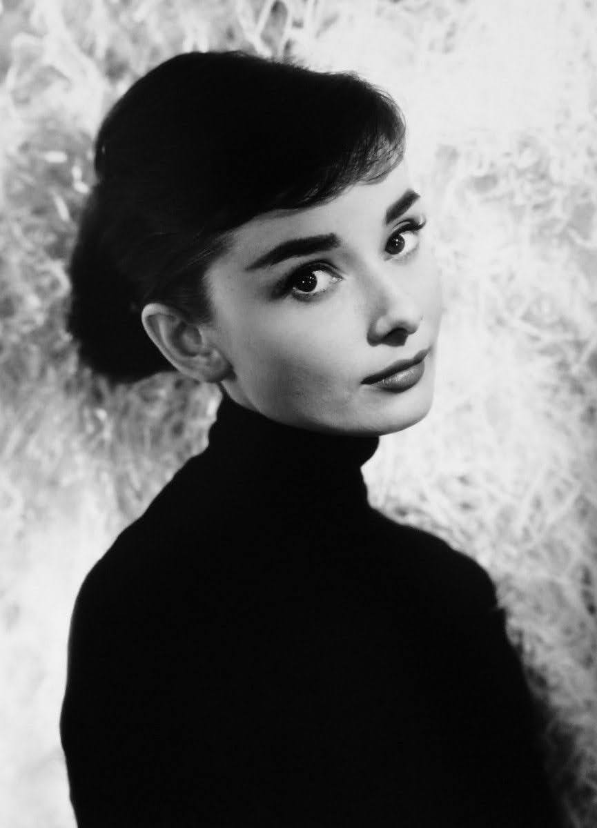
Figure 13.29: I met this person here. Occasionally, stunning beauties appear at JMT. (Public domain photo.)
"Oh, what are you doing here?"
"Oh man, it's terrible. I dropped my stylus pen and I'm looking for it. I must have dropped it somewhere around here. I can't find it anywhere."
I told this rather uninteresting story. On this occasion, I lost my stylus pen as soon as I arrived in America, bought a new one for about $10, and then lost it again. For some reason, I have bad luck with exceptionally beautiful women. I just end up chatting about trivial things with them, as if they were just girls living next door. It's a real problem. This woman was from New Zealand and had come with a group of people. As expected, this was the last time I would see her. I didn't take a picture of her, nor did I get her email address. I also never found my stylus pen
Red's Meadow was once burned down and reduced to a scorched wasteland. Afterward, flowers like lupines reappeared, and now low-lying trees are beginning to grow. Eventually, these will transform into tall pine trees. This is how American nature cycles over several decades. It's a natural process
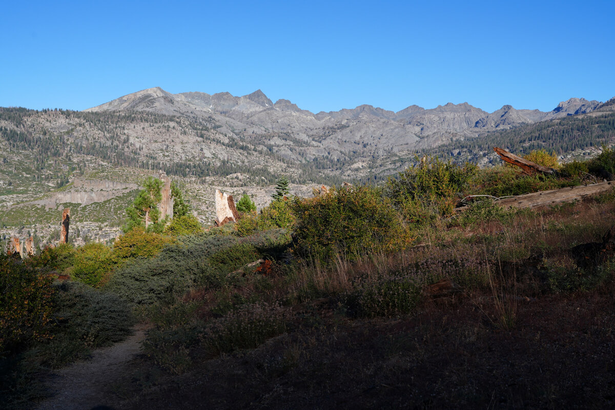
Figure 13.30: Reds Meadow. The Minarets mountains in the distance
Now, the pack station at Reds Meadow is shown in Figure 13.31. The trails nearby are mostly sandy, with a good mix of horse manure, as horses roam around there. When passing horses, keep your distance to avoid inhaling the dust
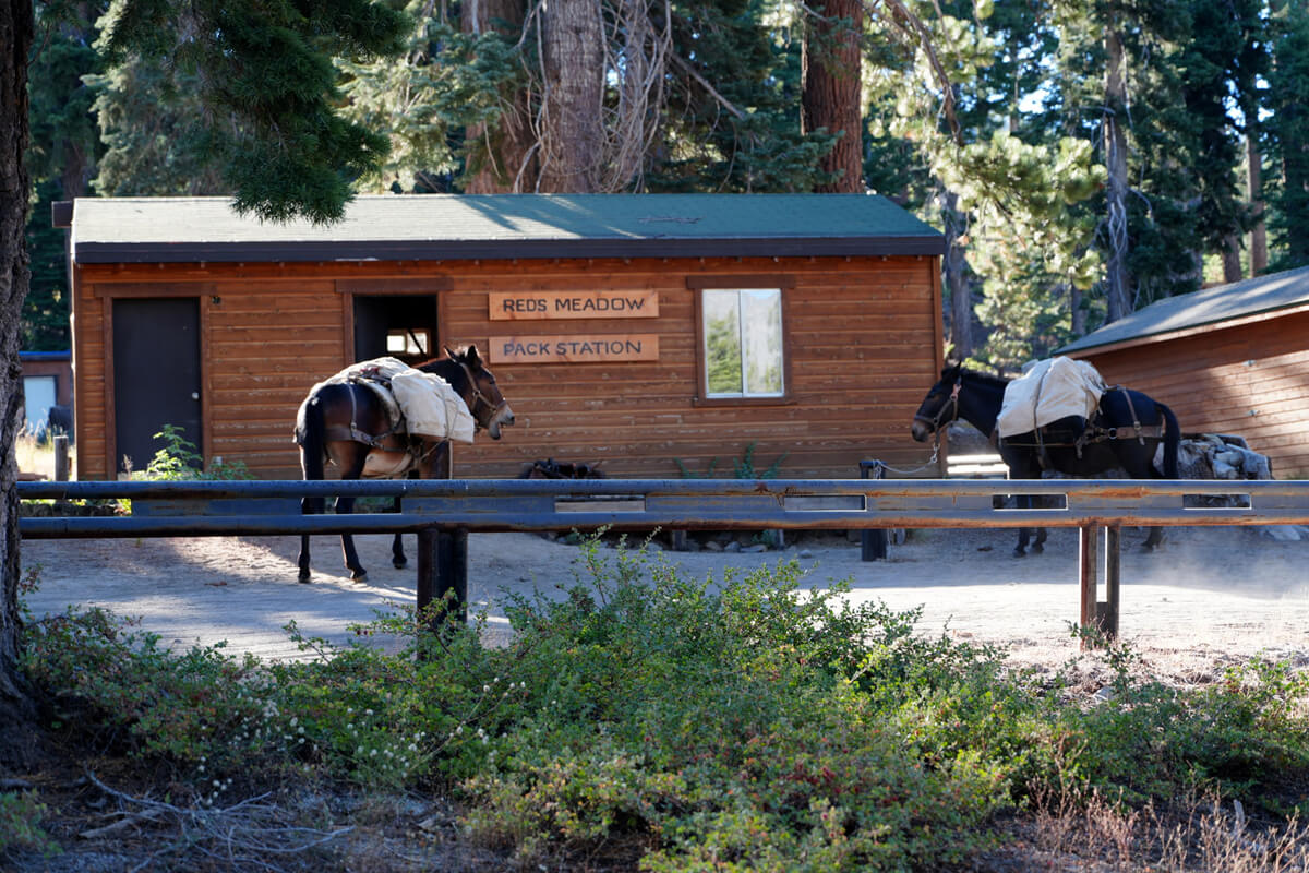
Figure 13.31: Pack station at Reds Meadow. It provides resupply services
I arrived at Reds Meadow at 8:40. I looked around the shops, but they were practically empty and there was nothing to buy. Usually they have fresh food like sausages, but there was nothing. They had Probar, so I bought four of them
I tried to go into the mule (donkey) cafe next door, but the door was locked. I shook it and got scolded. They pointed to the counter and told me to order there
Since it was morning, only the breakfast menu was available. I wasn't allowed inside the restaurant; I was told to eat outside. I ordered a burrito, as is my usual order. That's shown in Figure 13.32. The only difference is that it's wrapped in paper like in a restaurant. Previously, they would offer unlimited coffee refills, but there was nothing like that this time
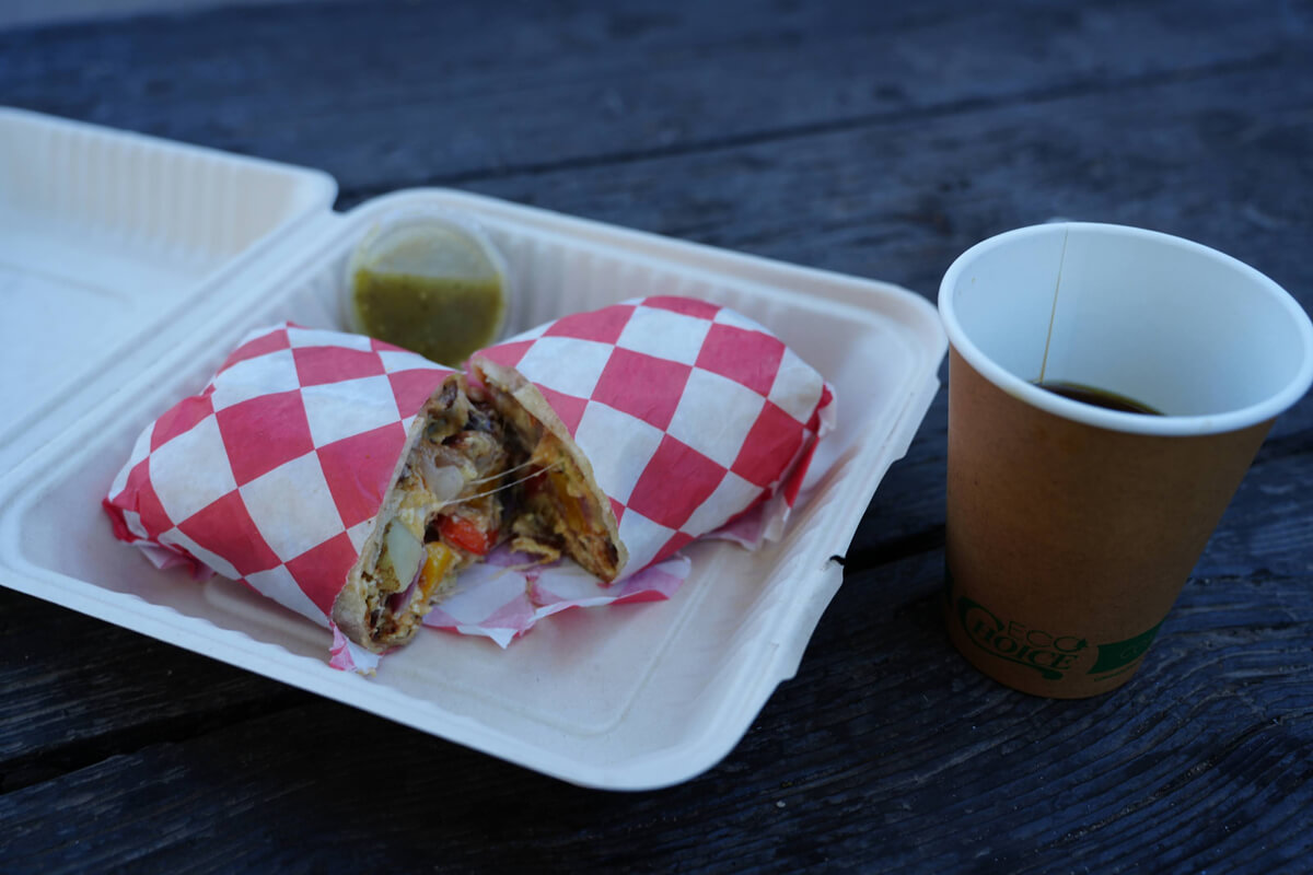
Figure 13.32: Burrito from Mule Cafe
After eating, I looked around for a hiker's box, thinking there must be one somewhere. I found a bucket. There were two energy bars inside, so I took one. A hiker who saw me did this
asked, "Don't you have any food?"
"No, I have a lot. It's a hobby of mine."
That was my reply. Apparently, I looked like a poor hiker who didn't even have money to buy food
I decided to leave a little after 9 o'clock. I gave Chieko my regular update
"I'm at Reds Meadows, but my SIM card has no signal. Since I'm here, I'll have a burrito and coffee. I bought some snacks and picked up a few things. I'm cutting it close to my schedule, but it's okay. Today I'm planning to go as far as just before the minaret."
I'm planning to cross-country ski from Minaret Lake east of Iceberg Lake, but it's an unknown route. Let's see how it goes
From Duck Lake to Mammoth Lakes
The distance from Duck Lake to Mammoth Lakes is about a two-day, one-night trip, and I used it as an escape route in 2018 and 2022. It's a scenic route, and it's also a good option to enter from here after obtaining a permit for Duck Pass
Located at the midpoint of the JMT, it can be hiked both north and south. Many people confuse it with the town of Mammoth Lakes, but there is no lake called Mammoth Lakes. There are many beautiful lakes in the southwest of the town. The most famous lakes are probably Twin Lakes (Figure 13.38), Lake Mary (Figure 13.37), Lake George (Figure 13.39), and Horseshoe Lake (Figure 13.40). South of Lake Mary is the Duck Pass Trailhead, and west of Horseshoe Lake is the Red Cornes Trailhead. There is a free bus (Figure 13.41) from Mammoth Lakes to each of the lakes
From the junction with the JMT, head towards Duck Pass. The trail is a little narrow, and you gain altitude with short switchbacks. The viewpoint opens up to the river flowing down from Duck Lake. There is a small flat area that makes you want to camp, but camping is prohibited. Figure 13.33 was taken from near this point
After crossing a stream, the trail traverses a slope. The view of the mountains on the opposite bank is beautiful, but there are no good campsites along the trail. That's because it's just a slow climb up the slope. If you want to camp, it's either at nearby Pika Lake or along the trail leading to it
Figure 13.34 shows the view north of Duck Pass. You can also camp at nearby Barney Lake. The mountains visible in the distance are the Mammoth Lakes. There are many day hikers on the way to Duck Lake. There is a car campground at Lake Mary, the trailhead, so they are probably hikers coming from there. In the afternoon, I walked along Duck Pass and encountered many people. They were all heading home. So I looked for a quiet site. A good spot was Skeleton Lake, shown in Figure 13.35. The photo shows the view from near the site, with the trail on the left side of the photo. This allows you to maintain distance from people resting by the lake. The campsite is shown in Figure 13.36. There is cell phone reception here, which is convenient
West of Skeleton Lake lies Arrowhead Lake. It's located in a lower elevation and requires a steep descent, so I haven't checked for campsites there
The trailhead is about an hour from Skeleton Lake, and Lake Mary is another hour or so away. The nearest bus stop is a few minutes' walk east along the lakeshore
Figure 13.33: Duck Lake. Photographed in 2018
Figure 13.34: North of Duck Pass. Barney Lake. Photographed in 2022
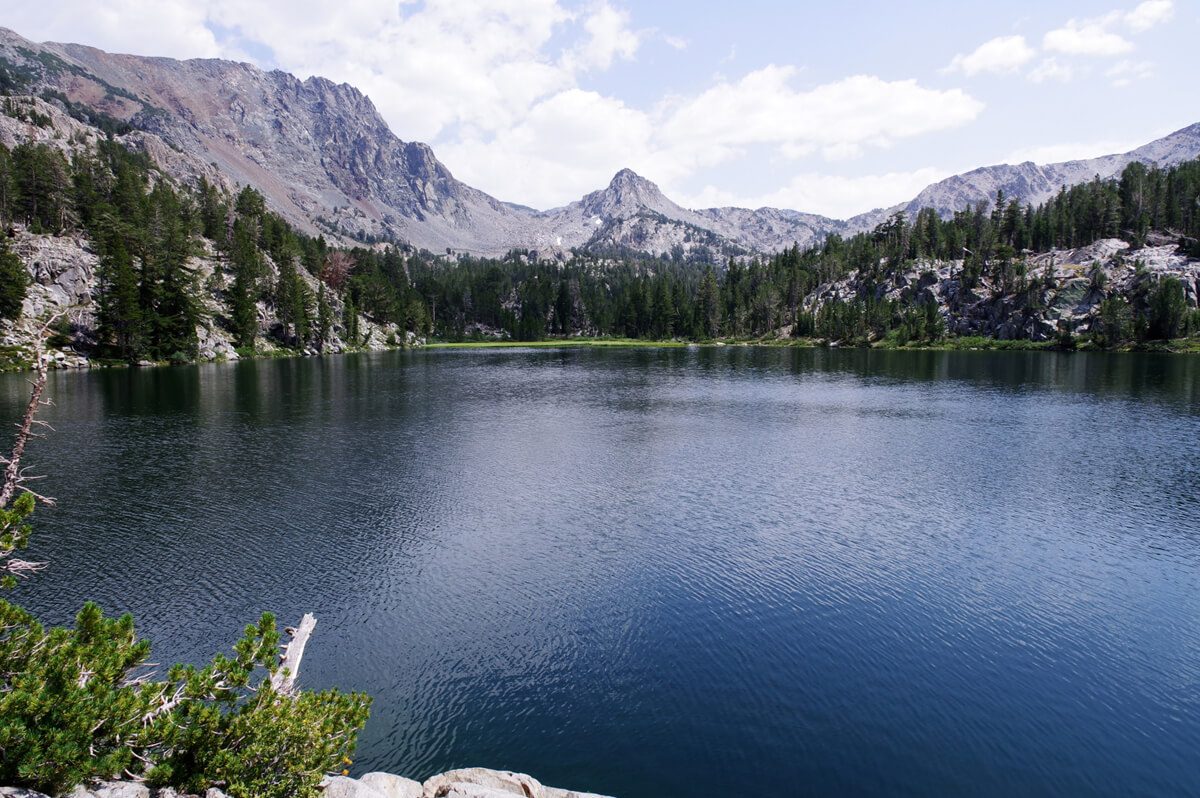
Figure 13.35: Skeleton Lake. Photographed in 2018
Figure 13.36: Camping at Skeleton Lake. Photographed in 2022
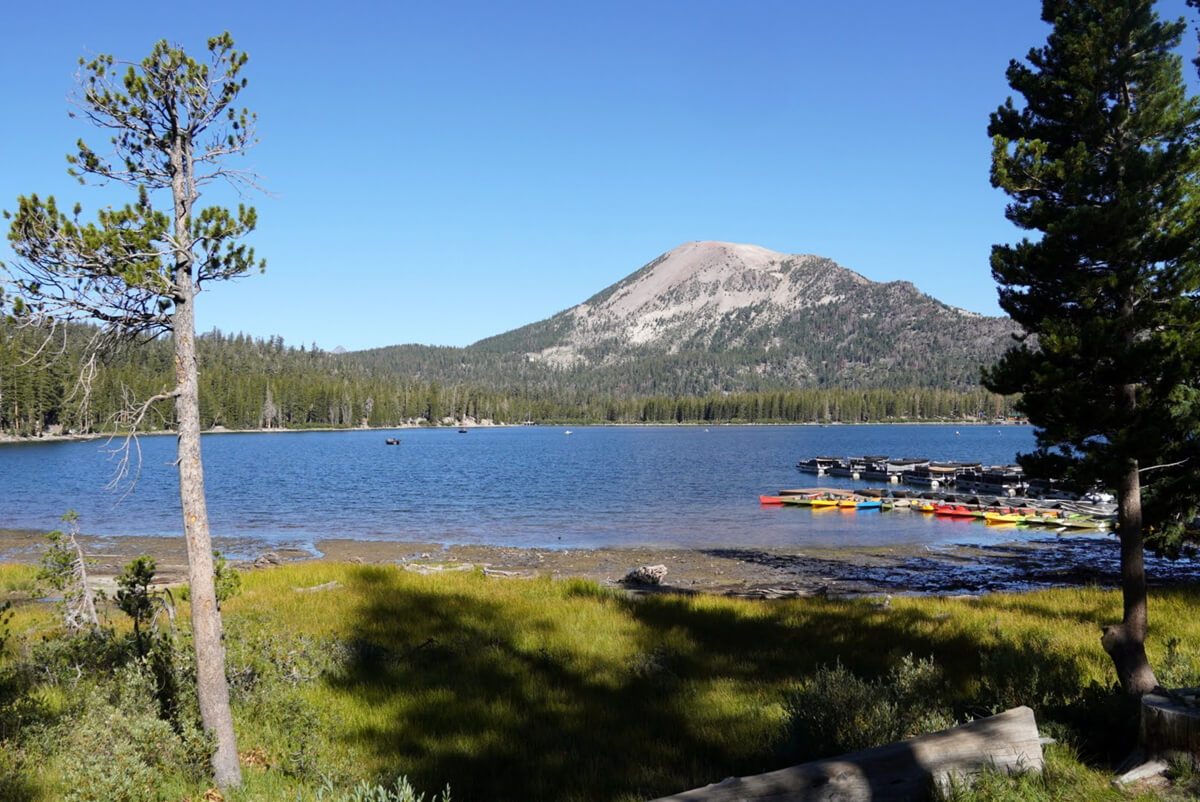
Figure 13.37: Lake Mary. Photographed in 2022
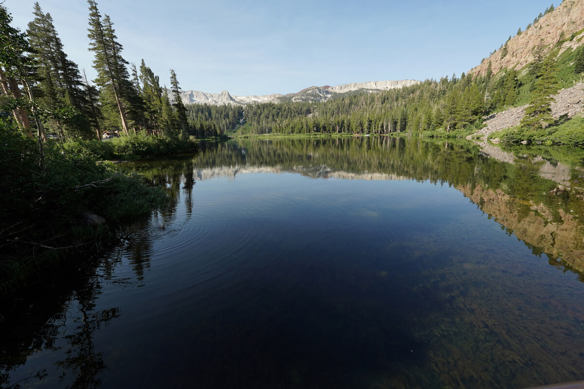
Figure 13.38: Lower Twin Lakes. Photographed in 2024
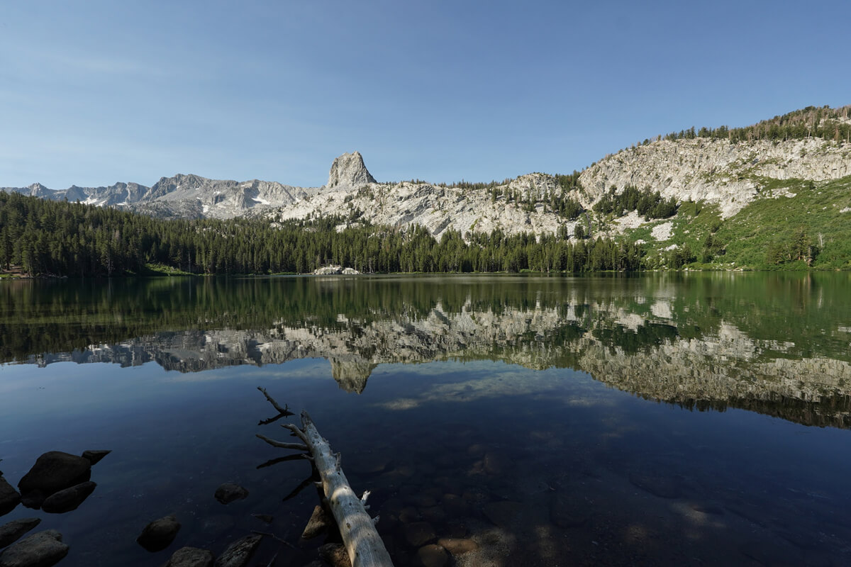
Figure 13.39: Lake George. Photographed in 2024
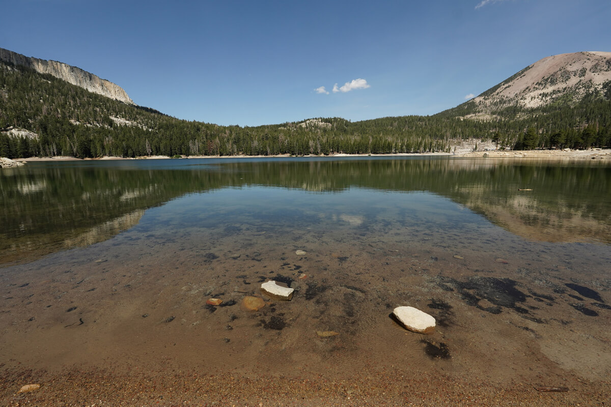
Figure 13.40: Horseshoe Lake
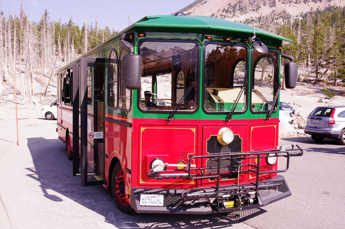
Figure 13.41: Free bus at Mammoth Lakes. Photographed in 2018
<To be continued in Chapter 14>
Nobuhiro Murakami's new hiking guide, "The Science of Hiking, 5th Edition," is now available on Amazon (Kindle edition is 100 yen)
Nobuhiro Murakami, a former professor at a national university and an experienced through-hiker who continues to share rational solo hiking know-how from a unique and profound scientific perspective in books such as "Hiking Handbook" (Shinyosha) and "The Complete Guide to Hiking in the United States" (Ei Publishing), has released his new book, "The Science of Hiking," which is now available on Amazon. This compelling and logical hiking textbook is based on his accumulated experience dating back to the dawn of long trails in Japan, as well as objective sources such as academic papers on hiking, exercise physiology, and a wide range of other fields

Consider a paid membership for access to premium content and events!
Nobuhiro Murakami
 Born in 1950. Former Professor Emeritus at Toyama University. Specializes in educational psychology and educational measurement. His outdoor-related works include "The Complete Guide to Sleeping Noshiki" (Sanichi Shobo), "Outdoor Gear Considerations: The World of Backpacking" (Shunjusha), and "Hiking Handbook" (Shinyosha). His psychology-related works include "Psychological Tests Are Lies" (Nikkei BP), "What Can Psychology Tell Us?" and "The Deceived Intelligence" (Chikuma Shobo). His recent works include "Introduction to American Hiking" and "The Science of Hiking" (Amazon), which compile the author's know-how from long-term annual hikes on numerous American long trails, including the Glacier Trail, the John Muir Trail, and the Winds Trail
 John Muir Trail Northbound Traverse (2025 NOBO) Record [Chapter 7] Middle Fork Junction to Muir Pass
 John Muir Trail Northbound Traverse (2025 NOBO) Record [Chapter 10] To the Muir Trail Launch
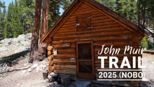 John Muir Trail Northbound Traverse (2025 NOBO) Record [Chapter 8] Muir Pass to the San Joaquin River
 John Muir Trail Northbound Traverse (2025 NOBO) Record [Chapter 6] From the Lower Basin to the Middle Fork