歩かずに死ねるか!アメリカ国立公園への旅(14) 知る人ぞ知る聖山、マウント・シャスタを巡る
written by Sayaka Kato
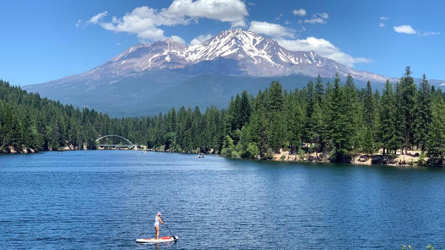
オレゴン州にほど近く北カリフォルニア州にある聖なる山、シャスタ。アメリカのパワースポットという言葉で思い浮かぶのはセドナが有名だと思いますが、シャスタもその一つ。むしろそこまで海外の旅行者に観光地化されていないシャスタは静かで人も少なく、美しい水と森と岩岩に囲まれ、アメリカの中でも他にはなかなか無い特別なエリア。
実際にこの地に足を踏み入れると自分を見つめ直す機会になったり、忘れかけていた懐かしいものを思い出したり、自然に自分自身の内側での崩れていたバランスが取れていったり、、ということがあるようです。五感で感じる何かがここにはあり、訪れた人の中でそれを感じた人々が多いのでしょうね。ゆっくりとした時間を過ごしながら、ここの澄んだ空気と空、美しい水、そして雄大な大地の中に身を置き、そこのエネルギーが体に染み込んでいくのを感じてみるのにぴったりな場所です。
色々な名前を持つシャスタですが古くから先住民が聖地としている山でも有名です。長い間人々から崇められてきた聖なる山。山頂付近には、いまだに聖域が多々あり、訪れる人々を、静寂で厳粛な気持ちに導きます。水が美しいのこのエリア。有名なクリスタルガイザーはここからの雪融け水を使用して生産されています。
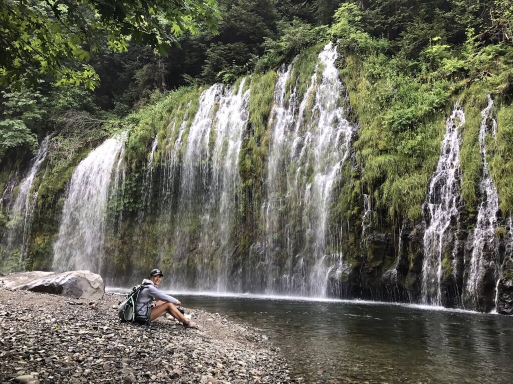
シャスタはよく、水の都・パワースポット・聖なる山・ボルテックスが渦巻く・7大聖山の一つ・ヒッピーが多い街、、なんて呼ばれていますが、実際に行ってみると納得します。美しさの中にも強さと優しさ両方のエネルギーを感じさせてくれるマウントシャスタの堂々たる姿。そしてその周りには透き通る雪融け水が流れ出す川や湖や滝、そして豊かな森。自然の美しさがバランスよく揃うマウントシャスタエリア。シャスタが私たちを守り包んでくれているようです。そんな大自然が広がるここは数多くのアウトドアが楽しめます。ハイキング、ウォーターアクティビティ、バイキング、乗馬、キャンピングと大自然を相手にありとあらゆる遊びがここでは待っています。
目次
シャスタ周辺のおすすめトレイル、Black Butte ブラックビュート
シャスタ山の標高は4,321m。主峰のほか、西側には標高3,758mの側火山シャスティーナ(Shastina)と二つの山が連なる万年雪のツインピークス(双耳峰)。2つのサミットがあり、カップル同士で佇んでいる様な山です。今回はこの北カリフォルニア州にある聖なる山、マウントシャスタ周辺にあって、比較的気軽に楽しめるトレイル「Black Butte(ブラックビュート)」またの名をベイビーシャスタと呼ばれる岩山のハイキングルートをご紹介いたします。
Black Butte ブラックビュート(ベイビーシャスタ)ハイキングのデータ
- 中級者向け
- ハイキングおすすめシーズン5月から11月
- トレイルヘッド標高:約1321m
- Black Butte 標高:約1927m
- 往復:約9.8km (6.1 mile)
- 高低差:約606m (1,991 ft)
- コースタイム:往復3時間から5時間(山頂休憩含む)

ハイキングに携行すると便利な持ち物
- 飲み物 (夏は多めに、2リットル位。)
- 気温の調整できる防寒着 特に山頂は風があると寒い日もあります。必ずフリースなどのご用意を。
- トレッキングシューズ (このトレイルは岩場が多いのでトレッキングシューズをおすすめします。)
- 帽子
- サングラス
- 日焼け止め
- ハイキング中に食べるスナックなど
- 常備薬などがある場合は薬やバンドエイドなどのファーストエイド
- 雨具(カリフォルニアの4−9月はまず雨は降りませんが必要だと思われる方は)
- その他、通常ハイキング装備
マウントシャスタへの行き方(車にて)
- サンフランシスコから車でI-5を北へ約5時間。直線距離で約245マイル(392km)
- サクラメントからは3時間。同じく車でI-5を北へ
- シャスタに近い空港はレディングまたはメッドフォード空港から車で、約1時間~1時間半(I-5を利用)
ベイビーシャスタと言われるピラミッド型の岩山がシャスタの手前にあり、まるでシャスタのミニバージョンのようなのでベイビーシャスタとも呼ばれています(下写真左)。このトレイルは途中からは岩岩しいトレイルを歩くことになります。常に絶景が広がり、シャスタが美しく見えるトレイルでも有名です。

ハイキングガイド
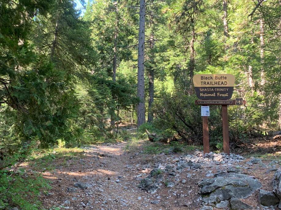
Black Butte トレイルヘッド
住所:Forest Rte 41N18, Mt Shasta, CA 96067
ここのトレイルヘッドへいくまでに最終的に未舗装のオフロードを走ることになります。トレイルヘッドにいくまでには細いオフロードと太いオフロードの分かれ道があり、どちらを通っても行けますが、メインの太いオフロード(太い道)を使用していきましょう。GPSが細い道を選択した場合も、少し遠回りになるかもしれませんが太い道を利用していくことをおすすめします。
細い道へ入ってしまうと道沿いの木々から伸びた枝が道路に突き出していたりするため、車を傷つけてしまう可能性があります。帰りも同じです。駐車場はトレイルヘッドのすぐ前にあり車が5~6台ほど停めることができるスペースがあります(お手洗いなどはありません)。写真は7月の頭で朝の10時でしたが2台ほどしか車はなく、駐車スペースに余裕がありました。
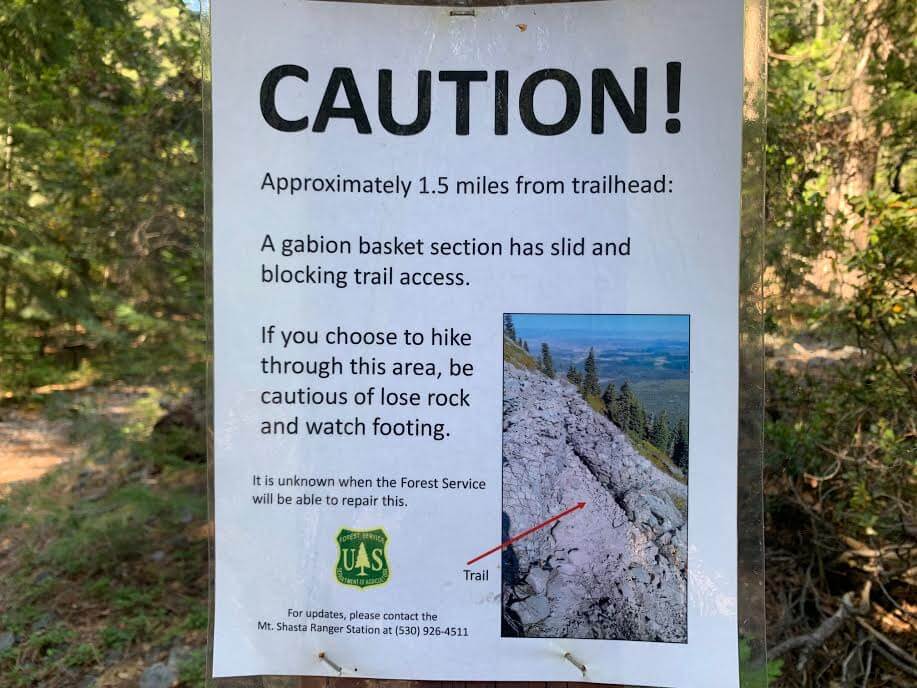
トレイルヘッドの掲示板のところに注意書きがあり、トレイルヘッドから1.5マイルのあたりに危険な場所があるから気をつけて!という内容で写真と共に説明があります。実際に歩いていて気になりませんでしたが、Black Butteのトレイル自体は古く、近年は整備が常にされている訳ではないので注意は必要です。崩れかけたところや、危険なところもあるので注意して歩いていきましょう。
それではハイキング出発。まずは木々が生い茂る森の中を歩いていきます。
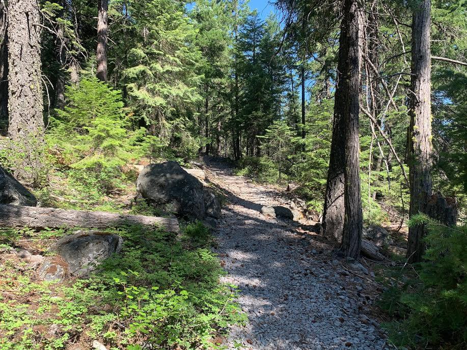
少し急な坂になってますが進んでいくとすぐにこんな岩場のエリアに。

そこから右側に広がる景色が雄大ですでに満足感でいっぱいです。
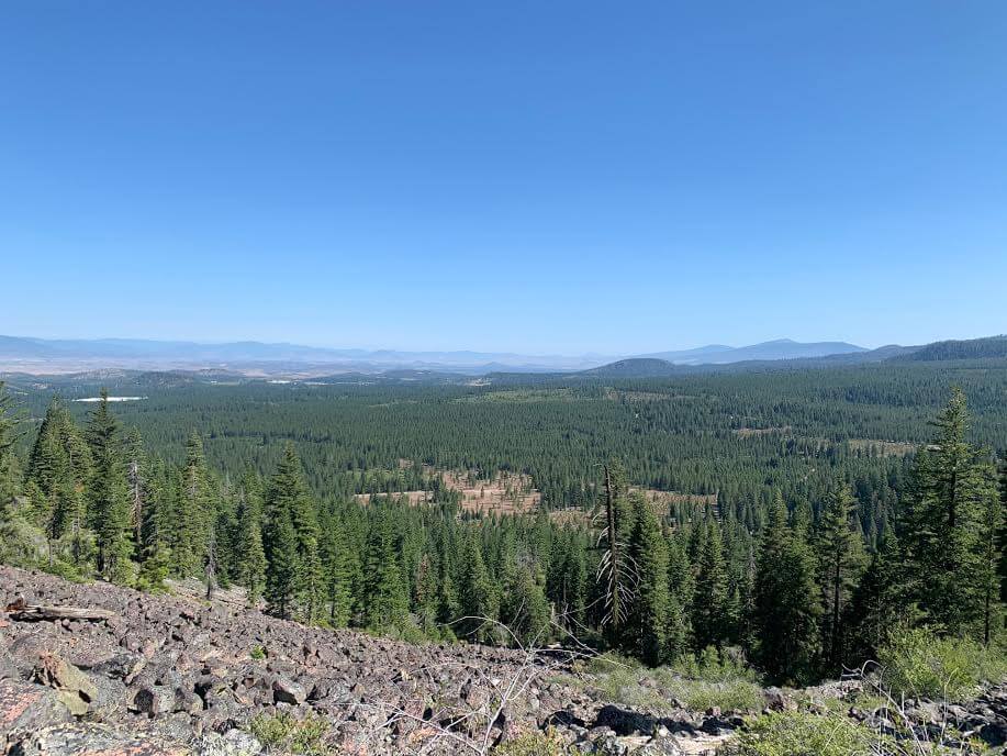
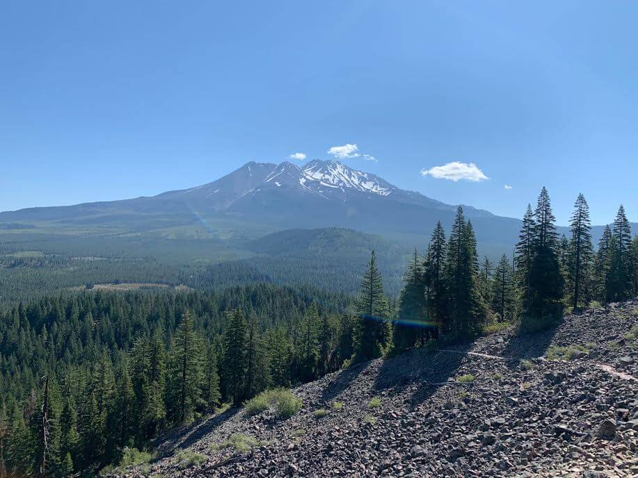
一体何キロ先まで見えているのだろう、、と感じる光景。どこまでもどこまでも広がる大地。そしてここからもマウントシャスタがすでに美しく見られます。トレイルヘッドから歩き始めて少しでこんな絶景が。まさにシャスタに来た!という感覚です。
さらにジグザク道を進みながらゆっくりと高度を上げていきます。森があったのは最初の部分で途中からはほぼ岩岩しい光景、トレイルになっていきます。
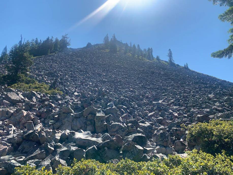
目の前にはこんな岩山。今にも岩が落ちてきそう。。笑
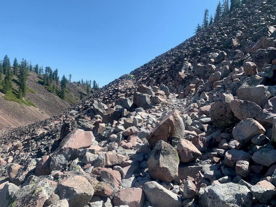
トレイルはわかりやすいので迷うことはないですが、見てのとおり足場は岩岩しく、断崖絶壁の様な場所をあるくこともあるので、しっかりとした登山靴でゆっくりいきましょう。下りは特に膝を痛めやすかったりします。
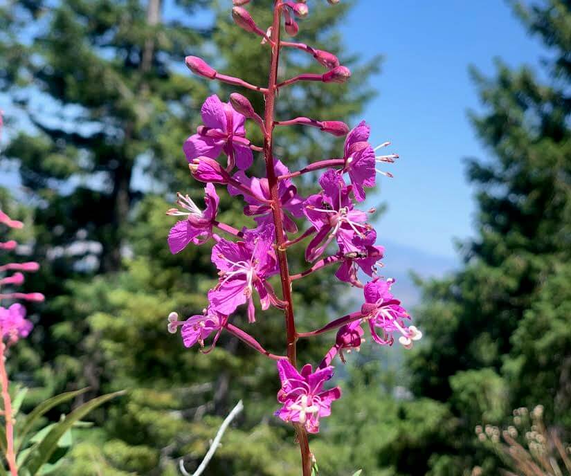
歩いた7月にはルートのあちこに、インディアンペイントブラシや、
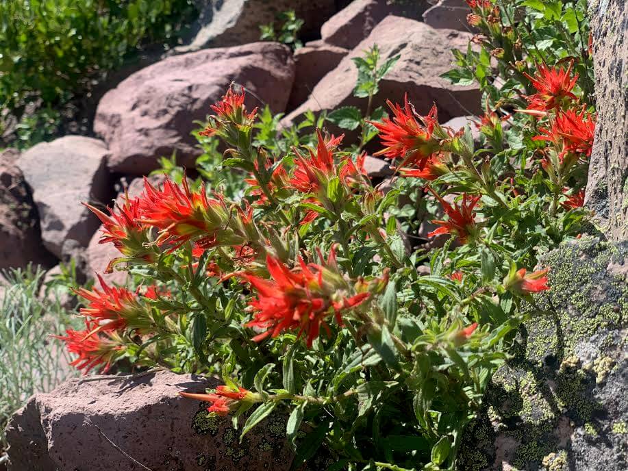
ファイヤーウィードなどの高山植物が。トレイルをカラフルに彩っています。
この先も絶景は続きます!歩きにくい岩岩しいトレイル以外には特に難関エリアもなくトレイルヘッドから約2時間スムーズにサミットに到着です。
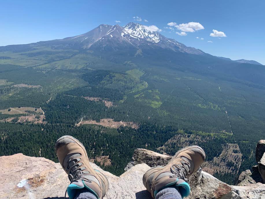
360度に広がる壮大な景色。目の前にはマウントシャスタが。
ここでランチをしつつ休憩タイム。
ここのサミットは以前、Fire lookout tower (火事の見張り塔)があり、360度見渡せるポイントなのでここから火事が発生していないかチェックする場所でもあったそうです。人々はここに登りここからシャスタエリアの安全確認をしていたのですね。。その時に作られた石の囲いがまだ残っています。
休憩後、来た道を下山します。
帰りは1時間でトレイルヘッドに到着しました。

マウントシャスタが目の前に佇むトレイル・ブラックビュート。トレイルではお子様連れのファミリーも数グループいらっしゃいました。健脚ならば小学生のお子様から年配の方まで楽しんでいただけるコースだと思います。
新型コロナウィルス感染拡大に関するご注意
2020年11月現在、各国では検疫体制強化に伴う入国制限をはじめ、国立公園への入園規制や国内の移動制限など、さまざまな状況があり得ます。そうした条件は予告なく変更になる場合がございますので、旅行の際には必ず各国の大使館・領事館及び外務省海外安全ホームページ(感染症危険情報)、国立公園ホームページをはじめとした現地情報を入手し、乗継地および渡航予定国、訪問予定地周辺の情報を確認してから無理のない計画・行動をしてください。
加藤 さやか
 マウントシャスタのハイキング・旅行プランはお任せください。父の影響もあり昔からアウトドアアクティビティーが大好きで、日本にいた頃から登山、国立公園巡りをする中で、アメリカやカナダの大自然に魅了され、その結果念願だったアメリカに辿り着きました。現在は日本人ガイドと行く完全プライベートハイキングツアーなど、お客様と一緒に作る現地オプショナルツアーを提供するANAMI TOURSを営んでいます。現地在住だから知り得る、スペシャルなオプションをご紹介させて頂きます。ご興味ある方は下記HPから。
あわせて読みたい
 マウント・シャスタ周辺のおすすめスポット【歩かずに死ねるか!アメリカ国立公園への旅(36)Mt. シャスタの宝石 おまけ編】
 歩かずに死ねるか!アメリカ国立公園への旅(12)雄大なシエラネバダの山々を望む絶景を堪能 レイクタホ マウント・タラック デイハイキング
 人気のスキーエリア近くで手軽に3,000m級のハイキングと360°の絶景が楽しめる「マウント・ローズ」【歩かずに死ねるか!アメリカ国立公園への旅(39)】
 歩かずに死ねるか!アメリカ国立公園への旅(16)花と緑、湖、頂からの大パノラマ。すべてが揃ったシャスタの秀峰、マウント・エディ・トレイル