歩かずに死ねるか!アメリカ国立公園への旅(12)雄大なシエラネバダの山々を望む絶景を堪能 レイクタホ マウント・タラック デイハイキング
written by Sayaka Kato
サンフランシスコから約4時間、州都サクラメントから約2時間の場所にあるローカルに大人気のリゾート地、レイクタホ。カリフォルニア州とネバダ州をまたぐレイクタホはとても大きく、”サウス”と”ノース”に大きく分けられています。
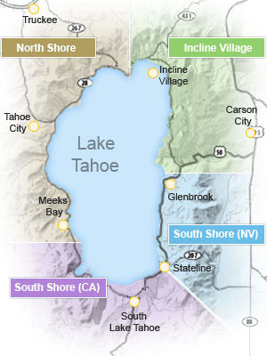
湖(湖岸線)の2/3はカリフォルニア州に属しますが、ネバダ州側はギャンブルが合法なのでネバダ側はホテルやカジノも多くカジノ好きはあえてネバダ州側に宿泊を好んだりもします。
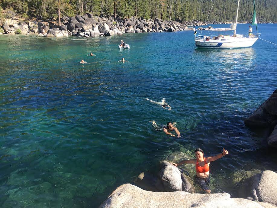
透明度が高く美しい湖は夏はウォーターアクティビティやハイキング、マウンテンバイキング、冬はスキー、スノボードなどのウィンターアクティビティーが盛んな大自然に囲まれたエリアで1年を通してとても人気なリゾート地です。一度トレイルに入ってしまえば、本格的な大自然が広がります。湖に沿ってビーチのようになっているスポットも多く、夏は海代わりに訪れる人も多いですよ。
目次
レイクタホ マウント・タラックのおすすめハイキングコース紹介
レイクタホの基本情報
レイク タホの大きさは、長さ35km、幅19km、面積49,624ヘクタール(レイクタホ 500km2。日本最大の面積を誇る「琵琶湖」が約670km2。)海岸線は116kmあります。レイクタホを一周するバックパッカーも多いですよ。深さは最も深い所で501mあり、北アメリカで3番目に深い湖で、世界で10番目に深い湖です。レイクタホは透明度が高いということで有名な美しい湖です。
今回はカリフォルニア州側のサウス・レイクタホエリアのMT. Tallac(マウントタラック)ハイキングトレイルをご紹介。こちらのトレイルは山頂までいくとすると距離、標高差がかなりあり、中級者から上級者向けのトレイルになりますが、いく途中途中に湖や景色の良いスポットが沢山ありますので、あまり歩きに自信のない方はマウントタラックのサミットまで行かず、途中のビュースポットまで行き、引き返すことで長さやレベルを調整できます。
サミットに到着するまでにレイクタホ以外にも3つの美しい湖の景色を楽しむことができます。後半は雄大なシエラネバダの山々の景観も広がり本格絶景トレイルです。
MT. Tallac(マウントタラック)トレイルのデータ
- 距離:往復10.2 miles (16.32km)
- トレイルヘッド標高:6,450 feet (1,966m)
- MT. Tallac標高:9,738 ft (2,968 m)
- 標高差:3,290 feet (約1002m)
- コースタイム:往復5時間から7時間(山頂休憩含む)
レイクタホ Mt. タラック・トレイルヘッドへの行き方
住所:Mt. タラック・トレイルヘッド, 〒96150 California, South Lake Tahoe。駐車場あり。
移動手段:車(レンタカー)でサンフランシスコから約4時間、州都サクラメントから約2時間。
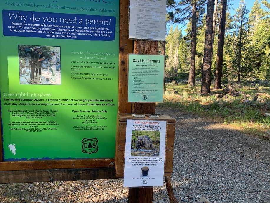
注意:ここはナショナルパークでは無いので入場料などは必要無いですが、このトレイルはセルフパーミット(無料)が必要で入山する時にトレイルヘッドに設置されているノートに名前や連絡先などを書く必要があります。しかし時期によって必要ではない時もあるので、トレイルヘッドに設置されている掲示板をチェックしましょう。(トレイル中にテント泊する場合は有料。事前にパーミットを取る必要あり)
ハイキングに携行すると便利な持ち物
- 飲み物 (夏は多めに、3~4リットル位。)
- 気温の調整できる防寒着 特に山頂は風があると寒い日もあります。必ずフリースなどのご用意を。
- トレッキングシューズ
- 帽子 後半はほぼ日陰なしなので帽子は必要です。
- サングラス
- 日焼け止め
- ハイキング中に食べるスナックなど
- 常備薬などがある場合は薬やバンドエイドなどのファーストエイド
- 雨具(カリフォルニアの4~10月はまず雨は降りませんが、万が一のため、また防風・防寒に)
- その他、通常ハイキング装備
レイクタホ Mt. タラック ハイキングガイド
トレイルヘッド
駐車場はありますが、人気ハイキングコースプラスキャンパーの人もいるのですでに車が常に停まっているのと、そこまで大きな駐車場スペースではないので車が埋まる前に早めにいく事をお薦めいたします。私の場合は朝8時前の時点で半分以上は埋まっていました。お手洗いはないので事前に済ませておきましょう。水を汲む場所もないので夏場は特にしっかりと水分を持参しましょう(最低3リットルはあると良いと思います。)
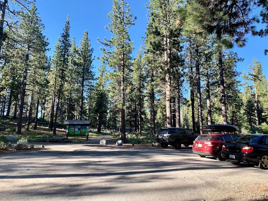
セルフパーミットは本来は必要なトレイルですが、私が行った6月は不必要でした。
いよいよハイキング出発!

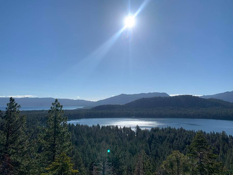
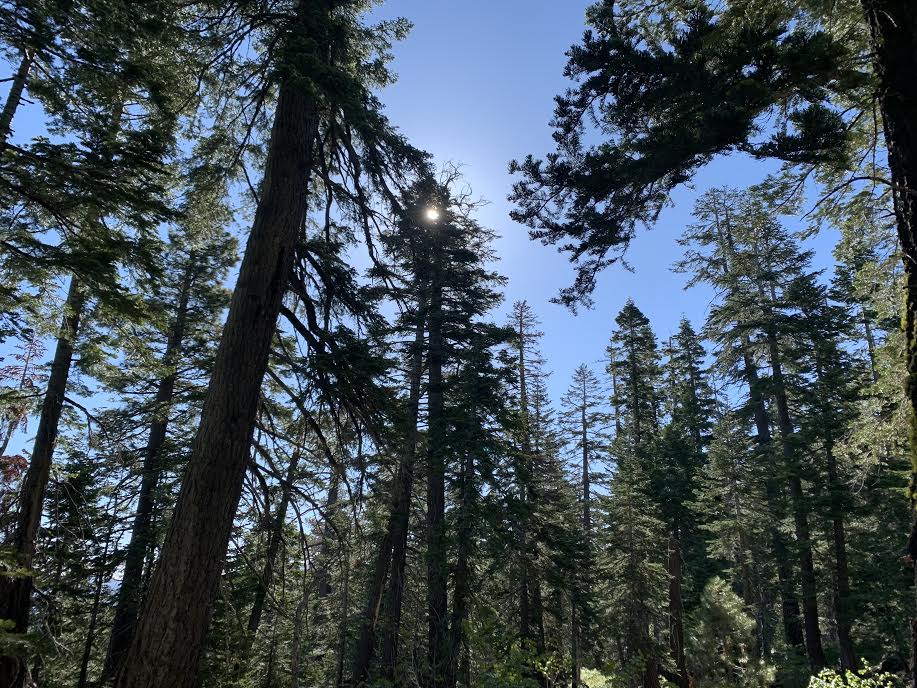
前半は緩やかな坂やフラットなトレイルが続いていきます、とても歩きやすいです。歩き始めて20分ほどすると左手にFallen leaf lake が見えてきます。まだ朝なので静かで神聖な雰囲気も漂い本当に美しい。Fallen leaf lakeの奥にはレイクタホも見えているので2つの美しい湖がまずは出迎えてくれます。
そして更に進んでいくと右手には本日の目的地MT. Tallac標高:9,738 ft (2,968 m)が遥か遠くに見えています。笑
あそこまで行くのだ、、と心を決めてまた気合が入ります。
前半は木々の間を歩いていくことも多く、日陰もあり気温も暑すぎず寒すぎず丁度いい感じ。
坂も少なくスムーズに進んでいきます。
右手にはTallac Creekの小川が見えてきます。水のせせらぎがまた気持ち良い。。
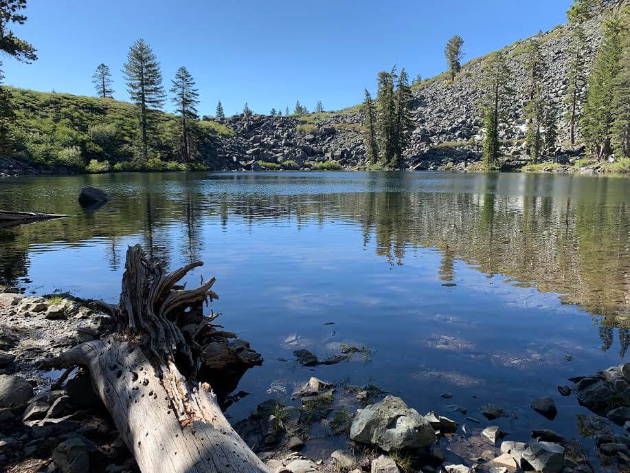
さらに進み、トレイルヘッドから約45分経過したあたりで右手に今度はまた違う湖、FlootingIsland Lake が見えてきます。朝という事もあり風が無いお陰でまさにミラーレイク!
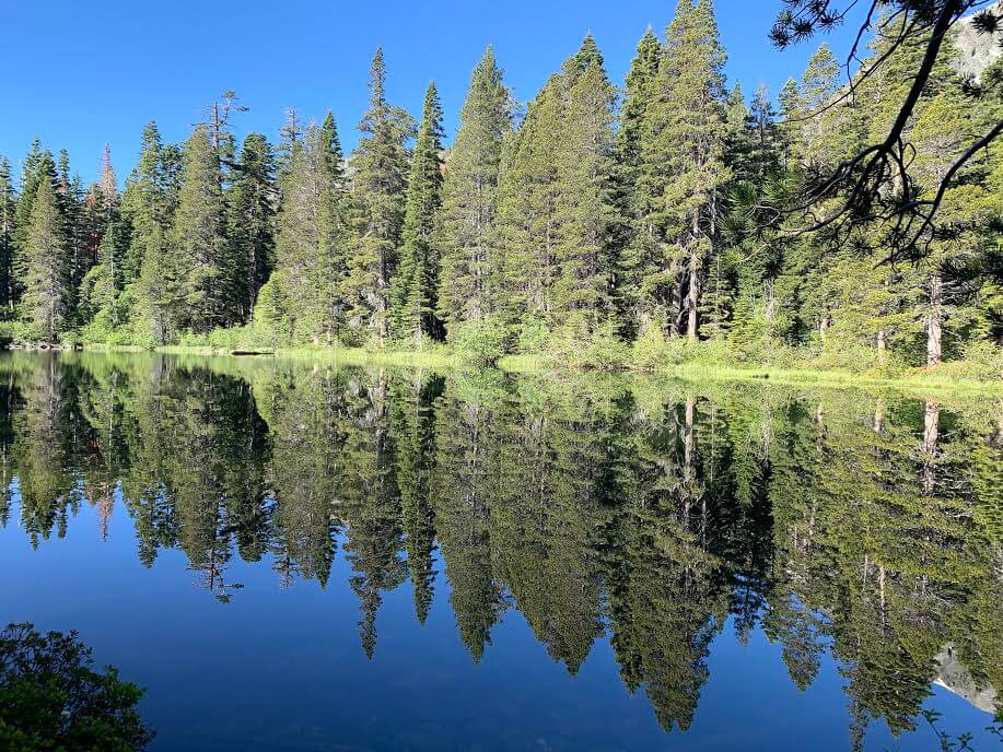
湖面に周りの景色が映し出され本当に神秘的です。時期的にカルガモ親子も居ました。微笑ましい光景に心癒されるひと時。誰もいないので、自分と大自然の空間を楽しむ事ができます。
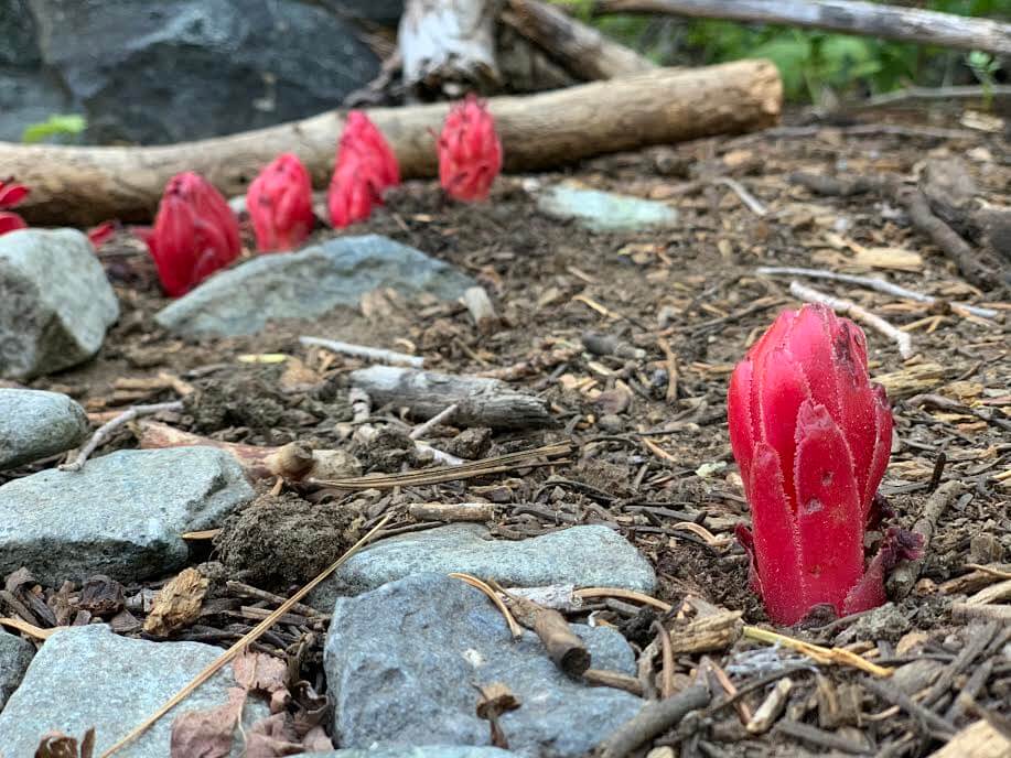
綺麗な空気の場所に生殖する鮮やかなスノープラントもしっかり顔を見せてくれています。
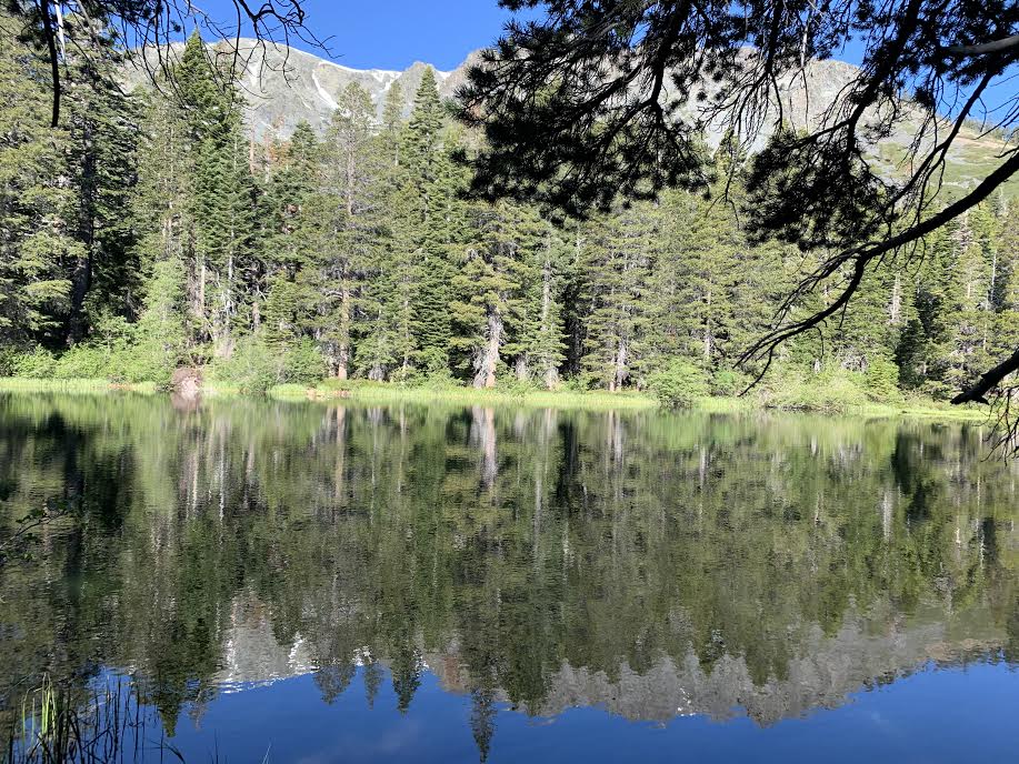
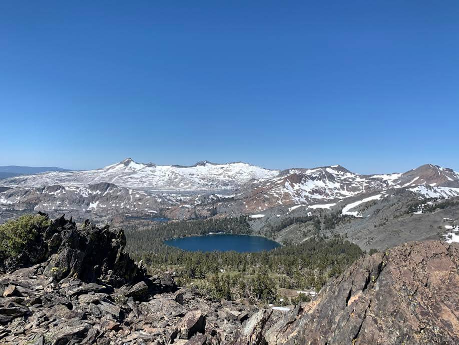
さらに30分進んでいくとまた違う湖 Cathedral Lake が見えてきます。トレイルヘッドから約1時間20分経過したあたりです。
ここで休憩してまた出発。短いハイキングコースが希望の方はこのポイントで引き返すと良いですね。
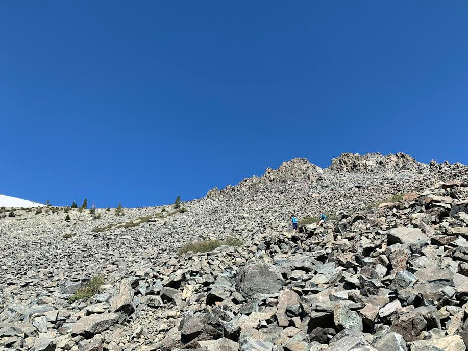
さ、この湖を過ぎると本格的な坂が始まります。
トレイルも岩岩しくなってきたりしますが、絶景はここからも更に続くので頑張っていきましょう。
道もジグザグ道がはじまり、所々に雪も残っています。(写真6月末)
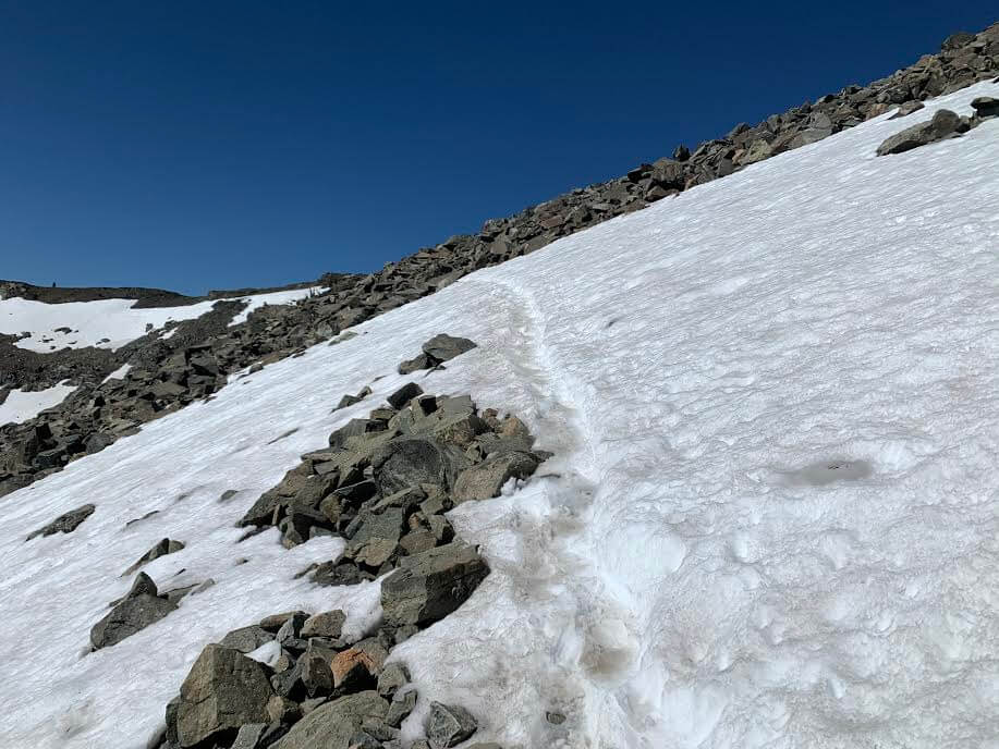
岩岩しいジグザグ道を登って一度フラットな場所まで来ると、その先トレイルがわかりずらくなっている場所が多々出てきますので、可能であればGPSを最初にダウンロードしておくとかなりスムーズだと思います。
もしGPSが無い場合はトレイルを注意しながら進み、迷いそうな場合はトレイルがしっかりある場所まで戻って、周りをしっかり見直していきましょう。
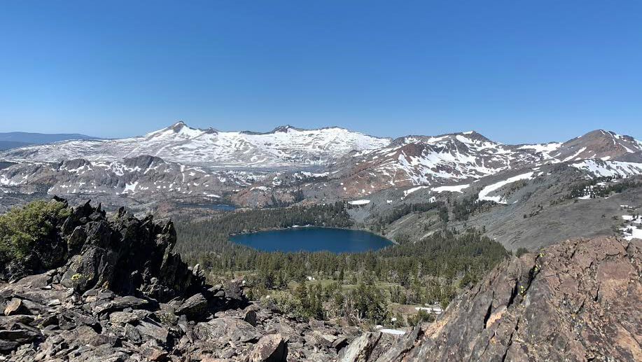
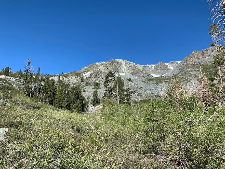
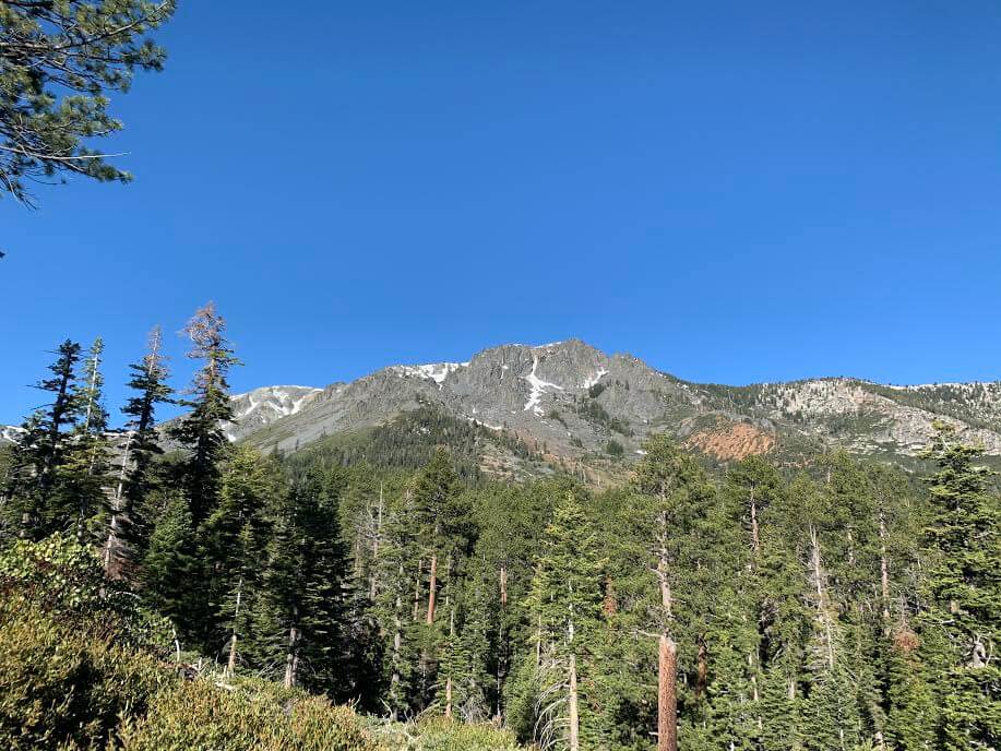
いつの間にか目線が同じくらいになったシエラネバダの美しい山々も見えてきます。山頂に雪が残とても美しい。
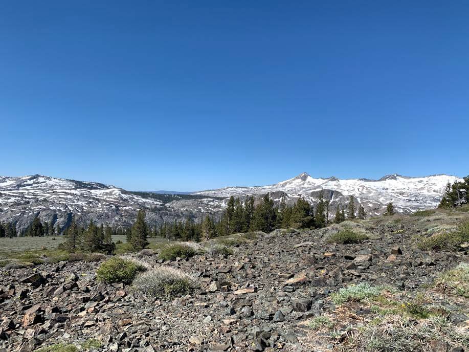
最後まで坂は続いていきますが、更に進みトレイルヘッドから約3時間半でMT. Tallac山頂にいよいよ到着です。
とくに山頂手前のあたりは勾配もきつく、標高も高いので体の負担を感じますが、ゆっくりゆっくり休憩しながらいけば大丈夫。
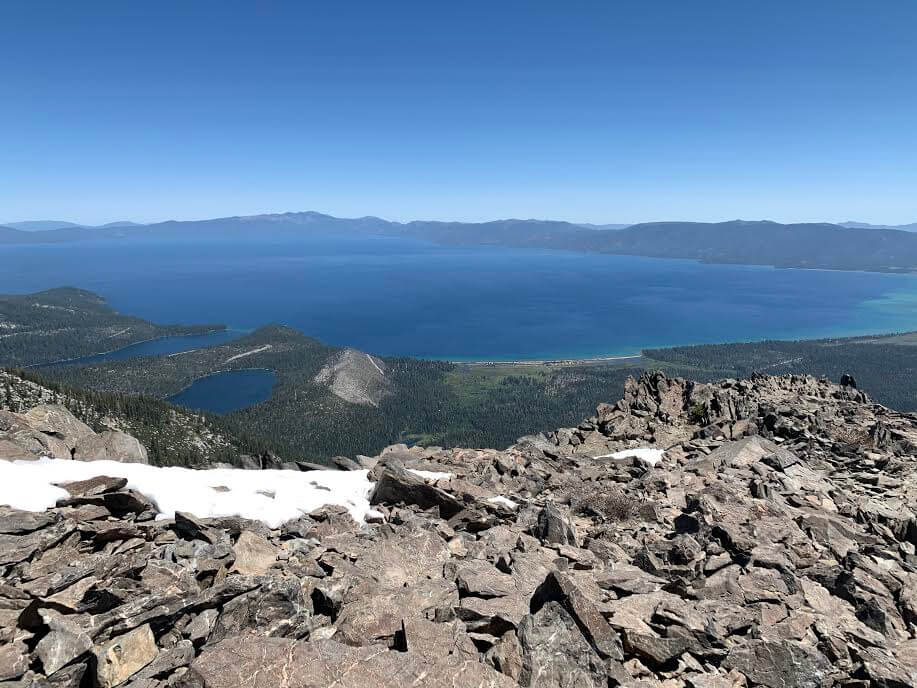
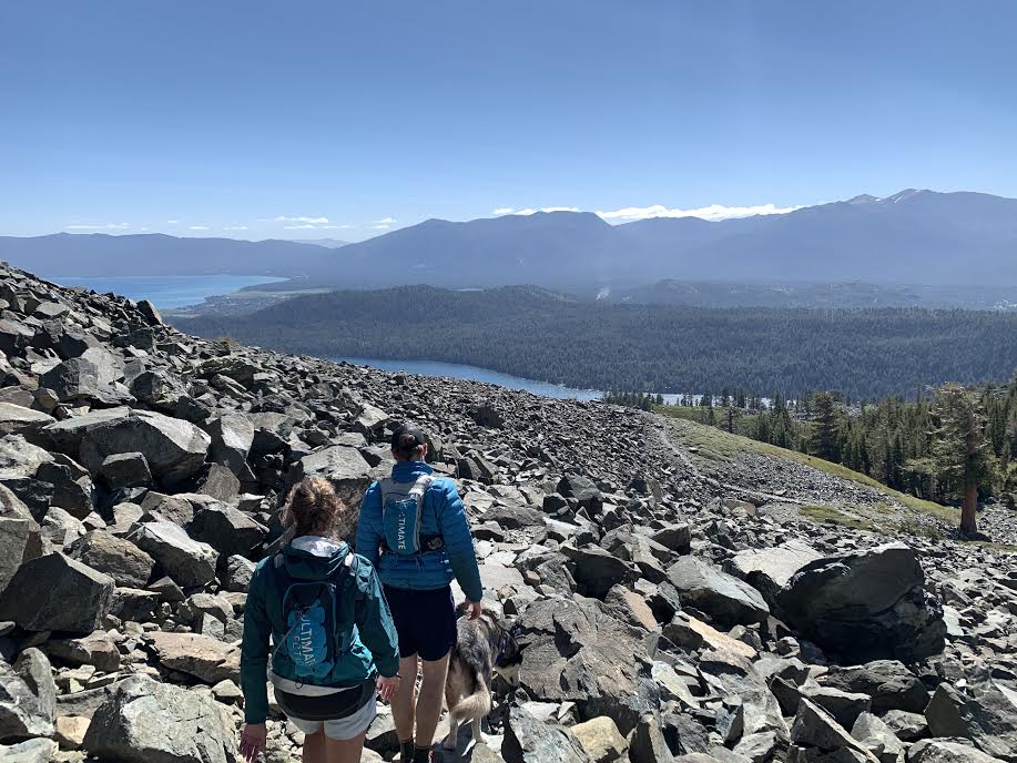
空の青と湖の青がつながる絶景が見渡せます。反対側にはシエラネバダの山々と湖も。
この美しい絶景はなかなか見られる景色ではないので、登頂後は満足感と共に大自然の絶景に心も癒されます。
山頂は標高も高く風があったりすると体が冷えると思いますので、フリースなどの防寒着も忘れず持っていくと良いと思います。寒いとゆっくりしたくても出来ないのでお忘れなく。
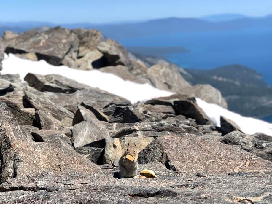
ご馳走を拾ったリスも。写真はないですが山頂にはマーモットにも遭遇。
ゆっくりした後は同じ道を戻っていきます。
帰りは約2時間半でトレイルヘッドまで戻りました。中級者から上級者向けのハイキングルート。簡単コースではないですが、大絶景が広がる登る価値のあるトレイルですよ。
新型コロナウィルス感染拡大に関するご注意
2020年9月現在、各国では検疫体制強化に伴う入国制限をはじめ、国立公園への入園規制や国内の移動制限など、さまざまな状況があり得ます。そうした条件は予告なく変更になる場合がございますので、旅行の際には必ず各国の大使館・領事館及び外務省海外安全ホームページ(感染症危険情報)、国立公園ホームページをはじめとした現地情報を入手し、乗継地および渡航予定国、訪問予定地周辺の情報を確認してから無理のない計画・行動をしてください。
加藤 さやか
 カリフォルニアのハイキング・旅行プランはお任せください。父の影響もあり昔からアウトドアアクティビティーが大好きで、日本にいた頃から登山、国立公園巡りをする中で、アメリカやカナダの大自然に魅了され、その結果念願だったアメリカに辿り着きました。現在は日本人ガイドと行く完全プライベートハイキングツアーなど、お客様と一緒に作る現地オプショナルツアーを提供するANAMI TOURSを営んでいます。現地在住だから知り得る、スペシャルなオプションをご紹介させて頂きます。ご興味ある方は下記HPから。
あわせて読みたい
 歩かずに死ねるか!アメリカ国立公園への旅(18)カリフォルニアらしさ満点のハイキングコース マウント タマルパイス州立公園
 歩かずに死ねるか!アメリカ国立公園への旅(19)カリフォルニア ベイエリアの名峰へ マウント・ディアブロ州立公園
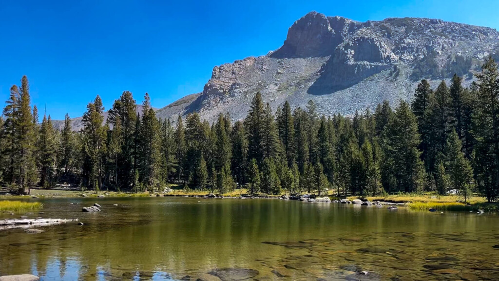 富士山よりも高い、ヨセミテ第二の高峰「マウント・デーナ」を登る日帰りハイキングコース【歩かずに死ねるか!アメリカ国立公園への旅(38)】
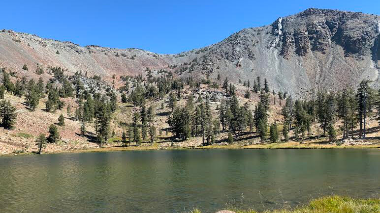 歩かずに死ねるか!アメリカ国立公園への旅(16)花と緑、湖、頂からの大パノラマ。すべてが揃ったシャスタの秀峰、マウント・エディ・トレイル