歩かずに死ねるか!アメリカ国立公園への旅(11)カリフォルニアの良いところすべてが詰まったトレイル ポイントレイズ国定海岸
written by Sayaka Kato
カリフォルアニアといえば、青い空にずっと続くビーチ、そしてブルーオーシャン。
そんな、まさにCA!という美しい景観が広がる場所がサンフランシスコから約1時間半くらいの場所にある「ポイントレイズ国定海岸」。
そこにはたくさんのトレイルもあり、サンフランシスコから日帰りで大自然を体感し、ハイキングがしたいという人にもおすすめな場所です。その場に足を踏み入れるだけで非日常な美しい景色が心を満たしてくれ、ハイキングをしなくてもドライブがてら自然に会いに行くだけで十分に楽しめるでしょう。
特に晴れた日は本当に見事なブルースカイとブルーオーシャンが迎えてくれますよ。
今回はそんなポイントレイズ国定海岸にある、ハイキングをしながら森、湖、ビーチ、海そして滝まで見えてしまうという、カリフォルニアの良いところが全て詰まったトレイルを紹介します。
目次
ポイントレイズ国定海岸(Point Reyes National Seashore)とは
ポイントレイズ国定海岸は名前の通り国立公園ではありません。また観光地として世界的に知名度が高いという訳でもないため、聞いたことがない方も多いと思います。でもこちらに住んでいる地元人の間では有名な場所で、ローカルの人も足をよく運ぶ大好きな場所です。そして何といっても近い。
ゴールデンゲートブリッジから約1時間のドライブで広大な自然保護区に到着し、エルクや鹿、コヨーテ、野ウサギなどなどの野生の動物たちと遭遇できたり、どこまでも続く、誰もいない静かなビーチを独り占めすることができます。いろんな場所にビューポイントがあり、撮影スポットも沢山ありますよ。
ポイントレイズ国定海岸への行き方
ポイントレイズへは、サンフランシスコから車で訪れるのがベスト。公共交通機関などは無いので車で行くことをお勧めいたします。
ゴールデンゲートブリッジを渡り、太平洋に沿ってハイウェイ1号線を北上すると、約30マイル(約48キロ)後に保護区の入り口を示す小さな看板が出てきます。(入場料は無料です)
ハイウェイ1号線は海岸線を走るので本当に景観が美しくドライブもとても楽しめますよ。天気が良く安定している日は是非ハイウェイ1号線からをお勧めいたします。まさにカリフォルニアの青い空と海が広がるドライブです。
もし天気があまりよくない場合はカーブなどが少ない国道101号線で!ゴールデンゲートブリッジを通っても、ベイブリッジからでも可能ですが、サンフランシスコから国道101号線で内陸を北上し、サンラフェル市から西に進んでポイントレイズを目指す別ルートもあります。ハイウェイ1号線とは対照的な緑の中のドライブが楽しめます。こちらはこちらでとても美しいドライブルートです(目的地によって駐車場などのゴールルートが変わってくるので、グーグルマップであらかじめ住所を入れて行かれるといいと思います)。
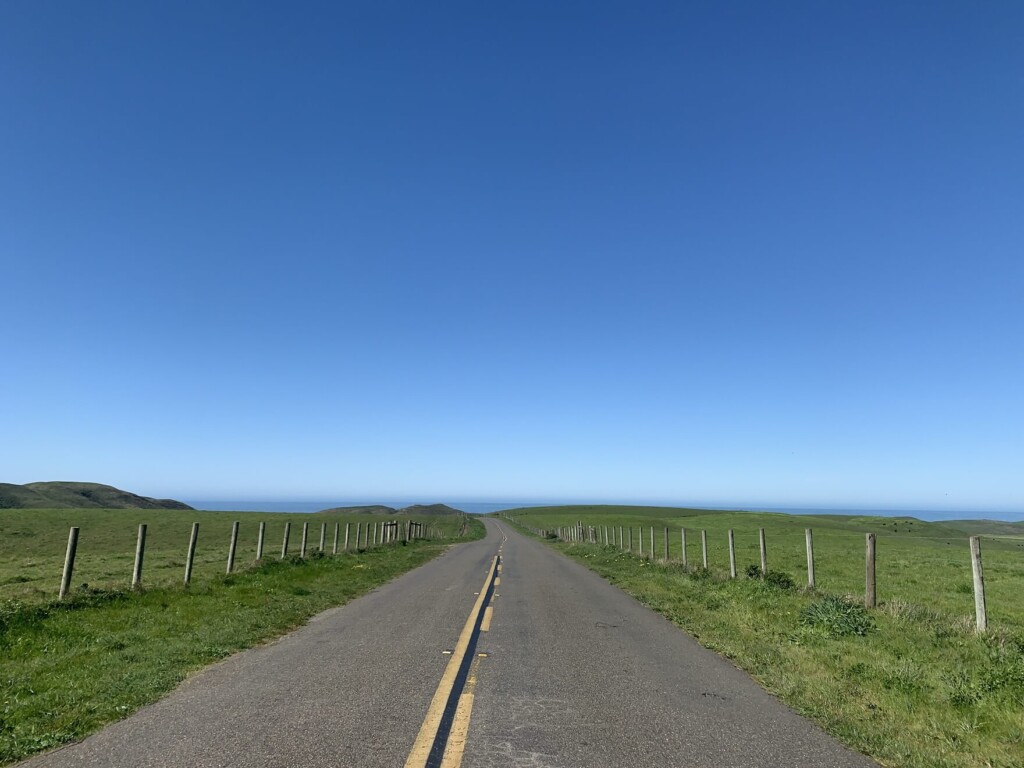
ポイントレイズはとても広く、28,732ヘクタールにも及ぶ広大な岬。まずはどこに行きたいかをあらかじめ決めておく必要があります。
「ハイキングをしたい」のか「ドライブがてらビューポイントを廻りたい」のかなど、目的により駐車場や、行く方角が変わり、ドライブルートも変わってきます。とても広いので電波のある場所であらかじめ目的地を決めてグーグルマップなどのGPSに行きたい場所を入れて向かうと、とても楽でスムーズです。
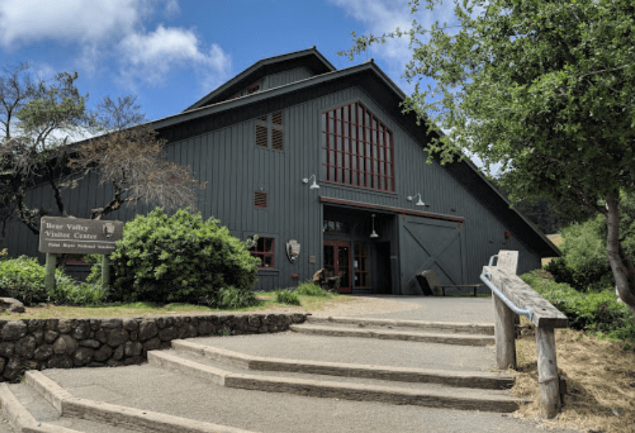
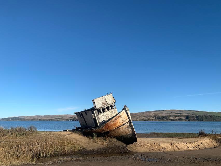
まずは手前にある「ポイントレイズビジターセンター(Point Reyes Visitor Center)」でトイレ休憩を兼ねてストップ、地図などを入手しましょう。そのあとはまずフォトジェニックなスポットとなる「ポイントレイズ難破船(Point Reyes Shipwrecks)」へ。
ポイントレイズ国定海岸をドライブで巡る場合のおすすめビューポイント
■ポイントレイズ難破船(Point Reyes Shipwrecks )
住所:12783 Sir Francis Drake Blvd, Inverness, CA 94937
放置されている寂れた難破船。一緒に近くまで行き写真を撮れる人気スポットです。
霧が多い上、危険な崖が続くポイントレイズエリアでは、何世代にもわたり、船乗り達から恐れられてきた場所でもあります。このような難破船や沈没船は、過去の悲劇の単なる記憶ではなく、タイムカプセルであり、海の歴史でもあります。昔ながらのレトロな雰囲気がたまりません。
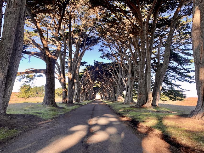
■木のトンネル (Cypress Tree Tunnel)
住所:Inverness, CA 94937
インスタグラムなどにもよく登場するこの場所。絵になる場所でポイントレイズ灯台へ行く手前にあるので是非立ち寄ってみてください。時間帯によっては光が木々の中からこぼれアートのような姿はとても幻想的な雰囲気があります。
■太平洋に突き出たポイントレイズ灯台( Point Reyes Lighthouse)
運が良いと鯨が見えるという展望台(例年1月から4月中旬)。
歴史がある展望台で、駐車場から展望台まで行くのに少し歩きます。展望台の中まで行きたい方は長い階段を下って行く事になります。なので帰りは長い階段を登って戻って来る形になります。少し行くまでに距離がありますがとても絵になる場所です。

■展望台近くの野生のゾウアザラシを見に行く (Elephant Seal Overlook)
野生のゾウアザラシが砂浜で寝転んでいるところを観に行きましょう。これも海水が冷たいノーザンカリフォルニアならではの風景です。なかなか野生のゾウアザラシなんて普段の生活では見れない光景ですよね!
行き方は、ポイントレイズ灯台から出発して初めての分岐を右へ折れると突き当たりに駐車場があり、Elephant Seal Overlook へ向かうトレイルがあります(近くにはChimney Rock Trail Head もありますが、そちらではありませんので注意)。
10分くらい歩いた突き当たりにビューポイントがあります。ポイントレイズ灯台から車で近いので是非立ち寄ってみてください。

ポイントレイズ国定海岸のハイキング情報
ここまではポイントレイズ国定海岸(Point Reyes National Seashore)を車で廻る場合のビューポイントの説明でした。ここからはハイキング情報です。
今回はアラメアフォールズ( Alamere Falls)というビーチ沿いの美しい滝を観に行くトレイルを紹介します。歩きながら森、湖、ビーチ、海そして滝!という色々な景色のバリエーションに出会え、楽しませてくれるトレイル。とてもピースフルで美しいトレイルです。
何よりも、そこまでアップダウンが無いのと標高も高く無いので身体への負担も軽減されるところも魅力的なトレイルです。
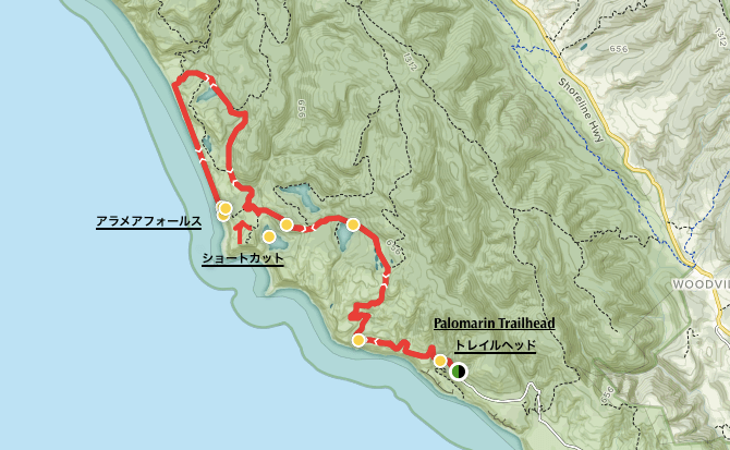
- 距離:13.8 mile 22.08km (途中Alamere Falls にダイレクトに下りるショートカットあり)
- 高低差:1,955 feet 595.884m
 トレイルヘッド
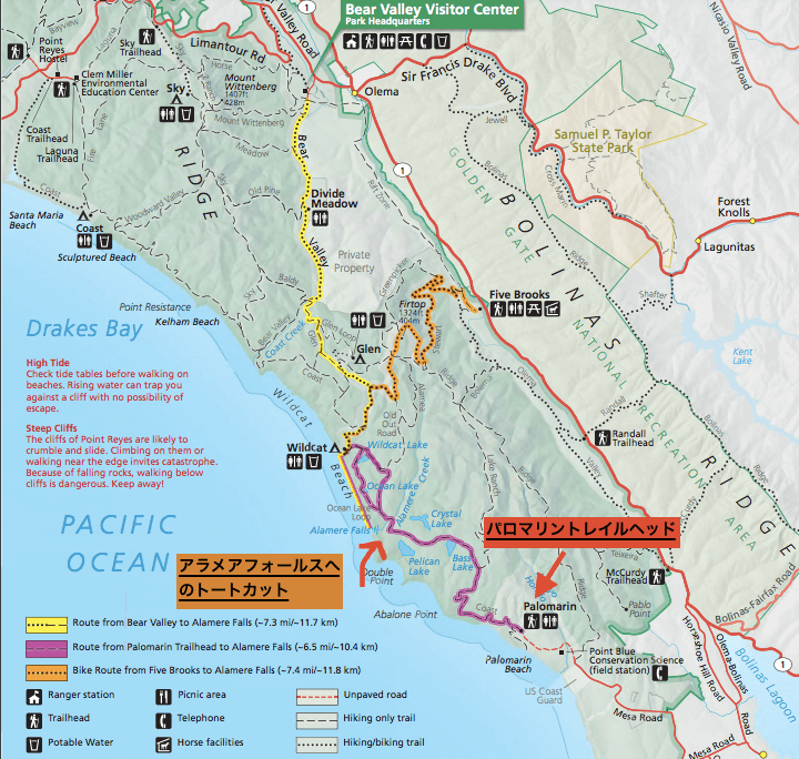
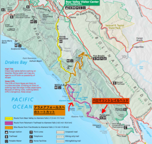
スタート地点(トレイルヘッド)は2つのオプションがあります。
- パロマリン トレイルヘッド (Palomarin Trailhead )お手洗いあり。住所は「Palomarin Trail Head, Bolinas, CA 94924」。
- ベアーバレー トレイルヘッド (Bear Valley Trailhead )すぐ近くにビジターセンターあり、お手洗いあり。住所は「Bear Valley Visitor Center Access Road, Point Reyes Station, CA 94956」。
上記2つが一番アラメアフォールズに近いトレイルヘッドになってますが、今回はそのうちの1番「パロマリン トレイルヘッド」からのルートをご紹介します。
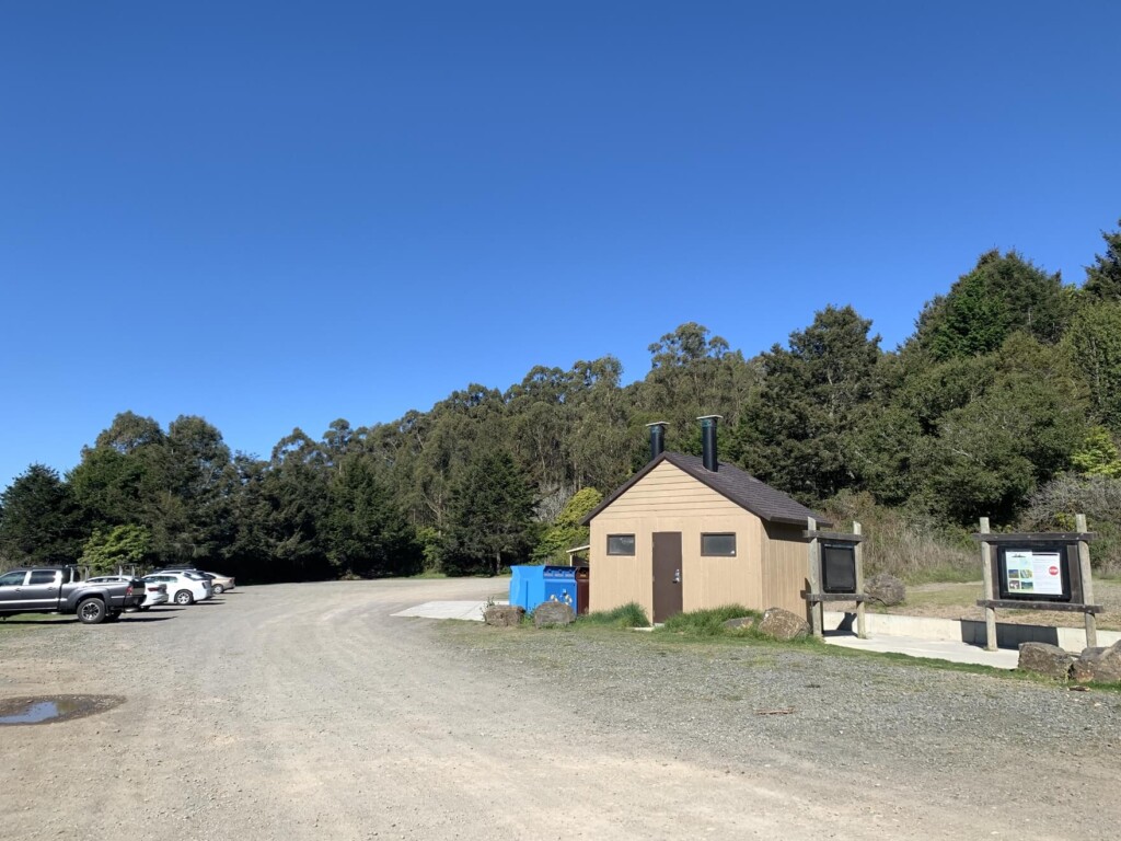
パロマリン トレイルヘッドには駐車場とお手洗いがあります。準備をしたら、いざハイキング開始です。
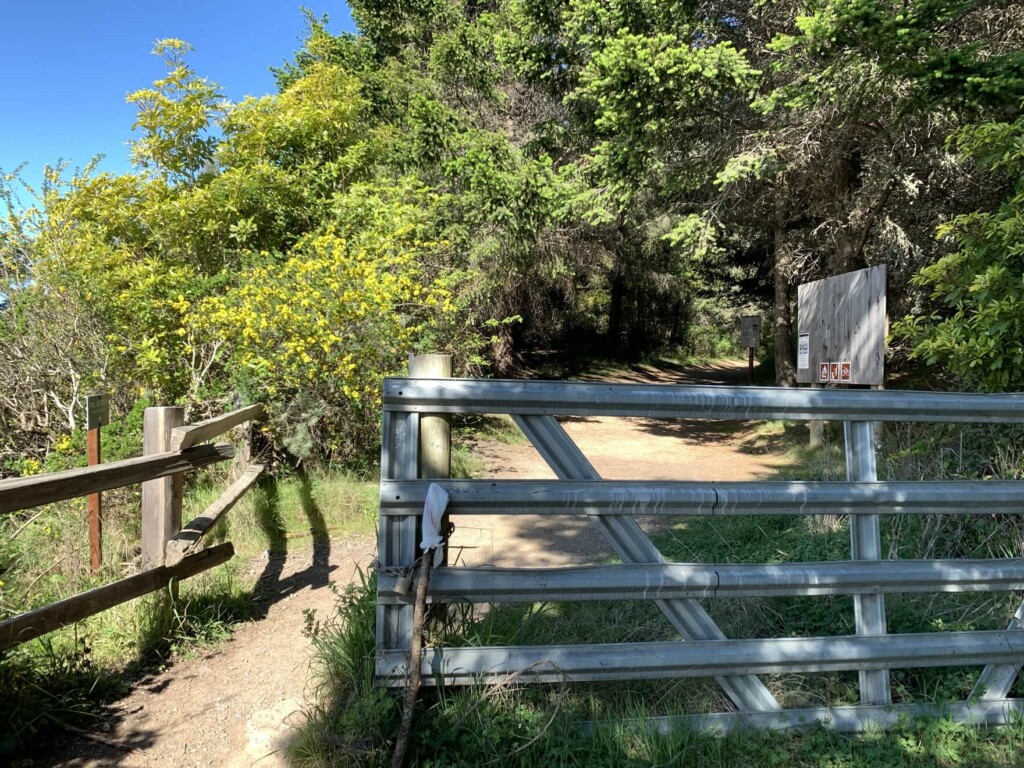
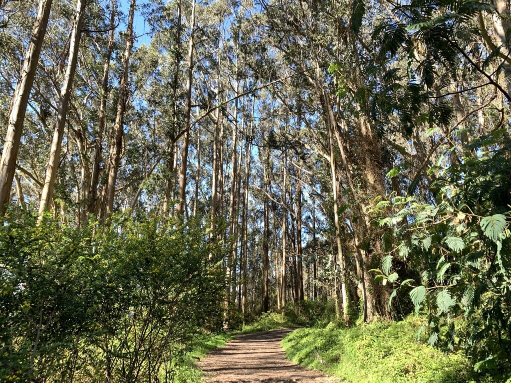
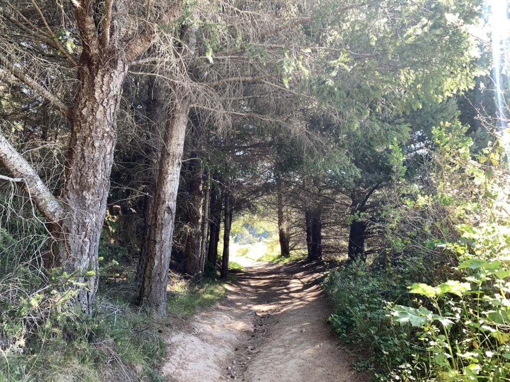
下の写真のゲートを通り過ぎユーカリプスの林の中を歩いていきます。
ユーカリプスのフレッシュな香りが、歩いていてとても気持ちよい。
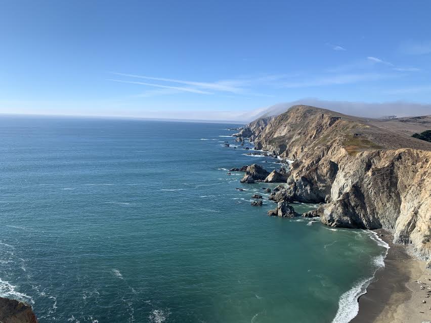
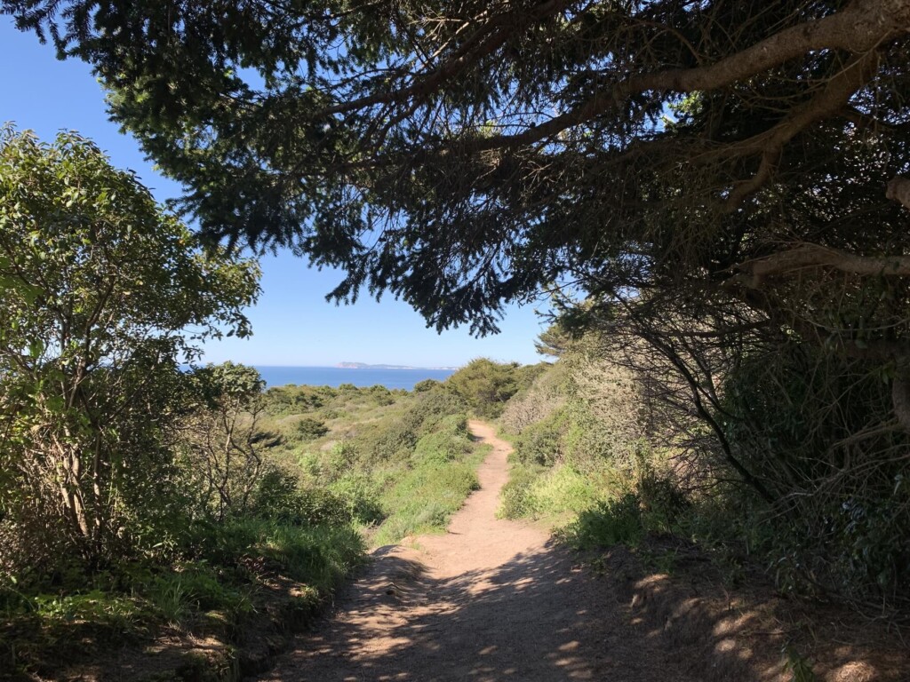
少し歩いて行くと1つめの看板が出てきます。私たちはコーストトレイル(COAST TRAIL)経由でアラメアフォールズに行くので、コーストトレイルの方へ歩いて5分くらいすると景色が変わり海が見えてきます。
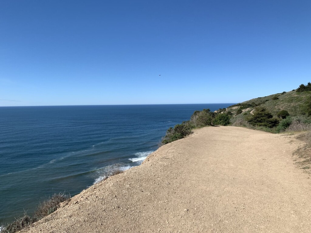
青い空、青い海がとても美しい。
森の中を歩いていたかと思うと海が見えてきたりと飽きさせない景観だけでなく、肌や香りで感じる空気の変化や心地よく響く鳥のさえずりなど、本当に気持ちよく歩けるトレイルです。
写真の季節は3月だったので、花々もちょうど咲き乱れていて春を色んな場所で感じます。
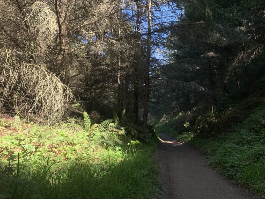
最初の30分くらい歩いていくと下り坂も出てきます。登ったり下ったり、平坦な道を歩いたりの繰り返しです。
2つ目の橋を過ぎ、橋から約10分程度で坂道が始まります。木のトンネルの様な場所も至る所にあってとても素敵です。
歩き始めて約1時間後、つかの間の日陰エリアが現れて一気にひんやり。とても心地よいのでちょっと休憩。
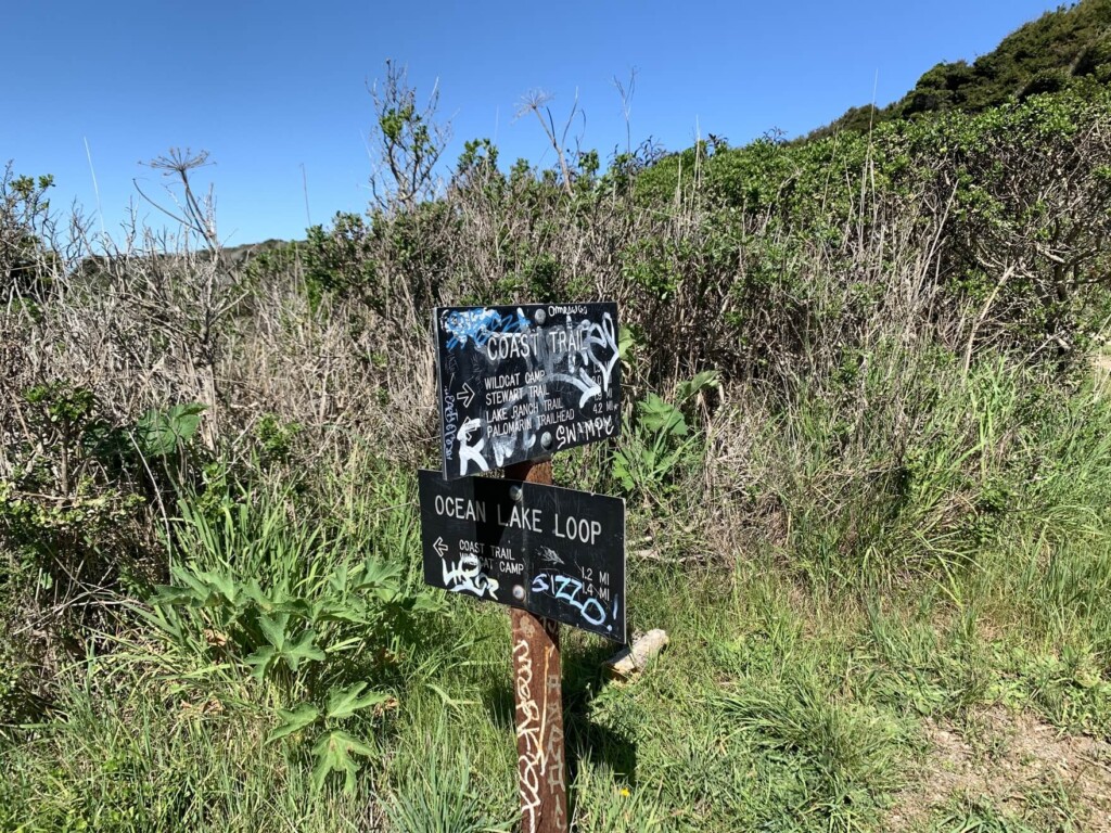
また下り坂などがあり、その後2つ目の看板(下写真)が見えてきます。ここでもコーストトレイル(COAST TRAIL)の方へ行きましょう。
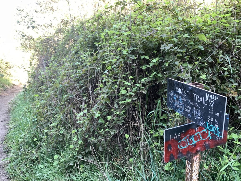
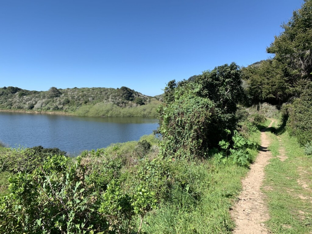
2つ目の看板から10分ほど進むとバスレイクという湖が左側に見えてきます。静かに佇む湖を過ぎ、また林を歩いていきます。
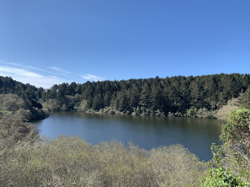
そうするとまた左側に2つ目のエリコンレイクという湖が見えてきます。同時に前方に海もまた見えてきます。このトレイルは見るものが多くて本当に盛りだくさん。トレイル中に湖が3つも出てきますよ。
この時点でトレイルの半分以上きているエリアですが、ここで、
- ショートカットをしてアラメアフォールズにいく
- 遠回りをしてビーチ沿いを歩いてアラメアフォールズにいくコーストトレイル(COAST TRAIL)経由
この2通りの選択から選ぶことができます。
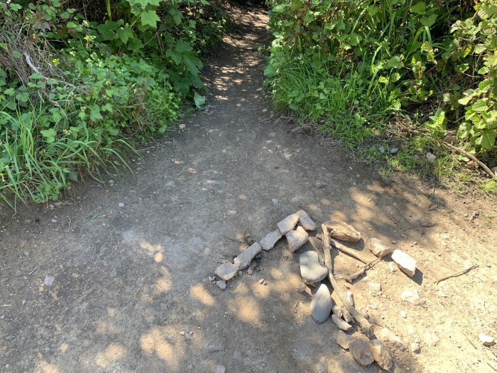
1ではショートカットをする分、時間も短縮になり、楽な方法ではあるのですがアラメアフォールズにいく最後の舗装されていないトレイルがとても急で、崖のような足場が不安定な場所を下りていくことになります。大半の方はこちらから行かれますが、ただ健脚の方でも注意が必要な場所で危険が伴いますので、それを配慮した上で行きたい方はそちらを選択しましょう。
ショートカットの入り口には矢印が石で作ってありますので、それを目印に進んでいけば大丈夫です(ショートカット手前にも似た様な細いトレイルがありますが、それはペリカントレイルという道で、そちらではないので注意してください)。
2では遠回りしてビーチを通ってアラメアフォールズにいき、復路でショートカットをして戻るという形。個人的にはこちらがおすすめです。
アイデアとしては往路でオリジナルのルート2をとりコーストトレイル経由、帰りはショートカットで帰るというスタイルもアリでしょう。なぜなら同じ崖でも下りより登りの方がまだ安定感があり、安全に行けると思うので、ここでは行きにコーストトレイル経由でアラメラフォールズに行くルートをご紹介します。
さきほどのショートカットのトレイルを左手にやり過ごし、メインのコーストトレイルを進んでいきます。
歩き始めて1時間30分ほどしてから3つめの橋が見えてきました。
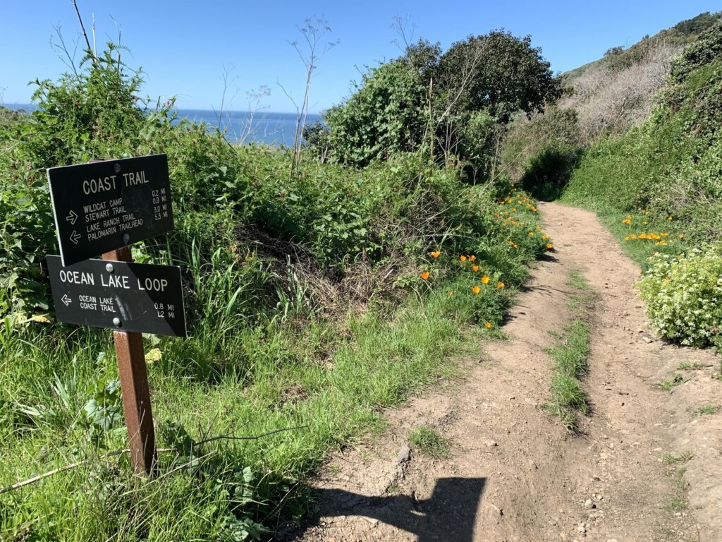
そのあと3番目の看板も見えてきます。ここでもまた分かれ道があり、左のオーシャンレイクループへ行くトレイルと、そのまま来た道と同じコーストトレイルへ進む分岐があります。
左から始まるオーシャンレイクループを歩いたとしても最終的にコーストトレイルへ繋がるのでこちらはどちらをとってもよいのですが、予定どおり、そのままコーストトレイルを進んでいきます。
3月はカリフォルニアの雨季にあたるので、トレイル沿いはたっぷりと水分を吸った緑たちが本当に生き生きしていました。そんな新緑に囲まれたトレイルを進んでいきます。
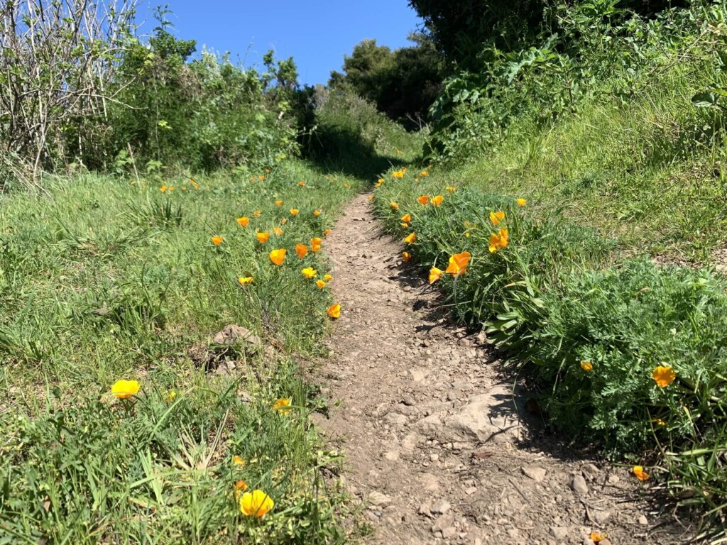
至る所に花々も。花好きの方にはたまりませんね。こちらのオレンジ色の花は州花でもあるカリフォルアポピー4つ目の看板もそのままコーストトレイル方面へ。
看板から5分くらい進んだところで左手に3つめの湖、ワイルドキャットレイクが見えてきます。
その先にはさきほど分岐があったオーシャンレイクループと今まで歩いてきたコーストトレイルが合流する場所があり、そこにもまた看板があります(5つめの看板)。
前方にはまた美しいブルーオーシャンが見えてきます。ビーチへもだいぶ近ずいてきたところで最後の橋が見えてきます。
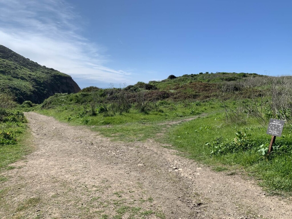
橋を渡ったら、ワイルドキャット・キャンプグラウンドへ行く道とビーチへ行く道との交差があるので、ビーチの方面へ(橋を渡ったあとの突き当たりを左へ)。
海の香りを感じながら、さきほどとは一気に変わる景色、風、香り、音にまた深呼吸。
一気に山のエネルギーからからビーチ変わるところも不思議です。このあとは山を左手に、進行方向に歩いていきます。
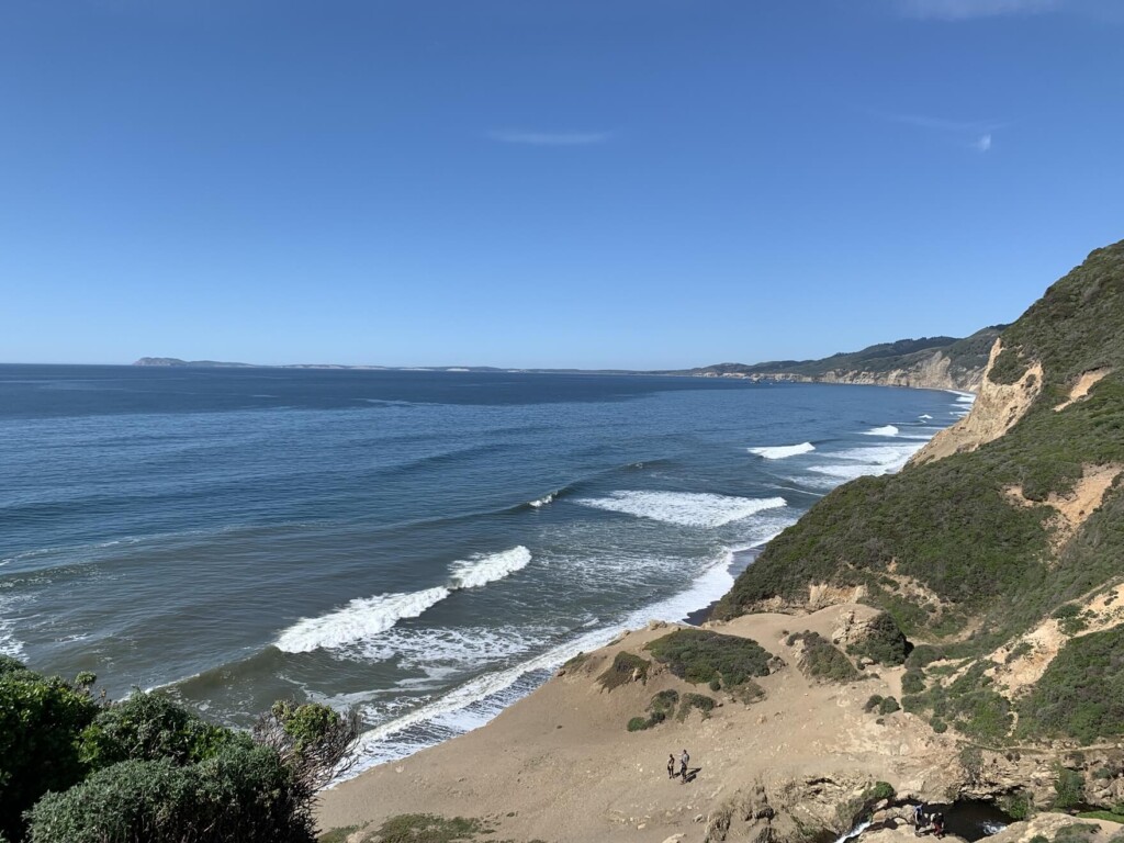
誰もいないビーチ。波の音と浜辺は全部あなたのものです!
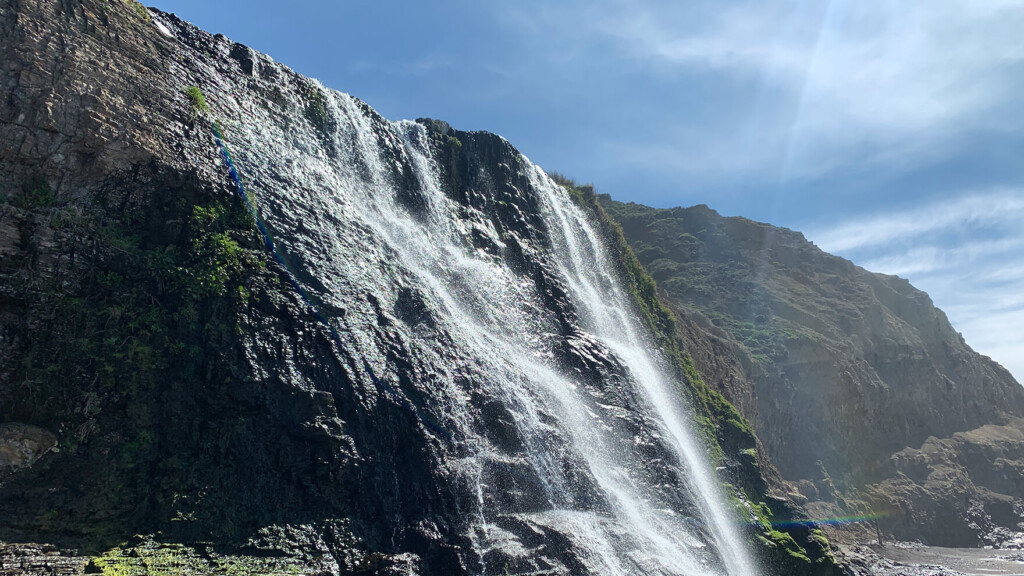
波の音を聞きながらビーチをひたすら歩いて行くと、遠くの方前方に滝が見えてきました。
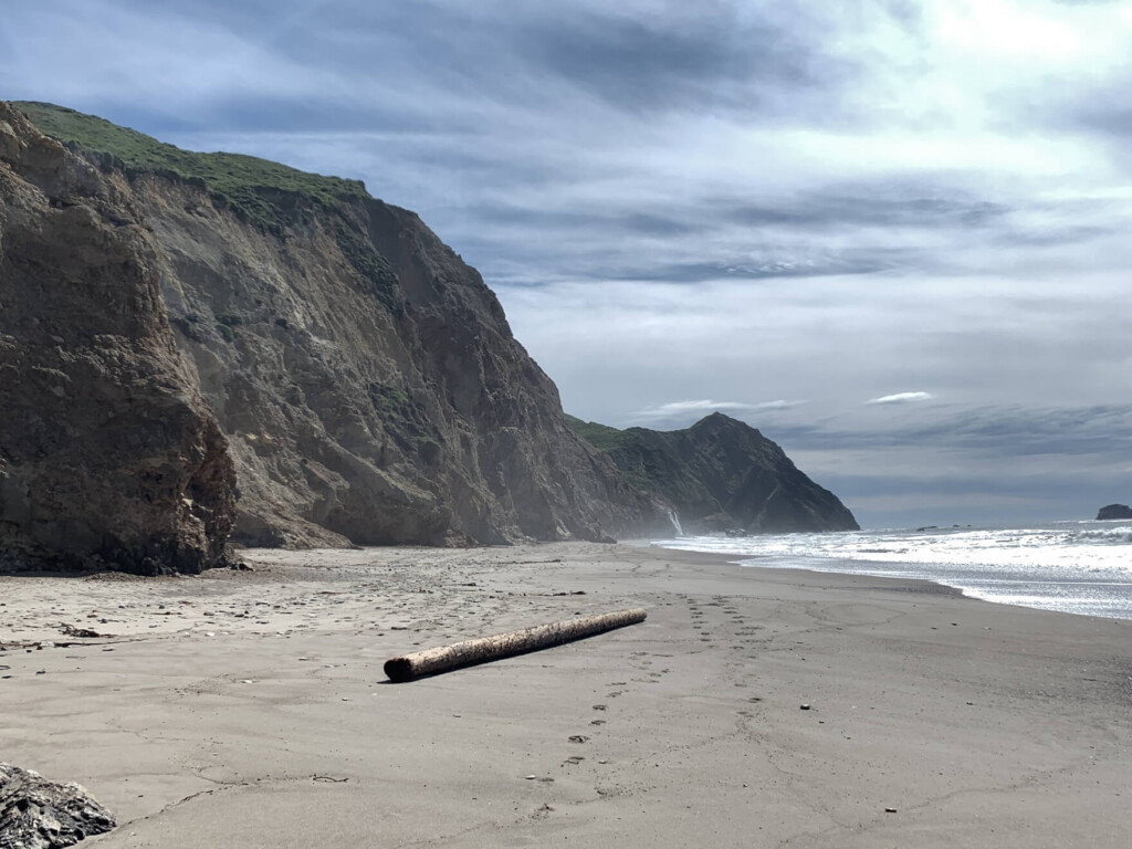
さらに歩き、スタートから約2時間半後、ついにアラメラフォール到着です。
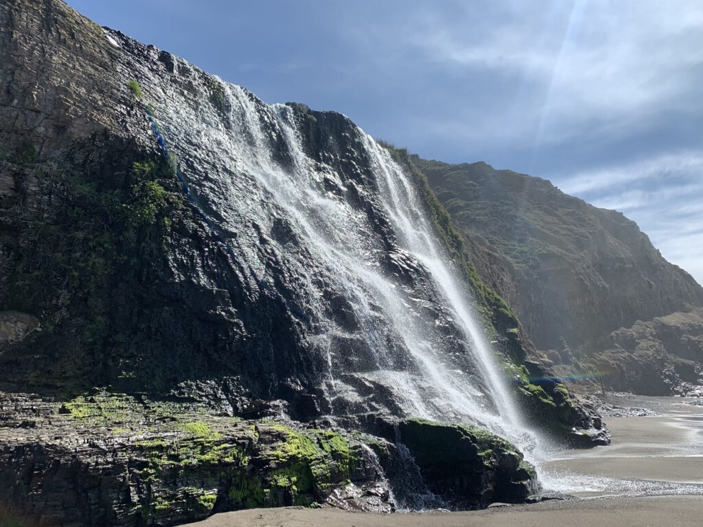
マイナスイオン沢山!
山からの恵みの水と大きな海が出会う場所です。
ランチなどで休憩したい方は滝の近くのビーチでも良いですが、帰りのショートカットのトレイルを上がってすぐのところに休憩できる素敵なスペースがあるので、そこで休憩されるといいと思います。
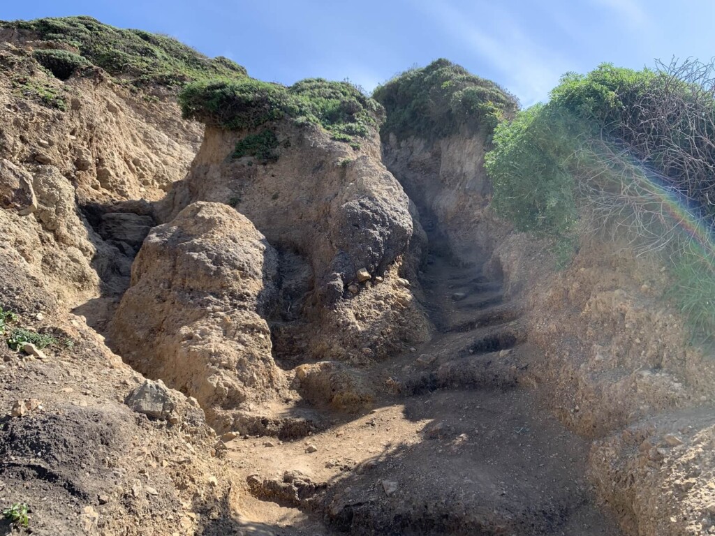
さ、滝のマイナスイオンでリフレッシュしたあとは、帰りはショートカットのトレイルで帰ります。滝のすぐ手前(来た道から見て)に岩と岩の間に崖のような窪みがあり、そこを歩いて行くことになります。
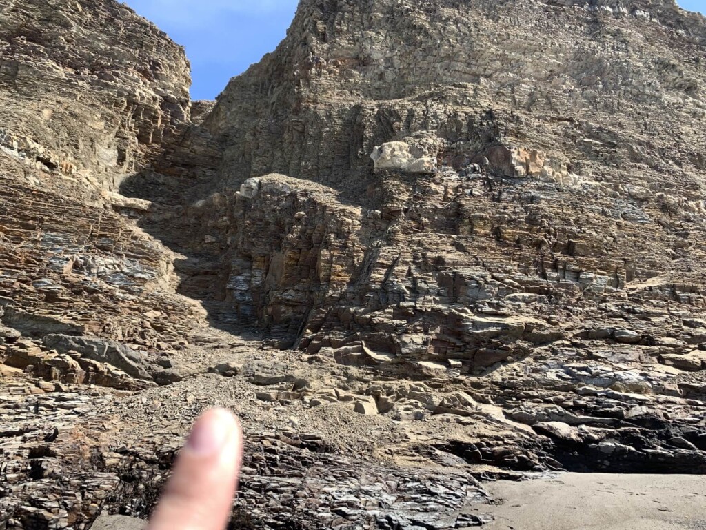
足元が安定せずとても急ですので自信がない方は来た道と同じコーストトレイルで帰りましょう。
崖を登ったあとに出てくるのは、なんとサプライズ!また違う滝が出迎えてくれます。3段階に分かれている滝で、ここもまた素晴らしい。規模は小さいですが素敵な眺めです。
ここか少しトレイルを登ったところにある空間でランチなどの休憩するのもいいですね。
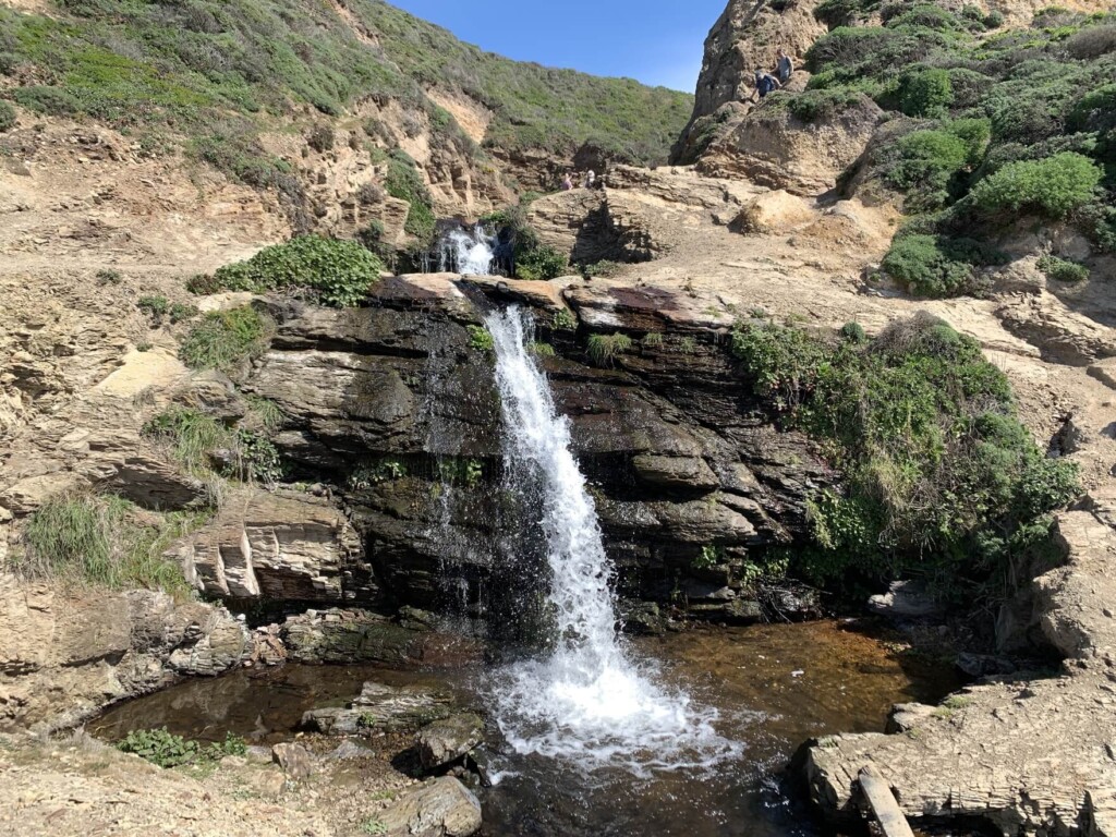
ショートカットをしなければ見れない景色がここにはありました笑。
滝の右側にトレイルが続くので滝を後に進んでいきます。
木のトンネルの様な木々に囲まれたトレイルを歩くと、元来た道のコーストトレイルとの合流地点に到着。 かなりのショートカットで、このトレイルを取ることで時間と体力がだいぶセーブされます。
その後は来た道を戻るだけ。帰りは順調にいけば1時間半くらいでトレイルヘッドまで戻ることができます。
青い空、青い海、生き生きとした緑と花々、そしてキラキラ光る滝に魅せられた素晴らしいハイキングトレイル、日和でした。霧などがよく出るエリアでもあるので、行かれる時は天気予報を確認して晴れの日に行かれるとこのエリアは色が映えてさらに美しいと思います。
新型コロナウィルス感染拡大に関するご注意
2020年8月現在、各国では検疫体制強化に伴う入国制限をはじめ、国立公園への入園規制や国内の移動制限など、さまざまな状況があり得ます。そうした条件は予告なく変更になる場合がございますので、旅行の際には必ず各国の大使館・領事館及び外務省海外安全ホームページ(感染症危険情報)、国立公園ホームページをはじめとした現地情報を入手し、乗継地および渡航予定国、訪問予定地周辺の情報を確認してから無理のない計画・行動をしてください。
加藤 さやか
 ポイントレイズ国定海岸やカリフォルニアのハイキング・旅行プランはお任せください。父の影響もあり昔からアウトドアアクティビティーが大好きで、日本にいた頃から登山、国立公園巡りをする中で、アメリカやカナダの大自然に魅了され、その結果念願だったアメリカに辿り着きました。現在は日本人ガイドと行く完全プライベートハイキングツアーなど、お客様と一緒に作る現地オプショナルツアーを提供するANAMI TOURSを営んでいます。現地在住だから知り得る、スペシャルなオプションをご紹介させて頂きます。ご興味ある方は下記HPから。
あわせて読みたい
 歩かずに死ねるか!アメリカ国立公園への旅(20)樹齢1500年以上の木々が広がる太古の森 レッドウッド国立州立公園
 歩かずに死ねるか!アメリカ国立公園への旅(8)天空の島 キャニオンランズ国立公園
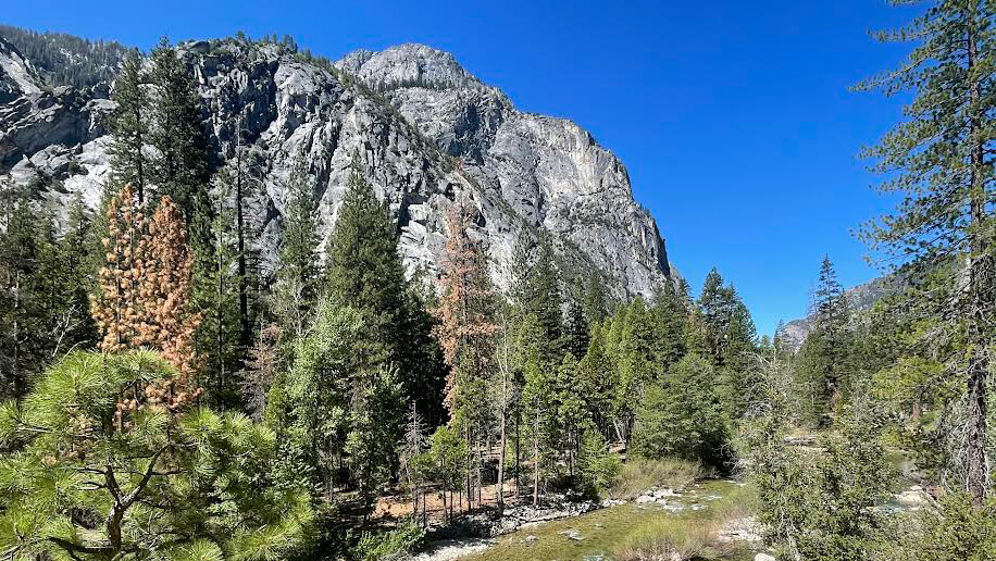 歩かずに死ねるか!アメリカ国立公園への旅(26)巨木の森の奥には息をのむような渓谷美 セコイア・キングスキャニオン国立公園
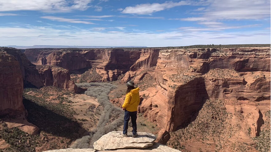 歩かずに死ねるか!アメリカ国立公園への旅(5)キャニオン・ディ・シェイ国定公園おすすめハイキング