Can you die without walking? A Journey to the American National Parks (17) Stillness and Movement. Experience the power of the living earth up close at Lassen Volcanic National Park
Written by Sayaka Kato
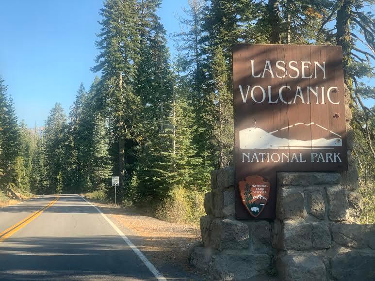
This time we will introduce Lassen Volcanic National Park, located in Northern California
Although it is a legitimate national park, it is less well known among Japanese people than Yosemite National Park and many others, so I think there are many people who don't know about it
However, this is actually a wonderful place that could be called California's "mini Yellowstone."
It was designated a national park on August 9, 1916, and the large-scale eruptions that continued for a year from May 1914 created a unique volcanic landscape in the surrounding area
It was also designated a national park for volcanic research, and in some places you can see steam bubbling up from underground, as well as geysers and hot springs. It really feels like a condensed version of Yellowstone National Park! (Volcanic activity has calmed down at present.)
The park is centered around Mount Lassen, which stands at 3,187 meters above sea level, and of course you can climb Mount Lassen. The area around Mount Lassen is home to numerous trails, beautiful lakes, and waterfalls, making it an ideal place for hiking and camping
This time, we will introduce the hiking trails of Lassen Peak, which is also the symbol of Lassen Volcanic National Park
table of contents
Enjoy the unique and diverse natural scenery created by volcanoes. How to get to Lassen Volcanic National Park
It is just over a four hour drive from San Francisco International Airport
From San Francisco International Airport, head north on Highway 80, then to Highway 505 and then to Highway 5
If you continue along Route 649 on Route 5 towards CA 36, you will come to CA 89, which runs through Lassen Volcanic National Park
entrance
There are two entrances to the park, one on the northwest side (Northwest Entrance) and one on the southwest side (Southwest Entrance). The main season is from June to September, and in winter, roads within the park are closed in some places due to snow accumulation
Activities in the park
Spring - Summer - Autumn
Day hikes, backpacking, camping, cycling, fishing, water activities like boating and swimming, driving, geyser tours, etc
Winter
You can enjoy a variety of snow activities, including snow sledding, snowshoeing, cross-country skiing, backcountry skiing, and snow camping
Admission fee (as of January 2021)
There is no need to go through any formalities beforehand to enter the park, just pay the admission fee at the entrance
The park itself is open 24 hours a day, year-round (make sure you fill up your car with gas before entering the park)
- Regular car (private car) $30.00 (valid for 7 days)
- Winter: $10.00 December 1st to April 15th
- Bike $25.00
- $15.00 per person for non-vehicle bicyclists and hikers
Opening hours
South entrance
Open 24 hours a day, all year round
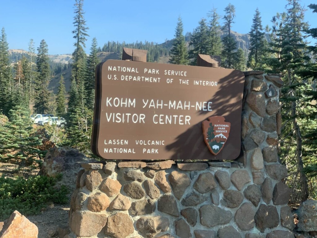
Kohm Yah-mah-nee Visitor Center is open from 9 am – 5 pm
North entrance
Closed during the winter from October 31st to May 21st
Loomis Museum is open from 9 am – 5 pm
Where are the information centers at the parks? Can I replenish my food and equipment?
There is a cafe and souvenir shop in the Kohm Yah-Mah-Nee Visitor Center area where you can get drinking water and food
Opening hours: 9 am – 5 pm during the main season from May 21st to October 12th. 11 am – 2 pm from October 13th to May 26th
Useful items to bring with you on a hike
- Drinks (larger in summer, about 2 liters)
- Warm clothing that can adjust to the temperature (it can get cold on windy days)
- hat
- sunglasses
- sunscreen
- Snacks to eat during the hike
- If you have any regular medications, bring first aid such as medicines and bandages
- Swimsuit (You can swim in the lake in the summer. There is no place to change clothes, but please bring your own if necessary.)
- Other normal hiking gear
LASSEN PEAK Hike Information
Trail Data
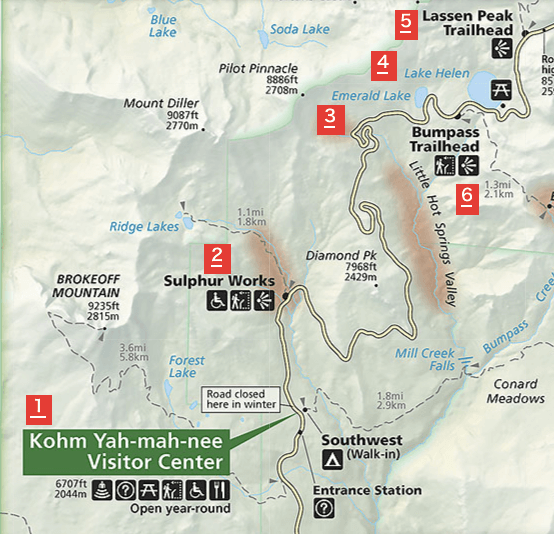
- For intermediate and above
- Season June to September
- Trailhead elevation: approx. 2587m
- LASSEN PEAK Altitude: approx. 3187m
- Round trip: Approximately 8.2 km (5.1 miles)
- Height difference: approx. 600m (1968 ft)
- Course time: 3 to 5 hours round trip (including breaks)
Start your hike from the trailhead
Address: Lassen Peak Trailhead: Volcanic Legacy Scenic Byway, Mill Creek, CA 96061
If you are heading towards San Francisco and enter the park from the south entrance, you will soon see the Kohm Yah-Mah-Nee Visitor Center (number 1 on the map above)
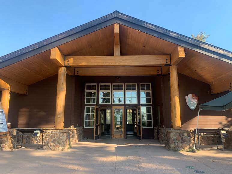
We then went into the visitor center to use the restroom. You can get maps and other items here if you need them. If you need drinks or snacks, you can get them at the cafe in the same area
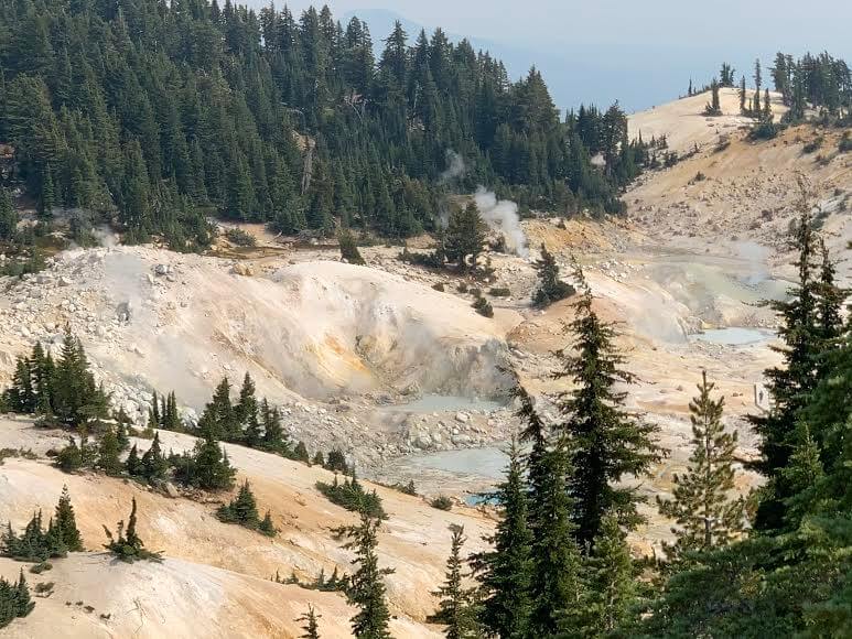
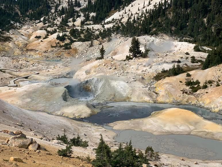
As we left the visitor center and drove to the trailhead, we could see steam rising everywhere and smell sulfur. These are signs of hot springs and mud springs
If you're interested, park your car in the parking lot of Sulphur Works along the road and take a look. You'll get a glimpse of the heartbeat of the Earth. (2 on the map above)
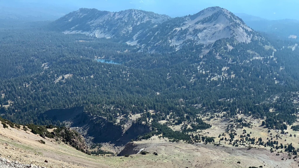
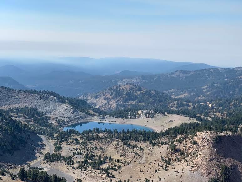
If you go further, you will see Emerald Lake on the left (3 on the map above)
It was early in the morning and there was no wind, so the surrounding scenery was reflected on the lake's surface, creating a mirror lake. The water was crystal clear and truly beautiful
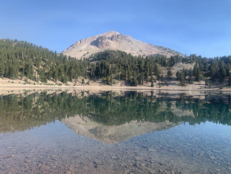
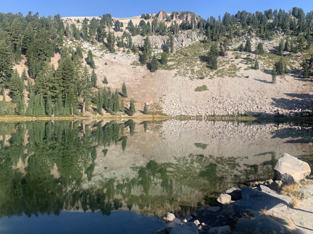
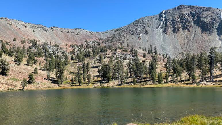
If you continue driving, you will see Lake Helen on your left (number 4 on the map above)
At the far end of the lake stands Lassen Peak, our destination for the day. We will later climb to the summit of that mountain, at an elevation of 3,187 meters. A shot from the south shore of Lake Helen shows Lassen Peak in the background, as shown here. This is also a beautiful, quiet lake with exceptionally clear water

Some people swim in the water in the summer. It must feel great

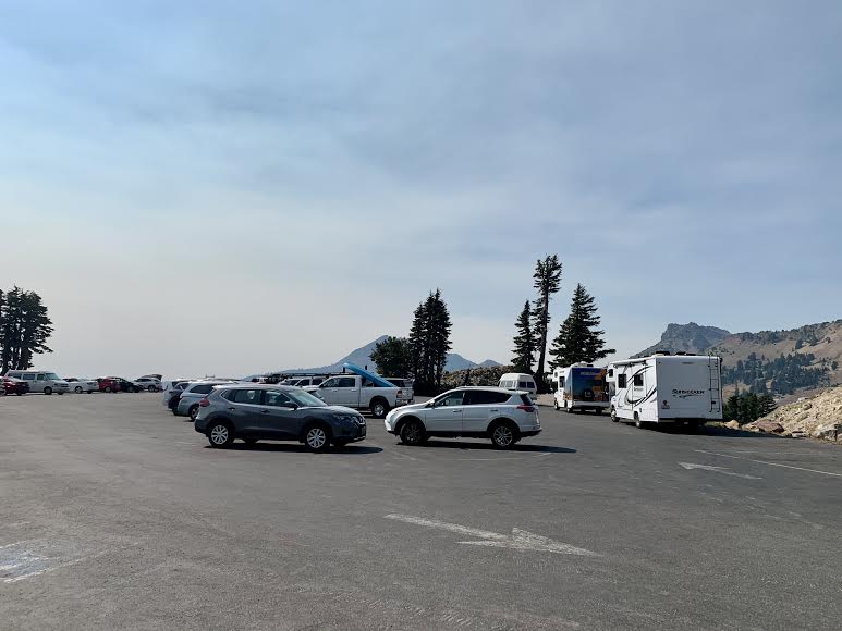
Leaving the lake behind, we headed to the parking area about a mile ahead. There was ample parking space at the trailhead, and there were also restrooms (number 5 on the map)
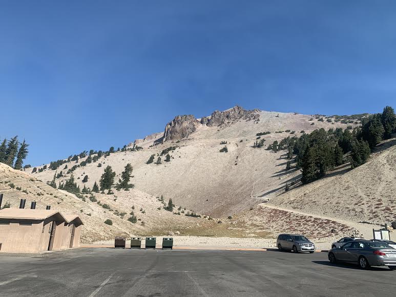
Once you're ready for the hike, it's time to set off
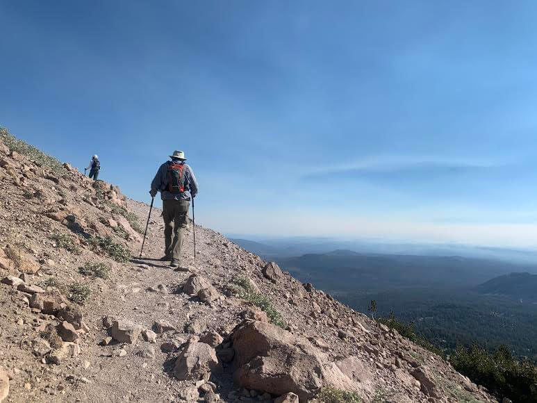
The trail is well-maintained and gravel-filled, and there are "STAY ON THE TRAIL" signs everywhere, encouraging people to stay on the trail and not take shortcuts. This is a basic rule to protect the natural world as much as possible
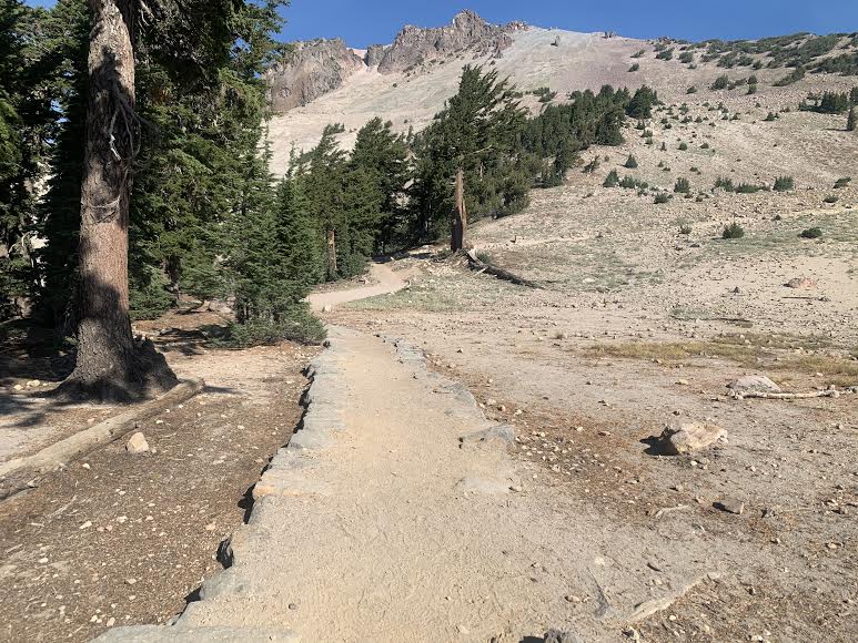
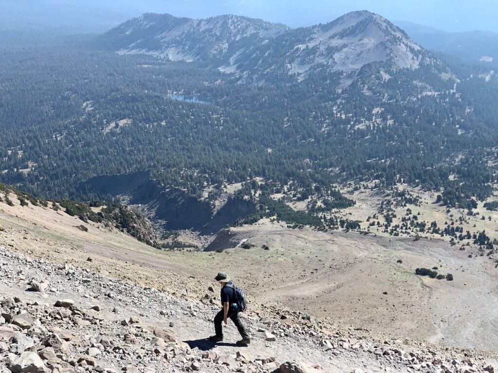
As you climb, you will approach the tree line and the trees and shade will gradually disappear. The steep switchbacks will require some physical strength, but the view that awaits at the top is spectacular
Don't forget to take precautions against the sun, such as sunscreen and a hat
The views of the surrounding area that come into view along the way are also spectacular, so be sure to take frequent breaks in places with good views
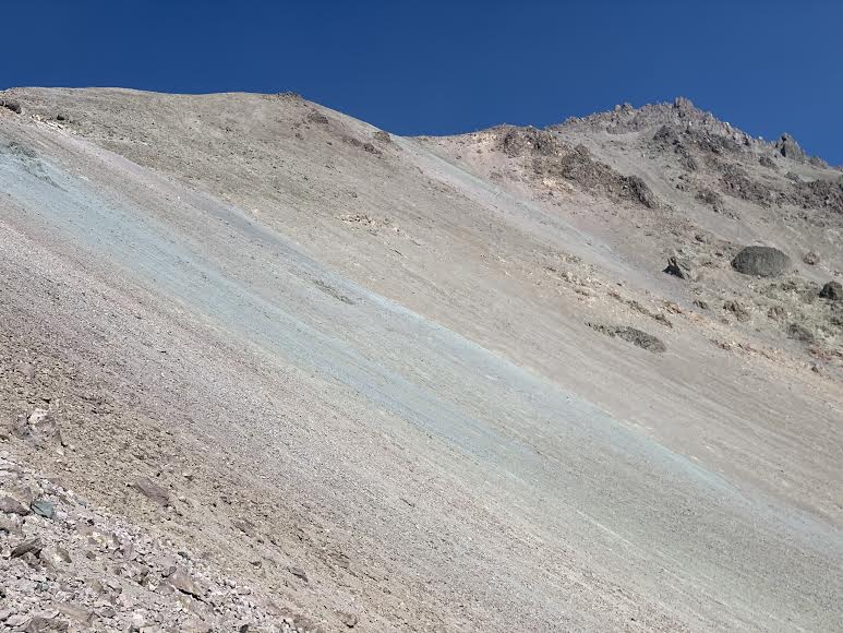
As we continued to climb, the air became thinner as we gained altitude. Lake Helen, which we had seen from the side earlier, now seemed quite far away
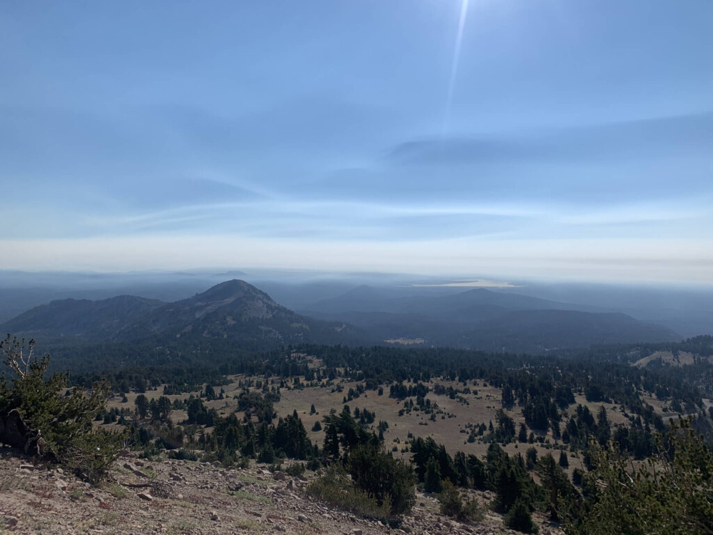
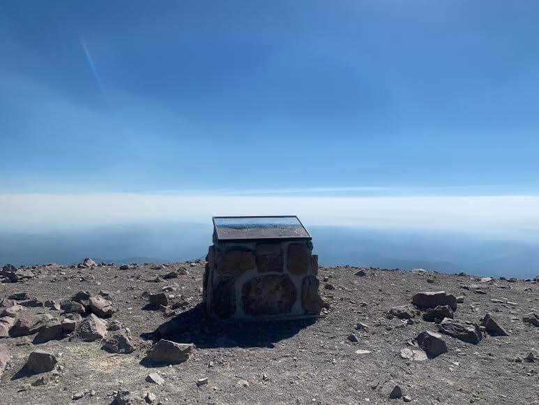
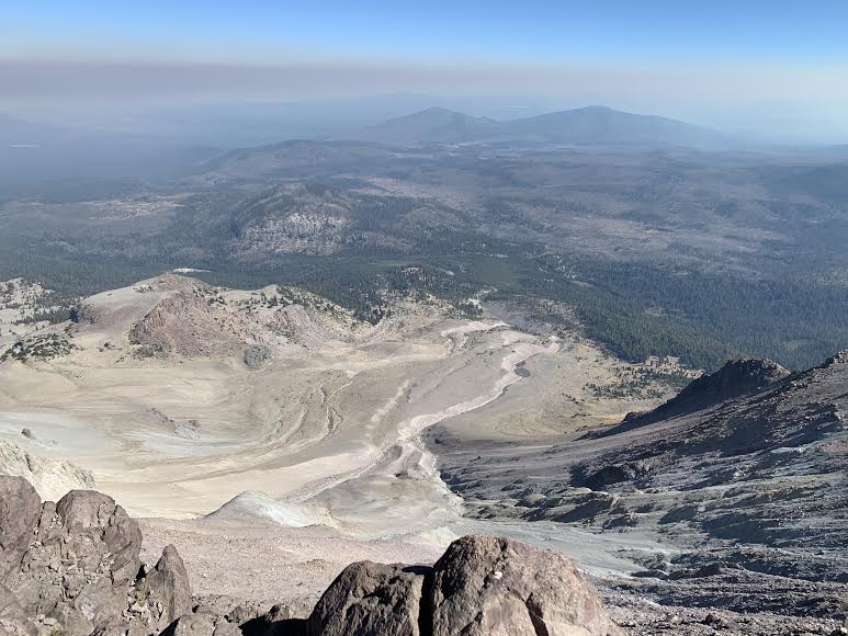
Near the summit at 3150m, dark stones and whitish rock walls become more noticeable. We reach the summit about an hour and a half after starting
From the summit, you can look down on the devastated area that was affected by the eruption that continued for several years starting in 1914. At the time, forest fires were occurring all over California, so the view was not clear, but it was still impressive!
On the way back, you will return the way you came
bonus
Bumpass Hell, a 3-mile (4.8 km) round trip trail that takes about 2 hours, is located near the Lassen Peak Trail. This is the largest hydrothermal area and offers a view that looks just like a mini Yellowstone (number 6 on the map above)
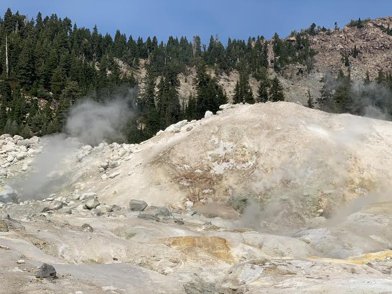
This hike takes you to an area where you can see hot water and muddy springs bubbling up everywhere, and see steam rising, a phenomenon unique to volcanic areas. If you're still confident in your physical strength, this is definitely worth a try!
I walked here after hiking Lassen Peak
Hiking Information
- For beginners
- Season June to September
- Round trip: Approximately 4.8km (3 miles)
- Height difference: approx. 129m (423 ft)
- Course time: 2 hours round trip
Trailhead
Address: Bumpass Trailhead Parking, Mill Creek, CA (6 on the map above. Located just before the Lassen Peak trailhead. Between Emerald Lake and Helen Lake.)
Trailhead parking lot Lassen Volcano NP
In the hydrothermal area, wooden boardwalks are laid out, and hikers are required to stay on them. For safety reasons, please be careful not to touch the hot springs or throw any objects or trash into them
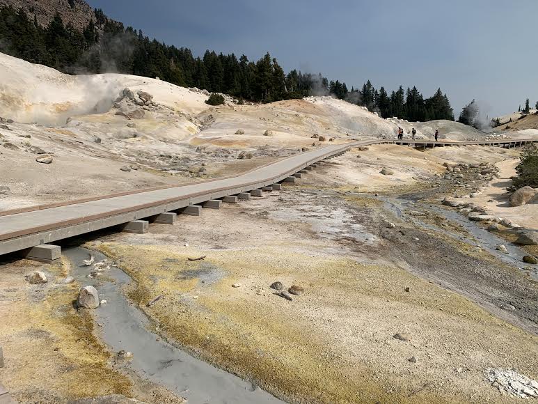
In areas where there are no boardwalks, be careful not to stray too far from the course
Precautions regarding the spread of COVID-19
As of February 2021, various countries are currently imposing entry restrictions due to strengthened quarantine measures, as well as restrictions on entry to national parks and domestic travel. These conditions are subject to change without notice, so when traveling, be sure to obtain local information from each country's embassy or consulate, the Ministry of Foreign Affairs' Overseas Safety Website (Infectious Disease Risk Information), national park websites, and other sources, and check information on transit points, countries you plan to travel to, and the areas around the places you plan to visit before making reasonable plans and taking action
Sayaka Kato
 Leave your hiking and travel plans for Lassen Volcanic National Park to us. Influenced by my father, I've always loved outdoor activities, and while living in Japan, I started hiking and touring national parks, which fascinated me with the natural beauty of the United States and Canada, ultimately leading me to my dream of visiting the United States. Currently, I run ANAMI TOURS, which offers local optional tours created together with clients, such as completely private hiking tours with Japanese guides. I'll introduce you to special options that I know only because I live in the area. If you're interested, please visit the website below
Related reading
 Can't die without walking? A Journey to the American National Parks (16) Flowers, greenery, lakes, and a panoramic view from the summit. Mount Shasta's magnificent peak, Mount Eddy Trail, has it all
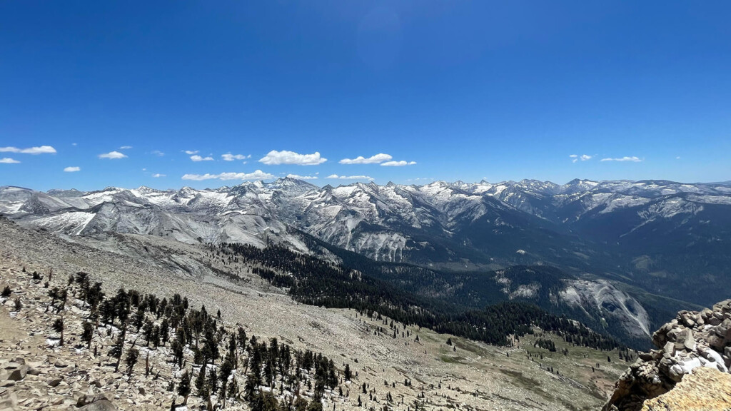 A journey to the US National Parks (27): A spectacular trail overlooking the forests of giant trees and the beautiful Sierra Nevada mountain range. Sequoia and Kings Canyon National Parks
 Can you die without walking? A trip to the US National Parks (28) See the waterfalls flowing through the glittering marble (Sequoia National Park)
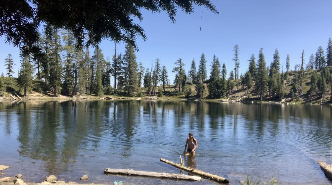 Can you die without walking? A trip to the US National Parks (15) Enjoy the crystal clear lakes with your whole body. Seven Lakes/Lake Helen Hike