歩かずに死ねるか!アメリカ国立公園への旅(8)天空の島 キャニオンランズ国立公園
written by Sayaka Kato
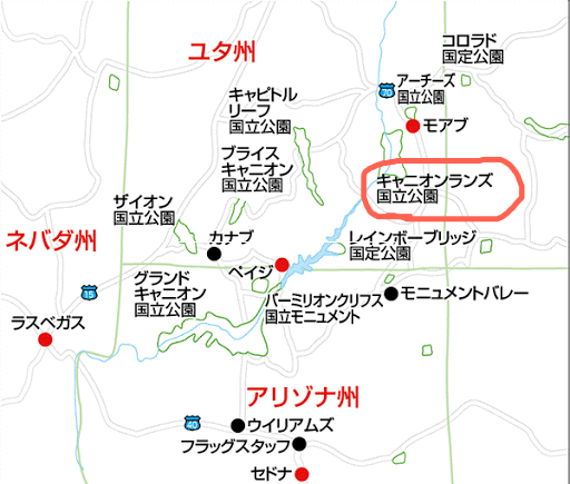
モニュメントバレーから北へ車を走らせ約2時間30分ほど北上していくとCanyonlands National Park・The Needles(キャニオンランズ国立公園 ・ザ・ニードルズ)があります。
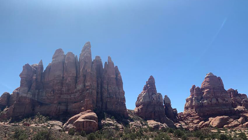
雄大という言葉以上に、まさにここも他の星か惑星に来たのではないか、と錯覚を起こすくらい非日常の景色が広がります。どこまでも続く真っ直ぐな道、様々な地形、興味深いフォーメンションを持つ岩岩、そして大きすぎる空間。

ユタ州にある5つの国立公園の中で一番大きい337,598エーカー(約1,366㎢)という広さをもつキャニオンランズ。ここは一度足を踏み入れて実際に見てもらわないと大きさが表現できません。あまりにも広く雄大なこの国立公園は公園内を流れるコロラド川とグリーン川によって3つのパートに分かれています。3つのエリアどこへ行く場合も同じ入場券で入ることができます。
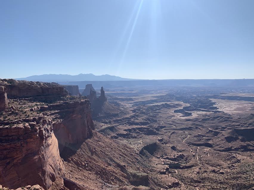
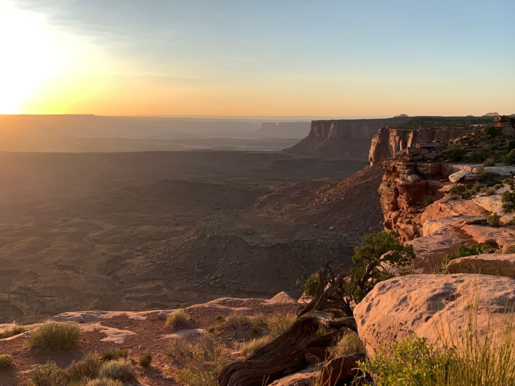
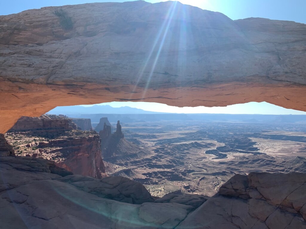
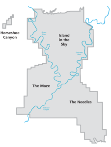 アイランド・イン・ザ・スカイ(Island in the Sky)車で簡単に廻れるビューポイントが多いエリア。名前の通り 天空に浮かぶ島 がそこにはあります。
- ザ・ニードルズ(The Needles)人が少なく、ハイキングトレイルが多いエリア。
- ザ・メイズ(The Maze)四駆車もしくはマウンテンバイクでのみ入場可能なエリア

この3つのパートは公園内でつながっていないので、各パートごと一旦それぞれのエントランスから公園の外に出て各パートのエントランスまで車を走らせ、再入場するしか方法がありません。あまりにも広いので1日で簡単に廻れるというわけではなく、時間がかかります。
アイランド・イン・ザ・スカイは舗装された道路が長く続き、その途中にいくつかのビューポイントがあり駐車場も完備されていて、ほとんど歩くことなく眺めを楽しむことができます。観光客に一番人気なエリア。「天空の島」と付けられた名前が納得できる場所です。
(こちらのエリアにも、様々なハイキングトレイルがありますよ。)
ザ・ニードルズはトレイルコースが沢山あり、しっかりと歩くハイキングをしたい人にはお勧めのエリア!何よりも一歩トレイルへ入ると人がほぼいないので自分と自然界の空間を楽しむ事ができます。
ザ・メイズはアクセスが大変悪く、一般の観光客はなかなか行かない場所ですが、マウンテンバイクなどのアドベンチャー、オフロードが好きな方にはもってこい。現在でも未開の地と呼ばれる迷路のような地形が続く場所です。徒歩、マウンテンバイク、四輪駆動車のみアクセス出来ます。(マウンテンバイクはすぐ近くのモアブの町にあるスポーツ屋さんなどでレンタル出来ます。)
目次
天空の島 キャニオンランズ国立公園への行き方
所要時間
- SLC ソルトレイクシティー国際空港からキャニオンランズ・アイランド・イン・ザ・スカイまで車で約4時間 (ザ・ニードルズへは更に2時間半かかります。)
- LAS マッカラン国際空港(ラスベガス)からキャニオンランズ・アイランド・イン・ザ・スカイ車で約7時間
- モニュメントバレーからザ・ニードルズまで車で約2時間半(ハイキングトレイルが多いエリア)
- モニュメントバレーからアイランド・イン・ザスカイまで車で約3時間半
- モアブの街からは車で40分ほどでキャニオンランズ国立公園のアイランド・イン・ザ・スカイ入り口へ到着。(ザ・ニードルズへは2時間半かかります。)
廻り方プラン例
一番近郊の国際空港は(SLC)ソルトレイクシティー国際空港になります。
- (SLC)を起点に:アーチーズ国立公園、キャニオンランズ国立公園、デッドホースポイント州立公園、モニュメントバレーなどを廻り(SLC)に戻る。
- (LAS)を起点に:グランドキャニオン国立公園、アンテロープキャニオン(ホースシューベンド)、モニュメントバレー、キャニオンランズ国立公園などを廻り(LAS)に戻る。
近郊の国立公園や州立公園との組み合わせ方は様々です。
宿泊施設
モアブという小さな街が近くにあり、そこを起点にアーチーズ国立公園、キャニオンランズ国立公園、デッドホースポイント州立公園などへアクセスが出来ます。モアブに2、3泊して、周辺の国立公園を一緒に回るのがベストです。アウトドア好きにはコロラド川エリアのマウンテンバイクツアー、四輪駆動車ツアー、リバーラフティングなどのツアーがこちらで申し込めます。モアブの街を起点に多くのAirbnbをはじめ、モーテルやリゾートホテル、レストランやスーパーマーケット、ギフトショップがあり必要なものは簡単に手に入ります。 夏休みなどの繁忙期はモアブの街も混んでいますので、 モアブに宿泊できない場合は1時間半ほど離れるとコロラド州グランドジャンクション、南に下りればモンティセロ、ブランディングと宿泊できるエリアは他にもありますが、モアブが便利です。
入園料 (2020年3月現在*)
公園に入るためには前もって手続きはいりません。エントランスで入場料を払うのみです。
- 一般車(自家用車)$30.00 (7日間有効)
- バイク $25.00
- 車以外の自転車やハイキングをする人は一人当たり $15.00
営業時間
エントランスは24時間1年中オープン。
ビジターセンター(祝日は特別営業の日有り)
各エリアによりビジターセンターがありますが営業時間は様々です。
アイランド・イン・ザ・スカイ
- 11月から3月:8時から16時
- 4月から10月:8時から17時
ザ・ニードルズ(ハイキングエリア)
- 冬季:クローズ
- 3月から4月:8時から15時半
- 5月から10月:8時から17時
- 11月:8時から16時
ザ・メイズ (Hans Flat Ranger Station )
- 年間オープン:8時から16時半
天候
キャニオンランズは砂漠地帯でシーズンにより1日で40度を超える気温の変動が激しいエリアでもあります。
温暖な最も人気のある季節は春4月から5月と秋9月から10月で、昼間の最高気温は平均15度から25度 、最低気温は平均0度から10 度です。
夏の気温はしばしば35度を超え、とても暑く水分補給がとても重要になります。
冬は寒く、最高気温は平均0度から10 度です最低気温は平均0度~マイナス5度 になります。
どの季節も乾燥しているので水分補給がとても重要です。特に夏は砂漠地帯の暑さでハイキングには厳しい時期になります。おすすめのハイキングシーズンは4月から6月、9月から10月です。
公園での案内所は?食料や装備は補充できる?
ビジターセンターが各3エリアありますので、そこでマップなどの情報収集ができますが飲食はアイランド・イン・ザ・スカイ以外では購入するのは難しいので予め準備していきましょう。走る距離が長いのでガソリンもしっかり入れてから行きましょう。
アイランド・イン・ザ・スカイ
食料に関しましてはアイランド・イン・ザ・スカイのビジターセンターすぐ横に売店があり、そこで食料などゲットできます。
ザ・ニードルズ
ザ・ニードルズのビジターセンターには食料などは販売してませんのであらかじめ事前に準備しておく必要があります。Needles Outpost というキャンプ場があり、そこで購入することはできますが公園外にあり、距離があるのとシーズンによって空いていないので、ハイキングへ行かれる時は必ず事前に水分、食料を用意しておきましょう。
ザ・メイズ
ザ・メイズに関しましても近くに売店はないので事前に準備が必要です。
ハイキングに携行すると便利な持ち物
- 飲み物(夏は多めに) ハイキングへいく際は夏場は4リットルくらいは必要だと思います。本当に乾燥しています。
- 気温の調整できる防寒着
- トレッキングシューズ
- 帽子
- サングラス
- 日焼け止め
- ハイキング中に食べるスナックなど
- 常備薬などがある場合は薬やバンドエイドなどのファーストエイド
- 雨具
キャニオンランズ国立公園(ザ・ニードルズ)のハイキング情報
Chesler Park ViewPoint 6 miles(10km)3~4時間
オプションとして:(Chesler Park Loop Trail 11.6 miles (18.56km) Elevation Gain: 1,935 feet (標高差 約590m)5~7時間)※飲料水が最低4リットル以上は必要です。
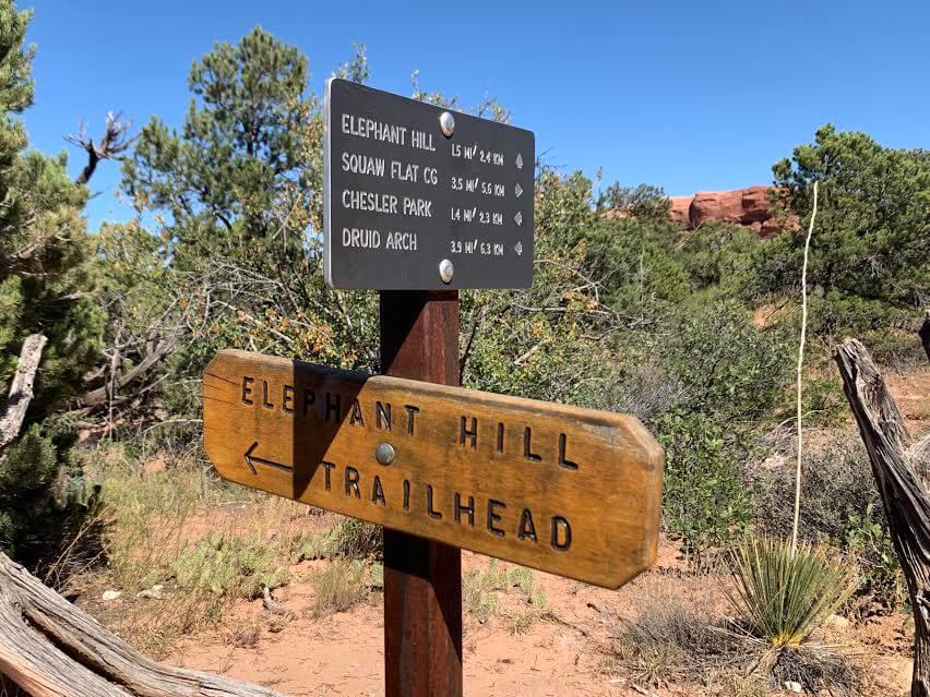
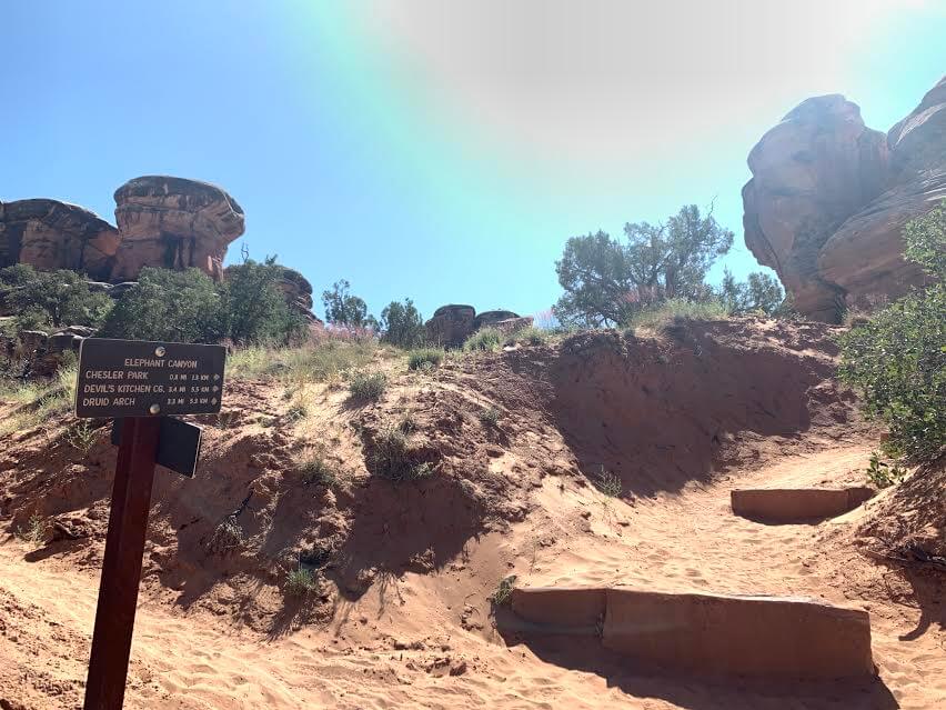
トレイルヘッド:Elephant Hil
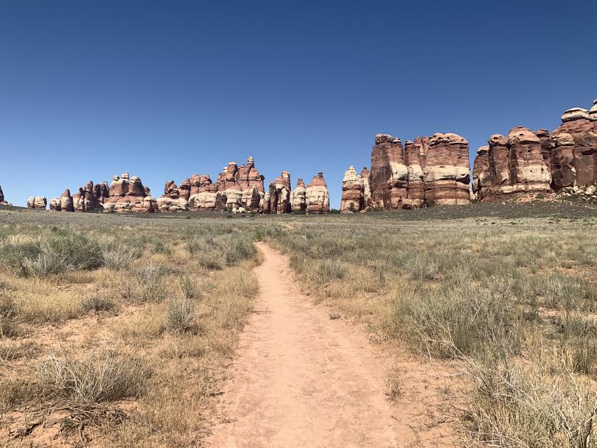
ザ・ニードルズには数多くのトレイルがありますが今回ご紹介しますのはElephant HilのトレイルヘッドからChesler Park ViewPoint までいく往復10kmのハイキングルートをご紹介します。
本来はChesler Park Loop Trail という長いハイキングルートでループになっているトレイルを歩く予定だったのですが、私が歩いたのが真夏の8月。持参した水2リットルでは足りないことに気づき、今回は途中のChesler Park ViewPointまで行き、そこから来た道と同じ道で戻りました。
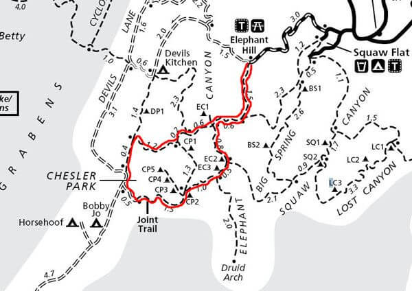
この赤いラインが Chesler Park Loop Trail 11.6 miles (18.56km) になります。今回私が行ったのが途中までの Chesler Park まで。6 miles(10km)そこからは来た道を戻りました。
注意:水を最低4リットル位持って行くことをお勧めいたします。(夏場はもっと必要です。)
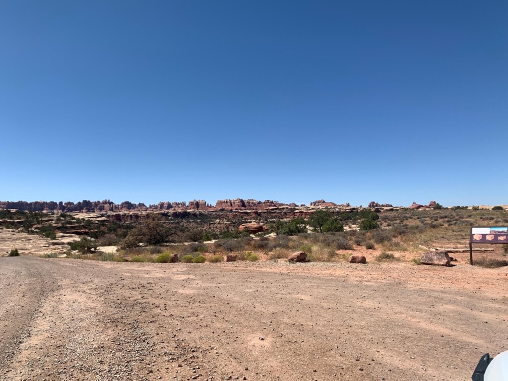
車でモアブ方面からもしくはモニュメンントバレー方面からハイウェイ191を走り、US-211にはいります。そこがザ・ニードルズへいく道。
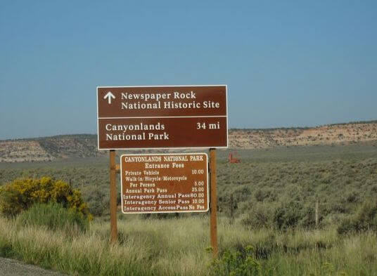
入り口に看板がありますが、ここからCanyonlands NPに入るまでさらに34mile(約55km)あります。アメリカは広いです。ドライブウェイも絶景が続いて運転もとても気持ちが良い。

Needles District に到着したらまずビジターセンターに行きましょう。(US-211に曲がってから50分ほど)こちらでマップや必要な情報をゲットします。お手洗いもありますよ。

トレイルヘッドへ
Elephant Hillのトレイルヘッドへ。ビジターセンターから車で約30分ほど車を走らせます。Elephant Hillのトレイルヘッドには最後1mileぐらいはダートロードを走ることになります。
路面は思ったよりなめらかですがカーブが多く、道幅は2台すれ違うギリギリで、対向車も来るのでお気をつけて。乗用車、四輪駆動車などは問題ありませんが、12人以上乗りの大きなバンなどは通行禁止になってます。
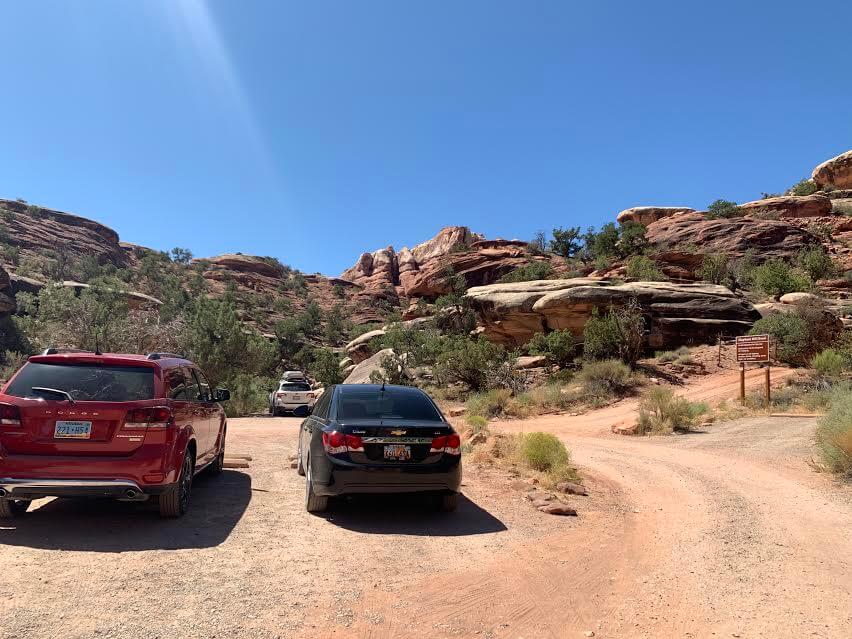
Elephant Hillのトレイルヘッドに駐車場があるので、そこに車を停めていよいよハイキングへ出発。(ここElephant Hill トレイルヘッドはハイカーたち用の駐車場に加え、そこから更に車でオフロードを走る人用の道が続きます。ハイキングの方はここで車を駐車します。)
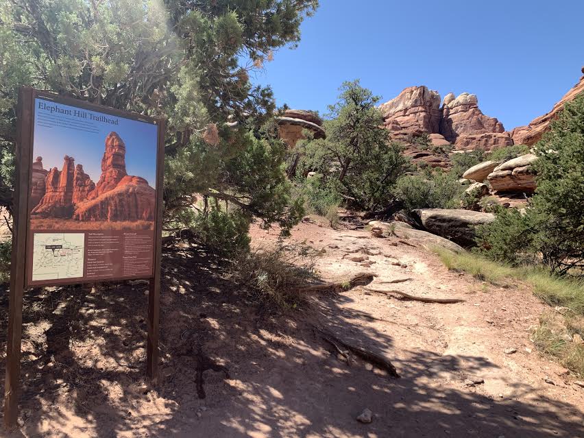
トレッキングに出発
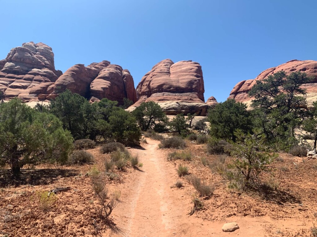
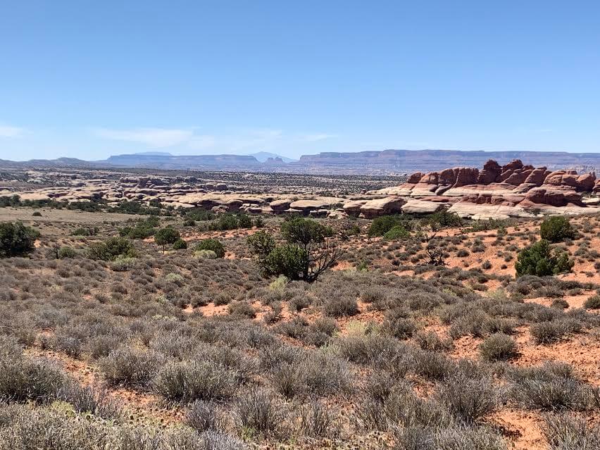
最初の10分位は登りが続き、そのあとは割と平らな台地の上を歩いて行きます。
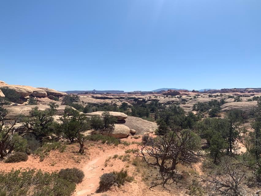
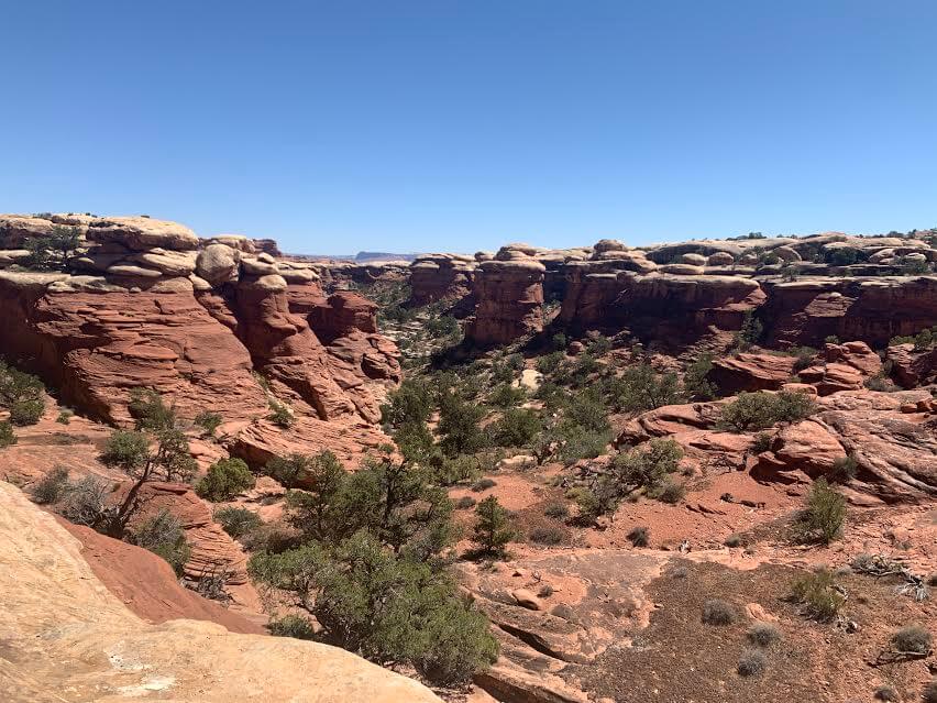
独特の形をした岩岩が周りを囲み、とてもユニークな世界。岩が像の足の様だったり、円柱型だったり、尖りがあって山の様だったり日本ではあまり見ない風景です。
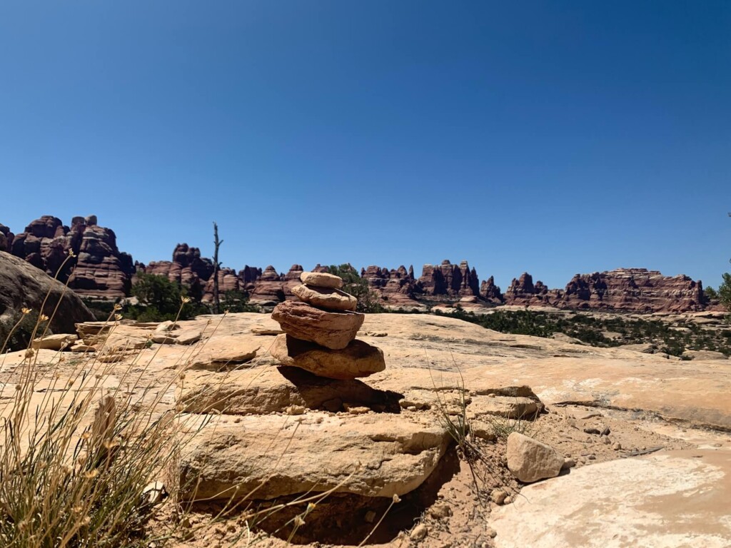
ありがたいことにケルンが至る所にあり、道案内をしてくれます。
ケルンを探しながら歩きつつ、日陰などを探してこまめに休憩を取りましょう。想像以上に乾燥しているので私が歩いた時は水を飲んでも飲んでも足りない感じで、どんどん無くなっていく水に途中からヒヤヒヤでした。笑
標高も高いので初めからペースを飛ばさない様に気をつけてください。歩き始めて45分位のところに初めての分岐点がありました。
Chesler Parkまで片道1.4mile(2.3km)
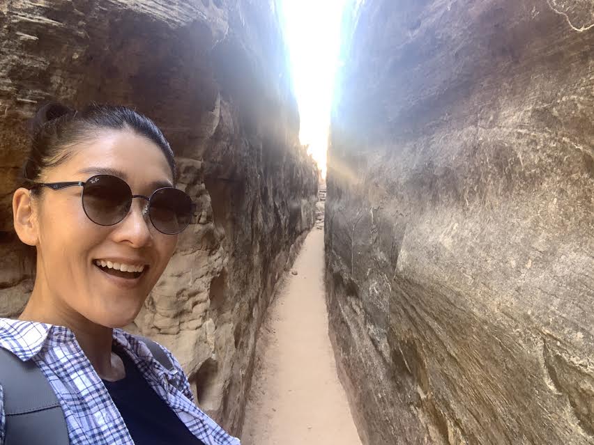
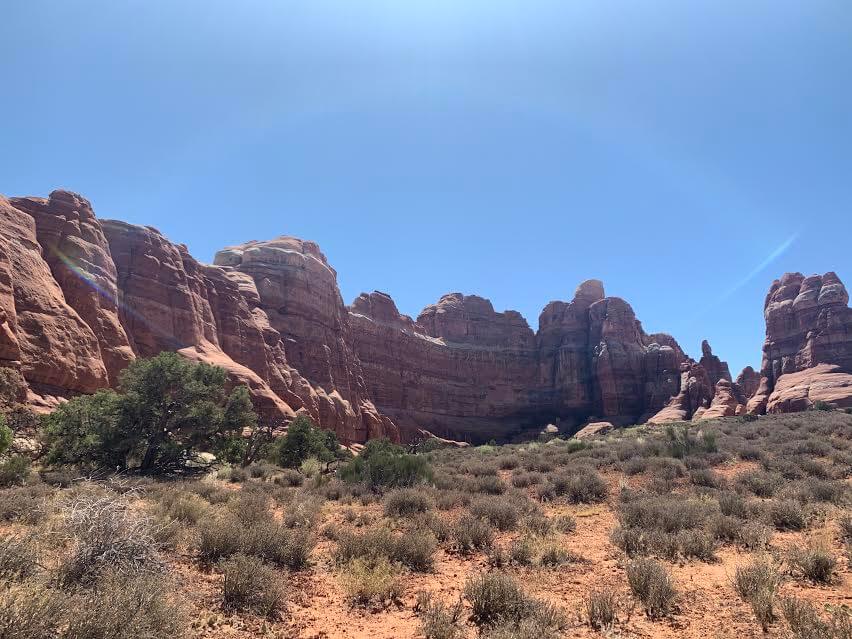
迷いやすい場所にはケルンがありますし、分岐点でしっかり看板もあるのでわかりやすいです。トレイルでは岩に囲まれたこんな場所なども(日陰で涼しい)
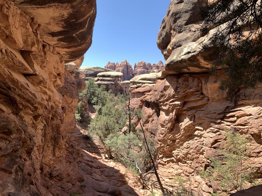
更に進んでユニークな岩岩達に囲まれながら歩くとまた平らな場所に出てきます。
景色もどんどん変わり本当に歩きながら観て楽しめるトレイルです。ここからはChesler Parkまで片道0.8mile 1.32km
日差しも強く、カラッカラで水が本当に必要でした。私が歩いたのは真夏の8月。想像で暑いのはわかっていましたが、本当に暑すぎる。。どんどん無くなっていく飲料水と自分の体力と相談しながら歩いて行きました。体力は大丈夫そうでしたが、水が無くなってしまう前にハイキングを切り上げなくてはなりません、、水がなくなると言うのは精神的に良くないということがすごく今回のハイキングで実感しましたよ。笑 良い教訓でした。重くてもしっかり持って行かなくちゃと改めて感じました。

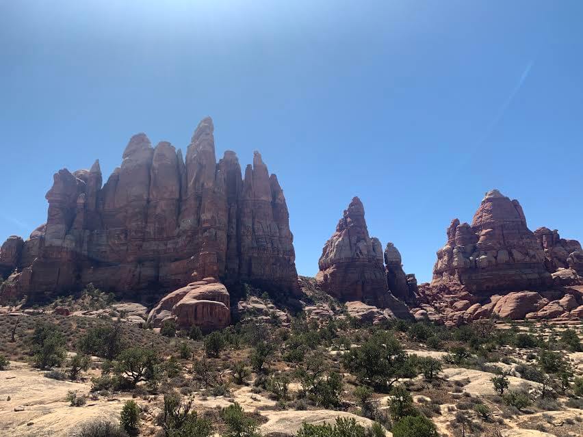
約2時間後、Chesler Park 到着。
驚いたのはハイカーがほとんどいなくて本当に静かな空間が続いたこと。こんな暑い8月にここでハイキングをする人はまずいないとは思っていましたが、途中でレンジャーさんと2組のカップルに会っただけで、それ以外はずっと自然界と自分だけでした。静かな静かな空間に自分の足音だけ。音が何も無い空間なんて生活していてなかなかなですよね。
あまりにも雄大な景色の中ですが、あまりにも静かな空間がとても不思議で、でもその中にいられる幸せを感じながら歩きました。
ここもまた、一体自分はどこへ来てしまったんだろう、、という、違う惑星にきてしまったかのような錯覚に。
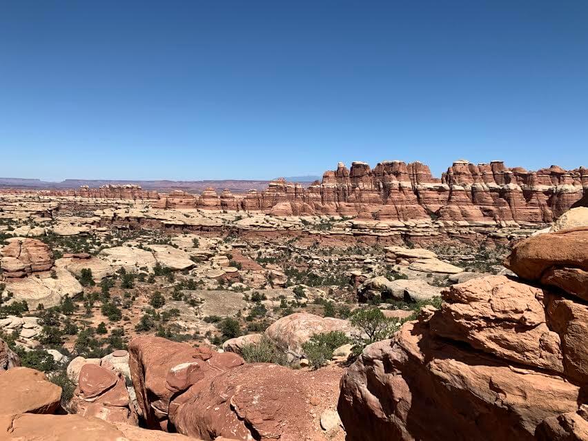
ここのトレイルの良いところは素晴らしい景色はもちろん、それに加え本当に人が少なく、雄大すぎる空間の中でのプライベート感がとてもあります。水さえ十分にあったら長いループトレイルも廻りたかったと思いつつ、飲料水がなくなるのは致命傷なのでまた来た道をもどります。
静かな空間で沢山の岩岩に出会い、大自然の中での彼らとの対話を楽しみました。次回は水を十分に持参し、またここから続く違うトレイルへ来たいなと思います。
皆様、ここのトレイルはお水をしっかりとご用意ください。笑
加藤 さやか
 ザ・ニードルズ ~ キャニオンランズ国立公園のハイキング・旅行プランはお任せください。父の影響もあり昔からアウトドアアクティビティーが大好きで、日本にいた頃から登山、国立公園巡りをする中で、アメリカやカナダの大自然に魅了され、その結果念願だったアメリカに辿り着きました。現在は日本人ガイドと行く完全プライベートハイキングツアーなど、お客様と一緒に作る現地オプショナルツアーを提供するANAMI TOURSを営んでいます。現地在住だから知り得る、スペシャルなオプションをご紹介させて頂きます。ご興味ある方は下記HPから。
あわせて読みたい
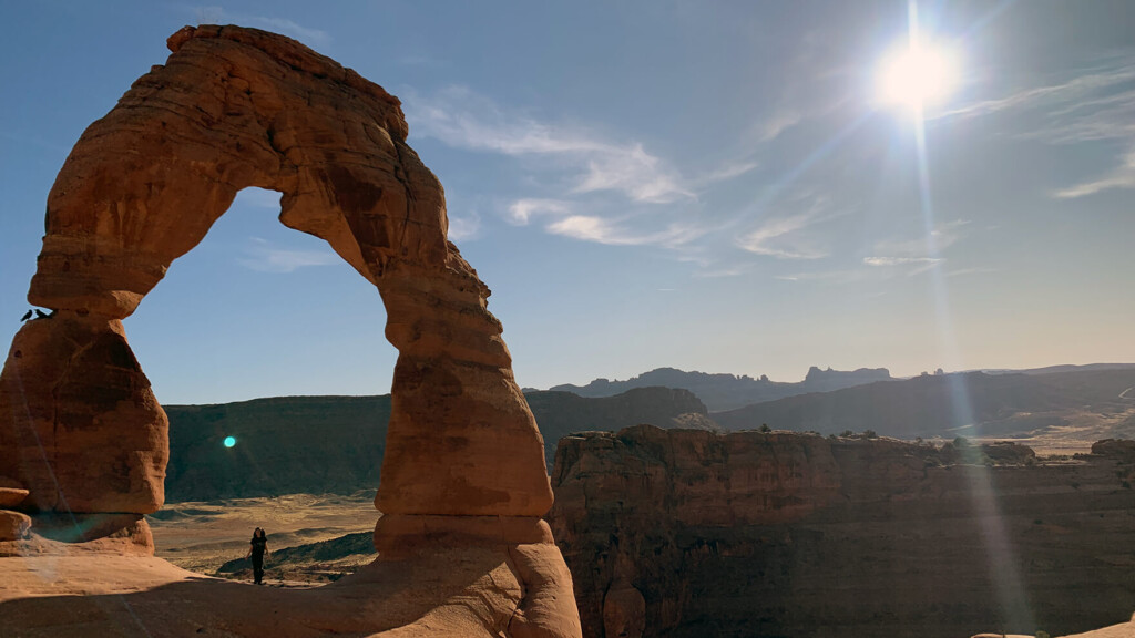 歩かずに死ねるか!アメリカ国立公園への旅(10)自然が作り出した芸術作品。見られなくなる前にぜひ行っておきたい アーチーズ国立公園
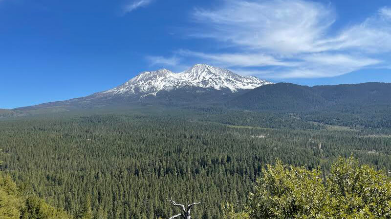 歩かずに死ねるか!アメリカ国立公園への旅(25)Mt. シャスタの宝石 ~Headwaters of the sacramento river と Spring Hill Trail編~
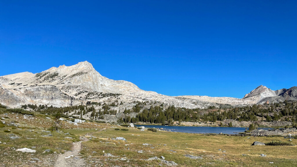 イースト・シエラネバダ山脈の美しい山々の絶景を堪能できる秀逸なトレイル Twenty Lakes Basin Loop Trail【歩かずに死ねるか!アメリカ国立公園への旅(37)】
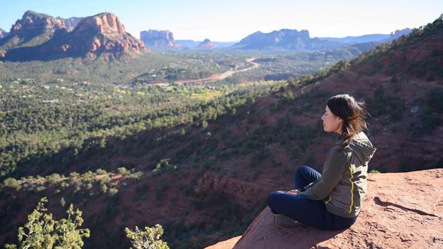 歩かずに死ねるか!アメリカ国立公園への旅(3)グランドサークル セドナおすすめハイキング