Can you die without walking? A trip to the US National Parks (13) Part 2 of the Lake Tahoe Trail. A trail to see the jewel-like lake
Written by Sayaka Kato
This time we will introduce a hiking route in the South Lake Tahoe area. This route allows you to see three lakes in one hike
Lake Tahoe can also be seen from viewpoints along the way, so including Lake Tahoe, you can visit four lakes, making this a recommended course where you can see the sparkling, beautiful, jewel-like lakes. Swimming is also permitted, so if you're interested, be sure to bring your swimsuit!
The second half of the course is a loop that goes around the area and returns to the same starting point, but the trail itself is long, so it is suitable for intermediate to advanced hikers. Please refer to the previous article
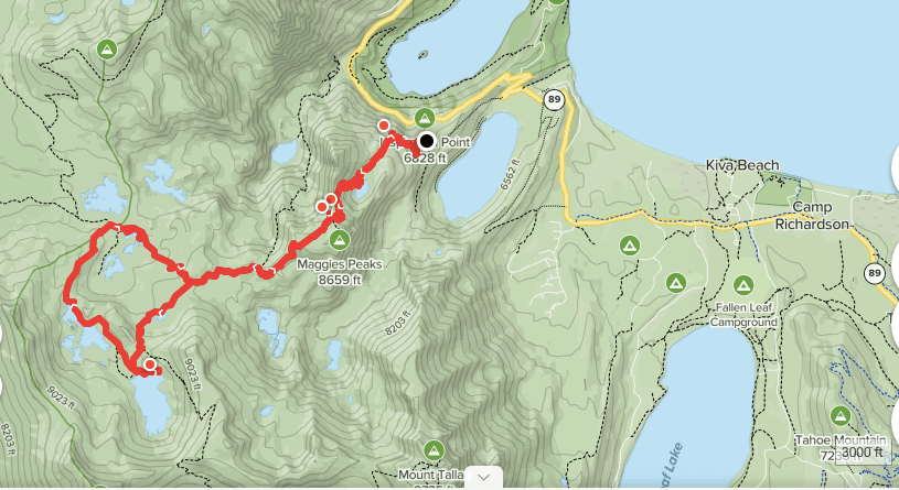
table of contents
Introducing hiking trails around Granite Lake, Dick's Lake, and Velma Lake
Granite Lake, Dick's Lake, Velma Lake hiking data
- Recommended hiking season: April to September (The photos used here were taken in late June)
- Distance: Approx. 12 mi (19 km) round trip, 6-7 hours
- Elevation difference: 2,723 ft (830m)
- Trailhead elevation: 6,828ft (2080m)

Useful items to bring with you on a hike
- Drinks (more in summer, about 3 to 4 liters)
- Temperature-adjustable winter clothing
- trekking shoes
- hat
- sunglasses
- sunscreen
- Snacks to eat during the hike
- If you have any regular medications, bring first aid such as medicines and bandages
- Insect repellent spray, etc. (I didn't have to worry about mosquitoes or insects this time.)
- Other normal hiking gear
Directions to the trailhead (by car)
Entering Cascade Falls Trail, South Lake Tahoe, CA 96150 into Google Maps will take you to the trailhead. The Cascade Falls Trail and the trail I'm introducing this time, which leads to Granite Lake, share the same trailhead. There are parking spaces along the road, but they are limited, so I recommend arriving early. Many people backpack into the mountains for several days and hike, so the parking lot is expected
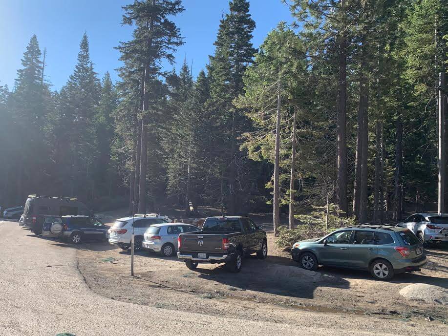
It was 8am, but the lot was already starting to fill up
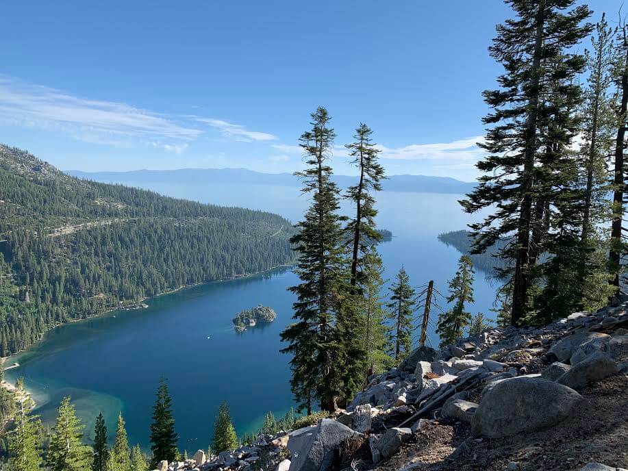
Inspiration Point (Address: South Lake Tahoe, CA 96150) is a viewpoint just across the road from the trailhead area, offering beautiful views of Lake Tahoe's Emerald Bay. There is also parking and restrooms there. Parking is limited
Hiking Guide
Trailhead Bayview Trailhead
There is also a campground in the area, so after parking your car, walk towards the campground
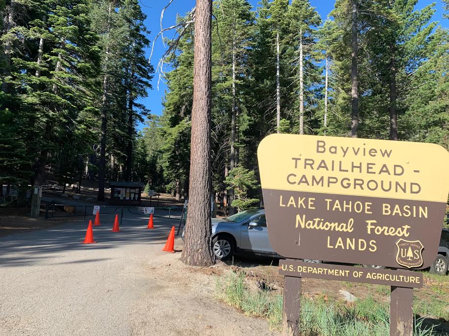
There are also restrooms in this area, so if you need to use them, please go there
We started hiking at 8:15 am
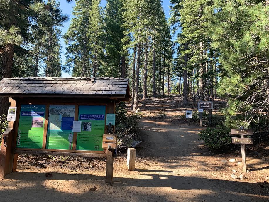
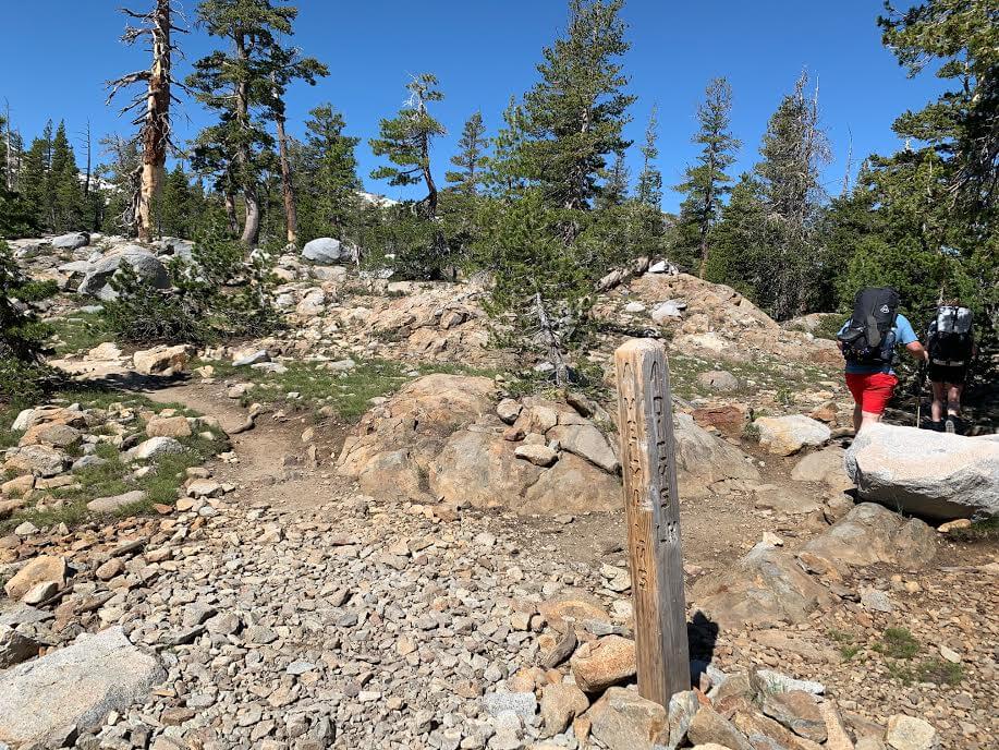
As you head towards the campground, you will finally see the trailhead. This is where the hike begins. Normally, day hikers are required to obtain a permit here. It's very simple, just fill out the necessary information on the form provided and place it in the box, but as of June this year, this was no longer necessary
At the trailhead, the road to CASCADE FALLS and the road to DESOLATION fork, but head right towards DESOLATION
Immediately after starting, the trail begins with a zigzag slope. The first 3 kilometers are quite steep. (The steepest slope of the trail is at the beginning.)
The slope is steep, but the beauty of Lake Tahoe's Emerald Bay that can be seen along the way makes it seem less difficult
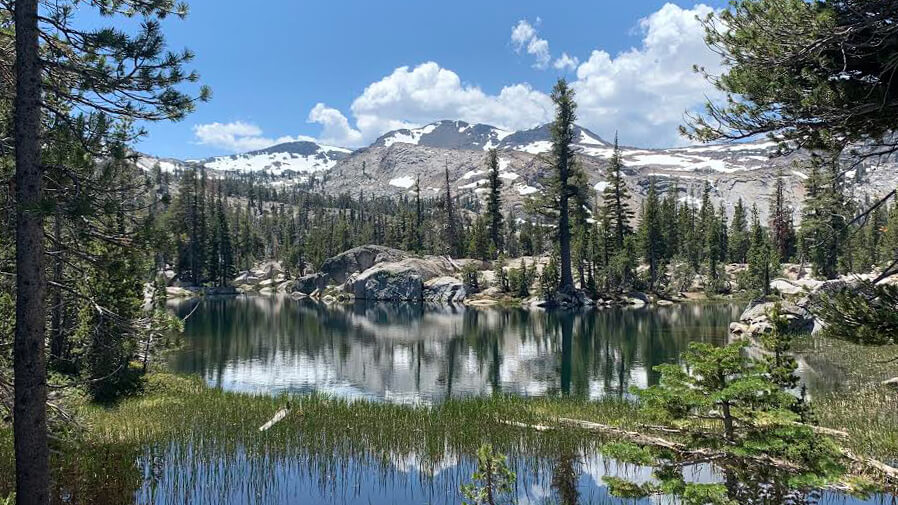
Granite Lake
About 35 minutes after we started, Granite Lake came into view on our left
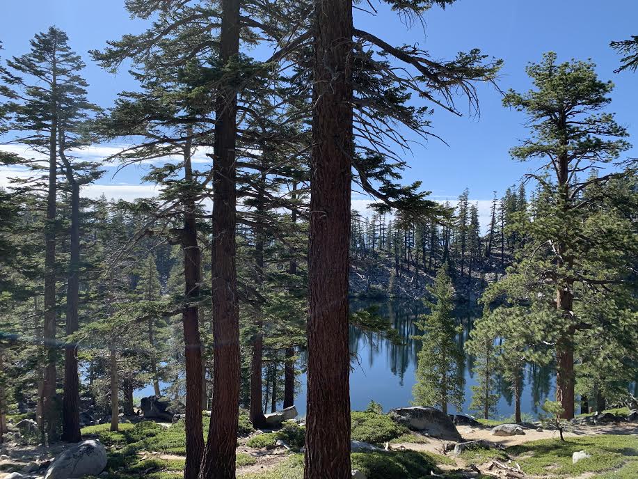
Although it is a small lake, the sacredness of the morning and the reflection of the surrounding trees on the water's surface are very beautiful, so it is a good place to take a short break. Depending on the time of the morning, you may see campers packing up their tents
The slope continues after that, but you can still catch glimpses of the beautiful scenery between the trees
At 9:30, the slope ends and you enter a flat area, then you come to your first downhill slope
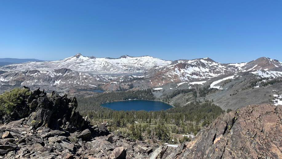
As we went further, the scenery changed dramatically. Snow-capped mountains came into view in the distance, and the tree line became closer and the rocky terrain increased


If you go further, you will come to a fork in the road
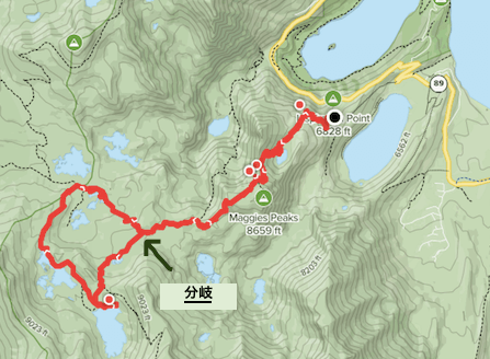
At the end of this fork is a loop, so no matter which path you take you will end up back at the same place, but this time we will take the trail that goes clockwise to the left
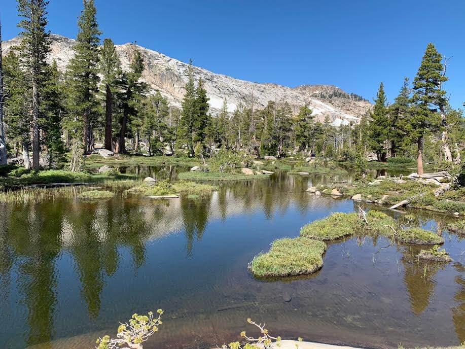
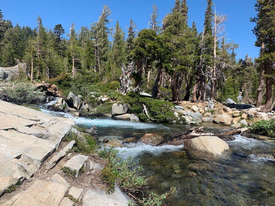
After walking a little further, we arrived at a marsh-like area. This area has no name, but it may be a lake-like marsh that forms when the snow melts
It's a very refreshing area, with water coming straight from the melting snow in the mountains!

If you go further, you will come across a river formed by melting snow and a flat rocky area, and you can easily find places to rest, so take a break and continue on until you come to another fork in the road
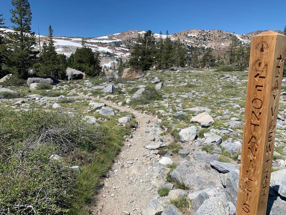
The fork leads towards FONTANILLIS
Dick's Lake
After about 5 minutes of walking along the fork, you will come to a fork in the road that leads to Dick's Lake. To see Dick's Lake, turn left here
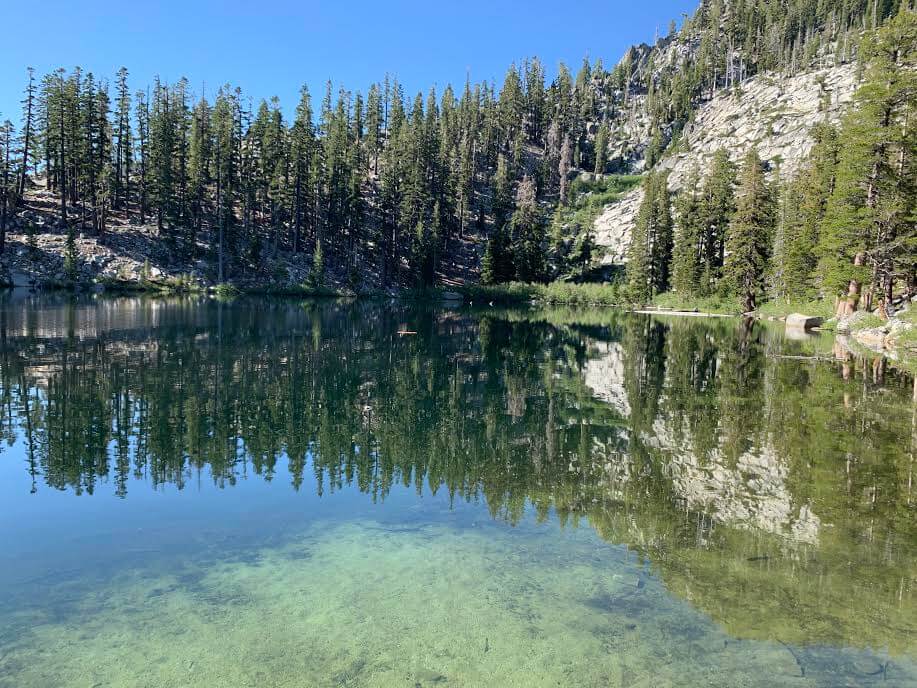
Soon you will see the second lake, Dick's Lake

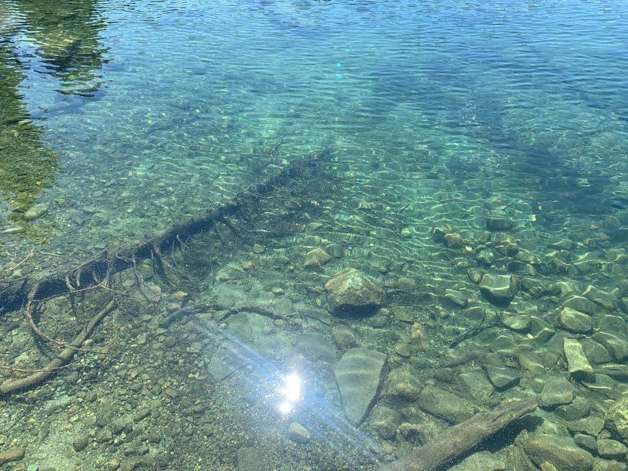
The crystal clear water sparkles in the sunlight, creating a truly mystical sight
The water is cold but you can swim in it. You may also come across people camping here
Leaving Dick's Lake behind, return to the fork and take the road heading towards FONTANILLIS
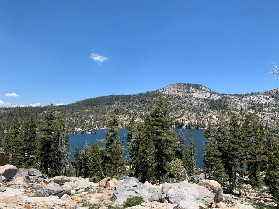
As you continue, you will see FONTANILLIS LAKE, the main attraction of this trip, on your left. It is a fairly large lake and continues all the way in the direction of the trail. At first, you can see FONTANILLIS LAKE in the distance on your left, but don't worry, the trail continues closer to the lakeside later on
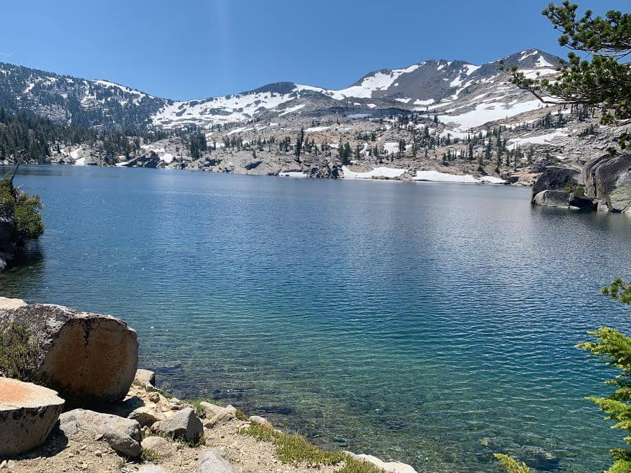
The water here is also incredibly clear and a beautiful emerald color, and if it weren't so cold, I'd want to go swimming right away. (Some people actually do.)
The snow-capped mountains at the back of the lake are truly picturesque. There are few people here, so it's very quiet and feels private
It was a bit sad to leave Fontanillis Lake behind and we continued on. As we continued on, we came across a river where the water from Fontanillis Lake flows down
I was able to get to the other side by climbing over rocks and trees with my shoes on, but when the water level is high it might be better to cross barefoot
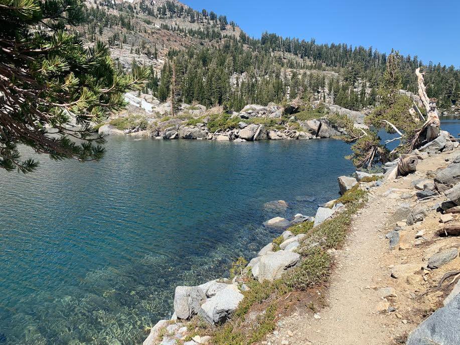
Velma Lake
We cross the river and continue on. This time, Middle Velma Lake appears in the background on the left. It's a little far away, but you can get closer if you want (though you'll have to walk an extra trail). This time, we'll just look at it from a distance and pass by
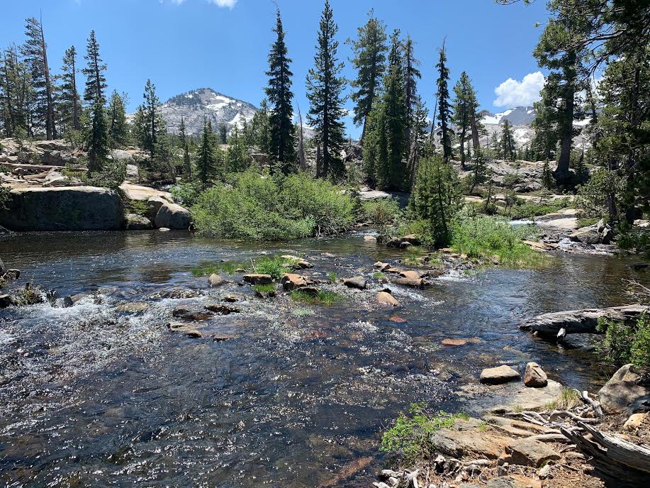
We continue along the trail and come across another river
Here too, you cross the river by walking on rocks with shoes on, but when the water level is high you will have to cross barefoot. It's a very pleasant area, so it's a good place to take a break by the river
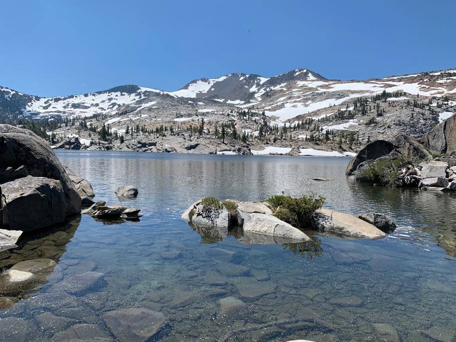
If you go further, you will come across another wetland on your right, but this is a lake called Upper Velma Lake. (It has the same name as Middle Velma Lake, which you saw in the distance on your left earlier.) This is the third lake

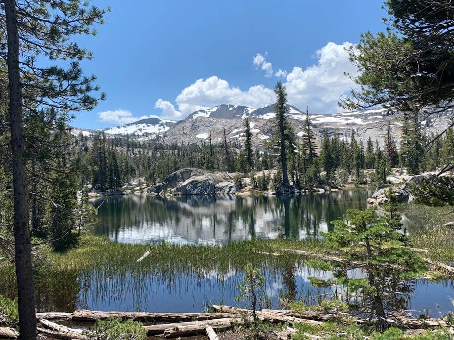
The blue sky, the snow-capped mountains, and the green aquatic plants were all so beautiful that I felt like just sitting there on the lakeshore forever, but the way back was still a long way off, so I continued on
13:30: The slope continues, and if you continue further you will come back to a loop-like fork. From there, you will return the same way you came
We returned to the trailhead at 2:45 PM, making the hike a total of 6.5 hours
The clouds are very dynamic in shape and movement, and the overall scenery on this trail is truly diverse

Lake Tahoe is not well known as a tourist destination for Japanese people, but it is a resort area rich in nature that is enjoyed casually by locals
It's easily accessible from San Francisco or Sacramento in California, so be sure to visit Lake Tahoe, home to beautiful lakes
Precautions regarding the spread of COVID-19
As of October 2020, various countries are currently imposing entry restrictions due to strengthened quarantine measures, as well as restrictions on entry to national parks and domestic travel. These conditions are subject to change without notice, so when traveling, be sure to obtain local information from each country's embassy or consulate, the Ministry of Foreign Affairs' Overseas Safety Website (Infectious Disease Risk Information), national park websites, and other sources, and check information on transit points, countries you plan to travel to, and the areas around the places you plan to visit before making reasonable plans and taking action
Sayaka Kato
 Leave your California hiking and travel plans to us. Influenced by my father, I've always loved outdoor activities, and while living in Japan, I started hiking and touring national parks, which fascinated me with the natural beauty of America and Canada, ultimately leading me to my dream of visiting the United States. I currently run ANAMI TOURS, which offers local optional tours created together with customers, such as completely private hiking tours with Japanese guides. I'll introduce you to special options that I know only because I live in the area. If you're interested, please visit the website below
Related reading
 Can you die without walking? A trip to the US National Parks (12) Enjoy the magnificent view of the Sierra Nevada Mountains. Lake Tahoe Mount Tallac Day Hike
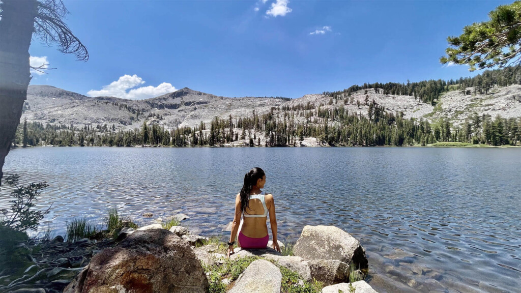 Can you die without walking? A trip to the US National Parks (29) Paradise Trail with swimming in the lake, a scenic hiking trail in the Lake Tahoe area
 Can you die without walking? A trip to the US National Parks (28) See the waterfalls flowing through the glittering marble (Sequoia National Park)
 Can you die without walking? A Journey to the American National Parks (23) The Jewel of Mt. Shasta ~Castle Lake~