Can you die without walking? A Journey to the American National Parks (14) A Tour of Mount Shasta, a Sacred Mountain Known to Those in the Know
Written by Sayaka Kato
Shasta is a sacred mountain in Northern California, near Oregon. When you think of power spots in the United States, Sedona is probably the most famous, but Shasta is one of them. Shasta is not as popular as other tourist destinations, and is quiet and sparsely populated, surrounded by beautiful water, forests, and rock formations, making it a special area that is hard to find anywhere else in the United States
It seems that actually stepping foot on this land can be an opportunity to reexamine yourself, to remember things you had almost forgotten, or to naturally restore a lost balance within yourself. There is something here that can be felt with all five senses, and it seems that many visitors have felt this. It is the perfect place to spend some time relaxing, immersing yourself in the clear air and sky, beautiful water, and majestic land, and to feel the energy of the place seep into your body
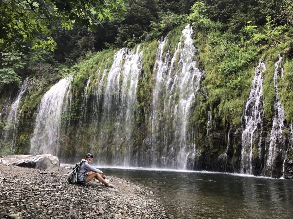
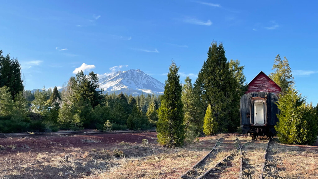
Shasta has many names, but it is also famous as a sacred place that has long been worshipped by indigenous people. It is a sacred mountain that has long been worshipped by people. There are still many sacred areas near the summit, which invite visitors into a sense of tranquility and solemnity. This area is also known for its beautiful water. The famous Crystal Geyser is produced using meltwater from this mountain
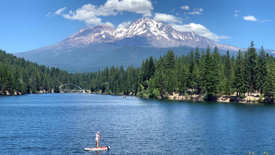
Shasta is often called the water city, a power spot, a sacred mountain, a vortex-filled mountain, one of the seven sacred mountains, and a hippie town, and when you visit, you'll understand why. Mount Shasta's imposing presence evokes both strength and gentle energy amid its beauty. Surrounding it are rivers, lakes, and waterfalls fed by crystal-clear meltwater, as well as lush forests. The Mount Shasta area is a balanced blend of natural beauty, as if Shasta were protecting and enveloping us. Surrounded by such vast nature, there are numerous outdoor activities to enjoy. Hiking, water activities, biking, horseback riding, camping, and all kinds of other activities await you here, all in the midst of nature
table of contents
Recommended trails near Shasta: Black Butte
Mount Shasta has an elevation of 4,321m. In addition to its main peak, it also has a 3,758m-high lateral volcano, Shastina, to the west, creating a twin-peaked mountain chain of mountains covered in perpetual snow. With two summits, the mountain resembles a couple standing side by side. In this article, we'll introduce a hiking route on Black Butte, also known as Baby Shasta, a relatively easy trail located around Mount Shasta, a sacred mountain in Northern California
Black Butte (Baby Shasta) Hiking Information
- Intermediate
- Recommended hiking season: May to November
- Trailhead elevation: approx. 1,321 m
- Black Butte Elevation: Approximately 1,927m
- Round trip: Approximately 9.8 km (6.1 miles)
- Height difference: approx. 606m (1,991 ft)
- Course time: 3 to 5 hours round trip (including summit break)

Useful items to bring with you on a hike
- Drinks (larger in summer, about 2 liters)
- Temperature-adjustable warm clothing. It can be particularly cold on the summit when there is wind, so be sure to bring a fleece or similar
- Trekking shoes (This trail is rocky, so we recommend trekking shoes.)
- hat
- sunglasses
- sunscreen
- Snacks to eat during the hike
- If you have any regular medications, bring first aid such as medicines and bandages
- Rain gear (it rarely rains in California from April to September, but if you think you might need it)
- Other normal hiking gear
How to get to Mount Shasta (by car)
- Drive north from San Francisco on I-5 for about 5 hours. The distance is about 245 miles (392 km) as the crow flies
- It takes 3 hours from Sacramento. Just drive north on I-5
- The closest airports to Shasta are Redding or Medford, which are about an hour to an hour and a half drive away (via I-5)
Just before Shasta lies a pyramid-shaped rocky mountain called Baby Shasta, which looks like a mini version of Shasta, hence the name Baby Shasta (see photo below, left). From halfway through, this trail becomes rocky. The views are always spectacular, and the trail is famous for offering beautiful views of Shasta

Hiking Guide
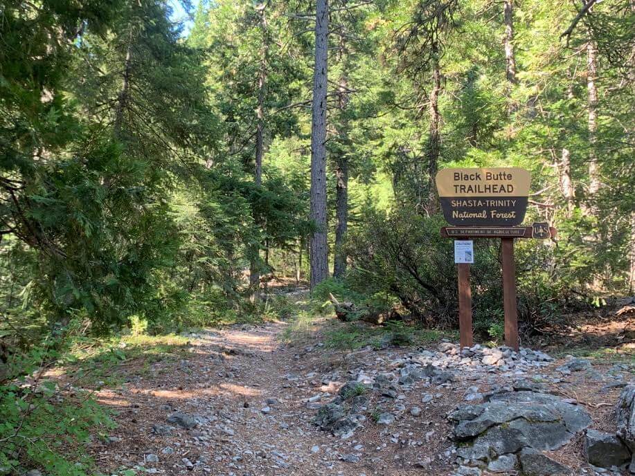
Black Butte Trailhead
Address: Forest Rte 41N18, Mt Shasta, CA 96067
You will eventually be riding on unpaved off-road roads to get to this trailhead. On the way to the trailhead, there is a fork in the road, with a narrow off-road path and a wide off-road path, and you can take either, but we recommend taking the main wide off-road path (wide road). Even if your GPS selects a narrow road, we recommend taking the wide road, even though it may be a bit of a detour
If you enter a narrow road, branches from the trees along the road may jut out into the road, which could damage your car. The same goes for the return trip. The parking lot is right in front of the trailhead, with space for about 5-6 cars (there are no restrooms or other facilities). The photo was taken at 10am in early July, but there were only about two cars there, so there was plenty of parking space
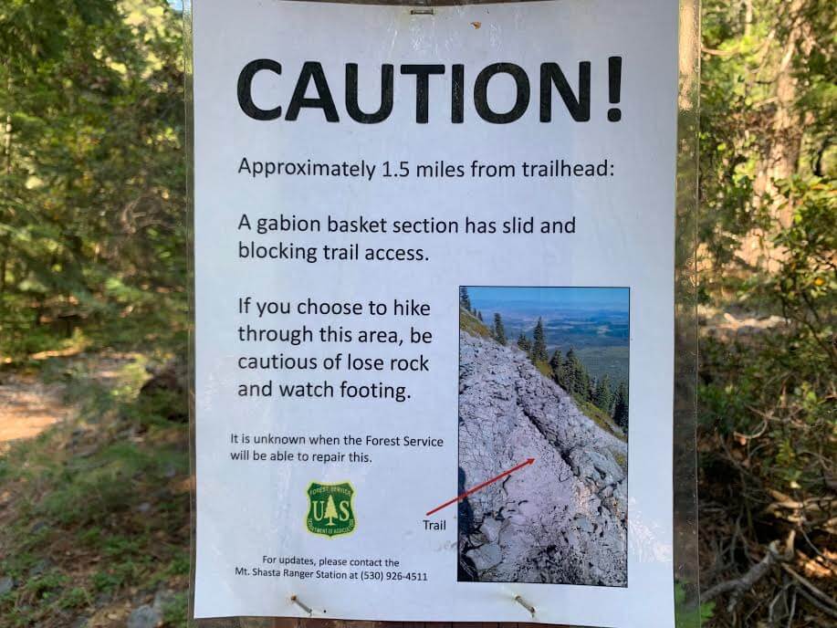
There is a warning sign on the trailhead that says, "Be careful, there is a dangerous area about 1.5 miles from the trailhead!" with a photo and explanation. I didn't notice it while walking, but the Black Butte trail itself is old and hasn't been well maintained in recent years, so you should be careful. There are some crumbling and dangerous areas, so please be careful as you walk
Now let's start our hike. First, we walk through the lush forest
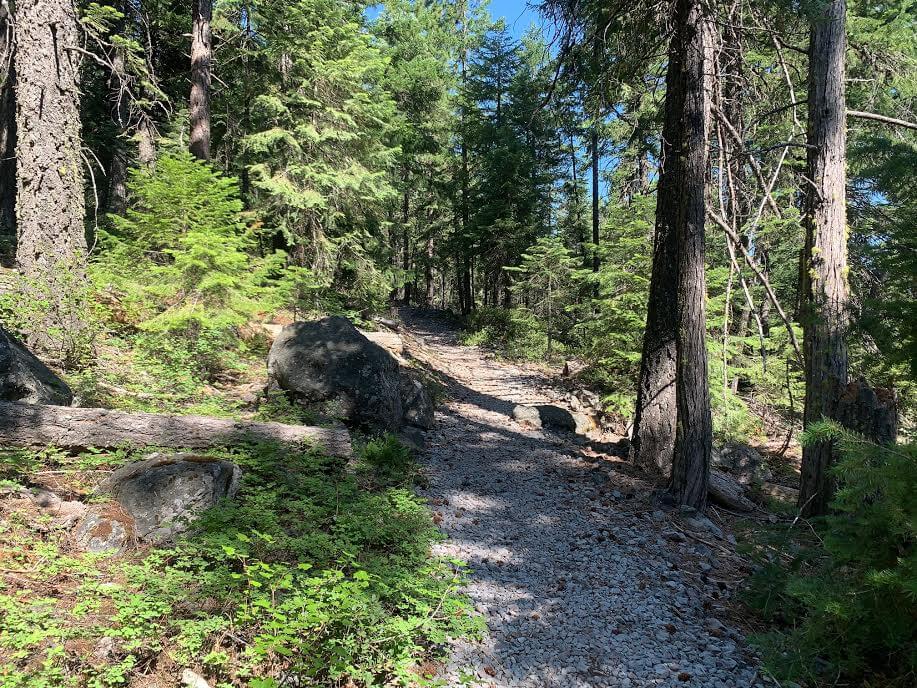
It's a bit of a steep slope, but as you keep going you'll soon come to a rocky area like this

The view that spreads out to the right from there is magnificent and already fills me with satisfaction
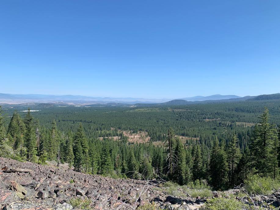
The view makes you wonder how many kilometers you can see. The land stretches out endlessly. And even from here, you can already see Mount Shasta in all its glory. You'll be greeted with this magnificent view just a short walk from the trailhead. It really feels like you've arrived at Shasta!
We continued on our zigzag path, slowly gaining altitude. At first there was forest, but halfway through the trail, it was mostly rocky scenery
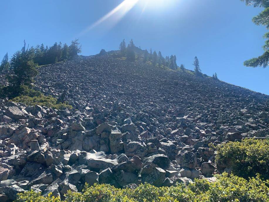
There is a rocky mountain right in front of me. It looks like rocks are about to fall...lol
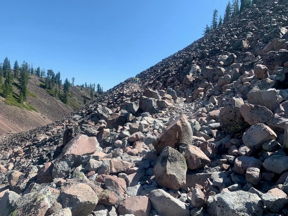
The trail is easy to follow, so you won't get lost, but as you can see, the footing is rocky and you'll be walking along cliff-like areas, so make sure you wear sturdy hiking boots and go slowly. It's easy to hurt your knees, especially on the way down
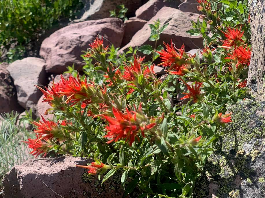
When I walked in July, I saw Indian paintbrush and other plants along the route
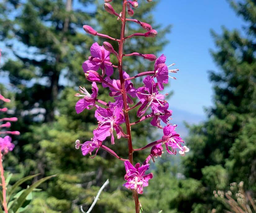
Alpine plants such as fireweed add a colorful touch to the trail
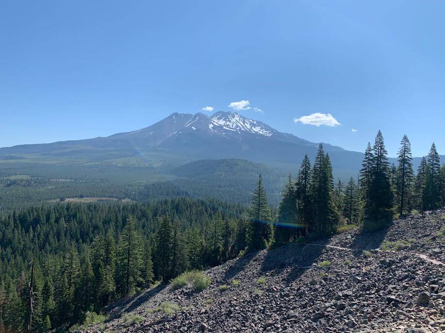
The spectacular views continue from here on! Other than the rocky trail that is difficult to walk on, there are no particularly difficult areas and you can reach the summit smoothly in about 2 hours from the trailhead
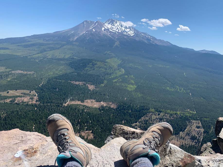
A magnificent 360-degree view, with Mount Shasta right in front of you
Here we have lunch and take a break
This summit used to be home to a fire lookout tower, which offered a 360-degree view and was apparently a place to check for fires. People would climb up here and check the safety of the Shasta area from here. The stone enclosure built at that time still remains
After a break, we head back down the same way we came
On the way back, it took about an hour to reach the trailhead

The Black Butte Trail offers a spectacular view of Mount Shasta. There were several families with children on the trail. Anyone with a good gait can enjoy this trail, from elementary school children to seniors
Precautions regarding the spread of COVID-19
As of November 2020, various countries are currently imposing entry restrictions due to strengthened quarantine measures, as well as restrictions on entry to national parks and domestic travel. These conditions are subject to change without notice, so when traveling, be sure to obtain local information from each country's embassy or consulate, the Ministry of Foreign Affairs' Overseas Safety Website (Infectious Disease Risk Information), national park websites, and other sources, and check the information for transit points, the country you plan to travel to, and the areas around the places you plan to visit before making reasonable plans and taking action
Sayaka Kato
 Leave your Mount Shasta hiking and travel plans to us. Influenced by my father, I've always loved outdoor activities, and while living in Japan, I was captivated by the natural beauty of America and Canada while hiking and touring national parks, which ultimately led me to my dream of visiting the United States. I currently run ANAMI TOURS, which offers local optional tours created together with customers, such as completely private hiking tours with Japanese guides. I'll introduce you to special options that I know only because I live in the area. If you're interested, please visit the website below
Related reading
 Recommended spots around Mount Shasta [Would you rather die without walking? A trip to America's National Parks (36) The Jewels of Mt. Shasta (Bonus Edition)]
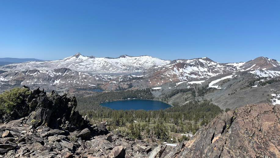 Can you die without walking? A trip to the US National Parks (12) Enjoy the magnificent view of the Sierra Nevada Mountains. Lake Tahoe Mount Tallac Day Hike
 Mount Rose, located near a popular ski area, offers an easy 3,000m hike and 360-degree views. [A trip to the US National Parks (39)]
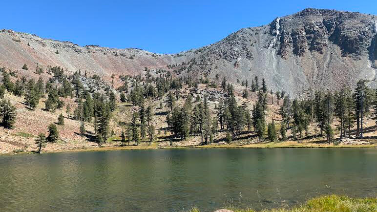 Can't die without walking? A Journey to the American National Parks (16) Flowers, greenery, lakes, and a panoramic view from the summit. Mount Shasta's magnificent peak, Mount Eddy Trail, has it all