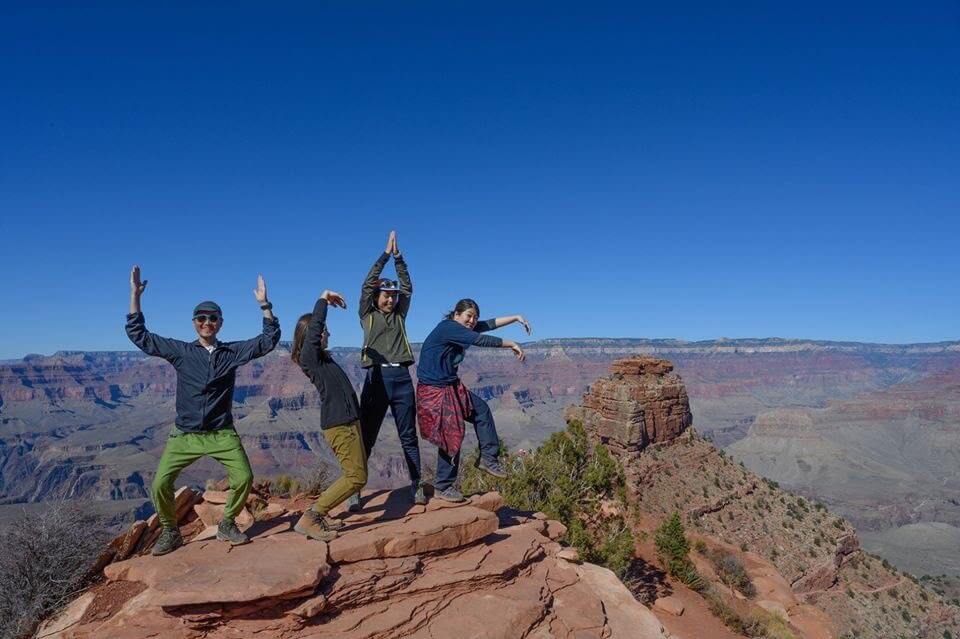
Can you die without walking? A trip to the US National Parks (4) Recommended hikes in Grand Canyon National Park
Written by Sayaka Kato
Following on from Sedona, this time we will be sharing some recommended hiking information for the Grand Canyon
table of contents
- What is the Grand Canyon?
- Recommended hiking trails at the Grand Canyon (South Rim)
- Best season to hike the Grand Canyon
- Do I need to go through any procedures before entering the park?
- What to wear when hiking the Grand Canyon
- Useful items to bring with you on a hike
- Things to be aware of in the national park
- Where are the information centres in the national parks? Can I replenish my food and equipment?
- How to Walk the South Kaibab Trail
What is the Grand Canyon?

The Grand Circle adventure tour allows you to pick out the places that interest you, including numerous national, state, and tribal parks, and arrange your own itinerary. Among these is the Grand Canyon, America's most iconic national park. A vast canyon carved by the Colorado River, it is a place of overwhelming scale that goes beyond the word "majestic." It is a place that the United States is proud of and highly recommended, so much so that President Roosevelt once said in a speech, "Every American should come here at least once in their lifetime. It is worth it."

The Grand Canyon is vast, and for ease of access it is divided into two areas: the North Rim (closed in winter) and the South Rim (open all year round). It is separated into north and south rims by the Colorado River, and this time we will introduce the South Rim's spectacular views from the South Kaibab Trail. The South Rim is also well-equipped with accommodations, souvenir shops, supermarkets, and more, making it very convenient for first-time visitors
Recommended hiking trails at the Grand Canyon (South Rim)
This time, we'll be introducing a day hiking route along the Kaibab Trail on the South Rim of Grand Canyon National Park. The South Kaibab Trail starts from the trailhead at an elevation of 2,213 meters, passes through several points along the way, descends to the Colorado River, and then continues all the way to the North Rim. This time, we'll be introducing a route up the trail that can be easily completed in one day. Skeleton Point is 3 miles (4.8 km) from the trailhead, and Skeleton Point is the final turnaround point for day hikers
Best season to hike the Grand Canyon
The Grand Canyon has four seasons, and no matter what season you visit, you can enjoy the truly beautiful scenery. However, hiking in the Grand Canyon basically involves descending from the top of the canyon to the bottom, so you descend on the way there and climb up on the way back
It's possible to hike the South Kaibab Trail in any season (of course, depending on the weather and conditions on the day), but in the summer, the further you descend into the valley, the scorching heat it becomes, making it extremely important to stay hydrated. Temperatures rise in the summer (especially from June to September), so you need to be careful to avoid dehydration and heatstroke. For these reasons, the best seasons for South Kaibab are March to May before summer, and October to mid-November before the snow falls. Since the temperature rises especially as you descend during summer hikes, we recommend starting early in the morning and finishing by mid-morning if you're planning a trek of several hours
There are three main routes on the South Rim of the Grand Canyon: Hermit Trail, Bright Angel Trail, and the South Kaibab Trail that we will introduce here. Each entrance can be reached by shuttle bus
Do I need to go through any procedures before entering the park?
There is no special procedure to enter the national park, as long as you pay the entrance fee at the entrance. There is a toll booth at the entrance of the park, and a park ranger will be there to help you pay and enter the park
What to wear when hiking the Grand Canyon
Summer
The temperature rises during the day, and the further you go into the valley, the more of a desert climate you will experience. A T-shirt and shorts are perfectly fine. However, as the temperature difference is extreme and the temperature drops to below 10°C in the morning and evening, it is useful to bring warm clothing such as a windbreaker or fleece
Winter
The starting point is at an altitude of 2,213m, so it is very cold. The maximum temperature will be below 10°C, and the minimum temperature will be below -5°C, so it is important to take proper measures to protect yourself from the cold. Shawls, scarves, and hot packs are also very useful
Sunlight and other things to be careful of
The sun is strong during the day, so be sure to bring sunglasses, a hat, sunscreen, etc. Be careful of UV rays that can hit your eyes, and sunglasses will help reduce fatigue on long hikes. There are many rocky areas underfoot, so choose sturdy, easy-to-walk-in shoes such as trekking shoes. The weather can change quickly at high altitudes when hiking, so it's a good idea to bring plenty of drinking water, rain gear, and snacks. There are also temperature differences between morning and evening, so be sure to always take precautions and be well prepared when hiking, such as taking measures to protect yourself from the cold
Useful items to bring with you on a hike
- Temperature-adjustable winter clothing
- trekking shoes
- hat
- sunglasses
- sunscreen
- Drinks (more in summer)
- Snacks to eat during the hike
- If you have any regular medications, bring first aid such as medicines and bandages
- headlights
- rain gear
Things to be aware of in the national park
There are several rules that must be followed in national parks to maintain their beauty and avoid damaging the ecosystem. Park rangers monitor the parks, and violations can result in fines, so be careful. Here are three of the most basic rules
- Do not take anything from the park and do not leave anything behind in the park, including trash
- All the animals you see in the park are wild. No matter how cute they may seem, never approach them. Do not touch them, try to feed them, or startle them. Also, throwing trash anywhere other than the designated trash cans will alter their lives
- Stay on the trail. Stay on the trail and avoid going off-trail
Where are the information centres in the national parks? Can I replenish my food and equipment?
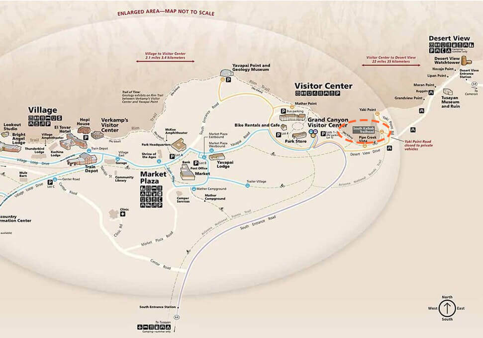
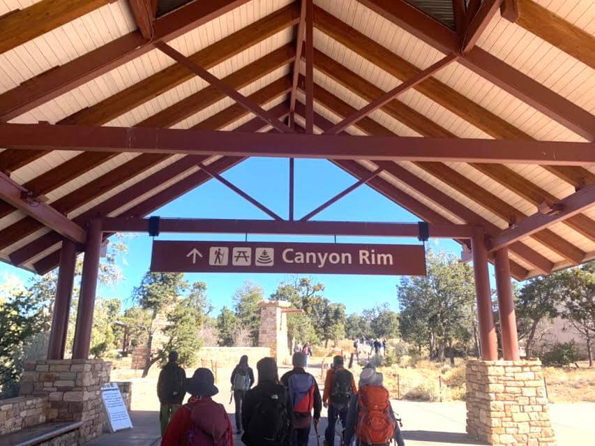
To get to the South Kaibab Trailhead, you first drive to the central area of the park, where the visitor center and park store are located. There is a bus stop there that takes you to the trailhead, where you can park your car. There is also a large parking lot. Near the bus stop, there are restrooms, a souvenir shop, a cafe, and a visitor center, so you can get everything you need for hiking there
How to Walk the South Kaibab Trail
Approach: From the East Entrance
You can enter the South Rim park from the East Entrance on the east side and the South Entrance on the south side
You can enter from either side, but if you use the east exit, be sure to stop by the Desert Viewpoint, located just inside the east exit. From the viewpoint, you can see the Colorado River curve. It's a beautiful and spectacular spot, and I personally recommend it as a stopping point
To the trailhead
Head to the Visitor Center, which is located in the same area as Mercer Point. There is a large parking lot, as well as restaurants and souvenir shops where you can buy snacks
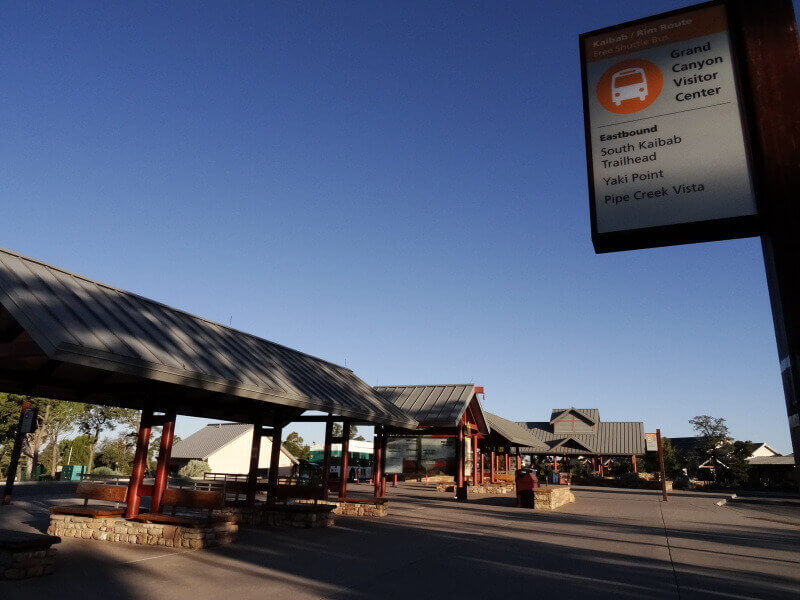
After parking your car and doing any necessary shopping or using the restroom, head to the bus stop. Take the orange Kaibab/Rim route and get off at the South Kaibab Trailhead. The trailhead is right where you get off. By the way, there are three different bus routes that run from the visitor center. There are orange, blue, and purple buses, but make sure you take the orange one. (The ride is less than 10 minutes.) Don't worry, it's easy to find. To return, take the same bus from the trailhead and return to the visitor center
The bus runs at a pace of once every 15 minutes

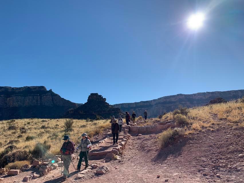
Start of hike: South Kaibab Trail to Skeleton Point
*All photos were taken during a hike in November
The South Kaibab Trail starts at the trailhead at an elevation of 2,213 meters, passes through several points along the way, descends to the Colorado River, and then continues to the North Rim. This time, we will cover part of the trail, which can be easily completed in one day. Skeleton Point is 3 miles (4.8 km) from the trailhead, and for day hikes, Skeleton Point is the final turnaround point
Note: You cannot reach the bottom of the valley on a day trip. There is a restroom on the way (at Ceder Point). There is a water station at the trailhead
DATA
- One way: 3 miles (4.8 km)
- Round trip: Approximately 10km
- Height difference: Approximately 620m
- Duration: 4 to 5 hours
Viewpoint
There are several viewpoints on the way to Skeleton Point, which is our goal for this trip
Outbound
- Ooh Aah Point: 1.5km from Ooh Aah Point Trailhead. Approximately 30 minutes from the trailhead
- Ceder Point: 2.5km from Cedar Point Trailhead. Approximately 30 minutes from Oher Point (restrooms available)
- Skeleton Point: 4.8 km from Skeleton Point Trailhead. Approximately 50 minutes to 1 hour from Cedar Point
Return journey
- Ceder Point is about 1 hour and 10 minutes from Skeleton Point
- Ooh Aah Point is about 50 minutes from Cedar Point
- It takes about 50 minutes from Oar Point to the trailhead
1. To Ooh Aah Point
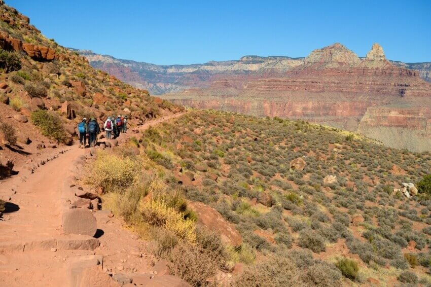
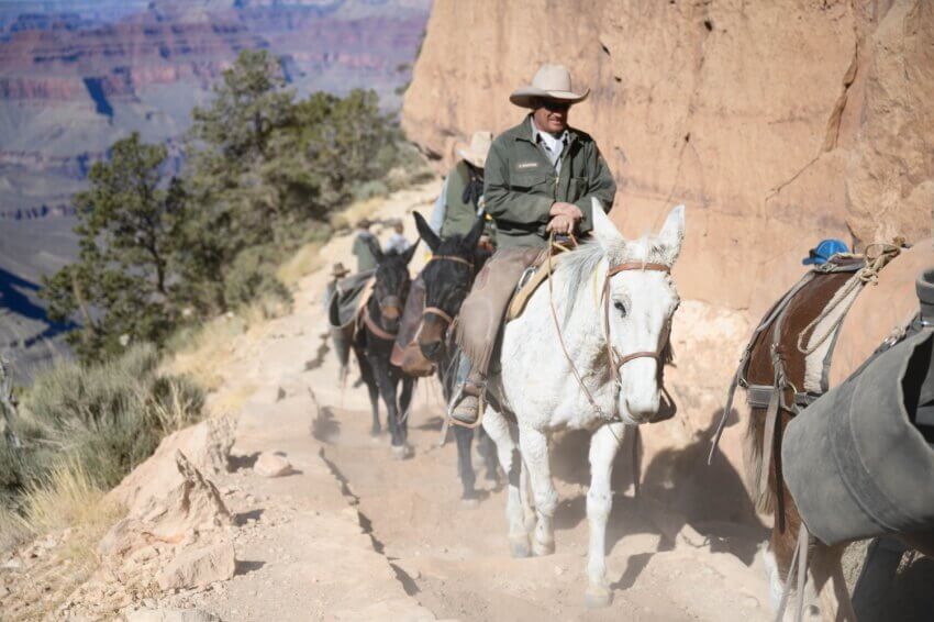
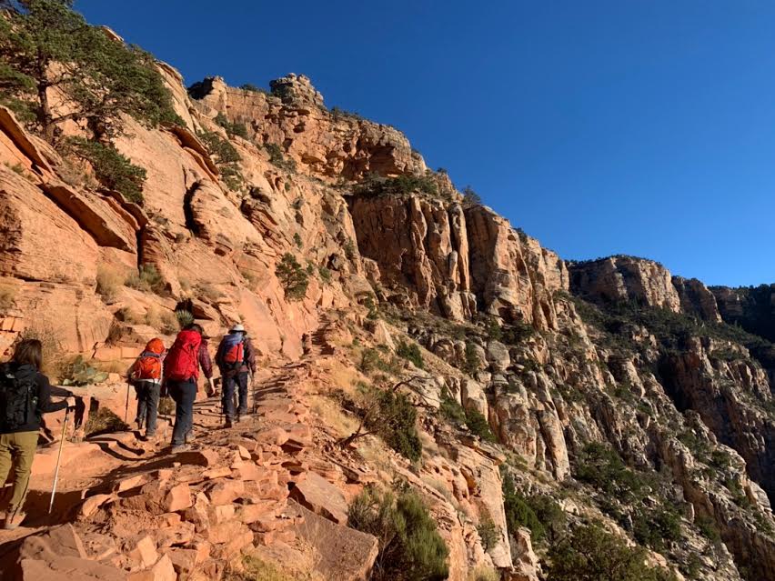
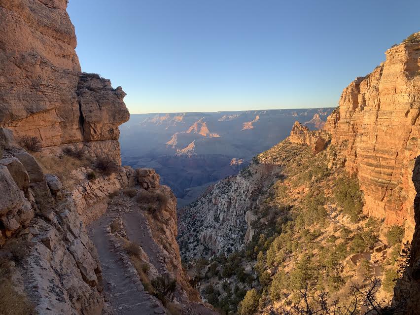
First, we start our descent from the trailhead. The road is paved and easy to walk on, but it is also used by mule tours, so be careful of mule droppings. If you come across a mule on the trail, it has priority, so let it pass by by moving to the side of the road. Don't forget to smile and say hello to the cowboys and mules!
Construction of the South Kaibab Trail began in the winter of 1924, with workers and mules carrying all the equipment, cutting away at the rock, and working through the night during the hot summer months. The trail finally opened in the fall four years later. It's only thanks to their hard work and dedication that we can fully experience the charm of the canyon and rock face we see today, and I'm filled with gratitude to the workers
As with any trail, I always take my hat off to the people who built it, thinking, "Wow, they managed to build a trail in a place like this!"
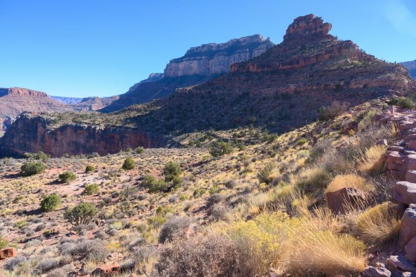
On the right is a rocky mountain, and on the left is a narrow path that runs along the steep cliffs. There is a lot of shade, and the altitude is high, so it can get cold depending on the season. The starting point is the Kaibab Formation, the newest rock formation, which has existed for 2.7 million years. The Grand Canyon is often referred to as the Earth's textbook. You will be walking through a history that has been built up over a long, long period of time
It takes about 30 minutes to walk from the trailhead to the first point, Ooh Aah Point
The view suddenly widens, and a shining valley bathed in light appears before your eyes. Apparently, people were so impressed by the gradation of the blue sky, red rocks, and layers of different colors that they couldn't help but exclaim "Oh! Ah!", hence the name Oh! Ah Point. It's just as cute as it is, isn't it?
2. Cedar Point (restrooms available)
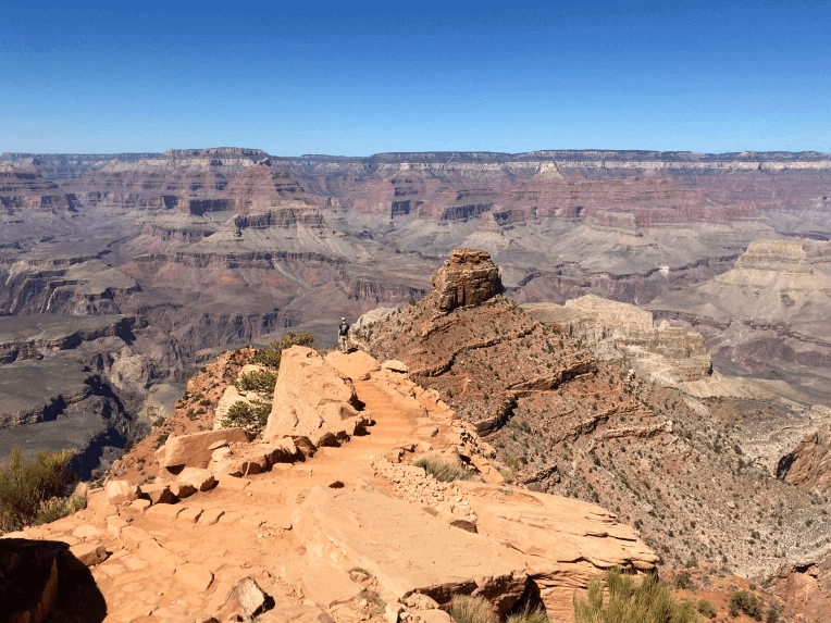
The canyon changes color with every passing moment depending on how the sunlight hits it. And the crystal clear blue sky stretches out as far as the eye can see. Captivated by the natural beauty that cannot be created by human power, the camera shutters never stop as one magnificent view after another appears. Just beyond Cedar Point, the rock formation called O'Neill Butte, right in front of you, is another beautiful and picturesque sight

The hike continues, moving along with the majesty and power that cannot be captured on camera, the deep silence of the vast land, and the sense of unity with nature that can only be felt by walking through the Grand Canyon
We recommend taking a break here and taking a short break. Depending on the time of day, it may also be a good idea to have lunch here. Rest your body by rehydrating and eating a light meal
3. To Skeleton Point
We head to Skeleton Point, the finish line of our day hike. This is about halfway from the trailhead to the valley floor. You can even see the Colorado River from here. Many people turn back here, making it a great resting spot. Rest your feet while enjoying the magnificent scenery. Because on the way back, you'll have to climb back up the same amount you came down!
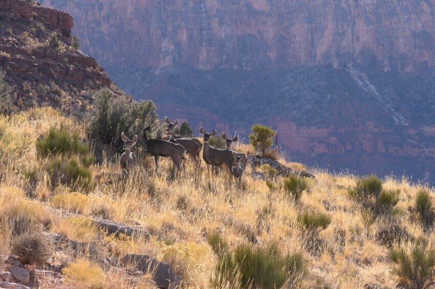
There's no doubt that once you're halfway down the canyon, you'll have a completely different experience than the Grand Circle seen from above. The color of the rocks changes over time, you encounter wildlife, the sound of the wind blowing through the Grand Canyon and the chirping of birds. There are certain sights and sensations that can only be experienced by walking on your own two feet and feeling the earth
Please make sure to regulate your body temperature by putting on a jacket to avoid getting cold, and get plenty of rest
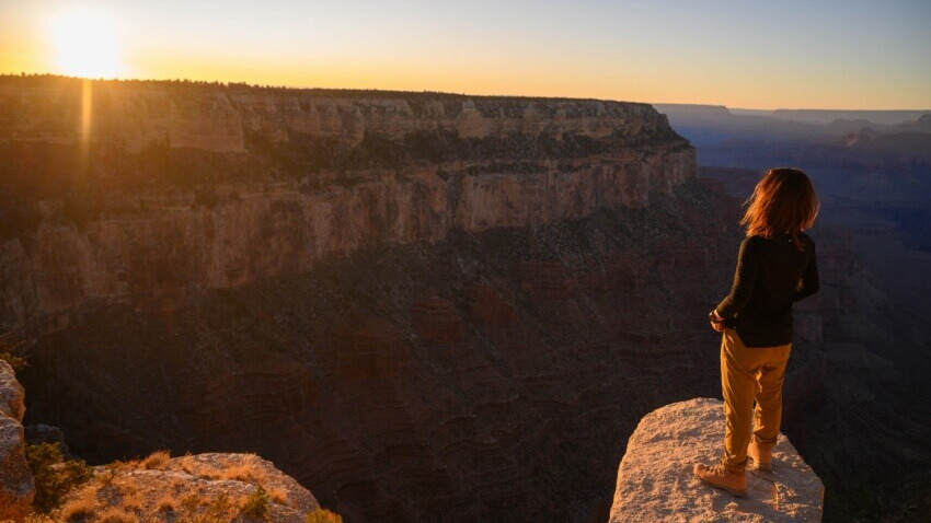
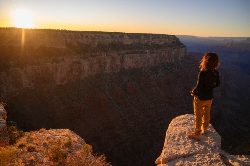
Return journey at sunset
We returned to the trailhead by slowly climbing the same path we had taken on the way there, and we did this hike in early November
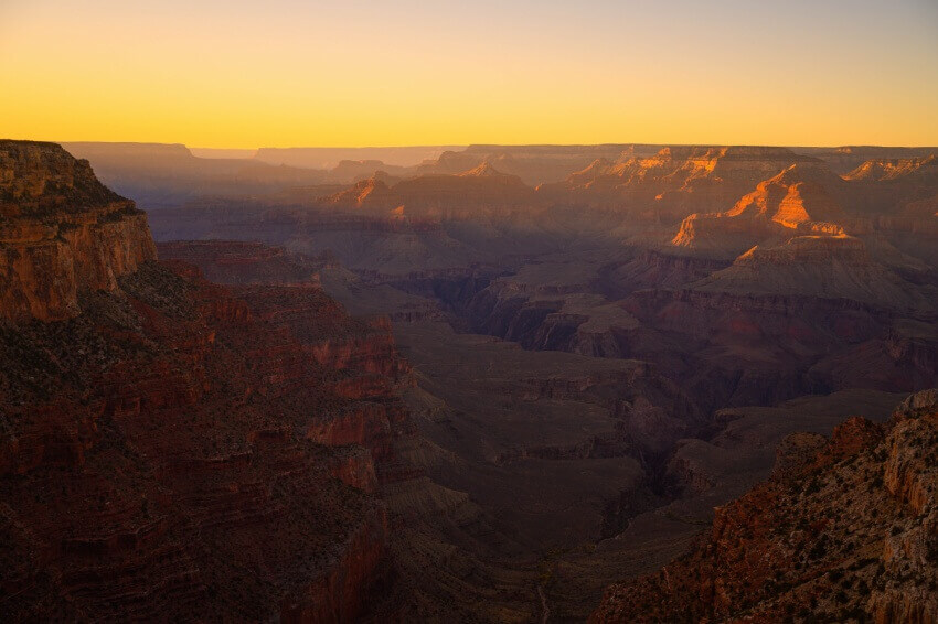
We arrived at the trailhead on our way back just as the sun was setting, so we were rewarded by nature after our hike
We all had some quiet time sitting on a rock with plenty of space near the trailhead

I don't know how the sunset reflected in each person's mind, but we all quietly gazed at the sunset
It's amazing that such beautiful natural art can be created every day over such a long, long period of time, and all I can say is, "It's truly amazing!". Standing before this natural art that we don't normally get to see, the mystery of what the Earth really is only deepens. (lol)

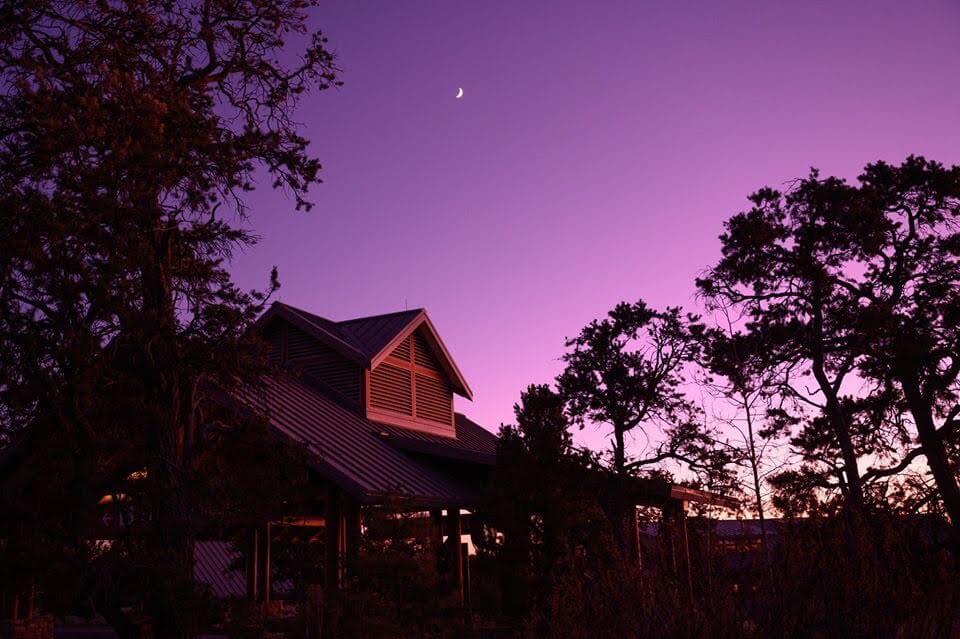
By the time we returned to the visitor center by bus, the sky was shining purple, which was also beautiful... If you are planning to visit the Grand Canyon, or if you are thinking of going in the future, be sure to walk into the canyon. The scenery and sensations that await you are beyond your imagination
Sayaka Kato
 Leave your Grand Canyon hiking to us. Influenced by my father, I've always loved outdoor activities, and while living in Japan, I started hiking and touring national parks, which fascinated me with the natural beauty of America and Canada, which ultimately led me to my dream of visiting America. I currently run ANAMI TOURS, which offers local optional tours created together with customers, such as completely private hiking tours with Japanese guides. I'll introduce you to special options that I know only because I live in the area. If you're interested, please visit the website below
Related reading
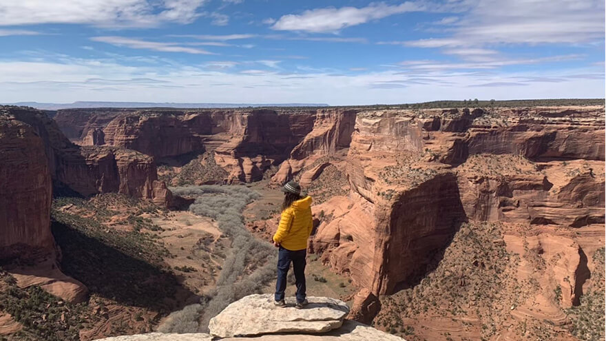 Can you die without walking? A trip to the US National Parks (5) Recommended hikes in Canyon de Chelly National Monument
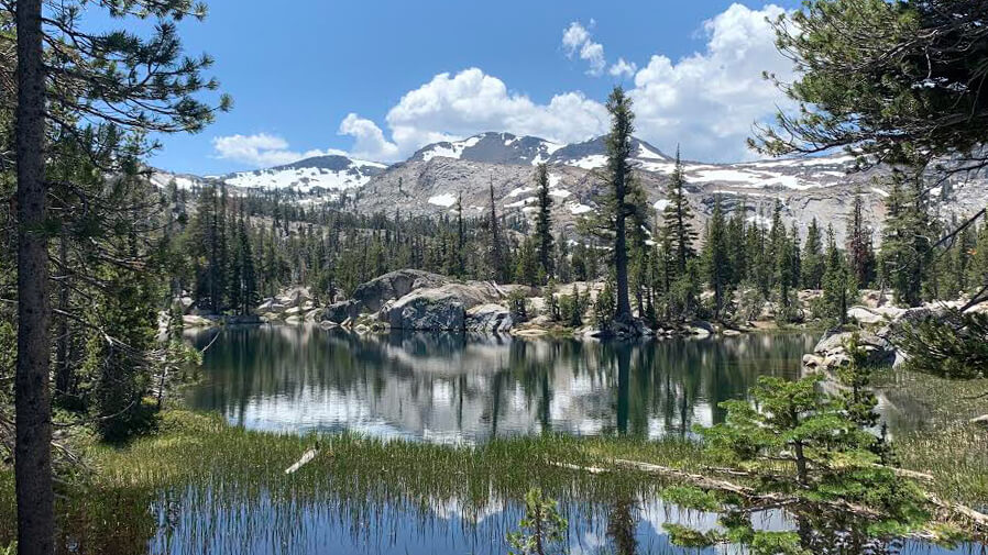 Can you die without walking? A trip to the US National Parks (13) Part 2 of the Lake Tahoe Trail. A trail to see the jewel-like lake
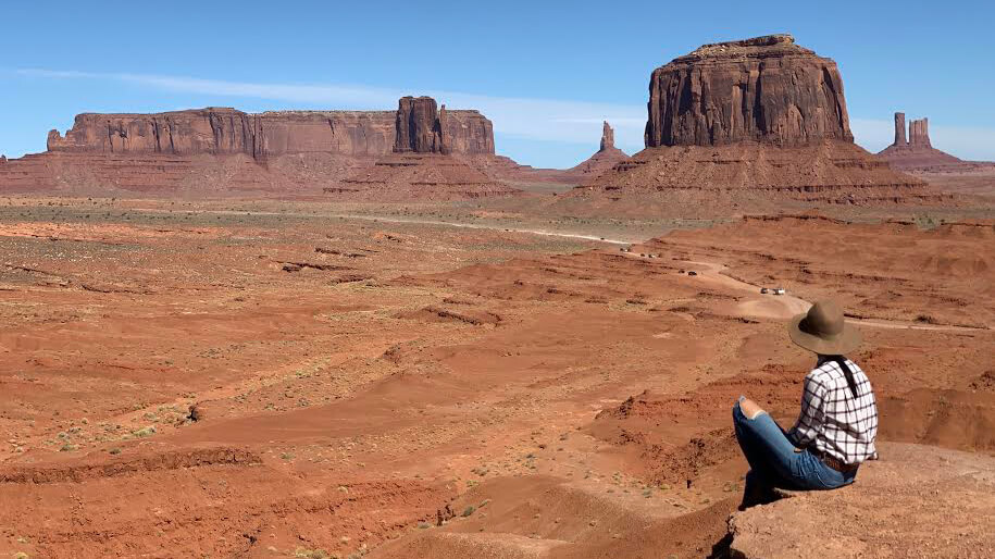 Can you die without walking? A trip to the US National Parks (6) Recommended hikes in Monument Valley and Navajo Tribal Park
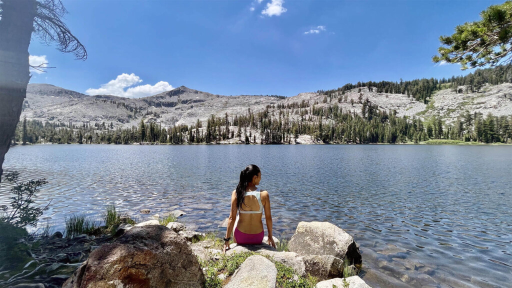 Can you die without walking? A trip to the US National Parks (29) Paradise Trail with swimming in the lake, a scenic hiking trail in the Lake Tahoe area