Can you die without walking? A trip to the US National Parks (12) Enjoy the magnificent view of the Sierra Nevada Mountains. Lake Tahoe Mount Tallac Day Hike
Written by Sayaka Kato
Lake Tahoe is a popular local resort located about four hours from San Francisco and two hours from the state capital, Sacramento. Lake Tahoe straddles the states of California and Nevada and is very large, being divided into two areas: "South" and "North."
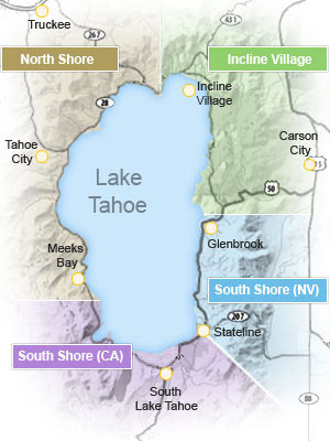
Two-thirds of the lake (shoreline) belongs to California, but gambling is legal on the Nevada side, so there are many hotels and casinos on the Nevada side, and casino enthusiasts often prefer to stay on the Nevada side
The beautiful, crystal clear lake is surrounded by nature and is a popular resort area year-round, with water activities, hiking, and mountain biking in the summer, and winter activities like skiing and snowboarding in the winter. Once you enter the trail, you'll be surrounded by true nature. There are many spots along the lake that are like beaches, and many people visit them in the summer as if they were the ocean
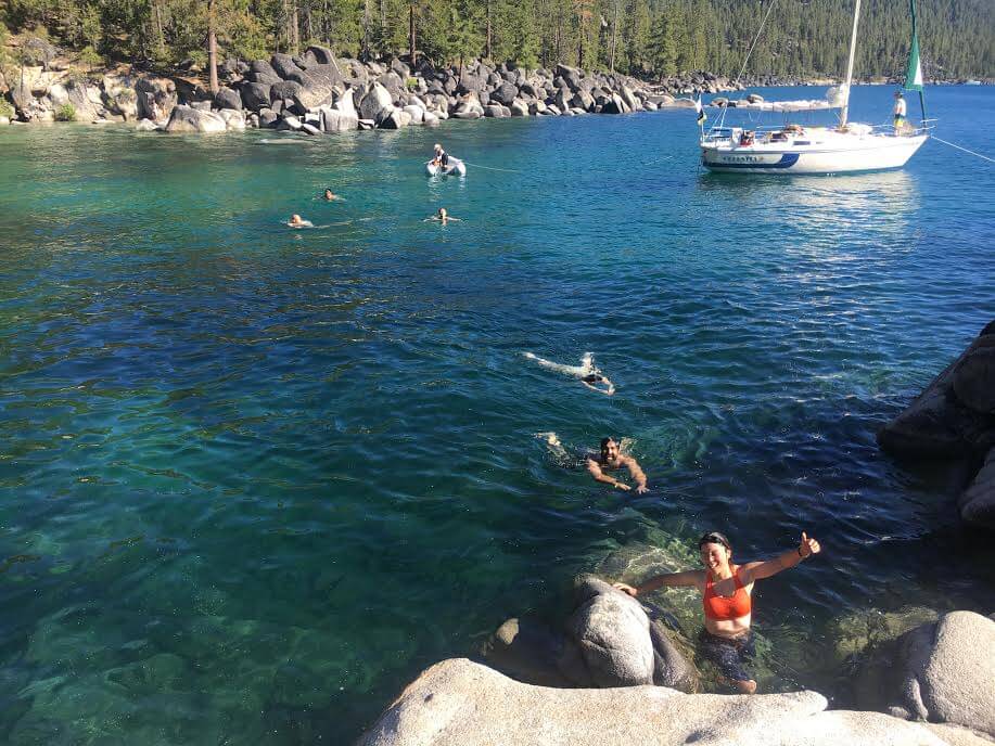
table of contents
Recommended hiking trails on Mount Tallac in Lake Tahoe
Lake Tahoe Basic Information
Lake Tahoe is 35km long, 19km wide, and has an area of 49,624 hectares (Lake Tahoe is 500km2. Japan's largest lake, Lake Biwa, is approximately 670km2). It has a coastline of 116km. Many backpackers make the rounds around Lake Tahoe. At its deepest point, it is 501m deep, making it the third deepest lake in North America and the 10th deepest lake in the world. Lake Tahoe is a beautiful lake famous for its crystal clear water
This time, we'll be introducing the Mt. Tallac hiking trail in South Lake Tahoe, California. This trail is quite long and has a lot of elevation gain if you want to reach the summit, so it's recommended for intermediate to advanced hikers. However, there are plenty of lakes and scenic spots along the way, so if you're not too confident with your hiking, you can adjust the length and level of your hike by skipping the summit of Mt. Tallac and going to one of the viewpoints along the way and then turning back
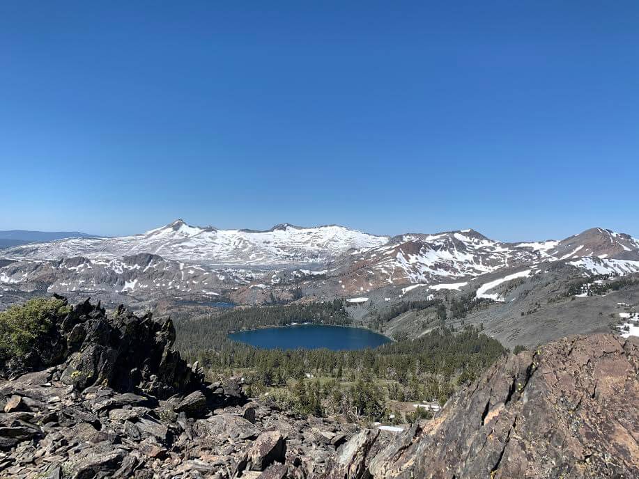
Before reaching the summit, you can enjoy the beautiful scenery of three other lakes in addition to Lake Tahoe. The second half of the trail is a truly spectacular one, with the majestic Sierra Nevada mountains unfolding before you
MT. Tallac Trail Data
- Distance: 10.2 miles (16.32km) round trip
- Trailhead elevation: 6,450 feet (1,966m)
- MT. Tallac elevation: 9,738 ft (2,968 m)
- Elevation gain: 3,290 feet (approx. 1002 m)
- Course time: 5 to 7 hours round trip (including summit break)
Directions to Lake Tahoe Mt. Tallac Trailhead
Address: Mt. Tallac Trailhead, South Lake Tahoe, California 96150. Parking available
Transportation: By car (rental car), it takes about 4 hours from San Francisco and about 2 hours from the state capital, Sacramento
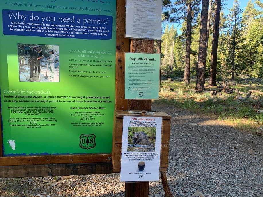
Note: This is not a national park, so there is no entrance fee, but this trail requires a self-permit (free of charge), and you must write your name, contact information, etc. in a notebook at the trailhead when you enter the mountain. However, this may not be required depending on the season, so be sure to check the notice board at the trailhead. (There is a fee if you plan to camp on the trail. You must obtain a permit in advance.)
Useful items to bring with you on a hike
- Drinks (more in summer, about 3-4 liters)
- Temperature-adjustable warm clothing. It can be particularly cold on the summit when there is wind, so be sure to bring a fleece or similar
- trekking shoes
- Hat: There is almost no shade in the second half of the hike, so a hat is essential
- sunglasses
- sunscreen
- Snacks to eat during the hike
- If you have any regular medications, bring first aid such as medicines and bandages
- Rain gear (it rarely rains in California from April to October, but just in case, bring rain gear to protect from the wind and cold)
- Other normal hiking gear
Lake Tahoe Mt. Tallac Hiking Guide
Trailhead
There is a parking lot, but since it is a popular hiking trail and there are also campers, there are always cars already parked there, and the parking space is not that big, so I recommend going early before it fills up. In my case, more than half the parking lot was filled by 8am. There are no restrooms, so make sure to use them beforehand. There is no place to collect water, so make sure to bring plenty of water with you, especially in the summer (I recommend at least 3 liters)
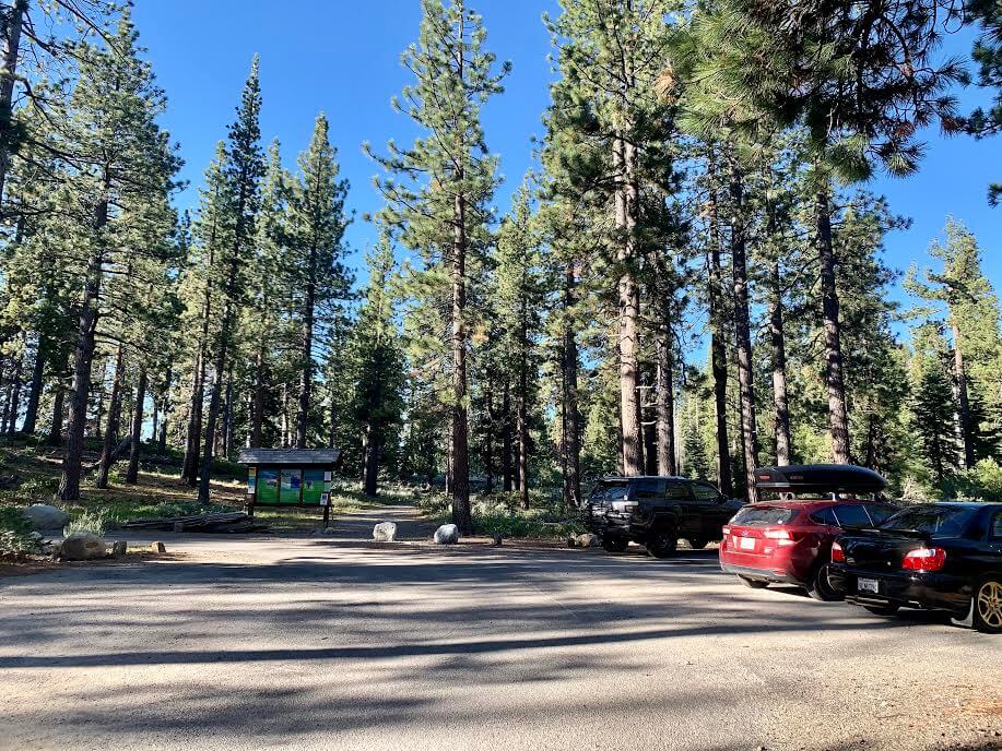
A self-permit is normally required for this trail, but it wasn't necessary when I went in June
It's time to start hiking!

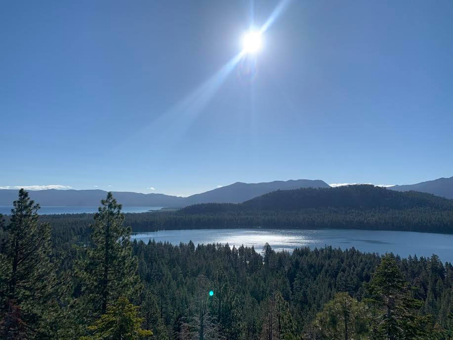
The first half of the trail is a series of gentle slopes and flat areas, making it very easy to walk. After about 20 minutes of walking, Fallen Leaf Lake comes into view on the left. It's still early in the morning, so the quiet and sacred atmosphere is truly beautiful. Lake Tahoe is visible in the distance from Fallen Leaf Lake, so you'll be greeted by two beautiful lakes
As we continued on, we could see our destination, MT. Tallac (elevation: 9,738 ft (2,968 m)) in the distance on our right
I make up my mind to go that far, and my motivation increases again
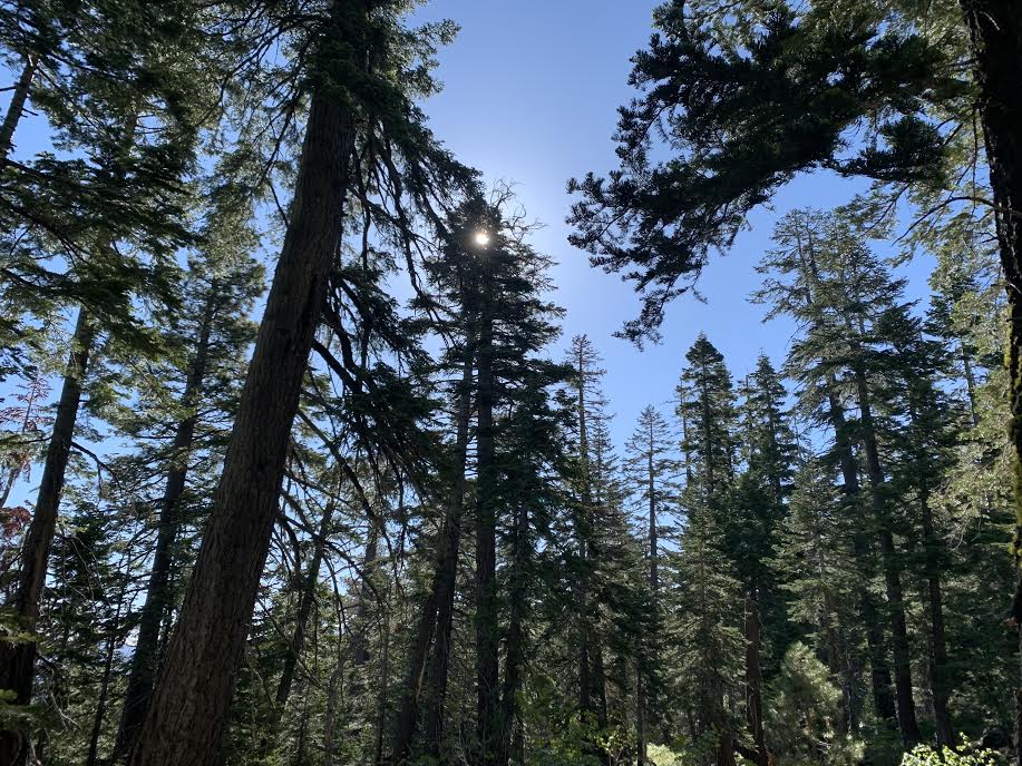
In the first half of the walk we walked through the trees, and there was plenty of shade, and the temperature was just right, neither too hot nor too cold
There are few slopes and the course proceeds smoothly
On the right you can see the Tallac Creek stream. The sound of the water flowing is very pleasant
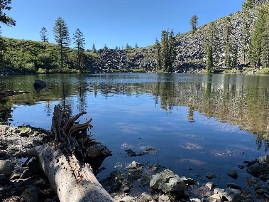
Continuing on, about 45 minutes from the trailhead, you will see another lake on your right: Flooting Island Lake. Since it was morning and there was no wind, it looked like a mirror lake!
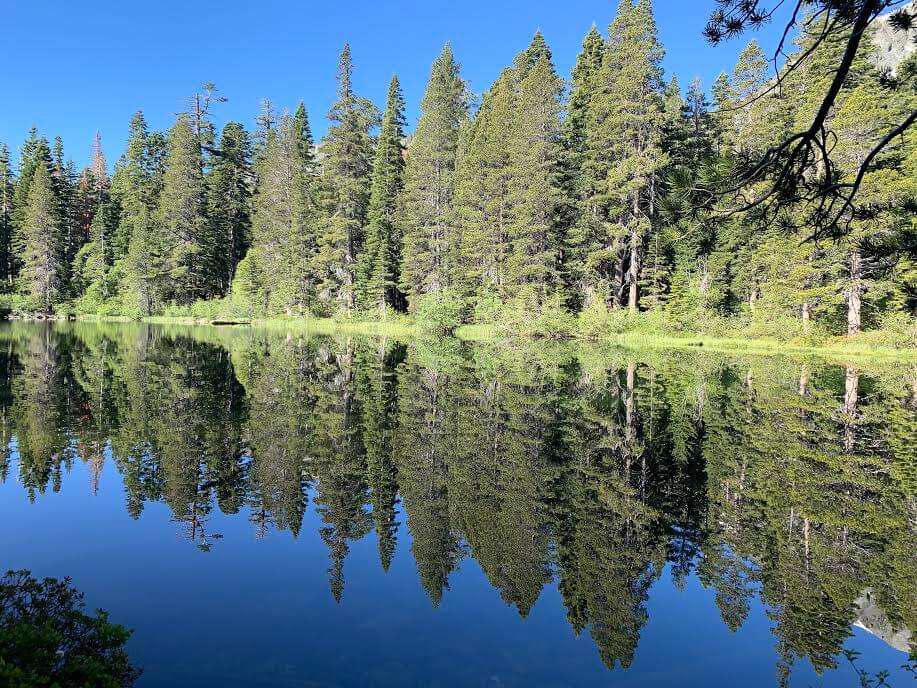
The surrounding scenery is reflected on the lake's surface, creating a truly mystical scene. As it was the season for ducks, there were also ducklings. The heartwarming sight soothes the soul. There is no one else around, so you can enjoy the space between you and nature
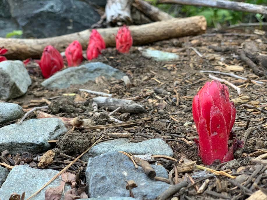
The vibrant snow plants that thrive in places with clean air are also making an appearance
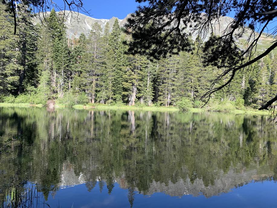
After another 30 minutes, you will come across another lake, Cathedral Lake, about 1 hour and 20 minutes from the trailhead
We take a break here and set off again. If you're looking for a shorter hiking trail, it's a good idea to turn back at this point
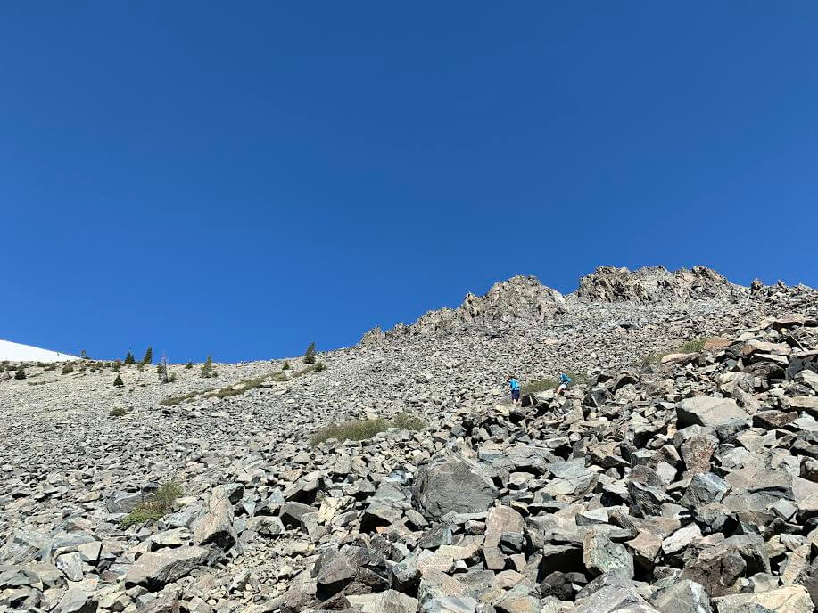
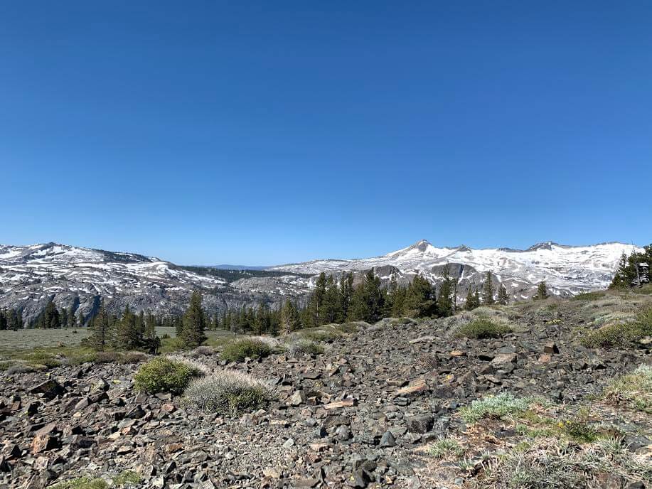
Now, once you pass this lake, the real slope begins
The trail becomes rocky, but the spectacular views continue from here, so keep going
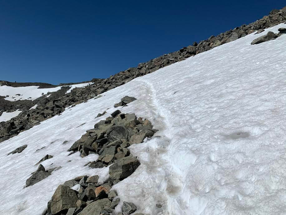
The road begins to zigzag, and there is still snow in places. (Photo taken at the end of June)
Once you reach a flat area after climbing the rocky zigzag path, there are many places where the trail becomes difficult to see, so if possible, I think it will be much smoother if you download a GPS beforehand
If you don't have a GPS, follow the trail carefully, and if you feel like you might get lost, go back to a place where the trail is clear and take a good look around
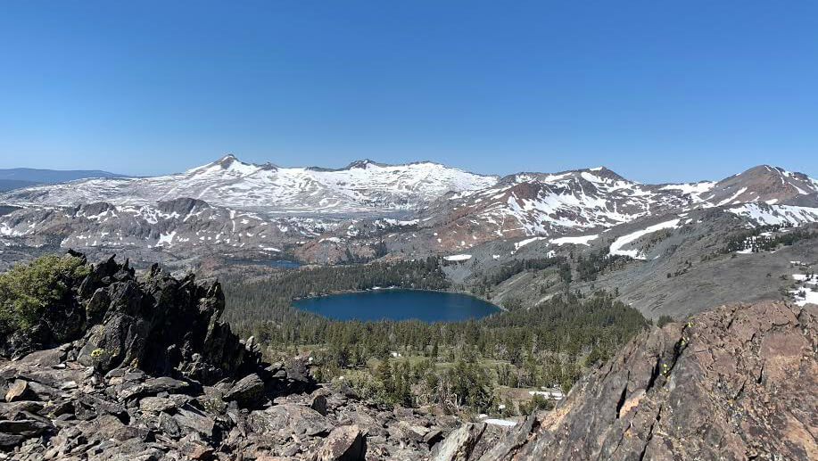
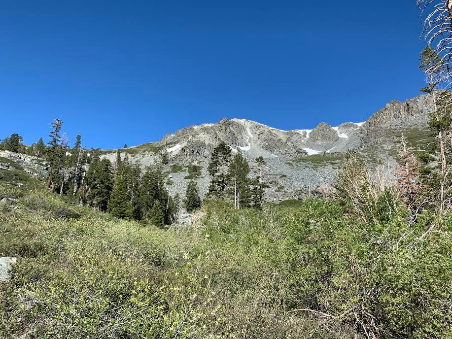
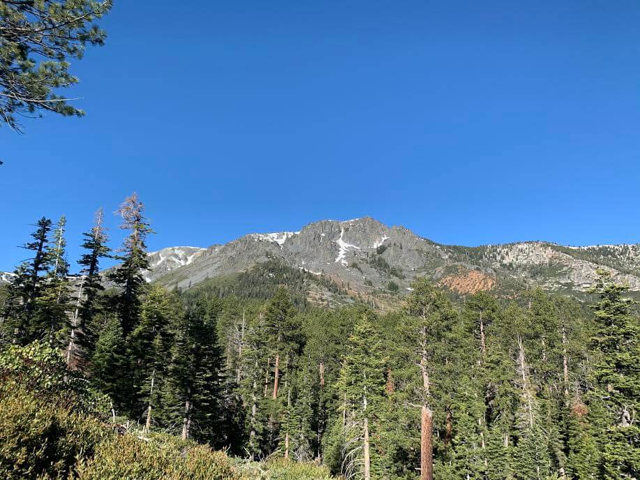
Before you know it, you're at eye level with the beautiful Sierra Nevada mountains. The snow still remains on the peaks, making for a truly beautiful sight
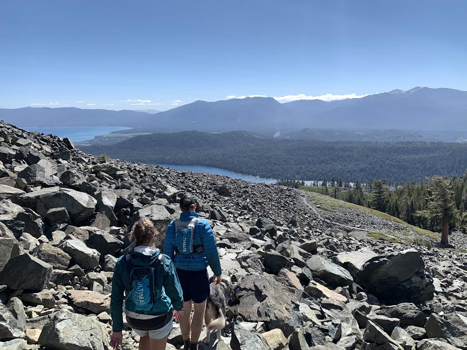
The slope continues to the end, but if you continue further, you will finally arrive at the summit of MT. Tallac in about 3.5 hours from the trailhead
The slope is particularly steep near the summit and the altitude is high, so it can be physically taxing, but if you take it easy and take breaks you'll be fine
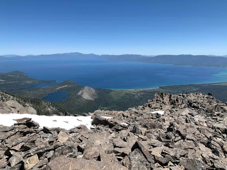
You can see the magnificent view of the blue sky and the blue lake, with the Sierra Nevada mountains and lake on the other side
This beautiful view is not something you see very often, so after reaching the summit you will feel a sense of satisfaction and your soul will be soothed by the magnificent view of nature
The summit is at a high altitude and the wind can make you feel cold, so it's a good idea to bring warm clothes like a fleece. Don't forget that if it's cold, you won't be able to relax even if you want to
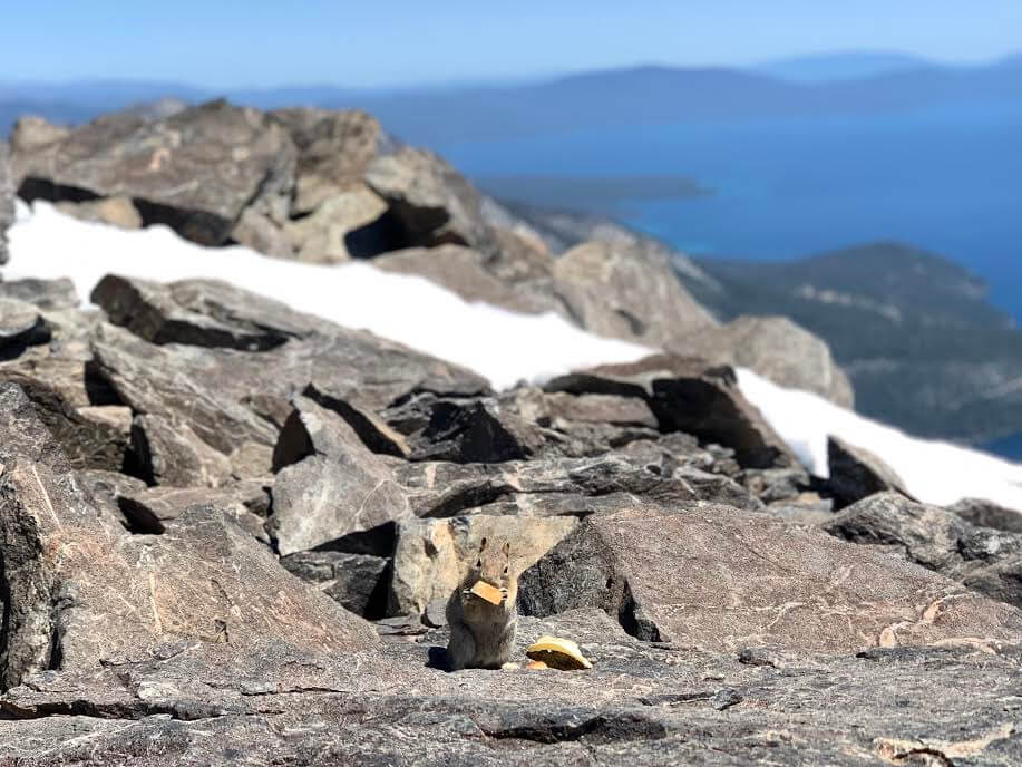
There was also a squirrel that picked up a treat. I don't have a photo, but I also encountered a marmot at the top of the mountain
After a short rest, we return the same way
It took about two and a half hours to get back to the trailhead. This hiking route is for intermediate to advanced hikers. It's not an easy course, but the spectacular views make it worth the climb
Precautions regarding the spread of COVID-19
As of September 2020, various countries are currently imposing entry restrictions due to strengthened quarantine measures, as well as restrictions on entry to national parks and domestic travel. These conditions are subject to change without notice, so when traveling, be sure to obtain local information from each country's embassy or consulate, the Ministry of Foreign Affairs' Overseas Safety Website (Infectious Disease Risk Information), national park websites, and other sources, and check information on transit points, countries you plan to travel to, and the areas around the places you plan to visit before making reasonable plans and taking action
Sayaka Kato
 Leave your California hiking and travel plans to us. Influenced by my father, I've always loved outdoor activities, and while living in Japan, I started hiking and touring national parks, which fascinated me with the natural beauty of America and Canada, ultimately leading me to my dream of visiting the United States. I currently run ANAMI TOURS, which offers local optional tours created together with customers, such as completely private hiking tours with Japanese guides. I'll introduce you to special options that I know only because I live in the area. If you're interested, please visit the website below
Related reading
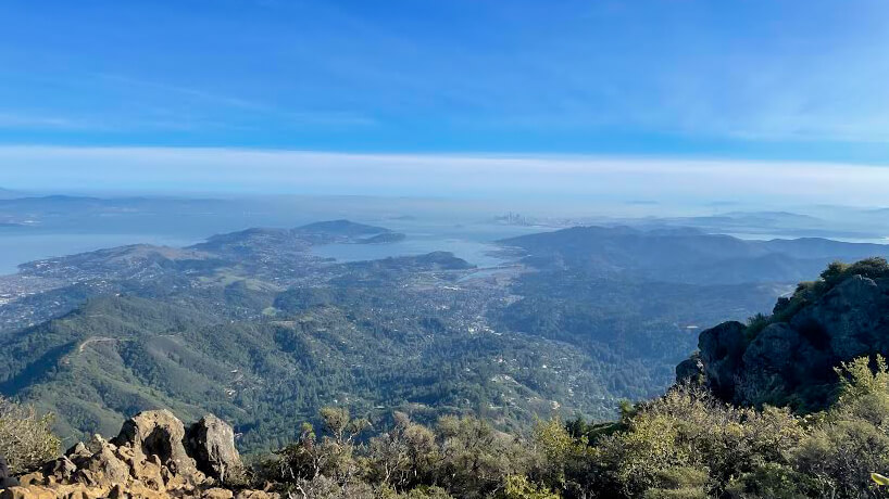 Can you die without walking? A trip to the US National Parks (18) A hiking trail that is full of California flavor: Mount Tamalpais State Park
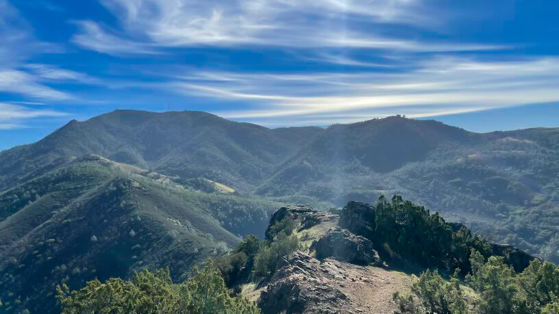 Can you die without walking? A Journey to the US National Parks (19) Mount Diablo State Park, a Famous Peak in the Bay Area of California
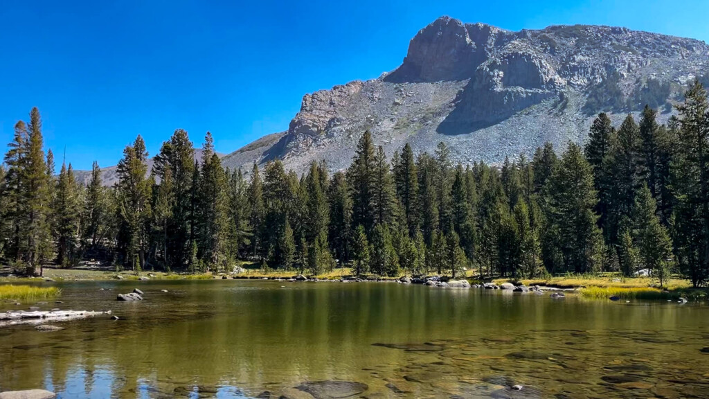 A day hike to Mt. Dana, Yosemite's second highest peak, higher than Mt. Fuji. [I can't die without walking! A trip to the American National Parks (38)]
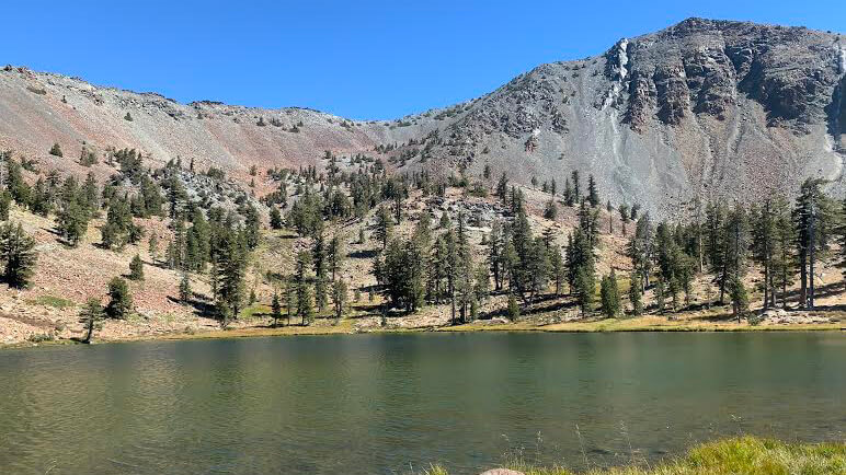 Can't die without walking? A Journey to the American National Parks (16) Flowers, greenery, lakes, and a panoramic view from the summit. Mount Shasta's magnificent peak, Mount Eddy Trail, has it all