Recommendations for Garmin inReach® Mini: Innovative satellite communication devices that everyone entering the mountain should know about
Written by Yoshihiro Murakami
table of contents
What is Inreach?
In 2018, Garmin released inReach Explorer®+ (hereinafter referred to as Explorer+) and inReach® Mini (hereinafter referred to as Mini) Both are two-way mail systems with location information that utilize an iridium satellite network, and can also be sent via SOS. Explorer + can be used as an independent GPS because it can be displayed on the main unit. The Mini is an ultra-lightweight satellite communication device. You can easily create emails by connecting both to your smartphone via Bluetooth. The Earthmate app can also be used as an independent GPS app.
Garmin currently sells inReach, but inReach is originally a product of a company called DeLorme. This is the result of Garmin's acquisition of Delore in 2016. Delore was established in 1976, and sold American topographic maps, with a market share of over 40%. In 2011, the company launched a two-way communication device using an iridium satellite network. The reason why the design of the inReach website and Garmin website is different is that they are originally different.
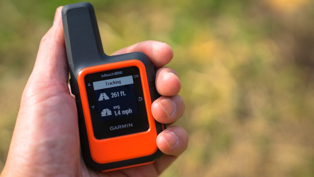
In early 2012, inReach became a hot topic among American hikers. Discussed on the PCT* mailing list. It seemed like an ideal device for the safety of hikers. So I bought the first generation of inReach in 2012 and used it until 2016. I later switched to Derore's Explorer and am still using it today. This time, I was able to borrow a Mini (Photo 1) from the Outdoor Gearzine, so I would like to compare it with the old model and check its performance.
*PCT: Abbreviation for the Pacific Crest Trail, a long trail that spans 1,600km in length on the West Coast of the United States.
table of contents
- What can you do
- What to do first
- Basic usage
- Differences between inReach Mini and Explorer (old model)
- American hikers
- Examples of use in Okutama
- Feelings of use of inReach Mini
- When did it help?
- To sum up
What can you do
- The Iridium satellite network covers the entire world. This allows two-way email to be used around the world and SOS can be sent. Due to political circumstances, the company excludes Cuba, Iran, South Korea, Sudan, Syria, Crimea, and others.
- If you can see the sky above, you can exchange emails with friends from anywhere, even if your mobile phone doesn't work. Friends can see the sender's location on a map and send emails.
- Three preset messages can be created and sent to multiple locations at the same time. This message is free no matter how many times you send it.
- You can connect to your smartphone via Bluetooth and create messages freely in a familiar way. However, Japanese cannot be displayed on an inReach device. It is safer to write messages in Roman letters or English.
- You can connect it to a Garmin smartwatch and exchange GPX files etc. In this case, you will need to use a site called Garmin Connect.
- The Earthmate app can also be used independently as a GPS app. The advantage is that it downloads a wide range of topographic maps during initial setup.
- MapShare allows you to share your location and messages with friends with maps. You can also post on Facebook and Twitter.
- Press the SOS button and an emergency signal will be sent to an organization called GEOS with location information, and a global rescue operation will begin. However, this is a last resort.
- Account holders can take up to $100,000 rescue insurance for $18 a year.
Since August 2018, messages have not been able to be posted to Facebook timeline due to security reasons. However, you can clear this issue by pasting a MapShare link on your blog or Facebook page.
What to do first
Satellite Communications Contract
After purchasing the inReach Mini, you will need to sign an Iridium satellite communications contract. There are individual plans and professional plans. There are four types of personal plans: Safety, Recreation, Expedition, and Extreme. Here we will explain the Safety plan for individuals.
The prices for the Safety plan are in the vertical row at the far left of Photo 2. Up to 10 text messages are included in the fee, and if you exceed that, you will be charged $0.5 per message. Getting the weather forecast counts as one message. Tracking is $0.1 per track. If this is a yearly contract, it would be $12 a month, and if it is a free contract, it would be $15 a month. Freedom agreements can be signed on a monthly basis when necessary, but when you change your contract, you may be charged a $25 fee, so think carefully. Preset messages are free, so if you use them well, you can use them surprisingly cheaply.
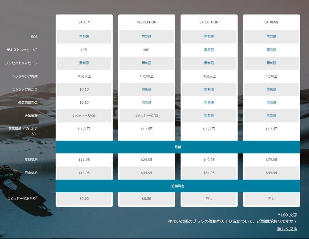
Photo 2: Take a closer look at this diagram for satellite communication contracts
Create your own account on the ExploreGarmin.com page (Photo 3) and make the specified selection, and a satellite communications contract will be concluded. This page also allows you to set up your own inReach environment, so be careful. A computer is required for maintenance of this page, etc. You cannot upgrade the firmware using just a smartphone.
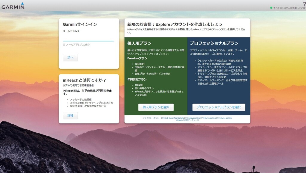
Photo 3: Create your own account here. This is an important page related to device preferences.
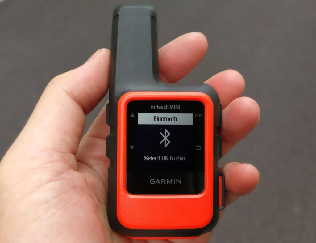
Once you have completed your contract online, you need to activate your device. This is easy, just go to a place where the sky is visible, turn on the Mini and wait a while (Photo 4).
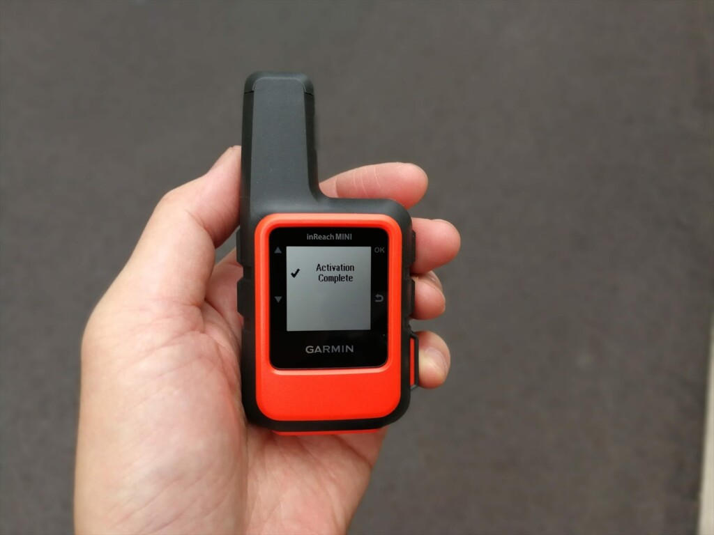
Photo 4: Once the activation is complete, the screen will appear as shown in this way and you can use it.
Bluetooth pairing
Install an app called Earthmate on your smartphone. When you start it, a map will appear, but the three vertical dots in the top right are the menu. Click here to see the following menus: Sync, Pair, Settings, and Help. Choose this pair. On the other hand, in inReach, turn on Bluetooth and select Pairing mode. After a while, you will see an inReach device that can be paired with your smartphone. Click this to complete the pairing. Photo 5 is on the way.
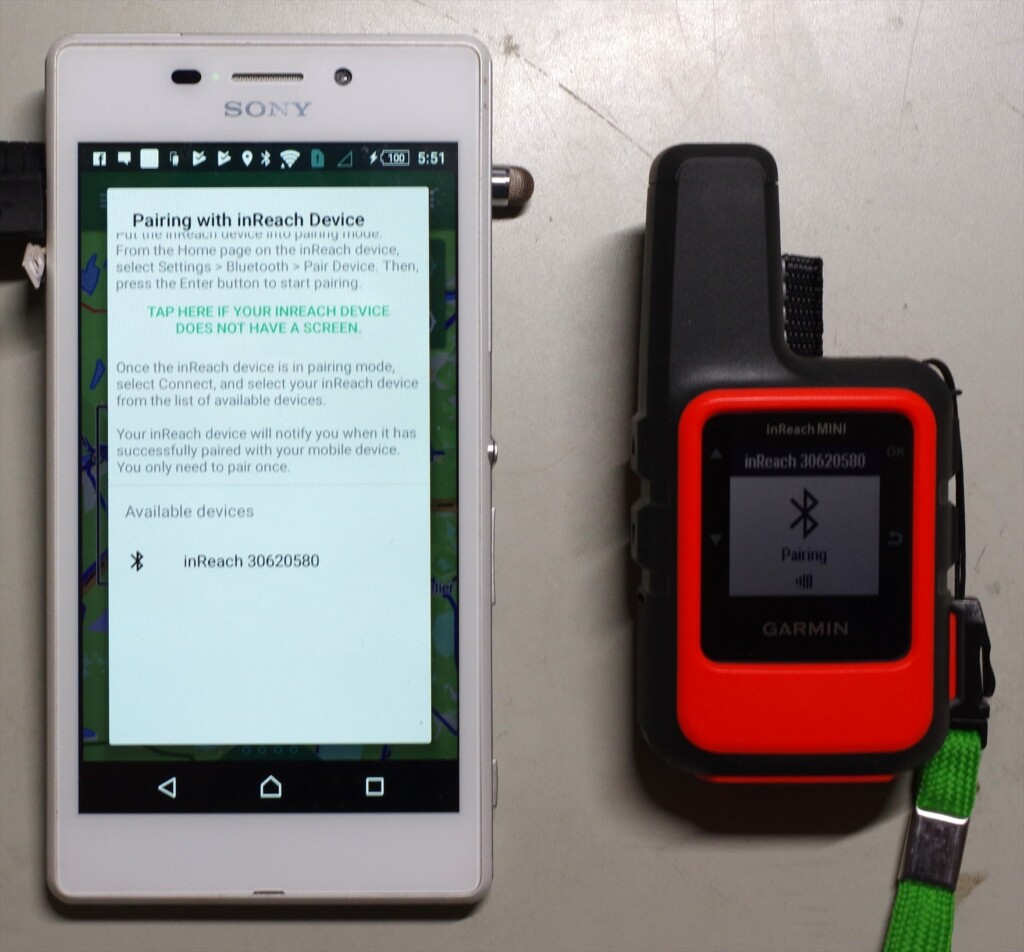
Photo 5: inReach30620580 is the device name for inReach. Click this name to start pairing
When paired, the menu contents in the top right will change (Photo 6). Select Download and download the map. The basic map is OpenStreetMap, and topographic maps of Japan are downloaded all at once. If you're interested, you can download other maps as well.
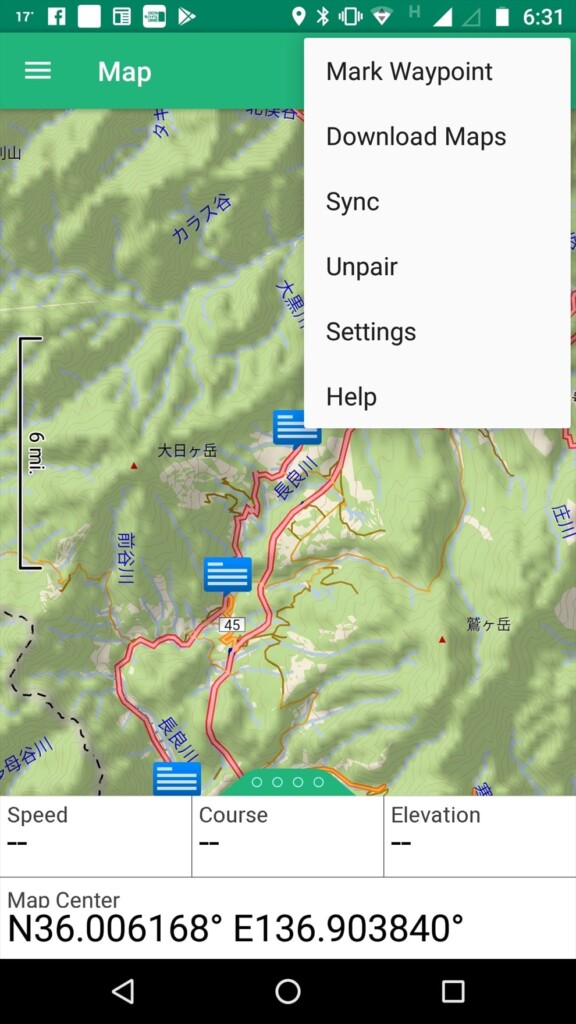
Photo 6: Top right menu after pairing
The other menu is the three lines in the word Map in the top left. Click here to see the basic menu (Photo 7). Log on: Map, Message, Tracking, Way-points, Routes, Compass, History, My inReach, Weather, SOS. I often use Maps and Messages.
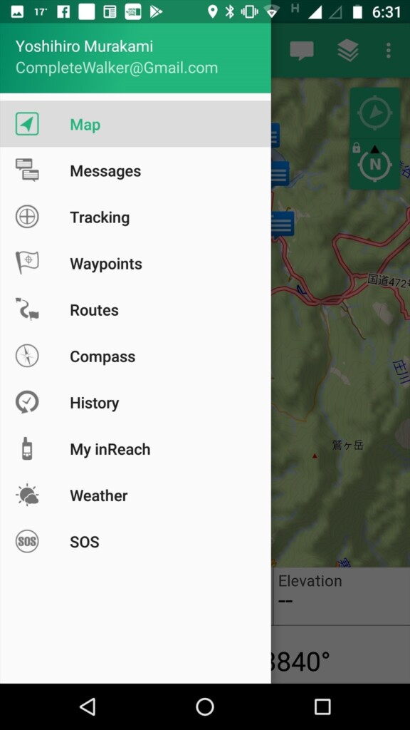
Photo 7: When you tapped the basic menu on the top left
firmware
Connect your computer to inReach using a USB cable and upgrade the firmware using a software called inReachSync. At this time, the account will also be synchronized, so preset texts, contacts, etc. will also be transferred to inReach. Photo 8 shows an image when this software is running.
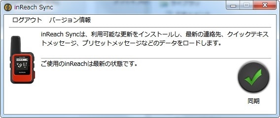
Photo 8: Update firmware to the latest status on your computer
Firmware upgrades occur once every few months and are essential for stable operation, so check it out from time to time to keep your inReach Mini up to date.