歩かずに死ねるか!アメリカ国立公園への旅(17)静と動。生きた地球の力を間近で感じられる ラッセン火山国立公園
written by Sayaka Kato
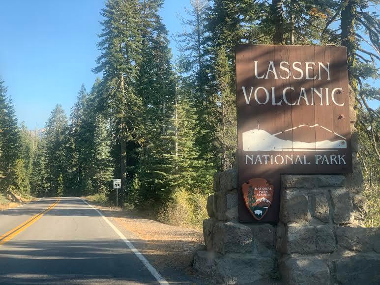
今回ご紹介しますのはノーザンカリフォルアに位置するラッセン火山国立公園(Lassen Volcanic National Park)。
れっきとしたナショナルパークですが、ヨセミテ国立公園などに比べると日本人には知名度が低く、知らない方も多いのかと思います。
が、、実はここはカリフォルニアの「ミニ・イエローストーン」ともいえる素敵な場所なのです。
1916年8月9日に国立公園に指定され、1914年5月から1年間続いた大規模な噴火により周辺は火山地帯特有の地形となりました。
火山研究のために国立公園に指定された場所でもあり、場所によって地下からボコボコと湯気が出ていたり、間欠泉や温泉も見えます。まさに凝縮したイエローストーン国立公園!という感じです(現在は火山活動は落ち着いてます)。
標高3,187メートルのラッセン山(Lassen Peak)を中心とする国立公園で、もちろんラッセン山に登ることもできます。ラッセン山の周辺にはいくつものトレイル、そして美しい湖や滝があり、ハイキングやキャンプにもってこいの場所です。
今回はそのラッセン火山国立公園のシンボルにもなるラッセン山(Lassen Peak)のハイキングコースをご紹介します。
目次
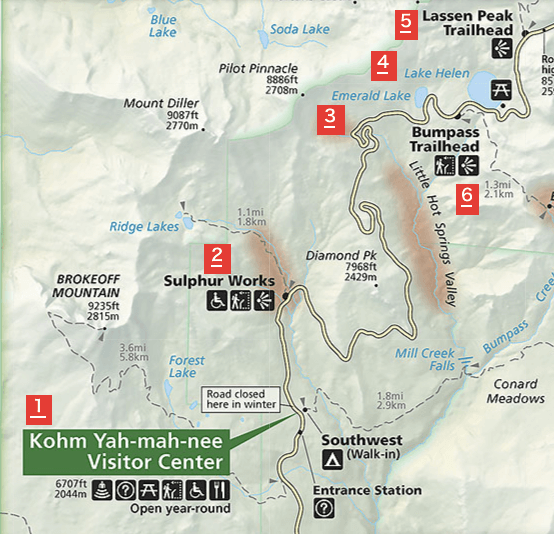
火山が創り出した、唯一無二の多様な自然の表情を堪能。ラッセン火山国立公園への行き方
サンフランシスコ国際空港から車で4時間強。
サンフランシスコ国際空港からハイウェイ80号線で北へ向かい、505号線、5号線と進みます。
さらに5号線の649をCA36号線に向かって進むと、ラッセン火山国立公園を走るCA89号線に突き当たります。
エントランス
公園内は2つエントランスがあり、北西側(Northwest Entrance)と南西側(SouthwestEntrance)にあります。メインシーズンはおおむね6月から9月で、冬季は積雪のため場所により公園内の道路が通行止めになります。
公園内でのアクティビティ
春~夏~秋
日帰りハイキング・バックパッキング・キャンピング・サイクリング・釣り・ボートや水泳などのウォーターアクティビティー・ドライブ・間欠泉巡りなど。
冬場
雪ソリなどのスノーアクティビティ・スノーシュー・クロスカントリー・バックカントリースキー・スノーキャンピングなど、多彩なスノーアクティビティが楽しめます。
入園料 (2021年1月現在)
公園に入るためには前もって手続きはいりません。エントランスで入場料を払うのみです。
公園自体は1年間24時間オープンしています。(公園内に入る前に車のガソリンをしっかり入れておきましょう)
- 一般車(自家用車)$30.00 (7日間有効)
- 冬季:$10.00 12月1日から4月15日まで
- バイク $25.00
- 車以外の自転車やハイキングをする人は一人当たり $15.00
営業時間
南側エントランス
24時間1年中オープン。
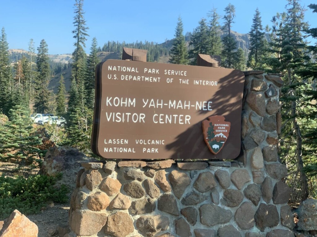
Kohm Yah-mah-nee Visitor Center(コーム ヤマニー ビジターセンター)営業時間は9 am – 5 pm。
北側エントランス
冬季の10/31 から5/21までクローズ。
Loomis Museum(ルーミス ミュージアム)営業時間は9 am – 5 pm。
公園での案内所は?食料や装備は補充できる?
コーム ヤマニー ビジターセンターのエリアにカフェとお土産屋さんがありますのでそこで飲料水や食料をゲットできます。
営業時間:5/21から10/12のメインシーズンで9 am – 5 pm。10/13~5/26は11 am – 2 pm。
ハイキングに携行すると便利な持ち物
- 飲み物 (夏は多めに、2リットル位。)
- 気温の調整できる防寒着 (風があると寒い日もあります。)
- 帽子
- サングラス
- 日焼け止め
- ハイキング中に食べるスナックなど
- 常備薬などがある場合は薬やバンドエイドなどのファーストエイド
- 水着(夏場は湖で泳げます。着替える場所はありませんが必要な場合は持参しましょう。)
- その他、通常ハイキング装備
ラッセンピーク(LASSEN PEAK)ハイキング情報
トレイルデータ
- 中級者以上向け
- シーズン6月から9月
- トレイルヘッド標高:約2587m
- LASSEN PEAK 標高:約3187m
- 往復: 約8.2km (5.1 mile )
- 高低差:約 600m(1968 ft)
- コースタイム:往復3時間から5時間 (休憩含む)
トレイルヘッドからハイキング出発
住所:Lassen Peak Trailhead:Volcanic Legacy Scenic Byway, Mill Creek, CA 96061
サンフランシスコ方面から向かい、南側エントランスから公園内に入るとすぐにコーム ヤマニー ビジターセンターが見えてきます(先程の地図上1)。
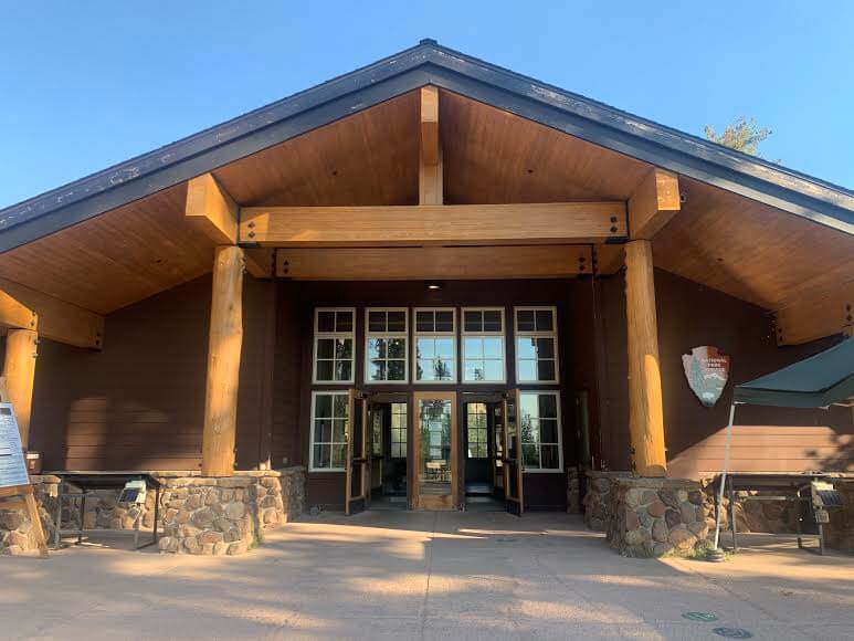
そこでお手洗い休憩をかねてビジターセンターの中へ。必要なら地図などもここでもらえます。ドリンクやスナックなどが必要な場合も同じエリアにあるカフェでゲットできますよ。
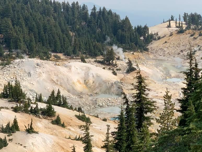
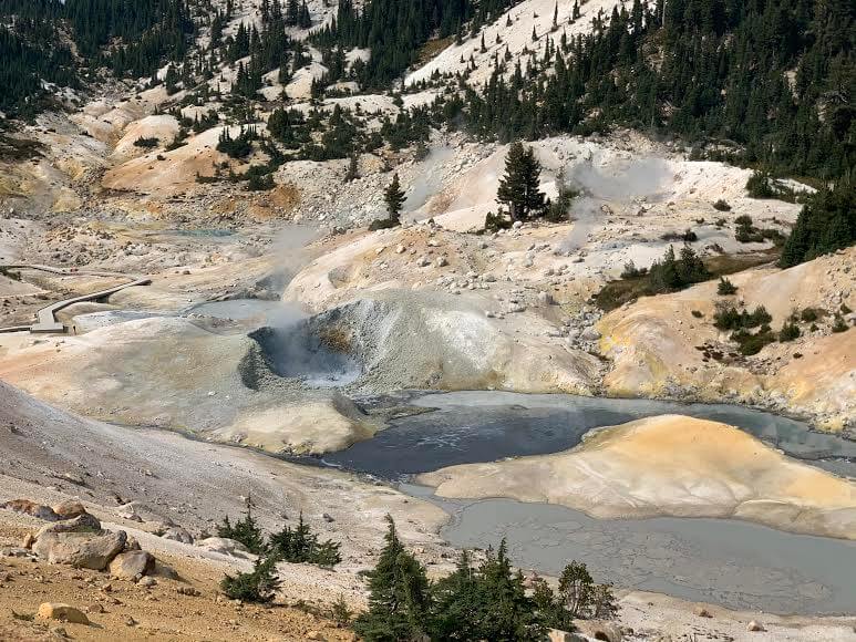
ビジターセンターを出発し、トレイルヘッドまで車を走らせていくと途中、もくもくと至る所で湯気が出ている光景が見えたりします。硫黄の匂いもしてきます。熱水線や泥泉がある証拠ですね。
興味がある方は道路沿いに出てくるソルファー・ワークス(Sulphur Works )の駐車場で車を停めて見てみてください。地球の鼓動が垣間見れますよ。(先程の地図上2)
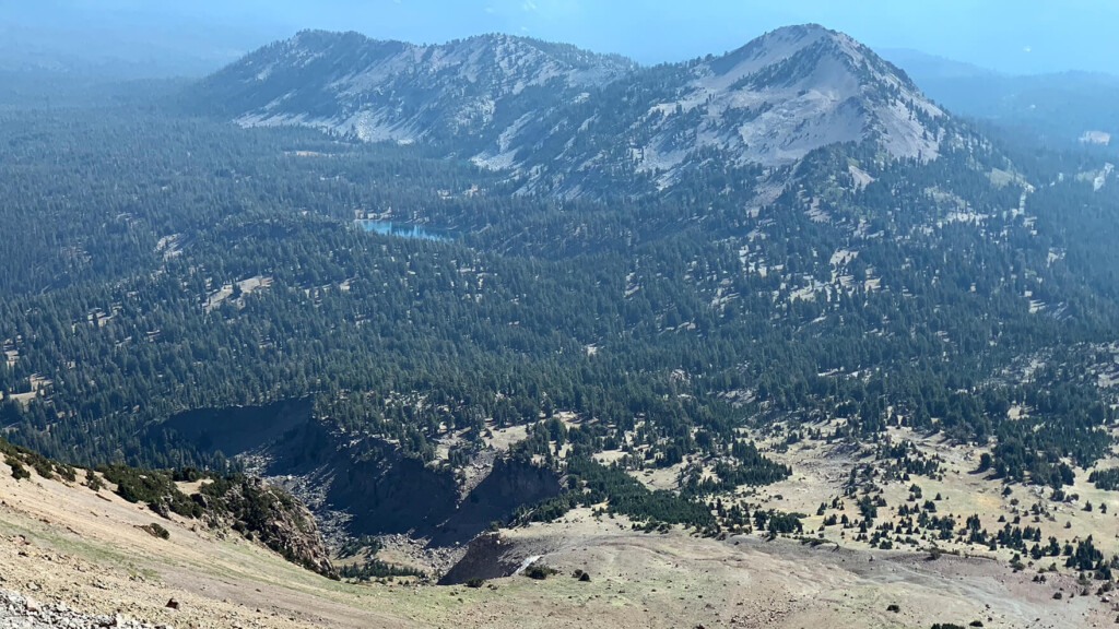
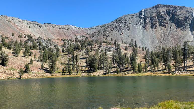
そしてさらに進むと左側に見えてくるのはエメラルドレイク (先程の地図上3)
ちょうど早朝で風もないので湖面に周りの景色が映り、ミラーレイクになっています。水が透き通っていて本当に美しい。
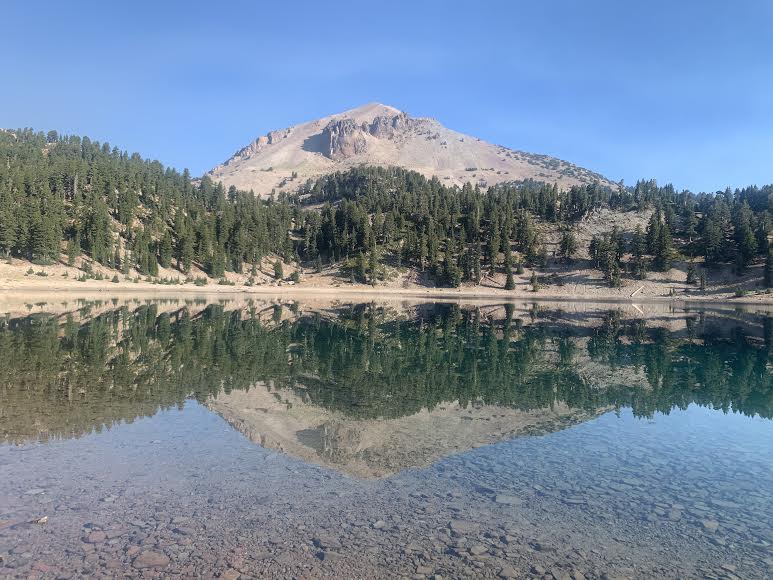
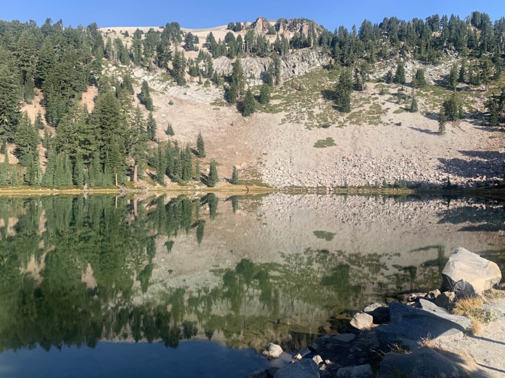
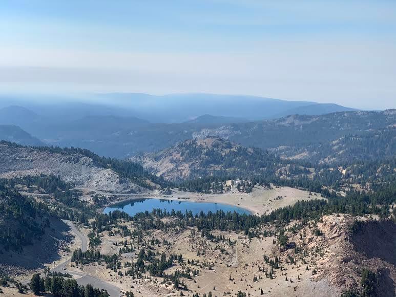
そしてさらに車を走らせると左側にレイクヘレンも見えてきます。(先程の地図上4)
湖の奥には本日の目的地であるラッセンピークがそびえ立っています。まさにあの山のてっぺん標高3,187メートルまで後ほど登るのです。レイクヘレンの南岸からのショットはこのようにラッセン ピークも映り絵になります。ここも本当に透明度が高く美しく静かに佇む湖です。

夏場は泳いでいる人もいますよ。気持ち良いでしょうね。

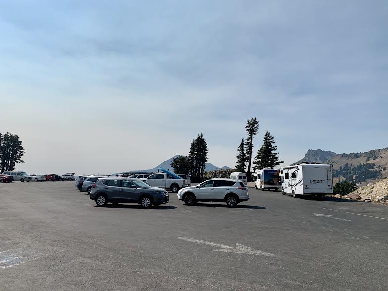
そして湖を後にし、1マイルほど先にあるパーキングエリアへ。ここのトレイルヘッドのパーキングは十分にスペースがあり、お手洗いもあります。(先程の地図上5)
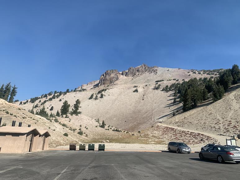
ハイキング準備を整えていざ出発です。
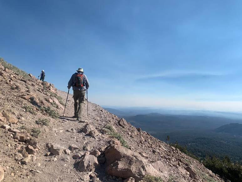
トレイルはわかりやすく砂利道で整備されています。「STAY ON THE TRAIL」という看板が至る所にあり、ショートカットをせずにトレイル上を歩きましょうというメッセージが書かれています。可能な範囲で自然界を守るための基本的ルールですね。
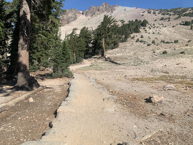
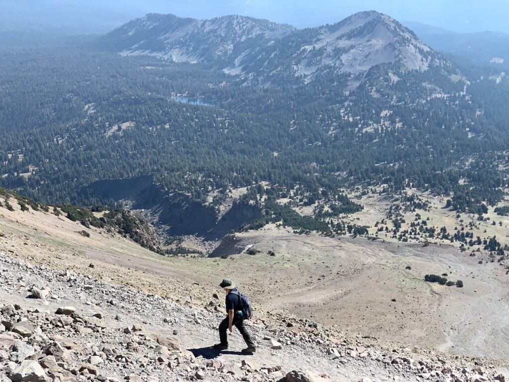
登っていくにつれ森林限界も近づき徐々に木々や日陰もなくなってきます。急坂のスイッチバックが続くので体力が必要となりますが、登った先に待っている景色は絶景です。
サンスクリーンや帽子などの日焼け対策もお忘れなく。
途中途中に見えてくる周りの眺めも絶景です。眺めの良い場所で休憩をこまめに取りましょう。
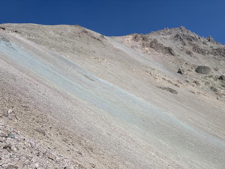
さらに登り、標高が上がっていくと空気も薄くなってくるのを感じます。先ほど真横から見ていたレイクヘレンもここまでくるとだいぶ遠くに、、
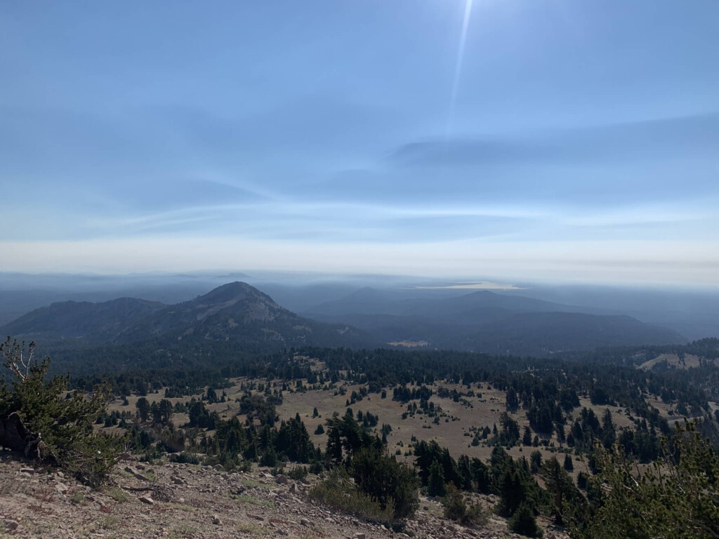
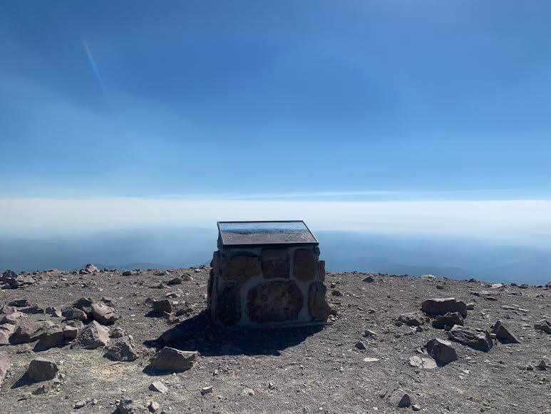
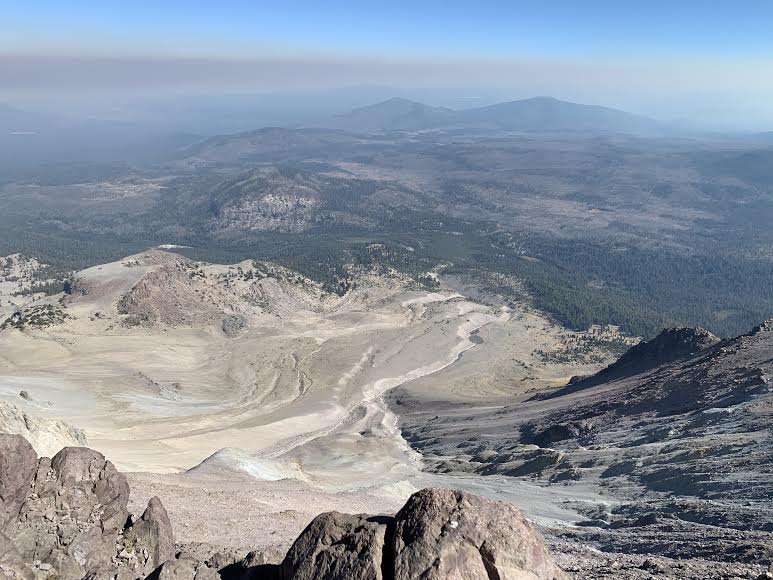
頂上近く3150mまでくると色の濃い石や白っぽい岩かべも目立ってきます。スタートから約1時間半後頂上に到着です。
頂上からは1914年から数年続いた噴火で被災した荒廃地域の景色を見下ろすことができます。この時期はカリフォルニアの至る所で森林火災が発生していた影響で景色はクリアではありませんでしたが、それでも大迫力!
帰りは来た道を戻る形です。
おまけ
バンパスヘル Bumpass Hell という往復3マイル(4.8km)、約2時間のトレイルがラッセンピークトレイルの近くにあります。ここは最大の熱水域でまさにミニ・イエローストーンのような光景に出会えます(先程の地図上6)。
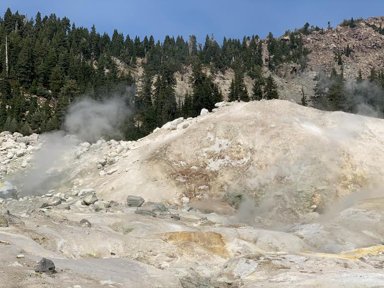
熱水や泥水泉が至る所で沸き、蒸気を吹き上げながら火山地帯特有の現象を観ることができるエリアのハイキング。まだまだ体力に自信がある方はこちらも是非!
私はラッセンピークのハイキング後、こちらも歩いてきましたよ。
ハイキング情報
- 初級者向け
- シーズン6月から9月
- 往復: 約4.8km (3mile )
- 高低差:約 129m(423 ft)
- コースタイム:往復2時間
トレイルヘッド
住所:Bumpass Trailhead Parking Mill Creek, CA (先程の地図上6。ラッセンピークのトレイルヘッドの少し手前に位置しています。エメラルド・レイクとヘレン・レイクの間)
トレイルヘッドである駐車場Lassen volcano NP
熱水地帯では、木製のボードウォークが敷かれていて、ハイカーはそこから外れないように歩くのがルール。安全のため熱水線に触ったり、物やゴミを投げ入れたりしないように注意です。
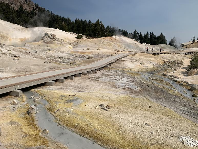
ボードウォークが無い場所では、コースから大きく外れないように注意しましょう。
新型コロナウィルス感染拡大に関するご注意
2021年2月現在、各国では検疫体制強化に伴う入国制限をはじめ、国立公園への入園規制や国内の移動制限など、さまざまな状況があり得ます。そうした条件は予告なく変更になる場合がございますので、旅行の際には必ず各国の大使館・領事館及び外務省海外安全ホームページ(感染症危険情報)、国立公園ホームページをはじめとした現地情報を入手し、乗継地および渡航予定国、訪問予定地周辺の情報を確認してから無理のない計画・行動をしてください。
加藤 さやか
 ラッセン火山国立公園のハイキング・旅行プランはお任せください。父の影響もあり昔からアウトドアアクティビティーが大好きで、日本にいた頃から登山、国立公園巡りをする中で、アメリカやカナダの大自然に魅了され、その結果念願だったアメリカに辿り着きました。現在は日本人ガイドと行く完全プライベートハイキングツアーなど、お客様と一緒に作る現地オプショナルツアーを提供するANAMI TOURSを営んでいます。現地在住だから知り得る、スペシャルなオプションをご紹介させて頂きます。ご興味ある方は下記HPから。
あわせて読みたい
 歩かずに死ねるか!アメリカ国立公園への旅(16)花と緑、湖、頂からの大パノラマ。すべてが揃ったシャスタの秀峰、マウント・エディ・トレイル
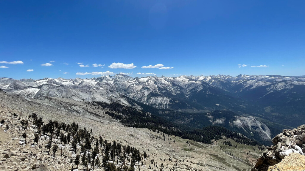 歩かずに死ねるか!アメリカ国立公園への旅(27)巨木の森とシエラ・ネバダの美しい山脈を見ながらの絶景トレイル セコイア・キングスキャニオン国立公園
 歩かずに死ねるか!アメリカ国立公園への旅(28)光り輝く大理石を流れる滝を見に行こう(セコイア国立公園)
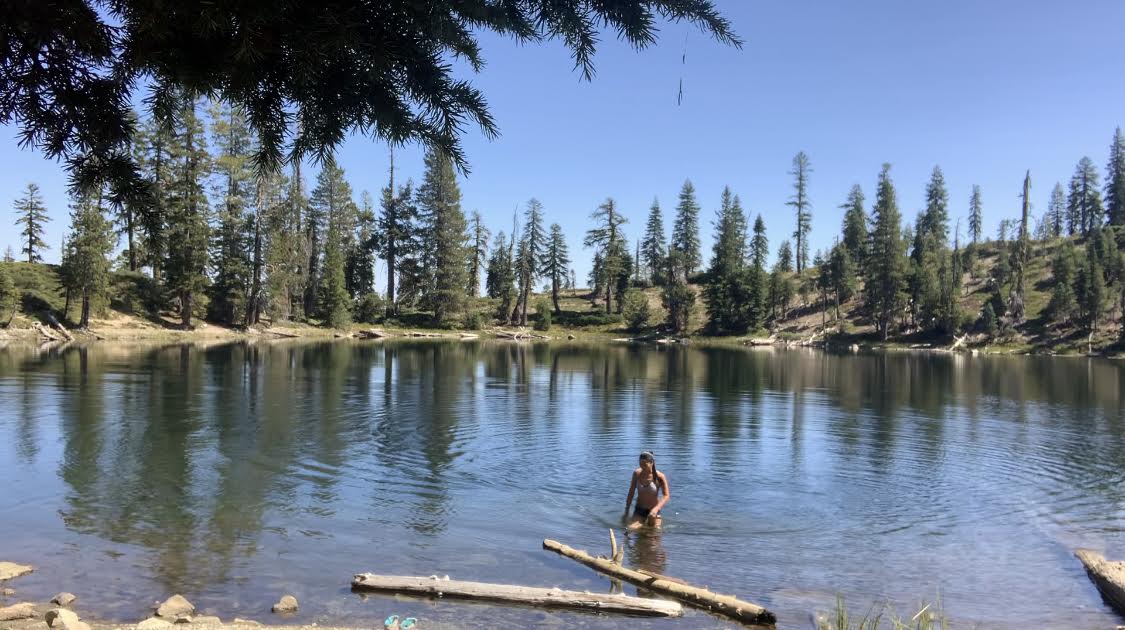 歩かずに死ねるか!アメリカ国立公園への旅(15)どこまでも澄みきった湖を全身で堪能。 セブン・レイクス/レイク・ヘレン ハイキング